August 25 , 2020.
Argentina / Chile , Nevados of Chillan :
The Servicio Geológico Minero Argentino (SEGEMAR) through its Argentine Volcanic Monitoring Observatory (OAVV) reports that the technical alert level for the Nevados de Chillan volcanic complex remains at the YELLOW level.
PERIOD ANALYSIS from August 1 to 15, 2020.
Seismicity parameters associated with both rigid material fracturing (VT) processes and fluid dynamics within the volcanic complex (LP and TR types) or surface activity (EX) have remained at levels similar to those of recent periods.
The highest energy VT-type event, with a local magnitude (ML) of 3.2, was located 6.6 km northeast (NE) of the active crater and at a depth of 5.7 km .
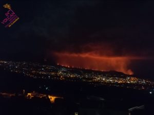
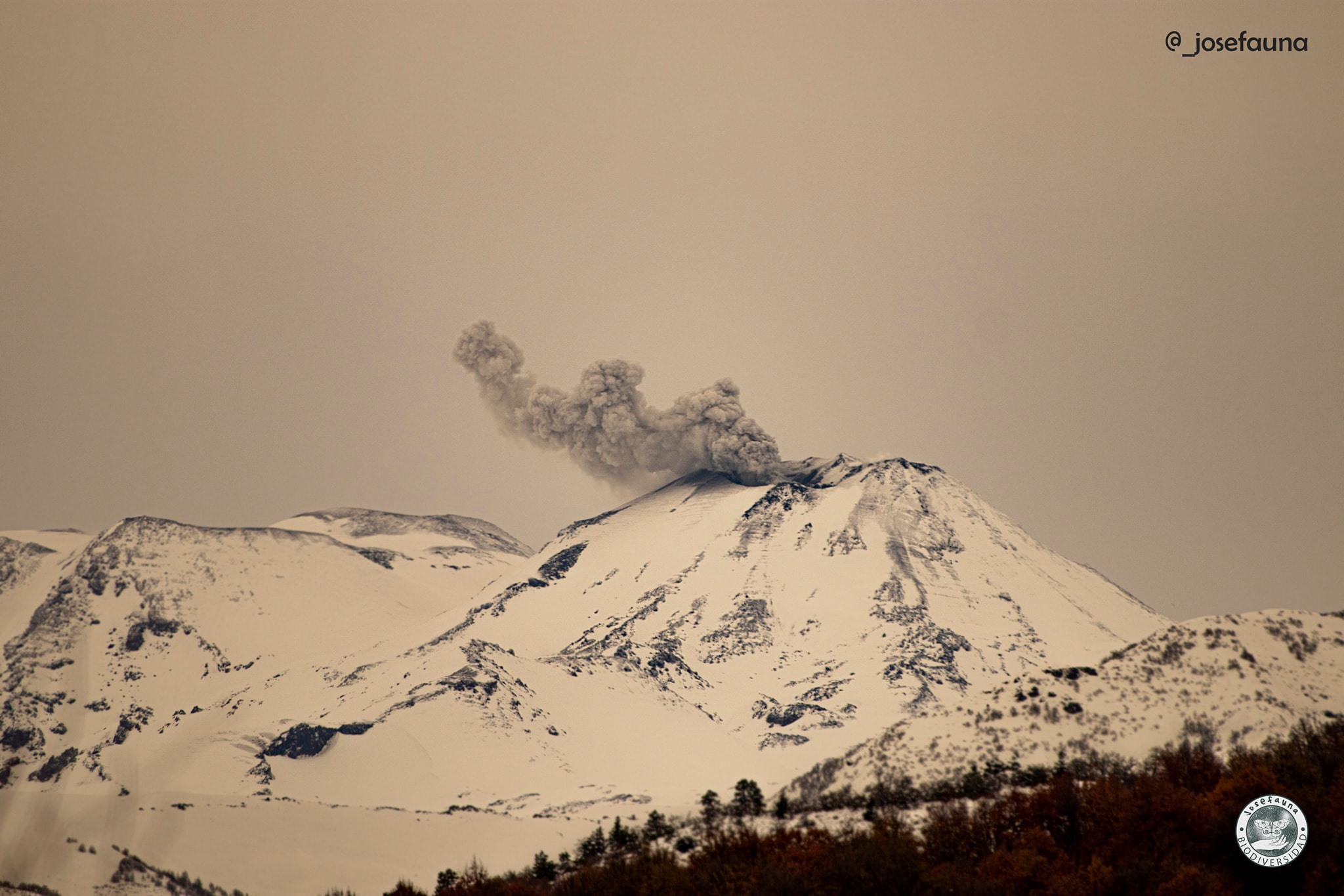
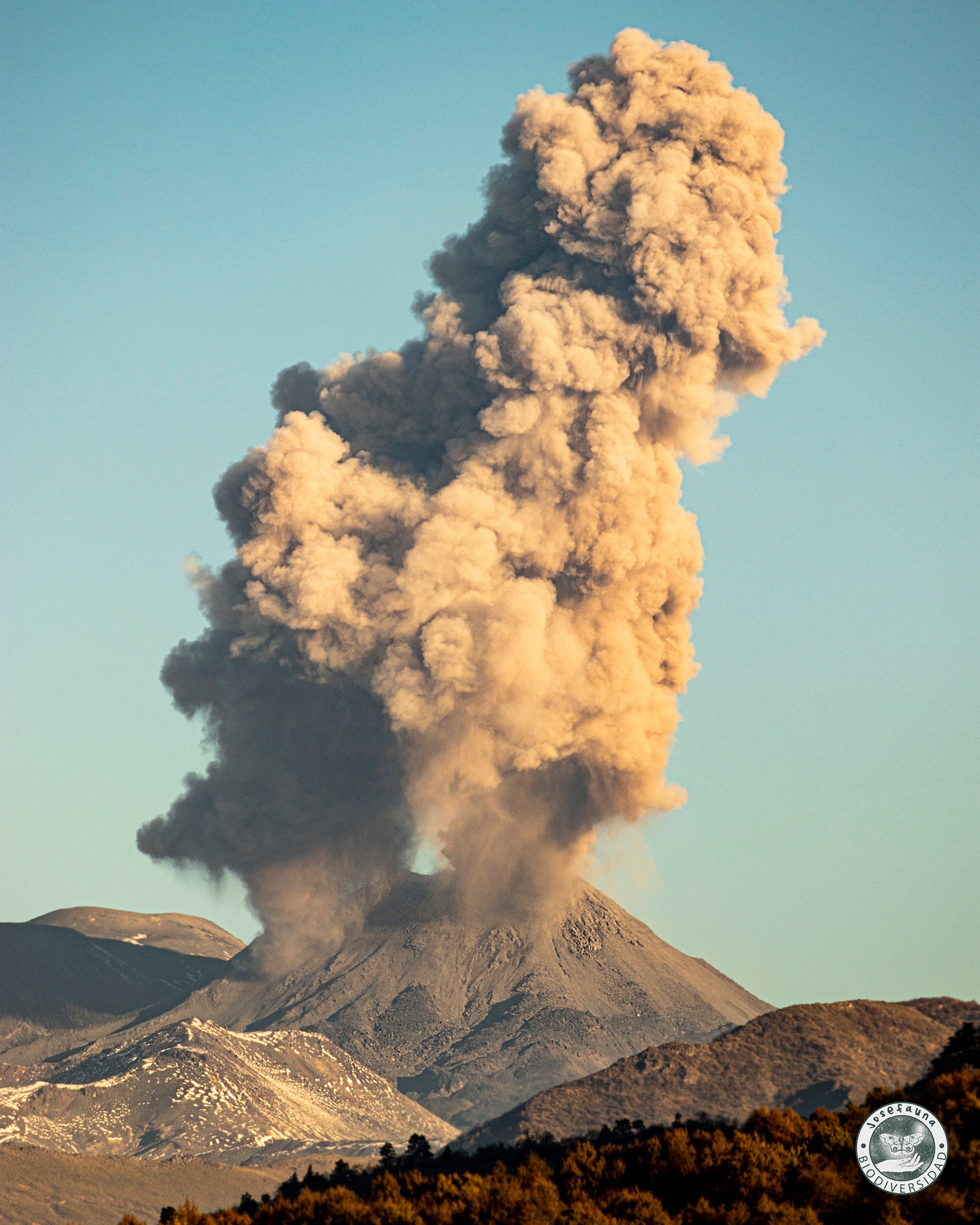
The images provided by the surveillance cameras allowed us to observe a dynamic of effusive and explosive activity during this fortnight. The effusive activity is characterized by the extrusion of lava, which accumulates at the level of the crater and advances outside the northern limit of the active crater, generating a flow which to date reaches 490 m from the edge of the crater. The explosive activity presented column heights less than 800 m, with a moderate content of particles and a higher content of volcanic gases. When weather conditions allowed, it was possible to record the incandescence of the crater.
According to data obtained from the network of GNSS stations and inclinometers installed on the volcano, a decrease is observed in the process of deformation of the volcanic complex, with cycles of ascent / descent in the vertical plane, although with a decrease in amplitude compared to previous reports. The deformation in the horizontal direction shows minor variations.
12 thermal alerts were recorded in the area with a maximum value of 3 MW, a value considered low.
Explosion of the Chillán volcano on June 4 at 4:11 p.m. View of the El Caracol sector in San Fabián de Alico, Ñuble region.
RECOMMENDATIONS
The impacted area is considered to be the one near the crater with a radius of 5 km.
Stay informed of the activity level of the volcano.
Receive information only from official media.
It is suggested to find out about preventive measures from the civil protection authorities in towns near the volcano, in Argentine territory.
Examination of the emergency plans of the neighboring towns of Argentina.
It is emphasized that Cv. Nevados de Chillan is entirely in Chilean territory. Any possibility of damage by products in the vicinity or by seismicity, would not affect the Argentine territory.
Any possibility of impact on Argentine territory will be due to the fall of particulate matter (volcanic ash).
Source : OAVV
Photos : Josefauna .
Indonesia , Sinabung :
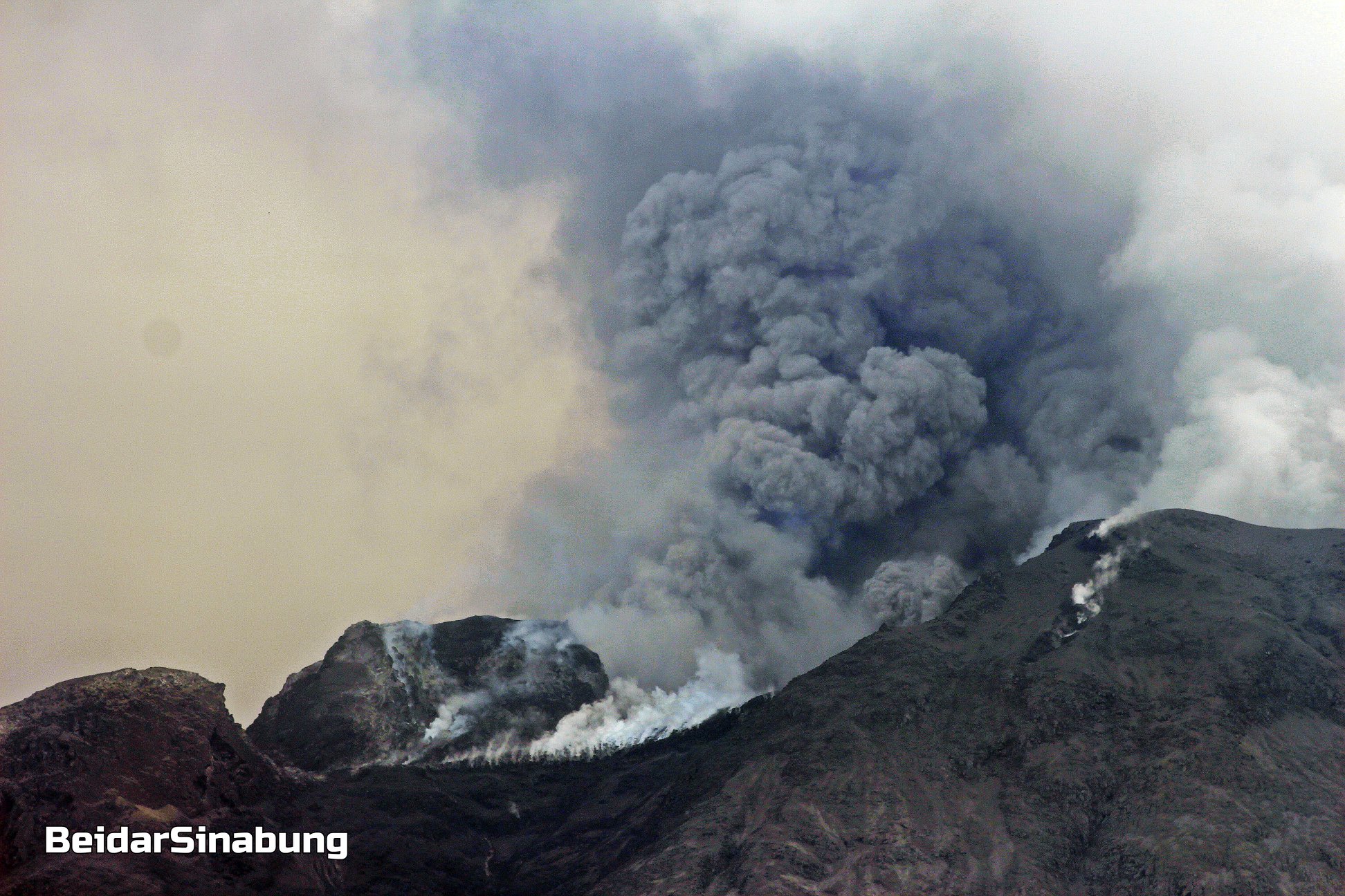
The level of activity since May 20, 2019 at 10:00 a.m. WIB is at level III (SIAGA). Mount Sinabung (2460m above sea level) has been erupting since 2013. The last sizeable eruption took place on August 19, 2020 at 6:23 pm WIB, resulting in an eruption column rising 4000 meters above the summit. The color of the eruption column was observed to be gray with a thick intensity oriented to the south and southwest.
The volcano was clearly visible until it was covered in fog. The smoke from the crater is white to gray / brown with moderate to thick intensity, about 600m high from the top of the summit. The weather is sunny to cloudy, with weak to moderate winds in the North-East, South-East and West.
According to the seismographs of August 24, 2020, it was recorded:
1 emission earthquake
14 low frequency earthquakes
2 local tectonic earthquakes
1 Distant Tectonic earthquake
1 Continuous tremor of amplitude 0.5 to 9 mm, dominant value of 1 mm.
VOLCANO OBSERVATORY NOTICE FOR AVIATION – VONA.
Issued : August 25 ,2020
Volcano : Sinabung (261080)
Current Aviation Colour Code : ORANGE
Previous Aviation Colour Code : orange
Source : Sinabung Volcano Observatory
Notice Number : 2020SIN21
Volcano Location : N 03 deg 10 min 12 sec E 98 deg 23 min 31 sec
Area : North Sumatra, Indonesia
Summit Elevation : 7872 FT (2460 M)
Volcanic Activity Summary :
Eruption with volcanic ash cloud at 03:50 UTC (10:50 local). Eruption and ash emission is continuing.
Volcanic Cloud Height :
Ash-cloud is not visible
Other Volcanic Cloud Information :
Ash-cloud moving to west-nortthwest
Remarks :
Seismic activity is characterized by continuous volcanic tremor
Source : PVMBG , Magma Indonésie .
Photo : Firdaus Surbakti / Beidar Sinabung.
Ecuador , Sangay :
MONDAY 24 AUGUST 2020
The Geophysical Institute of the National Polytechnic School reports that:
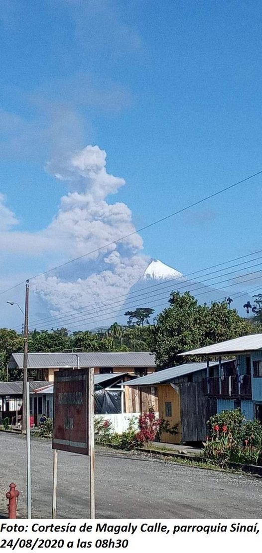
Today, August 24, thanks to the images of the networks, we can observe the strong activity of the Sangay volcano, with emission of ash and pyroclastic flows in the South-East ravine. The wind carries the ashes towards the southwest, which could generate moderate ash fall in the provinces of Chimborazo and Cañar.
This phenomenon has been persistent during the current eruptive period which began in May 2019. It is recommended to take the appropriate measures and receive the information from official sources.
This morning, on images shared by the ECU and the network of volcanic observers, gas emissions were observed ranging from 1000 to 2000 m above the level of the crater and the direction of dispersion was oriented towards the West -South West. The Washington VAAC recorded 5 ash emission alerts, the direction varied from West to Southwest and South. These emissions reached heights of 2,100 meters above crater level
The Geophysical Institute of the National Polytechnic School is keeping an eye on the activity of the volcano and will report on any changes that may be recorded.
Source : INSTITUT GÉOPHYSIQUE, NATIONAL SCHOOL OF POLYTECHNICS
Photo : IGEPN via Magaly Calle.
Peru , Sabancaya :
Analysis period: August 17-23, 2020, Arequipa, August 24, 2020
Alert level: ORANGE
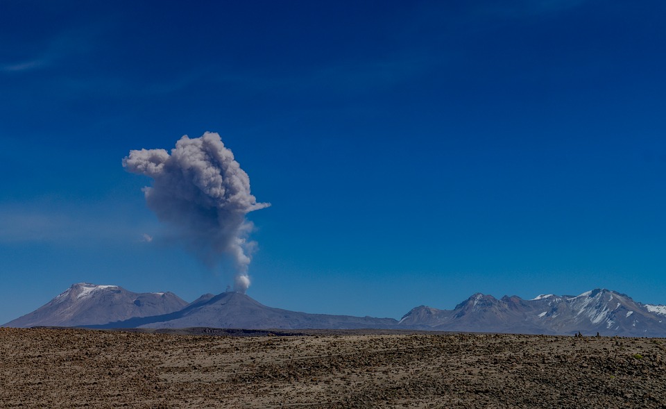
The Geophysical Institute of Peru (IGP) reports that the eruptive activity of the Sabancaya volcano remains at moderate levels; that is, with the continuous recording of explosions that generate columns of gas and ash that rise up to 2.2 km above the summit of the volcano. Therefore, for the following days, no significant change is expected regarding its eruptive activity.
The IGP recorded and analyzed the occurrence of 860 earthquakes of volcanic origin, associated with the circulation of magmatic fluids within the Sabancaya volcano. An average of 13 low to medium intensity explosions was recorded daily. During this period, the Volcano-Tectonic (VT) earthquakes presented magnitudes less than M3.9 and were located between 12 and 15 km in the northern sector of the Sabancaya volcano, near the towns of Pinchollo, Maca and Madrigal. The largest earthquake (M3.9), reported by the National Seismic Center (CENSIS), occurred on August 16 at 3:59 a.m., at a depth of 10 km.
The monitoring of the deformation of the volcanic structure, using GNSS data (processed with fast orbits), recorded a slight inflation of the south-eastern flank of Sabancaya and of the northern sector (Hualca Hualca volcano). A deformation was detected with the synthetic aperture radar differential interferometry (INSAR) technique 3 km northwest of the Hualca Hualca volcano, which would be associated with the process of reactivation of local faults that occurred between August 14 and August 18.
Visual surveillance identified columns of gas and ash up to 2.2 km high above the summit of the volcano, which were scattered towards the southern, southeast and eastern sectors of Sabancaya. Satellite surveillance has identified the presence of 2 thermal anomalies, with values of 2 MW, associated with the presence of the lava dome on the surface of the volcano’s crater.
Source : IGP.
Photo : Pixabay.
Peru , Ubinas :
Analysis period: August 17-23, 2020, Arequipa, August 24, 2020
Alert level: ORANGE
The Geophysical Institute of Peru (IGP) reports that the Ubinas volcano (Moquegua region) continues to record a slight increase in its seismic activity during the analysis period; therefore, it is suggested that the authorities and the public pay attention to the bulletins published by the IGP.
During the analysis period, the occurrence of 25 volcano-tectonic (VT) earthquakes with magnitudes less than M1.8 was identified, events associated with rock breaking processes that occur at the inside the volcano. On average, the occurrence of 4 earthquakes per day was recorded. Likewise, 7 seismic signals were recorded associated with movements of volcanic fluids (gas), including 3 events of the « Tornillos » type, linked to the increase in pressure inside the volcano. « Tornillos » type earthquakes are considered as precursor seismic signals of volcanic eruptions according to the forecast model developed by the IGP.
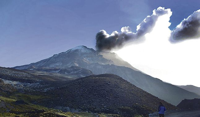
Surveillance cameras recorded columns of gas (mainly water vapor) reaching heights of up to 300 m above the summit of the volcano. These gases dispersed to the south-east of the volcano.
Monitoring of the deformation of the volcanic structure and satellite monitoring, through the SENTINEL, OMINASA (SO2 gas) and MIROVA (thermal anomalies) systems, did not record any anomalies during the analysis period.
Source : IGP.
Photo : La Republica .