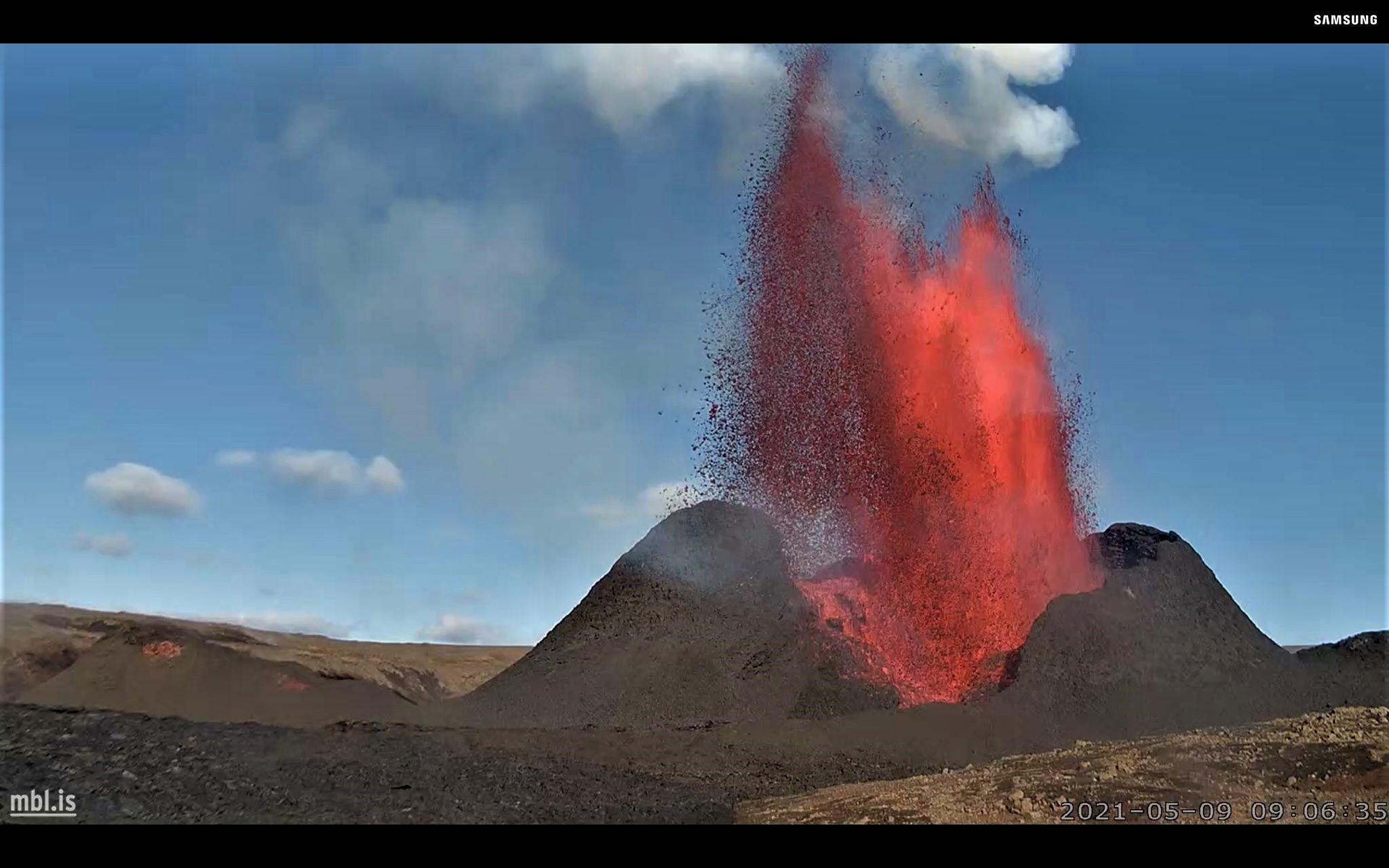
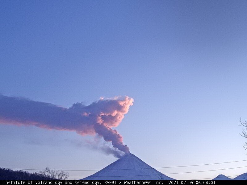
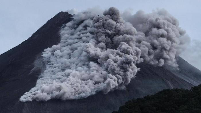
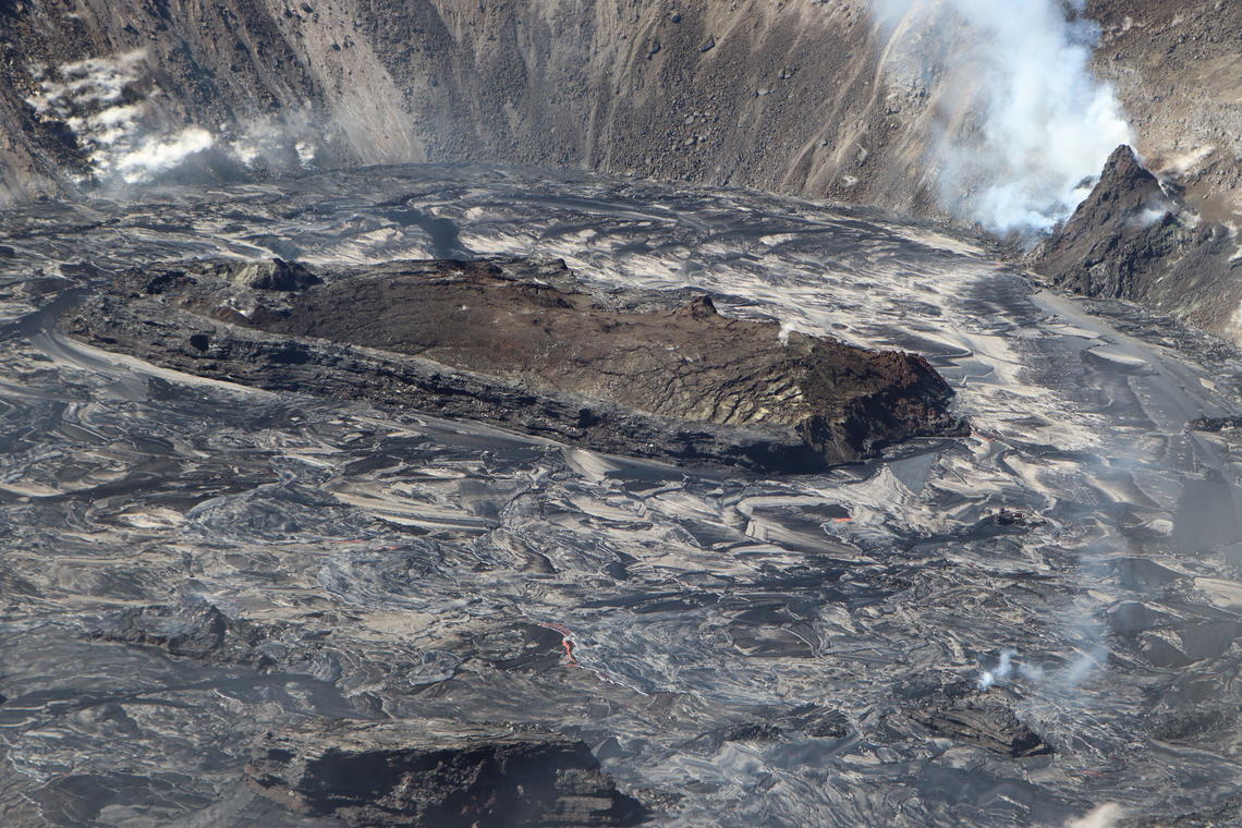
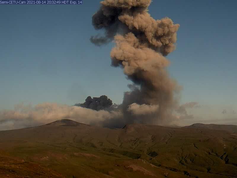
September 10, 2021. EN. Iceland : Askja / Skafta River , Alaska : Semisopochnoi , Northern Kuril Islands : Ebeko , Indonesia : Merapi , Chile : Cerro Hudson .

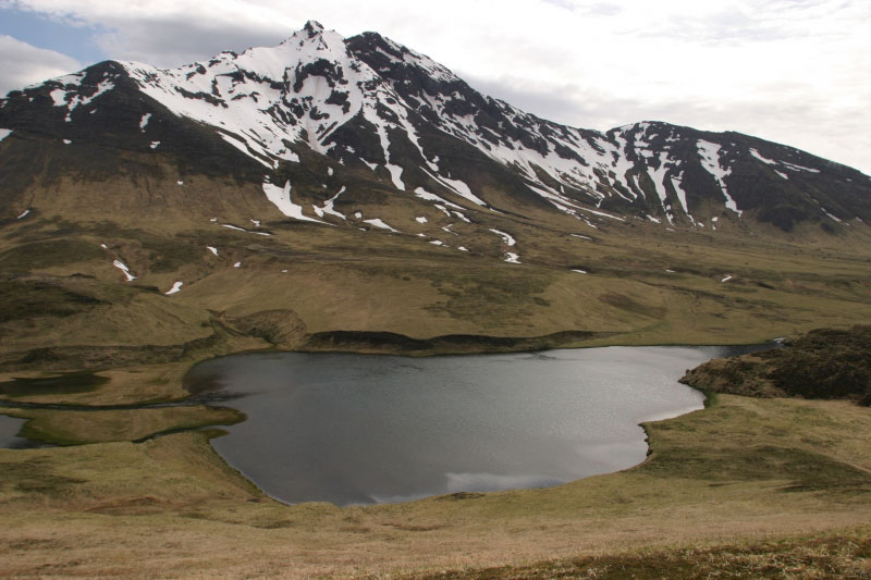
September 10 , 2021.


Iceland , Askja /  Skafta River :

Level of uncertainty declared for the current uplift of the Askja volcano, September 09, 2021.

Next week, IMO and the Faculty of Earth Sciences (UÍ) will begin to potentiate the level of monitoring of the volcanic area.

The image shows the quasi-vertical deformation in mm for the period from August 1 to September 5, 2021. The InSAR image is obtained from two passes of the Sentinel-1 satellite.

The National Commissioner, in agreement with the North East Iceland Police Department, declared the level of uncertainty due to the ongoing uprising of the Askja volcano. In recent weeks, rapid changes in deformation have been measured on the Askja, both from GPS stations and processed satellite images. The uplift reached about 7 centimeters and this is a significant change during this time period.

The most likely interpretation of this uplift is an influx of magma to a depth of 2-3 km. Next week, the IMO and the Institute of Earth Sciences (UÍ) will enhance the monitoring network around Askja to allow better coverage and monitoring of the volcano.

In light of the latest data, IMO has changed the aviation color code for Askja from green to yellow. This is done because the volcano is currently showing a level of activity above the known background level.

For civil protection, the level of uncertainty means that it is necessary to increase surveillance to monitor events which, in the long term, could lead to a threat to the health and safety of people, the environment and infrastructure. . Declaring a level of uncertainty is part of civil protection planning procedures to ensure formal communication and an exchange of information between the different intervention parties.

Skafta River:

The flow continues to decrease. At this point the likelihood of flood water flowing on Route 1 has been reduced, updated September 09, 4:15 PM

The flow of the Skaftá continues to decrease. The flow at Sveinstindur is less than 470m3 / sec and the flow at Eldvatn is around 370m3 / sec.
At this point, the likelihood of running water flowing onto Route 1 has decreased.

The meteorological office continues to monitor the area and assess the progress of the flood.

Source : Vedur.

Photos : Satellite Sentinel-1 / vedur is , Oddur Sigurðsson , mbl.is photographer Eggert Jóhannesson


Alaska , Semisopochnoi :

51°55’44 » N 179°35’52 » E,
Summit Elevation 2625 ft (800 m)
Current Volcano Alert Level: WATCH
Current Aviation Color Code: ORANGE

Eruptive activity continues at the north crater of Mount Cerberus on Semisopochnoi Island. Seismicity remains elevated and variable, with periods of continuous tremor, and occasional short-lived explosions of several minutes duration being detected in infrasound data. These explosive events are generating small ash clouds that typically rise from 5,000 to 10,000 ft asl and dissipate within an hour or two (as observed in satellite). Periods of lower-altitude ash emissions, interspersed with robust steaming, were observed in web camera images over the past day during periods of clear weather. These ash clouds were blown horizontally by the wind with little vertical uplift at altitudes below 5,000 ft asl. Sulfur dioxide emissions continue to be observed in satellite data (once per day).

Small eruptions producing minor ash deposits within the vicinity of the active north crater of Mount Cerberus and ash clouds usually under 10,000 feet above sea level have characterized the recent activity, which shows no signs of abating. Small explosions may continue to occur and could be difficult to detect, especially during poor weather conditions.

Semisopochnoi Island is monitored by local seismic and infrasound sensors, satellite data, web cameras, and remote infrasound and lightning networks.

Source et photo : AVO


Northern Kuril Islands , Ebeko :

50.69 N, 156.01 E;
Elevation 1156 m (3792 ft)
Aviation Colour Code is ORANGE

A moderate eruptive activity of the volcano continues. Ash explosions up to 6 km (19,700 ft) a.s.l. could occur at any time. Ongoing activity could affect low-flying aircraft and airport of Severo-Kurilsk.

A moderate explosive eruption of the volcano continues. According to visual data by volcanologists from Severo-Kurilsk, explosions sent ash up to 2 km a.s.l. on 04, and 06-08 September; ash clouds drifted to the north, south, and east of the volcano; ashfalls were noted on 06, and 08 September at Severo-Kurilsk. Satellite data by KVERT showed the volcano was quiet or obscured by clouds this week.

Source : Kvert

Photo : D. Sytnik


Indonesia , Merapi :

Level of activity level III (SIAGA) since November 5, 2020 at 12:00 WIB. Mount Merapi (2968 m above sea level) erupts intermittently.
The volcano is clearly visible. The smoke from the crater was observed to be white with moderate intensity and 100m high above the top of the crater. Avalanches of incandescent lava were observed with a maximum sliding distance of 1500 meters towards the southwest. The weather is sunny and a little cloudy. The wind is blowing in the West. The air temperature is 11 to 29 ° C, the humidity is 49 to 92%, and the air pressure is 627 to 718 mmHg.

According to the seismographs of September 9, 2021, it was recorded:

218 avalanche earthquakes
34 emission earthquakes
35 low frequency earthquakes
1 hybrid earthquake
2 distant tectonic earthquakes

Source : PVMBG

Photo : Detik.com


Chile , Cerro Hudson :

According to information provided by the South American Volcanic Observatory, Ovdas-Sernageomin, the Hudson volcano changes its technical alert level from yellow to green, the base state that characterizes the period of rest or calm, so a probable eruption could develop over a period of months or years.

Based on what is stated in the latest Volcanic Activity Report (RAV), released on Tuesday, which includes the period between August 16 and August 31, it is reported that 55 earthquakes classified as volcano-tectonic (VT) have been recorded, associated with the fracturing of rigid material, the locations of which are around the volcanic caldera.

Additionally, monitoring parameters indicate that seismic activity is prevalent, but with lower energy levels and without the presence of swarms or seismic tremors, a feature that was present in previous periods. The other monitoring parameters remain stable or unchanged.

With regard to the above, the Regional Directorate of Onemi Aysén updates the preventive preventive alert for the municipalities of Aysén and Río Ibáñez, due to the activity of the Hudson volcano, which has been in effect since December 22, 2020.

Finally, the Sernageomin continues the permanent monitoring of the volcanic complex and the Regional Directorate of Onemi Aysén, will maintain coordination with the members of the Regional Disaster Prevention and Response System to alert quickly and give an adequate response to possible emergency situations. resulting from the activity of this volcano.

Sources  :  eldivisadero.cl , Ovdas-Sernageomin

Photo : Norm Banks, 1991 (U.S. Geological Survey).


May 12, 2021. EN . Italy : Stromboli , Italy / Sicily : Etna , Iceland : Geldingadalur , Philippines : Bulusan , Chile : Cerro Hudson .

May 12 ,  2021.


Italy , Stromboli :

Weekly bulletin, from May 03, 2021 to May 09, 2021 (issue date May 11, 2021)

SUMMARY OF THE STATE OF ACTIVITY

In the light of surveillance data, it is highlighted:
1) VOLCANOLOGICAL OBSERVATIONS: Normal explosive volcanic activity of Strombolian type accompanied by sometimes intense projection activity in the N2 zone. The total frequency of events showed values ​​between medium (10 events / h) and medium-high (17 events / h).
The intensity of the explosions varied from low to medium-high in the North crater area and medium-high in the Center-South area.
2) SEISMOLOGY: The monitored seismological parameters do not show significant variations.
3) DEFORMATIONS: The variation of the radial component of the TDF station began on May 2, 2021 and continued during the week, until May 4, 2021.
4) GEOCHEMISTRY: SO2 flow at medium level
The C / S ratio in the plume is at average values, slightly increasing
The isotopic ratio of Helium shows average values.
5) SATELLITE OBSERVATIONS: The thermal activity in the summit area is at a moderate level.

Photo of the area of ​​the Stromboli crater on March 31, taken with a) shaded model of the terrain, the lines of different colors delimit the different areas of the crater; b) orthomosaic, the lines of different colors delimit the different areas of the crater; c) thermal ortho-image superimposed on the shaded terrain model, thermal anomalies are identifiable with white red yellow, cold areas are blue.

VOLCANOLOGICAL OBSERVATIONS
In the period under observation, the eruptive activity of Stromboli was characterized by the analysis of the images recorded by the surveillance cameras INGV-OE located at an altitude of 190 m, Punta Corvi and an altitude of 400 m.

Morpho-structural characterization of the crater area following the inspection of May 8, 2021.
Within the framework of the activities of the UNO project and the DPC / all convention. A, an ortho photo and a DSM (Digital Surface Model) of the crater area with a resolution of 7 and 25 cm, respectively, were processed. Direct on-site observation and morpho-structural analysis of the aforementioned areas made it possible to verify the following evolutions compared to the last morphological update of March 31, 2021 and to assess the state of the active vents:
(1) The area of ​​the N1 crater has widened by 8 m in the southwest direction and has 3 active vents
(2) In the area of ​​the N2 crater, 2 slag cones with a diameter of about 20 m and two other coalescers with a maximum elongation axis of 25 m were formed, where there were previously depressions of crater. It has 4 active mouths.
(3) The CS2 and CS1 crater areas are now merging and there are at least 10 mouths inside, of which 7 are active. The southwest edge widened a few meters in the southwest direction.
(4) The CS3 crater area has remained unchanged and has an inactive vent.


Description of the explosive activity captured by surveillance cameras.
In the area of ​​the North crater, the N1 crater produced explosions of varying intensity from low to medium-high (sometimes the products reached 250 m in height) emitting coarse materials (lapilli and bombs). The N2 vent, at four emission points, showed explosive activity of varying intensity from low to medium-high (sometimes the products reached 250 m in height) emitting mainly coarse materials with a throwing activity that was intense for short intervals on May 6. The average frequency of explosions varied from 8 to 13 events / h.
In the Center-South zone, there were at least three emission points with explosions, emitting coarse and fine materials, with medium and sometimes high intensity (the products exceeded 250 m in height).
The explosive activity showed average hourly frequency values ​​between 1 and 4 events / h.

PRESS RELEASE VOLCANIC ACTIVITY – STROMBOLI, May 11, 2021.

From around 08:00 a.m. on May 11, until 11:30 a.m. (UTC time), we observe by surveillance cameras and INGV personnel on the ground, a volcanic activity characterized by an intense activity of projections in the area. from the North crater. In particular, the activity was discontinuous with more intense phases between 8:10 a.m. and 9 a.m. and between 9:45 a.m. and 10:45 a.m., followed by short and more discontinuous phases. The Center-Sud crater sector produced explosive activity of varying and intense intensity. Overall, activity landed at a medium to high level to stay at an average level during the afternoon.


The SO2 flux showed values oscillating between a medium and high medium level, with progressive stages and a constant increase in coincidence with the intense projection activities. Since April, there has been a tendency to increase the degassing regime.
At the same time, from 08:05 hours (UTC time), an increase in the level of tremor of the top stations was observed, which reached medium to high values until 11:30 hours UTC and then returned to the levels. previous ones. The evolution of the VLP signals did not show variations either in number or in amplitude, which remains at low levels.
The available soil deformation data show no significant variation.

Source et photos : INGV.

Read the article :  https://www.ct.ingv.it/index.php/monitoraggio-e-sorveglianza/prodotti-del-monitoraggio/bollettini-settimanali-multidisciplinari/497-bollettino-settimanale-sul-monitoraggio-vulcanico-geochimico-e-sismico-del-vulcano-Stromboli20210511/file


Italy / Sicily , Etna : 

Weekly bulletin, from May 03, 2021 to May 09, 2021 (issue date May 11, 2021)

SUMMARY OF THE STATE OF ACTIVITY:

In the light of surveillance data, it is highlighted:

1) VOLCANOLOGICAL OBSERVATIONS: Degassing activity of summit craters and discontinuous Strombolian activity at the Southeast Crater, accompanied by low ash emissions.
2) SEISMOLOGY: significant swarm seismic activity, low level of tremor
3) INFRASOUND: Increase in infrasound activity.
4) DEFORMATIONS: There are no significant variations in the time series of soil deformation monitoring networks.
5) GEOCHEMISTRY: SO2 flow at medium-low level
The CO2 flux from the soil shows average values.
The partial pressure of dissolved CO2 in groundwater reaches background values.
No new data from the C / S ratio is available.
Helium isotopic ratio values ​​remain at high levels, although declining (sampling 04/23/2021).
6) SATELLITE OBSERVATIONS: The thermal activity in the summit area is at a low level.

Degassing of the summit of Etna with the central area of ​​the craters (Voragine and Bocca Nuova) on the left and the South-East crater on the right.

VOLCANOLOGICAL OBSERVATIONS
During the week, the monitoring of the volcanic activity at the level of the summit craters of Etna was carried out by analyzing the images of the network of surveillance cameras of the INGV Section of Catania, Etneo Observatory (INGV-OE).
During the week in question, the summit craters were affected by a variable degassing activity associated with a discontinuous Strombolian activity at the level of the Southeast Crater. In particular, intermittent and weak Strombolian activity was observed at the eastern mouth of the Southeast Crater, sometimes accompanied by small puffs of gray-brown ash, immediately dispersed in the summit area.

Volcanic tremor:
The magnitude of the tremor was low. The locations of the sources show a notable dispersion under the central craters and the Southeast Crater. The depths vary between 0.5 and 2.5 km above sea level.

Source : INGV.

Read the article https://www.ct.ingv.it/index.php/monitoraggio-e-sorveglianza/prodotti-del-monitoraggio/bollettini-settimanali-multidisciplinari/496-bollettino-settimanale-sul-monitoraggio-vulcanico-geochimico-e-sismico-del-vulcano-etna20210511/file

Photo: Giò Giusa


Iceland , Geldingadalur :

The magma fountains soar 300 meters into the air.

The volcanic projections that rise from the Geldingadalur crater reach a height of 300 meters when the power is at its highest. The crater that was created is now about 50 meters high.

Volcanologist Þorvaldur Þórðarson says the flow rate of the lava flow from Geldingadalur crater is always in the range of 5 to 10 cubic meters per second, and even closer to ten cubic meters. Updated results of lava flow and eruption measurements are expected today.

Around 1 p.m. yesterday, Monday, the crater jets were extremely high. They have been seen from many places. For example, they were clearly visible through the window of the Ríkisútvarp news agency in Efstaleit / Reykjavík. They always show up at a steady pace. The eruption seems to have stopped for a few minutes before setting off again in the crater and the magma is projected hundreds of meters into the air. It is an impressive sight, even from miles away.


The erupting volcano on the Reykjanes peninsula continues to surprise earth scientists, nearly two months after it started. According to the latest readings, lava flow is up by 70 percent and the eruption is twice as powerful as it has been for most of the time so far. “For an eruption to be growing in its eighth week is unusual and there are no signs we are about to see that stop. This is a different type of eruption than we are used to seeing,” says geophysicist Magnús Tumi Guðmundsson.
Data show that 95 percent of eruptions are most powerful at the beginning and then lose power gradually or quite suddenly. The eruption close to Fagradalsfjall appears to be an exception to that rule. “A significant increase in lava flow has occurred at Fagradalsfjall in recent weeks,” a press release from the University of Iceland earth sciences department confirms.

The increased lava flow appears to go hand-in-hand with the lava fountais that are being regularly throw high into the sky. The volcano’s new lava field now covers 1.8 square kilometres and has an overall mass of some 30 million cubic metres.

Most eruptions originate from a magma chamber under a central volcano. Pressure and the size of the chamber dictate how long and how big the eruption is. “But this eruption seems to be controlled by the eruption channel and how much it can transport. The channel that opened was particularly narrow and long,” the university report states—adding that the evidence suggests it is widening as time goes on.

Magnús Tumi says the data confirm what many have instinctively felt: that the eruption is getting bigger. It was not certain before, though, as the formerly stable eruption has become more volatile, so it is harder to compare.

Magnús Tumi says it is highly unusual for an eruption to be gaining strength two months in. He says there is no sign the current developments will change, and no way of knowing when the eruption will stop, or for how long it will continue growing in strength.

Source : RUV.

Photo: Hólmfríður Dagný Friðjónsd – RÚV , MBL .


Philippines , Bulusan : 

BULUSAN VOLCANO BULLETIN 12 May 2021 08:00 A.M.

In the past 24-hour period, the Bulusan Volcano Network recorded one hundred sixty-six (166) volcanic earthquakes. Ground deformation data from real-time electronic tilt monitoring recorded sustained inflation of the upper slopes that began 6 March 2021 consistent with short-term inflation of the edifice measured by continuous GPS monitoring since February 2021. These parameters generally indicate that shallow hydrothermal processes are occurring beneath the edifice.

Alert Level 1 status now prevails over Bulusan Volcano, which means that it is currently in an abnormal condition. Local government units and the public are reminded that entry into the 4-kilometer radius Permanent Danger Zone (PDZ) must be strictly prohibited and that vigilance in the 2-kilometer Extended Danger Zone (EDZ) on the southeast sector must be exercised due to the increased possibilities of sudden and hazardous phreatic eruptions. Civil aviation authorities must also advise pilots to avoid flying close to the volcano’s summit as ash from any sudden phreatic eruption can be hazardous to aircraft. Furthermore, people living within valleys and along river/stream channels especially on the southeast, southwest and northwest sector of the edifice should be vigilant against sediment-laden stream flows and lahars in the event of heavy and prolonged rainfall should phreatic eruption occur. DOST-PHIVOLCS is closely monitoring Bulusan Volcano’s condition and any new development will be communicated to all concerned stakeholders.

Source et photo : Phivolcs.


Chile , Cerro Hudson :

For the period evaluated, the seismic activity associated with rock fracturing (VT type events), whose locations are around the caldera, shows a slight increase in the quantity and energy of the events compared to the previous period. .
Two higher energy events stand out on April 17 and 23, both with a local magnitude (ML) of 2.9. They were located 4.1 km and 4.2 km, both southwest (SSW) of the center of the caldera with a depth of 4.1 and 1.8 km respectively.

The seismic activity associated with the fluid dynamics inside the volcano (type LP and HB) showed an increase in the number of long-term LP events compared to the previous fortnight, although they showed a decrease energy released. It should be noted that no hybrid earthquake was identified during the period analyzed.
The data provided by the GNSS stations recorded variations of 0.7 cm / month in the station located to the West-North-West of the volcanic building, however this variation would be attributable to seasonal effects.
No abnormal surface activity was recorded for the period evaluated.

Source : Cegemar.

Photo : Sernageomin.

12 Mai 2021. FR . Italie : Stromboli , Italie / Sicile : Etna , Islande : Geldingadalur , Philippines : Bulusan , Chili : Cerro Hudson .

12 Mai 2021.


Italie , Stromboli :

Bulletin hebdomadaire, du 03 Mai 2021 au 09 Mai 2021. (date d’émission 11 Mai 2021)

SOMMAIRE DE L’ÉTAT D’ACTIVITÉ

À la lumière des données de surveillance, il est mis en évidence:
1) OBSERVATIONS VOLCANOLOGIQUES: Activité volcanique explosive normale de type strombolienne accompagnée d’une activité de projection parfois intense dans la zone N2. La fréquence totale des événements a montré des valeurs comprises entre des niveaux moyens (10 événements / h) et moyens-élevés (17 événements / h).
L’intensité des explosions variait de faible à moyenne-élevée dans la zone du cratère Nord et moyenne-haute dans la zone Centre-Sud
2) SISMOLOGIE: Les paramètres sismologiques surveillés ne montrent pas de variations significatives.
3) DEFORMATIONS: La variation de la composante radiale de la station TDF a débuté le 2 mai 2021 et s’est poursuivie pendant la semaine, jusqu’au 4 mai 2021.
4) GÉOCHIMIE: flux de SO2 à niveau moyen
Le rapport C / S dans le panache se situe à des valeurs moyennes, en légère augmentation
Le rapport isotopique de l’Hélium montre des valeurs moyennes.
5) OBSERVATIONS SATELLITES: L’activité thermique dans la zone du sommet est à un niveau modéré.

Photo de la zone du cratère de Stromboli le 31 mars réalisée avec a) modèle ombré du terrain, les lignes de différentes couleurs délimitent les différentes zones du cratère; b) orthomosaïque, les lignes de couleurs différentes délimitent les différentes zones du cratère; c) ortho-image thermique superposée au modèle de terrain ombré, les anomalies thermiques sont identifiables au blanc rouge jaune, les zones froides sont bleues.

OBSERVATIONS VOLCANOLOGIQUES
Dans la période sous observation, l’activité éruptive de Stromboli a été caractérisée par l’analyse des images enregistrées par les caméras de surveillance INGV-OE situées à une altitude de 190 m, Punta Corvi et une altitude de 400 m.

Caractérisation morpho-structurelle de la zone du cratère suite à l’inspection du 8 mai 2021 .
Dans le cadre des activités du projet UNO et de la convention DPC / all. A, une ortho photo et un DSM (Digital Surface Model) de la zone du cratère avec une résolution de 7 et 25 cm, respectivement, ont été traités. L’observation directe sur site et l’analyse morpho structurale des zones précitées ont permis de vérifier les évolutions suivantes par rapport à la dernière mise à jour morphologique du 31 mars 2021 et d’évaluer l’état des évents actifs:
(1) La zone du cratère N1 s’est élargie de 8 m dans la direction Sud-Ouest et possède 3 évents actifs
(2) Dans la zone du cratère N2, 2 cônes de scories d’un diamètre d’environ 20 m et deux autres coalesceurs avec un axe d’élongation maximum de 25 m se sont formés, là où il y avait auparavant des dépressions de cratère. Il a 4 bouches actives.
(3) Les zones de cratère CS2 et CS1 sont maintenant en train de fusionner et il y a au moins 10 bouches à l’intérieur, dont 7 sont actives. Le bord Sud-Ouest s’est élargi de quelques mètres dans le sens Sud-Ouest .
(4) La zone du cratère CS3 est restée inchangée et a un évent inactif.


Description de l’activité explosive capturée par les caméras de surveillance.
Dans la zone du cratère Nord, le cratère N1 a produit des explosions d’intensité variable de faible à moyenne-élevée (parfois les produits atteignaient 250 m de hauteur) émettant des matériaux grossiers (lapilli et bombes). L’évent N2, à quatre points d’émission, a montré une activité explosive d’intensité variable de faible à moyenne-élevée (parfois les produits atteignaient 250 m de hauteur) émettant des matériaux principalement grossiers avec une activité de projection qui était intense pendant de courts intervalles le 6 mai. La fréquence moyenne des explosions variait de 8 à 13 événements / h.
Dans la zone Centre-Sud, il y avait au moins trois points d’émission avec des explosions, émettant des matériaux grossiers et fins , avec une intensité moyenne et parfois élevée (les produits dépassaient 250 m de hauteur).
L’activité explosive a montré des valeurs de fréquence horaire moyenne comprises entre 1 et 4 événements / h.

COMMUNIQUÉ ACTIVITÉ VOLCANIQUE – STROMBOLI , 11 Mai 2021 .

Depuis environ 08:00 heures le 11 Mai, jusqu’à 11:30 heures (temps UTC), on observe par les caméras de surveillance et le personnel INGV sur le terrain, une activité volcanique caractérisée par une activité intense de projections dans le secteur du cratère Nord. En particulier, l’activité a été discontinue avec des phases plus intenses entre 8:10 h et 09:00 h et entre 09:45 h30 et 10:45 h, suivie ensuite de phases courtes et plus discontinues. Le secteur du cratère Centre-Sud a produit une activité explosive d’intensité variable et intense. Dans l’ensemble, l’activité s’est posée à un niveau moyen à élevé pour rester à un niveau moyen en cours d’après-midi.
 
 
Le flux de SO2 a montré des valeurs oscillantes entre un niveau moyen et moyen élevé, avec des stades progressifs et une augmentation constante en coïncidence avec les activités de projections intenses. Depuis le mois d’avril, on observe une tendance à l’augmentation du régime de dégazage.
En même temps, à partir de 08:05 heures (temps UTC), une augmentation du niveau de tremor des stations sommitales a été observée, qui a atteint des valeurs moyennes à élevées jusqu’à 11:30 heures UTC pour ensuite revenir aux niveaux précédents. L ‘ évolution des signaux VLP n’a pas montré de variations ni en nombre ni  en amplitude, qui se maintient à des niveaux faibles.
Les données de déformation des sols disponibles ne montrent aucune variation significative.

Source et photos : INGV.

Lire l’article :  https://www.ct.ingv.it/index.php/monitoraggio-e-sorveglianza/prodotti-del-monitoraggio/bollettini-settimanali-multidisciplinari/497-bollettino-settimanale-sul-monitoraggio-vulcanico-geochimico-e-sismico-del-vulcano-Stromboli20210511/file


Italie / Sicile , Etna : 

Bulletin hebdomadaire, du 03 Mai 2021 au 09 Mai 2021. (date d’émission 11 Mai 2021)

SOMMAIRE DE L’ÉTAT D’ACTIVITÉ:

À la lumière des données de surveillance, il est mis en évidence:

1) OBSERVATIONS VOLCANOLOGIQUES: Activité de dégazage des cratères sommitaux et activité strombolienne discontinue au Cratère Sud-Est, accompagnée de faibles émissions de cendres.
2) SISMOLOGIE: activité sismique d’essaim significative, faible niveau de tremor
3) INFRASONS: Augmentation de l’activité infrasonore.
4) DEFORMATIONS: Il n’y a pas de variations significatives dans la série chronologique des réseaux de surveillance de la déformation des sols.
5) GÉOCHIMIE: flux de SO2 à niveau moyen-bas
Le flux de CO2 du sol montre des valeurs moyennes.
La pression partielle de CO2 dissous dans les eaux souterraines atteint les valeurs de fond.
Aucune nouvelle donnée du rapport C / S n’est disponible.
Les valeurs du rapport isotopique de l’hélium restent à des niveaux élevés, bien qu’en baisse (échantillonnage du 23/04/2021).
6) OBSERVATIONS SATELLITES: L’activité thermique dans la zone du sommet est à un niveau bas.

Dégazage du sommet de l’Etna avec la zone centrale des cratères (Voragine et Bocca Nuova) à gauche et le cratère Sud-Est à droite.

OBSERVATIONS VOLCANOLOGIQUES
Au cours de la semaine, le suivi de l’activité volcanique au niveau des cratères sommitaux de l’Etna a été réalisé en analysant les images du réseau de caméras de surveillance de la Section INGV de Catane, Observatoire Etneo (INGV-OE).
Au cours de la semaine en question, les cratères sommitaux ont été affectés par une activité de dégazage variable associée à une activité strombolienne discontinue au niveau du Cratère Sud-Est. En particulier, une activité strombolienne intermittente et faible a été observée à l’embouchure Est du Cratère Sud-Est  , parfois accompagnée de petites bouffées de cendres grises-brunes, immédiatement dispersées dans la zone sommitale  .

Tremor volcanique:
L’ampleur du tremor était faible. Les emplacements des sources montrent une dispersion notable sous les cratères centraux et le Cratère Sud-Est. Les profondeurs varient entre 0,5 et 2,5 km d’altitude.

Source : INGV.

Lire l’article https://www.ct.ingv.it/index.php/monitoraggio-e-sorveglianza/prodotti-del-monitoraggio/bollettini-settimanali-multidisciplinari/496-bollettino-settimanale-sul-monitoraggio-vulcanico-geochimico-e-sismico-del-vulcano-etna20210511/file

Photo: Giò Giusa


Islande , Geldingadalur :

Les fontaines de magma s’élève à 300 mètres dans les airs .

Les projections volcaniques qui s’élèvent du cratère de Geldingadalur atteignent une hauteur de 300 mètres lorsque la puissance est à son plus haut. Le cratère qui a été crée mesure maintenant environ 50 mètres de haut.

Le volcanologue Þorvaldur Þórðarson dit que le débit de la coulée de lave du cratère de Geldingadalur est toujours de l’ordre de 5 à 10 mètres cubes par seconde, et même plus proche de dix mètres cubes. Des résultats mis à jour des mesures de la coulée de lave et des éruptions sont attendus aujourd’hui.

Vers 13 heures hier, lundi, les jets du cratère étaient extrêmement hauts. Ils ont été vus depuis de nombreux endroits. Par exemple, ils étaient clairement visibles à travers la fenêtre de l’agence de presse Ríkisútvarp à Efstaleit / Reykjavík. Ils se manifestent toujours à un rythme régulier. L’éruption semble s’être arrêtée pendant quelques minutes avant de repartir à nouveau dans le cratère et le magma est projeté à des centaines de mètres dans les airs. C’est un spectacle impressionnant, même à des kilomètres.


Le volcan en éruption sur la péninsule de Reykjanes continue de surprendre les scientifiques de la Terre, près de deux mois après son démarrage. Selon les dernières analyses, la coulée de lave a augmenté de 70% et l’éruption est deux fois plus puissante qu’elle l’a été la plupart du temps jusqu’à présent. «Pour qu’une éruption se développe dans sa huitième semaine , c’est inhabituel et il n’y a aucun signe que nous soyons sur le point de voir cela s’arrêter. Il s’agit d’un type d’éruption différent de celui que nous avons l’habitude de voir », explique le géophysicien Magnús Tumi Guðmundsson.
Les données montrent que 95% des éruptions sont les plus puissantes au début, puis perdent progressivement ou soudainement de l’énergie. L’éruption près de Fagradalsfjall semble être une exception à cette règle. «Une augmentation significative de la coulée de lave s’est produite à Fagradalsfjall ces dernières semaines», confirme un communiqué de presse du département des sciences de la terre de l’Université d’Islande.

L’augmentation du flux de lave semble aller de pair avec les fontaines de lave qui sont régulièrement lancées haut dans le ciel. Le nouveau champ de lave du volcan couvre désormais 1,8 kilomètres carrés et a une masse totale d’environ 30 millions de mètres cubes.

La plupart des éruptions proviennent d’une chambre magmatique sous un volcan central. La pression et la taille de la chambre déterminent la durée et l’ampleur de l’éruption. «Mais cette éruption semble être contrôlée par le canal d’éruption et par combien il peut transporter. Le canal qui s’est ouvert était particulièrement étroit et long », indique le rapport de l’université, ajoutant que les preuves suggèrent qu’il s’élargit avec le temps.

Magnús Tumi dit que les données confirment ce que beaucoup ont instinctivement ressenti: que l’éruption grandit. Ce n’était pas certain avant, cependant, car l’éruption autrefois stable est devenue plus volatile, il est donc plus difficile de comparer.

 Magnús Tumi dit qu’il est très inhabituel qu’une éruption gagne en force deux mois plus tard. Il dit qu’il n’y a aucun signe que les développements actuels changent, et aucun moyen de savoir quand l’éruption s’arrêtera, ou pendant combien de temps elle continuera à se développer. 

Source : RUV.

Photo: Hólmfríður Dagný Friðjónsd – RÚV , MBL .


Philippines , Bulusan : 

BULLETIN D’ACTIVITE DU VOLCAN BULUSAN , 12 mai 2021 , 08h00 .

Au cours des dernières 24 heures, le Bulusan Volcano Network a enregistré cent soixante-six (166) tremblements de terre volcaniques. Les données de déformation du sol issues de la surveillance électronique en temps réel de l’inclinaison ont enregistré une inflation soutenue des pentes supérieures qui a commencé le 6 mars 2021, compatible avec l’inflation à court terme de l’édifice mesurée par une surveillance GPS continue depuis février 2021. Ces paramètres indiquent généralement que des processus hydrothermaux peu profonds se produisent sous l’édifice.

Le statut d’alerte de niveau 1 prévaut désormais sur le volcan Bulusan, ce qui signifie qu’il est actuellement dans un état anormal. Il est rappelé aux collectivités locales et au public que l’entrée dans la zone de danger permanent (PDZ) d’un rayon de 4 kilomètres doit être strictement interdite et que la vigilance dans la zone de danger étendu (EDZ) de 2 kilomètres sur le secteur Sud-Est doit être exercée en raison de la possibilités accrues d’éruptions phréatiques soudaines et dangereuses. Les autorités de l’aviation civile doivent également conseiller aux pilotes d’éviter de voler à proximité du sommet du volcan, car les cendres de toute éruption phréatique soudaine peuvent être dangereuses pour les aéronefs. En outre, les personnes vivant dans les vallées et le long des canaux fluviaux / rivières , en particulier dans les secteurs Sud-Est, Sud-Ouest et Nord-Ouest de l’édifice, doivent être vigilantes contre les écoulements et les lahars chargés de sédiments lors de pluies abondantes et prolongées en cas d’éruption phréatique. Le DOST-PHIVOLCS surveille de près l’état du volcan Bulusan et tout nouveau développement sera communiqué à toutes les parties prenantes concernées.

Source et photo : Phivolcs.


Chili , Cerro Hudson :

Pour la période évaluée, l’activité sismique associée à la fracturation  rocheuse (évènements de type VT), dont les emplacements sont autour de la caldeira, montre une légère augmentation de la quantité et de l’énergie des événements par rapport à la période précédente.
Deux événements d’énergie plus élevée se détachent les 17 et 23 avril, tous deux avec une magnitude locale (ML) de 2,9. Ils étaient situés à 4,1 km et 4,2 km, tous deux au Sud-Sud-Ouest (SSW) du centre de la caldeira avec une profondeur de 4,1 et 1,8 km respectivement.

L’activité sismique associée à la dynamique des fluides à l’intérieur du volcan (type LP et HB) a montré une augmentation du nombre d’événements LP de longue période par rapport à la quinzaine précédente, bien qu’ils aient montré une diminution de l’énergie libérée. Il est à noter qu’aucun séisme hybride n’a été identifié au cours de la période analysée.
Les données fournies par les stations GNSS ont enregistré des variations de 0,7 cm / mois dans la station située à l’Ouest-Nord-Ouest du bâtiment volcanique, cependant cette variation serait imputable à des effets saisonniers.
Aucune activité de surface anormale n’a été enregistrée pour la période évaluée.

Source : Cegemar.

Photo : Sernageomin.

March 28, 2021. EN. Alaska : Semisopochnoi , Indonesia : Sinabung , Chile / Argentina : Cerro Hudson , La Réunion : Piton de la Fournaise .

March 28 ,  2021 .


Alaska , Semisopochnoi :

51°55’44 » N 179°35’52 » E,
Summit Elevation 2625 ft (800 m)
Current Volcano Alert Level: WATCH
Current Aviation Color Code: ORANGE

Unrest continues. Two explosions were detected on regional infrasound sensors over the past day at 06:30 and 09:30 UTC (21:30 on March 26 and 00:30 on March 27 HADT). High meteorological clouds (> 30,000 ft asl) were in the region during the time of these explosions and no ash cloud was observed rising above them in satellite data. Satellite observations of the volcano were obscured by clouds over the past day. No evidence of sulfur dioxide emissions was observed in satellite data yesterday afternoon. These small explosions are typical for the recent eruptive behavior at Semisopochnoi.

Semisopochnoi, view of Ragged Top from the west.

Semisopochnoi is monitored by satellite data, regional infrasound, and lightning detection instruments. An infrasound array on Adak Island may detect explosive emissions from Semisopochnoi with a slight delay (approximately 13 minutes) if atmospheric conditions permit.

Source : AVO.

Photo : Jones, Ian.


Indonesia , Sinabung :

The activity level has been at level III (SIAGA) since May 20, 2019 at 10:00 a.m. WIB. Mount Api Sinabung (2460 m above sea level) has been erupting since 2013. The last eruption occurred on March 23, 2021 with a column height of 700 meters above the summit.
The volcano was clearly visible until it was covered in fog. We observe that the crater emits white smoke with a strong thickness, about 50-500 meters above the summit. The weather is sunny to cloudy, with light to moderate winds north, east, west and northwest.

According to the seismographs of March 27, 2021, it was recorded:
1 eruption / explosion earthquake
50 avalanche earthquakes
3 emissions earthquakes
28 hybrid / multi-phase earthquakes
1 local tectonic earthquake
5 distant tectonic earthquakes

Recommendation:

Communities and visitors / tourists should not conduct activities in villages that have been displaced, as well as within a radial radius of 3 km around the summit of Mount Sinabung, as well as a sector radius of 5 km for the sector. South-East, and 4 km for the North-East sector.

Source : PVMBG.

Photo : Sadrah PS.


Chile / Argentina , Cerro Hudson :

For the period evaluated, the seismic activity associated with rock fracturing (VT) showed a slight increase in the number of events, while maintaining similar magnitudes compared to the previous fortnight.
The highest energy event had a local magnitude (ML) of 2.7 and was located 5.5 km south (S) of the caldera center with a depth of 4.6 km.
The seismic activity associated with the fluid dynamics inside the volcano (LP and HB types) showed similar levels to the previous period with regard to the number of events, but showed a decrease in its energy.

The data provided by the GNSS stations did not record any variations suggesting changes in the internal dynamics of the volcano.
No abnormal surface activity was recorded for the period evaluated.

The YELLOW technical alert level implies the appearance of changes in the behavior of the volcano’s activity.

Source : Segemar .

Photo : Norm Banks,  (U.S. Geological Survey).


La Réunion , Piton de la Fournaise :

Preliminary activity bulletin of March 27, 2021.
Alert level: Vigilance.

Seismology

– Number of landslides on 03-27-2021: 1
Areas affected by landslides:
Summit cone
Enclos 
Outside Enclos 

– Number of volcano-tectonic earthquakes (VT) of 03-27-2021: 55
Zone affected by VT:
Summit cone

– Larger magnitude volcano-tectonic earthquake of 03-27-2021:
Length: 25.04 s
Magnitude of duration: 1.93.

Location map (epicenters) and North-South and East-West sections (showing the location in depth, hypocenters) of the earthquakes recorded and located by the OVPF-IPGP over 2 months in Reunion Island. Only localizable earthquakes have been shown on the map.
The observatory records seismic events that are not shown on this map because they cannot be located, due to their too low magnitude.
To find out about the number of earthquakes detected by the observatory networks, you can refer to the latest Activity Bulletin.

Deformations
– The GPS of the summit area record inflation, witnessing the pressurization of a surface source.
– Far-field GPS record an inflation, witnessing the pressurization of a deep source.

Illustration of the deformation over 2 months. The baselines (variation of distance between two GPS receivers) crossing the Piton de la Fournaise building, at the top (top), the base of the terminal cone (in the middle) and in the far field (bottom) are shown here. ) (see location on the associated maps). A rise is synonymous with elongation and therefore swelling of the volcano; conversely, a decrease is synonymous with contraction and therefore deflation of the volcano. Any periods colored in light pink correspond to eruptions.

Geochemistry
SO2 emissions at the top of the volcano: close to the detection threshold.
CO2 emissions from the ground: increasing throughout the network.

Source : OVPF.

Photo : Imaz Press

28 Mars 2021 . FR. Alaska : Semisopochnoi , Indonésie : Sinabung , Chili / Argentine : Cerro Hudson , La Réunion : Piton de la Fournaise .

28 Mars 2021 .


Alaska , Semisopochnoi :

51 ° 55’44 « N 179 ° 35’52 » E,
Altitude du sommet : 2625 pi (800 m)
Niveau d’alerte volcanique actuel: ATTENTION
Code couleur de l’aviation actuel: ORANGE

Les troubles continuent. Deux explosions ont été détectées sur des capteurs d’infrasons régionaux au cours de la dernière journée à 06h30 et 09h30 UTC (21h30 le 26 mars et 00h30 le 27 mars HADT). Des nuages météorologiques élevés (> 30 000 pieds d’altitude) se trouvaient dans la région au moment de ces explosions et aucun nuage de cendres n’a été observé s’élevant au-dessus d’eux dans les données satellitaires. Les observations satellitaires du volcan ont été obscurcies par les nuages au cours de la dernière journée. Aucune preuve d’émissions de dioxyde de soufre n’a été observée dans les données satellitaires hier après-midi. Ces petites explosions sont typiques du comportement éruptif récent du Semisopochnoi.

Semisopochnoi, vue de Ragged Top , vue orientée vers l’Ouest.

Le semisopochnoi est surveillé par des données satellitaires, des capteurs d’infrasons régionaux et des instruments de détection de la foudre. Un réseau de capteurs d »infrasons sur l’île d’Adak peut détecter les émissions explosives du Semisopochnoi avec un léger retard (environ 13 minutes) si les conditions atmosphériques le permettent.

Source : AVO.

Photo : Jones, Ian.


Indonésie , Sinabung :

Le niveau d’activité est au niveau III (SIAGA) depuis le 20 mai 2019 à 10h00 WIB. Le mont Api Sinabung (2460 m d’altitude) est en éruption depuis 2013. La dernière éruption s’est produite le 23 mars 2021 avec une hauteur de colonne de 700 mètres au-dessus du sommet.
Le volcan était clairement visible jusqu’à ce qu’il soit couvert de brouillard. On observe que le cratère émet de la fumée blanche avec une forte épaisseur , à environ 50-500 mètres au dessus du sommet. Le temps est ensoleillé à nuageux, les vents faibles à modérés orientés au Nord, à l’Est, à l’Ouest et au Nord-Ouest.

Selon les sismographes du 27 mars 2021, il a été enregistré:
1 tremblement de terre d’éruption / explosion
50 tremblements de terre d’avalanches
3 tremblements de terre d’émissions
28 tremblements de terre hybrides / multi-phases
1 tremblement de terre tectonique local
5  tremblements de terre tectoniques lointains

Recommandation:

Les communautés et les visiteurs / touristes ne doivent pas mener d’activités dans les villages qui ont été déplacés, ainsi que dans un rayon radial de 3 km autour du sommet du mont Sinabung, ainsi qu’un rayon sectoriel de 5 km pour le secteur Sud-Est, et 4 km pour le secteur Nord-Est .

Source : PVMBG.

Photo : Sadrah PS.


Chili / Argentine , Cerro Hudson :

Pour la période évaluée, l’activité sismique associée à la fracturation rocheuse (VT) a montré une légère augmentation du nombre d’événements, tout en conservant des magnitudes similaires par rapport à la quinzaine précédente.
L’événement d’énergie la plus élevée avait une magnitude locale (ML) de 2,7 et était situé à 5,5 km au Sud (S) du centre de la caldeira avec une profondeur de 4,6 km.
L’activité sismique associée à la dynamique des fluides à l’intérieur du volcan (types LP et HB) a montré des niveaux similaires à la période précédente en ce qui concerne le nombre d’événements, mais a présenté une diminution de son énergie.

Les données fournies par les stations GNSS n’ont pas enregistré de variations suggérant des changements dans la dynamique interne du volcan.
Aucune activité de surface anormale n’a été enregistrée pour la période évaluée.

Le niveau d’alerte technique JAUNE implique l’apparition de changements dans le comportement de l’activité du volcan.

Source : Segemar .

Photo : Norm Banks,  (U.S. Geological Survey).


La Réunion , Piton de la Fournaise :

Bulletin préliminaire d’activité du 27 Mars 2021.
Niveau d’alerte : Vigilance.

Sismologie

– Nombre d’éboulements du 27-03-2021 : 1
Zones concernées par les éboulements :
Cône sommital
Enclos
Hors Enclos

– Nombre de séismes volcano-tectoniques (VT) du 27-03-2021 : 55
Zone concernée par les VT :
Cone sommital

– Séisme volcano-tectonique de plus grande magnitude du 27-03-2021 :
Durée : 25.04 s
Magnitude de durée : 1.93.

Carte de localisation (épicentres) et coupes Nord-Sud et Est-Ouest (montrant la localisation en profondeur, hypocentres) des séismes enregistrés et localisés par l’OVPF-IPGP sur 2 mois sous La Réunion. Seuls les séismes localisables ont été représentés sur la carte.
L’observatoire enregistre des évènements sismiques non représentés sur cette carte car non localisables, en raison de leur trop faible magnitude.
Pour prendre connaissance du nombre de séismes détectés par les réseaux de l’observatoire, vous pouvez vous reporter au dernier Bulletin d’Activité.

Déformations
– Les GPS de la zone sommitale enregistrent une inflation, témoin de la mise en pression d’une source superficielle.
– Les GPS en champ lointain enregistrent une inflation, témoin de la mise en pression d’une source profonde.

Illustration de la déformation sur 2 mois. Sont ici représentées des lignes de base (variation de distance entre deux récepteurs GPS) traversant l’édifice du Piton de la Fournaise, au sommet (en haut), à la base du cône terminal (au milieu) et en champ lointain (en bas) (cf. localisation sur les cartes associées). Une hausse est synonyme d’élongation et donc de gonflement du volcan; inversement une diminution est synonyme de contraction et donc de dégonflement du volcan. Les éventuelles périodes coloriées en rose clair correspondent aux éruptions.

Géochimie
Émissions de SO2 au niveau du sommet du volcan: proches du seuil de détection.
Émissions de CO2 par le sol : en augmentation sur l’ensemble du réseau.

Source : OVPF.

Photo : Imaz Press

February 07, 2021. EN . Alaska : Semisopochnoi , Kamchatka : Klyuchevskoy , Philippines : Taal , Indonesia : Raung , Chile : Cerro Hudson .

February 07 ,  2021 .


Alaska , Semisopochnoi :

AVO/USGS Volcanic Activity Notice

Current Volcano Alert Level: ADVISORY
Previous Volcano Alert Level: UNASSIGNED
Current Aviation Color Code: YELLOW
Previous Aviation Color Code: UNASSIGNED

Issued: Saturday, February 6, 2021, 7:51 PM AKST
Source: Alaska Volcano Observatory
Notice Number: 2021/A11
Location: N 51 deg 55 min E 179 deg 35 min
Elevation: 2625 ft (800 m)
Area: Aleutians

Volcanic Activity Summary:
High-resolution satellite images on February 6 showed a small ash deposit extending less than 3 km to the north from North Cerebus Crater on Semisopochnoi Island. Steam emissions obscured views into the crater. There is no evidence for continuing activity, but observation of a new deposit suggests renewed unrest, and the Alaska Volcano Observatory is increasing the Aviation Color Code to YELLOW and the Volcano Alert Level to ADVISORY.

Worldview-3 satellite image of Semisopochnoi on February 6, 2021. A thin ash deposit is visible <3 km to the north of North Cerebus crater, which is filled with steam.

Small eruptions producing minor ash deposits within the vicinity of the volcano are typical of activity during unrest at Semisopochnoi since September 2018, with the last detected activity in June 2020. Local seismic stations have been offline since November 11, 2020. New explosions could occur at anytime with no warning.

Recent Observations:
[Volcanic cloud height] n/a
[Other volcanic cloud information] n/a

Remarks:
Semisopochnoi is monitored remotely by satellite and lightning sensors. An infrasound array on Adak Island could detect explosive emissions from Semisopochnoi with a 13 minute delay if atmospheric conditions permit.

Source : AVO

Photo : Loewen, Matt.


Kamchatka , Klyuchevskoy :

56.06 N, 160.64 E;
Elevation 4750 m (15580 ft)
Aviation Colour Code is ORANGE

A moderate explosive-effusive eruption of the volcano continues. Ash explosions up to 9-10 km (29,500-32,800 ft) a.s.l. could occur at any time. Ongoing activity could affect international and low-flying aircraft.


Powerful gas-steam activity with some amount of ash of Klyuchevskoy volcano in the rays of the setting sun on 05 February, 2021.

This eruption of the volcano continues, the Strombolian, gas-steam and sometimes Vulcanian activity is observing. The lava flow continues to move along Apakhonchichsky chute on the southeastern volcanic flank. Satellite data showed a large thermal anomaly in the area of the volcano all week; gas-steam plumes containing some amount of ash rose up to 6 km a.s.l., and extended for 92 km to the different directions of the volcano.

Source : Kvert .

Photo : IVS FEB RAS, KVERT


Philippines , Taal :

TAAL VOLCANO BULLETIN: 07 FEBRUARY 2021 08:00 A.M.

In the past 24-hour period, the Taal Volcano Network recorded forty-one (41) volcanic earthquakes. Emission of white steam-laden plumes from fumarolic activity at Main Crater vents was weak. Ground deformation parameters based on continuous GPS monitoring from 29 March 2020 to present indicated a slow and slight inflation of the northwestern sector of Taal Caldera, which was also recorded by electronic tilt on northwest Volcano Island starting the second week of July 2020. In contrast, GPS data from the southwestern sector of Taal Caldera and Volcano Island yielded no significant change after the huge post-eruption subsidence.


Alert Level 1 (Abnormal) is maintained over Taal Volcano. DOST-PHIVOLCS reminds the public that at Alert Level 1, sudden steam-driven or phreatic explosions, volcanic earthquakes, minor ashfall, and lethal accumulations or expulsions of volcanic gas can occur and threaten areas within the Taal Volcano Island (TVI). DOST-PHIVOLCS strongly recommends that entry into TVI, Taal’s Permanent Danger Zone or PDZ, especially the vicinities of the Main Crater and the Daang Kastila fissure, must remain strictly prohibited. Local government units are advised to continuously assess previously evacuated barangays around Taal Lake for damages and road accessibilities and to strengthen preparedness, contingency, and communication measures in case of renewed unrest. People are also advised to observe precautions due to ground displacement across fissures, possible ashfall, and minor earthquakes. Civil aviation authorities must advise pilots to avoid flying close to the volcano as airborne ash and ballistic fragments from sudden explosions and wind-remobilized ash may pose hazards to aircraft.

DOST-PHIVOLCS is closely monitoring Taal Volcano’s activity and any new significant development will be immediately communicated to all stakeholders.

Source : Phivolcs .

Photo : Grig C. Montegrande/Philippine Daily Inquirer.


Indonesia , Raung :

VOLCANO OBSERVATORY NOTICE FOR AVIATION – VONA.

Issued : February 06 , 2021
Volcano : Raung (263340)
Current Aviation Colour Code : ORANGE
Previous Aviation Colour Code : orange
Source : Raung Volcano Observatory
Notice Number : 2021RAU16
Volcano Location : S 08 deg 07 min 30 sec E 114 deg 02 min 31 sec
Area : East java, Indonesia
Summit Elevation : 10662 FT (3332 M)

Volcanic Activity Summary :
On 7 February 2021, Eruption with volcanic ash cloud 22h00 UTC ( 05h00 Local Time ). Eruption and ash emission is continuing.

Volcanic Cloud Height :
Best estimate of ash-cloud top is around 13862 FT (4332 M) above sea level, may be higher than what can be observed clearly. Source of height data: ground observer.

Other Volcanic Cloud Information :
Ash-cloud moving to east-southeast

Remarks :
Seismic activity is characterized by continuous volcanic tremor.

Since January 20, 2021, non-harmonic tremors have been recorded, followed by deep volcanic earthquakes, accompanied by changes in the color and height of the emission gas / ash column. Thus, since January 21, 2021, the activity level of G. Raung has been raised to level II (Waspada).

The volcano was clearly visible until it was covered in fog. The crater was observed to emit gray smoke of moderate intensity, rising about 600 meters above the summit. The weather is cloudy to rainy, with weak winds to the east and south. It was noted a roar as well as an incandescence, smoke / ash pointing east-northeast.

According to the seismographs of February 6, 2021, it was recorded:
4 continuous tremor signals with an amplitude of 3 to 32 mm, dominant value 16 mm

Recommendation:
The public / visitors / tourists should not practice activities within a radius of 2 km around the summit crater.

Source : Magma Indonésie , PVMBG.

Photo : Paula Caiado


Chile , Cerro Hudson :

162 earthquakes classified as volcano-tectonic (VT) type were recorded, associated with the fracturing of rigid materials; the largest of them had a local magnitude (ML) of 2.1 and was located 1.6 km West-South-West (OSW) of the center of the caldera at a depth of 2.5 km.
– In addition, 153 long-period (LP) seismic events have been classified, linked to the dynamics of fluids inside the volcanic building and / or produced by glacial activity; the most energetic earthquake presented a reduced displacement value (DR) equal to 5.5 cm2.
– In addition, 2 earthquakes classified as hybrid (HB) were recorded, generally linked to a mechanism composed of a fracturing of rigid material and a consequent disturbance due to the circulation of fluids inside the volcanic conduits . The earthquake with the highest energy exhibited a reduced displacement (DR) equal to 1.5 cm2 and was located 4.1 km west-northwest (ONO) at a depth of 1 , 9 km.

– According to the data provided by 2 GNSS stations which measure the surface deformation in the volcanic sectors, there are minor variations, of a seasonal nature, in the movements, probably linked to the glacial dynamics of the area. In particular, a trend towards the North of the station located to the North of the volcano with average rates of 0.15 cm / month, without this indicating changes in the internal dynamics of the volcano.
– No anomalies were reported in the emissions of sulfur dioxide (SO2) into the atmosphere in the area near the volcanic building.
– During the period, no thermal alert was recorded in the area associated with the volcanic building.
– Thanks to the observation of surveillance cameras and the processing of satellite images SENTINEL2L2A and PlanetScope, no surface activity or morphological change linked to volcanic activity was recorded.

On the Hudson volcano, the recording of combined VT, LP and HB seismicity persists, although during the period evaluated, there was a tendency to have lower recurrence and lower energy. Seismicity levels are still considered to be abnormal and above the baseline threshold of this volcanic system. There is no surface activity associated with volcanic activity. Based on the above, the technical alert remains yellow.

Source : Sernageomin .

Photo : Norm Banks, 1991 (U.S. Geological Survey).

07 Février 2021 . FR . Alaska : Semisopochnoi , Kamchatka : Klyuchevskoy , Philippines : Taal , Indonésie : Raung , Chili : Cerro Hudson .

07 Février 2021 .


Alaska , Semisopochnoi :

Avis d’activité volcanique AVO / USGS

Niveau d’alerte volcanique actuel: AVIS
Niveau d’alerte volcan précédent: NON ASSIGNÉ
Code couleur de l’aviation actuel: JAUNE
Code couleur de l’aviation précédent: NON ASSIGNÉ

Émis: samedi 6 février 2021, 19h51 AKST
Source: Observatoire du volcan Alaska
Numéro de l’avis: 2021 / A11
Localisation: N 51 deg 55 min E 179 deg 35 min
Altitude: 800 m (2625 pi)
Région: Aléoutiennes

Résumé de l’activité volcanique:
Des images satellite à haute résolution du 6 février ont montré un petit dépôt de cendres s’étendant à moins de 3 km au Nord du cratère North Cerebus sur l’île de Semisopochnoi. Les émissions de vapeur obscurcissaient les vues sur le cratère. Il n’y a aucune preuve d’une activité continue, mais l’observation d’un nouveau gisement suggère une nouvelle agitation, et l’Observatoire du volcan de l’Alaska augmente le code de couleur de l’aviation à JAUNE et le niveau d’alerte du volcan à AVIS.

Image satellite Worldview-3 du Semisopochnoi le 6 février 2021. Un mince dépôt de cendres est visible à moins de 3 km au Nord du cratère North Cerebus, qui est rempli de vapeur.

De petites éruptions produisant des dépôts mineurs de cendres à proximité du volcan sont typiques de l’activité pendant les troubles sur le Semisopochnoi depuis septembre 2018, la dernière activité détectée en juin 2020. Les stations sismiques locales sont hors ligne depuis le 11 novembre 2020. De nouvelles explosions pourraient se produire à à tout moment sans avertissement.

Observations récentes:
[Hauteur des nuages ​​volcaniques] n / a
[Autres informations sur les nuages ​​volcaniques] n / a

Remarques:
 Le Semisopochnoi est surveillé à distance par des satellites et des capteurs de foudre. Un réseau de capteurs d’infrasons sur l’île d’Adak pourrait détecter les émissions explosives du Semisopochnoi avec un retard de 13 minutes si les conditions atmosphériques le permettent.

Source : AVO

Photo : Loewen, Matt.


Kamchatka , Klyuchevskoy :

56,06 N, 160,64 E;
Élévation : 4750 m (15580 pi)
Code couleur de l’aviation : ORANGE

L’ éruption explosive-effusive modérée du volcan se poursuit. Des explosions de cendres jusqu’à 9-10 km (29,500-32,800 ft) d’altitude pourraient survenir à tout moment. L’activité en cours pourrait affecter les aéronefs internationaux volant à basse altitude.


Puissante activité gaz-vapeur avec une certaine quantité de cendres du volcan Klyuchevskoy dans les rayons du soleil couchant le 05 février 2021.

Cette éruption du volcan se poursuit, une activité strombolienne, gaz-vapeur et parfois vulcanienne est observée. La coulée de lave continue de se déplacer le long de la goulotte Apakhonchichsky sur le flanc volcanique Sud-Est. Les données satellitaires ont montré une grande anomalie thermique dans la zone du volcan toute la semaine; des panaches de gaz-vapeur contenant une certaine quantité de cendres se sont élevés jusqu’à 6 km au-dessus du niveau de la mer et se sont étendus sur 92 km vers les différentes directions du volcan.

Source : Kvert .

Photo : IVS FEB RAS, KVERT


Philippines , Taal :

BULLETIN D’ACTIVITE DU VOLCAN TAAL: 07 FÉVRIER 2021 , 08h00 .

Au cours des dernières 24 heures, le réseau de capteurs du volcan Taal a enregistré quarante et un (41) tremblements de terre volcaniques. L’émission de panaches blancs chargés de vapeur provenant de l’activité fumerolienne depuis les évents du cratère principal était faible. Les paramètres de déformation du sol basés sur une surveillance GPS continue du 29 mars 2020 à aujourd’hui ont indiqué une inflation lente et légère du secteur Nord-Ouest de la caldeira du Taal  , qui a également été enregistrée par inclinaison électronique sur le coté Nord-Ouest de l’île du volcan à partir de la deuxième semaine de juillet 2020. En revanche, Les données GPS du secteur Sud-Ouest de la caldeira du Taal et de l’île du volcan n’ont donné aucun changement significatif après l’énorme affaissement post-éruption.


Le niveau d’alerte 1 (anormal) est maintenu sur le volcan Taal. Le DOST-PHIVOLCS rappelle au public qu’au niveau d’alerte 1, des explosions soudaines , de vapeur ou phréatiques, des tremblements de terre volcaniques, des chutes de cendres mineures et des accumulations ou expulsions mortelles de gaz volcanique peuvent se produire et menacer des zones de l’île du volcan Taal (TVI). Le DOST-PHIVOLCS recommande vivement que l’entrée dans TVI, la zone de danger permanent de Taal ou PDZ, en particulier aux alentours du cratère principal et de la fissure de Daang Kastila, reste strictement interdite. Il est conseillé aux autorités locales d’évaluer en permanence les barangays précédemment évacués autour du lac Taal pour les dommages et les accessibilités routières et de renforcer les mesures de préparation, d’urgence et de communication en cas de reprise des troubles. Il est également conseillé aux gens d’observer les précautions en raison du déplacement du sol à travers les fissures, de possibles chutes de cendres et de tremblements de terre mineurs. Les autorités de l’aviation civile doivent conseiller aux pilotes d’éviter de voler à proximité du volcan car les cendres en suspension dans l’air et les fragments balistiques d’explosions soudaines et de cendres remobilisées par le vent peuvent présenter des dangers pour les aéronefs.

Le DOST-PHIVOLCS surveille de près l’activité du volcan Taal et tout nouveau développement significatif sera immédiatement communiqué à toutes les parties prenantes.

Source : Phivolcs .

Photo : Grig C. Montegrande/Philippine Daily Inquirer.


Indonésie , Raung :

AVIS D’OBSERVATION DU VOLCAN POUR L’AVIATION – VONA.

Date d’émission: 6 février 2021
Volcan: Raung (263340)
Code couleur de l’aviation actuel: ORANGE
Code couleur de l’aviation précédent: orange
Source: Observatoire du volcan Raung
Numéro de l’avis: 2021RAU16
Emplacement du volcan: S 08 deg 07 min 30 sec E 114 deg 02 min 31 sec
Zone: Java Est, Indonésie
Altitude du sommet: 10662 FT (3332 M).

Résumé de l’activité volcanique:
Le 7 février 2021, éruption avec nuage de cendres volcaniques à 22h00 UTC (05h00 heure locale). L’éruption et l’émission de cendres se poursuivent.

Hauteur du nuage volcanique:
La meilleure estimation du sommet des nuages de cendres est d’environ 4332 M au-dessus du niveau de la mer, ce qui peut être plus élevé que ce qui peut être observé clairement. Source des données d’altitude: observateur au sol.

Autres informations sur le nuage volcanique:
Nuage de cendres se déplaçant vers l’Est-Sud-Est

Remarques :
L’activité sismique est caractérisée par un tremor volcanique continu.

Depuis le 20 janvier 2021, des tremors non harmoniques ont été enregistrés, suivis de tremblements de terre volcaniques profonds, accompagnés de changements la couleur et de la hauteur de la colonne de gaz / cendres d’émission . Ainsi, depuis le 21 janvier 2021, le niveau d’activité du G. Raung a été élevé au niveau II (Waspada).

Le volcan était clairement visible jusqu’à ce qu’il soit couvert de brouillard. Il a été observé que le cratère émettait une fumée grise d’intensité modérée , s’élevant à environ 600 mètres au dessus du sommet. Le temps est nuageux à pluvieux , les vents faibles à l’Est et au Sud. Il a été noté un rugissement ainsi qu’une incandescence , fumée / cendres pointant vers l’Est-Nord-Est.

Selon les sismographes du 6 février 2021, il a été enregistré:
4 signaux de tremor continu avec une amplitude de 3 à 32 mm, valeur dominante 16 mm

Recommandation:
Le public / visiteurs / touristes ne doivent pas pratiquer d’activités dans un rayon de 2 km autour du cratère sommital.

Source : Magma Indonésie , PVMBG.

Photo : Paula Caiado


Chili , Cerro Hudson :

162 séismes classés comme type volcano-tectoniques (VT) ont été enregistrés, associés à la fracturation de matériaux rigides; le plus grand d’entre eux présentait une magnitude locale (ML) égale à 2,1 et était situé à 1,6 km à l’Ouest-Sud-Ouest (OSO) du centre de la caldeira à une profondeur de 2,5 km.
– De plus, 153 événements sismiques de type longue période (LP) ont été classés, liés à la dynamique des fluides à l’intérieur du bâtiment volcanique et / ou produits par l’activité glaciaire; le séisme le plus énergétique a présenté une valeur de déplacement réduit (DR) égale à 5,5 cm2.
– De plus, 2 tremblements de terre classés comme hybrides (HB) ont été enregistrés, généralement liés à un mécanisme composé d’une fracturation de matériau rigide et d’une perturbation consécutive due à la circulation de fluides à l’intérieur des conduits volcaniques. Le tremblement de terre avec l’énergie la plus élevée a présenté un déplacement réduit (DR) égal à 1,5 cm2 et a été localisé à 4,1 km à l’Ouest-Nord-Ouest (ONO) à une profondeur de 1,9 km.

– D’après les données fournies par 2 stations GNSS qui mesurent la déformation de surface dans les secteurs volcaniques, il existe des variations mineures, de nature saisonnière, dans les mouvements, probablement liées à la dynamique glaciaire de la zone. En particulier, une tendance vers le Nord de la station située au Nord du volcan avec des taux moyens de 0,15 cm / mois, sans que cela indique des changements dans la dynamique interne du volcan.
– Aucune anomalie n’a été signalée dans les émissions de dioxyde de soufre (SO2) dans l’atmosphère dans le secteur proche du bâtiment volcanique.
– Au cours de la période, aucune alerte thermique n’a été enregistrée dans la zone associée au bâtiment volcanique.
– Grâce à l’observation des caméras de surveillance et au traitement d’images satellite SENTINEL2L2A et PlanetScope, aucune activité de surface ou changement morphologique lié à l’activité volcanique n’a été enregistré.

Sur le volcan Hudson, l’enregistrement de sismicité combinée VT, LP et HB persiste, bien que pendant la période évaluée , on notait une tendance à présenter une récurrence et une énergie plus faibles. Les niveaux de sismicité sont toujours considérés comme anormaux et supérieurs au seuil de base de ce système volcanique. Il n’y a pas d’activité de surface associée à l’activité volcanique. Sur la base de ce qui précède, l’alerte technique reste jaune.

Source : Sernageomin .

Photo : Norm Banks, 1991 (U.S. Geological Survey).

January 27, 2021. EN . Philippines : Pinatubo , Italy / Sicily : Etna , Italy : Stromboli , Chile , Cerro Hudson , Indonesia : Merapi .

January 27 , 2021 .


Philippines , Pinatubo :

PINATUBO VOLCANO ADVISORY 27 JANUARY 2021 9:00 AM

This is to notify the public and concerned authorities of recent earthquake activity in Pinatubo Volcano.

Since 20 January 2021, the Pinatubo Volcano Network (PVN) and the Philippine Seismic Network (PSN) have detected a total of 826 imperceptible earthquakes east-northeast of Pinatubo Volcano in the vicinities of the City of Mabalacat, Pampanga. The strongest of these earthquakes occurred on 25 January at depths of 15-28 kilometers and ranged between ML1.0 and ML2.5 in magnitudes. Based on the general distribution of located events, these earthquakes were generated along a segment of the Sacobia Lineament, a fault that was last active during the post-eruption period of 1991. This development serves to remind us once again that several faults occur around the volcano and that these can generate earthquake activity that can be sometimes imperceptible and harmless but that can also sometimes be damaging. On 22 April 2019, a M6.1 earthquake on the southern foot slopes of Pinatubo Volcano shook the Central Luzon region and caused fatalities and substantial damages to buildings, roads and other structures.

DOST-PHIVOLCS would like to assure the public that Pinatubo Volcano remains at Alert Level 0 and remains in quiescent condition. Although there is currently no threat from the above recent earthquake activity, communities and local government units surrounding the volcano, nonetheless, have to be reminded to be always prepared for both earthquake and volcanic hazards and to build on the lessons of what they have experienced in the past years. DOST-PHIVOLCS continues to strengthen its monitoring of the volcano with ongoing upgrades to the PVN and upcoming geochemical surveys of the Pinatubo crater lake.

DOST-PHIVOLCS is closely monitoring the volcano’s condition and any new development will be relayed to all concerned.

Source : Phivolcs .

Photo : Lemuel Salibio / Wikipedia .


Italy / Sicily , Etna :

Weekly bulletin, from January 18, 2021 to January 24, 2021. (issue date January 26, 2021)

SUMMARY OF THE STATE OF ACTIVITY

In the light of surveillance data, it is highlighted:
1) VOLCANOLOGICAL OBSERVATIONS: Strombolian activity of variable intensity, episode of lava fountains, emissions of volcanic ash, lava overflow from the Southeast crater. Intra-crater Strombolian activity at the Northeast crater, at the crater of Bocca Nuova and at the crater of Voragine with occasional and diluted emissions of volcanic ash.
2) SEISMOLOGY: Increased rate of occurrence of fracturing earthquakes. Amplitude of the tremor between medium-high values. Episodes of sudden increases in the amplitude of the tremor associated with the lava overflow produced by the Southeast crater.
3) INFRASON: moderate infrasound activity.
4) DEFORMATIONS: No significant variation to report for the deformations measured by the networks of inclination and GNSS sensors, with the exception of the inclinometric station of the « Cratère del Piano » which recorded a variation of approximately 1 microradian on the two components of the inclinometric sensor, at the same time as the lava fountain episode of January 18.

5) GEOCHEMISTRY: SO2 flux: medium-high level
HCl flux occurs at a medium-high level.
The CO2 flux from the soil is at average levels.
The partial pressure of dissolved CO2 does not show significant changes.
There are no updates for the C / S report.
The helium isotope ratio is at average values ​​(last update 08/01/2021).
6) SATELLITE OBSERVATIONS: The thermal activity in the summit area is at a moderate level.

VOLCANOLOGICAL OBSERVATIONS

The monitoring of the volcanic activity of Etna, during the week in question, was carried out by analyzing the images of the network of surveillance cameras INGV, Osservatorio Etneo (INGV-OE) and through the observations made by the INGV-OE staff on January 18 and 19. Due to unfavorable weather conditions, it was not possible to observe continuous volcanic activity.
In the period considered, the activity of the summit craters of Etna, with the exception of the lava fountain of January 18, did not change compared to what was observed the previous week. This activity was characterized by a variable Strombolian activity, by a lava fountain episode, by the emission of overflow lava, and discontinuous ash emissions at the Southeast crater (SEC), by a strombolian activity mainly intra-crater at the Northeast crater (NEC), at the crater of Bocca Nuova (BN) and at the crater of Voragine (VOR) with sporadic emissions of ash which were immediately dispersed into the atmosphere.

Map of the lava field from January 18 on a shaded model of the terrain of the summit area of ​​Etna. BN: Bocca Nuova, VOR: Voragine; NEC: northeast crater; SEC: Southeast crater.

As of approximately 19:15 UTC, analysis of the CCTV images from the INGV-OE showed new lava overflow from the East Vent of the Southeast Crater (SEC) . The front branches off towards the Valle del Bove, east-south-east and reaches an altitude of about 2190 m above sea level, with a length of about 2 km . From 8:30 p.m. UTC, a new lava overflow developed on the north side of the Southeast Crater (SEC)   which moved east-northeast to reach an altitude of ‘about 2500 m and a length of 1.3 km  .
As of 19:15 UTC, there was also an increase in the intensity of Strombolian activity at the Southeast Crater (SEC).
Strombolian activity evolved into a lava fountain until reaching its maximum intensity around 8:30 p.m. UTC  . The explosive activity generated by the lava fountain gradually decreased until it ended immediately after 9:00 p.m. UTC. On the morning of January 19, there was only weak Strombolian activity at the Southeast Crater (SEC) which formed a diluted volcanic cloud in the atmosphere as the lava fronts cooled.

The lava fountain produced a volcanic cloud that dispersed to the southeast, forming a deposit that affected the villages of Etna located on the southeast flank of the volcano.
The thin deposit was sampled by INGV-OE staff in Fleri and Acicastello.
Starting at approximately 12:40 UTC on January 20, a new lava overflow was observed on the north side of the Southeast Crater that was heading east northeast overlapping the lava flow of January 18  . At the same time, an increase in Strombolian activity was also observed  .
The intensity of effusive activity decreased overnight, then regained strength at around 9.45 UTC   and decreased again. By late afternoon, the fronts were cooling  .
Finally, the activity of the Northeast crater (NEC), of Bocca Nuova (BN) and of Voragine (VOR) had a behavior comparable to that observed the previous week (Rep. N ° 03/2021), characterized by mainly intracrateral Strombolian emissions of varying intensity accompanied by sporadic and weak emissions of ash rapidly dispersed by high altitude winds.

Source : INGV.

Read the article: http://www.ct.ingv.it/index.php/monitoraggio-e-sorveglianza/prodotti-del-monitoraggio/bollettini-settimanali-multidisciplinari/462-bollettino-settimanale-sul-monitoraggio-vulcanico-geochimico-e-sismico-del-vulcano-etna20210126/file

Photos : Gio Giusa , INGV.


Italy , Stromboli :

Weekly bulletin, from January 18, 2021 to January 24, 2021. (issue date January 26, 2021)

SUMMARY OF THE STATE OF ACTIVITY.

In the light of surveillance data, it is highlighted:
1) VOLCANOLOGICAL OBSERVATIONS: Ordinary explosive volcanic activity of Strombolian type with projection activity in the North zone and establishment of lava flows. The total frequency of events showed values ​​oscillating between medium levels (13 events / h) and high levels (22 events / h). The intensity of the explosions was mainly medium-low in the North crater area and medium-high in the Center-South area.
2) SEISMOLOGY: The monitored seismological parameters do not show significant variations, except for the occurrence of the three lava overflows on 18-22-24 / 01 and the occurrence at 16:57 GMT on 24/01/2021 d ‘an explosive event of higher intensity than ordinary activity.
Finally, an increase in the amplitude of the tremor is reported from 01/22.

3) DEFORMATIONS: No significant change recorded by the tilt and GNSS networks.
4) GEOCHEMISTRY: SO2 flux: medium level
C / S Ratio – There is no updated data to date: the last available values ​​referring to 06-12-2020 are at average levels (C / S = 12.1).
The isotope ratio of helium is at high values ​​(R / Ra = 4.41 reported to the sampling of January 21, 2021).
5) SATELLITE OBSERVATIONS: The thermal activity in the summit area is at a medium-low level.

VOLCANOLOGICAL OBSERVATIONS
During the period under observation, the eruptive activity of Stromboli was characterized by the analysis of the images recorded by the surveillance cameras INGV-OE located at 190 m altitude, Punta Corvi and 400 m.
Four lava overflows occurred during this period, on January 18, 22 and 24, located in the area of ​​the North crater beyond the edge of the N2 crater, in the upper area of ​​the Sciara del fuoco. The two emission points are placed one at the limit between the area of ​​the N1 crater and the N2 crater called P1 and the second on a hornito, observed since October, called P2  . In all the overflows, the intense throwing activity was a prelude to the lava flows.


The first overflow  produced by P1 on January 18 between 10:11 UTC and 11:41 UTC showed a small flow composed of blocks of incandescent material which rolled for a few tens of meters in the upper part of the Sciara before stopping.
The second overflow  was produced by P2 on January 18 between 3:00 p.m. UTC and 8:00 p.m. UTC. From 4:15 p.m. UTC, the flow of boulders was continuous even though the volume of material involved seemed modest. The products stopped in the central part of the Sciara.
The third overflow  produced by P2 on January 22 between 11:22 UTC and 20:00 UTC shows a lava flow which, before breaking through, extends for a few hundred meters in the upper and central part of the Sciara. The volume of products from an estimate is much larger than the first two pours and the products reach the coast forming a small accumulation of a few tens of meters.
The fourth overflow  produced by P2 on January 24 at 18:56 UTC stops at the end of the morning of January 25. The estimated product volumes are lower than the third overflow.

In the area of ​​the North crater, the N1 crater, with two emission points, produced explosions of low intensity (less than 80 m high) to medium (less than 150 m high) emitting coarse materials (lapilli and bombs) mixed for purposes (ash). The N2 vent, at four emission points, mainly showed low to medium-high intensity explosive activity (sometimes the products were up to 250 m in height) emitting coarse materials. In addition, continuous projection activity was observed at the mouth of the N2 which for long periods was intense, reaching its peak on January 18, 22 and 23. The average frequency of explosions varied between 10 and 18 events / h.
In the Center-South zone, the explosions were produced by at least two vents, one of which produced only ash emissions and the other only large volumes of coarse incandescent material of medium and sometimes high intensity (the products reached 250 m in height).
The explosive activity showed hourly frequency values ​​ranging from 1 to 7 events / h.

Source : INGV.

Read the article : http://www.ct.ingv.it/index.php/monitoraggio-e-sorveglianza/prodotti-del-monitoraggio/bollettini-settimanali-multidisciplinari/461-bollettino-settimanale-sul-monitoraggio-vulcanico-geochimico-e-sismico-del-vulcano-Stromboli20210126/file

Photos : Stromboli ‘s pictures , webcam , INGV.


Chile , Cerro Hudson :

During the period, 146 earthquakes classified as volcano-tectonic (VT) were recorded, associated with the fracturing of rigid materials; the event with the highest energy had a local magnitude (ML) equal to 3.0 and was located 3.5 km northeast of the caldera center with a depth of 4.2 km.
– Similarly, 92 seismic events of the long period (LP) type have been classified, seismicity linked to the dynamics of fluids inside the volcanic building and / or produced by glacial activity; the largest earthquake presented an energy evaluated from the reduced displacement parameter (DR) equal to 26.1 cm2.
– In addition, 2 earthquakes classified as hybrid type (HB) were recorded, generally linked to a mechanism composed of a fracturing of a rigid material and a consequent disturbance due to the circulation of fluids inside volcanic conduits. The earthquake with the highest energy had a DR equal to 15.2 cm2.
– According to the data provided by 2 GNSS stations which make it possible to measure the surface deformation in the volcanic zones, movements of low magnitude are recorded, with rates lower than 0.3 cm / month.
– No anomalies were reported in the emissions of sulfur dioxide (SO2) in the atmosphere of the sector near the volcanic building.
– Similarly, no thermal alert was recorded in the area associated with the volcanic building.

Volcanic activity continues to record recurrent VT and LP type seismicity, although with a slight decrease in its frequency and associated energy. Only the VT earthquake of magnitude (ML) equal to 3.0 stands out. In a smaller proportion, hybrid type earthquakes have been classified. Despite the above, the levels of seismicity are still considered abnormal and above the baseline. Although other volcanic parameters remain within levels considered normal, the temporary persistence of the described seismic activity suggests greater internal activity of the volcanic system. Based on the above, the technical alert is kept in yellow.

Source et photo : Sernageomin .


Indonesia , Merapi :

Observation of hot cloud avalanches from Mount Merapi on January 27, 2021 from 6 a.m. to 10 a.m. WIB.

More than ten avalanches have taken place on the Merapi.

At 9:19 a.m. WIB, the hot avalanche clouds were recorded on a seismogram with an amplitude of 30 mm and a duration of 113 seconds, column height not observed, foggy weather, estimated sliding distance of 1000 m in the southwest, upstream of Kali Krasak and Boyong.
At 9:31 WIB, hot avalanche clouds were recorded on the seismogram with an amplitude of 20 mm and a duration of 112 seconds, column height not observed, foggy weather, estimated sliding distance of 1000 m upstream of Kali Krasak and Boyong.

At 9:42 a.m. WIB, the hot avalanche clouds were recorded on the seismogram with an amplitude of 15 mm and a duration of 90 seconds, column height not observed, foggy weather, sliding distance estimated at 900 m to the south -west upstream of Kali Krasak and Boyong.

As a result of these hot clouds, it was reported that a light rain of ash had occurred in several villages in Tamansari district, Boyolali Regency and Boyolali town. The public is advised to anticipate disturbances due to volcanic ash.

Source : BPPTKG.

Photo : Detik.com

27 Janvier 2021 . FR . Philippines : Pinatubo , Italie / Sicile : Etna , Italie : Stromboli , Chili , Cerro Hudson , Indonésie : Merapi .

27 Janvier 2021 .


Philippines , Pinatubo :

AVIS SUR L’ACTIVITE DU VOLCAN PINATUBO , 27 JANVIER 2021 , 9h00 .

Information au public et aux autorités concernées sur l’activité récente de la sismicité sur le volcan Pinatubo.

Depuis le 20 janvier 2021, le Pinatubo Volcano Network (PVN) et le Philippine Seismic Network (PSN) ont détecté un total de 826 tremblements de terre imperceptibles à l’Est-Nord-Est du volcan Pinatubo dans les environs de la ville de Mabalacat, Pampanga. Le plus fort de ces tremblements de terre s’est produit le 25 janvier à des profondeurs de 15 à 28 kilomètres et variait entre ML1.0 et ML2.5 en magnitudes. Sur la base de la distribution générale des événements localisés, ces tremblements de terre ont été générés le long d’un segment de Sacobia, une faille qui était active pour la dernière fois pendant la période post-éruption de 1991. Cette évolution sert à nous rappeler une fois de plus que plusieurs failles se situent autour du volcan et que celles-ci peuvent générer une activité sismique qui peut être parfois imperceptible et inoffensive mais qui peut aussi parfois être dommageable. Le 22 avril 2019, un tremblement de terre de M6.1 sur les pentes Sud du pied du volcan Pinatubo a secoué la région du centre de Luzon et a causé des morts et des dommages importants aux bâtiments, routes et autres structures.

Le DOST-PHIVOLCS tient à assurer au public que le volcan Pinatubo reste au niveau d’alerte 0 et reste en état de repos. Bien qu’il n’y ait actuellement aucune menace provenant de l’activité sismique récente ci-dessus, les communautés et les unités gouvernementales locales entourant le volcan doivent néanmoins se rappeler qu’elles doivent toujours être préparées à la fois aux risques sismiques et volcaniques et à tirer les leçons de ce qu’elles ont vécu en ces dernières années. Le DOST-PHIVOLCS continue de renforcer sa surveillance du volcan avec des mises à niveau en cours du PVN et des relevés géochimiques à venir du lac de cratère du Pinatubo.

Le DOST-PHIVOLCS surveille de près l’état du volcan et tout nouveau développement sera communiqué à tous.

Source : Phivolcs .

Photo : Lemuel Salibio / Wikipedia .


Italie / Sicile , Etna :

Bulletin hebdomadaire , du 18 Janvier 2021 au 24 Janvier 2021. (date d’émission 26 Janvier 2021)

SOMMAIRE DE L’ÉTAT D’ACTIVITÉ

À la lumière des données de surveillance, il est mis en évidence:
1) OBSERVATIONS VOLCANOLOGIQUES: Activité strombolienne d’intensité variable, épisode de fontaines de lave, émissions de cendres volcaniques, débordement de lave du cratère Sud-Est. Activité strombolienne intra-cratère au cratère Nord-Est, au cratère de la Bocca Nuova et au cratère de la Voragine avec des émissions occasionnelles et diluées de cendres volcaniques.
2) SISMOLOGIE: Augmentation du taux d’occurrence des tremblements de terre de fracturation. Amplitude du tremor entre des valeurs moyennes-élevées. Épisodes d’augmentations brutales de l’amplitude du tremor associé au débordement de lave produit par le cratère Sud-Est.
3) INFRASONS: activité infrasonore modérée.
4) DEFORMATIONS: Aucune variation significative à signaler pour les déformations mesurées par les réseaux de capteurs d’inclinaison et GNSS, à l’exception de la station inclinométrique duj « Cratère del Piano » qui a enregistré une variation d’environ 1 microradian sur les deux composants du capteur inclinométrique, en même temps que l’épisode de fontaine de lave du 18 Janvier .

5) GÉOCHIMIE: Flux de SO2: niveau moyen-élevé
Le flux de HCl se produit à un niveau moyen-élevé.
Le flux de CO2 du sol est à des niveaux moyens.
La pression partielle de CO2 dissous ne montre pas de changements significatifs.
Il n’y a pas de mises à jour pour le rapport C / S.
Le rapport isotopique de l’hélium est à des valeurs moyennes (dernière mise à jour le 08/01/2021).
6) OBSERVATIONS SATELLITES: L’activité thermique dans la zone du sommet est à un niveau modéré.

OBSERVATIONS VOLCANOLOGIQUES

Le suivi de l’activité volcanique de l’Etna, au cours de la semaine en question, a été réalisé en analysant les images du réseau de caméras de surveillance INGV, Osservatorio Etneo (INGV-OE) et à travers les observations faites par le personnel d’INGV-OE les 18 et 19 janvier. En raison de conditions météorologiques défavorables, il n’a pas été possible d’observer l’activité volcanique en continu.
Dans la période considérée, l’activité des cratères sommitaux de l’Etna, à l’exception de la fontaine de lave du 18 janvier, n’a pas changé par rapport à ce qui a été observé la semaine précédente . Cette activité était caractérisée par une activité strombolienne variable, par un épisode de fontaine de lave, par l’émission de lave de débordement, et des émissions de cendres discontinues au cratère Sud-Est (SEC), par une activité strombolienne principalement intra-cratère au cratère Nord-Est (NEC), au cratère de la Bocca Nuova (BN) et au cratère de la Voragine (VOR) avec des émissions sporadiques de cendres qui ont été immédiatement dispersées dans l’atmosphère.

Carte du champ de lave du 18 janvier sur une maquette ombrée du terrain de la zone sommitale de l’Etna. BN: Bocca Nuova, VOR: Voragine; NEC: cratère nord-est; SEC: Cratère sud-est.

À partir d’environ 19h15 UTC, l’analyse des images de vidéosurveillance de l’INGV-OE a montré un nouveau débordement de lave de l’évent Est du cratère Sud-Est (SEC) . Le front bifurque vers la Valle del Bove , vers l’Est-Sud-Est et atteint une altitude d’environ 2190 m au-dessus du niveau de la mer, avec une longueur d’environ 2 km . À partir de 20h30 UTC, un nouveau débordement de lave s’est développé du côté Nord du cratère Sud-Est (SEC) qui s’est dirigé vers l’Est-Nord-Est pour atteindre une altitude d’environ 2500 m  et une longueur de 1,3 km  .
À partir de 19h15 UTC, il y a également eu une augmentation de l’intensité de l’activité strombolienne au cratère Sud-Est (SEC) .
L’activité strombolienne a évolué en fontaine de lave jusqu’à atteindre son intensité maximale vers 20h30 UTC  . L’activité explosive générée par la fontaine de lave a progressivement diminué jusqu’à ce qu’elle se termine immédiatement après 21h00 UTC. Le matin du 19 janvier, il n’y avait qu’une faible activité strombolienne au cratère Sud-Est (SEC) qui a formé un nuage volcanique dilué dans l’atmosphère pendant que les fronts de lave se refroidissaient.

La fontaine de lave a produit un nuage volcanique qui s’est dispersé vers le Sud-Est , formant un dépôt qui a affecté les villages de l’Etna situés sur le flanc Sud-Est du volcan.
Le dépôt mince a été échantillonné par le personnel d’INGV-OE à Fleri et à Acicastello.
À partir d’environ 00 h 40 UTC le 20 janvier, un nouveau débordement de lave a été observé du côté Nord du cratère Sud-Est qui se dirigeait vers l’Est Nord-Est chevauchant la coulée de lave du 18 janvier  . Parallèlement, une augmentation de l’activité strombolienne a également été observée  .
L’intensité de l’activité effusive a diminué pendant la nuit, puis a repris de la force vers 9 h 45 UTC   et a de nouveau diminué. En fin d’après-midi, les fronts se refroidissaient  .
Enfin, l’activité du cratère Nord-Est (NEC), de la Bocca Nuova (BN) et de la Voragine (VOR) avait un comportement comparable à celui observé la semaine précédente (Rep. N ° 03/2021), caractérisé par des émissions stromboliennes principalement intra -cratère d’intensité variable accompagnées d’émissions sporadiques et faibles de cendres rapidement dispersées par les vents à haute altitude.

Source : INGV.

Lire L’article http://www.ct.ingv.it/index.php/monitoraggio-e-sorveglianza/prodotti-del-monitoraggio/bollettini-settimanali-multidisciplinari/462-bollettino-settimanale-sul-monitoraggio-vulcanico-geochimico-e-sismico-del-vulcano-etna20210126/file

Photos : Gio Giusa , INGV.


Italie , Stromboli :

Bulletin hebdomadaire , du 18 Janvier 2021 au 24 Janvier 2021. (date d’émission 26 Janvier 2021)

SOMMAIRE DE L’ÉTAT D’ACTIVITÉ.

À la lumière des données de surveillance, il est mis en évidence:
1) OBSERVATIONS VOLCANOLOGIQUES: Activité volcanique explosive ordinaire de type strombolienne avec activité de projection dans la zone Nord et mise en place de coulées de lave. La fréquence totale des événements a montré des valeurs oscillant entre des niveaux moyens (13 événements / h) et des niveaux élevés (22 événements / h). L’intensité des explosions était principalement moyenne-faible dans la zone du cratère Nord et moyenne-élevée dans la zone Centre-Sud.
2) SISMOLOGIE: Les paramètres sismologiques surveillés ne montrent pas de variations significatives, à l’exception de l’occurrence des trois débordements de lave les 18-22-24 / 01 et l’occurrence à 16h57 GMT le 24/01/2021 d’un événement explosif d’une intensité plus élevée que l’activité ordinaire.
Enfin, une augmentation de l’amplitude du tremor est signalée à partir du 22/01.

3) DEFORMATIONS: Aucun changement significatif enregistré par les réseaux d’inclinaison et GNSS.
4) GÉOCHIMIE: Flux SO2: niveau moyen
Ratio C / S – Il n’y a pas de données mises à jour à ce jour: les dernières valeurs disponibles se référant au 06-12-2020 sont à des niveaux moyens (C / S = 12.1).
Le rapport isotopique de l’hélium se situe à des valeurs élevées (R / Ra = 4,41 rapporté à l’échantillonnage du 21 janvier 2021).
5) OBSERVATIONS SATELLITES: L’activité thermique dans la zone du sommet est à un niveau moyen-bas .

OBSERVATIONS VOLCANOLOGIQUES
Pendant la période sous observation, l’activité éruptive de Stromboli a été caractérisée par l’analyse des images enregistrées par les caméras de surveillance INGV-OE situées à 190 m d’altitude, Punta Corvi et 400 m.
Quatre débordements de lave ont eu lieu au cours de cette période, les 18, 22 et 24 janvier, situés dans la zone du cratère Nord au-delà du bord du cratère N2, dans la zone supérieure de la Sciara del fuoco. Les deux points d’émission sont placés l’un à la limite entre la zone du cratère N1 et le cratère N2 appelé P1 et le second sur un hornito, observé depuis octobre, appelé P2  . Dans tous les débordements, l’intense activité de projection était un prélude aux coulées de lave.


Le premier débordement  produit par P1 le 18 janvier entre 10h11 UTC et 11h41 UTC a montré un petit écoulement composé de blocs de matière incandescente qui roulait sur quelques dizaines de mètres dans la partie supérieure della Sciara avant de s’arrêter .
Le deuxième débordement  a été produit par P2 le 18 janvier entre 15h00 UTC et 20h00 UTC. A partir de 16h15 UTC, le flux de blocs a été continu même si le volume de matériaux impliqué semble modeste. Les produits se sont arrêtés dans la partie centrale de la Sciara.
Le troisième débordement produit par P2 le 22 janvier entre 11h22 UTC et 20h00 UTC montre une coulée de lave qui, avant de percer, s’étend sur quelques centaines de mètres dans la partie supérieure et centrale de la Sciara . Le volume de produits à partir d’une estimation est beaucoup plus grand que les deux premières coulées et les produits atteignent la côte formant une petite accumulation de quelques dizaines de mètres.
Le quatrième débordement produit par P2 le 24 janvier à 18h56 UTC s’arrête en fin de matinée du 25 janvier. Les volumes de produits estimés sont inférieurs à ceux du troisième débordement.

Dans la zone du cratère Nord, le cratère N1, avec deux points d’émission, a produit des explosions de faible intensité (moins de 80 m de haut) à moyenne (moins de 150 m de haut) émettant des matériaux grossiers (lapilli et bombes) mélangés à des fins (cendres). L’évent N2, à quatre points d’émission, a principalement montré une activité explosive d’intensité faible à moyenne-élevée (parfois les produits atteignaient 250 m de hauteur) émettant des matériaux grossiers. De plus, une activité de projection continue a été observée à l’embouchure du N2 qui pendant de longues périodes a été intense, atteignant son apogée les 18, 22 et 23 janvier. La fréquence moyenne des explosions variait entre 10 et 18 événements / h.
Dans la zone Centre-Sud, les explosions ont été produites par au moins deux évents, dont l’un ne produisait que des émissions de cendres et l’autre uniquement de gros volumes de matériaux incandescents grossiers d’intensité moyenne et parfois élevée (les produits atteignaient 250 m de hauteur).
L’activité explosive a montré des valeurs de fréquence horaire allant de 1 à 7 événements / h.

Source : INGV.

Lire L’article : http://www.ct.ingv.it/index.php/monitoraggio-e-sorveglianza/prodotti-del-monitoraggio/bollettini-settimanali-multidisciplinari/461-bollettino-settimanale-sul-monitoraggio-vulcanico-geochimico-e-sismico-del-vulcano-Stromboli20210126/file

Photos : Stromboli ‘s pictures , webcam , INGV.


Chili , Cerro Hudson :

Au cours de la période, 146 tremblements de terre classés comme volcano-tectoniques (VT) ont été enregistrés, associés à la fracturation de matériaux rigides; l’événement avec l’énergie la plus élevée avait une magnitude locale (ML) égale à 3,0 et était situé à 3,5 km au Nord-Nord-Est  du centre de la caldeira avec une profondeur de 4,2 km.  
– De même, 92 événements sismiques de type longue période (LP) ont été classés, sismicité liée à la dynamique des fluides à l’intérieur du bâtiment volcanique et / ou produite par l’activité glaciaire; le tremblement de terre le plus important a présenté une énergie évaluée à partir du paramètre de déplacement réduit (DR) égale à 26,1 cm2.
– De plus, 2 tremblements de terre classés comme type hybrides (HB) ont été enregistrés, généralement liés à un mécanisme composé d’une fracturation d’un matériau rigide et d’une perturbation consécutive due à la circulation de fluides à l’intérieur des conduits volcaniques. Le séisme ayant la plus forte énergie a présenté un DR égal à 15,2 cm2.
– Selon les données fournies par 2 stations GNSS qui permettent de mesurer la déformation de surface dans les zones volcaniques, des déplacements de faible magnitude sont enregistrés, avec des taux inférieurs à 0,3 cm / mois.
– Aucune anomalie n’a été signalée dans les émissions de dioxyde de soufre (SO2) dans l’atmosphère du secteur à proximité du bâtiment volcanique.
– De même, aucune alerte thermique n’a été enregistrée dans la zone associée au bâtiment volcanique.

L’activité volcanique continue d’enregistrer une sismicité récurrente de type VT et LP, bien qu’avec une légère diminution de sa fréquence et de l’énergie associée. Seul le séisme VT de magnitude (ML) égale à 3,0 se démarque. Dans une plus petite proportion, des tremblements de terre de type hybride ont été classés. Malgré ce qui précède, les niveaux de sismicité sont toujours considérés comme anormaux et supérieurs au seuil de base. Bien que d’autres paramètres volcaniques restent dans des niveaux considérés comme normaux, la persistance temporaire de l’activité sismique décrite suggère une plus grande activité interne du système volcanique. Sur la base de ce qui précède, l’alerte technique est maintenue en jaune.

Source et photo : Sernageomin .


Indonésie , Merapi :

Observation des avalanches de nuages chauds du mont Merapi le 27 janvier 2021 de 06h00 à 10h00 WIB.

Plus d’une dizaine d’avalanches ont eu lieu sur le Merapi .

A 9h19 WIB, les nuages ​​chauds d’avalanche ont été enregistrés sur un sismogramme d’une amplitude de 30 mm et d’une durée de 113 secondes, hauteur de colonne non observée, temps brumeux, distance de glissement estimée à 1000 m au Sud-Ouest, en amont de Kali Krasak et Boyong .
A 9h31 WIB, les nuages ​​chauds d’avalanche ont été enregistrés sur le sismogramme avec une amplitude de 20 mm et une durée de 112 secondes, hauteur de colonne non observée, temps brumeux, distance de glissement estimée de 1000 m en amont de Kali Krasak et Boyong.

 A 9h42 WIB, les nuages ​​chauds d’avalanche ont été enregistrés sur le sismogramme avec une amplitude de 15 mm et une durée de 90 secondes, hauteur de colonne non observée, temps brumeux, distance de glissement estimée à 900 m vers le sud-ouest  en amont de Kali Krasak et Boyong.

À la suite de ces nuages chauds, il a été signalé qu’une légère pluie de cendres s’était produite dans plusieurs villages du district de Tamansari, de Boyolali Regency et de la ville de Boyolali. Il est conseillé au public d’anticiper les perturbations dues aux cendres volcaniques.

Source : BPPTKG.

Photo : Detik.com

January 8 , 2021. EN. Italy / Sicily : Etna , Chile : Hudson , Indonesia : Sinabung , Chile : Nevados of Chillan , Guatemala : Pacaya , Hawaii : Kilauea .

January 08 , 2021.


Italy / Sicily , Etna :

PRESS RELEASE ON ETNA’S ACTIVITY [UPDATE n. 114]

The National Institute of Geophysics and Volcanology, Osservatorio Etneo, reports that according to surveillance cameras and INGV personnel present in the summit area, a decrease in explosive activity at the Southeast Crater (SEC) is observed compared to the last update no. 113. Due to the cloud cover, which also affected the whole night the visibility was irregular. From the available images, we can observe that the explosive activity of variable nature continues at the Southeast crater and at the Voragine, even if it has strongly decreased. This activity still produces intermittent emissions of dilute ash, which are quickly dispersed in the summit area.

The volcanic tremor does not show significant variations compared to what was communicated previously and its amplitude fluctuates in the range of average values. The middle source is located in the area of the Southeast Crater between 2.8 and 3 km above sea level.
Infrasound activity over the past few hours did not show significant changes.
The distortion signals from the GPS and inclinometric networks do not presently show significant changes.

Further updates will be communicated shortly.

Source : INGV.

Photo : Boris Behncke .


Chile , Hudson :

Special Report on Volcanic Activity (REAV), Aysen del General Carlos Ibanez del Campo region, Hudson volcano, January 06, 2021, 10:45 am local time (Continental Chile).

The National Service of Geology and Mines of Chile (Sernageomin) publishes the following PRELIMINARY information, obtained thanks to the monitoring equipment of the National Volcanic Monitoring Network (RNVV), processed and analyzed in the Volcanological Observatory of the Andes of the South (Ovdas):

On Wednesday, January 06, 2021, at 10:14 a.m. local time (1:14 p.m. UTC), the monitoring stations installed near the Hudson volcano recorded an earthquake linked to rock fracturing (Volcano-Tectonic type) located in the caldera of the volcano.

The characteristics of the earthquake after its analysis are as follows:
ORIGINAL TIME: 10:14 a.m. local time (13:14 UTC)
LATITUDE: 45.894 ° S
LONGITUDE: 72.985 ° W
DEPTH: 4.1 km
LOCAL MAGNITUDE: 3.0 (ML)

Observations:

The weather conditions did not allow the observation of the volcanic edifice

The volcanic technical alert remains at the Yellow level.

The ice-filled, 10-km-wide caldera of the remote Cerro Hudson volcano was not recognized until its first 20th-century eruption in 1971. It is the southernmost volcano in the Chilean Andes related to subduction of the Nazca plate beneath the South American plate. The massive volcano covers an area of 300 km2. The compound caldera is drained through a breach on its NW rim, which has been the source of mudflows down the Río de Los Huemeles. Two cinder cones occur N of the volcano and others occupy the SW and SE flanks. This volcano has been the source of several major Holocene explosive eruptions. An eruption about 6700 years ago was one of the largest known in the southern Andes during the Holocene; another eruption about 3600 years ago also produced more than 10 km3 of tephra. An eruption in 1991 was Chile’s second largest of the 20th century and formed a new 800-m-wide crater in the SW portion of the caldera.

Source : Sernageomin . GVP.

Photo : sernageomin.


Indonésie , Sinabung :

The activity level has been at level III (SIAGA) since May 20, 2019 at 10:00 a.m. Mount Sinabung (2460 m above sea level) has been erupting since 2013. The last eruption occurred on January 5, 2021 with a column height of 800 m from the summit of the peak.

The volcano was clearly visible until it was covered in fog. Eruptions occurred but the height of the eruption column was not observed. When there is no eruption, the crater is observed to emit white smoke with a moderate height, thick about 100-500 meters above the summit. The weather is sunny to rainy, with weak to moderate winds in the South, West and North-West.

According to the ismographs of January 7, 2021, it was recorded:
● 2 erupton earthquakes
● 42 avalanche earthquakes
● 7 emission earthquakes
● 6 low frequency earthquakes
● 19 hybrid / multi-phase earthquakes
● 5 distant tectonic earthquakes.

VOLCANO OBSERVATORY NOTICE FOR AVIATION – VONA.

Issued : January 07 , 2021
Volcano : Sinabung (261080)
Current Aviation Colour Code : ORANGE
Previous Aviation Colour Code : orange
Source : Sinabung Volcano Observatory
Notice Number : 2021SIN06
Volcano Location : N 03 deg 10 min 12 sec E 98 deg 23 min 31 sec
Area : North Sumatra, Indonesia
Summit Elevation : 7872 FT (2460 M)

Volcanic Activity Summary :
Eruption with volcanic ash cloud at 14h18 UTC (21h18 local).

Volcanic Cloud Height :
Ash-cloud is not visible

Other Volcanic Cloud Information :
Ash-cloud is not visible

Remarks :
Seismic activity is characterized by eruption volcanic event

Source : PVMBG, Magma Indonésie.

Photo : Sadrah Peranginangin , 04/01.


Chile , Nevados of Chillan :

Special Report on Volcanic Activity (REAV), Ñuble region, Nevados de Chillán volcanic complex, January 7, 2021, 06:15 local time (Continental Chile)

The National Service of Geology and Mines of Chile (Sernageomin) publishes the following PRELIMINARY information, obtained thanks to the monitoring equipment of the National Volcanic Monitoring Network (RNVV), processed and analyzed in the Volcanological Observatory of the Andes of the South (Ovdas):

On Thursday January 7, at 5:55 am local time (8:55 am UTC), the monitoring stations installed near the Nevados de Chillán Volcanic Complex recorded an earthquake linked to the fracturing of rocks (Volcano-Tectonics).

The characteristics of the earthquake after its analysis are as follows:
ORIGINAL TIME: 05:55 local time (08:55 UTC)
LATITUDE: 36.872 ° S
LONGITUDE: 71.372 ° W
DEPTH: 1.5 km
LOCAL MAGNITUDE: 3.5 (ML)

OBSERVATIONS:
After the occurrence of this event, no significant changes were recorded in the internal dynamics of the volcanic complex, as well as in the high intensity surface activity.

The volcanic technical alert remains at the Yellow level.

Source : Sernageomin . 

Photo : Josefauna.


Guatemala , Pacaya :

SPECIAL VOLCANOLOGICAL BULLETIN

Explosions with ash emissions.

Surveillance and monitoring, as part of the Strombolian activity of the Pacaya, indicates that in the last hours, moderate to strong explosions are recorded accompanied by columns of ash that reach 300 to 500 meters above the crater. , which generate locomotive noises, rumblings and shock waves that vibrate the roofs and windows of villages near the volcano. The ejected ballistic projections reach a distance of 300 meters around the crater.

There is a likelihood that explosive activity will continue and ash columns will increase in the crater. All this is part of a phase of Strombolian activity of the Pacaya volcano, which may remain so for the next hours and days. On the north flank, at 07:40, two new lava flows of 200 and 50 meters long were generated, while on the southwest flank, the lava flow of 550 meters long continues to be observed.
There is a possibility of increased effusive and explosive activity.

INSIVUMEH maintains seismic and visual monitoring through the seismic stations of PCG and PCG5 and OVPAC, for any change or increase in activity that can be observed or recorded.

Source : Insivumeh .


Hawaii , Kilauea :

19°25’16 » N 155°17’13 » W,
Summit Elevation 4091 ft (1247 m)
Current Volcano Alert Level: WATCH
Current Aviation Color Code: ORANGE

Activity Summary:
Lava activity is confined to Halemaʻumaʻu with lava erupting from vents on the northwest side of the crater. Wednesday afternoon (Jan. 6), the lava lake was 194 m (636 ft) deep and perched 1-2 m (1-2 yds) above its edge. SO2 emission rates were still elevated.

Summit Observations:
Summit tiltmeters recorded weak deflationary tilt since Jan. 1; at 3pm yesterday (Jan. 6), rapid deflationary tilt started similar to the beginning of a possible deflation-inflation (DI) event.

Aerial image of the active west vent area and the largest island in Halemaʻumaʻu’s growing lava lake. During the overflight of Kīlauea’s summit today (January 7, 2021) at approximately 10:30 a.m. HST, HVO geologists noted that the dome fountain, which had been persistent near the base of the west vent area, had subsided and was no longer present.

Halemaʻumaʻu lava lake Observations:
The west vents spattered from the top of a small cone plastered on the northwest wall of Halemaʻumaʻu crater. This morning, lava is presumed flowing through crusted channels to the lake and also feeding a small photogenic dome fountain in front of the west vents probably from a submerged portion of the vent.

As of Wednesday (Jan. 6), the lake was perched at least 1-2 m (1-2 yds) above its narrow edges; overflows onto the narrow edge slowly elevated a low wall around the lake similar to the wall around an above-ground swimming pool.

The main island of cooler, solidified lava floating in the lava lake continued rotating counter-clockwise, in front of the west lava source filling the lake, while the 11 smaller islands moved a bit but remained in the east end of the lake; at 10:30 pm last night, the island stalled in rotation and movement.

Source : HVO .

Photo : USGS photo by K. Mulliken.