September 10 , 2021.
Iceland , Askja / Skafta River :
Level of uncertainty declared for the current uplift of the Askja volcano, September 09, 2021.
Next week, IMO and the Faculty of Earth Sciences (UÍ) will begin to potentiate the level of monitoring of the volcanic area.
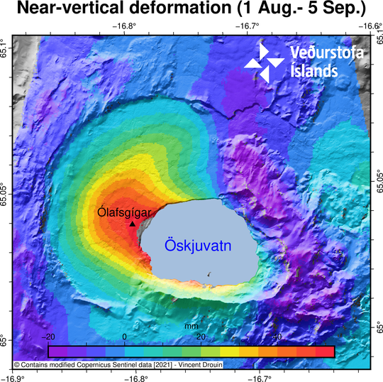
The image shows the quasi-vertical deformation in mm for the period from August 1 to September 5, 2021. The InSAR image is obtained from two passes of the Sentinel-1 satellite.
The National Commissioner, in agreement with the North East Iceland Police Department, declared the level of uncertainty due to the ongoing uprising of the Askja volcano. In recent weeks, rapid changes in deformation have been measured on the Askja, both from GPS stations and processed satellite images. The uplift reached about 7 centimeters and this is a significant change during this time period.
The most likely interpretation of this uplift is an influx of magma to a depth of 2-3 km. Next week, the IMO and the Institute of Earth Sciences (UÍ) will enhance the monitoring network around Askja to allow better coverage and monitoring of the volcano.
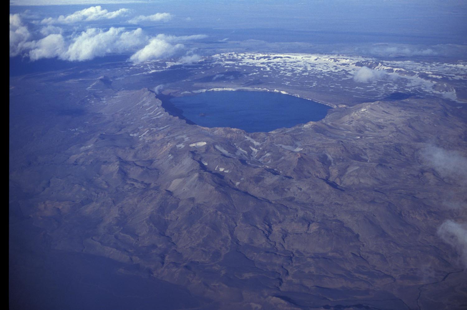
In light of the latest data, IMO has changed the aviation color code for Askja from green to yellow. This is done because the volcano is currently showing a level of activity above the known background level.
For civil protection, the level of uncertainty means that it is necessary to increase surveillance to monitor events which, in the long term, could lead to a threat to the health and safety of people, the environment and infrastructure. . Declaring a level of uncertainty is part of civil protection planning procedures to ensure formal communication and an exchange of information between the different intervention parties.
Skafta River:
The flow continues to decrease. At this point the likelihood of flood water flowing on Route 1 has been reduced, updated September 09, 4:15 PM
The flow of the Skaftá continues to decrease. The flow at Sveinstindur is less than 470m3 / sec and the flow at Eldvatn is around 370m3 / sec.
At this point, the likelihood of running water flowing onto Route 1 has decreased.
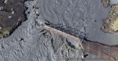
The meteorological office continues to monitor the area and assess the progress of the flood.
Source : Vedur.
Photos : Satellite Sentinel-1 / vedur is , Oddur Sigurðsson , mbl.is photographer Eggert Jóhannesson
Alaska , Semisopochnoi :
51°55’44 » N 179°35’52 » E,
Summit Elevation 2625 ft (800 m)
Current Volcano Alert Level: WATCH
Current Aviation Color Code: ORANGE
Eruptive activity continues at the north crater of Mount Cerberus on Semisopochnoi Island. Seismicity remains elevated and variable, with periods of continuous tremor, and occasional short-lived explosions of several minutes duration being detected in infrasound data. These explosive events are generating small ash clouds that typically rise from 5,000 to 10,000 ft asl and dissipate within an hour or two (as observed in satellite). Periods of lower-altitude ash emissions, interspersed with robust steaming, were observed in web camera images over the past day during periods of clear weather. These ash clouds were blown horizontally by the wind with little vertical uplift at altitudes below 5,000 ft asl. Sulfur dioxide emissions continue to be observed in satellite data (once per day).
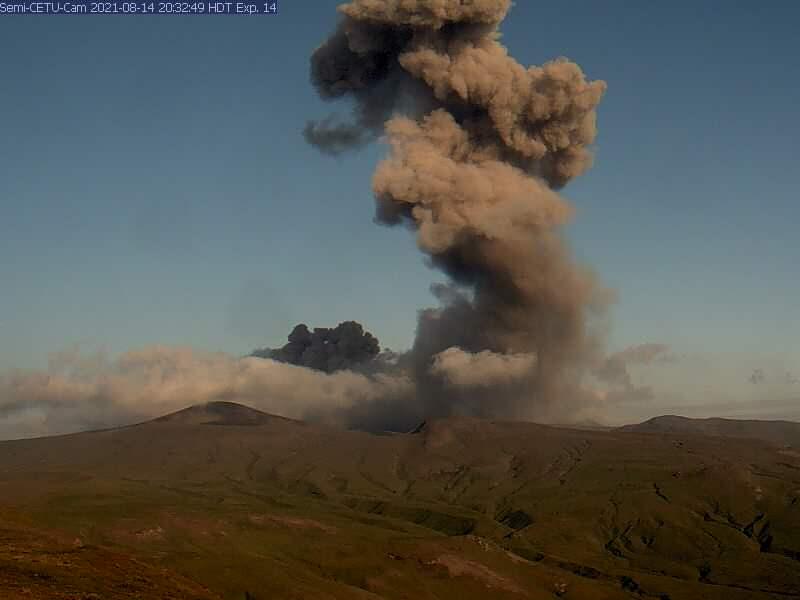
Small eruptions producing minor ash deposits within the vicinity of the active north crater of Mount Cerberus and ash clouds usually under 10,000 feet above sea level have characterized the recent activity, which shows no signs of abating. Small explosions may continue to occur and could be difficult to detect, especially during poor weather conditions.
Semisopochnoi Island is monitored by local seismic and infrasound sensors, satellite data, web cameras, and remote infrasound and lightning networks.
Source et photo : AVO
Northern Kuril Islands , Ebeko :
50.69 N, 156.01 E;
Elevation 1156 m (3792 ft)
Aviation Colour Code is ORANGE
A moderate eruptive activity of the volcano continues. Ash explosions up to 6 km (19,700 ft) a.s.l. could occur at any time. Ongoing activity could affect low-flying aircraft and airport of Severo-Kurilsk.
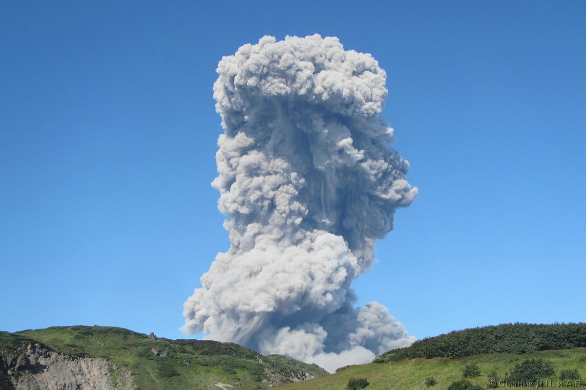
A moderate explosive eruption of the volcano continues. According to visual data by volcanologists from Severo-Kurilsk, explosions sent ash up to 2 km a.s.l. on 04, and 06-08 September; ash clouds drifted to the north, south, and east of the volcano; ashfalls were noted on 06, and 08 September at Severo-Kurilsk. Satellite data by KVERT showed the volcano was quiet or obscured by clouds this week.
Source : Kvert
Photo : D. Sytnik
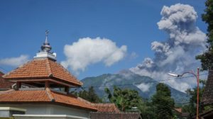
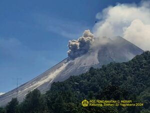
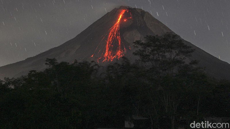
Indonesia , Merapi :
Level of activity level III (SIAGA) since November 5, 2020 at 12:00 WIB. Mount Merapi (2968 m above sea level) erupts intermittently.
The volcano is clearly visible. The smoke from the crater was observed to be white with moderate intensity and 100m high above the top of the crater. Avalanches of incandescent lava were observed with a maximum sliding distance of 1500 meters towards the southwest. The weather is sunny and a little cloudy. The wind is blowing in the West. The air temperature is 11 to 29 ° C, the humidity is 49 to 92%, and the air pressure is 627 to 718 mmHg.
According to the seismographs of September 9, 2021, it was recorded:
218 avalanche earthquakes
34 emission earthquakes
35 low frequency earthquakes
1 hybrid earthquake
2 distant tectonic earthquakes
Source : PVMBG
Photo : Detik.com
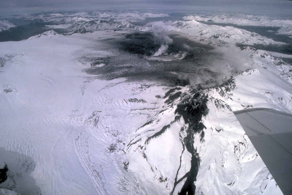
Chile , Cerro Hudson :
According to information provided by the South American Volcanic Observatory, Ovdas-Sernageomin, the Hudson volcano changes its technical alert level from yellow to green, the base state that characterizes the period of rest or calm, so a probable eruption could develop over a period of months or years.
Based on what is stated in the latest Volcanic Activity Report (RAV), released on Tuesday, which includes the period between August 16 and August 31, it is reported that 55 earthquakes classified as volcano-tectonic (VT) have been recorded, associated with the fracturing of rigid material, the locations of which are around the volcanic caldera.
Additionally, monitoring parameters indicate that seismic activity is prevalent, but with lower energy levels and without the presence of swarms or seismic tremors, a feature that was present in previous periods. The other monitoring parameters remain stable or unchanged.
With regard to the above, the Regional Directorate of Onemi Aysén updates the preventive preventive alert for the municipalities of Aysén and Río Ibáñez, due to the activity of the Hudson volcano, which has been in effect since December 22, 2020.
Finally, the Sernageomin continues the permanent monitoring of the volcanic complex and the Regional Directorate of Onemi Aysén, will maintain coordination with the members of the Regional Disaster Prevention and Response System to alert quickly and give an adequate response to possible emergency situations. resulting from the activity of this volcano.
Sources : eldivisadero.cl , Ovdas-Sernageomin
Photo : Norm Banks, 1991 (U.S. Geological Survey).