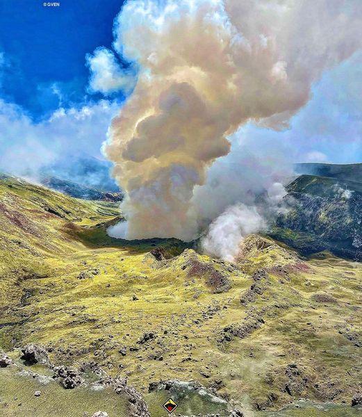
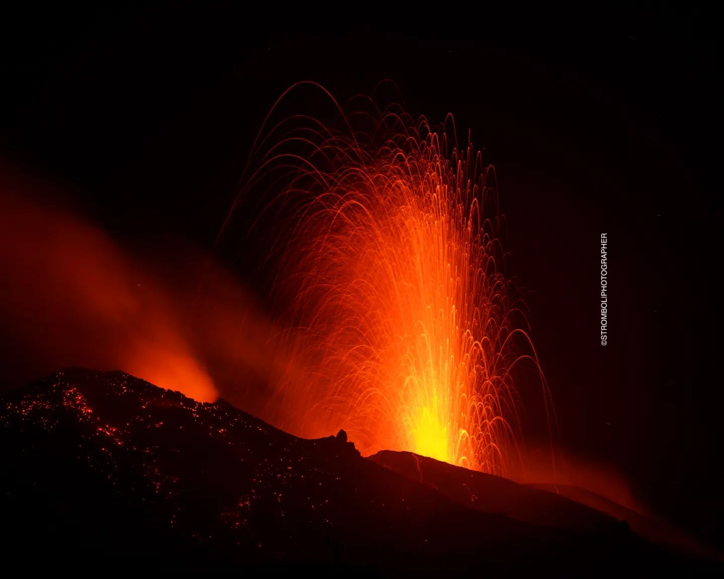
September 27, 2023. EN. Italy : Campi Flegrei , Italy : Stromboli , Italy / Sicily : Etna , Colombia : Chiles / Cerro Negro , Guatemala : Santiaguito .

September 27 , 2023 .


Italy , Campi Flegrei :

An earthquake of magnitude Md 4.2 occurred in the Campi Flegrei area.

September 27, 2023 at 01:35:34 (UTC), September 27, 2023, 03:35:34 (UTC +02:00) Italian time
with geographic coordinates (lat, lon) 40.8170, 14.1560 at a depth of 3 km.

SUMMARY STATEMENT OF ACTIVITY

In light of the monitoring data, it appears:
1) SISMOLOGY: In the week of September 18 to 24, 2023, in the Campi Flegrei area, 191 earthquakes of magnitude Md≥0.0 (Mdmax=3.2±0.3) were located.
2) DEFORMATIONS: From January 2023, the average value of the lifting speed in the maximum deformation zone is approximately 15±3 mm/month. In recent days there has been a possible increase in lifting speed, the real trend of which can be assessed using data from the coming weeks. The lift recorded at the RITE GNSS station is approximately 25 cm since January 2022.

3) GEOCHEMISTRY: There are no significant changes in the geochemical parameters monitored during the reference period. The temperature sensor installed in a fumarole emission 5 meters from the main Pisciarelli fumarole showed an average value of ~95°C, the condensation temperature of the fumarole fluid. The absence of liquid in the Pisciarelli basin remains.

SEISMOLOGY
In the week of September 18 to 24, 2023, in the Campi Flegrei area, 191 earthquakes of magnitude Md≥0.0 (Mdmax=3.2±0.3) were located.
59 earthquakes were recorded during 2 seismic swarms:
● the first, from 09:02 UTC on 09/22/2023, composed of 10 earthquakes of Md≥0.0 (Mdmax=3.2±0.3) occurring in the Solfatare zone;
● the second, from 9:15 p.m. UTC on 09/22/2023, composed of 49 earthquakes with Md≥0.0 (Mdmax=2.1±0.3) occurring in the Pozzuoli region.

Source : INGV

Photos : INGVStanley-goodspeed


Italy , Stromboli :

WEEKLY BULLETIN, from September 18, 2023 to September 24, 2023. (issue date September 26, 2023)

SUMMARY STATEMENT OF ACTIVITY

In light of the monitoring data, it appears:
1) VOLCANOLOGICAL OBSERVATIONS: During this period, normal Strombolian activity was observed with splashing activity in the North Crater area. The total hourly frequency of explosions fluctuated around high values (15-20 events/h). The intensity was low to medium in the North crater area and high in the South-Central area.
2) SISMOLOGY: The monitored seismological parameters do not show significant variations.
3) GROUND DEFORMATIONS: The island’s ground deformation monitoring networks did not show significant variations during the period studied.
4) GEOCHEMISTRY: SO2 flux at an average and increasing level.
The CO2 flow in the Pizzo area shows stable values at average levels.
The C/S ratio is at low values (C/S=2.9 as of 09/19/2023).
There is no update on the isotope ratio of dissolved helium in groundwater.
5) SATELLITE OBSERVATIONS: Thermal activity observed by satellite was generally at a moderate level.

VOLCANOLOGICAL OBSERVATIONS
In the observed period, the eruptive activity of Stromboli was characterized through the analysis of images recorded by the INGV-OE surveillance cameras at 190 m altitude (SCT and SCV), from Pizzo sopra la Fossa (SPT) and Punta dei Corvi (SPCT). The explosive activity was mainly produced by 3 eruptive vents located in the North crater area and by 3 vents located in the South-Central area.

Observations of explosive activity captured by surveillance cameras.
In the area of the North crater (N), characterized by two vents located in sector N1 and one in sector N2, explosive activity of varying intensity was observed from low (the erupting products reached a height of less than 80 m) to medium (height less than 150 m). The products emitted in the eruption were mainly coarse materials (bombs and lapilli), sometimes mixed with fine materials (ashes). Furthermore, continuous projection activity was observed in sector N1 which was intense on September 24. The average frequency of explosions oscillated between 8 and 12 events/h.
In the South-Central (CS) zone, sectors S1 and C did not show significant activity, while sector S2, characterized by three active vents (even simultaneously), mainly showed high intensity explosive activity (more than 150 m in height) with emission of coarse materials widely distributed along the external slopes of the crater terrace. The average frequency of explosions oscillated between 6 and 8 events/h

Source : INGV

Photo : Stromboli stati d’animo / Sebastiano Cannavo.


Italy / Sicily , Etna :

WEEKLY BULLETIN, from September 18, 2023 to September 24, 2023. (issue date September 26, 2023)

SUMMARY STATEMENT OF ACTIVITY

In light of the monitoring data, it appears:

1) VOLCANOLOGICAL OBSERVATIONS: Degassing activity mainly at the Bocca Nuova crater and the South-East crater.
2) SEISMOLOGY: Low seismic activity due to fracturing. Stationarity of volcanic tremor parameters.
3) INFRASOUND: Low infrasound activity.
4) GROUND DEFORMATIONS: Over the past week, ground deformation monitoring networks have not recorded any significant changes.
5) GEOCHEMISTRY: Medium-level SO2 flux.
The soil CO2 flux presents average values.
The partial pressure of CO2 dissolved in groundwater presents values included in seasonal variability.
There is no update on the helium isotope ratio.
6) SATELLITE OBSERVATIONS: Thermal activity observed by satellite was generally weak.

VOLCANOLOGICAL OBSERVATIONS
The monitoring of volcanic activity in the summit craters of Etna during the week was carried out thanks to the analysis of images from the network of surveillance cameras of the INGV – Catania Section, Osservatorio Etneo (INGV- OE) and through direct observations on earth (September 18).
The observations made during the inspection on September 18 highlighted that the degassing mainly affecting the South-East crater and Bocca Nuova continues and is unchanged compared to previous weeks.
Concerning the CSE, widespread degassing continues from the summit zone and from the upper part of the fracture present on its southwest flank.
Concerning Bocca Nuova, the intense degassing and temperatures remain almost unchanged compared to the last measurements. In particular, the degassing of the BN-1 vent is continuous and interspersed with strong explosions in conjunction with which temporary increases in the emission rate are observed; on the BN-2 mouth the degassing is of the pulsed type.
Regarding the Northeast crater, slight degassing was observed in an area of fumaroles along the Northwest wall, while the Voragine crater continues to be obstructed and inactive and no type of degassing occurs. was observed.

Source : INGV

Photo : Gio Giusa


Colombia , Chiles / Cerro Negro :

Weekly activity bulletin of the Chiles and Cerro Negro Volcanic Complex (CVCCN)

Regarding the monitoring of the activity of the CHILES AND CERRO NEGRO VOLCANOES, the MINISTRY OF MINES AND ENERGY, through the COLOMBIAN GEOLOGICAL SERVICE (SGC), reports that:

For the period from September 19 to 25, 2023, seismic activity continued to gradually decrease compared to the increase that began on August 5. However, significant levels persist, primarily in their occurrence, and the predominance of earthquakes associated with fracturing of rocks within the volcanic edifice continues. This type of earthquake was located mainly to the south of the Chiles volcano at distances of up to 4 km, with depths less than 7 km from its summit (4,700 m above sea level) and a maximum magnitude of 1 ,8. No felt earthquakes were reported. Deformation is maintained in several sectors of the volcanic edifice detected instrumentally by sensors installed in the volcanoes and also by satellite sensors.

The evolution of activity in the CVCCN continues based on the recorded manifestations of volcanic activity, which respond to processes derived from a complex interaction between the magmatic, hydrothermal and geological fault system of the area, which can trigger the occurrence of energetic earthquakes felt by residents in the CVCCN area of influence, as well as generate instability on slopes, landslides and structural damage to buildings, access roads, bridges, etc. . These are aspects that must continue to be taken into account by the authorities and the communities that reside in the zone of influence of these volcanoes.

The state of alert for volcanic activity remains at:
YELLOW ALERT: Active volcano with changes in the behavior of the base level of monitored parameters and other manifestations.

Source : SGC

Photo : hablemosdevolcanes.com


Guatemala , Santiaguito :

Weather conditions: Clear weather
Wind: East
Precipitation: 22.4 mm.

Activity:
Constant degassing on the Caliente Dome. Seismic stations continue to record small to moderate explosions that generate avalanches in all directions and a column of gas and ash that reaches 3,200 meters above sea level (10,498 feet) and disperses toward the West and the South-West. This can cause fine ash particles to fall and a foggy environment near the volcano. During the night and early morning, constant incandescence was observed in the upper part of the dome. Strong avalanches and audible noises can be generated several kilometers from the volcanic edifice. The occurrence of block and ash flows of moderate to strong characteristics is not excluded, as well as possible pyroclastic flows over long distances in different directions.

Source : Insivumeh

Photo : Thomas Spinner via FB .

29 Juin 2022. FR. Nouvelle Zélande : White Island , Nicaragua : San Cristobal , Italie / Sicile : Etna , Colombie : Chiles / Cerro Negro , Indonésie : Anak Krakatau , Chili : Villarica .

29 Juin 2022.


Nouvelle Zélande , White Island :

Whakaari/White Island : Mise à jour sur les observations récentes. Les troubles volcaniques mineurs se poursuivent. Publié: mar 28 juin 2022 , 09:00 .

Le niveau d’alerte volcanique reste à 1
Le code couleur de l’aviation reste au vert

Des données de surveillance récentes, y compris des vols pour effectuer des observations visuelles et mesurer les émissions de gaz, confirment que les troubles volcaniques restent à un faible niveau sur Whakaari/White Island. Le niveau d’alerte volcanique pour Whakaari / White Island reste au niveau 1. Le code de couleur de l’aviation reste également au vert.

La semaine dernière, nous avons effectué un vol pour mesurer les émissions de gaz et un vol d’observation pour documenter tout changement récent sur le volcan et mesurer à distance les températures des fumerolles. Les données de ces vols, ainsi que les données de surveillance collectées automatiquement, indiquent que le niveau d’agitation volcanique reste faible et qu’il y a eu peu de changement dans l’activité au cours des dernières semaines. Le vol de mesures de gaz a établi que les taux d’émission restent dans les niveaux typiques à long terme, avec une diminution de la quantité de gaz émis par les évents actifs depuis les dernières observations à la mi-mai 2022. La température du gaz et de la vapeur émis reste basse avec une observation d’environ 170 °C à partir du 22 juin 2022.

Aucune activité au-delà des émissions modérées de fumerolles n’a été observée à partir des évents au fond du cratère dans la zone d’évent active. Les émissions de fumerolles étaient exemptes de cendres volcaniques. La déformation du sol par satellite indique des changements mineurs dans la zone active du lac d’évent . L’activité sismique reste faible.

Ces observations sont cohérentes avec de faibles niveaux d’agitation volcanique. Le niveau d’alerte volcanique reste au niveau 1 et le code couleur de l’aviation reste vert.

Le niveau d’alerte volcanique reflète le niveau actuel d’agitation ou d’activité volcanique et n’est pas une prévision de l’activité future. Le niveau d’alerte volcanique 1 indique que les principaux dangers sont ceux attendus pendant les troubles volcaniques ; décharge de vapeur, gaz volcaniques, tremblements de terre, glissements de terrain et activité hydrothermale. Bien que le niveau d’alerte volcanique 1 soit principalement associé à des risques environnementaux, un risque d’éruption existe également et des éruptions peuvent encore se produire avec peu ou pas d’avertissement.

Notre équipement sur l’île s’est dégradé au cours des deux dernières années et demie. Cependant, nous sommes toujours en mesure de récupérer des données de l’île en raison d’un réacheminement des données vers le continent.

Source : Geonet / Steven Sherburn / Volcanologue de service.

Photo : Geonet .


Nicaragua , San Cristobal :

Le volcan San Cristóbal a eu une éruption avec émissions de gaz et de cendres à Chinandega au Nicaragua.
 Selon les habitants de la région, vers 7h35 du matin, il y a eu un tremblement de terre puis l’expulsion de cendres et de gaz.

« Il y a eu une explosion dans la zone du volcan San Cristóbal, il y a eu une expulsion de cendres, cela a provoqué un mouvement à ce moment-là et une explosion à l’intérieur du volcan, nous n’avons pas eu d’autre réplique », a déclaré l’ingénieur Agustín Moreira à 100% NEWS , de l’Observatoire des Phénomènes Naturels.
Selon l’expert, « les volcans expulsent ce type de matériaux lorsqu’ils nettoient les conduits de leurs cheminées », a-t-il expliqué.


Dans plusieurs photographies diffusées sur les réseaux sociaux, les internautes ont partagé une série d’images montrant le volcan avec une colonne de fumée visible à plusieurs kilomètres de distance.
Jusqu’à présent, on ne sait pas combien de communautés ou de villes sont touchées par la chute de cendres.

Le volcan San Cristóbal est le plus haut volcan du pays et est situé au Nord-Ouest du Nicaragua, dans la chaîne de montagnes Maribios . Selon le suivi effectué par l’OFENA, il n’y a pas eu de répliques  , ni d’éventualités majeures mettant en danger les habitants. « Selon les sismographes, les activités sismiques du volcan restent normales », a-t-il expliqué. Le volcan San Cristóbal est considéré comme l’un des plus actifs du pays en raison de ses éruptions constantes.

Jusqu’à présent, les autorités gouvernementales n’ont pas publié de rapport préliminaire sur cet événement qui a provoqué l’étonnement parmi les habitants de la zone ouest du Nicaragua.

L’expert a recommandé à la population de rester calme, de recouvrir les récipients d’eau potable et de porter des masques pour protéger les voies respiratoires en raison de la toxicité des gaz et des cendres.

Source et photo : Ineter , 100% Noticias .


Italie / Sicile , Etna :

BULLETIN HEBDOMADAIRE, du 20 Juin 2022 au 26 Juin 2022. (date d’émission 28 Juin 2022).

SOMMAIRE DE L’ÉTAT DE L’ACTIVITÉ

À la lumière des données de surveillance, il est mis en évidence :
1) OBSERVATIONS VOLCANOLOGIQUES : Dégazage pulsant du cratère de la Bocca Nuova, activité fumerolienne de différents points sur le Cratère Sud-Est, activité fumerolienne modeste du Cratère Nord-Est.
2) SISMOLOGIE : Faible activité sismique de fracturation ; amplitude moyenne du tremor volcanique dans le niveau moyen.
3) INFRASONS : activité infrasonore modérée.

4) DÉFORMATIONS DU SOL : Au cours de la dernière semaine, les réseaux de surveillance de la déformation du sol n’ont pas enregistré de changements significatifs, confirmant les tendances déjà mises en évidence dans les bulletins précédents.
5) GEOCHIMIE : Flux de SO2 à un niveau moyen
Les flux de CO2 du sol enregistrés la semaine dernière montrent une tendance à la baisse, s’établissant sur des valeurs moyennes-basses
La pression partielle de CO2 de Ponteferro montre un pic supérieur à 0,25 Atm dans la dernière période.
6) OBSERVATIONS SATELLITES : L’activité thermique dans la zone sommitale était à un niveau élevé en correspondance avec l’activité effusive qui s’est terminée le 16 juin. Dans les jours qui ont suivi, surtout cette dernière semaine, le niveau était bas.

Parois internes du cratère Nord-Est, avec le fond complètement obstrué .

OBSERVATIONS VOLCANOLOGIQUES
Au cours de la semaine, le suivi de l’activité volcanique de l’Etna a été réalisé en analysant les images des caméras de surveillance de l’INGV, Osservatorio Etneo (INGV-OE) et à travers une
enquête de terrain réalisée par le personnel de l’INGV-OE le 23 juin.
Après la cessation de l’activité effusive dans la Valle del Bove, dans la nuit du 15 au 16 juin, aucune activité éruptive n’a été observée sur l’Etna. Le dégazage des cratères sommitaux s’est poursuivi  , à l’exception du cratère de la Voragine, où l’activité fumerolienne est presque absente. Des émissions de gaz ont été observées dans quelques petites fumerolles dans les parois internes du cratère Nord-Est, dont le fond était complètement obstrué .

Les cratères d’effondrement du cratère de la Bocca Nuova à l’intérieur du cratère central du volcan

Une activité de dégazage généralisée s’est poursuivie au niveau du Cratère Sud-Est, alimentée par de nombreuses fumerolles largement concentrées le long du bord Nord du cratère et en correspondance avec la bouche qui s’est ouverte le 12 mai sur le même bord, qui a été le siège d’une activité explosive jusqu’à mi- juin . D’autres fumerolles se trouvaient à l’intérieur de la niche d’effondrement formée lors du paroxysme du 10 février dans le flanc Sud du cône. Aucune activité éruptive n’a été observée après le 15 juin 2022.
Le cratère de la Bocca Nuova a été celui avec les signes d’activité les plus évidents au cours de la semaine. Dans la partie Ouest du cratère, en correspondance avec le cratère BN-1, se trouvent deux puits ouverts, qui sont le siège de forts dégazages pulsés , souvent accompagnés de grondements audibles même à plusieurs kilomètres de distance sur les flancs du volcan. En l’absence de vent et de conditions de bonne visibilité, ce dégazage a formé un panache robuste et dense  . Pendant les heures de nuit, de faibles éclairs étaient visibles au BN-1, comme documenté par la caméra de surveillance visuelle sur la Montagnola et par une nouvelle caméra visuelle haute résolution à Piedimonte .

Source : INGV.

Lire l’article https://www.ct.ingv.it/index.php/monitoraggio-e-sorveglianza/prodotti-del-monitoraggio/bollettini-settimanali-multidisciplinari/656-bollettino-Settimanale-sul-monitoraggio-vulcanico-geochimico-e-sismico-del-vulcano-Etna-del-2022-06-28/file

Photos : Gruppo Guide Alpine e Vulcanologiche Etna Nord , INGV , Vincenzo Greco ( Guide Vulcanologiche Etna Nord ) . 


Colombie , Chiles / Cerro Negro :

Bulletin d’activité hebdomadaire des volcans Chiles et Cerro Negro.

L’activité des volcans se poursuit au NIVEAU JAUNE ■ (III) : CHANGEMENTS DANS LE COMPORTEMENT DE L’ACTIVITÉ VOLCANIQUE.

D’après le suivi de l’activité des VOLCANS CHILES ET CERRO NEGRO, le SERVICE GÉOLOGIQUE COLOMBIEN (SGC) rapporte que :

Entre le 21 et le 27 juin 2022, le processus d’essaim sismique qui a commencé le 27 mai 2022 s’est poursuivi, présentant des fluctuations à la fois du nombre et de l’énergie quotidienne des tremblements de terre. Au cours de cette semaine, 18 425 événements associés à une fracture du matériau crustal à l’intérieur du volcan ont été enregistrés. Les tremblements de terre ont été localisés près du sommet du volcan Chiles et au Sud de celui-ci, avec des distances épicentrales allant jusqu’à 4 km avec des profondeurs inférieures à 6 km de son sommet (4700 m). Parmi ces séismes, 22 se sont produits avec des magnitudes locales (ML) comprises entre 2,0 et 4,4, dont 3 ont été signalés comme ressentis dans la zone d’influence volcanique : le 21 juin à 23h50 (ML 4,4), le 22 juin à 3 : 31 h (ML 3.5) et le 23 juin à 7 h 59 (ML 2.5).

Certains capteurs faisant partie du réseau de déformation montrent des changements qui, bien que de faible ampleur, peuvent être associés à une activité volcanique qui s’est manifestée sismiquement. Aucune manifestation d’activité de surface n’a été observée et les autres paramètres du suivi volcanique restent stables.

Le SERVICE GÉOLOGIQUE COLOMBIEN et l’INSTITUT GÉOPHYSIQUE DE L’ÉCOLE NATIONALE POLYTECHNIQUE d’ÉQUATEUR restent attentifs à l’évolution du phénomène volcanique et informeront sur les changements qui peuvent survenir en temps opportun.

Source : SGC.

Photo : agence uno , biobiochiles.


Indonésie , Anak Krakatau :

AVIS D’OBSERVATION DU VOLCAN POUR L’AVIATION – VONA

Émis : 28 juin 2022
Volcan : Anak Krakatau (262000)
Code Couleur Aviation Actuel : ORANGE
Code Couleur Aviation précédent : orange
Source : Observatoire du volcan Anak Krakatau
Numéro d’avis : 2022KRA56
Emplacement du volcan : S 06 deg 06 min 07 sec E 105 deg 25 min 23 sec
Région : Lampung, Indonésie
Altitude du sommet : 502 FT (157 M).

Résumé de l’activité volcanique :
-Éruption avec des nuages de cendres à 07h09 UTC (02h09 heure locale). L’éruption a duré 24 secondes.
-Éruption avec des nuages ​​de cendres à 22h36 UTC (04h36 heure locale). L’éruption a duré 77 secondes

Hauteur des nuages ​​volcaniques :
La meilleure estimation du sommet du nuage de cendres est d’environ 3702 FT (1157 M) au-dessus du niveau de la mer, peut être plus élevée que ce qui peut être observé clairement. Source des données de hauteur : observateur au sol.

Autres informations sur les nuages ​​volcaniques :
Des visuels directement de la vidéosurveillance ont observés les éruptions avec une épaisse fumée d’émission de couleur noire à 1000m au dessus du sommet du volcan, la direction du vent est orientée vers le Nord.

Remarques :
-Eruption enregistrée sur sismogramme avec une amplitude maximale de 60 mm et une durée maximale de 24 secondes.
-Eruption enregistrée sur sismogramme avec une amplitude maximale de 60 mm et une durée maximale de 77 secondes.

Le mont Anak Krakatau est entré en éruption le mercredi 29 juin 2022 à 04h36 WIB avec une hauteur de la colonne de cendres observée à ± 1000 m au-dessus du sommet (± 1157 m au-dessus du niveau de la mer). On observe que la colonne de cendres est noire avec une intensité épaisse vers le nord. Cette éruption a été enregistrée sur un sismographe avec une amplitude maximale de 60 mm et une durée de 77 secondes.

Source et photo : Magma Indonésie.


Chili , Villarica :

Rapport spécial sur l’activité volcanique (REAV), Région de la Auracania, volcan Villarica, 28 Juin 2022, 13:05 heure locale (Chili continental)

Le Service national de géologie et des mines du Chili (Sernageomin) publie les informations PRÉLIMINAIRES suivantes, obtenues grâce aux équipements de surveillance du Réseau national de surveillance volcanique (RNVV), traitées et analysées dans l’Observatoire volcanologique des Andes du Sud (Ovdas):

Le Mardi 28 Juin à 12h47 heure locale ( 16h47 UTC) , les stations de surveillance installées à proximité du volcan Villarica ont enregistré un séisme associé à la fdynamique des fluides (type longue période) à l’intérieur du système volcanique.

Les caractéristiques sont les suivantes :
HEURE D’ORIGINE : 2h47 heure locale ( 16h47 UTC)
DEPLACEMENT REDUIT : 72,01 cm2
SIGNAL ACOUSTIQUE : 3,0 Pa réduits à un km.

Les caractéristiques de l’activité superficielle sont les suivantes :
HAUTEUR MAXIMALE DE LA COLONNE : Nuageux
DIRECTION DE DISPERSION : Nuageux


OBSERVATIONS :
Il n’a été enregistré de changements de l’activité depuis cet évènement . En dépit de la nébulosité , il n’a pas été enregistré d’activité superficielle suite à ces évènements .

L’alerte technique volcanique reste au niveau Vert .

Source : Sernageomin.

Photo : Franco Vera

May 07 , 2020. EN. Italy : Stromboli , Colombia : Nevado del Ruiz , Solomon Islands : Kavachi , El Salvador : San Miguel (Chaparrastique) , Chile : Nevados of Chillan .

May 07 , 2020.


Italy , Stromboli :

Weekly bulletin from April 27, 2020 to May 03, 2020 (issue date 05/05/2020)

SUMMARY OF ACTIVITY STATUS

In light of the monitoring data, it is highlighted:
1) VOLCANOLOGICAL OBSERVATIONS: During this period, normal explosive activity of the strombolian type was observed accompanied by degassing and splashing activities. The hourly frequency of explosions fluctuated between average values ​​(15 events / h on April 30) and high values ​​(21 events / h on April 28). The intensity of the explosions was mainly low in the area of ​​the North crater and medium in the area of ​​the Center-South crater.
2) SEISMOLOGY: The seismological parameters do not show significant variations.
4) DEFORMATIONS: Data from the Stromboli soil deformation monitoring networks did not show any significant changes last week.
5) GEOCHEMISTRY: The flow of SO2 is at an average level. The last measurement of the CO2 / SO2 ratio is at an average value (last update on 02/09/2020). The isotopic ratio of helium remains on average values ​​(last update of 09/03/2020). There is no update on the CO2 released by the soil.
6) SATELLITE OBSERVATIONS: The thermal activity in the summit area is low.

VOLCANOLOGICAL OBSERVATIONS
The analysis of the images recorded by the cameras placed at an altitude of 400m, at an altitude of 190m and at Punta dei Corvi made it possible to characterize the eruptive activity of Stromboli. During the reporting period, the explosive activity was mainly produced by at least 4 (four) eruptive vents located in the area of the North crater and by at least 2 (two) eruptive vents located in the area of the Center-South crater . All the vents are located inside the depression which occupies the crater terrace.
Due to unfavorable weather conditions on April 29, May 01 and May 03, the visibility of the crater terrace was insufficient for a correct description of the eruptive activity.

In the North zone, the explosions were mainly of variable intensity, low (less than 80 m in height) to medium (less than 150 m in height) emitting coarse materials (lapilli and bombs). During certain explosions, abundant fallout products covered the outer slopes of the area overlooking the Sciara del Fuoco. In addition, splashes were observed on April 27 and May 2, sometimes intense. The average frequency of explosions in the North zone varied between 9 and 17 events / h. The explosive activity of the Center-South zone caused explosions of mainly fine materials (ashes) mixed with coarse materials, with an average intensity (less than 150 m in height) and sometimes high (the products exceeded 250 m in height ). The frequency of explosions in the Center-South zone varied between 5 and 8 events / h.

The amplitude of the volcanic tremor generally had medium-low values, with a decrease from 02/05.

Source : INGV.

Read the whole article ile:///C:/Users/Utilisateur/AppData/Local/Packages/Microsoft.MicrosoftEdge_8wekyb3d8bbwe/TempState/Downloads/BollettinoStromboli20200505%20(1).pdf

Photos : F. Ciancitto, INGV-OE Catania , LGS – Laboratorio Geofisica Sperimentale .


Colombia , Nevado del Ruiz :

Weekly activity bulletin of the Nevado del Ruiz volcano
The level of activity continues at the level of yellow activity or (III): changes in the behavior of volcanic activity.

With regard to monitoring the activity of the Nevado del Ruiz volcano, the COLOMBIAN GEOLOGICAL SERVICE reports that:

The seismicity generated by the fracturing of the rocks showed a slight increase in the number of earthquakes and the seismic energy released, compared to the previous week. This type of seismicity was mainly located in the South-East, North-East and West-South-West sectors of the volcano, as well as in the Arenas crater, at depths varying between 0.6 and 6.1 km. The maximum magnitude recorded during the week was 1.9 ML (local magnitude) corresponding to the earthquake recorded on May 3 at 11:24 a.m. (local time) located 2.0 km south-south-east of the Arenas crater, 3.2 km deep.

Seismicity related to fluid dynamics inside volcanic conduits showed a slight decrease in both the number of events recorded and the seismic energy released, compared to the previous week. This seismic activity was characterized by the occurrence of continuous volcanic tremors, tremor pulses, earthquakes of the long period type and of the very long period type. These seismic events presented varying energy levels and spectral contents. Some of these signs were associated with small emissions of gas and ash, which were confirmed by cameras installed in the volcano area and by reports from officials of the Los Nevados National Natural Park in the region.

The deformation of the volcanic surface, measured from GNSS stations (Global Navigation Satellite System), showed some minor changes associated with volcanic activity, consistent with those recorded by the other volcanic monitoring parameters used during the complete evaluation of the activity of Nevado del Ruiz.

In the past week, the Mirova and NASA FIRMS web portals have not reported any thermal anomalies on the volcano.

The gas and vapor column reached a maximum height of 1221 m measured above the summit of the volcano on April 30. The dispersion of the column was governed by the wind direction, mainly with a northwestward trend of the volcano.

The Nevado del Ruiz volcano continues at a yellow activity level.

Source : SGC.

Photo : SGC , 12-04-2016 , Auteur inconnu .


Solomon Islands , Kavachi :

8.991°S, 157.979°E
Elevation -20 m

Satellite data showed discolored water around Kavachi beginning in January 2020; the discolored plumes became more frequent, dense, and stretched for longer distances. On 25 April a satellite image showed a plume in the water that was about 15 km long but spread over an approximate area of 30 square kilometers. A small brown circle about 50,000 square meters in area indicated the presence of material over the likely vent location. An image acquired on 30 April showed a thin ribbon of discolored water extending about 50 km W of Kavachi.

Clots of incandescent magma rise above Kavachi on 30 June 1978 after the vent of the submarine volcano had reached the sea surface. No eruptive activity was observed on 20 June, but there was an eruption the following day. On 22 June a 30-50 m island was observed erupting incandescent lava and gas and ash that rose a few thousand meters into the air. The eruption ended sometime between 16-28 July when observers on an overflight noted that the island was about 15 m wide and 3 m high.

Named for a sea-god of the Gatokae and Vangunu peoples, Kavachi is one of the most active submarine volcanoes in the SW Pacific, located in the Solomon Islands south of Vangunu Island about 30 km N of the site of subduction of the Indo-Australian plate beneath the Pacific plate. Sometimes referred to as Rejo te Kvachi (« Kavachi’s Oven »), this shallow submarine basaltic-to-andesitic volcano has produced ephemeral islands up to 1 km long many times since its first recorded eruption during 1939. Residents of the nearby islands of Vanguna and Nggatokae (Gatokae) reported « fire on the water » prior to 1939, a possible reference to earlier eruptions. The roughly conical edifice rises from water depths of 1.1-1.2 km on the north and greater depths to the SE. Frequent shallow submarine and occasional subaerial eruptions produce phreatomagmatic explosions that eject steam, ash, and incandescent bombs. On a number of occasions lava flows were observed on the ephemeral islands.

Sources: Sentinel Hub, Culture Volcan.

Photo : de W.G. Muller, 1977 (courtesy of Deni Tuni, Ministry of Lands, Energy and Mineral Resources, Solomon Islands).
, GVP.


El Salvador , San Miguel ( Chaparrastique) :

Location: San Miguel Department
Altitude: 2130 meters above sea level
Type of volcano: Stratovolcan
Activity type: Strombolienne-Vulcanienne
Last major eruption: December 29, 2013

In the early hours of Sunday, April 5, 2020, it was observed that the seismicity of the San Miguel volcano had changed configuration, presenting small fluctuations which did not exceed normal behavior.

During the following days, the activity of the volcano remained in acceptable levels, following slight fluctuations in its level of released seismic energy, varying between 40 and 114 average RSAM units per day, the threshold being 150 units.

The origin of the periodic fluctuations in the levels of seismic energy released by the volcano is associated with internal changes linked to the rise of gases from its active magmatic reservoir, in the degassing process. As for sulfur dioxide (SO2) emissions, measured with DOAS equipment, they fluctuated between 74 and 733 tonnes per day, with an average of 380 tonnes per day, the threshold being 300 tonnes per day.

Reports from the Network of Local Observers indicate that the volcano has a slight degassing in its crater. A forest fire broke out in the Finca El Cordero area, which was successfully brought under control by residents, firefighters and the armed forces.

Therefore, we can conclude that the volcano remains active, with high and low periods in its level of activity.

Source : Marn .

Photo : Volcanohotspot  .


Chile , Nevados of Chillan :

Special volcanic activity report (REAV), region of the Nevados de Chillán volcanic complex, on 06 May 2020 at 6:06 p.m. local time (mainland Chile).

The National Geological and Mining Service of Chile (Sernageomin) discloses the following PRELIMINARY information, obtained with the monitoring equipment of the National Volcanic Monitoring Network (RNVV), processed and analyzed at the South Andes Volcanological Observatory (OVDAS ):

On Wednesday May 06, 2020 at 5:47 p.m. local time (9:47 p.m. UTC), the monitoring stations installed near the Nevados de Chillán volcanic complex recorded an earthquake associated with fluid dynamics inside the volcanic system ( long period type).

Around 17.53 h, a new explosion was recorded, as is already the practice for this eruptive cycle. The photograph of the eruptive column, courtesy of @_josefauna, was captured from San Fabian d’Alico.

The characteristics of the LP earthquake are as follows:
TIME OF ORIGIN: 5:47 p.m. local time (9:47 p.m. UTC).
LATITUDE: 36 862 ° S
LONGITUDE: 71.379 ° W
DEPTH: 0.8 km
REDUCED MOVEMENT: 350cm2
ACOUSTIC SIGNAL: 19.9 Pa reduced to 1 km.

The characteristics of the associated surface activity are as follows:
Maximum height of the emission column: 2500 m above the emission point.
Direction of dispersion: North – East.

OBSERVATIONS:
Preliminary, we observe basal pyroclastic flows towards the East and Southeast sectors mainly. In addition, we note the presence of a second eruptive pulse at 6:00 p.m. local time, with a recorded altitude of 1,600 m above the point of emission, and with a reduced displacement value of 29 cm2.

The volcanic technical alert is maintained at the YELLOW level.

Source : Sernageomin .

Photo : @_josefauna, Volcanologia en Chile


January 4 , 2019. EN. Indonesia : Anak Krakatau , Colombia : Nevado del Huila , El Salvador : San Miguel ( Chaparrastique ) , Chile : Villarica , Mexico : Popocatepetl .

January 4 , 2019.


Indonesia , Anak Krakatau :

Eruption of Mount Anak Krakatau, Lampung, on 3 January 2019 at 12:03, with a height of ash column observed at ± 1,600 m above the summit (± 1,710 m above sea level) . The column of ash was black and thick in intensity, inclined to the north and north-east. This eruption is recorded on a seismogram of maximum amplitude of 31 mm and a duration of ± 1 minute 10 seconds. At present, the Anak Krakatau is at level III (SIAGA) with recommendations: people / tourists are not allowed to approach within a radius of 5 km around the crater

Anak Krakatau – 02.01.2019 – photo Planet Labs Inc. via BBC.


VOLCANO OBSERVATORY NOTICE FOR AVIATION – VONA.

Issued: January 04 , 2019 
Volcano: Anak Krakatau (262000)
Current Aviation Colour Code: ORANGE
Previous Aviation Colour Code: orange
Source: Anak Krakatau Volcano Observatory
Notice Number: 2019KRA05
Volcano Location: S 06 deg 06 min 07 sec E 105 deg 25 min 23 sec
Area: Lampung, Indonesia
Summit Elevation: 352 FT (110 M)

Volcanic Activity Summary:
Eruption with volcanic ash cloud at 05h30 UTC (12h30 local). Eruption and ash emission is continuing.

Volcanic Cloud Height:
Best estimate of ash-cloud top is around 5152 FT (1610 M) above sea level, may be higher than what can be observed clearly. Source of height data: ground observer.

Other Volcanic Cloud Information:
Ash-cloud moving to north-northeast.

Remarks:
Eruption recorded on seismogram with maximum amplitude 21 mm and maximum duration 161 second.

Source : PVMBG , Magma Indonésia.

Photos : Planet Labs Inc. via BBC. Øystein Lund Andersen.


Colombia , Nevado del Huila :

Weekly activity bulletin of Nevado del Huila
The level of activity of the volcano continues at the level: yellow activity level or (III): changes in the behavior of volcanic activity.

Based on the analysis and evaluation of the information obtained through the monitoring network of the Nevado del Huila volcano, from 25 to 31 December 2018, the COLOMBIAN GEOLOGICAL SERVICE – Volayan Volatological and Seismological Observatory states that:

• During the evaluated period, 101 seismic events were recorded, 45 related to rock fracturing processes (type VT) and 56 related to fluid dynamics in volcanic canals. Of these, 51 were classified as long period events (LP type), two (2) as hybrids (HB type) and three (3) as low energy tremor pulses (TR type).

• The images obtained during the week by the web cameras of Caloto, Tafxnú, Maravillas and La Palma showed a weak degassing of the volcanic system.
• Sensors for monitoring soil deformation, magnetic fields, and infrasound did not record any variations associated with changes in volcanic activity.

Therefore, it is concluded that the volcano exhibited stable behavior during the evaluated period. The Colombian geological service is attentive to the evolution of the volcanic phenomenon and will inform in due time any changes that may occur.

Source : SGC


El Salvador , San Miguel ( Chaparrastique ) : 

Special Report 3. The fumarole activity continues on the Chaparrastic volcano and emissions of fine materials are reported.

The degassing of the crater of the Chaparrastique volcano persists (figure 1), associated with the processes of pressurization of the gases of the volcanic system. Small changes in the amplitude of the seismic signal result in the emission of fine particles of ash.

Members of the local observers network (ROL) in the region reported this morning an increase in the degassing of the volcano and a drop of fine material in Conacastal Township, located northwest of the crater. There is no report of damage to people.

Figure 1. Degassing of the volcano in the southwest direction. Local observers reported a fall of fine material in the area of Conacastal Township 3.5 km northwest of the crater.

The recording of the seismic signal at the stations of San Miguel Volcano (VSM) and Ranchito shows changes in the shape and amplitude of the trace from 19:00, Tuesday 2 January 2019.
At 8:00 am on January 3, it was suddenly observed that the seismic amplitude in the VSM station is decreasing, while it is increasing in the Ranchito station. At this time, the local observers network reports the fall of fine materials in the region. of the canton. These facts allow us to interpret the possible appearance of gas from the internal system of the volcano, during the cleaning of the duct in the region of the central crater (Figure 2).

Figure 2. Seismicity record. On the left by the VSM station, right registration by the Ranchito station. Note the change in signal amplitude in both stations.

In the last 24 hours, the values of the seismic vibration (RSAM) of the volcano remained fluctuating between 78.60 and 151.67 96 units, with an hourly mean of 103.33 units, values considered slightly abnormal. (Figure 3).

Figure 3. Behavior of seismic vibrations recorded during the last seven days.

The volcanologists of the MARN left this morning in the region of the volcano to check the fall of the ashes and carry out gas measurements with the station DOAS MOVIL.
Due to the current situation of the activity of the volcano, degassing demonstrated in recent days could be maintained, which could be accompanied by emissions of fine materials that would be transported in the direction of the prevailing wind and reach other areas inhabited between the south and west side of the volcano, with a smell of sulfur in the region between El Carreto and Piedra Azul.
In case of increased activity, the most likely scenario is the generation of an eruptive column whose ashes could fall in the municipalities of San Rafael Oriente, San Jorge and Chinameca. The production of ballistic projectiles is not excluded in this scenario, up to three kilometers around the crater. However, the possible production of lava flows from the flanks of the volcano is less likely to exist.


The ministry calls on the general public not to approach the upper part of the volcano, because of the danger it represents. And he asks residents of the region to remain attentive to information provided by official means and to avoid making use of rumors from unofficial sources.

The next update will take place on Monday, January 7, 2019. In the event of a material change, an advance special report will be published.

Source : Marn .

Photos : Marn ,EPA .


Chile , Villarica :

Volcano Villarrica, Thursday, January 3rd.
After a break period of 5 weeks, strombolian explosions resume this morning. The lava fountains are projected about 30 meters high on the edges of the crater. There are falls of pyroclasts east of the volcano.

On December 25, we implemented a new technology (POVI 2.0) to capture sequential images of the Villarrica volcano. Between 2005 and 2018, 8,800 daily photos were captured per camera (one image every 10 seconds). In 2019, there were 86,400 photos per day per camera (1 image per second).
This important innovation allows us to observe and study volcanic phenomena with an unprecedented level of detail.
The POVI project thanks the collaborating partners of Fundación Volcanes de Chile who, thanks to their financial contributions, made this deployment possible..

Source : Werner Keller / POVI.


Mexico , Popocatepetl :

January 3rd at 11:00 am (January 3rd at 17:00 GMT).

During the past 24 hours, 140 exhalations have been identified using the monitoring systems of the Popocatépetl volcano, accompanied by water vapor, gas and sometimes small amounts of ash. In addition, three volcano-tectonic earthquakes were recorded: the first recorded yesterday at 19:34 and the two remaining recorded today at 03:01 and 04:06; the calculated magnitude is 1.7, 2.1 and 1.6, respectively.

At the time of writing this report, the continuous emission of volcanic gases dispersed in a north-northeast direction observed.

CENAPRED urges DO NOT APPROACH the volcano and especially the crater, because of the risk of falling ballistic fragments, and in case of heavy rains to move away from the bottom of the ravines because of the risk of landslides and flows mud.

The Volcanic Warning Light of Popocatepetl is located at Amarillo Phase 2.

Source : Cenapred .

Photo : W radio


September 04 , 2018. EN. Alaska : Veniaminof , Peru : Sabancaya , Chile : Guallatiri , Guatemala : Fuego .

September 04 , 2018.


Alaska , Veniaminof :

AVO/USGS Volcanic Activity Notice

Current Volcano Alert Level: ADVISORY
Previous Volcano Alert Level: NORMAL

Current Aviation Color Code: YELLOW
Previous Aviation Color Code: GREEN

Issued: Monday, September 3, 2018, 11:29 AM AKDT
Source: Alaska Volcano Observatory
Notice Number:
Location: N 56 deg 11 min W 159 deg 23 min
Elevation: 8225 ft (2507 m)
Area: Alaska Peninsula

Volcanic Activity Summary:
Seismic activity at Veniaminof, indicative of unrest, increased late last night and volcanic tremor is ongoing. Thus, AVO is rasing the Aviation Color Code to Yellow and the Volcano Alert Level to Advisory. There are, however, no signs of eruptive activity at this time.

Recent Observations:
[Volcanic cloud height] Unknown
[Other volcanic cloud information] Unknown

Remarks: Mount Veniaminof volcano is an andesitic stratovolcano with an ice-filled 10-km diameter summit caldera located on the Alaska Peninsula, 775 km (480 mi) southwest of Anchorage and 35 km (22 mi) north of Perryville. Veniaminof is one of the largest (~300 cubic km; 77 cubic mi) and most active volcanic centers in the Aleutian Arc and has erupted at least 13 times in the past 200 years. Recent significant eruptions of the volcano occurred in 1993-95, 2005, and 2013. These were Strombolian eruptions that produced lava fountains and minor emissions of ash and gas from the main intracaldera cone. During the 1993-95 activity, a small lava flow was extruded, and in 2013, five small lava flows effused from the intracaldera cone over about five months. Minor ash-producing explosions occurred nearly annually between 2002 and 2010. Previous historical eruptions have produced ash plumes that reached 20,000 ft above sea level (1939 and 1956) and ash fallout that blanketed areas within about 40 km (25 mi) of the volcano (1939).

Source : AVO

Photo : 2 Avril  2018   , Pepin, Dan


Peru , Sabancaya :

An average of 25 EXP / day was recorded. Earthquakes associated with the rise of magma (hybrid types) remain very few and low energy. 
The eruptive columns of gas and ash reached a maximum height of 3000 m above the crater. The dispersion of these materials occurred within a radius of approximately 50 km, mainly in the Southeast, East and Northeast directions.

The volcanic gas (SO2) flow recorded on September 2 a maximum value of 3970 tons / day, a value considered important. 
The deformation of the surface of the volcanic building presents a tendency associated with a deflationary process. 

The MIROVA satellite system recorded 6 thermal anomalies, with values between 1 MW and 87 MW VRP (Radiated Volcano Power).

In general, eruptive activity maintains moderate levels. No significant changes are expected in the following days.

Source : IGP


Chile , Guallatiri :

Special Report on Volcanic Activity (REAV)
Arica and Parinacota Region, Guallatiri Volcano, 03 September 2018, 07h00 Local time (Continental Chile)

The National Geological and Mining Service of Chile (Sernageomin) publishes the following PRELIMINARY information, obtained from monitoring equipment of the National Volcanic Monitoring Network (NVRN), processed and analyzed at the Volcanological Observatory of the Southern Andes (OVDAS) :

On Monday 03 September 2018 at 00h27 Local time (03h27 UTC), the monitoring stations installed near the Guallatiri volcano recorded an earthquake associated with a fracturing mechanism of the rocks (volcano-tectonic type) inside the volcanic building.

The characteristics of the earthquake after its analysis are as follows:

TIME OF ORIGIN: 00h27 Local time (03h27 UTC)
LATITUDE: 18.321 ° S
LONGITUDE: 69.138 ° W
DEPTH: 13,0 KM
LOCAL MAGNITUDE: 3.6 (Ml)

OBSERVATIONS:
After recording the seismic event, at 4:54 local time (07:54 UTC), another similar seismic event was recorded with a magnitude of M 2.6. Finally, associated with the period of occurrence of these events, a dozen low-energy events have been recorded where also the seismic characteristics associated with them make it possible to conclude that the whole process would be framed by the same seismogenic phenomenon, typical activity. associated with an active volcano, as is the case of the Guallatiri volcano.

The level of volcanic technical alert remains at the level: GREEN.

Sernageomin continues online monitoring and will inform in a timely manner about any changes observed.

Source : Sernageomin


Guatemala , Fuego :

Three months after its violent eruption that killed at least 169 people, the Fuego volcano in Guatemala continues its activity on Monday, with frequent explosions, said an official source.
According to the National Institute of Seismology, Volcanology, Meteorology and Hydrology (INSIVUMEH), the volcano, located 50 kilometers west of the capital, showed between 10 and 15 explosions per hour, of low to moderate intensity .
The plumes of ash reach between 4,300 and 4,700 meters high and move for 12 kilometers west of the volcanic cone, located between the departments of Chimaltenango, Escuintla and Sacatepequez.

The scientific entity stated that some explosions generate glow and low avalanches around the crater.
So far, ash falls have been reported in the cities of San Pedro Yepocapa and Sangre de Cristo, he added.
Three months ago, the Fuego volcano, one of the most active of the 32 in Guatemala, recorded a powerful eruption that left 169 dead, 256 missing and more than 1.71 million people affected.
Meanwhile, survivors continue to search for missing relatives in the community of San Miguel Los Lotes, in the southern department of Escuintla.

So far, only 94 families with more than 3,000 victims of the Fuego Volcano tragedy have benefited from temporary single-family homes.
But more than 2,500 Guatemalans still live in municipal shelters, piled up, without security or intimacy, they have been forgotten.

Type of activity: Vulcanian
Morphology: Composite Stratovolcan
Location: 14 ° 28’54˝ Latitude N; 90 ° 52’54˝ Longitude W.
Height: 3,763msnm
Weather conditions: Clear
Wind: North East 4 km / h
Precipitation: 70.5 mm


Activity:
Presence of low white fumaroles of approximately 4,100 m (13,451 ft) dispersed in a westerly direction. 10 to 15 explosions per hour are reported, with low to moderate characteristics, ash columns at an approximate height of 4,300 to 4,700 meters (14,108 to 15,420 feet), traveling 12 km in a westerly direction. Some explosions are incandescent and generate weak avalanches around the crater. Explosions are accompanied by weak degassing sounds with gaps of 1 to 2 minutes. Ash falls are noted in San Pedro Yepocapa, Sangre de Cristo, among other communities.

 Source : Elmercurio , Insivumeh .

23 Mars 2018. FR. Maly Semyachik , Kawah Ijen , Chiles/Cerro Negro , Turrialba , Poas , Rincon de la Vieja.

23 Mars 2018.


Maly Semyachik , Kamchatka :

54,14 N, 159,67 E;
Altitude :  5117 ft (1560 m)
Code couleur de l’aviation : JAUNE

L’ activité du volcan a augmenté. Des explosions de cendres jusqu’à 16 400-23 000 pi (5-7 km) pourraient se produire à tout moment. L’activité en cours pourrait affecter les aéronefs volant à basse altitude.

L’ activité du volcan a augmenté. Les données satellitaires du KVERT ont montré une anomalie thermique au-dessus du volcan les 20 et 22 mars. On suppose que la couverture de glace du lac a fondu. L’activité explosive du volcan est possible.

Le Maly Semyachik est un stratovolcan composite situé dans une caldeira de 10 km de large dans la caldeira Stena-Soboliny ( 15 x 20 km) datant du Pléistocène moyen. Après la construction au Pléistocène tardif du volcan Paléo-Semiachik, débutant il y a environ 20 000 ans, l’activité migra vers le Sud-Ouest, formant le Méso-Semiachik (environ 11 000-9 000 BP) et le Ceno-Semiachik (environ 8 000 BP jusqu’à nos jours). ). La phase initiale d’environ 3500 ans était principalement explosive, construisant le cône actuel. Une deuxième étape débutant il y a environ 4400 ans a été marquée par l’alternance de processus constructifs et destructeurs au cours desquels le volcan a été détruit par des explosions majeures puis reconstruit. Un lac de cratère remplit le cratère Troitsky historiquement actif, qui s’est formé au cours d’une grande éruption explosive il y a environ 400 ans.

Source : Kvert. GVP .

Photo : D. Melnikov, IVS FEB RAS , 15/10/2012 


Kawah Ijen , Indonésie:

Au moins 30 personnes ont été intoxiquées et 178 personnes vivant sur les pentes du volcan ijen sur l’île de java en Indonésie et ont été évacuées. La cause a été une émission de gaz sulfureux après plusieurs éruptions légères hier 21 mars dans l’après-midi.
Le volcan est connu pour son magnifique lac bleu turquoise et l’activité minière qui implique un travail dangereux et épuisant de la part de travailleurs mal payés. Le statut du volcan est normal mais l’accès à ces activités a été limité.

L’Agence Nationale de gestion des catastrophes (bnpb) assure que le volcan, fréquenté par des touristes qui vont voir la couleur saisissante des flammes bleues de gaz sulfurique la nuit, reste au niveau minimal d’alerte d’éruption, sur une échelle de 4. Les autorités ont mis en place 25.000 masques et 20 ambulances pour atténuer les émissions de gaz.
Les éruptions, qui ont été de type phréatique-eau accumulée dans le cratère ou sous la surface chauffée en raison de la proximité du magma et provoquant une explosion, ont obligé à fermer l’accès au volcan pour les visiteurs et les touristes.
Les éruptions du Mont Ijen sont sous la forme d’éruptions souterraines provenant du cratère principal. La dernière éruption phréatique a eu lieu en 1999. L’activité du volcan ijen se caractérise généralement par une plume blanche et mince qui sort du cratère, avec une altitude variant de 50 à 200 mètres.

Source : AVCAN via Olga Rodriguez


Chiles / Cerro Negro, Colombie :

Objet: Bulletin extraordinaire d’activité des volcans Chiles et Cerro Negro.
Le niveau d’activité des volcans est maintenu au niveau :
NIVEAU JAUNE ■ (III): CHANGEMENTS DANS LE COMPORTEMENT DE L’ACTIVITÉ VOLCANIQUE.

Suite à l’activité des VOLCANS CHILES et CERRO NEGRO, le SERVICE GÉOLOGIQUE COLOMBIEN (SGC) rapporte que:

Dans le courant d’aujourd’hui, le 21 mars 2018, le volcan Chiles a montré une nouvelle augmentation de sa sismicité associée à la fracturation du matériau cortical du bâtiment volcanique. Certains de ces séismes ont atteint des amplitudes allant jusqu’à M 3,7 sur l’échelle de Richter et ont été signalés comme ressenti par les habitants des municipalités de Cumbal, Túquerres, Pupiales et Ipiales. Cette manifestation sismique démontre le comportement d’un volcan qui reste actif.

Comme cela a été rapporté dans les bulletins réguliers, l’activité sismique a augmenté au cours des dernières semaines, il convient de noter que l’augmentation de ce qui est aujourd’hui arrivé, à la fois en nombre et en puissance, est nettement plus élevé que les changements qui ont été signalés.

Le Service géologique colombien et l’Institut Polytechnique National de Géophysique de l’Equateur suivent de près l’évolution de cette activité sismique et des phénomènes volcaniques et rendront compte sans délai des changements détectés.

Source : SGC


Turrialba , Poas , Rincon de la Vieja ,  Costa Rica :

Observatoire Vulcanologique et Sismologique de l’Université Nationale du Costa Rica , OVSICORI-UNA , Heredia , Costa Rica .
Rapport quotidien de l’activité des volcans Turrialba, Poás et Rincón de la Vieja: 21 mars 2018, mise à jour à 11h45.

Volcan Turrialba
Au cours des dernières 24 heures, des séismes volcaniques fréquents à basse fréquence (LP) et des tremors harmoniques intermittents de faible amplitude continuent d’être enregistrés. Ces événements sismiques sont associés aux mouvements des fluides au travers du volcan.

Le volcan Turrialba n’a pas re-émis de cendres dans la dernière semaine, cependant, il continue à émettre passivement un important flux de vapeur et de gaz magmatiques à haute température (600-800 ° C) à partir d’un corps de magma riche en volatils, suggérant que le système volcanique est suffisamment ouvert favorisant le transfert passif de matière et de chaleur vers  la surface. Le flux de chaleur de ce magma peu profond réchauffe la roche environnante des canaux volcaniques et produit une incandescence perceptible la nuit à l’intérieur du cratère occidental. Le panache de gaz magmatiques et d’aérosols a été dispersé par les vents dominants vers le Nord-Ouest, c’est-à-dire au Nord de Heredia et d’Alajuela.

Volcan Poas
Le volcan présente un dégazage persistant mais faible de vapeur d’eau et de gaz à basse température (<100 ° C) directement dans l’atmosphère puisque le nouveau lac acide apparu dans la seconde moitié de janvier 2018 reste sec depuis la mi-mars 2018. La vapeur d’eau et les gaz sont dispersés par les vents dominants au Sud-Ouest du volcan.

Volcan Poás. Photo prise par l’ing. Luis Fernando Brenes, du réseau sismologique national, le 16 mars 2018.

Le niveau de sismicité enregistré sur le Poás est très faible et correspond principalement à des séismes volcaniques de basse fréquence (type LP) et de faible amplitude, en plus de faibles tremors occasionnels de basse fréquence. Ces enregistrements sont associés à l’activité hydrothermale et fumerolienne du volcan

Volcan Rincón de la Vieja  
Au cours des deux derniers jours, aucune éruption phréatique n’a été observée sur le Rincon. La dernière petite éruption phréatique que les sismographes ont enregistrée et qui a été observée au travers des caméras web de l’OVSICORI-UNA situées à Gavilán et Buenos Aires d’Upala, est celle du 19 mars 2018 à 14h13.

La sismicité présente un niveau relativement faible avec des tremblements de terre occasionnels de basse fréquence (type LP) et de faible amplitude ainsi que de courts tremors associés à des sorties de gaz sous la forme de grosses bulles qui sortent du lac super acide du cratère principal.

Source : Ovsicori.