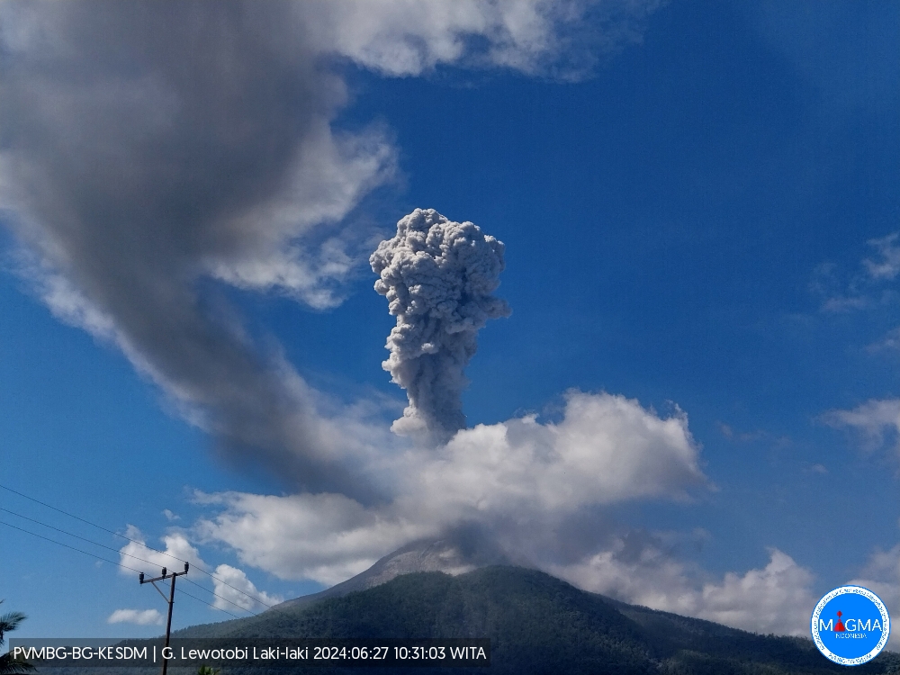
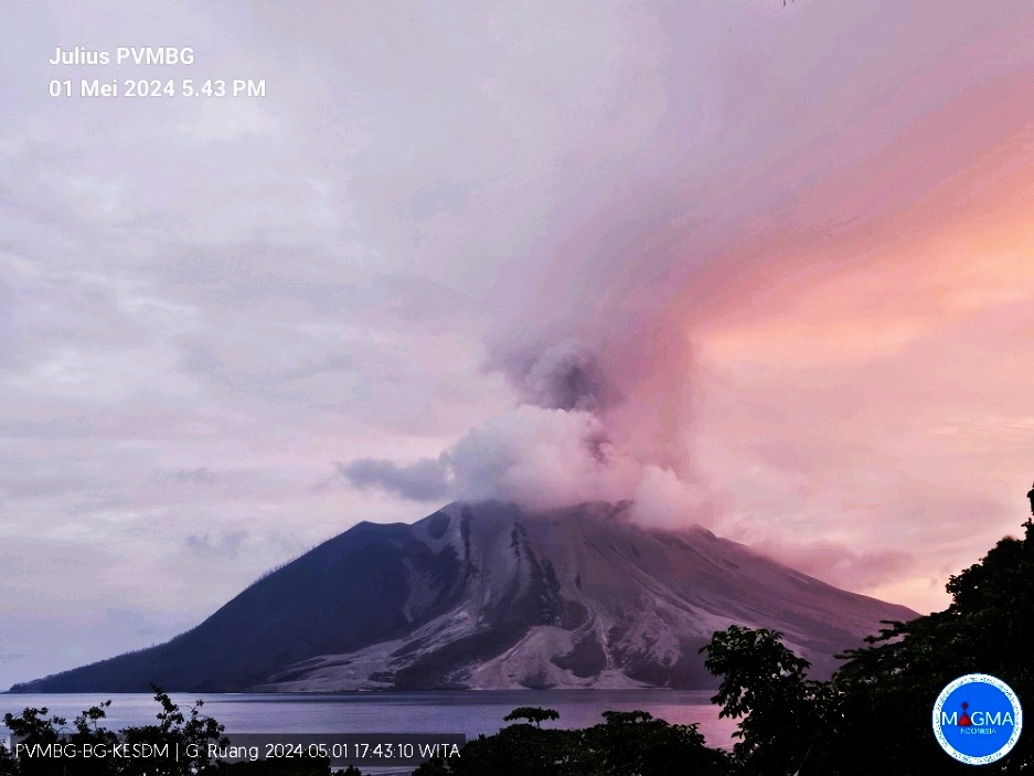
October 28, 2022. EN. Kamchatka : Bezymianny , Italy : Vulcano , Colombia : Puracé – Los Coconucos Volcanic Chain , Indonesia : Anak Krakatau , Tonga Islands : Tofua .

October 28 , 2022.


Kamchatka , Bezymianny :

VOLCANO OBSERVATORY NOTICE FOR AVIATION (VONA)

Issued: October 27 , 2022
Volcano: Bezymianny (CAVW #300250)
Current aviation colour code: ORANGE
Previous aviation colour code: yellow
Source: KVERT
Notice Number: 2022-151
Volcano Location: N 55 deg 58 min E 160 deg 35 min
Area: Kamchatka, Russia
Summit Elevation: 2882 m (9452.96 ft)

Volcanic Activity Summary:
The strong explosive eruption of the volcano occurred on 23-24 October. The extrusive-effusive eruption of the volcano continues, a strong fumarole activity, an incandescence of the lava dome at night, and hot avalanches accompanies this process. Sometimes the large ash clouds were forming after hot avalanches, for example, such ash cloud 10×13 km in size moved for 70 km to the east of the volcano on 26 October. Probably, next strong explosive eruption could occur at any time. KVERT continues to monitor Bezymianny volcano.
The extrusive-effusive eruption of the volcano continues, but the activity of the volcano remains very high. Strong ash explosions up to 10-15 km (32,800-49,200 ft) a.s.l. could occur at any time. Ongoing activity could affect international and low-flying aircraft.

Volcanic cloud height:
NO ASH CLOUD PRODUSED

Other volcanic cloud information:
NO ASH CLOUD PRODUSED

Activity at Bezymianny increased during 22-23 October characterized by incandescence at the summit, sometimes strong fumarolic activity, and an increasing temperature of a thermal anomaly identified in satellite images. KVERT raised the Aviation Color Code to Orange (the second highest level on a four-color scale). A strong explosive phase commenced and by 23h40 local time on 23 October satellite images showed ash plumes rising to 10 km (32,800 ft) a.s.l. and drifting 10 km ENE. The Aviation Color Code was raised to Red. By 10h05 local time on 24 October the phase was over, and the Aviation Color Code was lowered to Orange. Satellite images showed gas-and-steam plumes drifting NE and an intense thermal anomaly. The ash plumes from the day before had drifted as far as 1,915 km NE. At 20h28 local time on 25 October KVERT lowered the Aviation Color Code to Yellow and noted that the intense thermal anomaly persisted. Dates are based on UTC times; specific events are in local time where noted.

Source : Kvert.

Photos : Yu. Demyanchuk, IVS FEB RAS, KVERT , O. Girina, IVS FEB RAS, KVERT


Italy , Vulcano :

WEEKLY BULLETIN, from October 17, 2022 to October 23, 2022, (issue date October 25, 2022).

ACTIVITY STATUS SUMMARY

In the light of the surveillance data, it is highlighted:
1) Temperature of the crater fumaroles: Along the upper edge, the maximum emission temperature has stable and high values, around 375°C.
2) CO2 flux in the crater area: The CO2 flux in the crater area remains at medium-high values.
3) SO2 flux in the crater area: stable at a moderately medium-high level
4) Geochemistry of fumarolic gases: The concentration of CO2 and He is constant or slightly increasing and remains at an average level. The carbon isotope ratio is constant at high values and the helium isotope ratio is stable at medium levels.

5) CO2 fluxes at the base of the La Fossa cone and in the Vulcano Porto area: The CO2 fluxes recorded in the Rimessa, C. Sicilia sites always show values ​​above background levels. The P4max site shows average values, while on the Faraglione site there are values ​​close to the background level.
6) Geochemistry of thermal aquifers: in the well of Camping Sicilia there are always high values ​​of temperature and conductivity at medium-low levels; in the Bambara well, the level and conductivity values ​​show no significant variations.
7) Local seismicity: Low occurrence rate of local micro-seismicity.
8) Regional seismicity: No earthquake with Ml >= 1.0 was located in the Vulcano region last week.
9) Deformations – GNSS: The GNSS network does not show significant variations
10) Deformations – Inclinometry: The inclination network does not show significant variations
11) Gravimetry: There are no significant variations.
12) Other Notes: Mobile GNSS. The GNSS mobile network acquires and transmits movements in real time at a frequency of 1 Hz. The historical series acquired so far do not show significant variations around the Porto di Levante area.

Flux diffus de CO2 du sol dans le site situé à l’Est de la zone fumerolienne (site VSCS).

CO2 FLOW IN THE CRATER AREA
The data from the VSCS station do not show any significant changes in the CO2 flux (approximately 8000 g m2 d-1) compared to the previous week, still settling on abnormal values compared to the average background values assessed on the last decade of observations and monitoring.

Source et photos : INGV.

Read the article : https://www.ct.ingv.it/index.php/monitoraggio-e-sorveglianza/prodotti-del-monitoraggio/bollettini-settimanali-multidisciplinari/701-bollettino-Settimanale-sul-monitoraggio-vulcanico-geochimico-e-sismico-del-vulcano-Vulcano-del-2022-10-25/file


Colombia, Puracé – Los Coconucos volcanic chain:

Weekly bulletin of the activity of the Puracé volcano – Los Coconucos volcanic chain.

The activity level of the volcano continues at the Yellow activity level or (III): changes in the behavior of volcanic activity.

From the analysis and evaluation of the information obtained through the monitoring network of the Puracé volcano – Los Coconucos volcanic chain, during the week of October 18 to 24, 2022, the COLOMBIAN GEOLOGICAL SERVICE – Volcanological and Seismological Observatory of Popayan reports that:

With regard to the seismic activity recorded, there were no notable variations in terms of the number of events and the energy released. A total of 683 seismic events were recorded, of which 74 were associated with rock fracturing processes (VT type) and 609 with fluid dynamics in volcanic conduits. On October 18, a VT type event was recorded which reached an ML of 3.2 located in the Paletará valley, south of the volcanic edifice.
The geodetic network of GNSS (Global Navigation Satellite System) stations for monitoring ground deformation continues to record a process associated with inflation.

By monitoring the surface activity with the images obtained during the week through the web cameras Mina, Lavas Rojas, Cerro Sombrero and Curiquinga, it has been highlighted
degassing of the volcanic system, with a white column oriented preferentially to the northwest.
Regarding the monitoring of volcanic gases, sulfur dioxide (SO2) measurements continue to show changes, with a maximum flow of 246 t / day for the week evaluated. The other instruments measuring the concentration of carbon dioxide (CO2) and radon gas (222Rn) in the volcanic influence zone recorded increases for the period evaluated, which is normal in active volcanic systems.

Magnetic field and infrasonic wave monitoring sensors did not record variations associated with changes in volcanic activity.

It is concluded from the above that variations in volcanic activity continue to be recorded, consistent with the behavior expected at activity level III (yellow level), which could evolve towards states of greater activity. The Colombian Geological Service continues to monitor the evolution of the volcanic phenomenon and will report any changes that may occur in due course.

Source : SGC.

Photo : Ingeominas


Indonesia , Anak Krakatau :

Anak Krakatau presented an eruption on Friday October 28, 2022 at 04:38 WIB with an ash column height observed at ± 300 m above the summit (± 457 m above sea level). The ash column is observed to be gray with a thick intensity, oriented towards the northeast. This eruption was recorded on a seismograph with a maximum amplitude of 40 mm and a duration of 12 seconds.

VOLCANO OBSERVATORY NOTICE FOR AVIATION – VONA

Issued : October 27 , 2022
Volcano : Anak Krakatau (262000)
Current Aviation Colour Code : ORANGE
Previous Aviation Colour Code : orange
Source : Anak Krakatau Volcano Observatory
Notice Number : 2022KRA82
Volcano Location : S 06 deg 06 min 07 sec E 105 deg 25 min 23 sec
Area : Lampung, Indonesia
Summit Elevation : 502 FT (157 M)

Volcanic Activity Summary :
Eruption with ash clouds at 05:05 UTC (12:05 local time). The eruption lasted for 25 seconds.

Volcanic Cloud Height :
Best estimate of ash-cloud top is around 1302 FT (407 M) above sea level, may be higher than what can be observed clearly. Source of height data: ground observer.

Other Volcanic Cloud Information :
Visuals directly from the cctv were observed eruptions with the color of the grey eruption smoke 250m from the top of the volcano, the wind direction slowly to the northeast.

Remarks :
Eruption recorded on seismogram with maximum amplitude 37 mm and maximum duration 25 second.

Source et photo : Magma Indonésie.


Tonga Islands, Tofua :

The sulphur dioxide gas measured 9,000 ppm (parts per million) on the eve of the 15th October, 2022 on the eastern side of Tofua Volcano. This is an indication that the magma chamber is close to the earth’s surface. The measurement was taken below the volcanic gas plume drifting eastward from Lofia Volcano Cone on Tofua Island.
There are no immediate danger, however, the public is advised to report any peculiar activities activities from the area.

The low, forested Tofua Island in the central part of the Tonga Islands group is the emergent summit of a large stratovolcano that was seen in eruption by Captain Cook in 1774. The summit contains a 5-km-wide caldera whose walls drop steeply about 500 m. Three post-caldera cones were constructed at the northern end of a cold fresh-water caldera lake, whose surface lies only 30 m above sea level. The easternmost cone has three craters and produced young basaltic-andesite lava flows, some of which traveled into the caldera lake. The largest and northernmost of the cones, Lofia, has a steep-sided crater that is 70 m wide and 120 m deep and has been the source of historical eruptions, first reported in the 18th century. The fumarolically active crater of Lofia has a flat floor formed by a ponded lava flow.

Source et photo : Tonga geological service.

28 Octobre 2022. FR. Kamchatka : Bezymianny , Italie : Vulcano , Colombie : Puracé – Chaîne volcanique Los Coconucos , Indonésie : Anak Krakatau , Iles Tonga : Tofua .

28 Octobre 2022.


Kamchatka , Bezymianny :

AVIS D’OBSERVATION DU VOLCAN POUR L’AVIATION (VONA)

Publié : 27 octobre 2022
Volcan : Bezymianny (CAVW #300250)
Code couleur aviation actuel : ORANGE
Code couleur aviation précédent : jaune
Source : KVERT
Numéro d’avis : 2022-151
Emplacement du volcan : N 55 deg 58 min E 160 deg 35 min
Région : Kamtchatka, Russie
Altitude du sommet : 2 882 m (9 452,96 pi).

Résumé de l’activité volcanique :
Une forte éruption explosive du volcan s’est produite les 23 et 24 octobre. L’éruption extrusive-effusive du volcan se poursuit, une forte activité de fumerolles, une incandescence du dôme de lave la nuit, et des avalanches chaudes accompagnent ce processus. Parfois, de grands nuages ​​de cendres se forment après des avalanches chaudes. Par exemple, un tel nuage de cendres de 10×13 km s’est déplacé sur 70 km à l’Est du volcan le 26 octobre. Probablement, une prochaine forte éruption explosive pourrait se produire à tout moment. Le KVERT continue de surveiller le volcan Bezymianny.
L’éruption extrusive-effusive du volcan se poursuit, mais l’activité du volcan reste très élevée. De fortes explosions de cendres jusqu’à 10-15 km (32 800-49 200 pieds) d’altitude pourraient survenir à tout moment. L’activité en cours pourrait affecter les aéronefs internationaux volant à basse altitude.

Hauteur des nuages ​​volcaniques :
AUCUN NUAGE DE CENDRES PRODUIT

Autres informations sur les nuages ​​volcaniques :
AUCUN NUAGE DE CENDRES PRODUIT.

L’activité sur le Bezymianny a augmenté les 22 et 23 octobre, caractérisée par une incandescence au sommet, parfois une forte activité fumerolienne et une augmentation de la température d’une anomalie thermique identifiée sur les images satellites. Le KVERT a élevé le code de couleur de l’aviation à Orange (le deuxième niveau le plus élevé sur une échelle de quatre couleurs). Une forte phase explosive a commencé et à 23h40 heure locale le 23 octobre, des images satellites ont montré des panaches de cendres atteignant 10 km (32 800 pieds) au-dessus du niveau de la mer , dérivant de 10 km vers l’Est-Nord-Est. Le code couleur de l’aviation est passé au rouge. Le 24 octobre à 10 h 05, heure locale, la phase était terminée et le code couleur de l’aviation a été abaissé à Orange. Les images satellites ont montré des panaches de gaz et de vapeur dérivant vers le Nord-Est et une anomalie thermique intense. Les panaches de cendres de la veille avaient dérivé jusqu’à 1 915 km vers le Nord-Est. Le 25 octobre à 20h28 heure locale, le KVERT abaisse le Code Couleur Aviation à Jaune et constate que l’anomalie thermique intense persiste. Les dates sont basées sur les heures UTC ; les événements spécifiques sont à l’heure locale, le cas échéant.

Source : Kvert.

Photos : Yu. Demyanchuk, IVS FEB RAS, KVERT , O. Girina, IVS FEB RAS, KVERT


Italie , Vulcano :

BULLETIN HEBDOMADAIRE, du 17 Octobre 2022 au 23 Octobre 2022, (date d’émission 25 Octobre 2022).

SOMMAIRE DE L’ÉTAT DE L’ACTIVITÉ

À la lumière des données de surveillance, il est mis en évidence :
1) Température des fumerolles du cratère : Le long du bord supérieur, la température maximale d’émission a des valeurs stables et élevées, autour de 375°C.
2) Flux de CO2 dans la zone du cratère : Le flux de CO2 dans la zone du cratère reste sur des valeurs moyennes-élevées.
3) Flux de SO2 dans la zone du cratère : stable à un niveau modérément moyen-élevé
4) Géochimie des gaz fumeroliens : La concentration en CO2 et en He est constante ou en légère augmentation et reste dans un niveau moyen. Le rapport isotopique du carbone est constant sur des valeurs élevées et le rapport de l’isotope de l’Hélium est stable aux niveaux moyens.

5) Flux de CO2 à la base du cône de La Fossa et dans la zone de Vulcano Porto : Les flux de CO2 enregistrés dans les sites de Rimessa, C. Sicilia affichent toujours des valeurs supérieures aux niveaux de fond. Le site P4max, montre des valeurs moyennes, alors que sur le site de Faraglione, il y a des valeurs proches du niveau de fond.
6) Géochimie des aquifères thermiques : dans le puits du Camping Sicilia, il y a toujours des valeurs élevées de température et de conductivité à des niveaux moyens-bas ; dans le puits Bambara les valeurs de niveau et de conductivité ne montrent pas de variations significatives.
7) Sismicité locale : Faible taux d’occurrence de micro-sismicité locale.
8) Sismicité régionale : Aucun tremblement de terre avec Ml> = 1,0 n’a été localisé dans la région de Vulcano la semaine dernière.
9) Déformations – GNSS : Le réseau GNSS ne présente pas de variations significatives
10) Déformations – Inclinométrie : Le réseau d’inclinaison ne montre pas de variations significatives
11) Gravimétrie : Il n’y a pas de variations significatives.
12) Autres remarques : GNSS mobile. Le réseau mobile GNSS acquiert et transmet les mouvements en temps réel à une fréquence de 1 Hz. Les séries historiques acquises jusqu’à présent ne montrent pas de variations significatives autour de la zone de Porto di Levante.

Flux diffus de CO2 du sol dans le site situé à l’Est de la zone fumerolienne (site VSCS).

FLUX DE CO2 DANS LA ZONE DU CRATÈRE
Les données de la station VSCS ne montrent pas d’évolutions significatives du flux de CO2 (environ 8000 g m2 j-1) par rapport à la semaine précédente, se fixant toujours sur des valeurs anormales par rapport aux valeurs de fond moyennes évaluées sur la dernière décennie d’observations et de surveillance.

Source et photos : INGV.

Lire l’article : https://www.ct.ingv.it/index.php/monitoraggio-e-sorveglianza/prodotti-del-monitoraggio/bollettini-settimanali-multidisciplinari/701-bollettino-Settimanale-sul-monitoraggio-vulcanico-geochimico-e-sismico-del-vulcano-Vulcano-del-2022-10-25/file


Colombie, Puracé – Chaîne volcanique Los Coconucos :

Bulletin hebdomadaire de l’activité du volcan Puracé – Chaîne volcanique Los Coconucos.

Le niveau d’activité du volcan continue au niveau d’activité Jaune ou (III) : changements dans le comportement de l’activité volcanique.

À partir de l’analyse et de l’évaluation des informations obtenues grâce au réseau de surveillance du volcan Puracé – chaîne volcanique Los Coconucos, au cours de la semaine du 18 au 24 octobre 2022, le SERVICE GÉOLOGIQUE COLOMBIEN – Observatoire volcanologique et sismologique de Popayan rapporte que :

En ce qui concerne l’activité sismique enregistrée, il n’y a pas eu de variations notables en termes de nombre d’événements et d’énergie libérée. Au total, 683 événements sismiques ont été enregistrés, dont 74 étaient associés à des processus de fracturation des roches (type VT) et 609 à la dynamique des fluides dans les conduits volcaniques. Le 18 octobre, un événement de type VT a été enregistré qui a atteint un ML de 3,2 situé dans la vallée de Paletará, au Sud de l’édifice volcanique.
Le réseau géodésique de stations GNSS (Global Navigation Satellite System) pour la surveillance de la déformation du sol continue d’enregistrer un processus associé à l’inflation.

En surveillant l’activité de surface avec les images obtenues au cours de la semaine à travers les caméras Web Mina, Lavas Rojas, Cerro Sombrero et Curiquinga, il a été mis en évidence
dégazage du système volcanique, avec une colonne blanche orientée préférentiellement vers le Nord-Ouest.
Concernant le suivi des gaz volcaniques, les mesures de dioxyde de soufre (SO2) continuent de montrer des évolutions, avec un débit maximum de 246 t/jour pour la semaine évaluée. Les autres instruments de mesure de la concentration de dioxyde de carbone (CO2) et de gaz radon (222Rn) dans la zone d’influence volcanique ont enregistré des augmentations pour la période évaluée, ce qui est normal dans les systèmes volcaniques actifs.

Les capteurs de surveillance des champs magnétiques et des ondes infrasonores n’ont pas enregistré de variations associées aux changements de l’activité volcanique.

On conclut de ce qui précède que des variations d’activité volcanique continuent d’être enregistrées, conformes au comportement attendu au niveau d’activité III (niveau jaune), qui pourrait évoluer vers des états d’activité plus importante. Le Service géologique colombien continue de surveiller l’évolution du phénomène volcanique et signalera tout changement qui pourrait survenir en temps opportun.

Source : SGC.

Photo : Ingeominas


Indonésie , Anak Krakatau :

L’Anak Krakatau a présenté une éruption le vendredi 28 octobre 2022 à 04h38 WIB avec une hauteur de la colonne de cendres observée à ± 300 m au-dessus du sommet (± 457 m au-dessus du niveau de la mer). La colonne de cendres est observée comme étant grise avec une intensité épaisse , orientée vers le Nord-Est. Cette éruption a été enregistrée sur un sismographe avec une amplitude maximale de 40 mm et une durée de 12 secondes.

AVIS D’OBSERVATION DU VOLCAN POUR L’AVIATION – VONA

Émis : 27 octobre 2022
Volcan : Anak Krakatau (262000)
Code Couleur Aviation Actuel : ORANGE
Code Couleur Aviation précédent : orange
Source : Observatoire du volcan Anak Krakatau
Numéro d’avis : 2022KRA82
Emplacement du volcan : S 06 deg 06 min 07 sec E 105 deg 25 min 23 sec
Région : Lampung, Indonésie
Altitude du sommet : 502 FT (157 M).

Résumé de l’activité volcanique :
Éruption avec nuages ​​de cendres à 05h05 UTC (12h05 heure locale). L’éruption a duré 25 secondes.

Hauteur des nuages ​​volcaniques :
La meilleure estimation du sommet du nuage de cendres est d’environ 1302 FT (407 M) au-dessus du niveau de la mer, peut-être plus élevée que ce qui peut être observé clairement. Source des données de hauteur : observateur au sol.

Autres informations sur les nuages ​​volcaniques :
Les visuels directement de la vidéosurveillance ont observés des éruptions avec une couleur de la fumée d’éruption grise à 250m du sommet au-dessus du volcan, la direction du vent est orientée vers le Nord-Est.

Remarques :
Eruption enregistrée sur sismogramme avec une amplitude maximale de 37 mm et une durée maximale de 25 secondes.

Source et photo : Magma Indonésie.


Iles Tonga , Tofua :

Le dioxyde de soufre gazeux mesurait 9 000 ppm (parties par million) à la veille du 15 octobre 2022 sur le côté Est du volcan Tofua. C’est une indication que la chambre magmatique est proche de la surface de la terre. La mesure a été prise sous le panache de gaz volcanique dérivant vers l’Est depuis le cône du volcan Lofia sur l’île de Tofua.
Il n’y a pas de danger immédiat, cependant, il est conseillé au public de signaler toute activité particulière dans la région.

L’île basse et boisée de Tofua, dans la partie centrale du groupe des îles Tonga, est le sommet émergent d’un grand stratovolcan qui a été vu en éruption par le capitaine Cook en 1774. Le sommet contient une caldeira de 5 km de large dont les parois chutent fortement à environ 500 M. Trois cônes post-caldeira ont été construits à l’extrémité Nord d’un lac de caldeira d’eau douce froide, dont la surface se trouve à seulement 30 m au-dessus du niveau de la mer. Le cône le plus à l’Est a trois cratères et a produit de jeunes coulées de lave basaltique et andésite, dont certaines se sont rendues dans le lac de la caldeira. Le plus grand et le plus septentrional des cônes, Lofia, possède un cratère escarpé de 70 m de large et 120 m de profondeur et a été la source d’éruptions historiques, signalées pour la première fois au 18ème siècle. Le cratère avec des fumeroles actives de Lofia a un fond plat formé par une coulée de lave en étang.

Source et photo : Tonga geological service.

February 24, 2022 . EN. New Zealand : White Island , Japan : Mount Ontake / Aso , Italy : Vulcano / Etna , Solomon Islands : Kavachi , Tonga Islands : Hunga Tonga-Hunga Ha’apai .

February 24 , 2022 .


New Zealand , White Island :

Whakaari/White Island: Volcanic unrest continues with some minor ash emission and vent changes . Published: Wed Feb 23 2022 11:45 AM
Volcanic Alert Level remains at 2
Aviation Colour Code remains at Yellow

An observation flight last week (17 February 2022) has confirmed that dilute ash emission continues from the 2019 active vent and the area of geysering activity has developed to form a pit crater. Data obtained from the improved transmission data link also confirms the state of moderate to heightened unrest. The Volcanic Alert Level remains at Level 2
On Thursday 17th GNS volcanologists undertook an observation flight over the island. This confirmed that a small amount of brown ash was being entrained in the steam and gas discharging from the 2019 active vent area. The dilute ash plume was not extending above the Main Crater wall. This is similar to many observations this year from flights and the web cameras.

The flight also confirmed that the area of geyser activity recently seen on the web cameras has developed into a shallow, mud-filled pit crater. Features like this are not unusual and this one has formed where steam and geyser activity has been noted in the past. Small scale steam explosions were ejecting mud that is building up a small dark grey cone around the crater.

Aerial view of the active vents at Whakaari / White Island showing the dilute ash column and the new crater with dark grey muds around it. Bright colours are hydrothermal minerals precipitated in the lake and on the ground

FLIR thermal InfraRed data obtained during the flight established that high temperatures continue to be present in the gas and steam feeding the active vent. A maximum temperature of 435 °C was measured during the flight. A temperature of 172 °C was recorded from a different vent in the 2019 area. The water level of the lake has receded slightly in the past few weeks.
Overall, the conditions remain similar to those observed over the past few months, characterised by intermittent weak ash emissions, high steam and gas temperatures from the active vents and varying lake levels. When the lake level is high some vents can be drowned and the style of activity changes.
The current level of activity is consistent with moderate to heightened levels of unrest. As such the Volcanic Alert Level remains at 2 and the Aviation Colour Code remains at Yellow.

As noted previously, our on-island equipment has degraded over the past two years. However, recent improvements of the transmission of data means that some of the data is more continuous and more complete than it has been recently.
The Volcanic Alert Level reflects the current level of volcanic unrest or activity and is not a forecast of future activity. While Volcanic Alert Level 2 is mostly associated with volcanic unrest hazards (including discharge of steam and hot volcanic gases, earthquakes, landslides, and hydrothermal activity), potential for eruption hazards also exists and eruptions can still occur with little or no warning.

Source et photo : Geonet / Mike Rosenberg Volcanologue de service .


Japan , Mount Ontake / Aso :

Mount Ontake :

Japan’s weather agency on Wednesday raised its alert level for Mt. Ontake in the central part of the country, warning against going near its crater as volcanic earthquakes have increased.

The level-2 alert for the 3,067-meter volcano straddling Nagano and Gifu prefectures is the first since Aug. 21, 2017, with the Japan Meteorological Agency warning about the possibility of flying rocks around the 1-kilometer area from the crater on the mountain’s summit.
It was moved up from level 1, meaning « potential increased activity. » The agency has a five-scale volcanic alert system.

Photo taken Sept. 23, 2018, from a Kyodo News helicopter shows Mt. Ontake in central Japan.

The volcano straddling Nagano and Gifu prefectures erupted Sept. 27, 2014, killing 58 people and leaving five more unaccounted for.

On Wednesday, there were 80 tremors between 2 p.m. and 3 p.m. caused by volcanic activity, and slight swelling of the mountain was observed around its highest peak, according to the agency.
Since 2014, climbers have not been allowed on the mountain during the winter season.

Mount Aso

Japan’s Meteorological Agency raised the volcanic alert for Mount Aso, in southwestern Japan, after detecting an increase in tremors in the volcano Thursday morning.

The agency declared a Level 3 volcanic alert in the area, on a scale where the maximum is 5, urging the population not to approach the vicinity of the volcano due to the risk of an eruption and the expulsion of pyroclastic flows and rockfall within a radius of 2 kilometers.

Mount Aso, in the Kumamoto prefecture, erupted on Oct. 20 and although it did not record human or material damage, expelled smoke that traveled more than 1 kilometer around it and reached heights of up to 3,500 meters.

After the eruption four months ago, Japanese authorities maintained the alert at Level 3, but lowered it to Level 2 on Nov. 18.

Mount Aso, about 1,600 meters high, is located in a sparsely populated area within a national park on the island of Kyushu, in southwestern Japan.

Sources :Kyōdo news. laprensalatina.com.

Photo :  Kyōdo news. Efe .


Italy , Vulcano / Etna :

WEEKLY BULLETIN, from February 14, 2022 to February 20, 2022. (issue date February 22, 2022)

ACTIVITY STATUS SUMMARY
In the light of the surveillance data, it is highlighted:
1) Temperature of the crater fumaroles: The updated data of the temperatures recorded on the edge of the crater show stable values ​​and confirm the continuation of the thermal anomaly.
2) CO2 flux in the crater area: The CO2 flux in the crater area remains at high values.
3) SO2 flux in the crater area: SO2 flux at a high and decreasing level
4) Geochemistry of fumarolic gases: No update is available.
5) CO2 fluxes at the base of the La Fossa cone and in the Vulcano Porto area: The CO2 fluxes at the base of the crater remain at medium to high values, during the last two days there has been a increase in values ​​on the peripheral areas of Camping Sicilia, Rimessa and P4 max, with the exception of the Faraglione site, where values ​​close to the background level are recorded.
6) Geochemistry of thermal aquifers: The physico-chemical parameters recorded in the Camping Sicilia and Bambara wells remain stable at high values ​​while showing a very slight decrease.

7) Local seismicity: low occurrence rate of local events.
8) Regional seismicity: No earthquake with Ml >= 1.0 was located in the week in question in the area of ​​the island of Vulcano.
9) Deformations – GNSS: The GNSS surveillance network does not present substantial variations
10) Deformations – Inclinometry: During the week relating to this press release, the signals from the network of inclination sensors of Vulcano do not show any significant changes.
11) Other observations: Mobile GNSS: The mobile GNSS stations do not seem to show significant variations during the period considered.
Gravimetry: During the reporting period, no significant gravimetric change was recorded.
Monthly CO2 flux campaign: a slight decrease in CO2 emissions is observed in the Vulcano Porto area.
Monthly well campaign: a stabilization of the temperature values ​​of the dissolved carbonate species is observed in all the wells monitored.
GB-RAR: The GB-RAR monitoring results referring to the period December 14, 2021 – February 21, 2022, show a general stability of the area, with deformations along the LOS of less than 1 mm.

CO2 FLOW IN THE CRATER AREA:
The CO2 flux values ​​on the ground in the summit zone on a daily average (VCSCS) show high values ​​around 10262 g/m2/day, still on an order of magnitude higher than the averages recorded over the past 10 years. The average CO2 flux value (monthly average) for the month of February 2022 (updated to date) is 11244 g/m2/day. A stabilization of degassing at high values ​​is therefore observed on a monthly scale, with a slight decrease compared to the previous month (January: 13354 g/m2/day).

Communication on the activity of Etna, February 23, 2022, 19:15 (18:15 UTC).

The National Institute of Geophysics and Volcanology, Osservatorio Etneo, announces that surveillance cameras show that intra-crater Strombolian activity at the level of the Southeast Crater, reported in the previous press release (Etna Release – Update n.550), has ceased and the lava flow that was observed yesterday, on the east side of the Southeast Crater, is cooling.

The average amplitude of the volcanic tremor is currently at a low level. The centroid of volcanic tremor sources is located in the Bocca Nuova crater area at an altitude of about 1500-2000 meters above sea level.
Infrasound activity remains low.
There are no significant changes in the deformation data recorded at the inclinometer and GNSS stations.

Further updates will be communicated soon.

Source : INGV.

Read the article https://www.ct.ingv.it/index.php/monitoraggio-e-sorveglianza/prodotti-del-monitoraggio/bollettini-settimanali-multidisciplinari/603-bollettino-settimanale-sul-monitoraggio-vulcanico-geochimico-e-sismico-del-vulcano-Vulcano-del-2022-02-22/file

Photos : Georges Vitton , Francesco Tomarchio .


Salomon Islands , Kavachi :

Satellite data showed discolored water around Kavachi in the month of February, on three of four image acquisition dates. Discolored water fanned out short distances (around 3 km) mainly to the E on 4 February and to the WSW on 14 February. Cloudy weather prevented views of the vent area on 9 February. On 19 February a relatively narrow plume of discolored water drifted E and then dispersed about 6 km away.

Named for a sea-god of the Gatokae and Vangunu peoples, Kavachi is one of the most active submarine volcanoes in the SW Pacific, located in the Solomon Islands south of Vangunu Island. Sometimes referred to as Rejo te Kvachi (« Kavachi’s Oven »), this shallow submarine basaltic-to-andesitic volcano has produced ephemeral islands up to 1 km long many times since its first recorded eruption during 1939. Residents of the nearby islands of Vanguna and Nggatokae (Gatokae) reported « fire on the water » prior to 1939, a possible reference to earlier eruptions. The roughly conical edifice rises from water depths of 1.1-1.2 km on the north and greater depths to the SE. Frequent shallow submarine and occasional subaerial eruptions produce phreatomagmatic explosions that eject steam, ash, and incandescent bombs. On a number of occasions lava flows were observed on the ephemeral islands.

Source : GVP.

Photo : Richard White/EYOS.


Tonga Islands , Hunga Tonga-Hunga Ha’apai :

Recovery efforts from the 14-15 January eruption of Hunga Tonga-Hunga Ha’apai continued in Tonga. According to a news article, the main undersea international fiber-optic communication cable that had been severed in multiple places due to the eruption had been repaired by 21 February, and internet connectivity was restored by 22 February. Repairs had begun on 3 February to rejoin 5-6 pieces and replace a 55 km section of the cable that was missing and likely buried in sediment.

A domestic cable that was located closer to the volcano may take months to repair. Another news article noted that over 200 fishing boats had been destroyed by the tsunamis; dozens of new boats had been gifted by international donors.

Source : GVP.

Photo : Hunga Tonga-Hunga Ha’apai , Tonga Geological Services, Government of Tonga.

January 20, 2022. EN . Tonga Islands : Hunga Tonga-Hunga Ha’apai , Italy / Sicily : Etna , Ecuador / Galapagos : Wolf , Japan : Sakurajima , Indonesia : Semeru .

January 20 , 2022.


Tonga Islands , Hunga Tonga-Hunga Ha’apai :

Large eruptions at Hunga Tonga-Hunga Ha’apai on both 14 and 15 January produced plumes that reached the stratosphere and caused significant regional effects. Activity on the 14th apparently removed approximately the middle third of the island that had been expanded over the previous few weeks, revealed by a Planet Lab image acquired at 15h25 on 15 January. About two hours after that image was taken an even stronger eruption activity produced a stratospheric plume seen in satellite images, sent pressure waves across the atmosphere, and caused tsunami that traversed the Pacific. Following these explosions, a Sentinel image acquired on 17 January showed that most of the previous combined island had been destroyed, leaving only small parts of the NE island of Hunga Tonga (200 m long) and the SW island of Hunga Ha’apai (700 m long) above the ocean surface.

A sub-aerial eruption that began at 04h20 on 14 January produced mushroom-shaped ash, steam, and gas plumes that rose as high as 20 km (65,600 ft) a.s.l., into the stratosphere, and expanded radially at the top of the plume to 240 m in diameter, according to the Tonga Geological Services (TGS). Geologists observing from a boat around 17h00-18h30 in the afternoon noted that the plume was about 5 km wide at its base, with Surtseyan pulses ejecting dark dense material into the air, and pyroclastic flows expanding over the ocean. The eruption plume drifted over the island groups of Tongatapu, ‘Eua, Ha’apai, and Vava’u, carrying an estimated sulfur dioxide mass of 0.05 Tg (50,000 tonnes) based on satellite data. Sulfur odors were reported in Tongatapu (70 km S), near the capital on Motutapu Island, and on ‘Eua (106 km SSE). Ashfall was reported on many islands, including Fonoi and Mango (75 km ENE). The Tonga Meteorological Services (TMS) issued tsunami warnings for areas including ‘otu Mu’omu’a in Ha’apai (Nomuka, Mango, Fonoifua), ‘Atataa, ‘Eueiki, and Tongatapu mo ‘Eua. At 20h00 on 14 January a tsunami with a height of 20 cm was recorded by the Nuku’olofa tide gauge. TMS warned residents to stay away from low-lying coastal areas, beaches, and harbors. The Wellington VAAC noted that the eruption was intermittent during 00h43-06h04 on 15 January; plumes rose to altitudes of 14 km (45,900 ft) a.s.l. The Global Lightning Detection Network (GLD360) ground-based network detected 191,309 lightning events during a 21-hour period (03h34 on 14 January-01h34 on 15 January), or up to 30,000 events per hour; for comparison, during 22-28 December 2018 the partial collapse eruption of Krakatau generated 337,000 events. TGS noted that at 07h20 on 15 January an eruption lasting 10-15 minutes sent an ash plume to 14 km (45,900 ft) a.s.l. that drifted E.

A larger, submarine eruption began at 17h00 on 15 January. According to news reports and social media posts, residents in Nuku’alofa (65 km S) heard multiple loud booms and saw a large expanding eruption plume that eventually covered all of the Tongan islands. According to the Wellington VAAC the plume had risen to 15.2 km (50,000 ft) a.s.l. by 18h19; the top of the plume as seen in satellite images was at least 600 km in diameter by 19h03. During 17h19-23h00 there were almost 400,000 lightning events recorded in the plume by the GLD360 network, with 200,000 of those during 18h00-19h00. By 03h43 on 16 January the plume had risen to 19.2 km (63,000 ft) a.s.l. Analysis of other satellite datasets suggested that the plume may have risen to 30 km (98,400) a.s.l. The sulfur dioxide mass of the plume was 0.4 Tg (400,000 tonnes) derived from satellite-based estimates; the cloud drifted W consistent with stratospheric winds. Significant ashfall was reported on populated islands of Tonga, 70-100 km E. News articles noted that some residents had difficulty breathing from the ash in the air.

Most domestic and international communications on the islands were severed due to a break in an underwater cable, and ashfall has delayed both damage assessment and relief assistance. An update on 18 January from the Government of Tonga provided details about the eruption and its effects, noting that tsunami warnings issued after the eruption began had triggered evacuations. Tsunami waves up to 2 m high, based on a news article, arrived on the W coasts of the Tongatapu, ‘Eua, and Ha’apai islands, and three people in Tonga were confirmed to have died as a result, with many others injured. Extensive damage was reported on Mango, Fonoifua, and Nomuka islands, and on the W part of Tongatapu. Aerial surveillance by the New Zealand Defence Force’s showed brown, damaged vegetation and landscapes, debris, and modified coastlines with sediment-laden waters.


The Government of Tonga also noted that communications to the outer islands were accomplished with a patrol boat on 17 January, and limited communication with residents of Vava’u and Ha’apai was possible the next day. Evacuation efforts were underway for some remote islands. Ashfall contaminated fresh water supplies, hindered sea transportation and harbor access, and caused flights to be cancelled. According to a news report the small island of Atata, near Nuku’alofa, had been completely submerged. Tsunami warnings were also issued in several other countries surrounding the Pacific Ocean. Several news sources reported flooding and damage caused by the tsunamis at locations as far away as Peru (over 10,000 km), where it caused two deaths. Warnings were issued for the N and E coasts of New Zealand’s North Island and the Chatham Islands; multiple boats were destroyed. Thousands in Japan evacuated after tsunami warnings, and the waves there reached 80 cm, disrupting train services, flights, and damaging harbors and boats. In Anchorage, Alaska, the US National Weather Service reported maximum waves heights of 20-100 cm on Alaskan coastlines, and along the British Columbia coast waves were 16-29 cm on 15 January.


3D bathymetric image of the central Tofua arc in Tonga islands with known submarine volcanic eruptions (since 2000). Volcanic activity is not uncommon but the recent HungaTongaHungaHaapai eruption was much bigger than any historic event in the region.

The explosions produced multiple pressure (shock) waves that rippled through surrounding weather clouds, though the pressure wave from the largest explosion propagated across the planet. The sonic boom from this wave was heard at great distances, including in Fiji (about 500 km NW), within about two hours in New Zealand (1,600-2,000 km), and within about nine hours in Alaska, USA (9,370 km NE). The pressure wave was also recorded by infrasound and weather instruments worldwide as it circled the Earth, with instruments picking up the wave a second time as it arrived from the opposite direction. Very small perturbances in the ocean waves recorded in the Caribbean, which some referred to as meteotsunamis, were likely generated by atmospheric disturbances from the pressure waves after they passed over South America.

Source : GVP.

Photos : Tonga Geological Services, Government of Tonga , Patrice Zwenger ,  My Tongan / FDB , Taaniela Kula/TGS. Taken from Matangi Tonga Online, Philipp Brandl .


Italy / Sicily , Etna :

WEEKLY BULLETIN, from January 10, 2022 to January 16, 2022 (Date of issue January 18, 2022)

ACTIVITY STATUS SUMMARY

In the light of the surveillance data, it is highlighted:
1) VOLCANOLOGICAL OBSERVATIONS: Degassing activity at variable rate of all the summit craters.
2) SEISMOLOGY: Absence of fracturing seismic activity with Ml >= 2.0; average amplitude of the volcanic tremor on the low level.
3) INFRASOUND: medium low infrasound activity.
4) GROUND DEFORMATIONS: There are no significant variations during the last week
5) GEOCHEMISTRY: SO2 flux at a medium-low level
CO2 flux at an average level
Isotope ratio of helium on medium to high values
CO2 in groundwater under seasonal variability
6) SATELLITE OBSERVATIONS: The thermal activity in the summit area observed by satellite was at a low level.

VOLCANOLOGICAL OBSERVATIONS
During the week under review, the monitoring of Etna’s volcanic activity was carried out thanks to the analysis of images from the network of INGV surveillance cameras, Etneo Observatory (INGV-OE).
Overall, the state of activity of the summit craters showed no change from what was observed the previous week (see Rep. N. 02/2022). In particular, the degassing activity of the summit craters was mainly carried out by the collapse crater located in the northwest sector of Bocca Nuova, characterized by intense, sometimes impulsive degassing. The Voragine and Southeast Crater craters, on the other hand, showed predominant degassing related to fumarole systems present along the edges of the crater. Finally, the Northeast Crater was affected by a small ash emission on the morning of December 16.

Source : INGV.

Photo : Gio Giusa .


Ecuador / Galapagos , Wolf :

On 13 January IG reported that the eruption at Wolf was continuing, but at decreasing levels. Lava from at least three fissures had traveled about 16.5 km SE, and covered an estimated 7.4 square kilometers, but had not reached the coast. Daily counts of thermal anomalies were in the hundreds but had progressively decreased in quantity and intensity in recent days, interpreted as a decrease in the effusion rate and cooling flows. Notices of ash-and-gas plumes were issued by the Washington VAAC on 7-8 January, noting that plumes decreased from 2.6 km to 300 m above the vent. Additionally, sulfur dioxide emissions decreased from 60,000 tons per days recorded on 7 January to 8,100 tons per day on 12 January. Seismicity also trended downward.

DAILY REPORT OF THE STATE OF WOLF VOLCANO. January 19, 2022.

Surface Activity Level: High, Surface Trend: Unchanged
Internal activity level: High, Internal trend: No change.

Seismicity: From January 18, 2022, 11:00 a.m. to January 19, 2022, 11:00 a.m.:
Long period type (VT): 3

Emission / ash column:
Thanks to the satellites, it was possible to observe slight gas emissions towards the South-West during the last 24 hours.

Other Monitoring Parameters:
MIROVA reports 2 extreme thermal alerts (15119 and 14727 MW), 1 moderate and 1 high (390 MW) and FIRMS reports hundreds of thermal alerts in the last 24 hours

Comments
According to satellite monitoring, it is observed that the thermal anomalies are maintained.

Source : GVP , IGEPN.

Photos : GOES , Galápagos Naciente.


Japan , Sakurajima :

JMA reported that incandescence from Minamidake Crater (at Aira Caldera’s Sakurajima volcano) was visible at night during 10-17 January. Seismic data showed a decreasing number of volcanic earthquakes. The Alert Level remained at 3 (on a 5-level scale), and residents were warned to stay 2 km away from the crater.

The Aira caldera in the northern half of Kagoshima Bay contains the post-caldera Sakurajima volcano, one of Japan’s most active. Eruption of the voluminous Ito pyroclastic flow accompanied formation of the 17 x 23 km caldera about 22,000 years ago. The smaller Wakamiko caldera was formed during the early Holocene in the NE corner of the Aira caldera, along with several post-caldera cones. The construction of Sakurajima began about 13,000 years ago on the southern rim of Aira caldera and built an island that was finally joined to the Osumi Peninsula during the major explosive and effusive eruption of 1914. Activity at the Kitadake summit cone ended about 4850 years ago, after which eruptions took place at Minamidake. Frequent historical eruptions, recorded since the 8th century, have deposited ash on Kagoshima, one of Kyushu’s largest cities, located across Kagoshima Bay only 8 km from the summit. The largest historical eruption took place during 1471-76.

Source : GVP, Agence météorologique japonaise (JMA), Tokyo Volcanic Ash Advisory Center (VAAC)

Photo : @volcanohull / public domain / Volcanodiscovery.


Indonesia , Semeru :

PVMBG reported that the eruption at Semeru continued during 12-17 January. White steam plumes that were sometimes dense rose as high as 1 km above the summit almost daily, and crater incandescence was visible nightly. Incandescent avalanches traveled as far as 500 m down the Kobokan drainage on the SE flank during 11-12 January. White-and-gray ash plumes rose 300 m during 14-15 January.

At 10h20 on 16 January a collapse from the end of the active lava flow in the Kobokan drainage produced a pyroclastic flow, and an ash plume that rose 1.5 km and drifted North. An eruptive event at 05h34 on 17 January generated an ash plume that a ground observer reported rising 400 m. The Alert Level remained at 3 (on a scale of 1-4). The public was warned to stay at least 500 m away from Kobokan drainages within 17 km of the summit, along with other drainages originating on Semeru, including the Bang, Kembar, and Sat, due to lahar, avalanche, and pyroclastic flow hazards.

Source : GVP

Photo : Oystein lund Andersen .

December 22, 2021. EN . La Reunion : Piton de la Fournaise , Italy : Vulcano , Tonga Islands : Hunga Tonga-Hunga Ha’apai , Italy / Sicily : Etna , Spain / La Palma : Cumbre Vieja , Indonesia : Semeru .

December 22 ,  2021 .


La Réunion , Piton de la Fournaise :

Press release of December 22, 2021 – 2:15 a.m.

Since 01:15 local time (21:15 UTC), a seismic crisis has been recorded on the instruments of the Volcanological Observatory of Piton de la Fournaise. This seismic crisis is accompanied by
rapid deformation for a few minutes. This indicates that the magma is leaving the magma reservoir and is spreading towards the surface.
An eruption is likely shortly within the next few minutes or hours.
Additional information will follow concerning the sector impacted by this magmatic propagation towards the surface.
Recommended alert level: Alert 1.

Press release of December 22, 2021 – 3:45 a.m.

Following the seismic crisis that began at around 1:15 a.m. local time, the volcanic tremor synonymous with the arrival of magma near the surface has been recorded since around 3:30 a.m. local time (11:30 p.m. UT). According to OVPF records, the source of this tremor is located on the southern flank in the Enclos .
No visual confirmation of the start of an eruption could be made on webcams yet due to bad weather conditions and we cannot confirm the arrival of lava on the surface. However, the presence of a tremor shows the emission of hot and incandescent gases at the surface, and the possibility of lava emission in the short term.

Recommended alert level: Alert 2-1 (eruption in the enclos )

Source : direction de l’OVPF-IPGP

Photo : imaz press (page oficielle) via Sherine France .


Italy , Vulcano :

WEEKLY NEWSLETTER, from December 13, 2021 to December 19, 2021 (issue date December 21, 2021)

SUMMARY STATUS OF THE ACTIVITY
In view of the monitoring data, it is highlighted:

1) Temperature of the fumaroles of the crater: The temperature values continue to show a decreasing trend on the edge of the crater while they remain stable on the internal face.
2) CO2 flux in the crater area: The ground CO2 flux values in the summit area (VCSCS) show a downward trend, while remaining high.
3) SO2 flow in the crater area: SO2 flow appears at a high level
4) Geochemistry of fumarolic gases: The concentrations of magmatic gases (CO2, He) are at high levels.

5) CO2 flux at the base of the La Fossa cone and in the Vulcano Porto area: The values ​​at the base of the cone, automatically acquired by the VULCANOGAS network, are at high values. For the Faraglione site the recorded values ​​can be considered as typical of the background level of the site.
6) Geochemistry of thermal aquifers: The physicochemical parameters are stable on the Sicilia and Bambara Camping sites.
7) Local seismicity: The phase of increase of low frequency events (VLP) has been interrupted which in any case have a high frequency of occurrence.
8) Regional seismicity: No earthquake with Ml> = 1.0 was located last week in the Vulcano region
9) Deformations – GNSS: The GNSS network does not show substantial variations.
10) Deformations – Inclinometry: The inclinometric network shows a tendency to return to the deformations observed in recent months.
11) Other observations: Gravimetry: The gravimetric variations located at the continuous station VSOCR are recorded. There are no variations attributable to significant phenomena of deep mass redistribution.
Monthly CO2 flow campaign: there is a general decrease in CO2 emissions in the Vulcano Porto area; the flow of CO2 emitted by the soil goes from 420 t / d on 11/10/2021 to 310 t / d on 12/14/2021.
Monthly well campaign: a slight decrease in the temperature values ​​of the dissolved carbonate species is observed in all the monitored wells.
 

CO2 FLOWS IN THE CRATER ZONE

The values of the CO2 flux on the ground in the summit area (VCSCS) show high values around 9400 g / m2 / day, remaining in an order of magnitude above the averages recorded over the last 10 years. The average value of the CO2 flux (monthly average) in the month of December is currently 9327 g / m2 / day. A gradual decrease in degassing is observed on a monthly scale.

Source : INGV.

Read the article https://www.ct.ingv.it/index.php/monitoraggio-e-sorveglianza/prodotti-del-monitoraggio/bollettini-settimanali-multidisciplinari/576-bollettino-settimanale-sul-monitoraggio-vulcanico-geochimico-e-sismico-del-vulcano-Vulcano-del-2021-12-21/file

Photo : INGV , Webcam .


 Tonga Islands , Hunga Tonga-Hunga Ha’apai :

Tonga’s erupting Hunga Ha’apai volcano put on a show of lightning at sunset tonight. As a large gaseous cloud continues to rise to 18km altitude and drift over all islands, all Tongan residents were advised by geologists this evening to protect their water tanks from possible acidic rainfall, until the volcanic eruption ceases.
Hunga Ha’apai is located 65km NNW of Nuku’alofa, from where the bright white gas cloud can be seen on the horizon.
Bursts of lightning at the top of the 18km high cloud were seen from Nuku’alofa and the Kanokupolu coast after 7:30pm tonight.

The Tonga Geological Service monitoring update at 6:50pm today said the intermittent gaseous and water vapour emission from Hunga Ha’apai had been consistent all day.
Taaniela Kula confirmed that yesterday’s eruption of volcanic ash and dust occurred between 9:30-9:40am, originating from Hunga Ha’apai, determined from NOAA/CIMSS HIMAWARI 8 AHI satellite imagery.

The eruption initially reached 3-16km altitude in a mushroom formation with a 30km radius, and during the rest of the day reached 18km altitude over the ‘Otu Mu’omu’a and ‘Otumotu Lulunga of Ha’apai, as well as ‘covering Tongatapu and ‘Eua.

On 20 Dec., at 4:40pm, the ash/dust eruption maintained 18 km altitude and reached over the Vava’u Islands including Fonualei Island. At 7:00pm, it reached Niuafo’ou Island and beyond. At 9:00pm, it reached Niuatoputapu and Tafahi Islands, he said.

The ash cloud cleared today, but the gaseous emission continued with the cloud formation drifting over Tonga.

Source : matangitonga.to

Photos : Shane Egan via Sherine France , Mary Lyn Fonua / matangitonga.to.


Italy / Sicily , Etna :

WEEKLY NEWSLETTER, from December 13, 2021 to December 19, 2021 (issue date December 21, 2021)

SUMMARY STATUS OF THE ACTIVITY
In view of the monitoring data, it is highlighted:

1) VOLCANOLOGICAL OBSERVATIONS: Modest effusive activity of two open eruptive vents in the western wall at the bottom of the Valle del Bove. Strombolian activity of the Southeast Crater, with very abundant ash emissions on December 14 and 15. Degassing activity on the other summit craters.
2) SEISMOLOGY: Weak seismic activity due to fracturing with Ml> = 2.0; amplitude of the volcanic tremor on medium-high to high levels until December 15, thereafter on medium-low to low levels.
3) INFRASOUND: Weak infrasound activity in the periods when it was possible to make observations.
4) SOIL DEFORMATION: During the past week, the soil deformation monitoring networks have not recorded any significant changes, not even in correspondence with the eruption event of December 13th.

Fig. 3.1 Map of the summit area and the lava field of December 13, 2021 on a shaded model of the terrain. In the yellow box, the detail of the SEC edge of the Skysat satellite image acquired on December 15, 2021 at 9:26 UTC, spatial resolution 50 cm; the red line delimits the deposit of incoherent material detected by the satellite images, the black line set back the edges of the crater. Red circle: active mouth; yellow circle: degassing port.

5) GEOCHEMISTRY: The flow of SO2 occurs at an average level
The CO2 fluxes from the soil recorded by the Etnagas network place them at medium-high levels.
The partial pressure of dissolved CO2 shows values ​​consistent with the seasonal trend.
There is no update on the values ​​of the helium isotope ratio measured in the peripheral manifestations of Etna. The latest figure from 11/30/2021 stood at medium to high levels (0.59).
There are no updates for the C / S report.
6) SATELLITE OBSERVATIONS: The thermal activity in the summit area was at a low level after the effusive activity of December 13-14, 2021.

VOLCANOLOGICAL OBSERVATIONS

During the week, the monitoring of the volcanic activity of Etna was carried out thanks to the analysis of the images of the surveillance cameras of the INGV, the Etneo Observatory (INGV-OE) and through the observations made by INGV staff during the inspections on 13 (in the town of Monte Fontane) and on 14 and 15 December (in the summit area).
In general, the week was characterized by modest and brief effusive activity from two open eruptive vents in the lower western wall of the Valle del Bove and by Strombolian activity and ash emission from the Southeast Crater (SEC), which became very intense between December 14 and 15. Variable entity degassing activity of the other summit craters (Fig. 3.1).

In particular, from around 4.30 p.m. UTC on December 13, the Southeast Crater (SEC) produced weak intracrater Strombolian activity with sporadic ash emissions, which were scattered in the summit area.

From 17:05 UTC on December 13, the opening of a main effusive vent was observed located at an altitude of 2100 m, in the western wall of the Valle del Bove, immediately north of the relief of the Serra Giannicola Grande ( Fig. 3.1.), And another effusive vent located a few tens of meters below the main one. These vents did not produce significant explosive activity and fed a small lava flow which, by the morning of December 15, was already cooling. The flow, which was mapped using the Skysat satellite image of December 15 (Fig. 3.1), developed for about 600 m in a south-easterly direction and reached the base of the Valle del Bove, at a altitude of 1820 m above sea level, covering an area of ​​33×103 m2.

On December 14, from around 11:15 UTC, an intracrater Strombolian activity was again observed at the Southeast Crater (SEC), with the emission of abundant very fine material and the formation of an ash cloud. which reached a height of about 7000 m, dispersing in a southerly direction. The ash production had a variable trend throughout the night between December 14 and 15, alternating phases in which the matter emitted decreased significantly, with phases in which the emission was abundant and continuous, to finally cease in the early hours of December 15. The ash produced was extremely fine, almost dusty, reddish in color. The ash fall affected the southern sector of the volcano and was reported as far as Capo Passero (SR).
Satellite images (yellow box in figure 3.1) highlighted the presence of a small deposit of incoherent material, about 250 m long, in the depression formed following the activity of October 23, 2021, which deeply dug the eastern part of the crater rim. This deposit was probably formed due to the partial remobilization of the pieces of lava emitted during the Strombolian activity of December 14. Detailed investigations will be carried out to better define the extent of the morpho-structural changes that have affected the Southeast Crater (SEC).

Source : INGV.

Read the article:  https://www.ct.ingv.it/index.php/monitoraggio-e-sorveglianza/prodotti-del-monitoraggio/bollettini-settimanali-multidisciplinari/575-bollettino-settimanale-sul-monitoraggio-vulcanico-geochimico-e-sismico-del-vulcano-Etna-del-2021-12-21/file

Photos : INGV , Gio Giusa , Guide Alpine Vulcanologiche Etna


Spain / La Palma : Cumbre Vieja :

December 21, 2021 09:00 UTC. Volcanic monitoring continues on La Palma.

Since the last declaration, 9 earthquakes have been located on the island of La Palma, none of them have been felt by the population.
The magnitudes vary between 1.9 and 2.3 (mbLg). The localization of hypocenters continues under the central area of Cumbre Vieja in the same areas as the previous days. 8 earthquakes were located at depths between 6 and 14 km and one earthquake at a depth greater than 30 km.
The volcanic tremor continues unobserved, maintaining the seismic noise at levels close to the pre-eruptive period.

The island’s network of permanent GNSS stations shows a partial reversal of the elevation recorded on December 19 at station LP03, which is closest to the eruptive centers. In the rest of the stations, no significant deformation is observed which could be associated with volcanic activity.
No type of emission is seen, without the possibility of measuring the height of the cone today.

Scientists again corroborated « signs of exhaustion » from the Cumbre Vieja volcano on Tuesday. All the parameters analyzed to assess the volcanic activity point in this direction, with the sole exception of the local deformation of the terrain in the station closest to the emitting centers, which reached 8 centimeters, but has already partially reversed, but that requires monitoring and experts call for caution. Rubén Fernández, spokesperson for the steering committee of the Canary Islands Volcanic Emergency Plan (Pevolca), admitted on Tuesday that the biggest concern right now was gas concentrations in the regions of Puerto Naos, El Remo and La Bombilla .

The network of permanent GNSS stations (National Geodetic Network of Reference Stations) of La Palma shows that the deformation and altitude recorded in station LP03, which is closest to the eruptive centers of the volcano, have already started their inversion and are in the study. The national responsible for volcanic monitoring of the National Geographic Institute (IGN) and spokesperson for the Scientific Committee of Pevolca, Carmen López, told a press conference that this local deformation recorded in the station of Jedey has started yesterday morning and, after reaching the maximum of 8 cm at 22:00, began its inversion, which continues this Monday.

López explained that this deformation should be interpreted with the rest of the observation parameters and clarified that once the eruption is over, seismicity and residual deformations can continue to be recorded, as has already happened in the case of the eruption of the El Hierro volcano, where there were episodes of deformation and seismicity that lasted for months and, even, years. Regardless, she pointed out that observations, both directly on the surface and from monitoring systems, continue to corroborate signs of exhaustion of the eruptive process, although a further rise in the Strombolian activity and the emission of castings are not excluded.

Sources : IGNes , El Pais .

Photos : Involcan , I love the world .


Indonesia , Semeru :

VOLCANO OBSERVATORY NOTICE FOR AVIATION – VONA

Issued : December 22 , 2021
Volcano : Semeru (263300)
Current Aviation Colour Code : ORANGE
Previous Aviation Colour Code : orange
Source : Semeru Volcano Observatory
Notice Number : 2021SMR87
Volcano Location : S 08 deg 06 min 29 sec E 112 deg 55 min 12 sec
Area : East java, Indonesia
Summit Elevation : 11763 FT (3676 M)

Volcanic Activity Summary :
Pyroclastic flow occured from the edge of lava deposit at 03h27 UTC ( 10h27 local )

Volcanic Cloud Height :
Ash-cloud is not visible

Other Volcanic Cloud Information :
Ash-cloud moving to southeast.

Remarks :
Lava flow is observed through the Southeast direction of the Semeru summit crater.


The volcano was clear / hazy.
Two strong emissions of white smoke at an altitude of about 300 meters, thick, were observed in the southwest.
An incandescence is observed visually when the volcano is clearly visible

Seismicity is the activity of magma as well as tectonic activity.
– 3 eruption earthquakes / explosions
– 21 avalanche earthquakes
– 4 earthquakes of emissions
– 1 vibration of lahar.

Sources : Magma Indonésie , PVMBG.

Photo : Oystein Lund Andersen .

22 Décembre 2021 . FR . La Réunion : Piton de la Fournaise , Italie : Vulcano , Iles Tonga : Hunga Tonga-Hunga Ha’apai , Italie / Sicile : Etna , Espagne / La Palma : Cumbre Vieja , Indonésie : Semeru .

22 Décembre 2021 .


La Réunion , Piton de la Fournaise :

Communiqué du 22 Décembre 2021 – 02h15.

Depuis 01h15 heure locale (21h15 UTC), une crise sismique est enregistrée sur les instruments de l’Observatoire Volcanologique du Piton de la Fournaise. Cette crise sismique est accompagnée de
déformation rapide depuis quelques minutes. Ceci indique que le magma est en train de quitter le réservoir magmatique et se propage vers la surface.
Une éruption est probable à brève échéance dans les prochaines minutes ou heures.
Des informations complémentaires vont suivre concernant le secteur impacté par cette propagation magmatique vers la surface.
Niveau d’alerte recommandé : Alerte 1.

Communiqué du 22 Décembre 2021 – 03h45

Suite à la crise sismique débutée aux environ de 01h15 heure locale, le trémor volcanique synonyme d’arrivée du magma à proximité de la surface est enregistré depuis environ 03h30 environ heure locale (23h30 heure TU). D’après les enregistrements de l’OVPF, la source de ce trémor est localisée sur le flanc Sud dans l’Enclos.
Aucune confirmation visuelle d’un début d’éruption n’a pu être faite pour l’instant sur les webcams du fait des mauvaises conditions météorologiques et nous ne pouvons pas confirmer l’arrivée de la lave en surface. Néanmoins la présence d’un trémor montre l’émission de gaz chauds et incandescents en surface, et la possibilité d’émission de lave à court terme.

Niveau d’alerte recommandé : Alerte 2-1 (éruption dans l’Enclos)

Source : direction de l’OVPF-IPGP

Photo : imaz press (page oficielle) via Sherine France .


Italie , Vulcano :

BULLETIN HEBDOMADAIRE, du 13 Décembre 2021 au 19 Décembre 2021. (date d’émission 21 Décembre 2021)

STATUT SOMMAIRE DE L’ACTIVITÉ
Au vu des données de suivi, il est mis en évidence :

1) Température des fumerolles du cratère : Les valeurs de température continuent d’afficher une tendance à la baisse sur le bord du cratère alors qu’elles restent stables sur la face interne.
2) Flux de CO2 dans la zone du cratère : Les valeurs de flux de CO2 au sol dans la zone sommitale (VCSCS) montrent une tendance à la baisse, tout en restant élevées.
3) Flux de SO2 dans la zone du cratère : Le flux de SO2 apparaît à un niveau élevé
4) Géochimie des gaz fumeroliens : Les concentrations des gaz magmatiques (CO2, He) sont à des niveaux élevés.

5) Flux de CO2 à la base du cône de La Fossa et dans la zone de Vulcano Porto : Les valeurs  à la base du cône, acquises automatiquement par le réseau VULCANOGAS, sont à des valeurs élevées. Pour le site Faraglione les valeurs enregistrées peuvent être considérées comme typiques du niveau de fond du site.
6) Géochimie des aquifères thermiques : Les paramètres physico-chimiques sont stables sur les sites Camping Sicilia et Bambara.
7) Sismicité locale : La phase d’augmentation des événements de basse fréquence (VLP) a été interrompue qui de toute façon ont une fréquence d’occurrence élevée.
8) Sismicité régionale : Aucun séisme avec Ml> = 1,0 n’a été localisé la semaine dernière dans la région de Vulcano
9) Déformations – GNSS : Le réseau GNSS ne montre pas de variations substantielles.
10) Déformations – Inclinométrie : Le réseau inclinométrique montre une tendance à revenir dans les déformations observées au cours des derniers mois.
11) Autres observations : Gravimétrie : Les variations gravimétriques localisées à la station continue VSOCR sont enregistrées. Il n’y a pas de variations attribuables à d’importants phénomènes de redistribution des masses profondes.
Campagne mensuelle de flux de CO2 : il y a une diminution générale des émissions de CO2 dans la zone de Vulcano Porto ; le débit de CO2 émis par les sols passe de 420 t/j le 10/11/2021 à 310 t/j le 14/12/2021.
Campagne de puits mensuelle : une légère diminution des valeurs de température des espèces carbonatées dissoutes est observée dans tous les puits surveillés.
 

FLUX DE CO2 DANS LA ZONE DU CRATÈRE

Les valeurs de flux de CO2 au sol dans la zone sommitale (VCSCS) montrent des valeurs élevées autour de 9400 g/m2/jour, restant dans un ordre de grandeur au-dessus des moyennes enregistrées au cours des 10 dernières années. La valeur moyenne du flux de CO2 (moyenne mensuelle) au mois de décembre est actuellement de 9327 g/m2/jour. Une diminution progressive du dégazage est observée sur une échelle mensuelle.

Source : INGV.

Lire l’article https://www.ct.ingv.it/index.php/monitoraggio-e-sorveglianza/prodotti-del-monitoraggio/bollettini-settimanali-multidisciplinari/576-bollettino-settimanale-sul-monitoraggio-vulcanico-geochimico-e-sismico-del-vulcano-Vulcano-del-2021-12-21/file

Photo : INGV , Webcam .


Iles Tonga , Hunga Tonga-Hunga Ha’apai :

Le volcan hunga Ha’apai en éruption dans les Iles Tonga a mis en place un spectacle d’éclairs au coucher du soleil le soir. Alors qu’un gros nuage gazeux continue de s’élever à 18 km d’altitude et de dériver au-dessus de toutes les îles, tous les habitants tongiens ont été conseillés par des géologues de protéger leurs réservoirs d’eau d’éventuelles pluies acides, jusqu’à ce que l’éruption volcanique cesse.
Hunga Ha’apai est situé à 65 km Nord-Nord-Ouest de Nuku’alofa, d’où l’on peut voir le nuage de gaz blanc brillant à l’horizon.
Des éclairs au sommet du nuage de 18 km de haut ont été vus de Nuku’alofa et de la côte de Kanokupolu après 19h30 ce soir.

La mise à jour de surveillance du Service géologique des Tonga à 18h50 aujourd’hui a déclaré que l’émission intermittente de gaz et de vapeur d’eau de Hunga Ha’apai avait été constante toute la journée.

Taaniela Kula a confirmé que l’éruption de cendres volcaniques et de poussière d’hier s’est produite entre 9h30 et 9h40, provenant de Hunga Ha’apai, déterminée à partir de l’imagerie satellite NOAA/CIMSS HIMAWARI 8 AHI.

L’éruption a d’abord atteint 3-16 km d’altitude dans une formation de champignons avec un rayon de 30 km, et pendant le reste de la journée a atteint 18 km d’altitude sur les iles ‘Otu Mu’omu’a et ‘Otumotu Lulunga de Ha’apai, ainsi que recouvrant Tongatapu et ‘Eua.

Le 20 décembre, à 16h40, l’éruption de cendres et de poussière a maintenu une altitude de 18 km et a atteint les îles Vava’u, y compris l’île Fonualei. À 19h00, il a atteint l’île de Niuafo’ou et au-delà. À 21h00, il a atteint les îles Niuatoputapu et Tafahi, a-t-il déclaré.

Le nuage de cendres s’est dissipé aujourd’hui, mais l’émission gazeuse s’est poursuivie avec la formation nuageuse dérivant au-dessus des Tonga.

Source : matangitonga.to

Photos : Shane Egan via Sherine France , Mary Lyn Fonua / matangitonga.to.


Italie / Sicile , Etna :

BULLETIN HEBDOMADAIRE, du 13 Décembre 2021 au 19 Décembre 2021. (date d’émission 21 Décembre 2021)

STATUT SOMMAIRE DE L’ACTIVITÉ
Au vu des données de suivi, il est mis en évidence :

1) OBSERVATIONS VOLCANOLOGIQUES : Activité effusive modeste de deux évents éruptifs ouverts dans le mur occidental en bas de la Valle del Bove. Activité strombolienne du Cratère Sud-Est, avec émissions de cendres très abondantes les 14 et 15 décembre. Activité de dégazage sur les autres cratères sommitaux.
2) SISMOLOGIE : Faible activité sismique due à la fracturation avec Ml> = 2,0 ; amplitude du trémor volcanique sur des niveaux moyens-élevés à élevés jusqu’au 15 décembre, par la suite sur des niveaux moyens-bas à bas.
3) INFRASONS : Faible activité infrasonore dans les périodes où il était possible de faire des observations.
4) DEFORMATIONS DU SOL : Au cours de la semaine dernière, les réseaux de surveillance de la déformation du sol n’ont pas enregistré de changements significatifs, même pas en correspondance avec l’événement éruption du 13 décembre.

Fig. 3.1 Carte de la zone sommitale et du champ de lave du 13 décembre 2021 sur un modèle ombré du terrain. Dans l’encadré jaune, le détail du bord SEC de l’image satellite Skysat acquise le 15 décembre 2021 à 9h26 UTC, résolution spatiale 50 cm ; la ligne rouge délimite le dépôt de matière incohérente détectée par les images satellites, la ligne noire en retrait les bords du cratère. Cercle rouge : bouche active ; cercle jaune : bouche de dégazage.

5) GEOCHIMIE : Le flux de SO2 se présente à un niveau moyen
Les flux de CO2 du sol enregistrés par le réseau Etnagas les placent à des niveaux moyens-élevés.
La pression partielle de CO2 dissous montre des valeurs conformes à la tendance saisonnière.
Il n’y a pas de mise à jour sur les valeurs du rapport isotopique de l’hélium mesurée dans les manifestations périphériques de l’Etna. Le dernier chiffre du 30.11.2021 se situait à des niveaux moyens à élevés (0,59).
Il n’y a pas de mises à jour pour le rapport C/S.
6) OBSERVATIONS SATELLITES : L’activité thermique dans la zone sommitale était à un niveau bas après l’activité effusive des 13-14 décembre 2021.

OBSERVATIONS VOLCANOLOGIQUES

Au cours de la semaine, le suivi de l’activité volcanique de l’Etna a été réalisé grâce à l’analyse des images des caméras de surveillance de l’INGV, de l’Observatoire Etneo (INGV-OE) et
à travers les observations faites par le personnel d’INGV lors des inspections du 13 (dans la localité de Monte Fontane) et des 14 et 15 décembre (dans la zone sommitale).
En général, la semaine a été caractérisée par une activité effusive modeste et brève de deux évents éruptifs ouverts dans la paroi Ouest inférieure de la Valle del Bove et par une activité strombolienne et une émission de cendres du Cratère Sud-Est (SEC), qui est devenue très intense entre le 14 et 15 décembre. Activité de dégazage d’entité variable des autres cratères sommitaux (Fig. 3.1).

En particulier, à partir d’environ 16h30 UTC le 13 décembre, le Cratère Sud-Est (SEC)  a produit une faible activité strombolienne intra-cratère avec des émissions de cendres sporadiques, qui ont été dispersées dans la zone du sommet.

A partir de 17h05 UTC le 13 décembre, l’ouverture d’un évent effusif principal a été observée située à une altitude de 2100 m, dans la paroi Ouest de la Valle del Bove, immédiatement au Nord du relief de la Serra Giannicola Grande (Fig. 3.1. ), et un autre évent effusif situé quelques dizaines de mètres en dessous du principal  . Ces évents n’ont pas produit d’activité explosive significative et ont alimenté une petite coulée de lave qui, au matin du 15 décembre, se refroidissait déjà. L’écoulement, qui a été cartographié grâce à l’image satellite Skysat du 15 décembre (Fig. 3.1), s’est développé sur environ 600 m en direction Sud-Est et a atteint la base de la Valle del Bove, à une altitude de 1820 m d’altitude, couvrant une superficie de 33×103 m2.

Le 14 décembre, à partir d’environ 11h15 UTC, une activité strombolienne intra-cratère a de nouveau été observée au Cratère Sud-Est (SEC) , avec l’émission de matière très fine abondante et la formation d’un nuage de cendres qui a atteint une hauteur d’environ 7000 m, se dispersant en direction Sud . La production de cendres a eu une tendance variable tout au long de la nuit entre le 14 et le 15 décembre, alternant des phases dans lesquelles la matière émise diminuait significativement, avec des phases dans lesquelles l’émission était abondante et continue, pour finalement cesser aux premières heures du 15 décembre. La cendre produite était extrêmement fine, presque poussiéreuse, de couleur rougeâtre. Les retombées de cendres ont affecté le secteur Sud du volcan et ont été signalées jusqu’à Capo Passero (SR).
Les images satellites (encadré jaune sur la figure 3.1) ont mis en évidence la présence d’un petit dépôt de matière incohérente, d’environ 250 m de long, dans la dépression formée suite à l’activité du 23 octobre 2021, qui a profondément creusé la partie orientale du bord du cratère . Ce gisement s’est probablement formé en raison de la remobilisation partielle des lambeaux de lave émis lors de l’activité strombolienne du 14 décembre. Des investigations détaillées seront menées pour mieux définir l’étendue des changements morpho-structuraux qui ont affecté le Cratère Sud-Est (SEC).

Source : INGV.

Lire l’article :  https://www.ct.ingv.it/index.php/monitoraggio-e-sorveglianza/prodotti-del-monitoraggio/bollettini-settimanali-multidisciplinari/575-bollettino-settimanale-sul-monitoraggio-vulcanico-geochimico-e-sismico-del-vulcano-Etna-del-2021-12-21/file

Photos : INGV , Gio Giusa , Guide Alpine Vulcanologiche Etna


Espagne / La Palma : Cumbre Vieja :

21 Décembre 2021 09h00 UTC. La surveillance volcanique se poursuit sur La Palma.

Depuis la dernière déclaration, 9 tremblements de terre ont été localisés sur l’île de La Palma, aucun d’entre eux n’a été ressenti par la population.
Les magnitudes varient entre 1,9 et 2,3 (mbLg). La localisation des hypocentres se poursuit sous la zone centrale de Cumbre Vieja dans les mêmes zones que les jours précédents. 8 séismes ont été localisés à des profondeurs comprises entre 6 et 14 km et un séisme à une profondeur supérieure à 30 km.
Le trémor volcanique se poursuit sans être observé, maintenant le bruit sismique à des niveaux proches de la période pré-éruptive.

Le réseau de stations GNSS permanentes de l’île montre une inversion partielle de l’élévation enregistrée le 19 décembre à la station LP03, qui est la plus proche des centres éruptifs. Dans le reste des stations, aucune déformation significative n’est observée qui pourrait être associée à l’activité volcanique.
Aucun type d’émission n’est vu, sans possibilité de mesurer la hauteur du cône aujourd’hui.

Les scientifiques ont de nouveau corroboré mardi les « signes d’épuisement » du volcan de Cumbre Vieja. Tous les paramètres analysés pour évaluer l’activité volcanique pointent dans cette direction, à la seule exception de la déformation locale du terrain dans la station la plus proche des centres émetteurs, qui a atteint 8 centimètres, mais s’est déjà partiellement inversée, mais qui  nécessite une surveillance et des experts demandent de la prudence. Rubén Fernández, porte-parole du comité directeur du Plan d’urgence volcanique des îles Canaries (Pevolca), a admis mardi que la plus grande préoccupation en ce moment était les concentrations de gaz dans les régions de Puerto Naos, El Remo et La Bombilla.

Le réseau de stations GNSS permanentes (Réseau géodésique national des stations de référence) de La Palma montre que la déformation et l’altitude enregistrées dans la station LP03, qui est la plus proche des centres éruptifs du volcan, ont déjà commencé leur inversion et sont à l’étude. La responsable nationale de la surveillance volcanique de l’Institut géographique national (IGN) et porte-parole du Comité scientifique de Pevolca, Carmen López, a déclaré lors d’une conférence de presse que cette déformation locale enregistrée dans la station de Jedey a commencé hier matin et, après avoir atteint le maximum de 8 cm à 22h00, a commencé son inversion, qui se poursuit ce lundi.

López a expliqué que cette déformation doit être interprétée avec le reste des paramètres d’observation et a précisé que, une fois l’éruption terminée, la sismicité et les déformations résiduelles peuvent continuer à être enregistrées, comme cela s’est déjà produit dans le cas de l’éruption du volcan El Hierro, où il y a eu des épisodes de déformation et de sismicité qui ont duré des mois et, même, des années. Quoi qu’il en soit, elle a souligné que les observations, à la fois directement à la surface et à partir des systèmes de surveillance, continuent de corroborer les signes d’épuisement du processus éruptif, bien qu’une nouvelle hausse de l’activité strombolienne et de l’émission de coulées ne soit pas exclues.

Sources : IGNes , El Pais .

Photos : Involcan , I love the world .


Indonésie , Semeru :

AVIS D’OBSERVATION DU VOLCAN POUR L’AVIATION – VONA

Émis : 22 décembre 2021
Volcan : Semeru (263300)
Code Couleur Aviation Actuel : ORANGE
Code Couleur Aviation précédent : orange
Source : Observatoire du volcan Semeru
Numéro d’avis : 2021SMR87
Emplacement du volcan : S 08 deg 06 min 29 sec E 112 deg 55 min 12 sec
Région : Java oriental, Indonésie
Élévation du sommet : 11763 FT (3676 M)

Résumé de l’activité volcanique :
Une coulée pyroclastique s’est produite à partir du bord du dépôt de lave à 03h27 UTC ( 10h27 locale )

Hauteur des nuages volcaniques :
Le nuage de cendres n’est pas visible

Autres informations sur les nuages volcaniques :
Nuage de cendres se déplaçant vers le Sud-Est.

Remarques :
Une coulée de lave est observée dans la direction Sud-Est depuis le cratère sommital du Semeru.


Le volcan était clair / brumeux.  
Deux fortes émissions de fumée blanche à environ 300 mètres d’altitude , épaisses , ont été observées au Sud-Ouest.
Une incandescence est observée visuellement lorsque le volcan est clairement visible

La sismicité est à l’activité du magma ainsi qu’à l’activité tectonique.
– 3 tremblements de terre d’éruption/explosions
– 21 tremblements de terre d’avalanches
– 4  tremblements de terre d’émissions
– 1 vibration de lahar.

Sources : Magma Indonésie , PVMBG.

Photo : Oystein Lund Andersen .

21 Décembre 2021. FR . Iles Tonga : Hunga Tonga-Hunga Ha’apai , Espagne / La Palma : Cumbre Vieja , Pérou : Sabancaya , Alaska : Semisopochnoi , Hawaii : Kilauea .

21 Décembre 2021.


Iles Tonga , Hunga Tonga-Hunga Ha’apai :

Nous avons eu un volcan en éruption à environ 160 miles au Sud de nous ce matin, et il semble que nous pourrions avoir un Noël blanc à Vava’u car les cendres ont atteint nos cieux à l’Est. Cela devrait faire un coucher de soleil fantastique.


Voici une photo prise par un passager (crédit : Kimberlyn Hoyla) sur le vol intérieur de Tongatapu à Vava’u.
Note : L’éruption était si violente et bruyante que plusieurs personnes ici à Vava’u les ont entendues. Notre pelouse était en train d’être tondue à ce moment-là, nous avons donc raté les explosions.

Lundi 20/12/2021.
Volcan sous-marin 149 m / 489 ft, Localisation : -20,57°S / -175,38°W
Avis de cendres volcaniques :
CODE DE COULEUR AVIATION : ROUGE
SOMMET ALTITUDE : 114 M
DÉTAILS DE L’ÉRUPTION : PANACHE DE FUMÉE/VAPEUR CONTINU. CONTINUER DE S’ELEVER.
L’IMAGERIE SATELLITE INDIQUE UN PANACHE DE VAPEUR SANS CENDRES
SERA MIS À JOUR SI PLUS D’INFORMATIONS DEVIENNENT DISPONIBLES.
 NZ MetService, Wellington Volcanic Ash Advisory Center (VAAC).

Hunga Tonga-Hunga Ha’apai eruption on January 15, 2015. 

Les petites îles de Hunga Tonga et Hunga Ha’apai coiffent un grand mont sous-marin situé à environ 30 km au Sud-Sud-Est de l’île Falcon. Les deux îles andésitiques linéaires mesurent environ 2 km de long et représentent les vestiges Ouest et Nord du bord d’une caldeira en grande partie sous-marine située à l’Est et au Sud des îles.


Hunga Tonga atteint une altitude d’environ 114 m au-dessus du niveau de la mer, et les deux îles présentent des falaises tournées vers l’intérieur avec des couches de lave et de téphra plongeant doucement loin de la caldeira sous-marine. Un haut-fond rocheux à 3,2 km au Sud-Est de Hunga Ha’apai et à 3 km au Sud de Hunga Tonga marque un évent historiquement actif. Plusieurs éruptions sous-marines se sont produites à Hunga Tonga-Hunga Ha’apai depuis la première éruption historique en 1912. Une éruption qui a commencé à la mi-décembre 2014 a construit une nouvelle île entre les deux autres grandes îles.

Sources : NZ MetService, Wellington Volcanic Ash Advisory Center (VAAC). GVP.

Photo : Brian Meikle , Kimberlyn Hoyla , Image credit: New Zealand High Commission – Tonga / The watchers ,Tonga Ministry of Lands, Survey, and Natural Resources, 1991 (published in Taylor and Ewart, 1997)


Espagne / La Palma , Cumbre Vieja :

20 Décembre 2021 , 09:00 UTC La surveillance volcanique se poursuit à La Palma.

Depuis la dernière déclaration, un total de 30 tremblements de terre ont été localisés sur l’île de La Palma, aucun d’entre eux n’a été ressenti par la population.
Les magnitudes varient entre 1,3 et 2,5 (mbLg).
La localisation des hypocentres se poursuit sous la zone centrale de Cumbre Vieja dans les mêmes zones que les jours précédents. 4 tremblements de terre peu profonds ont été localisés, 17 tremblements de terre à des profondeurs comprises entre 11 et 15 km et 9 tremblements de terre à des profondeurs supérieures à 30 km.
De même, des événements de type basses fréquences (LP) continuent d’être détectés dans les enregistrements des stations de l’île en plus des séismes volcano-tectoniques localisés.

Au cours des dernières 24 heures, aucun trémor volcanique n’a été observé, maintenant le bruit sismique à des niveaux proches de la période pré-éruptive.
Le réseau de stations GNSS permanentes de l’île montre une élévation d’environ 6 cm à la station LP03, qui est la plus proche des centres éruptifs.
Dans le reste des stations, il n’y a pas de déformations significatives pouvant être associées à l’activité volcanique.
Au vu de l’image calibrée à 08:45 UTC, aucun type d’émission n’est visible.

La hauteur du cône est mesurée en obtenant une valeur de 1 122 m sur le niveau de la mer.

Sources : IGNes , El Pais .

Photos : Instituto Geográfico Nacional de España y CNIG


Pérou , Sabancaya : 

Période d’analyse: du 13 Décembre 2021 au  19 Décembre 2021 , Arequipa, 20 Décembre 2021.
Niveau d’alerte: ORANGE

L’Institut géophysique du Pérou (IGP) rapporte que l’activité éruptive du volcan Sabancaya reste à des niveaux modérés, c’est-à-dire avec l’enregistrement d’une moyenne de 51 explosions quotidiennes , avec des colonnes de cendres et de gaz jusqu’à 3,0 km d’altitude au dessus du sommet du volcan et leur dispersion consécutives . Par conséquent, pour les jours suivants, aucun changement significatif n’est attendu concernant l’ activité éruptive.


L’IGP a enregistré et analysé l’occurrence de 130 tremblements de terre d’origine volcanique, associés à la circulation de fluides magmatiques à l’intérieur du volcan Sabancaya. Une moyenne de 51 explosions a été enregistrée quotidiennement . Au cours de cette période, les tremblements de terre de type Volcano-Tectoniques (VT) associés à des fracturations rocheuses ont été localisés principalement dans le Nord-Ouest, Nord , et l’ Est du Sabancaya et ont présenté des magnitudes comprises entre M 1,8 et M 2,0 . 

Le suivi de la déformation de la structure volcanique à l’aide de techniques GNSS (traitées avec des orbites rapides) ne présente pas d’anomalies significatives. Cependant, de manière générale, un processus d’inflation a été observé dans le secteur  Nord ( environs du volcan Hualca Hualca ). La surveillance visuelle a permis d’identifier des colonnes de gaz et de cendres jusqu’à 3,0  km d’altitude au dessus du sommet du volcan , qui étaient dispersées vers les secteurs Sud , Sud-Ouest et Sud – Est du  Sabancaya.  Les enregistrements par satellites ont identifiés la présence de 4 anomalies thermiques ( valeur maximale de 36 MW ) associées à la présence d’un corps de lave à la superficie du cratère du volcan  . 

RECOMMANDATIONS
• Garder le niveau d’alerte volcanique en orange.
• Ne pas s’ approcher dans un rayon de moins de 12 km du cratère.

Source : IGP

Photo : pixabay


Alaska , Semisopochnoi :

51°55’44 » N 179°35’52 » E,
Élévation du sommet 2625 pi (800 m)
Niveau d’alerte volcan actuel : ATTENTION
Code couleur de l’aviation actuel : ORANGE

L’activité éruptive de bas niveau et la sismicité élevée se poursuivent sur le volcan Semisopochnoi. De petites explosions du cratère Nord du mont Cerberus ont été enregistrées par des capteurs sismiques et infrasons. Des températures de surface élevées ont été observées dans le cratère Nord dans plusieurs vues satellites claires de la nuit dernière. Des émissions de cendres de faible niveau s’étendant vers le Nord-Est ont été observées dans des vues satellites partiellement nuageuses tout au long d’hier et d’hier soir. Ce matin, les vents ont basculé et relâché, avec des cendres de très basse altitude se dirigeant un peu plus au Sud.

De petites éruptions produisant des dépôts de cendres mineurs à proximité du cratère Nord actif du mont Cerberus et des nuages ​​de cendres généralement inférieurs à 10 000 pieds au-dessus du niveau de la mer ont caractérisé l’activité récente. De petites explosions et les émissions de cendres associées peuvent se poursuivre et pourraient être difficiles à détecter, en particulier lorsqu’une épaisse couverture nuageuse obscurcit le volcan.

Le Semisopochnoi est surveillé par des capteurs sismiques et infrasons locaux, des données satellitaires, des caméras Web et des réseaux distants de capteurs d’infrasons et de foudre.

Source : AVO.

Photo : AVO /USGS ( Archive )


Hawaii , Kilauea :

19°25’16 » N 155°17’13 » O,
Altitude du sommet 4 091 pi (1 247 m)
Niveau d’alerte volcan actuel : ATTENTION
Code couleur de l’aviation actuel : ORANGE

Résumé de l’activité :
Le volcan Kīlauea est en éruption à partir d’un seul évent dans la paroi Ouest du cratère Halema’uma’u. L’évent fournit de la lave à un lac de lave dans la partie Ouest du cratère. Toute l’activité récente de lave reste confinée dans le cratère Halema’uma’u dans le parc national des volcans d’Hawai’i.

Observations du Sommet :
L’inclinaison était légèrement déflationniste hier, le 19 décembre 2021 et est plate ce matin. L’activité sismique reste inférieure au bruit de fond. La mesure la plus récente du taux d’émission de dioxyde de soufre (SO2) le 16 décembre 2021 était d’environ 1 400 tonnes par jour.


L’éruption dans le cratère Halema’uma’u, au sommet du Kīlauea, continue d’alimenter un lac de lave . Au cours de la soirée du 15 décembre 2021, une période d’activité éruptive accrue comprenait de la lave entrant dans le lac à partir de plusieurs sources et de fréquentes grandes éclaboussures projetant de la lave sur les côtés du cône de ventilation Ouest. La photo a été prise du point de vue public près du cratère Keanakāko’i dans le parc national des volcans d’Hawai’i.

Observations du lac de lave du cratère Halema’uma’u :
La lave jaillit du même évent Ouest, remplissant l’ancienne zone du lac de lave fraîche ce matin. Le lac a connu une augmentation totale d’environ 69 mètres (226 pieds) depuis que la lave a émergé le 29 septembre. Le volume total en éruption depuis le début de l’éruption a été estimé à environ 30 millions de mètres cubes (7,8 milliards de gallons) le 16 novembre.

Observations de la zone du Rift Est :
Aucune activité inhabituelle n’a été notée dans la zone du rift Est du Kīlauea  . Les faibles taux de déformation du sol et de sismicité se poursuivent le long des zones de rift. Les émissions de SO2 et de sulfure d’hydrogène (H2S) de Pu’u’ō’ō étaient inférieures aux niveaux de détection instrumentale lors de la dernière mesure le 7 janvier 2021.

Source : HVO

Photo : USGS/ B. Carr.