May 09 , 2024.
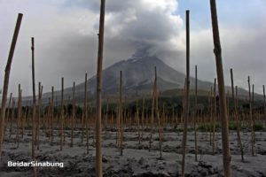
Indonesia , Ibu :
Increase in activity level of Mount Ibu, Halmahera North from Level II (WASPADA) to Level III (SIAGA) on May 8, 2024 at 11:00 WIT.
The (G.) Ibu volcano is a strato-volcano which peaks at 1,340 meters above sea level. Geographically, Mount Ibu is located at the coordinate position 1°29′ N and 127°38′ E and administratively, it is included in the area of Ibu District, West Halmahera Regency, North Maluku Province. Mount Ibu was observed visually and instrumentally from the Volcano Observation Post (PGA) located in Gam Ici village, Ibu district, West Halmahera regency, North Moluccas.
Since 1999 until today, Mount Ibu has experienced continuous eruptions. The current state of Mount Ibu is the formation of a lava dome within the crater with significant growth that has overtaken the crater walls, resulting in lava avalanches to the North and Northwest.
The latest developments in G. Ibu’s activity until May 8, 2024 are as follows:
On April 26, 2024 at 7:19 p.m. WIT, an eruption occurred with column height observed at approximately 2,000 m above the summit, gray in color, with thick intensity, oriented towards the South-West and West . An incandescence was observed ± 700 m from the summit and the sound of an explosion accompanied by a loud roar was heard at the PGA Ibu station, ashes fell on residential areas to the West and South-West.
On April 27, 2024 at 09:15 WIT, an eruption occurred with an ash column with a height of 1,200 meters, the ash column leaned towards the West and South-West.
On April 28, 2024 at 00:37 WIT, an eruption occurred with an eruption column height of approximately 3,500 meters, the direction of the eruption column was oriented to the West, lightning was observed in the eruption column, the sound of an explosion and a roar could be heard all the way to PGA Ibu Post. Ash rains fell on residential areas west of Mount Ibu.
On April 29, 2024 at 9:37 p.m. WIT, an eruption occurred with the height of the eruptive column observed at ± 1,000 m above the peak, gray in color with thick intensity oriented towards the West and Northwest . During this eruption, an incandescence was observed at approximately 500 m and incandescent lava was ejected towards the West, the North-West and the South-West. During this eruption, a dull noise accompanied by rumbling was also heard reaching the PGA post.
On May 2, 2024 at 11:14 p.m. WIT, an eruption occurred with the height of the eruptive column observed approximately 2,000 meters above the peak, gray in color with thick intensity, oriented towards the West and North- West. During this eruption, an incandescence was observed approximately 500 meters away and incandescent lava was ejected towards the southwest. Flashes were observed in the eruption column and the sound of an explosion was heard as far away as the PGA Post.
On May 8, 2024 at 01:58 WIT, an eruption occurred with the height of the eruptive column observed approximately 2,000 meters above the peak, gray in color with thick intensity oriented towards the East and Southeast . Fires and lightning were observed, and roars could be heard all the way to the PGA station.
Observations of the seismicity of Mount Ibu show high seismicity. Seismicity records are dominated by eruption earthquakes, emissions earthquakes, and volcanic tremors. Just before the eruption, a series of fairly intense shallow volcanic earthquakes and continuous tremors were recorded.
Based on visual and instrumental monitoring until April 8, 2024, the Geological Agency has raised the activity level of Mount Ibu from Level II (WASPADA) to Level III (SIAGA).
Source : PVMBG
Photos : PVMBG , Andi Rosati / Volcanodiscovery (Archive) .
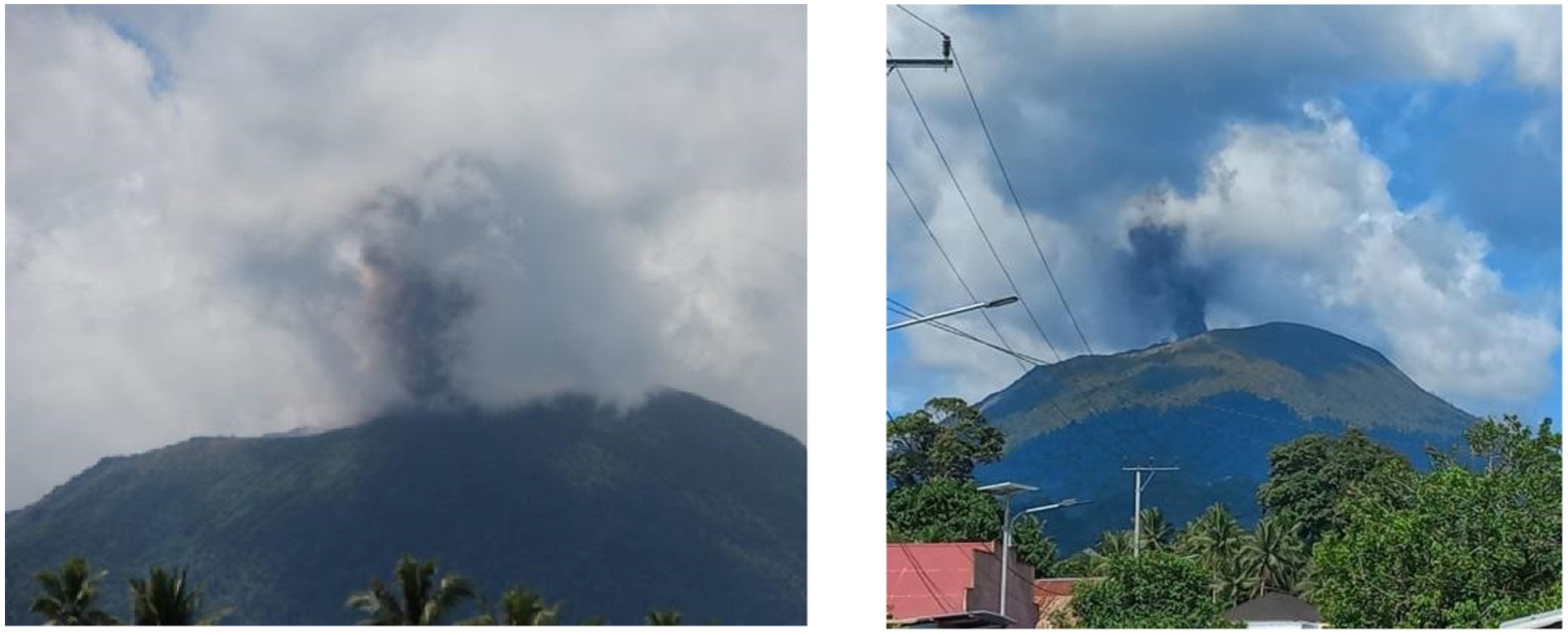
Colombia , Puracé :
Popayan, May 8, 2024, 2:30 p.m.
From the monitoring of the activity of the PURACE VOLCANO – LOS COCONUCOS VOLCANIC CHAIN, the COLOMBIAN GEOLOGICAL SERVICE (SGC), an entity attached to the MINISTRY OF MINES AND ENERGY, reports that:
Since yesterday until the time of publication of this Bulletin, both the seismic activity associated with the fracturing of rocks inside the volcanic edifice and that linked to the movement of fluids, have been characterized by behavior similar to that observed in previous days. Fracture earthquakes continue to be located beneath the crater of the Puracé volcano and its eastern flank, at depths of up to 4.0 km. The maximum magnitude calculated was 1.8 ML, corresponding to an earthquake recorded yesterday at 11:51 p.m. Seismicity linked to the movement of fluids continues to be concentrated in the crater sector and on its northern flank, at depths less than 1 km. The recording of earthquakes associated with the rise, settling or movement of magma, which were located under the eruptive centers of Piocollo and Curiquinga at depths between 1 and 3 km, showed a decrease by compared to yesterday.

Due to the low visibility associated with the weather conditions, during the duration evaluated in this bulletin it was not possible to observe the gas column. Ground deformation processes and concentrations of carbon dioxide (CO2) and sulfur dioxide (SO2) gases have not shown changes and their values continue to be above known baselines for this volcano.
The SGC confirms that the alert state of the PURACE VOLCANO continues at ORANGE: volcano with significant changes in the monitored parameters.
Observatorio Vulcanológico y Sismológico de Popayán, Servicio Geologico Colombiano (SGC) reported that the number of both volcanic tremor (VT) and long-period (LP) seismic events at Puracé increased during 23-29 April. The events had low magnitudes and were located at depths of 0-5 km; the VT events were located beneath the Puracé, Piocollo, and Curiquinga cones. Sulfur dioxide emissions had increased in the previous few weeks and carbon dioxide emissions continued to be above baseline levels at a fumarole on the N crater rim. Slow deformation which began in April 2022 between Puracé and Curiquinga was ongoing.
Both the number and intensity of earthquake events suddenly increased during 29-30 April. Seismicity continued to be elevated during 1-3 May and, along with continuing deformation and increases in gas emissions and other monitoring data, the activity was sustained at a higher level. On 3 May the Alert Level was raised to Orange (the second highest level on a four-color scale). During 3-4 May gas-and-steam emissions rose 1.4 km above the summit and drifted W. Seismicity during 3-6 May continued to increase; VT events were mainly located beneath Puracé at depths less than 4 km and LP events were located beneath the crater and the N flank at depths less than 1 km. Additionally, very low-magnitude events indicating rising magma were located at depths of 1-3.5 km beneath Piocollo and Curiquinga.
Source : SGC, GVP.
Photos : SGC
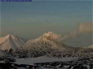
Japan , Suwanosejima :
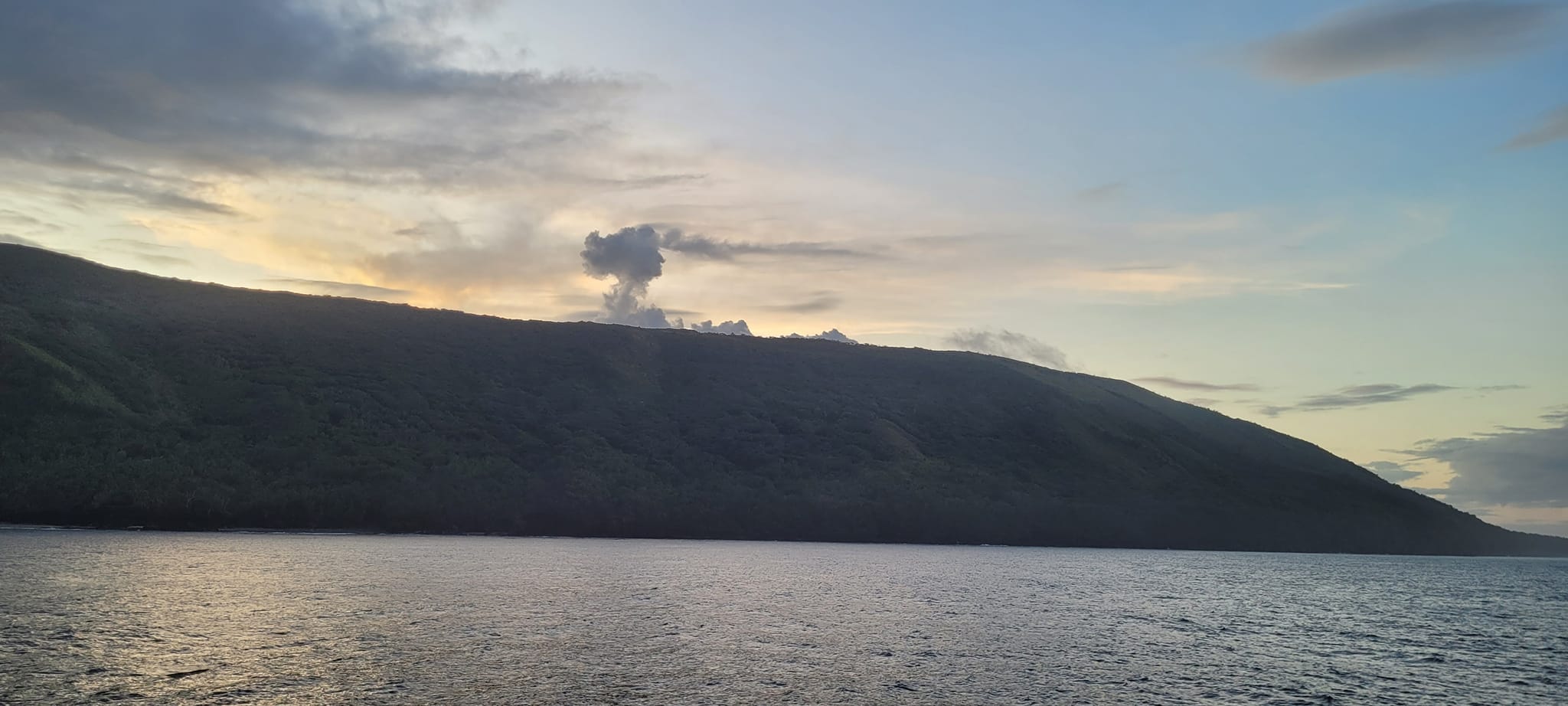
JMA reported that eruptive activity at Suwanosejima’s Ontake Crater continued during 29 April-6 May. Crater incandescence was observed nightly in webcam images. Emissions rose as high as 600 m above the crater rim and blocks were ejected as far as 300 m from the crater’s center; no explosions were detected. The Alert Level remained at 2 (on a 5-level scale) and the public was warned to stay at least 1.5 km away from the crater.
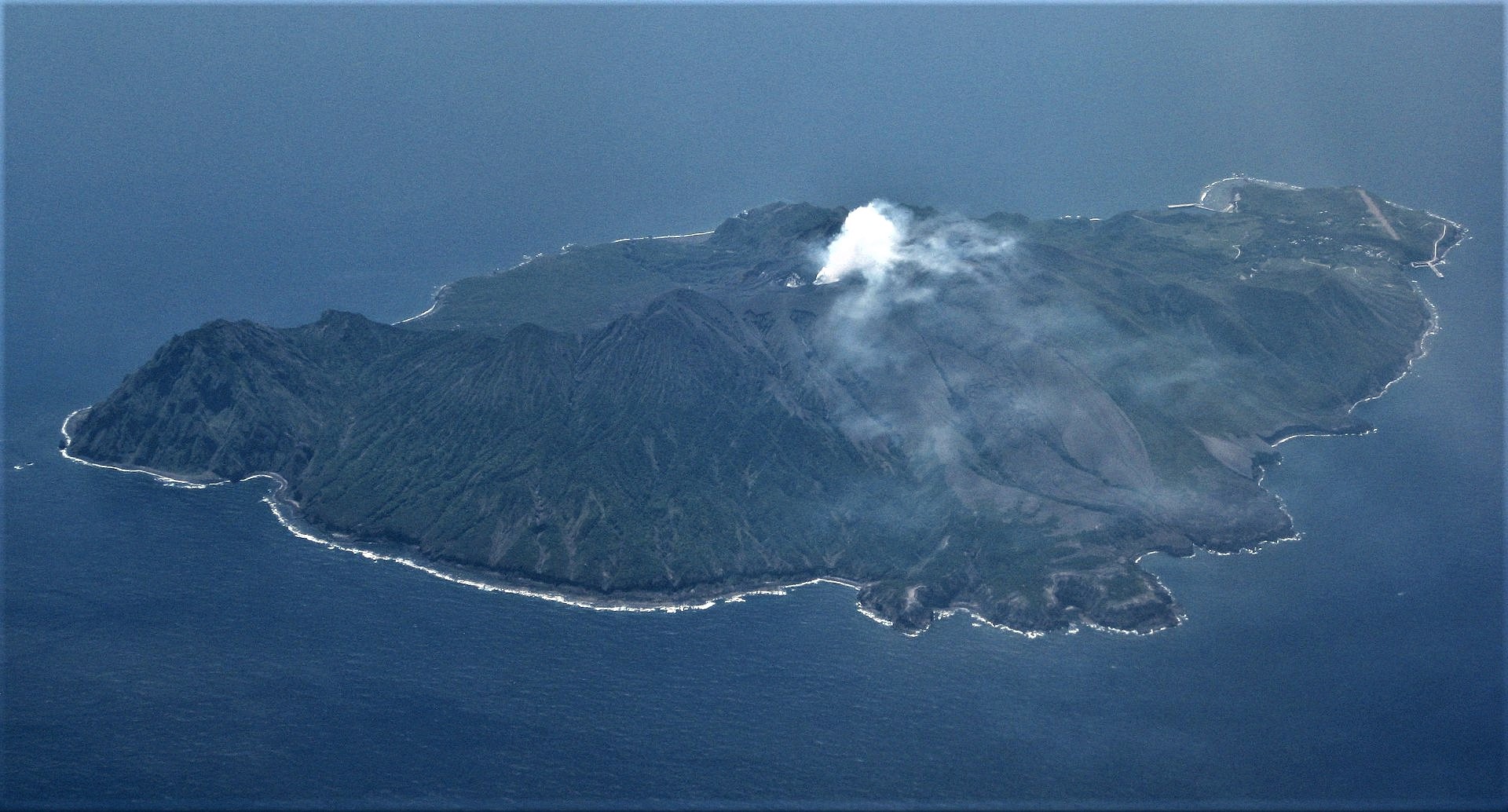
The 8-km-long island of Suwanosejima in the northern Ryukyu Islands consists of an andesitic stratovolcano with two active summit craters. The summit is truncated by a large breached crater extending to the sea on the E flank that was formed by edifice collapse. One of Japan’s most frequently active volcanoes, it was in a state of intermittent Strombolian activity from Otake, the NE summit crater, between 1949 and 1996, after which periods of inactivity lengthened. The largest recorded eruption took place in 1813-14, when thick scoria deposits covered residential areas, and the SW crater produced two lava flows that reached the western coast. At the end of the eruption the summit of Otake collapsed, forming a large debris avalanche and creating an open collapse scarp extending to the eastern coast. The island remained uninhabited for about 70 years after the 1813-1814 eruption. Lava flows reached the eastern coast of the island in 1884. Only about 50 people live on the island.
Source : Agence météorologique japonaise (JMA) , GVP.
Photo : Ray Go ( archive).
Tonga Islands , Tofua :
Tonga Geological Services reported that unrest at Tofua continued during 1-7 May. Thermal anomalies with varying intensities were detected daily. Sulfur dioxide plumes from the 28 April emission event continued to be identified in satellite data during 1-2 May. The Aviation Color Code was raised to Yellow (the second lowest color on a four-color scale) on 2 May; the Maritime Alert Level remained at Orange (the second highest level on a four-color scale); mariners were advised to stay 2 km away from the island; the Alert level for residents of Vava’u and Ha’apai remained at Green (the lowest color on a four-color scale).
The low, forested Tofua Island in the central part of the Tonga Islands group is the emergent summit of a large stratovolcano that was seen in eruption by Captain Cook in 1774. The summit contains a 5-km-wide caldera whose walls drop steeply about 500 m. Three post-caldera cones were constructed at the northern end of a cold fresh-water caldera lake, whose surface lies only 30 m above sea level. The easternmost cone has three craters and produced young basaltic-andesite lava flows, some of which traveled into the caldera lake. The largest and northernmost of the cones, Lofia, has a steep-sided crater that is 70 m wide and 120 m deep and has been the source of historical eruptions, first reported in the 18th century. The fumarolically active crater of Lofia has a flat floor formed by a ponded lava flow.
Sources : Services géologiques des Tonga, gouvernement des Tonga , GVP.
Photo : Tonga geological service ( archive)
Hawaii , Kilauea :
Wednesday, May 8, 2024, 9:11 AM HST (Wednesday, May 8, 2024, 19:11 UTC)
19°25’16 » N 155°17’13 » W,
Summit Elevation 4091 ft (1247 m)
Current Volcano Alert Level: ADVISORY
Current Aviation Color Code: YELLOW
Activity Summary:
Kīlauea volcano is not erupting. Unrest continues beneath the upper East Rift Zone and the summit caldera south of Halemaʻumaʻu.
Summit and upper East Rift Zone Observations:
Earthquake counts remain elevated with approximately 250 earthquakes in the past 24 hours, an increase over the preceding day. These earthquakes are clustered in the upper East Rift Zone as well as the south caldera region. Earthquake depths have averaged 2-4 km (1.2-3.1 miles) beneath the surface, and magnitudes have been mostly below M2.0, with one M3.3 yesterday morning.
Ground deformation continues beneath Halemaʻumaʻu and the south caldera region. The Uēkahuna tiltmeter continues to record inflation beneath Halemaʻumaʻu that began early Saturday morning. The tiltmeter at Sandhill continues to record uplift in the south caldera region.
Sulfur dioxide (SO2) gas emission rates remain low. An SO2 emission rate of approximately 62 tonnes per day was recorded on May 2.

Rift Zone Observations:
Elevated seismic activity on the East Rift Zone is confined to the upper East Rift Zone, with no significant earthquakes occurring past the Pauahi Crater. At this time, seismicity in Kīlauea’s Southwest Rift Zone remains relatively low outside of the summit region. Measurements from continuous gas monitoring stations downwind of Puʻuʻōʻō in the middle East Rift Zone—the site of 1983–2018 eruptive activity—continue to be below detection limits for SO2, indicating that SO2 emissions from Puʻuʻōʻō are negligible.
Analysis:
Magma continues to pressurize the system beneath beneath Halemaʻumaʻu and the south side of Kalaupele and Keanakākoʻi crater, activating seismicity along faults in the upper East Rift Zone. At this time, it is not possible to say whether this increase in activity will lead to an intrusion or eruption in the near future or simply continue as seismic unrest at depth. Changes in the character and location of unrest can occur quickly, as can the potential for eruption.
Source : HVO
Photo : Keanakākoʻi Crater / NPS Photo/M. Szoenyi .