May 18 , 2023.
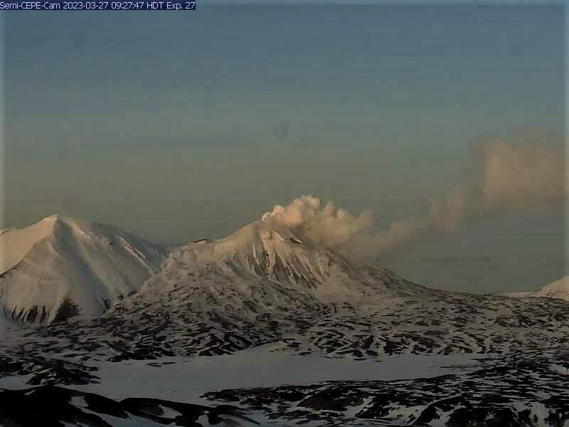
Alaska , Semisopochnoi :
AVO/USGS Volcanic Activity Notice
Current Volcano Alert Level: ADVISORY
Previous Volcano Alert Level: WATCH
Current Aviation Color Code: YELLOW
Previous Aviation Color Code: ORANGE
Issued: Wednesday, May 17, 2023, 1:25 PM AKDT
Source: Alaska Volcano Observatory
Notice Number: 2023/A694
Location: N 51 deg 55 min E 179 deg 35 min
Elevation: 2625 ft (800 m)
Area: Aleutians
Volcanic Activity Summary:
The level of eruptive activity at Semisopochnoi has declined in the past week. The last evidence of ash emissions from the volcano was observed on May 5 and consisted of a light dusting of ash on the northwest flank of Mount Young. The Aviation Color Code and Volcano Alert Level are being lowered to YELLOW/ADVISORY.
Small eruptions producing minor ash deposits within the vicinity of the active north crater of Mount Young and ash clouds usually under 10,000 ft (3 km) above sea level have characterized the recent activity and more ash-producing events could occur again with little warning.
Semisopochnoi is monitored by a local seismic and infrasound network, local web cameras, regional lightning and infrasound sensors, and satellite data.
Remarks:
Remote Semisopochnoi volcano occupies the largest, young volcanic island in the western Aleutians. The uninhabited island is part of the Alaska Maritime National Wildlife Refuge. It is located 65 km (40 mi) northeast of Amchitka Island and 200 km (130 mi) west of Adak, Alaska. Semisopochnoi volcano is dominated by an 8-km (5-mile) diameter caldera that contains a small lake and several post-caldera cones and craters. The age of the caldera is not known with certainty but is likely early Holocene. The north cone of Mount Young, in the southwest part of the caldera, is the site of the current eruption, which began in 2018. The last known eruption prior to 2018 was in 1987 from Sugarloaf Peak on the south coast of the island
Source : USGS
Photo : Loewen, Matt / Alaska Volcano Observatory / U.S. Geological Survey.
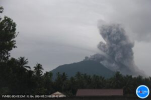
Indonesia , Semeru :
VOLCANO OBSERVATORY NOTICE FOR AVIATION – VONA
Issued : May 18 , 2023 .
Volcano : Semeru (263300)
Current Aviation Colour Code : ORANGE
Previous Aviation Colour Code : orange
Source : Semeru Volcano Observatory
Notice Number : 2023SMR184
Volcano Location : S 08 deg 06 min 29 sec E 112 deg 55 min 12 sec
Area : East java, Indonesia
Summit Elevation : 11763 FT (3676 M)
Volcanic Activity Summary :
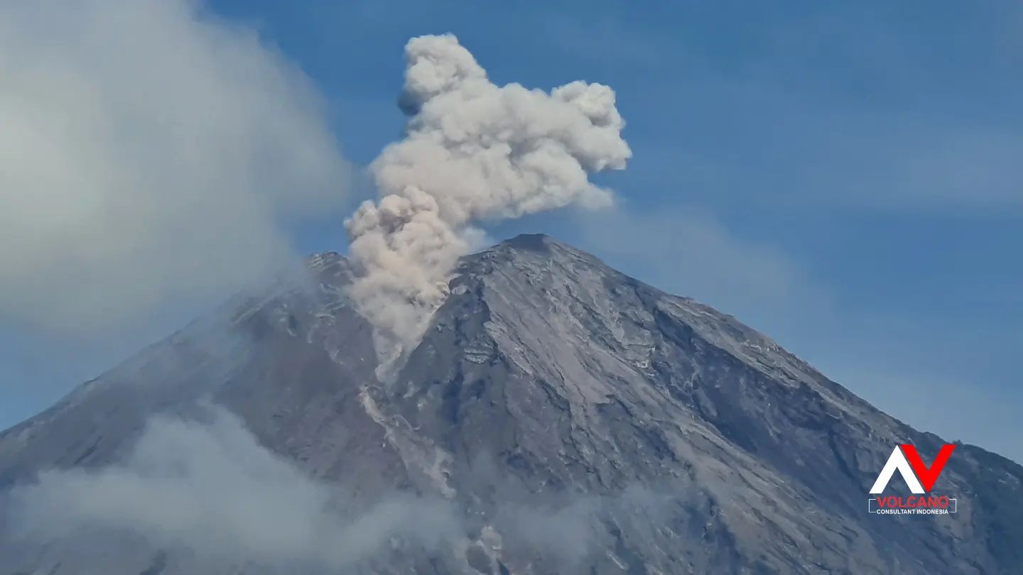
Eruption with volcanic ash cloud at 01h22 UTC (08h22 local).
Volcanic Cloud Height :
Best estimate of ash-cloud top is around 14323 FT (4476 M) above sea level or 2560 FT (800 M) above summit. May be higher than what can be observed clearly. Source of height data: ground observer.
Other Volcanic Cloud Information :
Ash cloud moving to south. Volcanic ash is observed to be white to gray. The intensity of volcanic ash is observed to be thick.
Remarks :
Eruption recorded on seismogram with maximum amplitude 22 mm and maximum duration 79 second.
Source : Magma Indonésie.
Photo : Andi volcanist
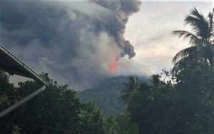
Japan , Sakurajima :
JMA reported ongoing activity at both Minamidake Crater and Showa Crater (Aira Caldera’s Sakurajima volcano) during 8-15 May. Crater incandescence was observed nightly at Minamidake Crater. On 8 May sulfur dioxide emissions were extremely high at 3,900 tons per day. At 13h15 on 9 May an explosion at Minamidake generated an ash plume that rose 1.2 km above the crater rim and drifted SW, and ejected blocks 1.1 km from the vent. Eruptive events at 15h27, 17h24, and 18h17 on 11 May produced ash plumes that rose as high as 1.3 km and drifted NW and W.
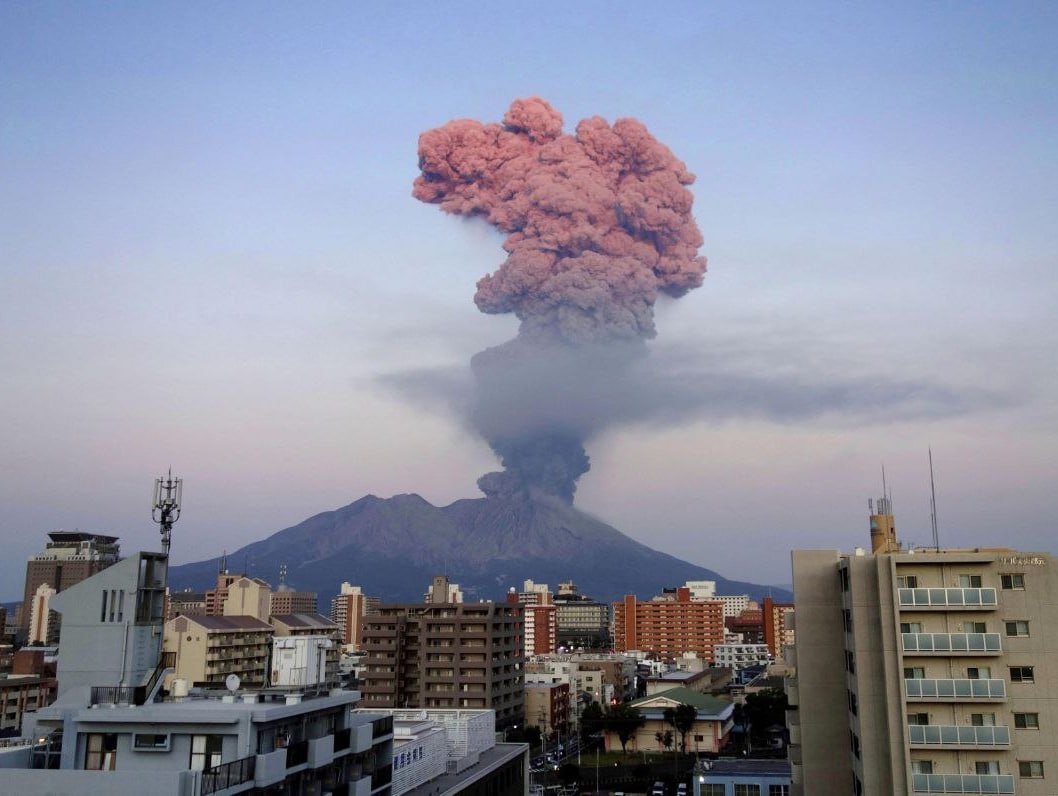
At Showa Crater eruptive events recorded at 10h09, 13h03, and 14h01 on 8 May, at 05h50, 07h26, 22h04, and 23h21 on 11 May, at 18h31 on 12 May, and at 08h59 on 14 May produced ash plumes that rose as high as 1.7 km above the crater rim and drifted in multiple directions. Sulfur dioxide emissions were somewhat high on 12 May, averaging 1,800 tons per day. The Alert Level remained at 3 (on a 5-level scale), and residents were warned to stay 2 km away from both craters.
Sources: Japan Meteorological Agency (JMA), GVP
Photo : Deniss García Mendoza
Hawaii , Kilauea :
Wednesday, May 17, 2023, 9:06 AM HST (Wednesday, May 17, 2023, 19:06 UTC)
19°25’16 » N 155°17’13 » W,
Summit Elevation 4091 ft (1247 m)
Current Volcano Alert Level: ADVISORY
Current Aviation Color Code: YELLOW
Activity Summary:
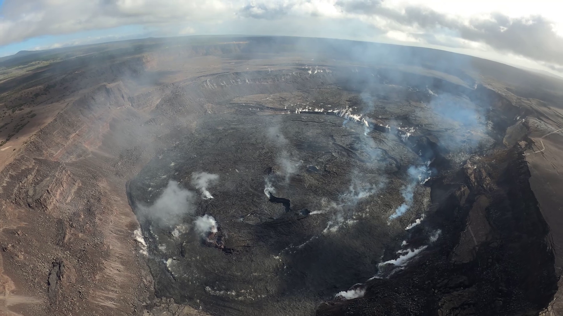
Kīlauea volcano is not erupting, and no active lava has been observed since March 7, 2023. Summit seismicity remains elevated. Tiltmeters have returned to gradual inflation. No significant changes have been observed along either of the volcano’s rift zones over the past day.
Halemaʻumaʻu Crater Observations:
No active lava has been observed over the past day.
Summit Observations:
Summit tiltmeters are showing gradual inflation over the last day. Overall, inflation at the summit of Kīlauea is still higher than conditions preceding the January 5, 2023, summit eruption. Small flurries of earthquakes continue irregularly beneath Halemaʻumaʻu, Keanakākoʻi Crater, and the southern margin of Kaluapele (Kīlauea caldera) since April 16. Overall, rates of summit earthquakes remain elevated, and additional earthquake flurries are possible. The most recent sulfur dioxide (SO2) emission rate of approximately 151 tonnes per day was measured on May 16, 2023.
Rift Zone Observations:
No unusual activity has been noted along the East Rift Zone or Southwest Rift Zone; steady rates of ground deformation and seismicity continue along both. Measurements from continuous gas monitoring stations in the middle East Rift Zone—the site of 1983–2018 eruptive activity—remain below detection limits for SO2.
Source : HVO
Photo : USGS / M. Patrick.
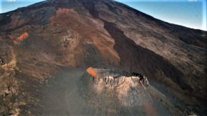
Colombia , Chiles / Cerro Negro :
Weekly activity bulletin of the volcanic complex of Chiles and Cerro Negro (CVCCN)
Regarding the monitoring of the activity of the VOLCANOES CHILES AND CERRO NEGRO, the MINISTRY OF MINES AND ENERGY through the COLOMBIAN GEOLOGICAL SERVICE (SGC) informs that:
Compared to the previous week, the assessment of volcanic activity in the period between May 9 and May 15, 2023, showed an increase, both in occurrence and in seismic energy released, without reaching the levels observed for the months of March or April. Earthquakes associated with rock fractures continue to predominate inside the volcano and fluctuations are recorded in events related to fluid dynamics inside the volcanic system.
Most fracture earthquakes continue to be located near and south of the Chiles volcano, at distances up to 4 km, with depths less than 10 km, from its summit.

In the period evaluated, the magnitude 4.1 earthquake of May 12 at 01:06 is highlighted, reported as felt by the inhabitants of the regions near the CVCCN. Additionally, this week eight events of magnitude greater than or equal to 2 occurred, although none of them were reported as felt by area residents.
The deformation processes recorded continue, both by sensors installed on the volcanoes and by remote satellite sensors.
It is important to remember that due to the fluctuating behavior of the CVCCN, the possibility of high-energy earthquakes that can be felt by the inhabitants of the area of influence is not excluded.
The activity level of volcanoes remains at the YELLOW LEVEL ■ (III): CHANGES IN THE BEHAVIOR OF VOLCANIC ACTIVITY
Source : SGC
Photo : IGEPN