May 07 , 2020.
Italy , Stromboli :
Weekly bulletin from April 27, 2020 to May 03, 2020 (issue date 05/05/2020)
SUMMARY OF ACTIVITY STATUS
In light of the monitoring data, it is highlighted:
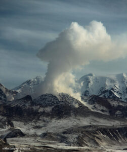
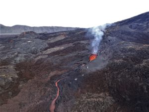
1) VOLCANOLOGICAL OBSERVATIONS: During this period, normal explosive activity of the strombolian type was observed accompanied by degassing and splashing activities. The hourly frequency of explosions fluctuated between average values (15 events / h on April 30) and high values (21 events / h on April 28). The intensity of the explosions was mainly low in the area of the North crater and medium in the area of the Center-South crater.
2) SEISMOLOGY: The seismological parameters do not show significant variations.
4) DEFORMATIONS: Data from the Stromboli soil deformation monitoring networks did not show any significant changes last week.
5) GEOCHEMISTRY: The flow of SO2 is at an average level. The last measurement of the CO2 / SO2 ratio is at an average value (last update on 02/09/2020). The isotopic ratio of helium remains on average values (last update of 09/03/2020). There is no update on the CO2 released by the soil.
6) SATELLITE OBSERVATIONS: The thermal activity in the summit area is low.
VOLCANOLOGICAL OBSERVATIONS
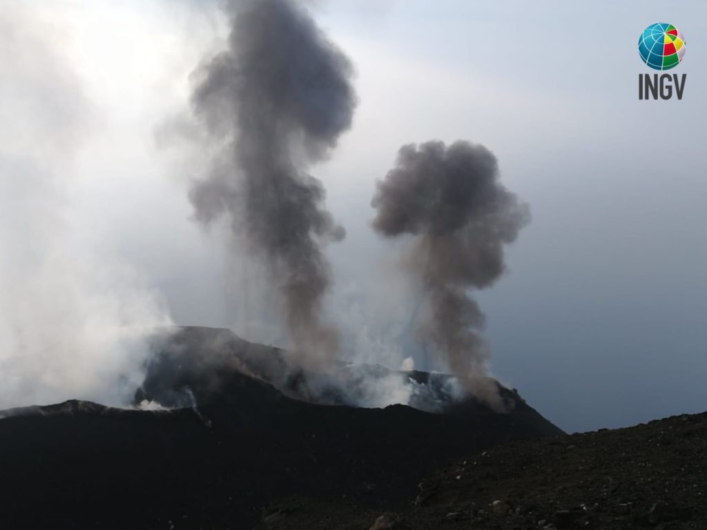
The analysis of the images recorded by the cameras placed at an altitude of 400m, at an altitude of 190m and at Punta dei Corvi made it possible to characterize the eruptive activity of Stromboli. During the reporting period, the explosive activity was mainly produced by at least 4 (four) eruptive vents located in the area of the North crater and by at least 2 (two) eruptive vents located in the area of the Center-South crater . All the vents are located inside the depression which occupies the crater terrace.
Due to unfavorable weather conditions on April 29, May 01 and May 03, the visibility of the crater terrace was insufficient for a correct description of the eruptive activity.
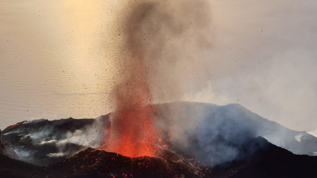
In the North zone, the explosions were mainly of variable intensity, low (less than 80 m in height) to medium (less than 150 m in height) emitting coarse materials (lapilli and bombs). During certain explosions, abundant fallout products covered the outer slopes of the area overlooking the Sciara del Fuoco. In addition, splashes were observed on April 27 and May 2, sometimes intense. The average frequency of explosions in the North zone varied between 9 and 17 events / h. The explosive activity of the Center-South zone caused explosions of mainly fine materials (ashes) mixed with coarse materials, with an average intensity (less than 150 m in height) and sometimes high (the products exceeded 250 m in height ). The frequency of explosions in the Center-South zone varied between 5 and 8 events / h.
The amplitude of the volcanic tremor generally had medium-low values, with a decrease from 02/05.
Source : INGV.
Read the whole article : ile:///C:/Users/Utilisateur/AppData/Local/Packages/Microsoft.MicrosoftEdge_8wekyb3d8bbwe/TempState/Downloads/BollettinoStromboli20200505%20(1).pdf
Photos : F. Ciancitto, INGV-OE Catania , LGS – Laboratorio Geofisica Sperimentale .
Colombia , Nevado del Ruiz :
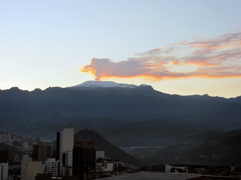
Weekly activity bulletin of the Nevado del Ruiz volcano
The level of activity continues at the level of yellow activity or (III): changes in the behavior of volcanic activity.
With regard to monitoring the activity of the Nevado del Ruiz volcano, the COLOMBIAN GEOLOGICAL SERVICE reports that:
The seismicity generated by the fracturing of the rocks showed a slight increase in the number of earthquakes and the seismic energy released, compared to the previous week. This type of seismicity was mainly located in the South-East, North-East and West-South-West sectors of the volcano, as well as in the Arenas crater, at depths varying between 0.6 and 6.1 km. The maximum magnitude recorded during the week was 1.9 ML (local magnitude) corresponding to the earthquake recorded on May 3 at 11:24 a.m. (local time) located 2.0 km south-south-east of the Arenas crater, 3.2 km deep.
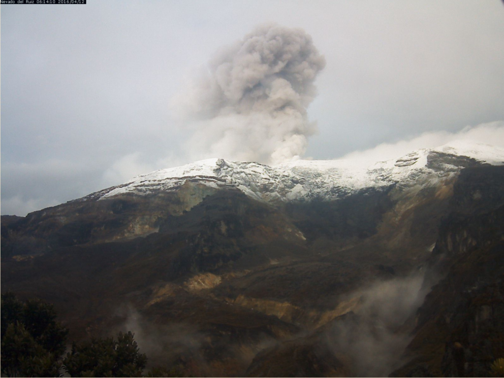
Seismicity related to fluid dynamics inside volcanic conduits showed a slight decrease in both the number of events recorded and the seismic energy released, compared to the previous week. This seismic activity was characterized by the occurrence of continuous volcanic tremors, tremor pulses, earthquakes of the long period type and of the very long period type. These seismic events presented varying energy levels and spectral contents. Some of these signs were associated with small emissions of gas and ash, which were confirmed by cameras installed in the volcano area and by reports from officials of the Los Nevados National Natural Park in the region.
The deformation of the volcanic surface, measured from GNSS stations (Global Navigation Satellite System), showed some minor changes associated with volcanic activity, consistent with those recorded by the other volcanic monitoring parameters used during the complete evaluation of the activity of Nevado del Ruiz.
In the past week, the Mirova and NASA FIRMS web portals have not reported any thermal anomalies on the volcano.
The gas and vapor column reached a maximum height of 1221 m measured above the summit of the volcano on April 30. The dispersion of the column was governed by the wind direction, mainly with a northwestward trend of the volcano.
The Nevado del Ruiz volcano continues at a yellow activity level.
Source : SGC.
Photo : SGC , 12-04-2016 , Auteur inconnu .
Solomon Islands , Kavachi :
8.991°S, 157.979°E
Elevation -20 m
Satellite data showed discolored water around Kavachi beginning in January 2020; the discolored plumes became more frequent, dense, and stretched for longer distances. On 25 April a satellite image showed a plume in the water that was about 15 km long but spread over an approximate area of 30 square kilometers. A small brown circle about 50,000 square meters in area indicated the presence of material over the likely vent location. An image acquired on 30 April showed a thin ribbon of discolored water extending about 50 km W of Kavachi.
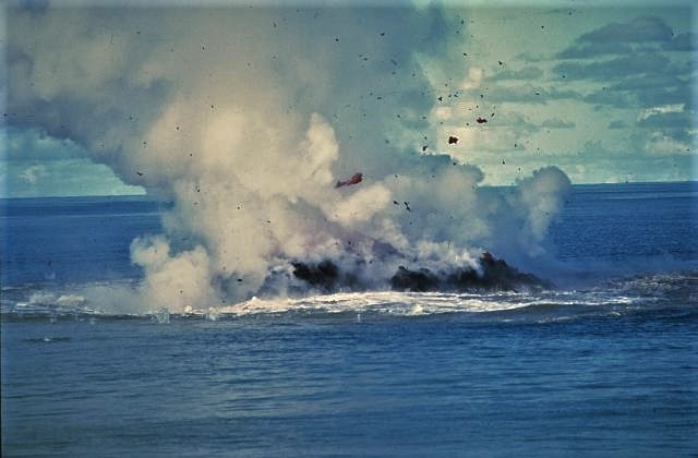
Clots of incandescent magma rise above Kavachi on 30 June 1978 after the vent of the submarine volcano had reached the sea surface. No eruptive activity was observed on 20 June, but there was an eruption the following day. On 22 June a 30-50 m island was observed erupting incandescent lava and gas and ash that rose a few thousand meters into the air. The eruption ended sometime between 16-28 July when observers on an overflight noted that the island was about 15 m wide and 3 m high.
Named for a sea-god of the Gatokae and Vangunu peoples, Kavachi is one of the most active submarine volcanoes in the SW Pacific, located in the Solomon Islands south of Vangunu Island about 30 km N of the site of subduction of the Indo-Australian plate beneath the Pacific plate. Sometimes referred to as Rejo te Kvachi (« Kavachi’s Oven »), this shallow submarine basaltic-to-andesitic volcano has produced ephemeral islands up to 1 km long many times since its first recorded eruption during 1939. Residents of the nearby islands of Vanguna and Nggatokae (Gatokae) reported « fire on the water » prior to 1939, a possible reference to earlier eruptions. The roughly conical edifice rises from water depths of 1.1-1.2 km on the north and greater depths to the SE. Frequent shallow submarine and occasional subaerial eruptions produce phreatomagmatic explosions that eject steam, ash, and incandescent bombs. On a number of occasions lava flows were observed on the ephemeral islands.
Sources: Sentinel Hub, Culture Volcan.
Photo : de W.G. Muller, 1977 (courtesy of Deni Tuni, Ministry of Lands, Energy and Mineral Resources, Solomon Islands).
, GVP.
El Salvador , San Miguel ( Chaparrastique) :
Location: San Miguel Department
Altitude: 2130 meters above sea level
Type of volcano: Stratovolcan
Activity type: Strombolienne-Vulcanienne
Last major eruption: December 29, 2013
In the early hours of Sunday, April 5, 2020, it was observed that the seismicity of the San Miguel volcano had changed configuration, presenting small fluctuations which did not exceed normal behavior.
During the following days, the activity of the volcano remained in acceptable levels, following slight fluctuations in its level of released seismic energy, varying between 40 and 114 average RSAM units per day, the threshold being 150 units.
The origin of the periodic fluctuations in the levels of seismic energy released by the volcano is associated with internal changes linked to the rise of gases from its active magmatic reservoir, in the degassing process. As for sulfur dioxide (SO2) emissions, measured with DOAS equipment, they fluctuated between 74 and 733 tonnes per day, with an average of 380 tonnes per day, the threshold being 300 tonnes per day.
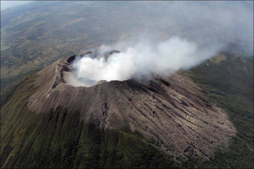
Reports from the Network of Local Observers indicate that the volcano has a slight degassing in its crater. A forest fire broke out in the Finca El Cordero area, which was successfully brought under control by residents, firefighters and the armed forces.
Therefore, we can conclude that the volcano remains active, with high and low periods in its level of activity.
Source : Marn .
Photo : Volcanohotspot .
Chile , Nevados of Chillan :
Special volcanic activity report (REAV), region of the Nevados de Chillán volcanic complex, on 06 May 2020 at 6:06 p.m. local time (mainland Chile).
The National Geological and Mining Service of Chile (Sernageomin) discloses the following PRELIMINARY information, obtained with the monitoring equipment of the National Volcanic Monitoring Network (RNVV), processed and analyzed at the South Andes Volcanological Observatory (OVDAS ):
On Wednesday May 06, 2020 at 5:47 p.m. local time (9:47 p.m. UTC), the monitoring stations installed near the Nevados de Chillán volcanic complex recorded an earthquake associated with fluid dynamics inside the volcanic system ( long period type).
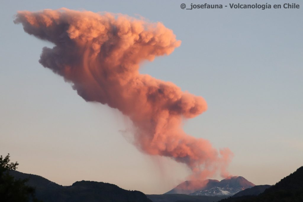
Around 17.53 h, a new explosion was recorded, as is already the practice for this eruptive cycle. The photograph of the eruptive column, courtesy of @_josefauna, was captured from San Fabian d’Alico.
The characteristics of the LP earthquake are as follows:
TIME OF ORIGIN: 5:47 p.m. local time (9:47 p.m. UTC).
LATITUDE: 36 862 ° S
LONGITUDE: 71.379 ° W
DEPTH: 0.8 km
REDUCED MOVEMENT: 350cm2
ACOUSTIC SIGNAL: 19.9 Pa reduced to 1 km.
The characteristics of the associated surface activity are as follows:
Maximum height of the emission column: 2500 m above the emission point.
Direction of dispersion: North – East.
OBSERVATIONS:
Preliminary, we observe basal pyroclastic flows towards the East and Southeast sectors mainly. In addition, we note the presence of a second eruptive pulse at 6:00 p.m. local time, with a recorded altitude of 1,600 m above the point of emission, and with a reduced displacement value of 29 cm2.
The volcanic technical alert is maintained at the YELLOW level.
Source : Sernageomin .
Photo : @_josefauna, Volcanologia en Chile

