April 23 , 2019.
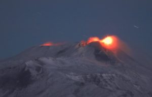
Indonesia , Anak Krakatau :
VOLCANO OBSERVATORY NOTICE FOR AVIATION – VONA.
Issued : April 23 , 2019
Volcano: Anak Krakatau (262000)
Current Aviation Colour Code: ORANGE
Previous Aviation Colour Code: orange
Source: Anak Krakatau Volcano Observatory
Notice Number: 2019KRA59
Volcano Location: S 06 deg 06 min 07 sec E 105 deg 25 min 23 sec
Area: Lampung, Indonesia
Summit Elevation: 502 FT (157 M)
Volcanic Activity Summary:
Eruption with ash clouds at 04:57 UTC (11:57 local time). The eruption lasted for94 seconds.
Volcanic Cloud Height:
Ash-cloud is not visible
Other Volcanic Cloud Information:
0
Remarks:
Eruption recorded on seismogram with maximum amplitude 45 mm and duration 94 second.
Level of activity at level II (Waspada), since March 25, 2019. G. Anak Krakatau (167 m altitude) has increased its volcanic activity since June 18, 2018, which was followed by a series of eruptions from September 2018 to February 2019. In April 2019, eruptions still occur but decreasing intensity.
Since yesterday and until this morning, the volcano was clearly visible until it was covered with fog. Crater smoke was not observed.
The seismographs of April 22, 2019 recorded:
2 earthquakes of eruption
5 earthquakes of explosion
7 low frequency earthquakes
3 shallow volcanic earthquakes
Tremor continuous with a dominant amplitude of 1 mm.
Recommendation:
People / tourists are not allowed to approach the crater within 2 km.
Sources : Magma Indonésie , PVMBG.
Photo : James Reynolds / EarthUncut Tv
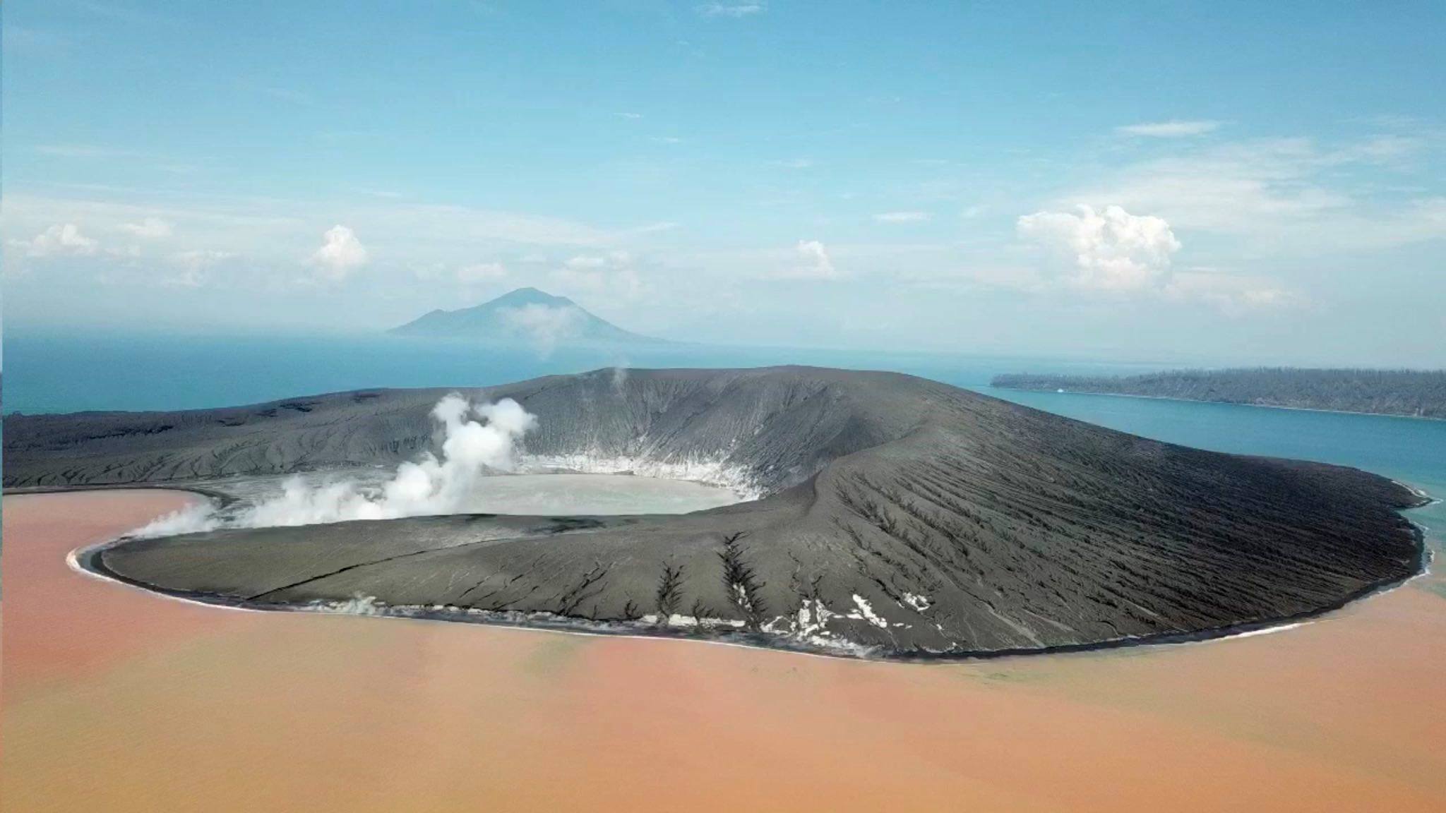
Kamchatka , Sheveluch :
VOLCANO OBSERVATORY NOTICE FOR AVIATION (VONA).
Issued: April 23 , 2019
Volcano:Sheveluch (CAVW #300270)
Current aviation colour code:ORANGE
Previous aviation colour code:orange
Source:KVERT
Notice Number:2019-84
Volcano Location:N 56 deg 38 min E 161 deg 18 min
Area:Kamchatka, Russia
Summit Elevation:10768.24 ft (3283 m), the dome elevation ~8200 ft (2500 m)
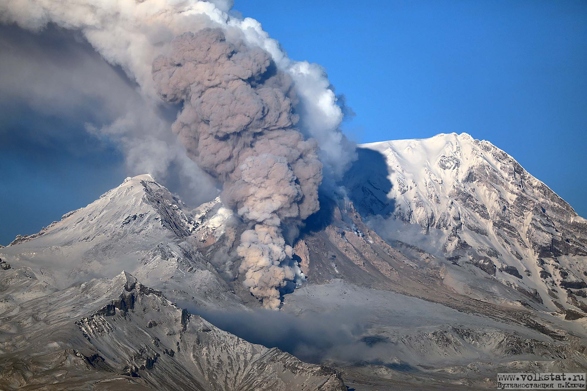
Volcanic Activity Summary:
A growth of the lava dome continues (a viscous lava blocks extrude out on the northern part of it), a strong fumarolic activity and an incandescence of the dome blocks and hot avalanches accompanies this process. According to satellite data, gas-steam plume containing some amount of ash to drift to northeast of the volcano.
Explosive-extrusive eruption of the volcano continues. Ash explosions up to 32,800-49,200 ft (10-15 km) a.s.l. could occur at any time. Ongoing activity could affect international and low-flying aircraft.
Volcanic cloud height:
13120-14760 ft (4000-4500 m) AMSL Time and method of ash plume/cloud height determination: 20190423/0230Z – Himawari-8
Other volcanic cloud information:
Distance of ash plume/cloud of the volcano: 50 mi (80 km)
Direction of drift of ash plume/cloud of the volcano: NE / azimuth 43 deg
Source : Kvert
Photo : YU. Demyanchuck , volkstat ru .
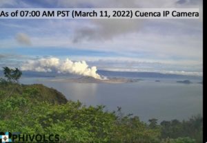
Chile , Nevados de Chillan :
Volcanic Activity Report (RAV), Volcanological Observatory of the South Andes – Ovdas, 22 April 2019 16:00 HL.
Current alert level: ORANGE
Volcanic monitoring
Seismic activity: During the last 24 hours, the monitoring network of the Nevados volcanic complex in Chillan continues to record volcano tectonic (VT) type seismicity, long period type (LP) and tremor episodes, with seismic energy who remains at a rank considered moderate. The seismicity LP and TR being related to the occurrence of explosions which impulses the surface activity and is associated with the variation between the growth and the partial destruction of the viscous lava dome in the crater Nicanor.

Observations:
When weather conditions permitted, it was possible to visualize a pulsatile column of emission, of white color with the predominance of water vapor, and sometimes with greyish tones due to the presence of particulate materials. During the night, incandescence is observed associated with a high temperature degassing produced from the active crater and the exit of projectiles produced by the explosions and deposited on the periphery of the crater. The maximum height of the gas column does not correspond with the largest explosion recorded.
Other observations
⦁ Infrasound sensors recorded acoustic signals associated with explosions (EX) with maximum values and less than 0.81 Pa (reduced to 1 km as a reference).
⦁ No thermal radiation was reported according to the information processed by the MIROVA group.
Danger
Exposure / Specific risks:
After one year of observation, the dacitic dome maintains a low growth rate, with values around 0.003 m3 / s. Under these conditions, and if a major explosive event occurs, global statistics indicate that in 64% of cases it will be associated with a moderate to low explosive explosion (IEV = 0 to 2).
…/…
Read the full report: http://sitiohistorico.sernageomin.cl/reportesVolcanes/20190422050955603RAV_Ñuble_Abril_2019_Nº112.pdf
Source : Sernageomin.
Photo : Publimetro.
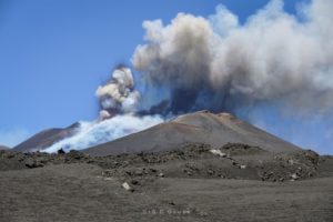
Guatemala , Santiaguito :
Activity type: Pelean
Morphology: Complex of dacitic domes
Geographical location: 14 ° 44 ’33 ˝ Latitude N; 91 ° 34’13˝ Length O.
Height: 2,500msnm.
Weather Conditions: Clear Weather
Wind: East at 10 km / h
Precipitation: 0.0 mm.

Activity:
Presence of a white degassing at a height of 2900 meters, which is dispersed towards the Southwest. The seismic stations record 11 low explosions /, 24-hour that lift white ash columns at an altitude of 2900-3200 m with dispersion towards the southwest. Low to moderate avalanches are recorded on the eastern and southwestern flanks reaching the base of the Caliente dome. There are slight drops of fine ash particles in the volcanic perimeter.
Source : Insivumeh.
Photo : annie winson , earthobservatory.sg