August 30 , 2020.
Italy / Sicily , Etna :
ETNA COMMUNICATION [UPDATE n. 73]
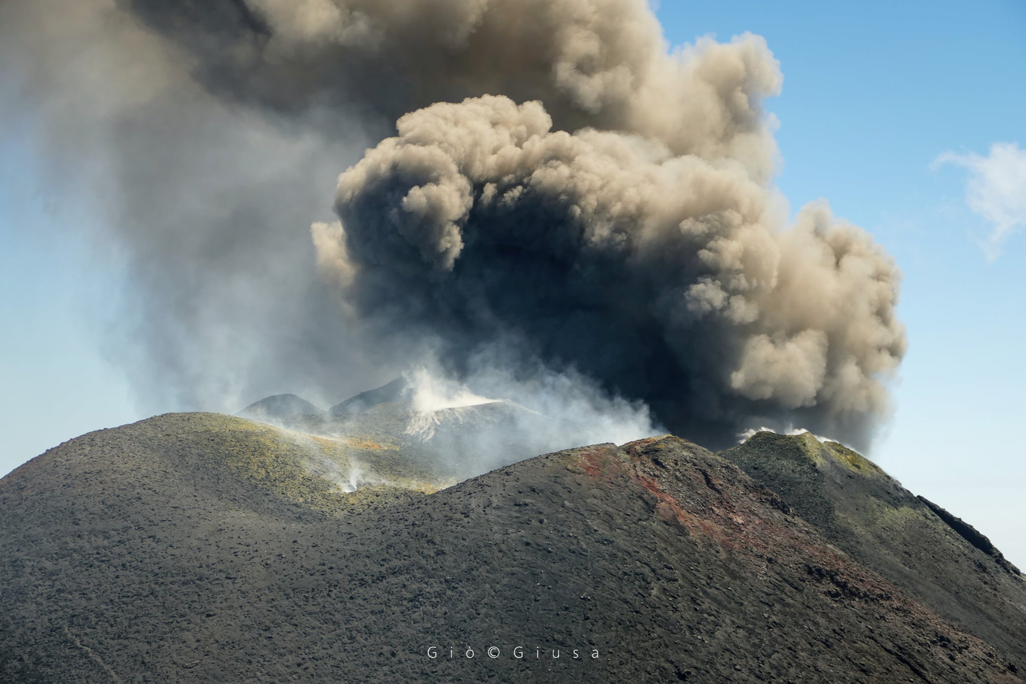
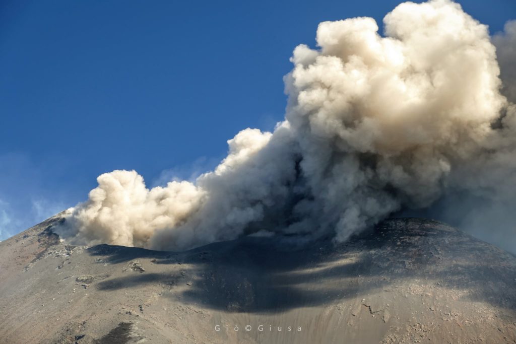
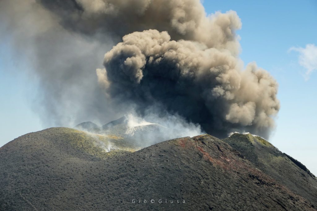
The National Institute of Geophysics and Volcanology, Osservatorio Etneo, announces that the activity of the New Southeast Crater from the morning of August 28 is characterized by a discontinuous and modest ash emission which produces a strongly diluted volcanic cloud of gray color. clear. The volcanic cloud, which reaches a height of about 4.5 km above sea level, is quickly dispersed eastward by high altitude winds.
A close-up of the Bocca della Sella (new south-eastern crater) with its now usual ash emission. Etna Sud, August 28, 2020
As for the temporal trend of the mean amplitude of the volcanic tremor, it continues to show marked amplitude fluctuations which globally define a substantially stationary trend which is maintained mainly in the interval of the mean values. The location of the source of the tremor is located near the Southeast Crater / New Southeast Crater area, at a depth of approximately 2900-3000 meters above mean sea level.
From the point of view of infrasound activity, during the last 24 hours, the events have been mainly localized in the area of the New Southeast Crater and in the area of the Northeast Crater.
The analysis of the data from the permanent and inclinometric GNSS networks does not show any significant deformations of the ground. Only the two main inclinometer stations PDN and CPN and the CBD station show slight variations.
ETNA COMMUNICATION [UPDATE n. 74]
The National Institute of Geophysics and Volcanology, Osservatorio Etneo, announces that from 11:30 UTC, the emission of ash from the New Southeast Crater has gradually intensified, producing an eruptive cloud that reaches a height of approximately 4.5 km above sea level to the east / northeast. Currently, no ash fall has been reported in the inhabited centers of the Etna region.
As for the temporal trend of the mean amplitude of the volcanic tremor, it continues to show marked amplitude fluctuations which globally define a substantially stationary trend which is maintained mainly in the interval of the mean values. The location of the source of the tremor is located near the Southeast Crater / New Southeast Crater area, at a depth of approximately 2900-3000 meters above mean sea level.
From the point of view of infrasound activity, no significant changes were reported.
Analysis of GNSS data and permanent inclinometric networks does not show significant deformations of the ground compared to the previous update (update n ° 73).
https://www.facebook.com/giovanni.giusa/videos/3134137406635969/
ETNA COMMUNICATION [UPDATE n. 75]
The National Institute of Geophysics and Volcanology, Osservatorio Etneo, announces that at 14:55 UTC, the emission of ash from the New Southeast Crater has ceased. Intense degassing continues, sometimes accompanied by intermittent and light explosive activity.
As for the temporal trend of the mean amplitude of the volcanic tremor, it continues to show obvious amplitude oscillations which globally define a slightly positive trend which is maintained mainly in the range of the mean values. The location of the source of the tremor is located near the Southeast Crater / New Southeast Crater area, at a depth of approximately 2900-3000 meters above mean sea level.
From the point of view of infrasound activity, the events are mainly localized in the area of the New Southeast Crater and in the area of the Northeast Crater.
The analysis of the data from the permanent and inclinometric GNSS networks does not show any significant deformations of the ground compared to update n ° 74.
Further updates will be communicated shortly.
Source : INGV .
Read the articles : http://www.ct.ingv.it/index.php/monitoraggio-e-sorveglianza/prodotti-del-monitoraggio/comunicati-attivita-vulcanica
Photo et video : Giò Giusa.
Iceland , Reykjanes Peninsula :
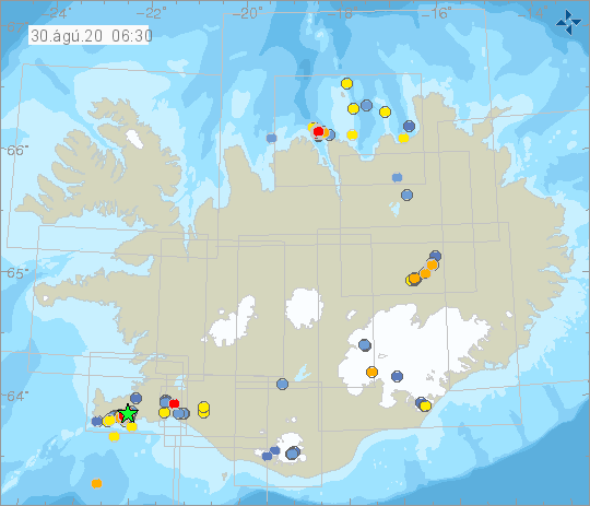
At 19:06 and 19:08 yesterday evening (29 August) M3.6 and M3.0 earthquakes occurred just west of Kleifarvatn on the Reykjanes peninsula. Two earthquakes of similar magnitude, M3.4 and M3.0 occurred in the same place at 16:23 and 16:39 yesterday. The earthquakes were felt in the Reykjanes peninsula, the Capital region and in Akranes. Smaller aftershocks have since occurred and are expected to continue.
The seismic activity is likely caused by stress changes in the crust due to multiple intrusions of magma on the Reykjanes peninsula since January this year.
Source : Vedur is.
Philippines , Taal / Mayon / Kanlaon / Bulusan :
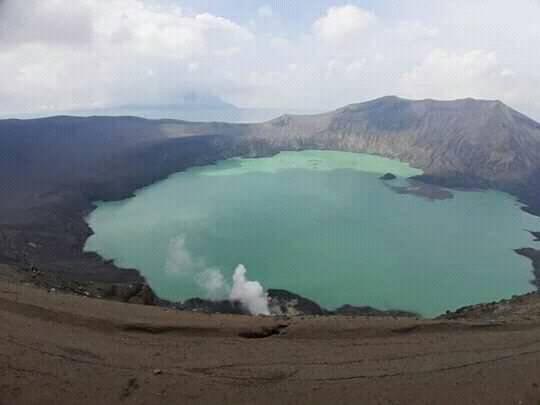
TAAL VOLCANO BULLETIN: 30 August 2020 08:00 A.M.
In the past 24-hour period, the Taal Volcano Network recorded thirteen (13) volcanic earthquakes. Weak steaming or fumarolic activity rising 5 meters high before drifting northeast was observed from vents on the Main Crater.
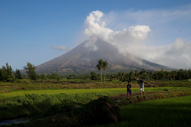
MAYON VOLCANO BULLETIN: 30 August 2020 08:00 A.M.
Mayon Volcano’s monitoring network did not detect any volcanic earthquake during the 24-hour observation period. Moderate emission of white steam-laden plumes that crept downslope before drifting south-southeast was observed. Sulfur dioxide (SO2) emission was last measured at an average of 182 tonnes/day on 25 August 2020. Ground deformation data from Precise Leveling surveys on 12–19 June 2020 indicated slight inflation of the edifice relative to the February 2020 survey. Electronic tilt data also indicated non-steady inflation of the middle to upper edifice that began in late 2019. This follows an inflationary trend that has been recorded by continuous GPS monitoring since the middle of 2019.
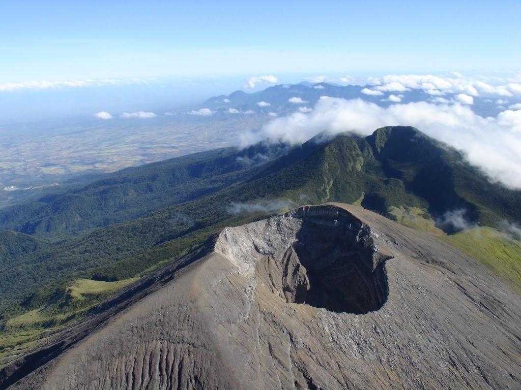
KANLAON VOLCANO BULLETIN: 30 August 2020 08:00 A.M.
Kanlaon Volcano’s monitoring network recorded one (1) volcanic earthquake during the 24-hour observation period. Moderate emission of white steam-laden plumes that rose 500 meters before drifting southwest was observed. Sulfur dioxide (SO2) emission was measured at an average of 437 tonnes/day on 28 August 2020. Ground deformation data from continuous GPS measurements indicate slight inflation of the lower and mid slopes since May 2020, while short-term electronic tilt monitoring on the southeastern flanks recorded inflation on the lower to mid slopes that began on June 21, 2020. These parameters may indicate hydrothermal or magmatic processes occurring beneath the edifice.
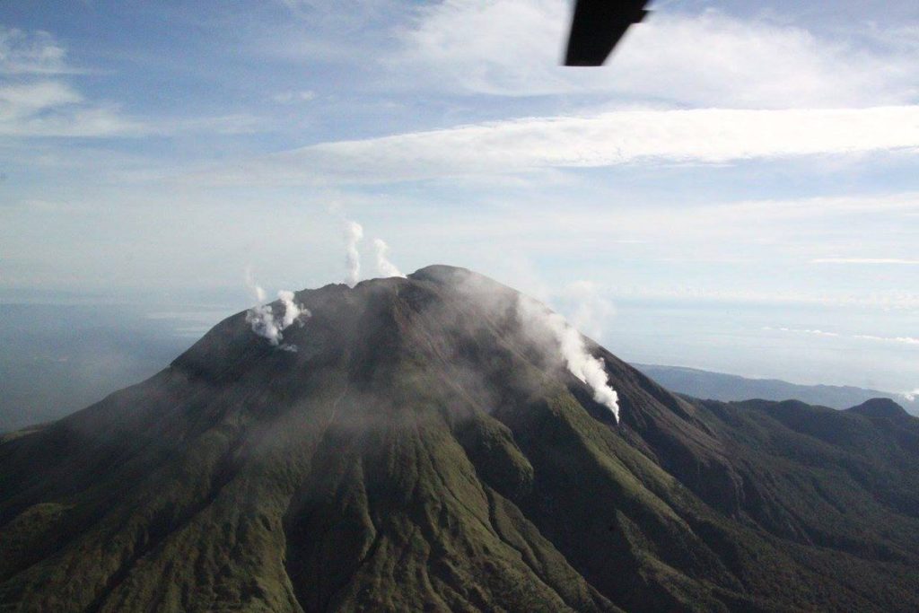
BULUSAN VOLCANO BULLETIN: 30 August 2020 08:00 A.M.
Bulusan Volcano’s monitoring network did not detect any volcanic earthquake during the 24-hour observation period. Ground deformation data from continuous GPS measurements indicate slight inflation on the edifice since July 2020, while the long-term trend since May 2019 denotes that the edifice is still deflated. These parameters indicate that volcanic processes are underway beneath the edifice that may be caused by deep-seated degassing or hydrothermal activity or magmatic intrusion.
Source : Phivolcs.
Photos : Yuri Harmony , Czar Dancel / Manila Bulletin , Sunstar , Phivolcs .
Guatemala , Fuego :
Activity type: Vulcanian
Morphology: composite stratovolcano
Geographical location: 14 ° 28’54˝ Latitude N; 90 ° 52’54˝ Longitude W
Height: 3763 meters above sea level.
Atmospheric conditions: Clear /
Wind: from the East at 5 km / h. /
Precipitation: 5.3 mm.
Activity:
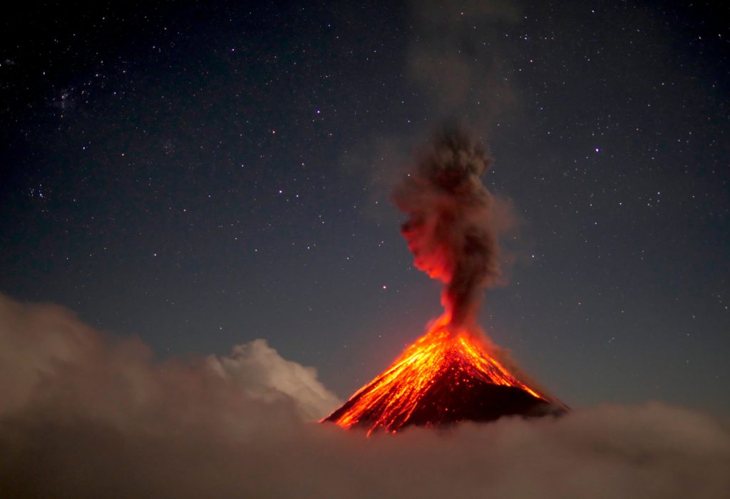
Maintains the lava flow on the southwest flank, with a length of 500 meters, from the front of it, constant avalanches are released. Weak, moderate and some strong explosions are observed, in a range of 12 to 16 per hour, accompanied by columns of ash, which rise to 4700 meters of altitude. (15,419 feet). The moderate to strong explosions generate audible rumblings more than 20 kilometers downwind, accompanied by shock waves that vibrate the roofs and windows of community houses 6 kilometers from the crater. At night, incandescent pulses were observed at 100 and 200 meters above sea level, as well as boulder avalanches in the ravines, Seca, Ceniza, Trinidad, Las Lajas and Honda, some reaching the vegetation. Sounds similar to that of a train locomotive were heard for periods of 5 to 15 minutes. Ash particles are reported to fall on the villages of Panimache, Morelia, Santa Sofía, El Porvenir, Palo Verde and San Pedro Yepocapa.
Source : Insivumeh.
Photo : 660citynews.com

