August 12 , 2020.
Italy / Sicily , Etna :
Weekly bulletin from August 03, 2020 to August 09, 2020, (issue date August 11, 2020)
SUMMARY OF THE STATE OF ACTIVITY
In the light of surveillance data, it is highlighted:
1) VOLCANOLOGICAL OBSERVATIONS: Explosive activity of the Northeast crater, the Voragine crater and the New Southeast Crater with discontinuous volcanic ash emissions and degassing activities. Ordinary degassing of the Bocca Nuova.
2) SEISMOLOGY: Very low fracturing seismicity; average amplitude of volcanic tremor mainly in the range of average values.
3) INFRASON: Increase in infrasound activity.
4) DEFORMATIONS: The Etna soil deformation monitoring networks have not shown significant variations over the past week.
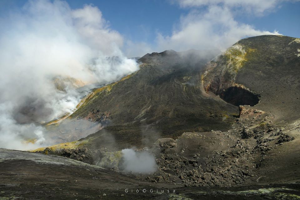
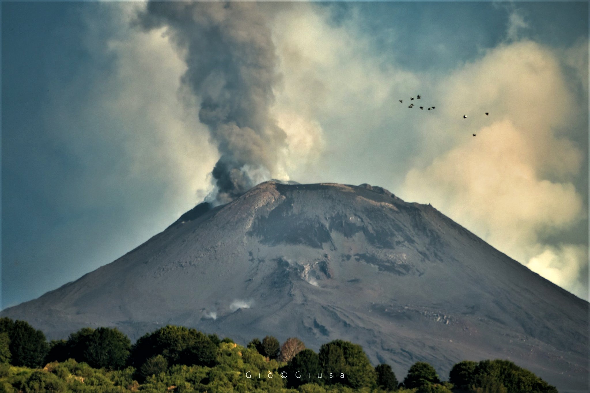
Craters of the Voragine and the Boocca Nuova. Etna 3270 m. August 9, 2020
5) GEOCHEMISTRY: The flow of SO2 is at a medium-low level
the flow of HCl is at a medium-low level.
The flow of CO2 emitted by the ground (EtnaGas) shows a clear decrease compared to the values measured last week, settling at low levels.
The partial pressure of dissolved CO2 does not show significant changes.
Regarding the C / S ratio, no new measurement is available.
There are no updates regarding the isotope ratio of helium
6) SATELLITE OBSERVATIONS: The thermal activity in the summit area is at a medium-low level.
VOLCANOLOGICAL OBSERVATIONS
During the week, the monitoring of the volcanic activity of the summit craters of Etna was carried out by analyzing the images of the surveillance cameras of the INGV, by the Etneo observatory (INGV-OE) and by the staff of the INGV in the field. In general, the week was characterized by discontinuous cloud cover which on some days considerably limited the observations.
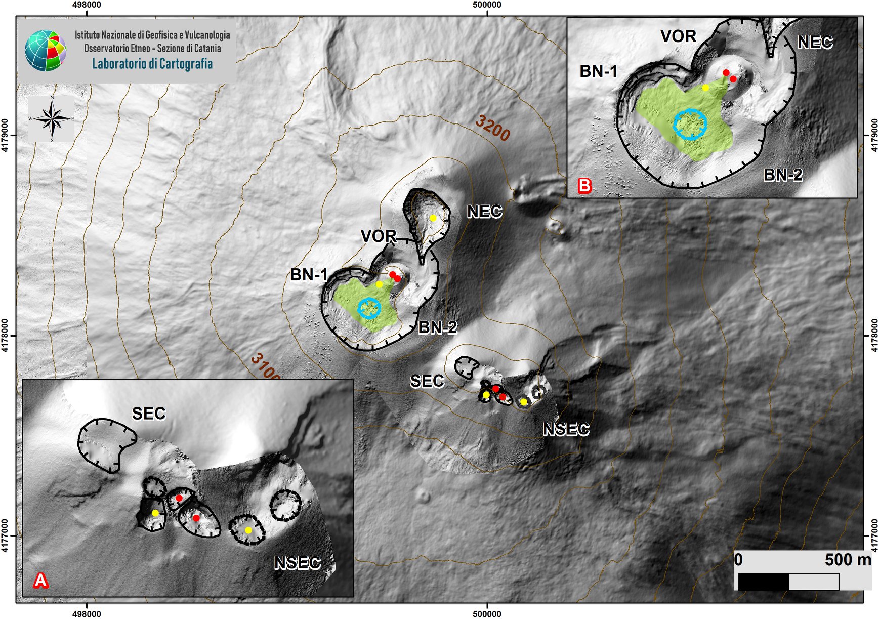
Zone of the summit of Etna with zoom of the zone relating to the SEC-NSEC system (A). The indented black lines indicate the edge of the summit craters (BN: Bocca Nuova, with the Northwest (BN-1) and Southeast (BN-2) depressions; VOR: Voragine; NEC: Northeast Crater; SEC : Southeast Crater and NSEC: New Southeast Crater The recessed blue line indicates the depression inside the Bocca Nuova, the yellow and red circles indicate degassing and active vents.
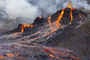
During the period studied, the activity of Etna was characterized by an eruptive activity of the New Southeast Crater (NSEC), the Northeast Crater (NEC) and the Voragine Crater (VOR), while the Crater of Bocca Nuova (BN) was characterized by ordinary degassing.
In particular, Strombolian activity fueled by the saddle cone, reported in the previous bulletin (Bulletin Etna Rep. N ° 32/2020), continued at the NSEC. During the week, the activity
Strombolian was variable in both intensity, frequency of explosions and type of products expelled. The activity, in fact, was characterized by discontinuous ash emissions, but
also by the emission of gases and the launching of fragments of lava which often exceeded the edge of the crater of the cinder cone.
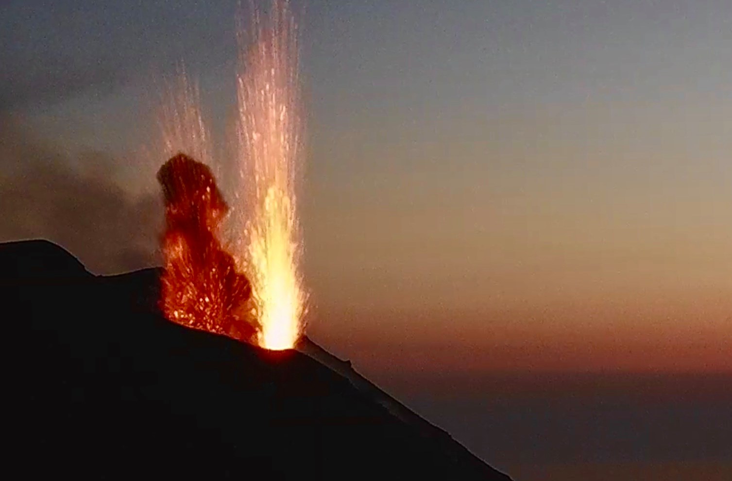
Close-up on the New Southeast Crater (NSEC) and its “bubbling” Bocca della Sella Etna Sud, August 10, 2020.
Between the evening of August 6 and the morning of August 7, the activity was almost continuous. INGV staff reported that between about 3:00 a.m. and 4:00 a.m. (LT), such activity produced continuous explosions, audible several kilometers away. The ash emissions were mostly discontinuous and produced volcanic clouds which scattered near the summit area. On the morning of August 9, the NSEC produced a series of ash emissions, the most intense of which were recorded at 07:57 UTC.
During the observation period, the Northeast Crater and Voragine fed the intracrater activity which produced sporadic and light emissions of volcanic ash to the surface which quickly dispersed near the summit area.
Volcanic tremor: The average value of the amplitude of the volcanic tremor showed variations, both gradual and sudden, in the range of average values and, sometimes, in that of high values. The source of the tremor was located between 2800 and 2900 m of altitude and in the zone of the New South-East Crater.
Source : INGC .
Photos : Gio Giusa , INGV .
Italy , Stromboli :
Weekly bulletin from August 03, 2020 to August 09, 2020, (issue date August 11, 2020)
SUMMARY OF THE STATE OF ACTIVITY
In the light of surveillance data, it is highlighted:
1) VOLCANOLOGICAL OBSERVATIONS: Normal explosive volcanic activity of Strombolian type at an average level (11-15 events / h) and of average intensity in the area of the North crater and low in the area of the Center-South crater.
2) SEISMOLOGY: The seismological parameters do not show significant variations.
4) DEFORMATIONS: The island’s soil deformation monitoring networks did not show any significant variations over the period studied.
5) GEOCHEMISTRY: The flow of SO2 occurs at a medium-low level.
There is no update of the soil CO2 flux data.
There is no update of the CO2 / SO2 report because the station was destroyed during the explosion of July 19, 2020. The station is being restored.
The isotopic values of He from the last update (07/15/2020) are average values, in line with the previous ones
6) SATELLITE OBSERVATIONS: The thermal activity in the summit area is at a medium-low level.
VOLCANOLOGICAL OBSERVATIONS
During the observation period, the eruptive activity of Stromboli was characterized by the analysis of the images recorded by the surveillance cameras INGV-OE located at 190 m altitude, at Punta dei Corvi and 400 m. The Pizzo camera was damaged during the event of July 19, 2020 and the station is being restored in the INGV-OE laboratories.
The description of the activity and the determination of the vents that fuel the explosive activity in the individual areas of the North and Center-South craters could present uncertainties due to the framing of the cameras at an altitude of 400 m and an altitude of 190 m which do not make it possible to determine the emission points, in particular in the Center-South zone.

The crater terrace seen by the thermal camera placed on the Pizzo sopra la Fossa in an image of July 18 with the delimitation of the crater zones North Zone and Center-South Zone (AREA N, AREA C-S respectively). The abbreviations and arrows indicate the names and locations of the active vents on the date of the image. The area above the crater terrace is divided into three height intervals relating to the intensity of the explosions.
The explosive activity was at a medium-low level with an average daily total hourly frequency (North zone plus Center-South zone) between 11 and 15 events / h. The North crater area produced explosions of low to medium intensity, emitting mainly coarse materials (lapilli and bombs), with radial fallout in the crater area and with a weak distribution along the Sciara del Fuoco. In the Center-South crater area, the explosions mainly emitted fine materials mixed with coarse materials, with low intensity.
The amplitude of the volcanic tremor generally had medium-low values.
Source : INGV.
Photos : Web cam , INGV.
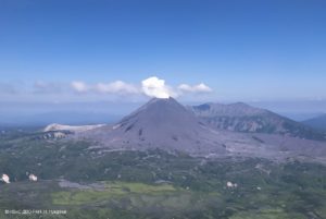
Colombia , Nevado del Ruiz :
Weekly activity bulletin of the Nevado del Ruiz volcano
The activity level continues at Yellow Activity Level or (III): Changes in the behavior of volcanic activity.
Regarding the monitoring of the activity of the Nevado del Ruiz volcano, the COLOMBIAN GEOLOGICAL SERVICE reports that:
Seismicity generated by rock fracturing showed an increase in the number of earthquakes and seismic energy released compared to the previous week. This type of seismicity was localized mainly in the West-South-West and South-East sectors of the volcano and to a lesser extent in the Arenas crater. The depth of the earthquakes varied between 0.3 and 7.7 km. The seismic increase recorded between August 08 and August 09 stands out, located about 5.8 km west-southwest of the Arenas crater, at depths between 2.6 and 6.4 km. The maximum magnitude recorded during this increase corresponds to the earthquake that occurred on August 8 at 7:04 a.m. (local time), with a magnitude of 3.1 ML (local magnitude), located 6.1 km to the west-south -West of Arenas crater, 4.1 km deep. This earthquake was reported as felt by officials at Los Nevados National Natural Park.
The seismicity related to the dynamics of the fluids inside the volcanic conduits showed a slight decrease in the number of events and an increase in the seismic energy released, compared to the previous week. This seismic activity was characterized by the appearance of volcanic tremor, pulses of continuous tremor, earthquakes of long and very long period type, which presented variable energy levels and spectral content. This seismicity was localized around the Arenas crater.
Some of these seismic signals were associated with small emissions of gas and ash which were confirmed by cameras installed in the volcano area.
The deformation of the volcanic surface, measured from GNSS (Global Navigation Satellite System) stations and electronic inclinometers, has not shown any additional changes compared to those reported in recent weeks.
The Nevado del Ruiz volcano continues at the yellow activity level.
Source : SGC.
Photo : Milton_H_Arias
Mexico , Popocatepetl :
August 11, 11:00 a.m. (August 11, 4:00 p.m. GMT)
During the last 24 hours, according to the monitoring systems of the Popocatépetl volcano, 120 exhalations have been identified, some accompanied by volcanic gases and sometimes small amounts of ash. In addition, 94 minutes of tremor and a volcano-tectonic earthquake were recorded yesterday at 10:24 am, with a calculated magnitude of M1.7.
At night, the volcano was partially visible, however, a constant emission of volcanic gases could be observed.
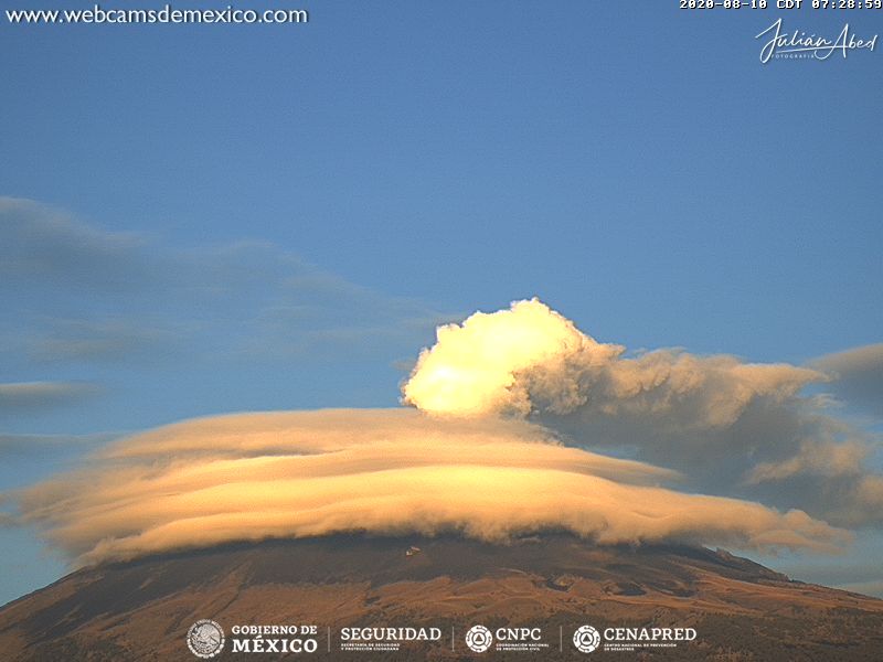
At the time of this report, we observe a constant emission of volcanic gases with a slight amount of ash, which disperses towards the West-South-West.
CENAPRED urges NOT TO APPROACH the volcano and especially the crater, because of the danger of falling ballistic fragments, and in case of heavy rains, to stay away from the bottom of the ravines because of the danger of mudslides and debris.
The Popocatépetl volcanic warning fire is in PHASE 2 YELLOW.
Source : Cenapred .
Photo : Webcamdemexico