August 11 , 2020.
New Zealand , Ruapehu :
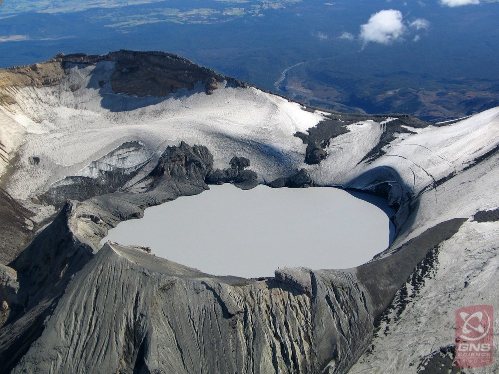
Mt Ruapehu: Activity and Crater Lake temperature update. Volcanic Alert Level remains at Level 1.
Tue Aug 11 2020 9:30 AM
Volcanic Alert Level remains at 1
Aviation Colour Code remains at Green
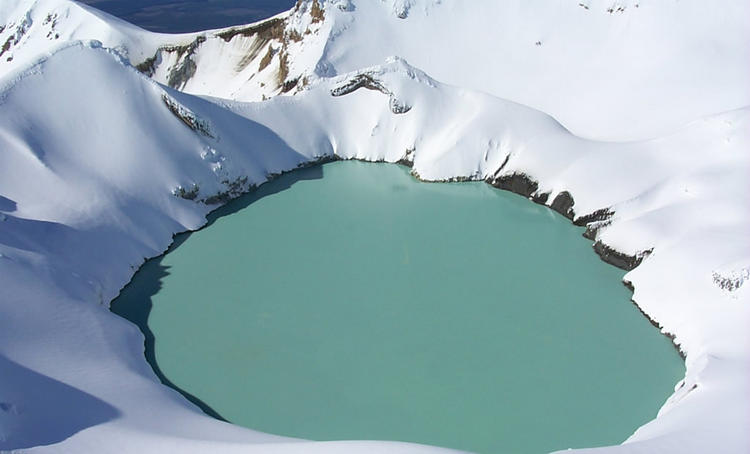
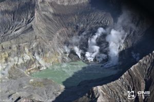
New observations in July-August continue to indicate low levels of volcanic activity at Ruapehu. The Volcanic Alert Level remains at 1. Crater Lake (Te Wai ā-moe) has cooled from a peak temperature of 42°C in early April and is currently around 22-23°C. Recent monitoring results indicate continuous gas flux into the lake.
Crater Lake (Te Wai ā-moe) has a long history of heating and cooling, with each cycle occurring over a few months. Since April this year, lake temperature has decreased from a high of 42°C to around 22-23 °C. This lower lake temperature is normal for Crater Lake.
To keep the lake at this temperature, low-level heat must continue to flow into the lake. This indicates that the underlying vent area is open to volcanic gases and hydrothermal fluids. Other signs that point to this open vent are visible upwellings and sulphur slicks on the lake surface.
Over the last three months, we have conducted two gas flights and collected two lake samples for laboratory analysis. The results from these visits show an increase in H2S (hydrogen sulfide) gas and declines in CO2 (carbon dioxide) and SO2 gas (sulphur dioxide). This is consistent with more hydrothermal than magmatic chemical reactions in the lake.
The level of volcanic tremor intensity has been variable but weak, over the past three months. Small earthquakes continue to be located near the volcano.
None of these observations are unusual for Mt Ruapehu. All observations over the past months indicate that the volcano remains in minor volcanic unrest and at Volcanic Alert Level 1.
Some people may have noticed that our camera on the north side of the volcano has been shifted. This is part of the ongoing refinement of the GeoNet networks and equipment used to monitor the active volcanoes.
The Volcanic Alert Level remains at Level 1. The Volcanic Alert Level reflects the current level of volcanic activity and is not a forecast of future activity. Mt Ruapehu is an active volcano and has the potential to erupt with little or no warning when in a state of volcanic unrest. There is no change in the Aviation Colour Code and it remains at Green.
GNS Science and the National Geohazards Monitoring Centre continues to closely monitor Mt Ruapehu for further signs of activity. GeoNet monitors Mt Ruapehu via network of seismic and acoustic sensors, GPS receivers, sensors in the lake and visits to the lake area, and gas flights.
Source : Geonet / Yannik Behr , Duty Volcanologist
.
Photos : Geonet , Bradd Scott .
Peru , Sabancaya :
Analysis period: August 3 to 9, 2020, Arequipa, August 10, 2020
Alert level: ORANGE
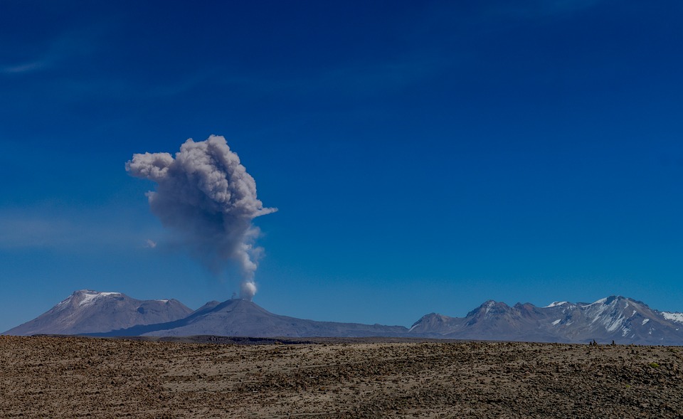
The Geophysical Institute of Peru (IGP) reports that the eruptive activity of the Sabancaya volcano remains at moderate levels; that is to say with the continuous recording of explosions with columns up to 2.5 km altitude above the summit of the volcano and consequent emissions of ash and gas. Therefore, for the following days, no significant change is expected in the eruptive activity.
The IGP recorded and analyzed the occurrence of 1,118 earthquakes of volcanic origin, associated with the circulation of magmatic fluids on the Sabancaya. In addition, an average of 19 explosions of low to medium intensity was recorded daily. During this period, Volcano-Tectonic (VT) earthquakes were located mainly in the North and North-West of Sabancaya. These events had magnitudes between M2.1 and M3.8. The representative earthquake (M3.8) was recorded on August 8 at 7:06 am, 9 km northwest of Sabancaya and at a depth of 9 km.
The monitoring of the deformation of the volcanic structure, using GNSS data (processed with fast orbits), does not present any significant anomalies; however, a slight inflation was observed with an acceleration of the vertical component recorded since July 30 in the northern sector of the Hualca Hualca volcano and the south-eastern flank of the Sabancaya volcano. Visual surveillance made it possible to identify columns of gas and ash up to 2.5 km altitude above the summit of the volcano, which were scattered towards the South, South-East, South-West and North-West sectors. West of Sabancaya.
Satellite monitoring has identified the presence of 5 thermal anomalies with values between 1 MW and 9 MW, associated with the presence of a lava body on the surface of the volcano crater.
RECOMMENDATIONS
• Maintain the orange volcanic alert level.
• Do not approach within a radius of less than 12 km from the crater. In the event of an ash fall, cover your nose and mouth with damp rags or masks. Keep doors and windows of houses closed.
• Implement prevention and mitigation actions in the face of an increase in volcanic activity.
Source : IGP.
Photo : Pixabay
Peru , Ubinas :
Analysis period: August 3 to 9, 2020, Arequipa, August 10, 2020
Alert level: ORANGE
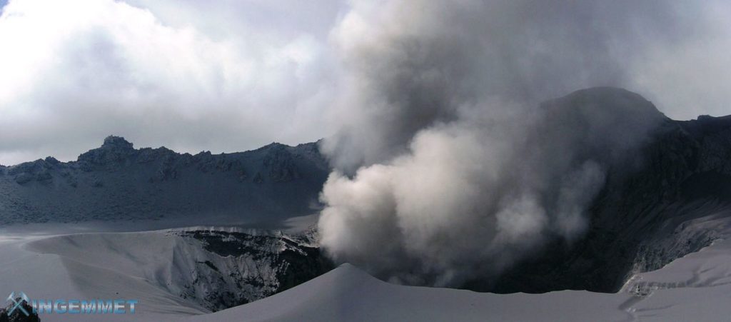
The Geophysical Institute of Peru (IGP) reports that the Ubinas volcano (Moquegua region) continued to record a slight increase in seismic activity during the analysis period; Therefore, it is suggested that the authorities and the public pay attention to the bulletins published by the IGP.
During the period of analysis, a slight increase compared to the previous period was observed in the type of seismic signals related to the movements of volcanic fluids, such as the Long Periods (LP) and Tornillos type signals.
On average, the occurrence of 41 earthquakes with a magnitude less than M1.6 has been identified, events related to rock fracturing processes that occur inside the volcano. On average, the occurrence of 6 earthquakes per day was recorded.
Likewise, 18 seismic signals have been recorded, associated with movements of volcanic fluids (gas). Within these, 10 Tornillos-type events were identified, linked to the increase in pressure inside the volcano. Tornillo-type earthquakes are considered as precursor signals for volcanic eruptions according to the volcanic eruption prediction model developed by the IGP.
Surveillance cameras recorded columns of gas (mainly water vapor) which reached heights of up to 500 m above the summit of the volcano; these emissions were dispersed towards the South-East and North-East sectors of the volcano.
Both the monitoring of the deformation of the volcanic structure and the satellite monitoring through the SENTINEL, OMI-NASA (SO2 gas) and MIROVA (thermal anomalies) systems did not record any anomalies during the period.
RECOMMENDATIONS
• Stay informed at all times of volcanic activity in the Ubinas thanks to the bulletins published by the IGP: (http://www.igp.gob.pe/servicios/centro-vulcanologico-nacional/).
• Do not go within a radius of less than 4 km around the crater of the volcano.
Source : IGP.
Photo : Ingemmet.
Kamchatka , Sheveluch :
56.64 N, 161.32 E;
Elevation 10768 ft (3283 m), the dome elevation ~8200 ft (2500 m)
Aviation Colour Code is ORANGE
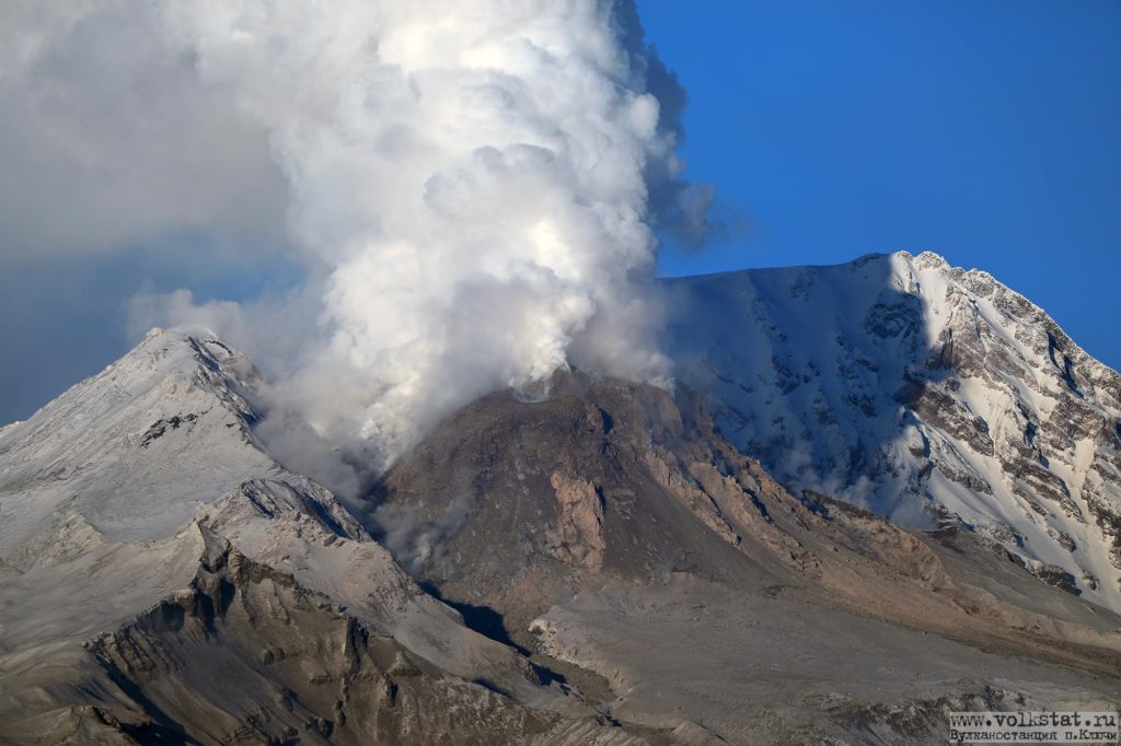
The explosive-extrusive eruption of the volcano continues. Ash explosions up to 32,800-49,200 ft (10-15 km) a.s.l. could occur at any time. Ongoing activity could affect international and low-flying aircraft.
The growth of the lava dome continues, a strong fumarolic activity sometimes with some amount of ash, and an incandescence of the western part of the lava dome and hot avalanches accompanie this process. According to video data, a moderate explosion sent ash up to 4.5 km a.s.l., a small ash cloud drifted to the east of the volcano. Satellite data showed a thermal anomaly over the volcano all week.
Source : Kvert.
Photo : Yu Demianchuck.

Bonjour
Merci pour ce site très agréable à consulter. Tout est clairement expliqué pour des non non-spécialistes. Les photos sont nombreuses et très récentes souvent. C’est un peu difficile de comprendre le classement en regroupements de volcans.
Dorénavant je consulterai ce site. Merci
merci beaucoup à vous.
Si vous avez des questions , j’essaie d’y répondre simplement…