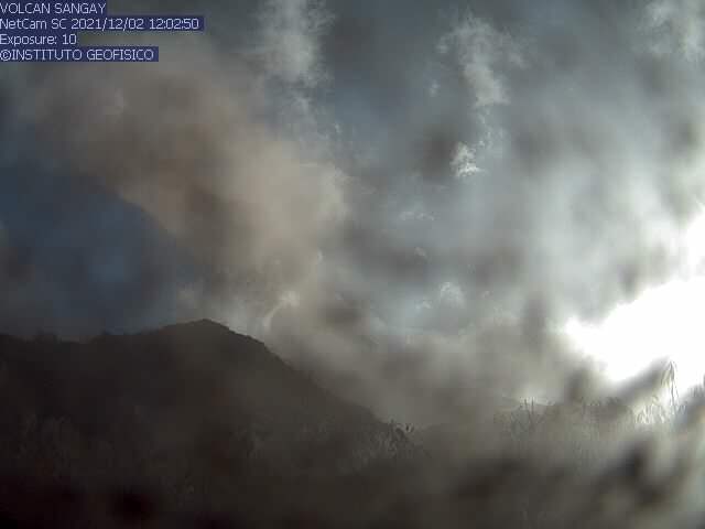
Décembre 06 , 2021.
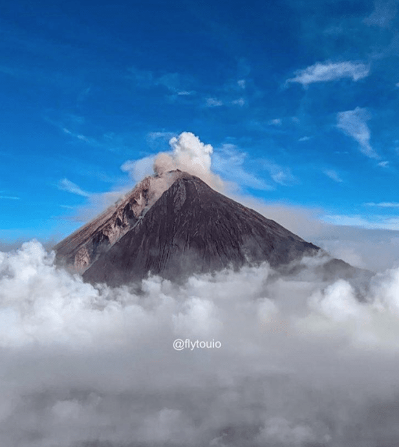
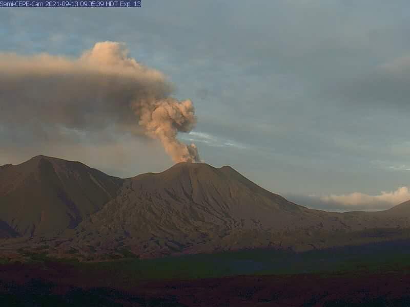
Indonesia , Semeru :
Press release on the volcanic activity of Mount Semeru – East Java of December 4/5, 2021. 05 December 2021.
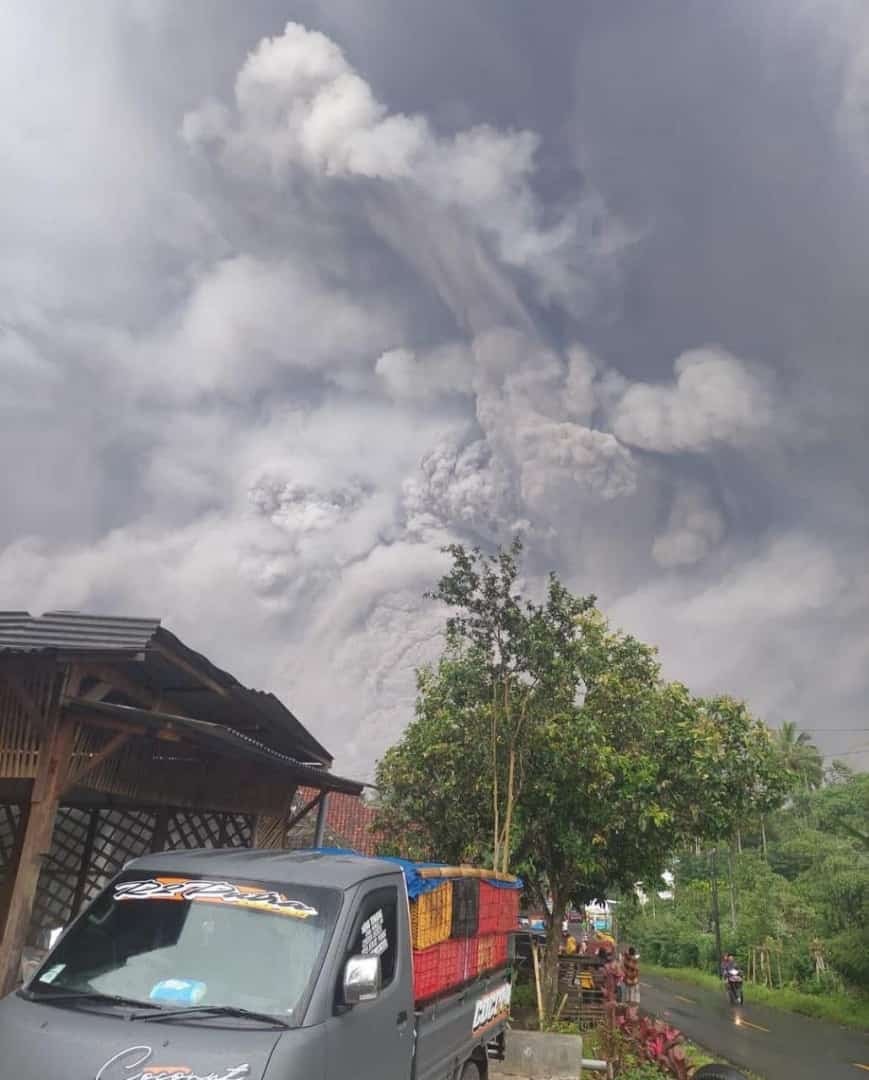
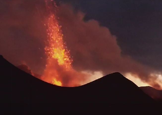
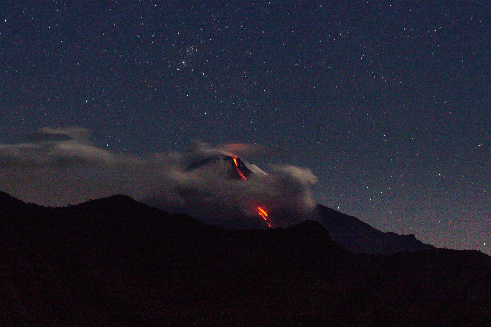
Hot Cloud Avalanche (APG) occurred over Mount Semeru on December 4, 2021. Hot Cloud Avalanche (APG) is a typical threat in Mount Semeru, namely in the form of clouds Hot from the front of the lava flow on the mountain slopes. The hot cloud avalanche (APG) is made up of rocky material with a high temperature of 800 -900 ° Celsius which moves towards the south-eastern slope of Mount Semeru up to ± 4 km from the summit, or ± 2 km of the end of the lava flow. The hot cloud avalanche enters the Kobokan River Valley and interacts with the river water and ancient materials in the river body, forming lahar flows along the Kobokan River.
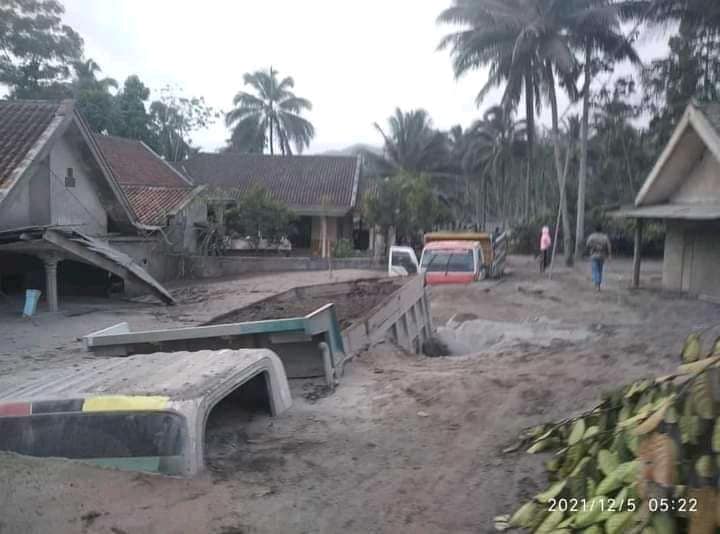
Until December 5, 2021 at 10:00 AM WIB, hot cloud avalanche activity still occurred with relatively decreasing intensity and glide distance. Monitoring continues to be carried out intensively and on an ongoing basis to anticipate significant changes in potential threats.
The level of activity of Mount Semeru currently remains Level II (Alert), it is recommended to the public / visitors / tourists:
Comply with the recommendations issued by the Geological Agency through the Center for Volcanology and Geological Risk Mitigation, Do not move within a radius of 1 km around the crater of Mount Semeru and at a distance of 5 km towards the opening of the crater in the South-South-East sector. One should be aware of the potential for lava and lahar avalanches along the river / valley that originates at the top of Mount Semeru, especially along the Besuk Kobokan, Besuk Bang, Besuk Kembar and Besuk Sat streams.
VOLCANO OBSERVATION NOTICE FOR AVIATION – VONA
Issued: December 06, 2021
Volcano: Semeru (263300)
Current Aviation Color Code: ORANGE
Previous Aviation Color Code: orange
Source: Semeru Volcano Observatory
Notice Number: 2021SMR78
Location of the volcano: S 08 deg 06 min 29 sec E 112 deg 55 min 12 sec
Region: East Java, Indonesia
Summit Elevation: 11763 FT (3676 M)
Volcanic Activity Summary :
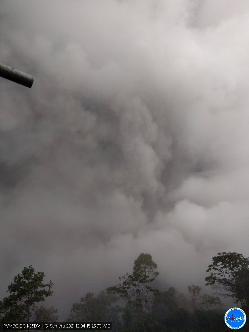
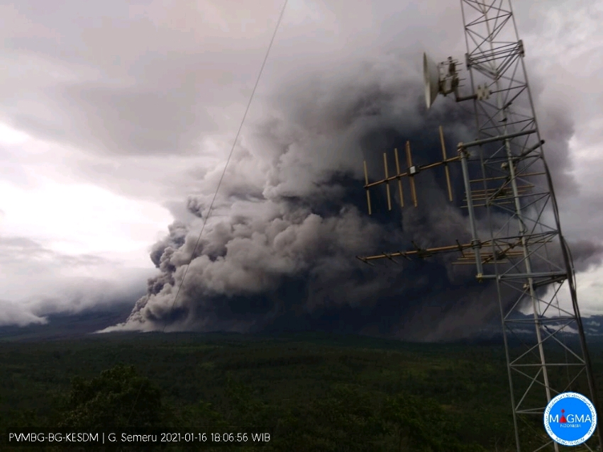
Pyroclastic flow occured from the edge of lava deposit at 01h55 UTC ( 08h55 local )
Volcanic Cloud Height : Ash-cloud is not visible
Other Volcanic Cloud Information :
Ash-cloud moving to southeast
Remarks :
Lava flow is observed through the southeast direction of the Semeru Summit Crater
Source : PVMBG. Magma Indonesia
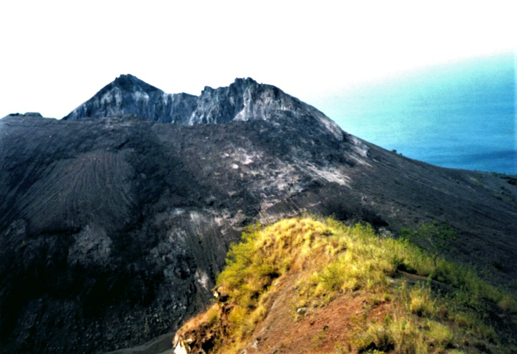
Photos : lipan baraa, Magma Indonésia ( archive Janvier 2021.).
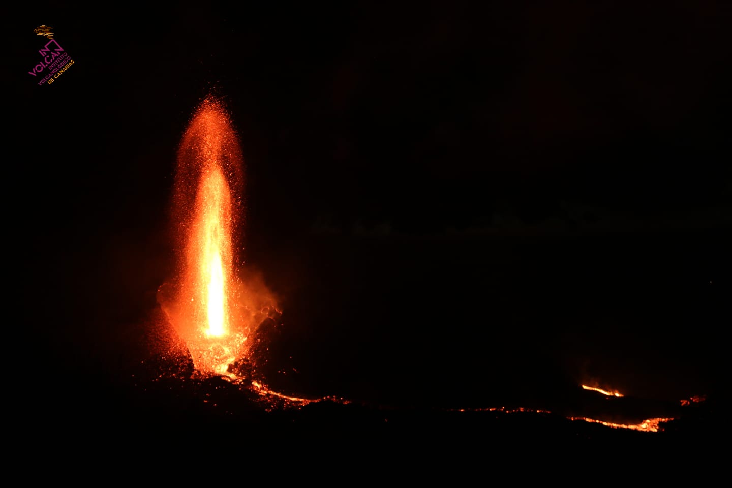
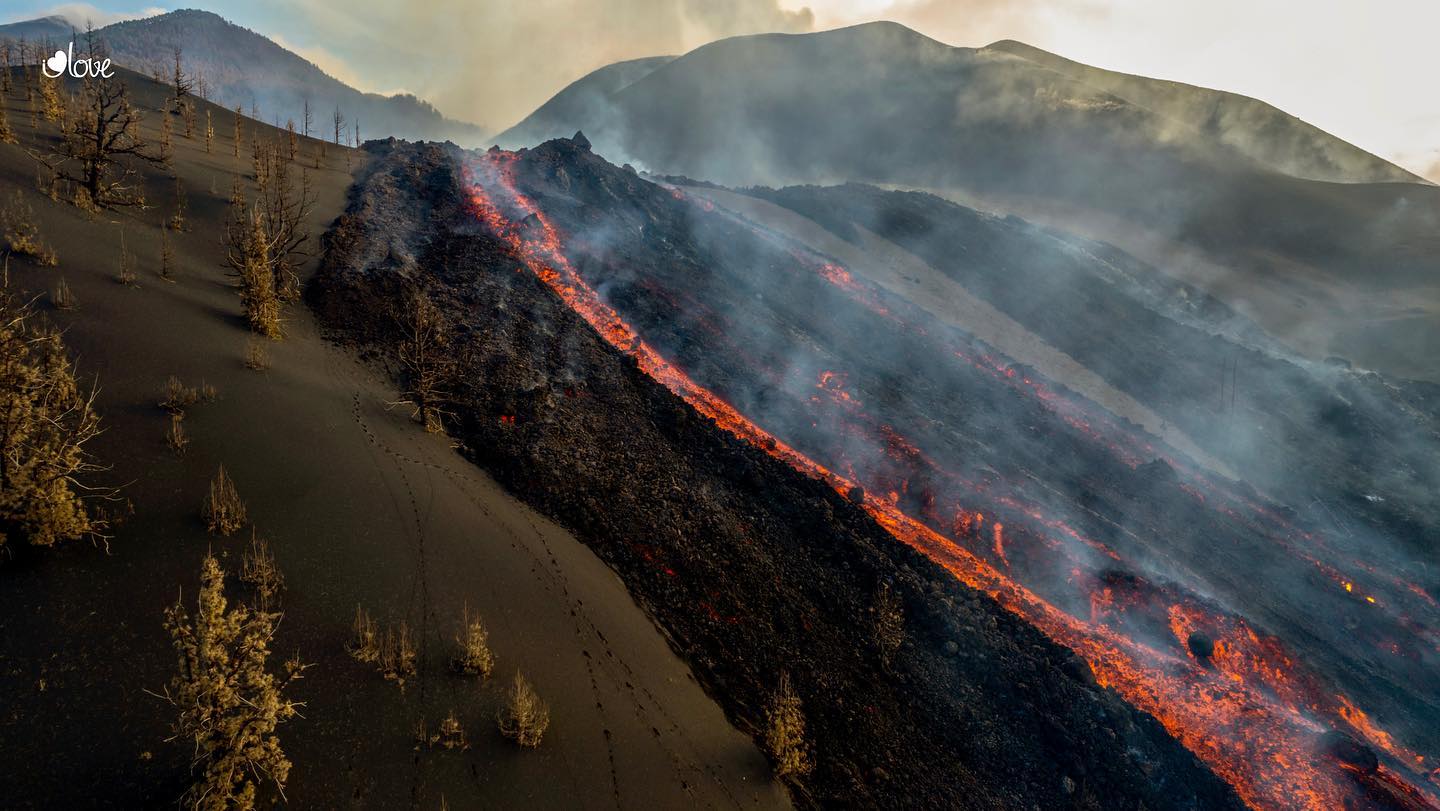
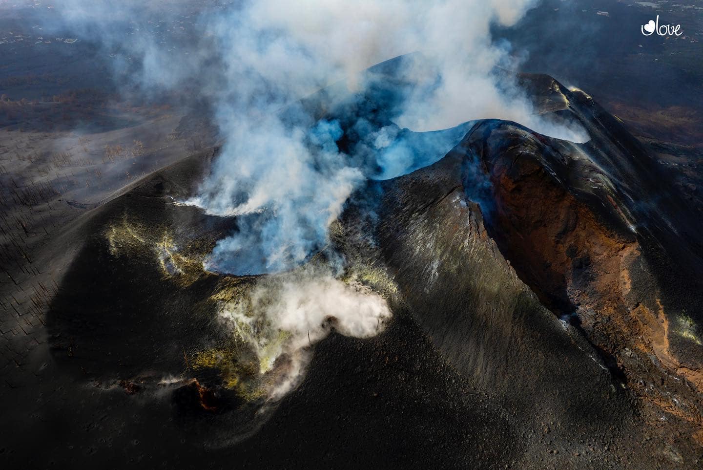
Spain / La Palma , Cumbre Vieja :
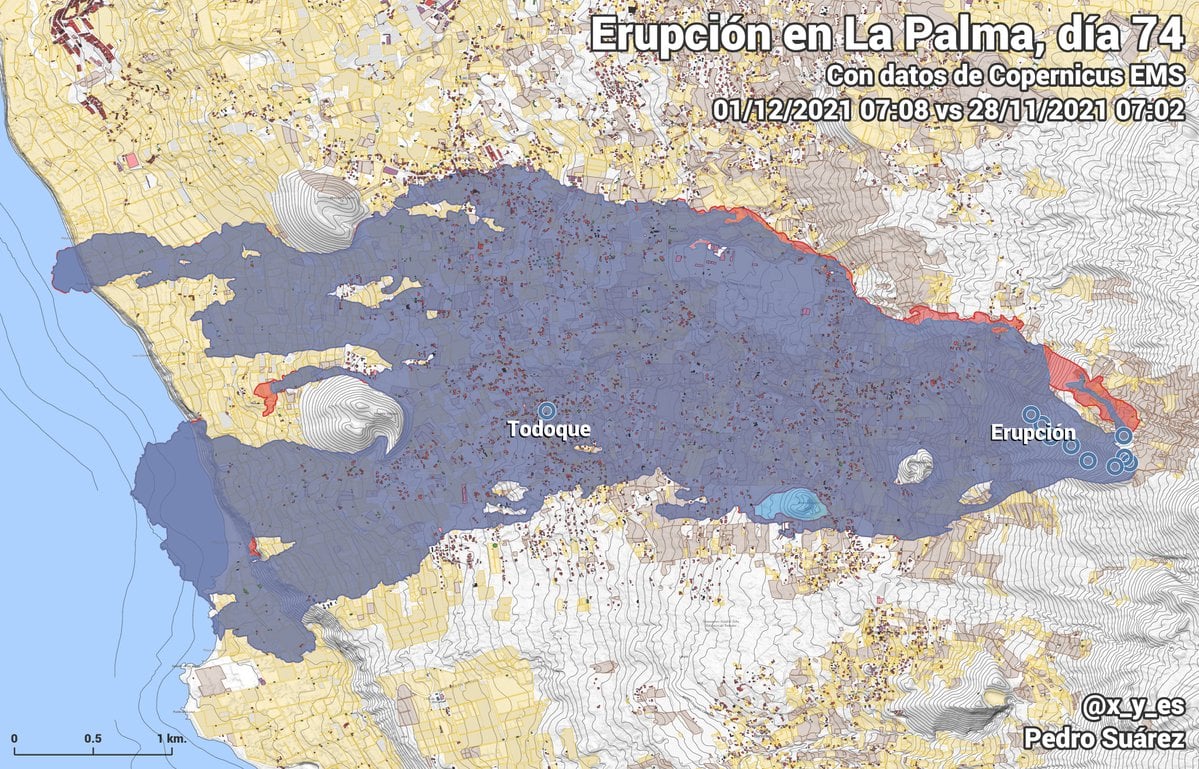
December 05 , 2021, 10:00 UTC. Eruptive activity continues on La Palma
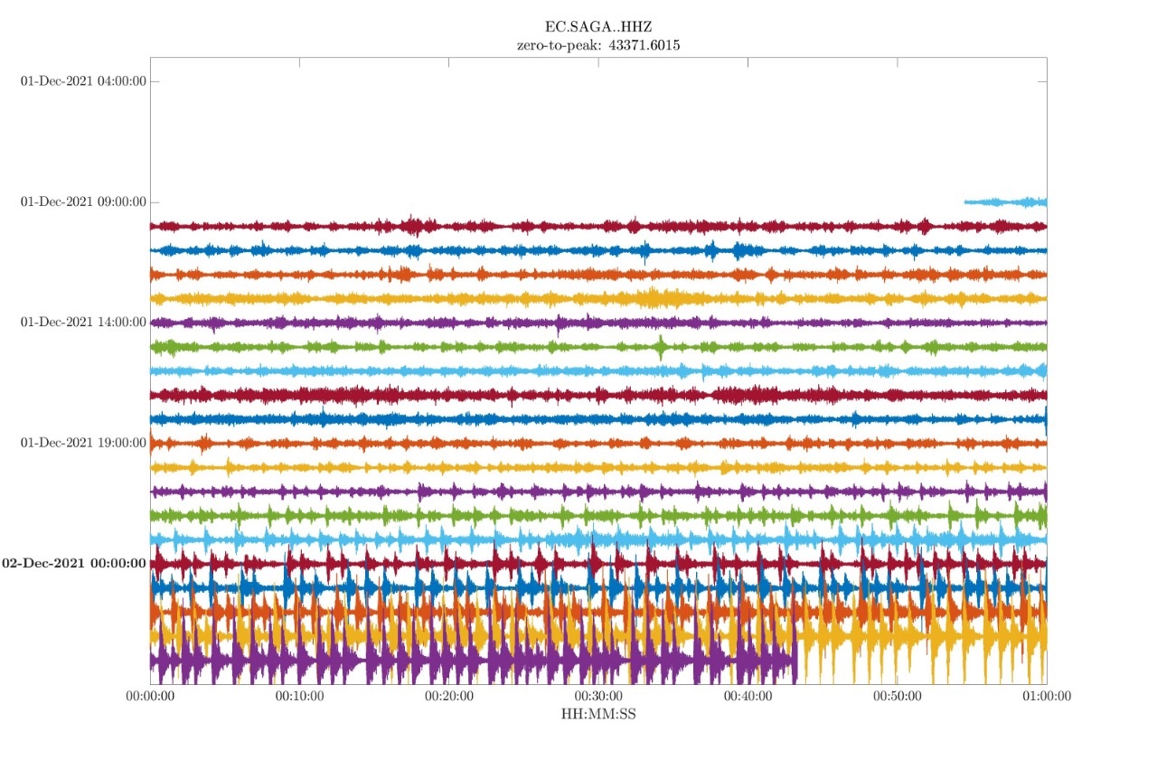
Since the last declaration, a total of 36 earthquakes have been located in the area affected by the volcanic reactivation on the island of La Palma, none of them have been felt by the population.
Seismicity continues below the central area of Cumbre Vieja in the same areas of the previous days, 33 of these earthquakes are located at depths of 9 to 17 km and only 3 at depths greater than 34 km. The maximum recorded magnitude is 3.4 (mbLg) corresponding to two earthquakes yesterday, at 12:19 UTC and 14:48 UTC, with depths of 36 km and 13 km respectively.
The amplitude of the tremor signal remains low and more stable than the previous days.
The island’s network of permanent GNSS stations shows a complete reversal of the elevation recorded on December 2 at station LP03, which is closest to the eruptive centers.
In the rest of the stations, the slight deflation possibly linked to the deep seismicity has stabilized, except in LP01 which continues to record it.
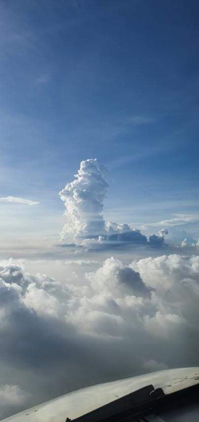
In view of the image calibrated at 08:45 UTC, a degassing cloud height of 1400 m is estimated.
The height of the cone is measured by obtaining a value of 1,124 m at sea level.
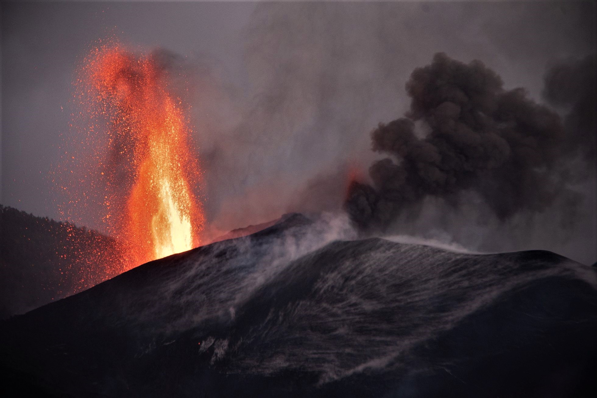
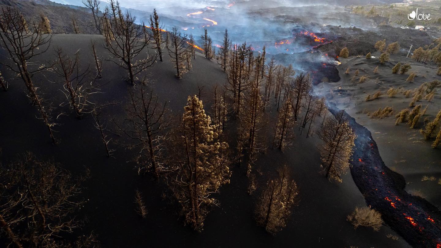
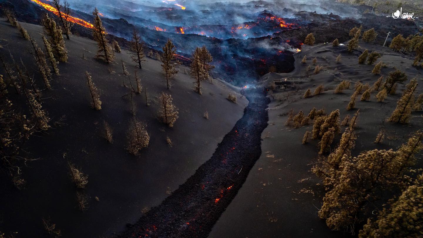
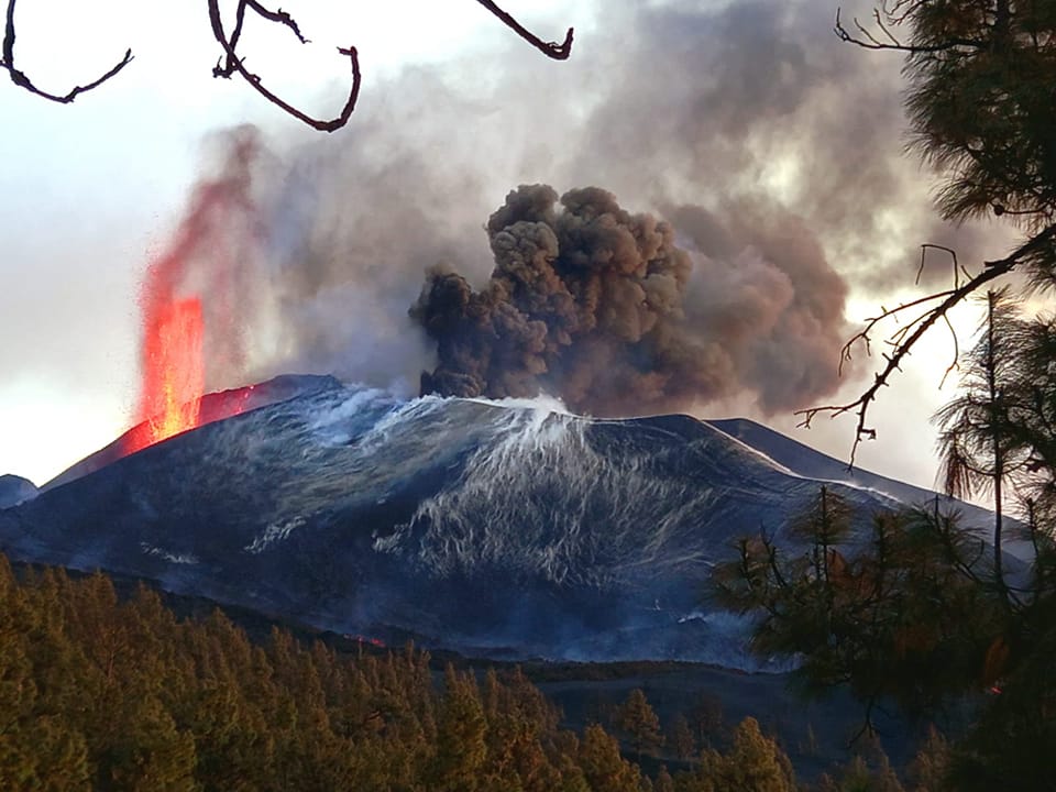
The effusive focus located west of the main cone of the Cumbre Vieja volcano has reactivated in recent hours, as the volcanologist of the National Geographic Institute (IGN), Carmen López, explained this Sunday after the committee meeting. technicians and scientists responsible for monitoring the eruption. The lava it emits passes through a volcanic tube, which has several ramifications, from which two flows originate that move westward on the previous ones.
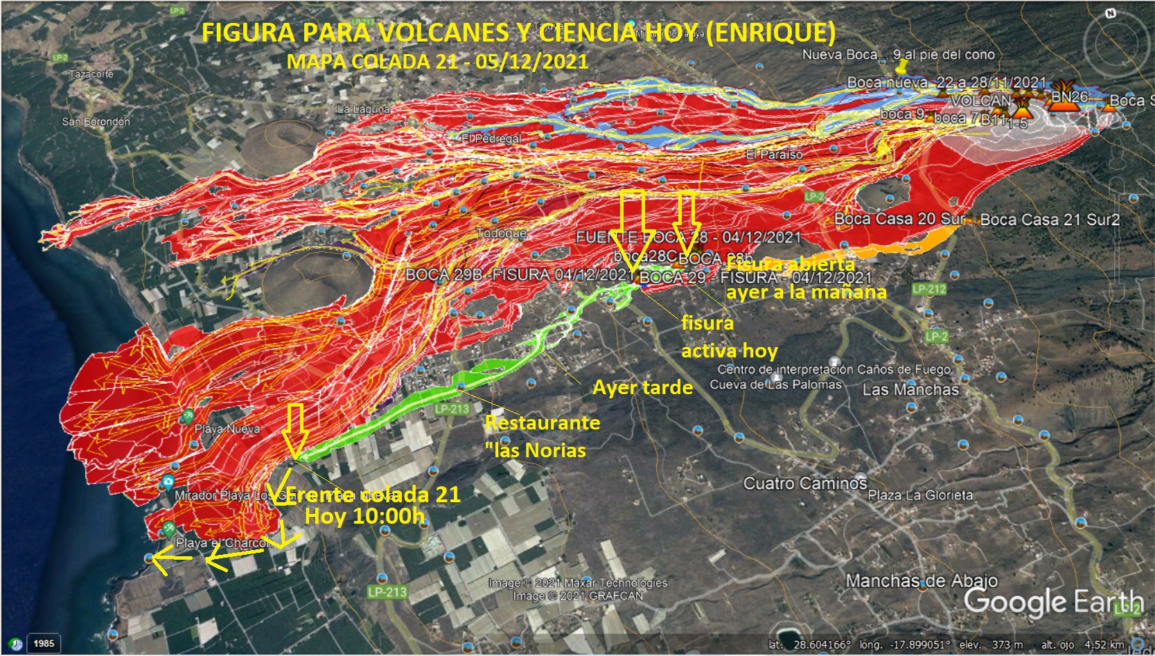
At noon on Saturday, several emission centers associated with East-West trending cracks west of the Cogote Mountain were opened, from which started several very fluid and degassed flows. These flows are moving at high speed westward, over previously unaffected land, currently reaching the cliff face in the Las Hoyas region.
Sources : IGN es , El Pais .
Photo : I love the world
Carte : Volcanes y Ciencia Hoy
Alaska , Pavlof :
55°25’2″ N 161°53’37 » W,
Summit Elevation 8261 ft (2518 m)
Current Volcano Alert Level: WATCH
Current Aviation Color Code: ORANGE
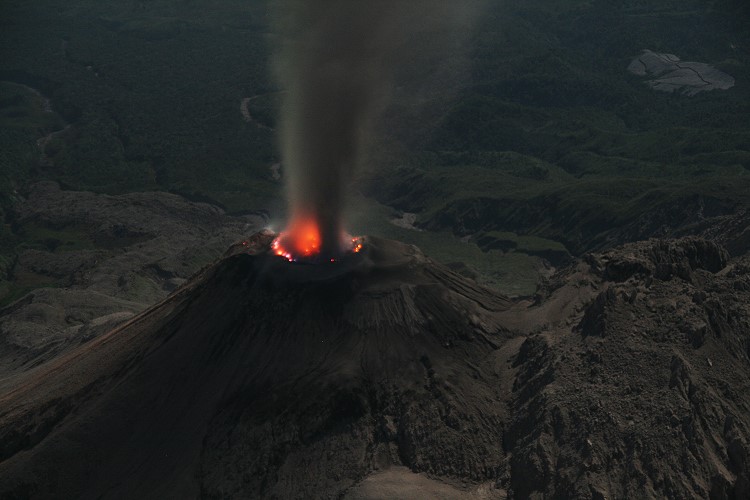
Unrest continues at Pavlof Volcano. Seismicity remains elevated and several explosions were detected by infrasound sensors over the past day. A diffuse ash cloud reaching as high as 10,000 feet above sea level and extending several tens of miles beyond the volcano was evident in web camera images and observed by a passing pilot. Minor ash emissions were also were observed intermittently in clear web camera images throughout the afternoon yesterday, but no ash emissions were observed in clear to partly cloudy satellite views of the volcano over the past day.
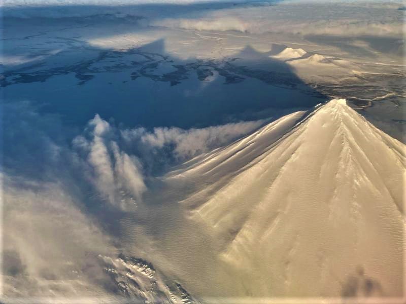
Small explosions accompanied by low-level ash emissions could happen at any time, and are typically a hazard in the immediate vicinity of the summit. The level of unrest at Pavlof can change quickly and the progression to more significant eruptive activity can occur with little or no warning.
Pavlof is monitored by local seismic and infrasound sensors, satellite data, web cameras, and remote infrasound and lightning networks.
Source : AVO
Photo : Musselwhite, Levi .
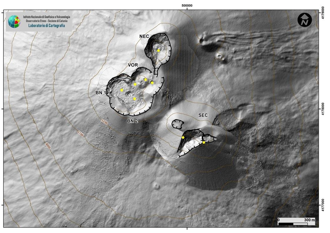
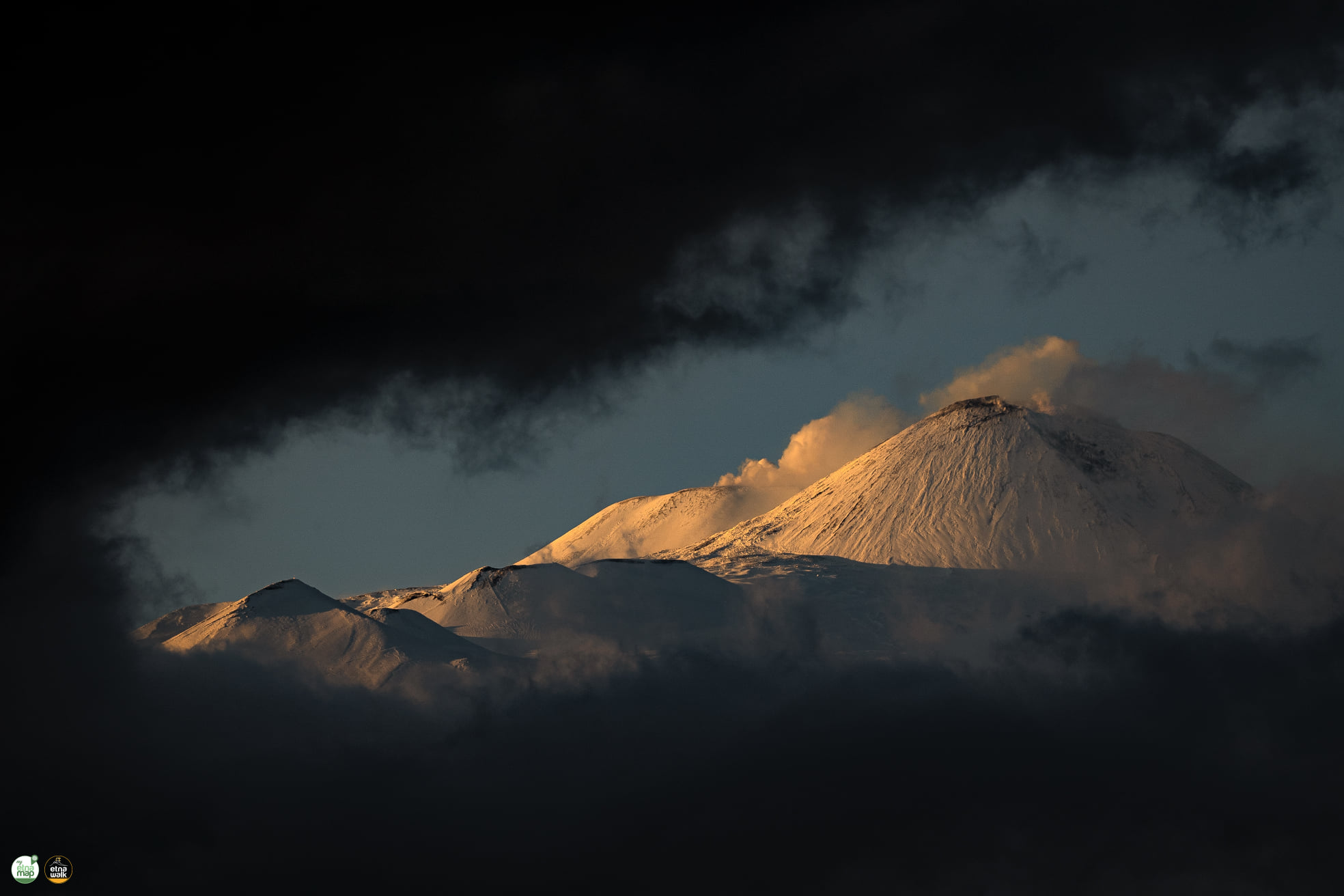
Italy / Sicily , Etna :
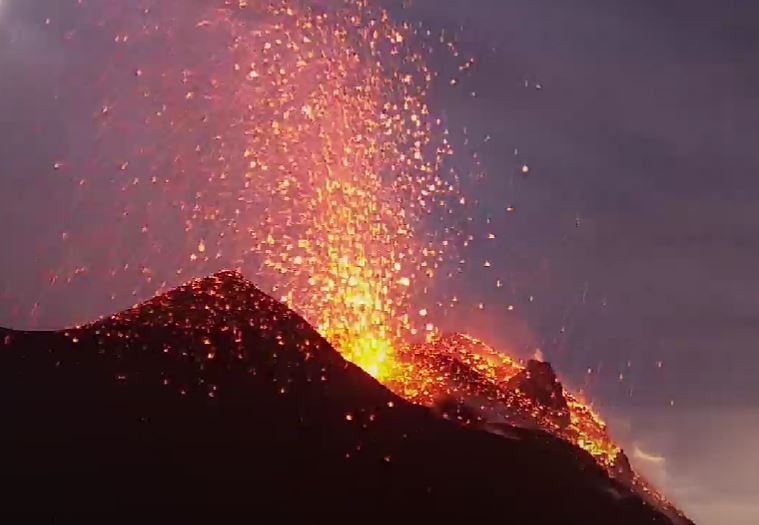
05 December 2021 18:34 (17:34 UTC). COMMUNICATION ON ETNA’S ACTIVITY.
The National Institute of Geophysics and Volcanology, Osservatorio Etneo, announces that the Strombolian activity of the Southeast Crater, already described in the previous update release, continued during the day. The activity produced sporadic ash emissions which dispersed in the summit area. At dusk, a few flashes were observed in the clouds, but due to the presence of dense cloud cover in the summit area, it was not possible to assess the intensity and frequency of the explosions.
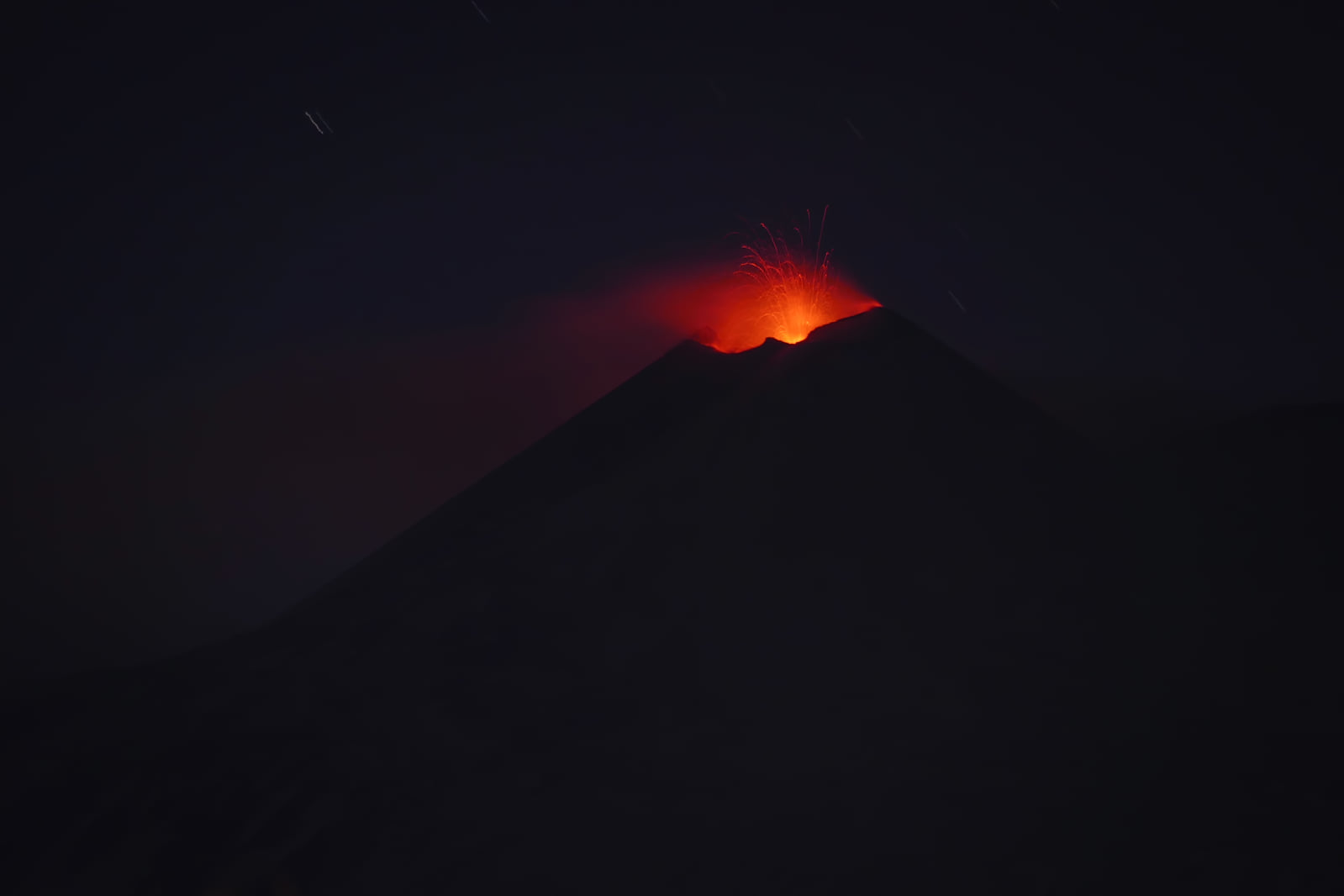
The amplitude of the tremor is stable on average values and its location is close to the Southeast Crater. The number of infrasound events is low.
GNSS and inclinometric monitoring networks for soil deformation do not show significant variations.
Further updates will be communicated shortly
Source : INGV.
Photo : Gio Giusa .
Hawaii , Kilauea :
19°25’16 » N 155°17’13 » W,
Summit Elevation 4091 ft (1247 m)
Current Volcano Alert Level: WATCH
Current Aviation Color Code: ORANGE
Activity Summary:
Kīlauea volcano has been erupting from a single vent in the western wall of Halemaʻumaʻu crater. As of this morning, December 5, 2021, the rate of eruption continues to be very low and any activity is difficult to view given the current weather. All recent lava activity has been confined within Halemaʻumaʻu crater in Hawai‘i Volcanoes National Park.
Summit Observations:
Lava effusion from the western vent decreased significantly Friday afternoon, accompanied by a decrease in volcanic tremor. Both remain low this morning. A minor deflationary tilt signal recorded on summit tiltmeters that began on Friday afternoon has stabilized and there was little change in tilt over the past 24 hours. The most recent measurement of Sulfur dioxide (SO2) emission rates on November 29, 2021 was approximately 1200 tonnes per day obtained. However, continuous instrument measurements indicate that SO2 emission rates have decreased with the change in eruption rate. Earthquake activity remains below background.

Halemaʻumaʻu Lava Lake Observations:
Lava has been erupting from a single vent in the western wall of Halemaʻumaʻu crater, while the eastern edge of the lake has advanced onto the lowest of the exposed down-dropped caldera floor blocks. Friday afternoon, the rate of lava effusion from the western vent decreased sharply. Today, poor viewing conditions make it difficult to confirm the level of activity, however there was no active lava visible at the surface when it was last clearly visible at 9PM yesterday. The decrease in activity indicates an effective pause in the current eruption, however this is the fourth such pause since the eruption began on September 29 and a return to earlier rates of eruption is possible. The western end of the lake has shown little change in maximum elevation over the past several days, with HVO’s permanent laser rangefinder showing an elevation of approximately 809 meters (2654 ft) when a measurement was last possible. The lake has seen a total increase of about 65 meters (213 ft) since lava emerged on September 29. Webcams have shown spatter and ponded lava within the west vent, an area of active lava at the surface of the lava lake, and sporadic oozes of lava along the cooler outer lake margins. The total erupted volume since the beginning of the eruption was estimated to be about 30 million cubic meters (7.8 billion gallons) on November 16.
Source : HVO.
Photo : Archive 11/2021 , USGS/ B. Carr.