August 31 , 2020.
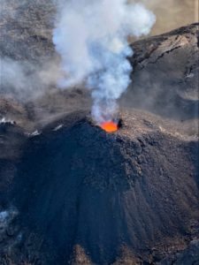
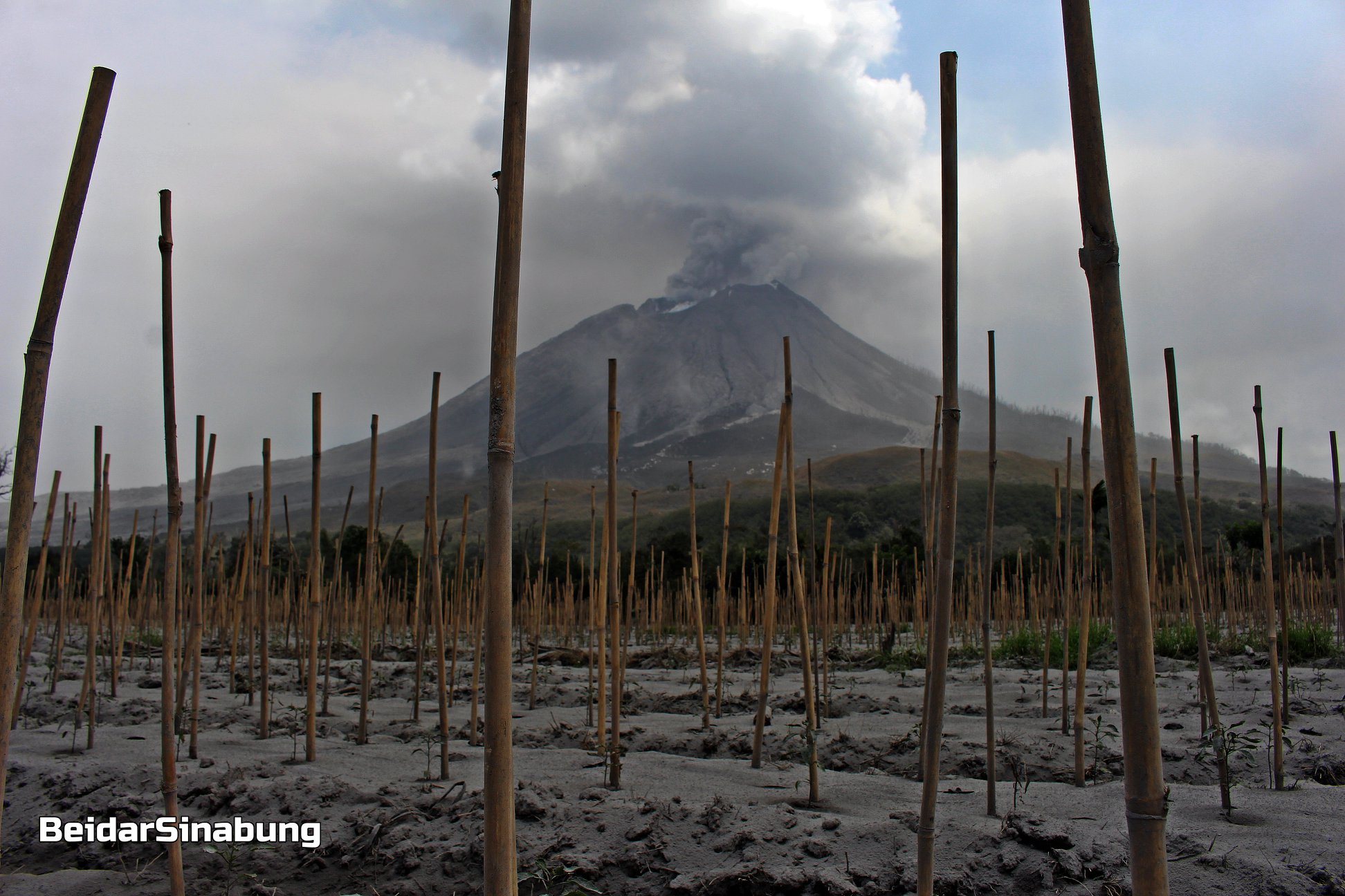
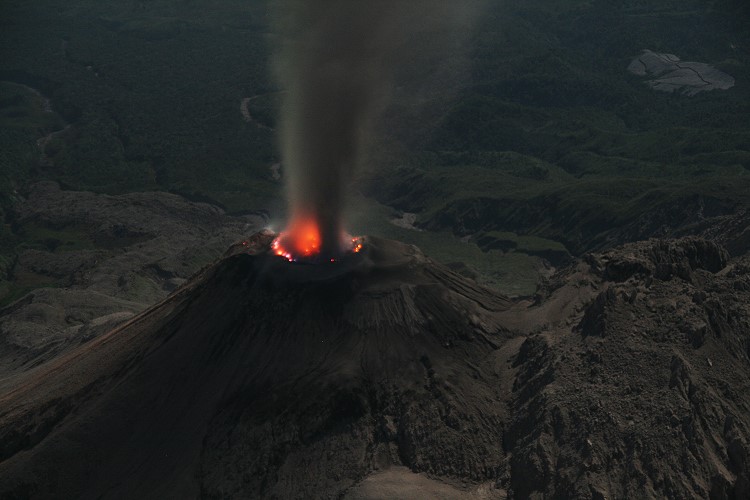
Indonesia , Sinabung :
The activity level has been at level III (SIAGA) since May 20, 2019 at 10:00 a.m. WIB. The Sinabung volcano (2460 m above sea level) has been erupting since 2013. The last eruption occurred on August 25, 2020, resulting in a column height of 800 meters above the summit.
The volcano was clearly visible until it was covered in fog. The crater emits white smoke, of great thickness, which rises about 100 to 300 meters above the summit. The weather is sunny, cloudy, cloudy to rainy, the wind is weak, oriented to the South-West, North-West and West.
According to the seismographs of August 30, 2020, it was recorded:
4 emissions earthquakes
5 low frequency earthquakes
2 distant tectonic earthquakes
1 Tectonic earthquake
Recommendation:
The community and visitors / tourists should not conduct activities in the villages that have been moved, as well as within a radial radius of 3 km around the summit of Mount Sinabung, and within a sector radius of 5 km for the southern sector -East and 4 km for the East-North sector.
VOLCANO OBSERVATORY NOTICE FOR AVIATION – VONA.
Issued : August 31 , 2020
Volcano : Sinabung (261080)
Current Aviation Colour Code : ORANGE
Previous Aviation Colour Code : orange
Source : Sinabung Volcano Observatory
Notice Number : 2020SIN24
Volcano Location : N 03 deg 10 min 12 sec E 98 deg 23 min 31 sec
Area : North Sumatra, Indonesia
Summit Elevation : 7872 FT (2460 M)
Volcanic Activity Summary :
Eruption with volcanic ash cloud at 02:28 UTC (09:28 local). Eruption and ash emission is continuing.
Volcanic Cloud Height :
Best estimate of ash-cloud top is around 11072 FT (3460 M) above sea level, may be higher than what can be observed clearly. Source of height data: ground observer.
Other Volcanic Cloud Information :
Ash-cloud moving to East-northeast
Remarks :
Seismic activity is characterized by continuous volcanic tremor
Source : PVMBG, Magma Indonésie .
Photo : Firdaus Surbakti.
Ecuador , Sangay :
The Geophysical Institute of the National Polytechnic School reports that:
This Sunday, August 30, via the Volcanic Observers Network, an ash haze is reported in the northern sector of Macas. This could cause a slight fall of ash in the area. This phenomenon has been persistent during the current eruptive period of the Sangay volcano which began in May 2019. It is recommended to take the appropriate measures and not to expose yourself for long periods to the ash fall.
The Geophysical Institute of the National Polytechnic School is keeping an eye on the activity of the volcano and will report on any changes that may be recorded.
DAILY REPORT ON THE STATE OF SANGAY VOLCANO, Sunday August 30, 2020.
Surface activity level: High, Surface trend: No change.
Internal activity level: High, Internal trend: Increasing.
Seismicity:
From August 29, 2020, 11:00 to August 30, 2020, 11:00:
Long period type events: 13
Explosions: 27
Emission tremor: 4
Rains / lahars:
No rain was recorded.
* In case of heavy rains, lahars can be generated in the Volcán, Upano and other tributaries. *
Emission / ash column:
This morning, with images shared by ECU911 and the network of volcanic observers, gas and ash emissions were identified that reached up to 1000m above crater level, heading west. . Thanks to satellite images from the Washington VAAC, 2 ash emission alerts were reported in a northwest direction and their heights varied between 1270 and 1470 m above the crater level.
Other monitoring parameters: No changes.
Observations:
During the morning, the mentioned emissions and a decrease in pyroclastic flows were observed on the south-eastern flank.
Until the close of this bulletin, there are no reports of possible ash fall. There is seismic data corresponding to 22 hours of transmission from the station.
Alert level: yellow.
Source : IGEPN.
Guatemala , Santiaguito :
Activity type: Pelean
Morphology: Complex of dacitic domes
Geographical location: 14 ° 44 ’33 ˝ Latitude N; 91 ° 34’13˝ Longitude W
Height: 2,500msnm.
Weather conditions: Partly cloudy
Wind: south-east
Precipitation: 21.08 mm.
Activity:
The STG3 seismic station records moderate to strong boulder avalanches, constantly observed on the South, South-West and South-East flanks, some reaching the base of the dome, and others accompanied by small pyroclastic flows. Weak explosions and a few moderate explosions are recorded up to 3,400 meters (11,155 feet), with a slight presence of ash on the volcanic perimeter. The Caliente Dome is observed with a white fumarole mainly of water vapor at a height of 3000 meters (9843 feet), which the wind moves to the west and southwest of the volcanic complex. An incandescence is observed on the crater of the Caliente dome. Larger pyroclastic flows could be generated. (The recommendations of the special bulletin of the Santiaguito volcano 63-2020, remain valid).
Source : Insivumeh .
Photo : Marc Szeglat , 2009 , wikimedia.
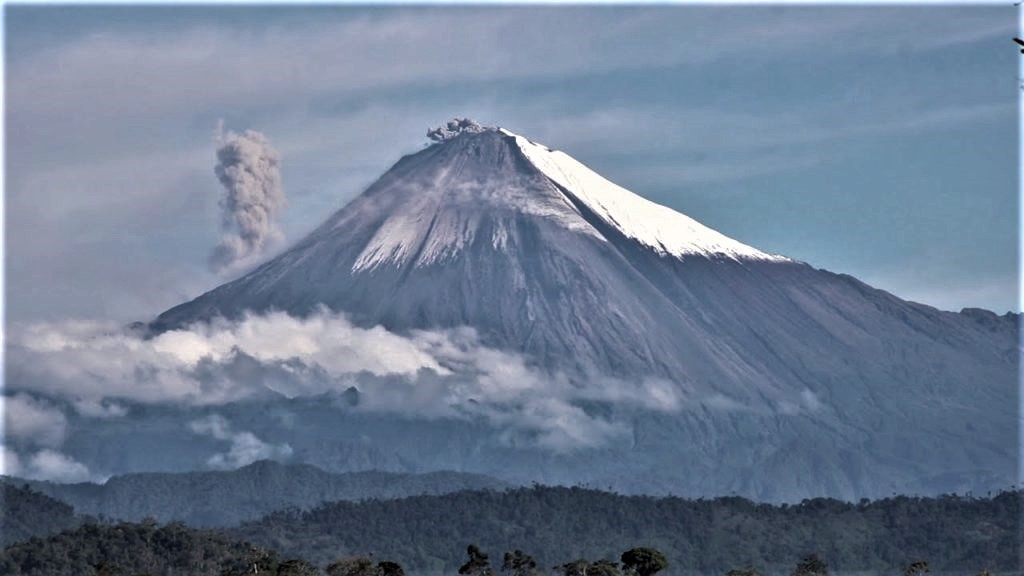
Mexico , Popocatepetl :
August 30, 11:00 a.m. (August 30, 4:00 p.m. GMT)
During the last 24 hours, according to the monitoring system of the Popocatepetl volcano, 191 exhalations accompanied by volcanic gases and sometimes small amounts of ash have been identified. In addition, 620 minutes of tremor were recorded.
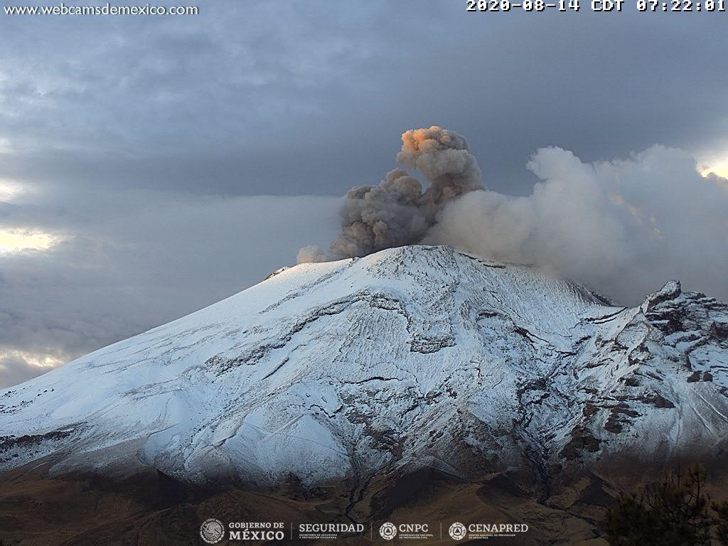
At the time of this report, there is no visibility towards the volcano, however during the early hours of the morning we could observe the emission of volcanic gases dispersed towards the southwest.
CENAPRED urges not to approach the volcano and in particular the crater, because of the danger posed by the fall of ballistic fragments and, in the event of heavy rains, to stay away from the bottom of the ravines because of the danger of mudslides and debris.
The Popocatépetl volcanic alert semaphore is in YELLOW PHASE 2.
Source : Cenapred .
Photo : Archive webcamdemexico