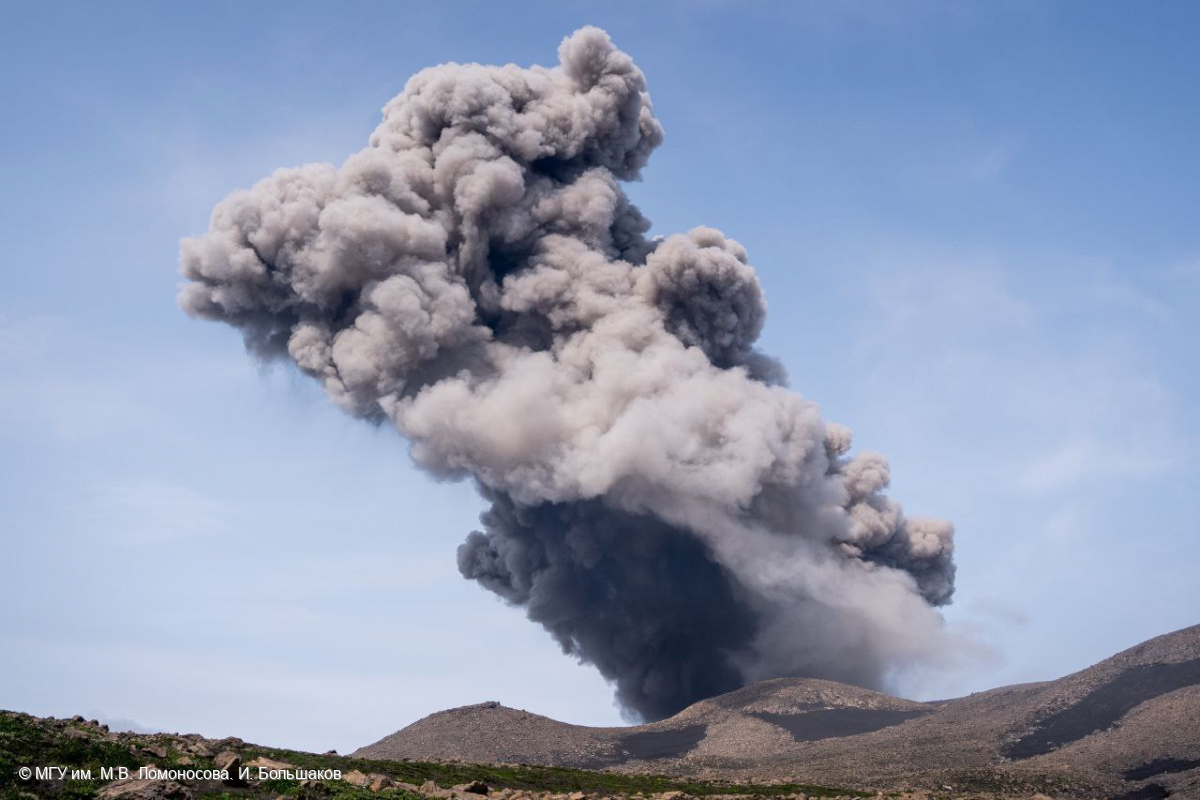
August 05 , 2023.
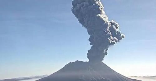
Alaska , Shishaldin :
Friday, August 4, 2023, 9:04 AM AKDT
Volcanic Activity Summary:
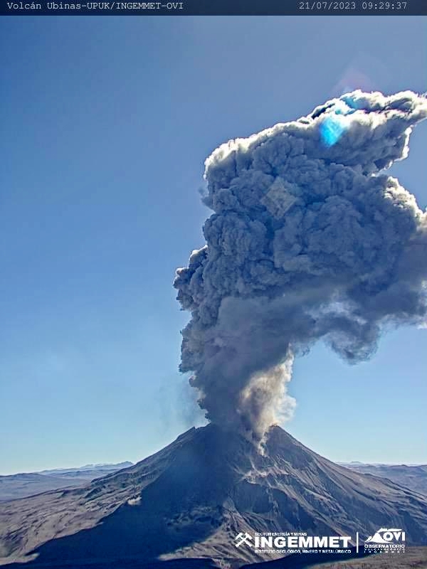
Explosive eruptive activity is occurring at Shishaldin Volcano. A low-level ash cloud up to 25,000 ft (7.6 km) above sea level and extending 37-47 miles (60-75 km) northeast of the volcano is evident in satellite data at 5:20 AM AKDT (13:20 UTC) and reported by passing pilots at 8:36 AM AKDT (16:36 UTC). This follows a 20-hour increase in seismic tremor and an increase in surface temperatures at the volcano seen in satellite data. Explosion signals have been detected in infrasound and seismic data overnight during cloudy altmospheric conditions. Surface temperatures have greatly increased in the past few hours. The National Weather Service has issued a SIGMET for this ash cloud.
Based on previous eruption cycles, significant ash emissions are likely to continue for the next few hours. Pyroclastic and mudflows are likely on the immediate flanks of the volcano.
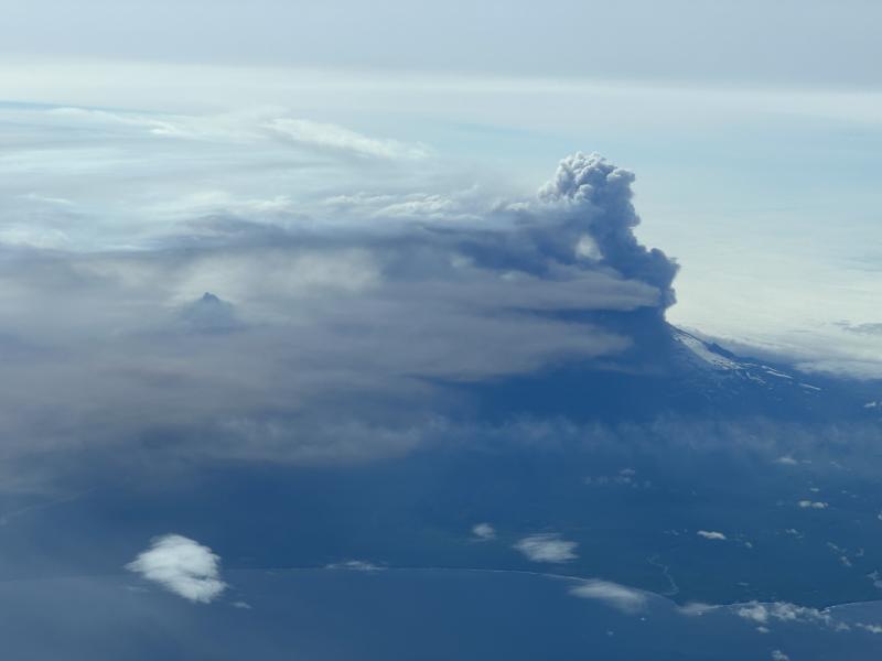
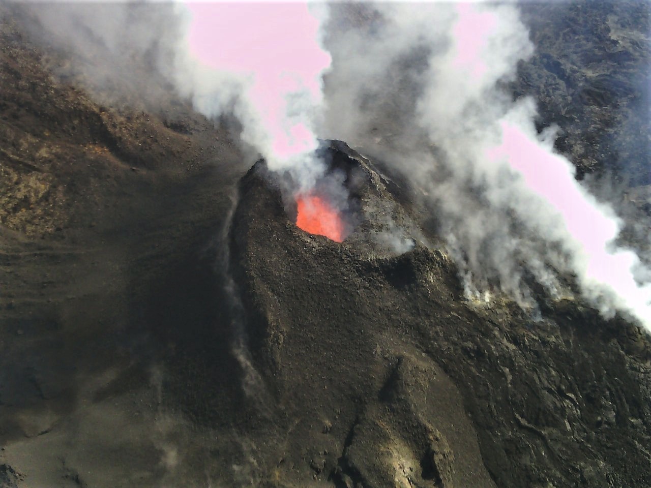
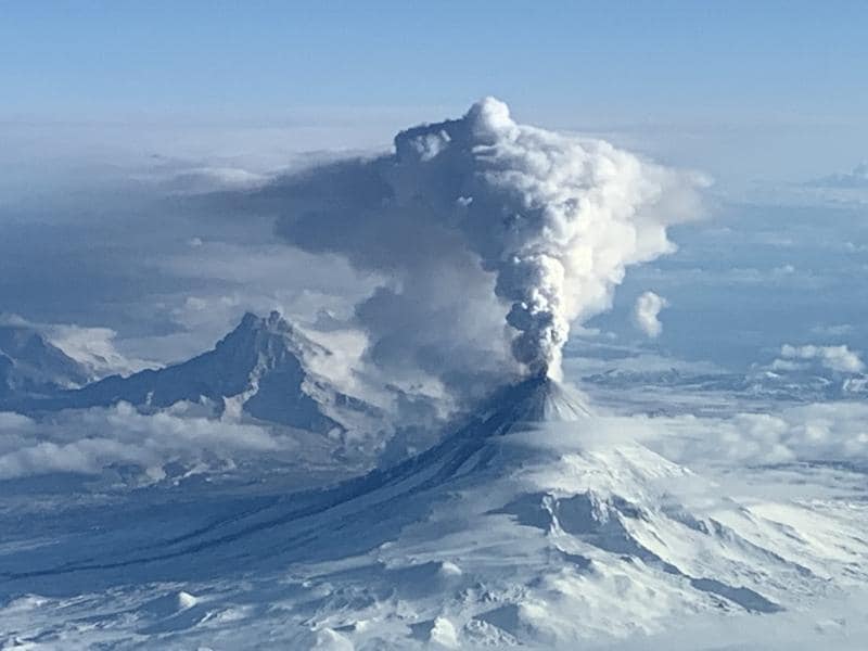
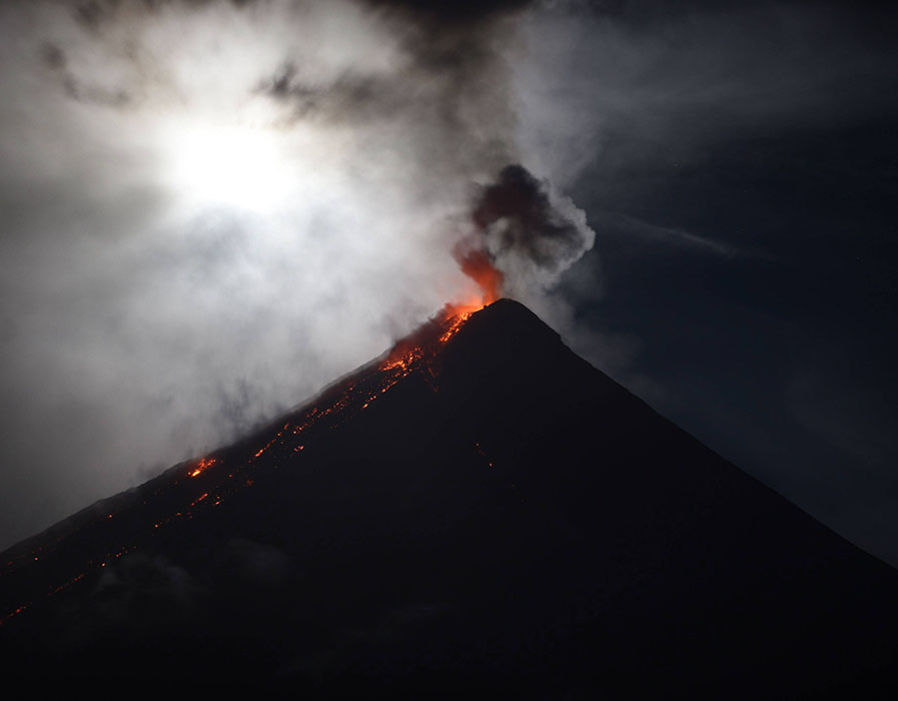
Eruptive plumes from the August 4, 2023, eruption of Shishaldin Volcano taken by a passing aircraft flying at 31,000 ft. The view is from the north showing the higher, white and puffy gas-rich plume, the lower, gray ash-rich plume, and proximal dark tephra deposits on the volcano’s flank. The summit of Isantoski is also visible through the plume and meteorological clouds.
Friday, August 4, 2023, 10:17 AM AKDT
Volcanic Activity Summary:
An ash cloud from Shishaldin Volcano reaching 30,000 ft (9 km) above sea level was observed in satellite data at 9:00 am AKDT (17:00 UTC). This follows a several-hour increase in observed eruptive activity. In response, the Aviation Color Code is being raised to RED and the Volcano Alert Level is being raised to WARNING. The National Weather Service has issued a SIGMET for this ash cloud, and a Special Weather Statement has been issued for possible trace ash on marine waters downwind of Shishaldin Volcano.
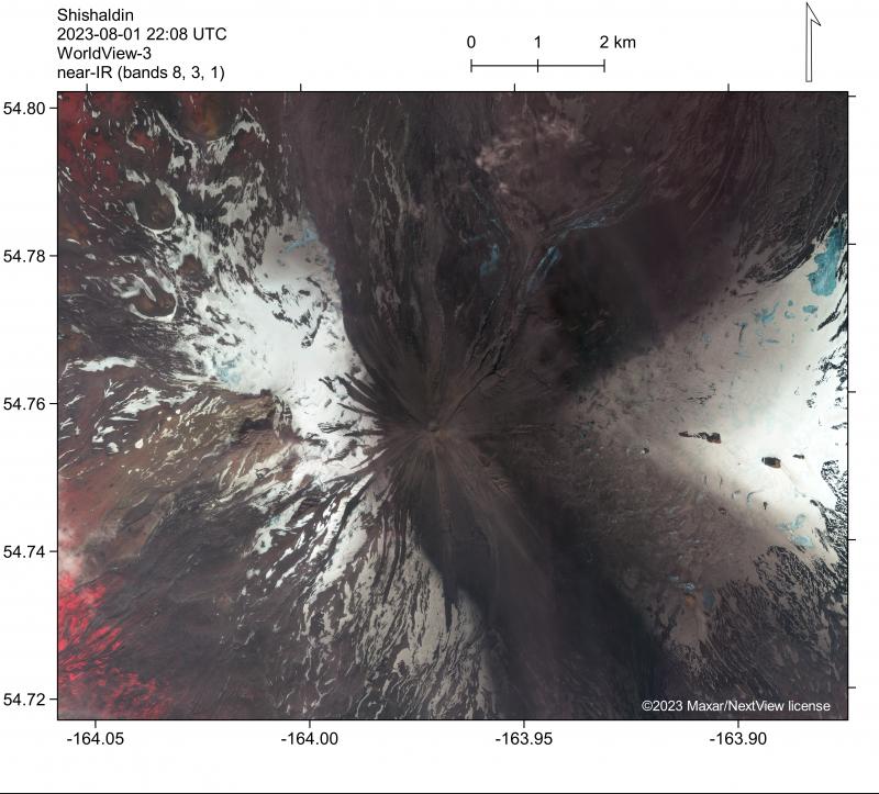
Near-infrared false-color satellite image of Shishaldin Volcano on August 1, 2023, documenting deposits from eruption activity in mid- to late-July. Cooling deposits are visible near the summit and within summit crater, but no active lava is visible.
Friday, August 4, 2023, 2:07 PM AKDT
Volcanic Activity Summary:
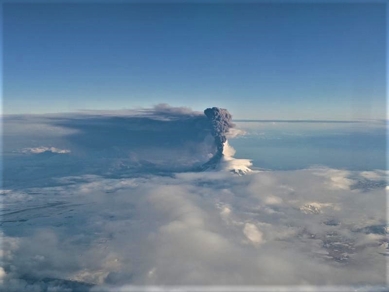
Eruptive activity continues at Shishaldin Volcano, with continuous ash emissions, strongly elevated surface temperatures, and high levels of seismic tremor. A continuous ash plume extends to the east-northeast with two branches visible in satellite imagery and confirmed by passing aircraft. The volcanic cloud extends up to ~112 miles (~180 km) from the volcano, with its top as high as 31,000 ft (9.4 km) above sea level. Additionally, a gas-rich but less ash-laden volcanic plume is also drifting to the southeast. The National Weather Service has issued a SIGMET for these ash clouds, a Marine Weather Statement and a Special Weather Statement for trace ash on marine waters and land areas downwind of Shishaldin Volcano. The color code and alert level remain at RED/WARNING.
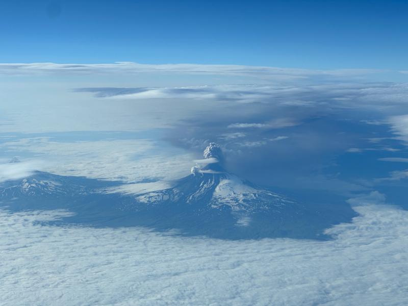
Photo of Shishaldin Volcano on July 18, 2023, as an ash-rich plume was emitted, taken from the air. View from the north of Shishaldin, with the ash-rich plume extending to the southeast. The Isanotsky volcano is visible on the left side of the image, partially obscured by clouds.
Friday, August 4, 2023, 7:55 PM AKDT
Volcanic Activity Summary:
Volcanic activity has significantly declined at Shishaldin Volcano and any remaining ash emissions are likely low level. Seismic tremor began declining from a peak at 2:00 pm AKDT (22:00 UTC) and is and is currently at low levels. The eruption produced a sustained ash plume ash plume during the period of high seismicity which drifted to the northeast. Currently, meteorological clouds at 30,000 ft (9 km) above sea level have obscured the volcano and any potential ash clouds. It is possible that low level ash production could be continuing during this period of waning seismicity. Due to this decrease in intensity of the eruption, the Aviation Color Code is being lowered to ORANGE and the Alert Level is being lowered to WATCH.
Source : AVO
Photos : Chris Barnes, Aleutian Airways, Loewen, Matt , Barnes, Chris .
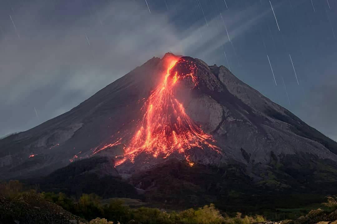
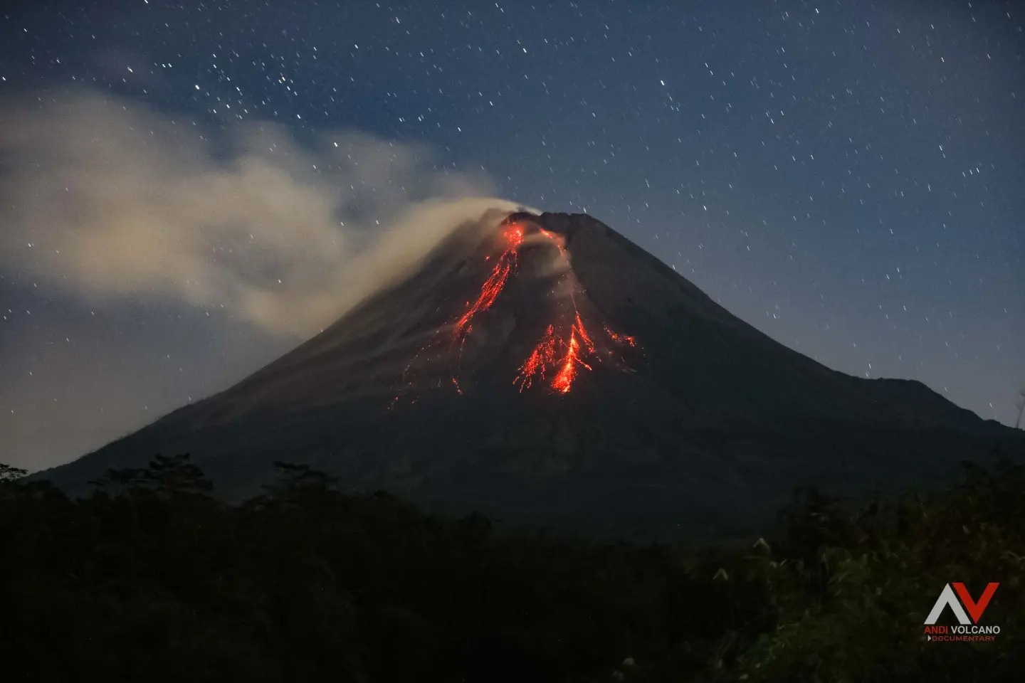
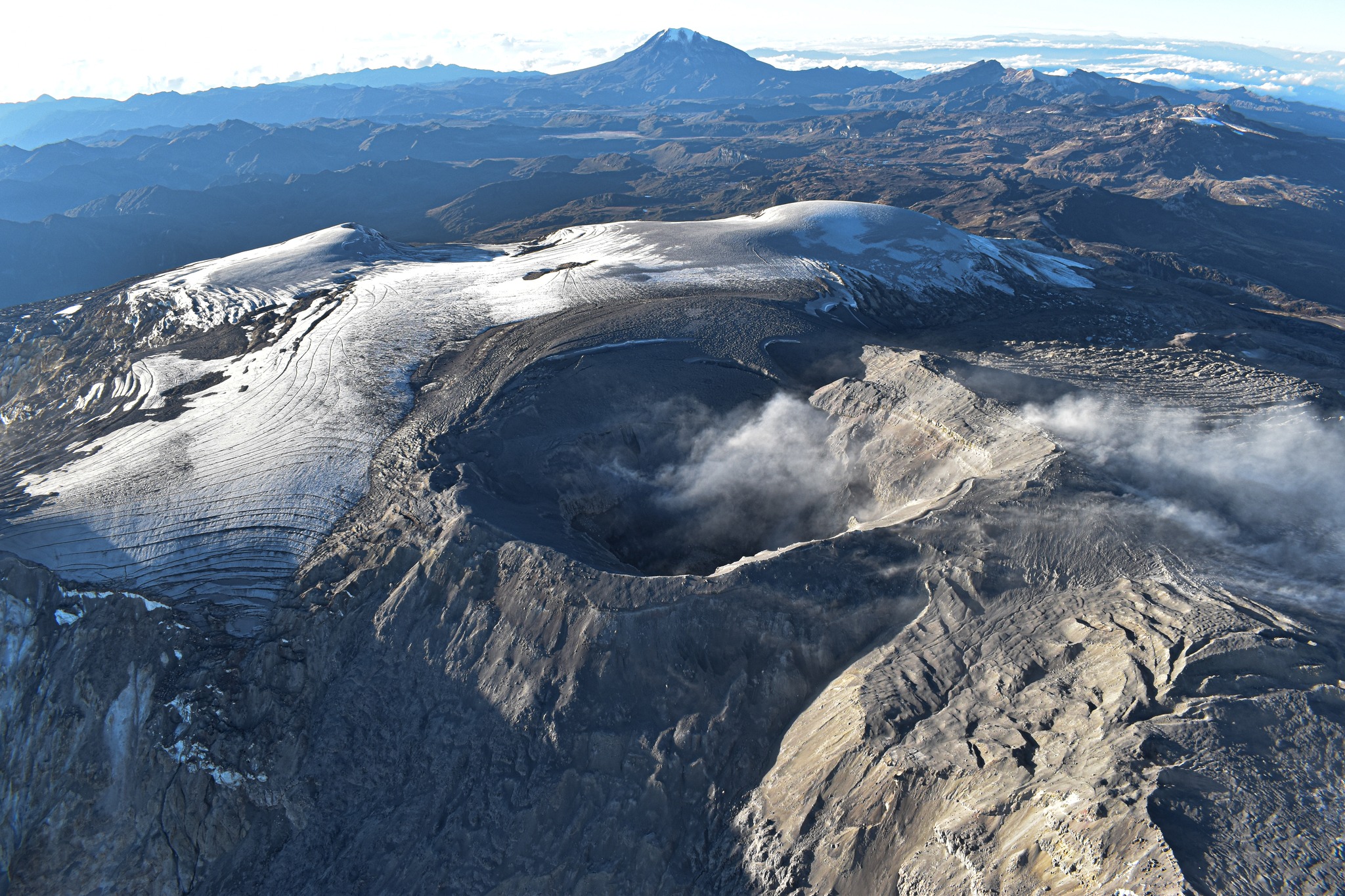
Indonesia , Merapi :
Report on the activity of Mount Merapi from July 28, 2023 to August 03, 2023, Published on August 04, 2023.
RESULTS OF OBSERVATIONS
Visual
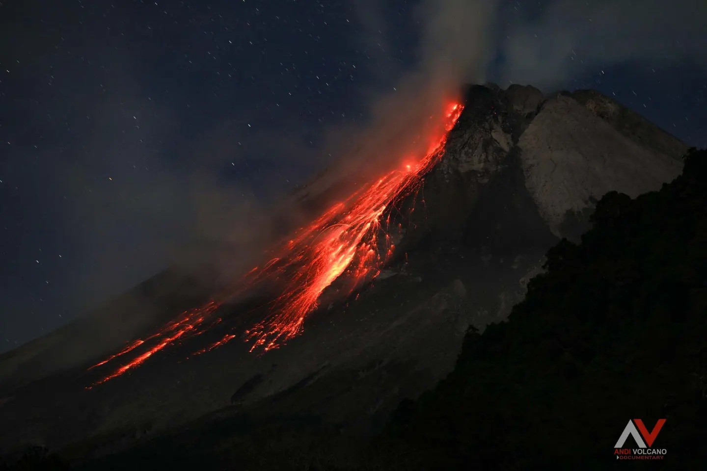
The weather around Mount Merapi is usually sunny in the morning and afternoon, while the evening is foggy. White, fine to thick smoke, low to medium pressure and 450 m high was observed from the Mount Merapi observation post in Selo on August 2, 2023 at 05:35.
This week, lava avalanches have been observed 194 times to the south and southwest, including 12 times upstream of the Boyong River to a maximum of 1,600 m and 182 times upstream of the Bebeng River to at 2000m. The sound of the avalanches was heard 39 times from Babadan post with low to moderate intensity.
The morphology of the southwest dome has undergone slight changes due to lava activity, while no significant changes have been observed for the central dome. According to an aerial photo dated June 24, 2023, the measured volume of the southwest dome is 2,573,600 m3 and the central dome is 2,369,800 m3.
Seismicity
This week, the seismicity of Mount Merapi showed:
1 earthquakes hot cloud avalanches (APG)
19 shallow volcanic earthquakes (VTB),
115 multiphase earthquakes (MP),
2 low frequency earthquakes (LF),
848 avalanche earthquakes (RF)
9 tectonic earthquakes (TT).
The intensity of seismicity this week is lower than last week, but the number of earthquakes is still quite high.
Deformation
Mount Merapi’s deformation that was monitored using EDM this week showed a shortening of the steepening distance by 5 cm/day.
Rain and lahars:
This week, there was no rain at the Mount Merapi observation post. There have been no reports of additional flows or lahars from rivers descending from Mount Merapi.
Conclusion
Based on the results of visual and instrumental observations, it is concluded that:
-The volcanic activity of Mount Merapi is still quite high in the form of effusive eruption activity. The state of the activity is defined at the « SIAGA » level.
The current danger potential is in the form of lava avalanches and hot clouds in the South-South-West sector comprising the Boyong River for a maximum of 5 km, the Bedog, Krasak, Bebeng rivers for a maximum of of 7 km. In the South-East sector, it includes the Woro River for a maximum of 3 km and the Gendol River for 5 km. While the ejection of volcanic material in the event of an explosive eruption can reach a radius of 3 km from the summit.
Source : BPPTKG
Photo : Andi volcanist
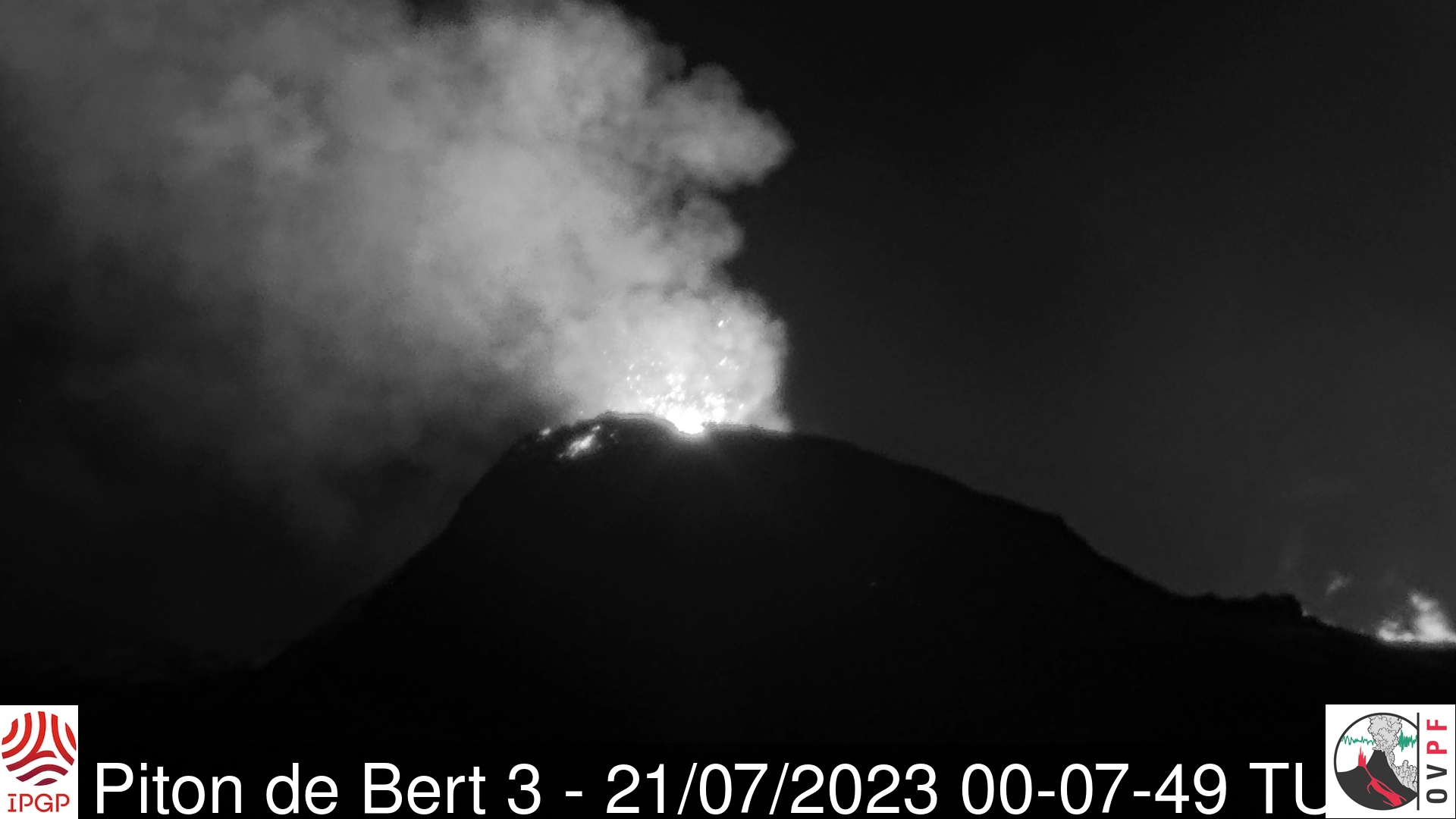
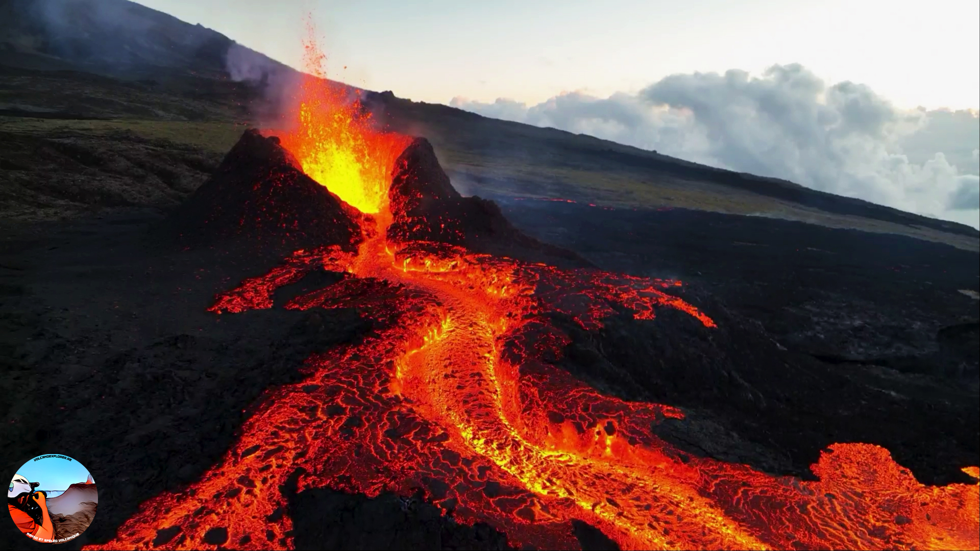
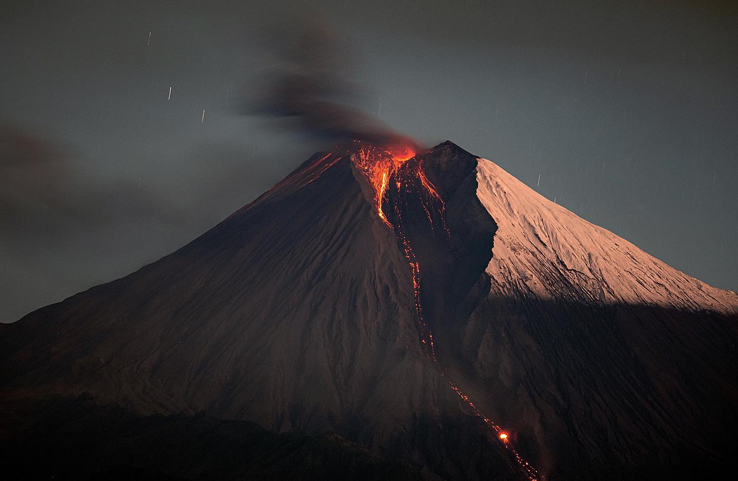
La Réunion , Piton de la Fournaise :
Press release from the Paris Institute of Earth Physics, Piton de la Fournaise Volcanological Observatory, August 04, 2023 – 09:45 – 05:45 UTC
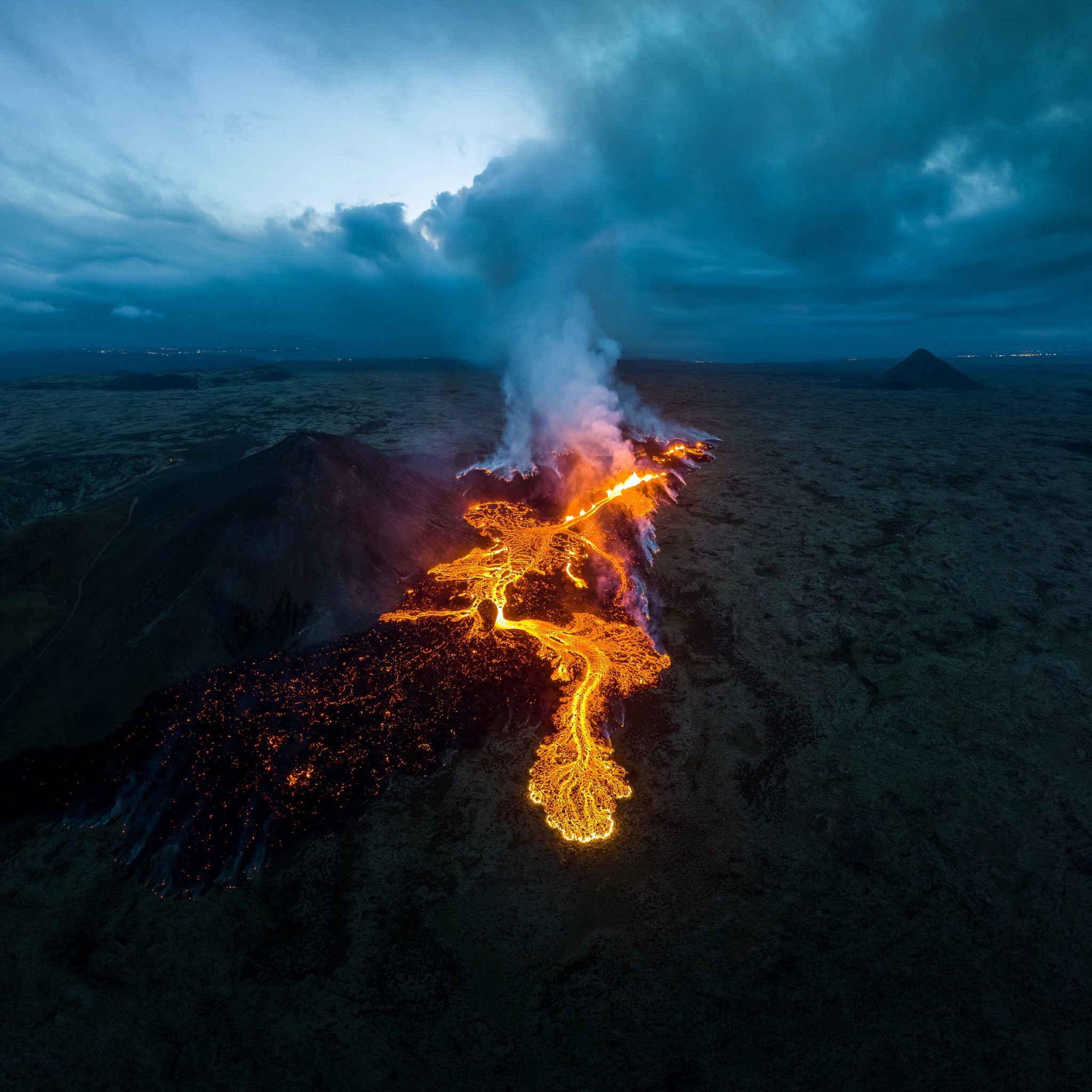
Ongoing eruption
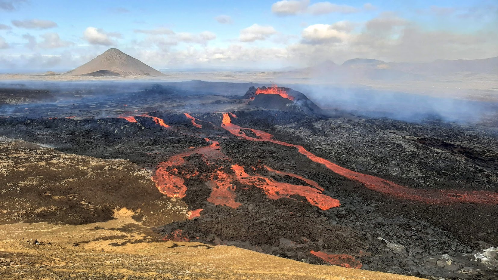
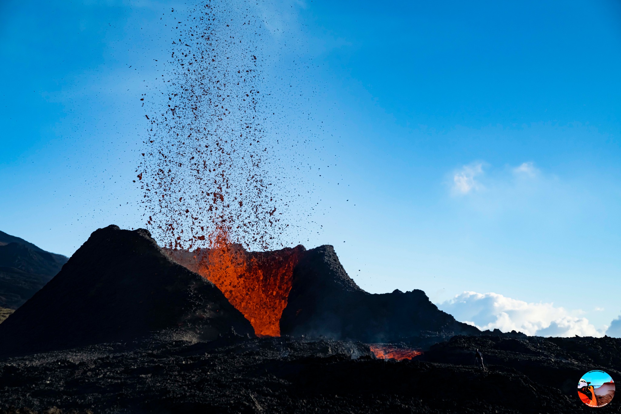
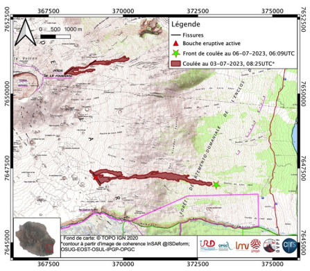
The eruption which began on July 02, 2023, around 08:30 local time continues. The amplitude of the volcanic tremor (indicator of an emission of lava and gas on the surface) remains very low compared to the start of the eruption and has been relatively stable for several days.
Thanks to the good weather conditions on the volcano, which occurred on August 3, 2023 at the very beginning of the day in local time (August 2, 2023 9:24 p.m. UTC), lava flow estimates were calculated by satellite method on the MIROVA platform ( University of Torino). During this favorable period, the flows were of the order of 1.8 m3 /sec. Given the cloud mass present regularly on the eruptive site as well as the presence of lava tunnels, these flows may be underestimated.
Since the beginning of the eruption, and until this date, the total volume of lava emitted at the surface was 11.2 (± 3.9) Mm3.
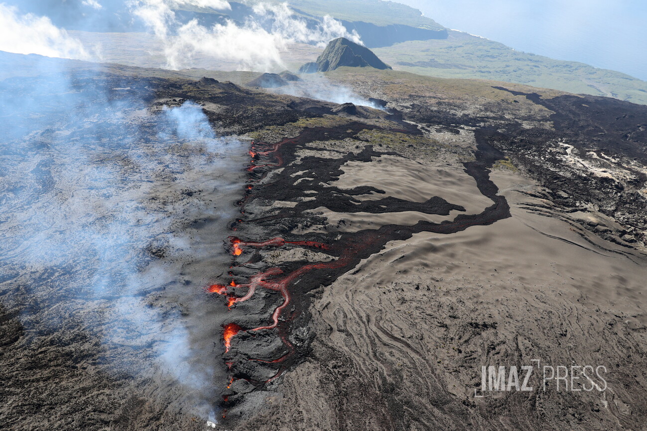
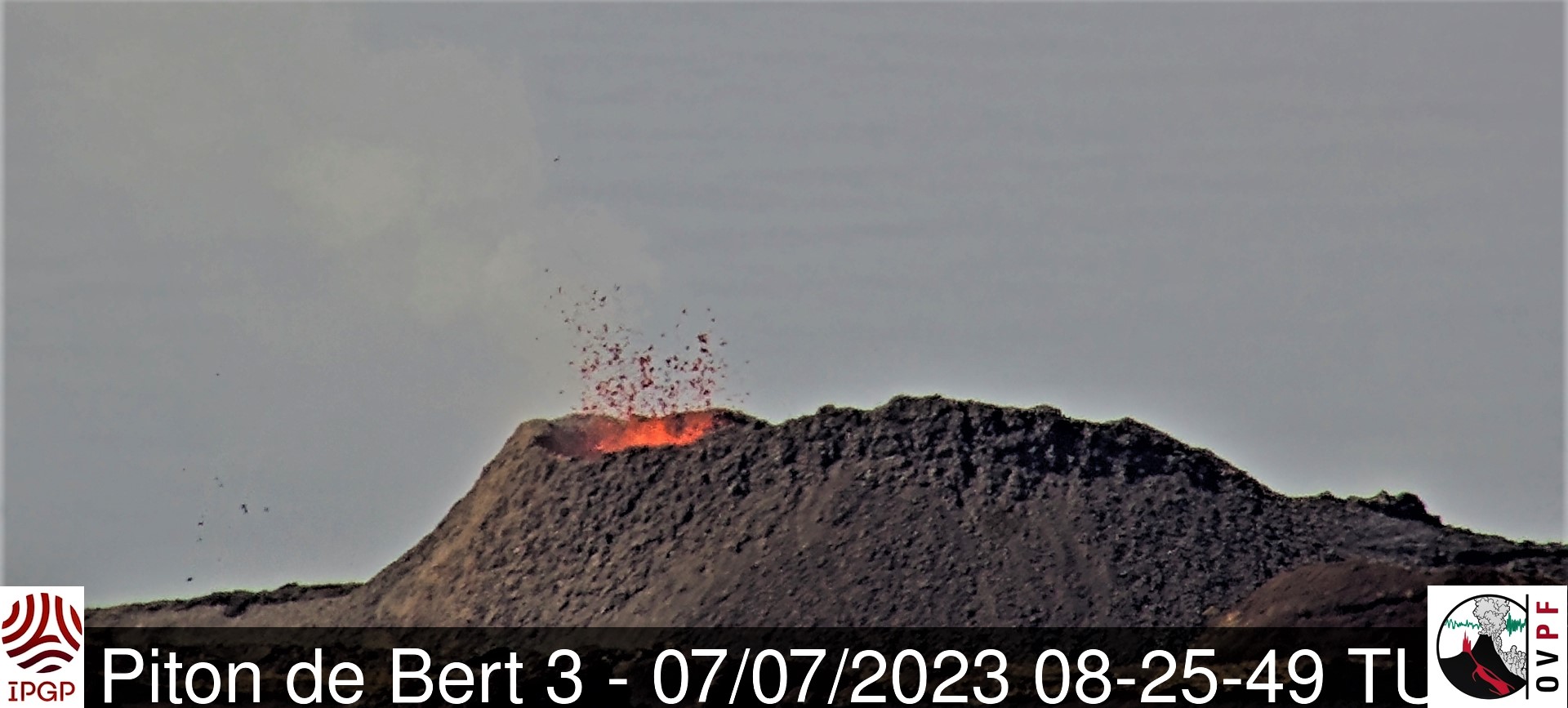
Given the poor weather conditions currently on site, no estimate of the lava flows by satellite method could be made over the last 24 hours. In addition, no visual return of the eruptive site and flows was possible both on our camera located at low altitude (Piton des Cascades in Ste-Rose) and on that located at altitude (Piton de Bert).
The activity most likely continues with weak lava projections at the level of the eruptive cone.
Low inflation of the summit area has been recorded since mid-July, indicating a re-pressurization of the volcano’s feeding system centered under the summit area with possible transfer of deep magma to the latter, then feeding the eruption.
The seismic activity recorded under the summit zone remains weak. Thus over the past 24 hours, seven superficial volcano-tectonic earthquakes have been recorded. This low seismic activity leads to a low risk of the appearance of a new crack and / or collapse in the crater, but does not allow to exclude it as shown by the continuation of the summit inflation and the fluctuations in the amplitude of the tremor which are regularly observed.
Alert level: Alert 2-1 (eruption in the Enclos without any particular threat to the safety of people, property or the environment).
Source : OVPF
Photo : sly/rb/www.imazpress.com
Colombia , Nevado del Ruiz :
Weekly activity bulletin of the Nevado del Ruiz volcano
Regarding the monitoring of the activity of the NEVADO DEL RUIZ VOLCANO, the MINISTRY OF MINES AND ENERGY through the COLOMBIAN GEOLOGICAL SERVICE (SGC) informs that:
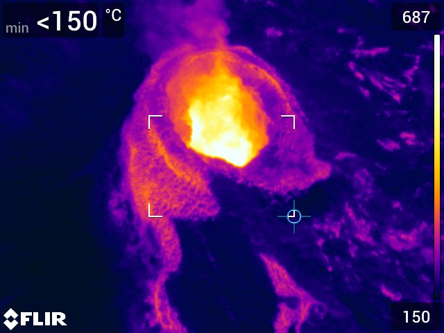
The seismicity associated with the movement of fluids inside the volcanic conduits presented similar levels in the number of recorded earthquakes and increased in the seismic energy released, compared to the previous week. The seismic signals showed low to moderate energy levels and, as of July 27, some of them were characterized by a longer duration compared to those recorded during the rest of the month. Thanks to the conventional and thermographic cameras used to monitor the volcano, it was possible to confirm various gas and ash emissions in the atmosphere, as well as certain changes in the relative temperature of the material emitted, which were associated with these signals.
Regarding the seismicity associated with the fracturing of the rock inside the volcanic edifice and, after the July 25 increase reported in the previous bulletin, this type of seismic activity has decreased both in the number of earthquakes recorded and in the seismic energy released compared to the previous week.
The earthquakes were located mainly in the North-West and North-East to East-North-East sectors of the volcano (at distances between 7 and 8 km and 1 and 4 km from the Arenas crater respectively) and, in a lesser extent, in the Arenas crater and other areas of the volcano. The depths of the earthquakes varied between 1 and 8 km from the top of the volcano and most of them were of low energy (magnitude less than 1). The maximum magnitude recorded was 1.1, corresponding to the earthquake recorded on July 30 at 4:59 a.m. In addition, low energy seismicity associated with the activity of the lava dome located at the bottom of the crater was recorded.
Regarding surface activity, the volcano continued to emit water vapor and gases, mainly sulfur dioxide. The maximum height of the column of gas and ash was observed on July 27 with values of 2,300 and 3,500 meters measured at the top of the volcano, respectively vertically and in dispersion. These column heights were associated with the emission of ash recorded by the volcano at 06:17, which was not only evidenced by the energy level of the signal, but also by the observation reports received from different sectors of the municipalities of Manizales and Neira, in Caldas. In addition, thanks to satellite monitoring platforms, a report of a low-energy thermal anomaly was obtained from the bottom of the crater on July 27 at dawn.
Source et photo : SGC.
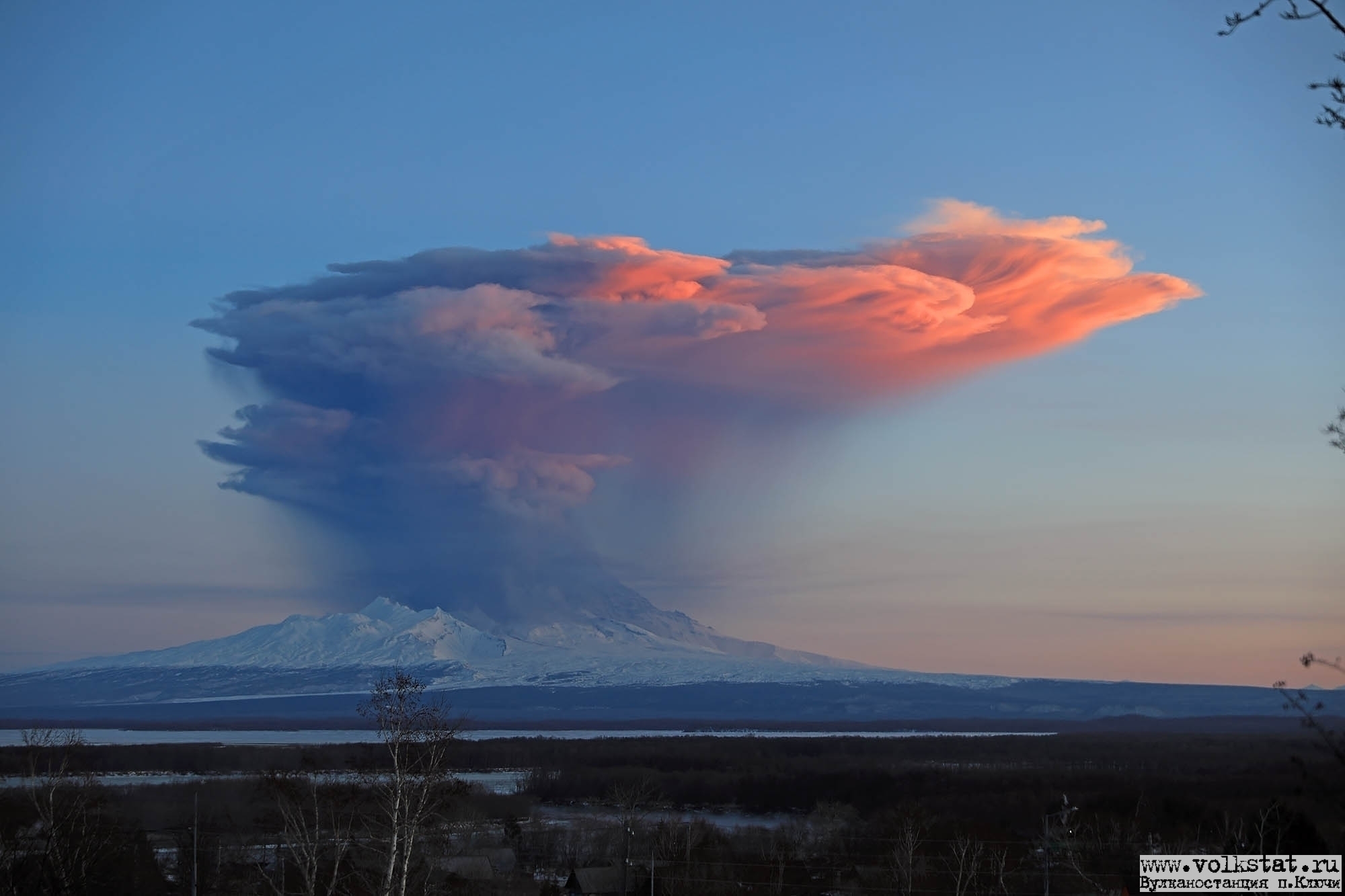
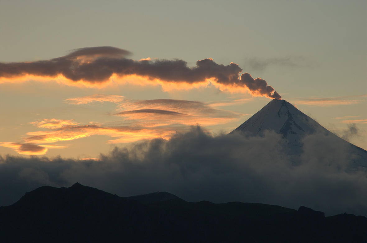
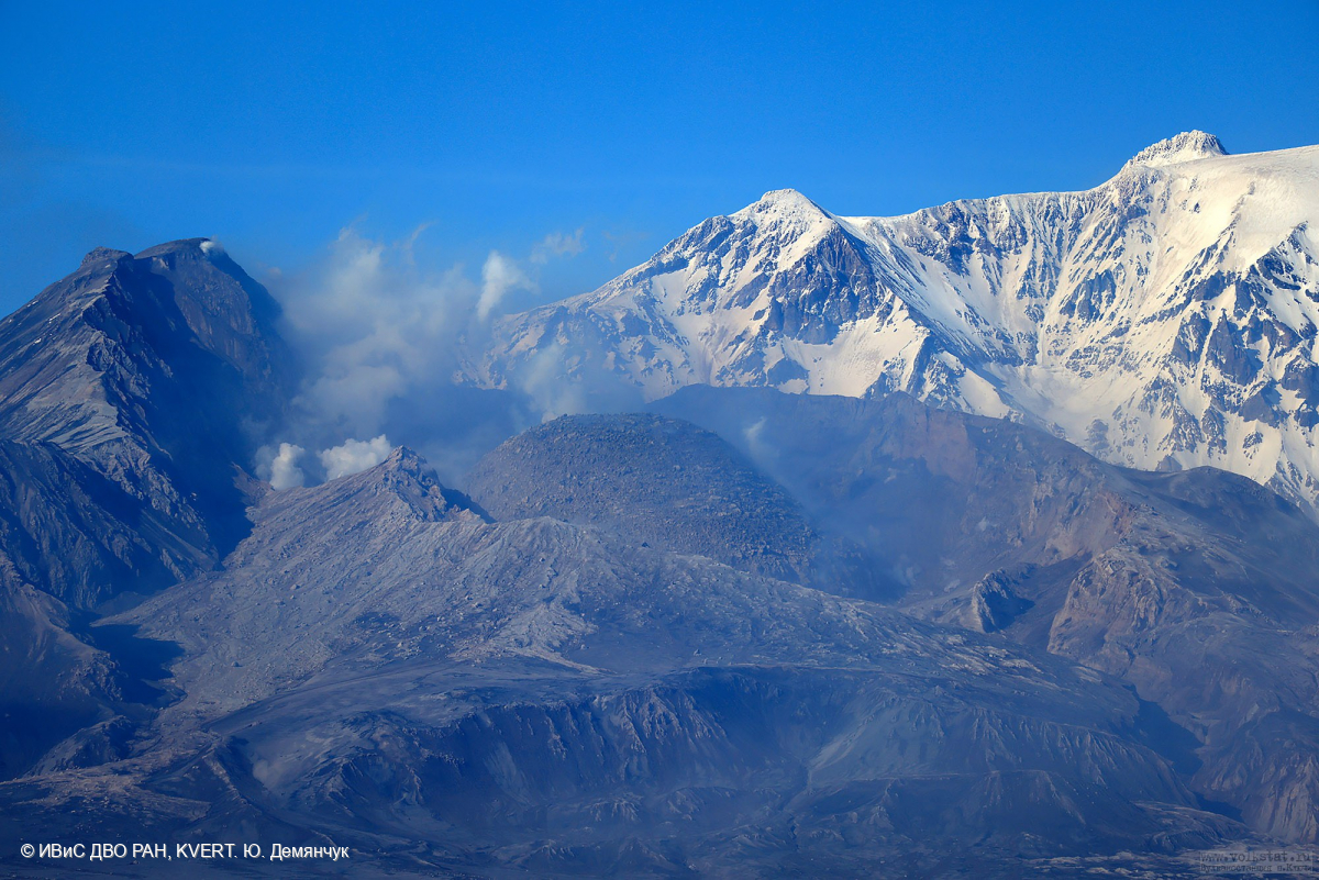
Kamchatka , Klyuchevskoy :
56.06 N, 160.64 E;
Elevation 4750 m (15580 ft)
Aviation Colour Code is YELLOW
An explosive-effusive eruption of the volcano continues. Ash explosions up to 6 km (19,700 ft) a.s.l. could occur at any time. Ongoing activity could affect low-flying aircraft.
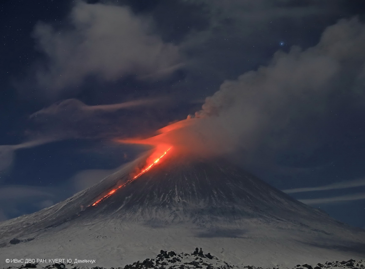
A summit eruption of the volcano continues. Against the background of explosive activity of the Strombolian type (lava fountaining in the volcanic crater), a lava flow continues to effuse along the Apakhonchich chute on the south-eastern slope of the volcano. Satellite data by KVERT showed a bright thermal anomaly over the volcano all week.
Source : Kvert
Photo : Yu. Demyanchuk, IVS FEB RAS, KVERT ( archive 2020)