July 17 , 2023.
Alaska , Shishaldin :
AVO/USGS Volcanic Activity Notice
Current Volcano Alert Level: WATCH
Current Aviation Color Code: RED
Previous Aviation Color Code: ORANGE
Issued: Saturday, July 15, 2023, 11:57 PM AKDT
Source: Alaska Volcano Observatory
Notice Number: 2023/A1066
Location: N 54 deg 45 min W 163 deg 58 min
Elevation: 9373 ft (2857 m)
Area: Aleutians
Volcanic Activity Summary:
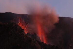
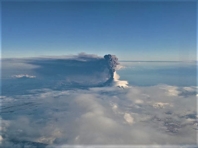
The explosive eruption of Shishaldin Volcano is continuing. A continuous ash plume now extends over 80 mi (125 km) to the SSE from the volcano with an altitude of about 16,000 ft (4.9 km) above sea level. Seismicity has remained elevated for over 6 hours and frequent explosion signals are being detected at regional infrasound (pressure sensor) networks. Some explosions are sending ash plumes as high as 20,000 ft (6 km) above sea level. Due to the duration of this current activity and the extent of the distributing ash cloud the Aviation Color Code is being raised to RED and the Volcano Alert Level is being raised to WARNING.
The recent magnitude 7.3 earthquake located 55 mi (89 km) SW of Sand Point is not related to volcanic activity.
Eruptions from Shishaldin have produced minor and on occasion significant ash clouds in the past. These can occur with little warning. Shishaldin is monitored by local seismic and infrasound sensors, web cameras, and a telemetered geodetic network. The local monitoring network is partially impaired, therefore AVO is also using nearby geophysical networks, satellite data and regional infrasound and lighting data to detect activity. AVO will continue to closely monitor unrest at Shishaldin Volcano.
Recent Observations:
[Volcanic cloud height] up to 20,000 feet above sea level
[Other volcanic cloud information] Drifting more than 80 mi (125 km) to the SSE
Hazard Analysis:
[Ash cloud] drifting ash clouds up to 16,000 feet above sea level
[Ashfall] trace ashfall possible downwind of the volcano.
[Mud flow] on all flanks of the volcano.
AVO/USGS Volcanic Activity Notice
Current Volcano Alert Level: WATCH
Current Aviation Color Code: ORANGE
Previous Aviation Color Code: RED
Issued: Sunday, July 16, 2023, 7:34 AM AKDT
Volcanic Activity Summary:
Explosive eruptive activity at Shishaldin Volcano has declined. Seismicity has significantly declined and no explosion signals are being detected in infrasound (pressure sensor) data. The drifting ash cloud from last night’s activity is still visible in satellite imagery about 350 nautical miles ESE from the volcano. The NWS has a SIGMET for this cloud and estimate it to be under 16,000 ft (4.9 km) above sea level.
In response to this decline in explosive activity, the Aviation Color Code is being reduced to ORANGE and the Volcano Alert Level is being raised to WATCH.
Source : AVO
Photos : Cyrus_Read , Brekke, Matt. ( Archives)
Iceland , Litli Hrútur :
Access to the eruption site will still be closed today and will be evaluated tomorrow morning at 9 AM Monday. This is in an announcement from the Police of Suðurnes today. This is because the safety of the first responders and travellers needs to be ensured.
“There is a significant pollution in the area, and this is especially due to vegetation fires. Unfortunately, the Commissioner cannot guarantee the safety of those entering the area under these circumstances.”
While the wind has been slightly reduced, wind direction still seems unfavorable to hikers. Smoke from vegetation fires and eruptions spreads over hiking trails to the eruption sites.
Today, the fire department will focus on extinguishing vegetation fires north of the fire station. The helicopter of the Coast Guard is involved in firefighting, with a quarter of the people involved in these operations, which began this morning.
The National Police Chief in consultation with the Suðurnesj Police Chief cancels the civil defense level of uncertainty due to the seismic activity that started last July 4 under the Reykjanes Peninsula.
The largest earthquake in the series measured 5.2 on July 9. During the duration of the swarm, six earthquakes of magnitude greater than 4 were recorded.
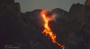
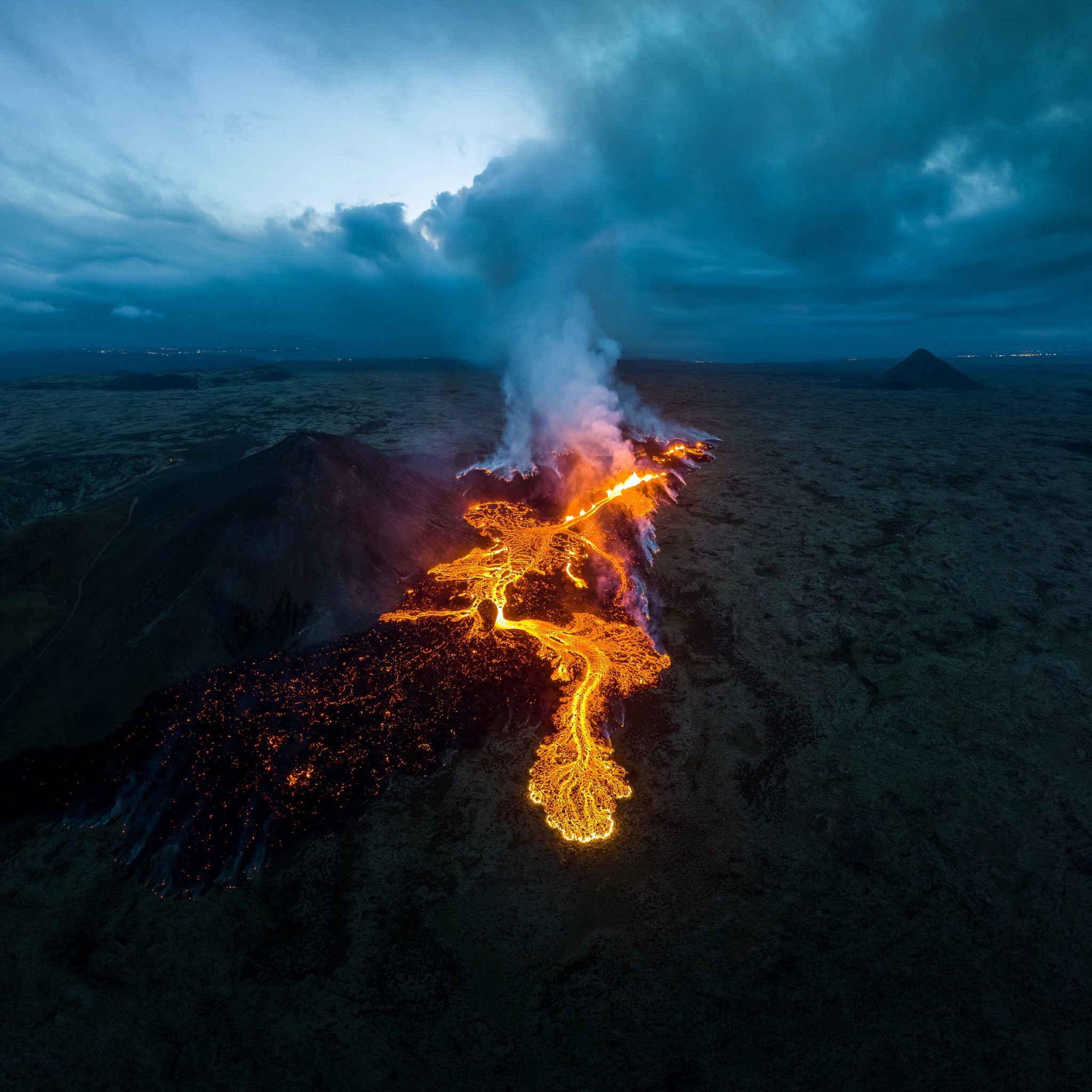
Although the uncertainty level has now been removed, Civil Defense remains at the danger level as a volcanic eruption continues northeast of Litla Hrútur. New fissures can open in the immediate vicinity of the volcano without warning, and gas pollution is high near craters and active lava flows. There is also a lot of wind in the area. The area is now closed due to smoke and gas pollution. It is important to follow the recommendations of the speakers.
Source : Iceland monitor. almannavarnir.is .
Photo : Inspired by Iceland via Sherine France.
La Réunion , Piton de la Fournaise :
Press release from the Institut de physique du globe de Paris. Volcanological Observatory of Piton de la Fournaise, July 16, 2023 – 11h00 – 07h00 UTC.
Ongoing eruption
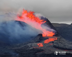
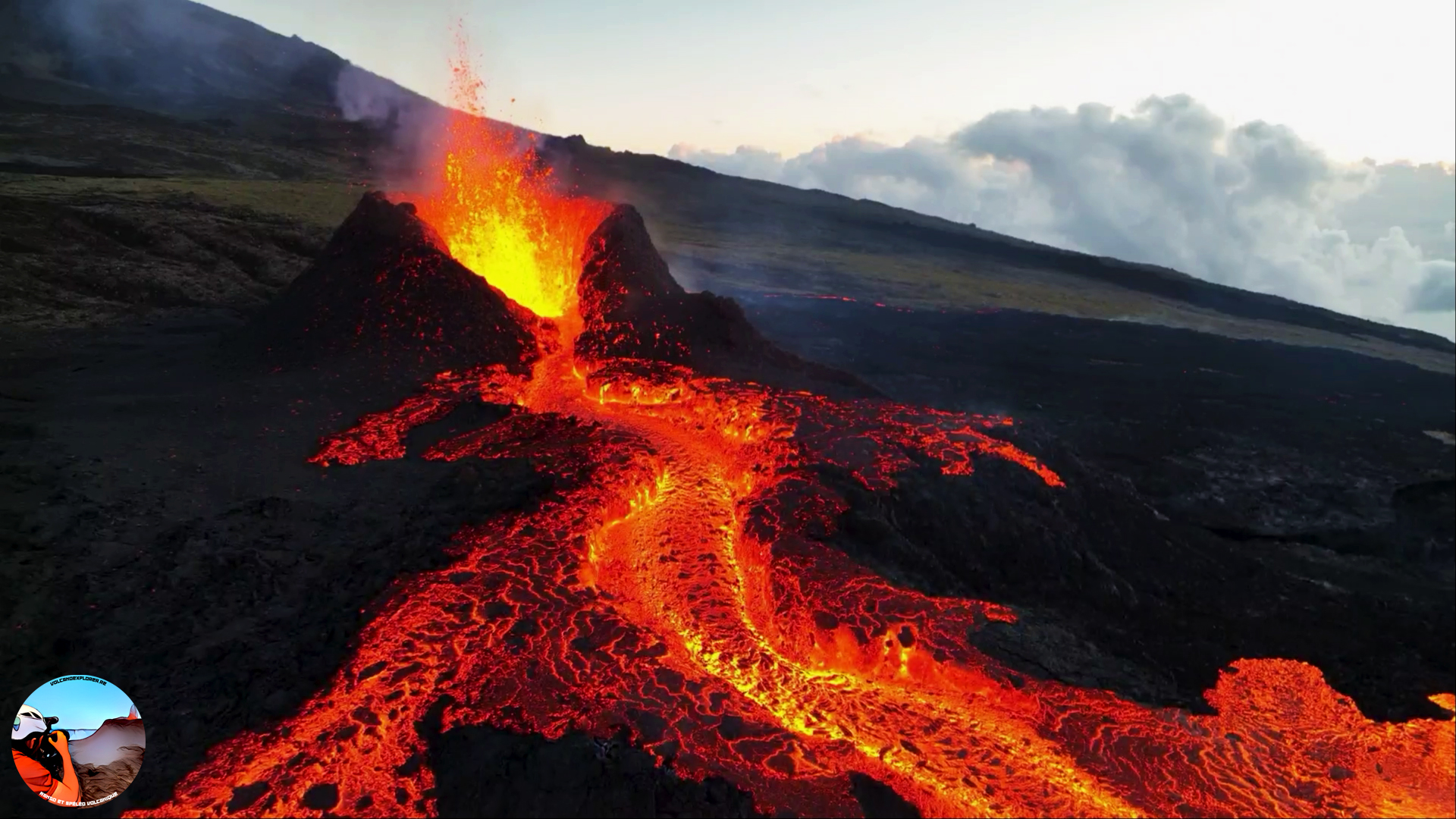
The eruption which began on July 02, 2023, around 08:30 local time continues. The amplitude of the volcanic tremor (indicator of an emission of lava and gas on the surface) is always fluctuating over time on the scale of a few tens of minutes, with continuous tremor phases and intermittent tremor phases. The amplitude of the tremor nevertheless remains low compared to the beginning of the eruption.
The fluctuations observed in the tremor are reflected at the level of the eruptive site by variations in intensity in the activity, with projections of lava fountains at the level of the more or less intense eruptive cone.
Given the persistent bad weather conditions currently on site:
– no visual feedback on the eruptive site and the lava field could be made today and tonight,
– nor any estimate of lava flows by satellite method.
A slight deflation of the summit area is still recorded.
The seismic activity recorded under the summit zone remains weak. Thus over the last 24 hours, no superficial volcano-tectonic earthquake has been recorded. This low seismic activity leads to a reduction in the risk of the appearance of a new crack and/or collapse in the crater, but does not mean that it can be excluded.
Alert level: Alert 2-1 (eruption in the Enclos without any particular threat to the safety of people, property or the environment).
Source : OVPF.
Photo : Volcanoexplorer.re Tunnels de lave Réunion/ Vincent Cheville .
Indonesia , Merapi :
Report on the activity of Mount Merapi from July 07, 2023 to July 13, 2023, Published on July 14, 2023.
RESULTS OF OBSERVATIONS
Visual
The weather around Mount Merapi is usually sunny in the morning and afternoon, while the evening is foggy. A white smoke, fine to thick, low to medium pressure and 175 m high was observed from the observation post of Mount Merapi in Badaban on July 09, 2023 at 05:30.
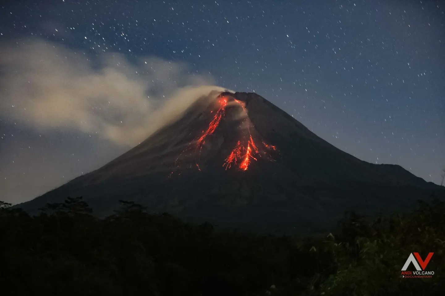
This week lava avalanches were observed 156 times towards the Southwest, including 152 times upstream of the Bebeng River up to a maximum of 2,000 m, 3 times upstream of the Boyong River up to a maximum of 800 m, and 1 time upstream of the Sat/Putih river up to 1,200 m. The sound of the avalanches was heard 29 times from Babadan post with low to moderate intensity.
The morphology of the southwest dome has undergone slight changes due to lava activity, while no significant changes have been observed for the central dome. According to an aerial photo dated June 24, 2023, the measured volume of the southwest dome is 2,465,900 m3 and that of the central dome is 2,346,500 m3.
Seismicity
This week, the seismicity of Mount Merapi showed:
13 shallow volcanic earthquakes (VTB),
44 multiphase earthquakes (MP),
3 low frequency earthquakes (LF),
911 fall earthquakes (RF)
8 times tectonic earthquakes (TT).
The intensity of seismicity this week is lower than last week, but the number of earthquakes is still quite high.
Deformation
Mount Merapi’s deformation that was monitored using EDM this week showed a shortening of the steepening distance by 2 cm/day.
Rain and lahars:
This week, it rained at the Mount Merapi observation post with a rain intensity of 24 mm/hour for 30 minutes at the Kaliurang post on July 13, 2023. There were no reports of additional flows or lahars from rivers that descend from Mount Merapi.
Conclusion
Based on the results of visual and instrumental observations, it is concluded that:
-The volcanic activity of Mount Merapi is still quite high in the form of effusive eruption activity. The state of the activity is defined at the « SIAGA » level.
The current danger potential is in the form of lava avalanches and hot clouds in the South-South-West sector comprising the Boyong River for a maximum of 5 km, the Bedog, Krasak, Bebeng rivers for a maximum of of 7 km. In the South-East sector, it includes the Woro River for a maximum of 3 km and the Gendol River for 5 km. While the ejection of volcanic material in the event of an explosive eruption can reach a radius of 3 km from the summit.
Source : BPPTKG
Photo : Andi Volcanist.
Peru , Ubinas :
Analysis period: July 05-10, 2023 Arequipa, July 11, 2023.
Alert level: ORANGE
The Geophysical Institute of Peru (IGP) reports that the geophysical processes that allow to know the dynamic behavior of the Ubinas volcano (Moquegua region) are maintained at a low to moderate level, characterized by a decrease in explosive activity and emissions. of ash For this, it is suggested that the authorities maintain the volcanic alert level at the Orange level.
During the analysis period, the occurrence of 67 volcano-tectonic (VT) type earthquakes was detected, associated with rock breaking processes that occur inside the volcano. In addition, 47 long-period (LP) type seismic signals were recorded, associated with the movements of volcanic fluids (gas and magma). On July 6, 2 seismic signals associated with major explosive events were recorded. Finally between 08 and 1 July it was noted the absence of explosive activity and ash emissions.
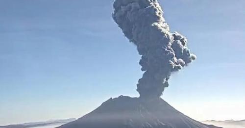
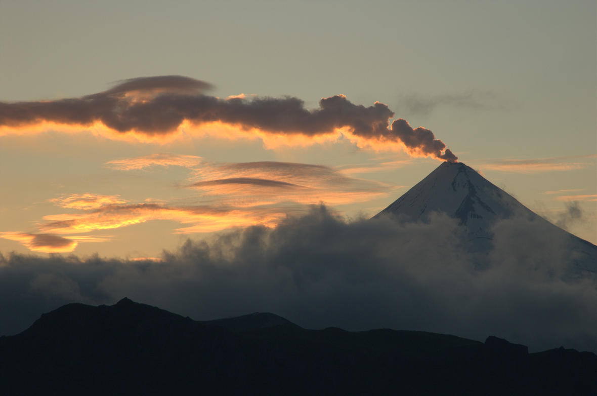
The monitoring of the deformation of the volcanic structure, show variations of less than 5 mm of displacement (within the margin of error of the instruments). Satellite monitoring shows 1 thermal anomalies in the Ubinas crater with a maximum value of 5 MW. Surveillance cameras identified volcanic explosions and columns of gas and ash that reached heights of 3500 m above the summit of the volcano, which were dispersed mainly to the South, South-East, North-East, North-West and East, of the Ubinas volcano with a radius of 30 km (districts of Ubinas, Matalaque, Lloque, Chojata and Yunga).
Date: July 16, 2023
Observations:
Satellite images and those obtained by scientific cameras installed around the volcano show that the ashes ejected by the Ubinas volcano dispersed towards the eastern, southeastern and southwestern sectors of the volcano, where the districts of Ubinas, Lloque, Chojata, San Juan de Tarucani and their respective populated centers.
RECOMMENDATIONS
• Maintain the Volcanic Alert Level to ORANGE.
Source : Cenvul
Photo : Gestion PE.