July 29 , 2023.
La Réunion , Piton de la Fournaise :
Press release from the Paris Institute of Earth Physics, Piton de la Fournaise Volcanological Observatory, July 28, 2023 – 12:00 – 08:00 UTC
Ongoing eruption
The eruption which began on July 02, 2023, around 08:30 local time continues. The amplitude of the volcanic tremor (indicator of an emission of lava and gas on the surface) remains very low compared to the start of the eruption and still shows fluctuations.
Between 11:50 p.m. and 12:15 a.m. local time, a piston gas phase was recorded, resulting in renewed activity at the lava field.
Over the past 24 hours, the flows – estimated by satellite method on the HOTVOLC platform (OPGC – Clermont Auvergne University) – were always < or = 4 m3/sec. Given the cloud mass present regularly on the eruptive site as well as the presence of lava tunnels, these flows may be underestimated.
With the low surface activity, the morphology of the active volcanic cone – located southeast of the Enclos Fouqué at 1720 m altitude – hardly changes, even if its summit tends to close. Lava projections are rare and the flow of lava takes place mainly in lava tunnels. This morning during a field mission by an OVPF-IPGP team carried out with the assistance of SAG and PGHM, no resurgence of flow from the lava tunnels was visible near the eruptive cone. The resurgence points – and therefore the visible flows – are currently located at lower altitudes at distances between 1200 and 2000 m from the eruptive cone, i.e. down to a minimum altitude of 1000-1100 m.
The flow front has not changed since July 5 and is now frozen. It is 1.8 km from the road.
A weak inflation of the summit zone is always recorded since mid-July, indicating a re-pressurization of the feeding system of the volcano centered under the summit zone, with possibly the transfer of deep magma towards the latter, then coming to feed the eruption.
The field mission to the eruptive site carried out today enabled a team from the OVPF-IPGP to carry out a sampling of eruptive products emitted at the level of the active cone. The analysis of the samples collected this morning will make it possible to know the nature of the lavas which are currently emerging at the level of the eruptive vent and to compare them with the lavas sampled at the start of the eruption, to determine if a deeper magma is currently in going out.
The seismic activity recorded under the summit zone remains weak. Thus over the last 24 hours, two superficial volcano-tectonic earthquakes have been recorded. This low seismic activity leads to a reduction in the risk of the appearance of a new crack and/or collapse in the crater, but does not mean that it can be excluded, as shown by the continuation of the summit inflation and the fluctuations in the amplitude of the tremor which are regularly observed.
Alert level: Alert 2-1 (eruption in the Enclos without any particular threat to the safety of people, property or the environment).
Source et photos : OVPF
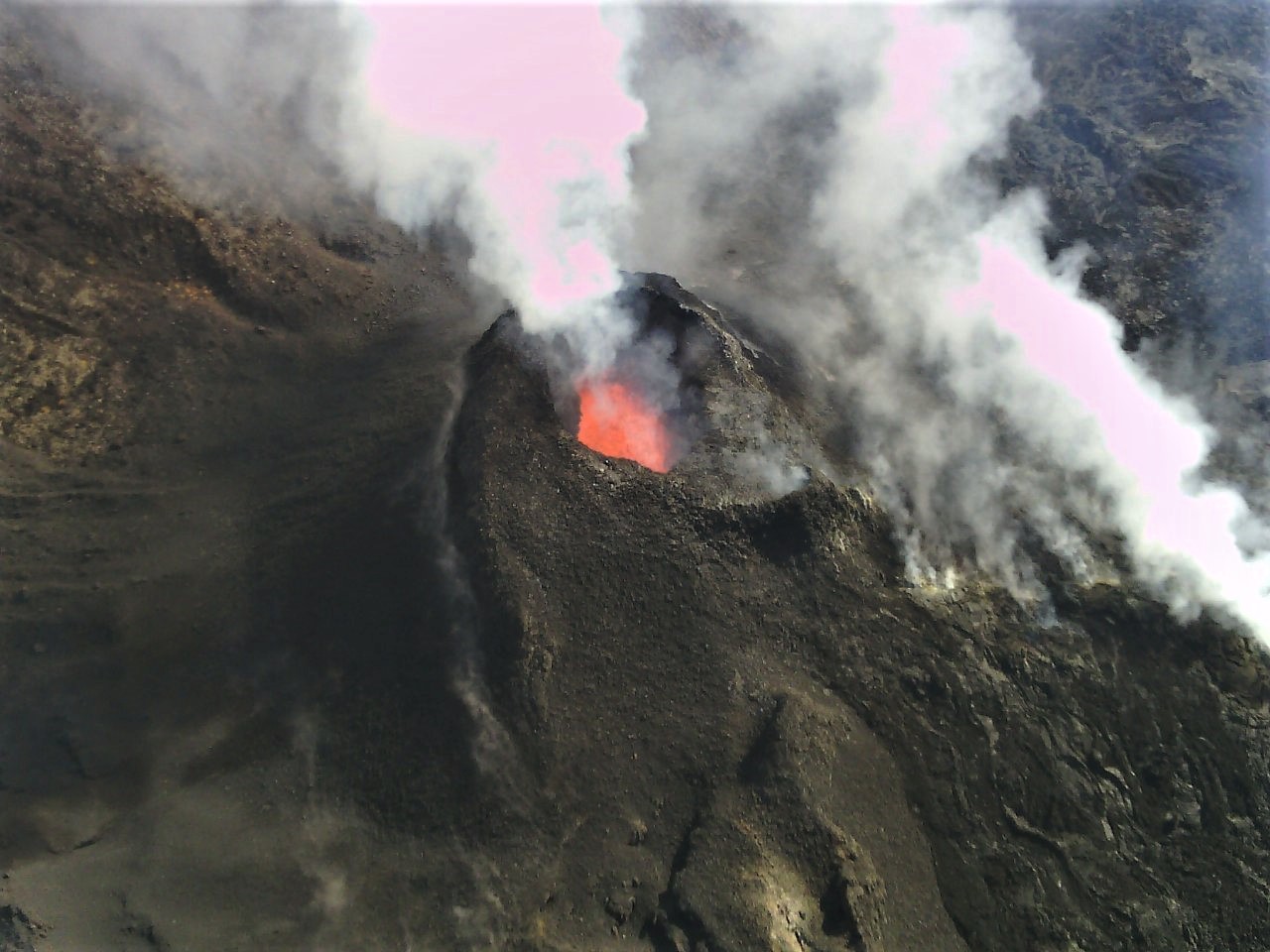
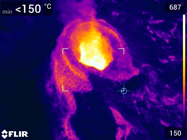
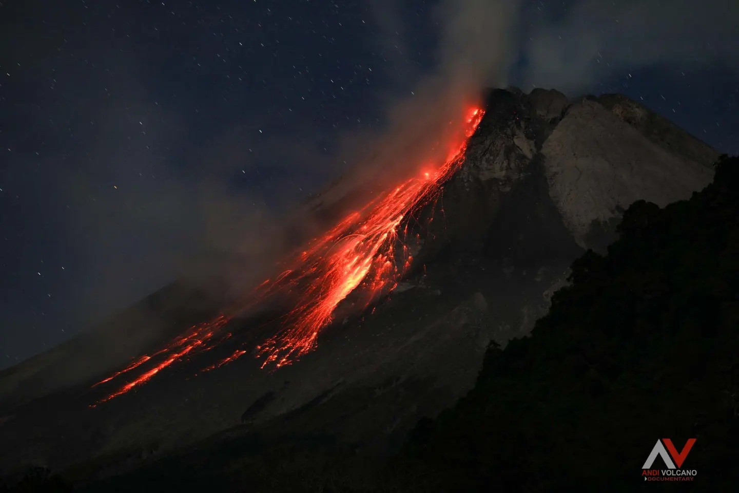
Indonesia , Merapi :
Report on the activity of Mount Merapi from July 14, 2023 to July 20, 2023, Published on July 22, 2023.
RESULTS OF OBSERVATIONS
Visual
The weather around Mount Merapi is usually sunny in the morning and afternoon, while the evening is foggy. White, fine to thick, low to medium pressure, 350 m high white smoke was observed from the Mount Merapi de Selo observation post on July 27, 2023 at 09:10.
This week lava avalanches were observed 254 times towards the South-West, including 2 times upstream of Kali Sat/Putih up to 1,500 m, 30 times upstream of Kali Boyong up to 1,800 m maximum and 222 times at upstream of Kali Bebeng up to 2,000 m. The sound of the avalanches was heard 31 times from Babadan post with low to moderate intensity.
The morphology of the southwest dome has undergone slight changes due to lava activity, while no significant changes have been observed for the central dome. According to an aerial photo dated June 24, 2023, the measured volume of the southwest dome is 2,465,900 m3 and that of the central dome is 2,346,500 m3.
Seismicity
This week, the seismicity of Mount Merapi showed:
4 shallow volcanic earthquakes (VTB),
51 multiphase earthquakes (MP),
1 low frequency (LF) earthquakes,
907 avalanche earthquakes (RF)
16 times tectonic earthquakes (TT).
The intensity of seismicity this week is lower than last week, but the number of earthquakes is still quite high.
Deformation
Mount Merapi’s deformation that was monitored using EDM this week showed a shortening of the steepening distance by 2 cm/day.
Rain and lahars:
This week, there was no rain at the Mount Merapi observation post. There have been no reports of additional flows or lahars from rivers descending from Mount Merapi.
Conclusion
Based on the results of visual and instrumental observations, it is concluded that:
-The volcanic activity of Mount Merapi is still quite high in the form of effusive eruption activity. The state of the activity is defined at the « SIAGA » level.
The current danger potential is in the form of lava avalanches and hot clouds in the South-South-West sector comprising the Boyong River for a maximum of 5 km, the Bedog, Krasak, Bebeng rivers for a maximum of of 7 km. In the South-East sector, it includes the Woro River for a maximum of 3 km and the Gendol River for 5 km. While the ejection of volcanic material in the event of an explosive eruption can reach a radius of 3 km from the summit.
Source : BPPTKG
Photo : Andi volcanist
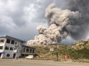
Iceland , Litli Hrútur :
Loud explosion noises at the eruption site . The reason for the loud noise are methane exposions.
Loud bangs are heard regularly at the eruption site at Litli-Hrútur. The reason for the bangs is methane explosions.
It shows that when lava flows over a vegetated area, methane gas can form when vegetation is not completely burned. The gas then builds up in the gaps and voids in the lava flow.
“It mixes with oxygen and when it is bombarded with a burning ember or flame from the volcanic eruption, an explosion occurs.”
The Icelandic Met Office says there are reasons to avoid this hazard and not to get too close to the edge of the lava.
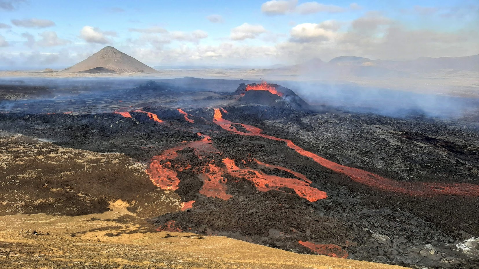
The Litli-Hrútur volcanic eruption is ongoing and Monday’s gas measurements indicate that 40-72 kg of SO2 are being released into the atmosphere every second, which is similar to previous measurements. The weather forecast predicts northerly winds, 5-10 m/s by the eruption site today, so the pollution is moving south. Variable light winds will be in the area tonight and tomorrow, so there is a chance of pollution buildup around the volcano.
Source : Icelandmonitor.mbl.is , Veðurstofa Íslands .
Photo : Sigridur Kristjánsdóttir.
Colombia , Purace – Los Coconucos Volcanic Range :
Weekly bulletin of activity of the Puracé volcano – Volcanic chain of Los Coconucos.
From the monitoring of the activity of the PURACÉ VOLCANO – VOLCANIC CHAIN OF LOS COCONUCOS, the MINISTRY OF MINES AND ENERGY through the COLOMBIAN GEOLOGICAL SERVICE (SGC) reports that:
During the week of July 18 to 24, 2023, seismic activity showed a similar trend to that observed in previous weeks, both in energy released and in number of
recorded events, maintaining the predominance of seismic events related to the movement of fluids in the volcanic conduits, which were located mainly under the crater of the Puracé volcano. This activity was accompanied by localized deformations in the upper part of the volcanic chain.
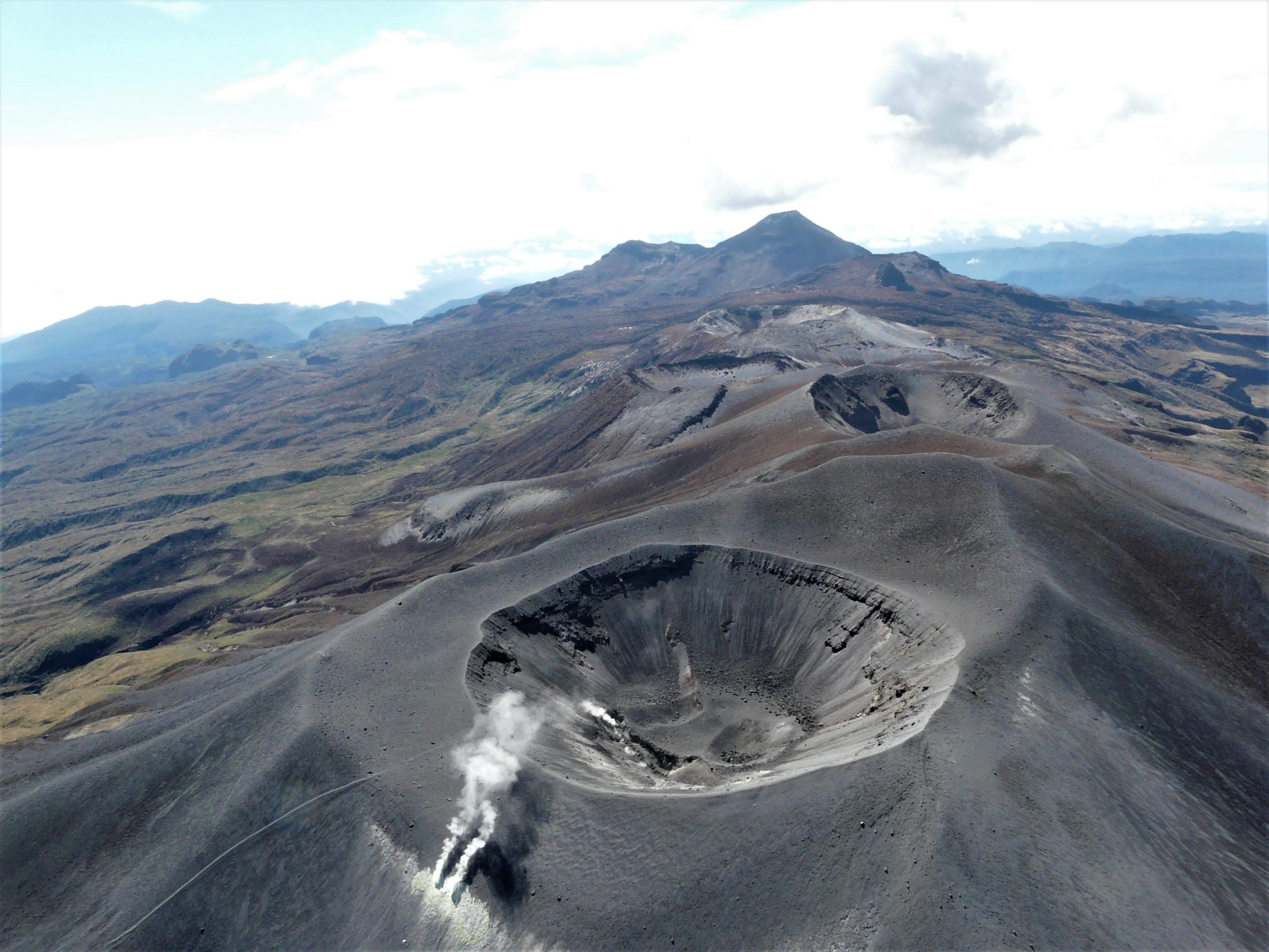
Similarly, stable values continued to be evidenced in sulfur dioxide (SO2) fluxes. On the other hand, the concentration of carbon dioxide (CO2) is currently showing high values compared to what was recorded in the second half of 2022.
The other parameters measured and used for the diagnosis of volcanic activity did not show significant changes during the period evaluated.
The activity level of the volcano remains at YELLOW LEVEL (III): CHANGES IN THE BEHAVIOR OF VOLCANIC ACTIVITY
Source et photo : SGC
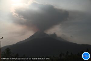
Kamchatka , Sheveluch :
VOLCANO OBSERVATORY NOTICE FOR AVIATION (VONA)
Issued: July 28 , 2023.
Volcano: Sheveluch (CAVW #300270)
Current aviation colour code: ORANGE
Previous aviation colour code: red
Source: KVERT
Notice Number: 2023-88
Volcano Location: N 56 deg 38 min E 161 deg 18 min
Area: Kamchatka, Russia
Summit Elevation: 3283 m (10768.24 ft), the dome elevation ~2500 m (8200 ft)
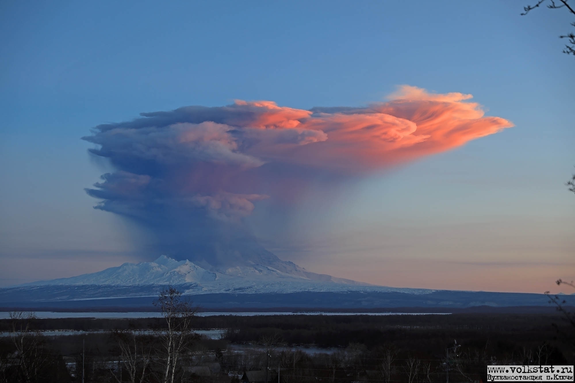
Volcanic Activity Summary:
An extrusive-effusive eruption of the volcano continues. Satellite data by KVERT showed ash plume is extending on the height of 5.5-5.7 km a.s.l. to the east-northeast of the volcano.
An extrusive-effusive eruption of the volcano continues. A danger of ash explosions up to 10 km (32,800 ft) a.s.l. is remains. Ongoing activity could affect international and low-flying aircraft.
Volcanic cloud height:
5500-5700 m (18040-18696 ft) AMSL Time and method of ash plume/cloud height determination: 20230728/0510Z – Himawari-9 14m15
Other volcanic cloud information:
Distance of ash plume/cloud of the volcano: 82 km (51 mi)
Direction of drift of ash plume/cloud of the volcano: ENE / azimuth 78 deg
Time and method of ash plume/cloud determination: 20230728/0510Z – Himawari-9 14m15
Source : Kvert.
Photo : Yu Demyanchuck / Volkstat ru.