July 23 , 2023.
Indonesia , Merapi :
Report on the activity of Mount Merapi from July 14, 2023 to July 20, 2023, Published on July 22, 2023.
RESULTS OF OBSERVATIONS
Visual
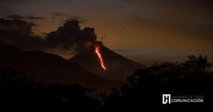
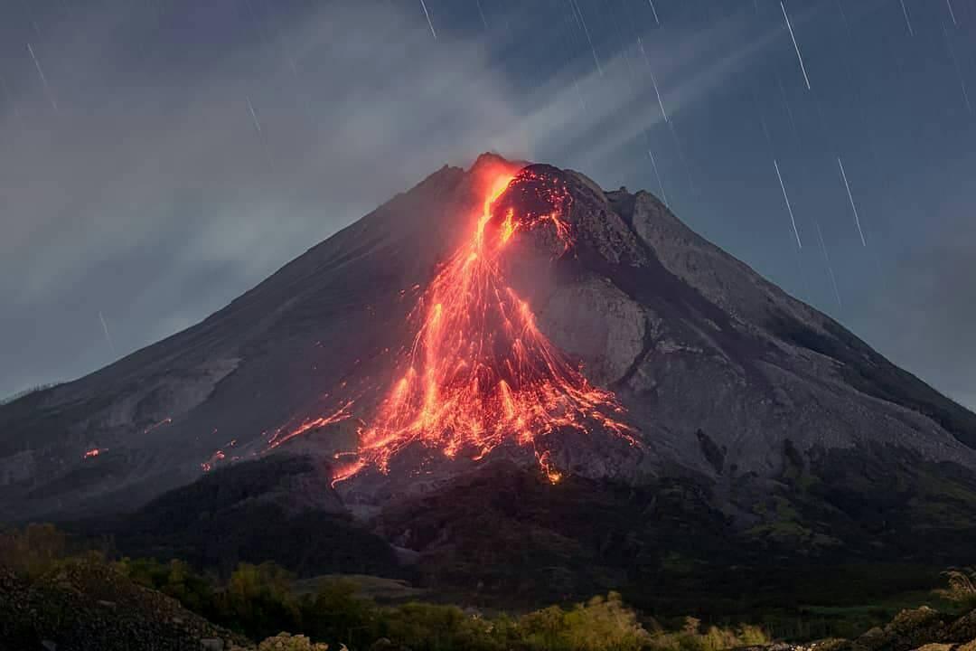
The weather around Mount Merapi is usually sunny in the morning and afternoon, while the evening is foggy. White, fine to thick smoke, low to medium pressure and 1000 m high was observed from the Mount Merapi observation post in Badaban on July 20, 2023 at 06:24.
This week lava avalanches were observed 281 times from west to south, including 1 time upstream of the Sat/Putih river up to 1000 m, 2 times upstream of the Senowo river up to a maximum of 500 m, 8 times upstream of the Boyong river up to a maximum of 2000 m and 270 times upstream of the Bebeng river up to 1800 m. The sound of the avalanches was heard 34 times from Babadan post with low to moderate intensity.
The morphology of the southwest dome has undergone slight changes due to lava activity, while no significant changes have been observed for the central dome. According to an aerial photo dated June 24, 2023, the measured volume of the southwest dome is 2,465,900 m3 and that of the central dome is 2,346,500 m3.
Seismicity
This week, the seismicity of Mount Merapi showed:
24 shallow volcanic earthquakes (VTB),
64 multiphase earthquakes (MP),
2 low frequency earthquakes (LF),
984 fall earthquakes (RF)
9 times tectonic earthquakes (TT).
The intensity of seismicity this week is lower than last week, but the number of earthquakes is still quite high.
Deformation
Mount Merapi’s deformation that was monitored using EDM this week showed a shortening of the steepening distance by 3 cm/day.
Rain and lahars:
This week, there was no rain at the Mount Merapi observation post. There have been no reports of additional flows or lahars from rivers descending from Mount Merapi.
Conclusion
Based on the results of visual and instrumental observations, it is concluded that:
-The volcanic activity of Mount Merapi is still quite high in the form of effusive eruption activity. The state of the activity is defined at the « SIAGA » level.
The current danger potential is in the form of lava avalanches and hot clouds in the South-South-West sector including the Boyong River for a maximum of 5 km, the Bedog, Krasak, Bebeng rivers for a maximum of 7 km. In the South-East sector, it includes the Woro River for a maximum of 3 km and the Gendol River for 5 km. While the ejection of volcanic material in the event of an explosive eruption can reach a radius of 3 km from the summit.
Source : BPPTKG
Photo : @ilhamm_ska
La réunion , Piton de la Fournaise :
Press release from the Institute of Earth Physics in Paris, Volcanological Observatory of Piton de la Fournaise. July 20, 2023 – 09:30 – 05:30 UTC.
Ongoing eruption
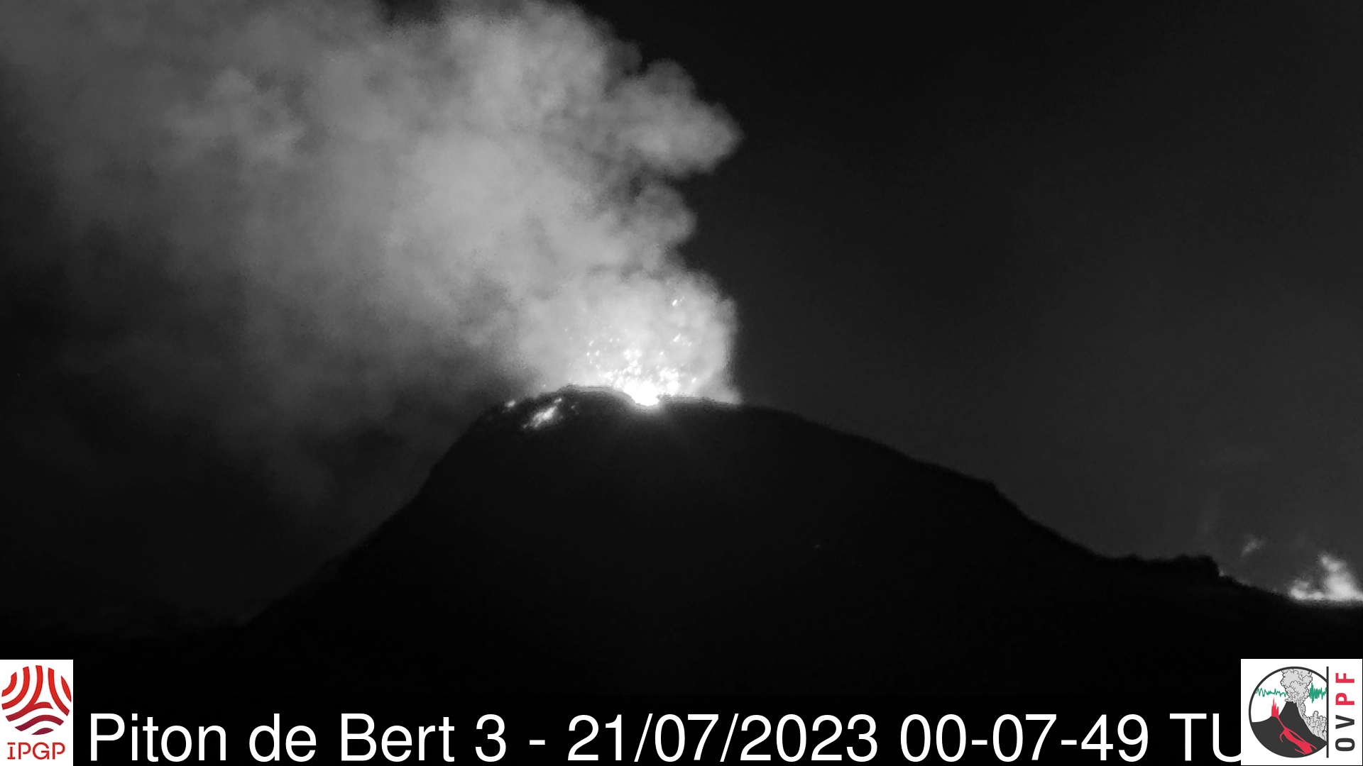
The eruption which began on 02/07/2023, around 08:30 local time continues. The amplitude of the volcanic tremor (indicator of an emission of lava and gas on the surface) is always fluctuating over time on the scale of a few tens of minutes, with phases of continuous tremor and phases of intermittent tremor. The amplitude of the tremor nevertheless remains low compared to the start of the eruption.
The fluctuations observed in the tremor are reflected at the level of the eruptive site by variations in intensity in the activity, with projections of lava fountains at the level of the more or less intense eruptive cone.
Thanks to milder weather conditions on the volcano yesterday afternoon, lava flow estimates were calculated by satellite method on the HOTVOLC platform (OPGC – Clermont Auvergne University) and MIROVA (University of Turin). During the last 24 hours the flows were between <1 and 4 m3/sec, with an average of 3.7 m3/sec. Given the cloud mass present regularly on the eruptive site as well as the presence of lava tunnels, these flows may be underestimated.
Since the beginning of the eruption, the total volume of lava emitted on the surface is of the order of 8.5 (± 3) Mm3.
With the low surface activity, the morphology of the active volcanic cone – located southeast of the Enclos Fouqué at 1720 m altitude – hardly changes and the flow of the lava takes place mainly in lava tunnels, even if flows are still visible at resurgence points. On the VIIRS image (375 m resolution), acquired on July 21, 2023 at 9:48 UTC (1:48 p.m. local time), the thermal anomaly extended about 2 km from the vent and the active front was located at an altitude between about 1300-1500 m.
The flow front has not changed since July 5 and is now frozen. It is still 1.8 km from the road.
Low inflation of the summit area is still recorded, indicating a re-pressurization of the volcano’s feeder system with possible transfer of deep magma to the latter.
The seismic activity recorded under the summit zone remains weak. Thus over the last 24 hours, no superficial volcano-tectonic earthquake has been recorded. This low seismic activity leads to a reduction in the risk of the appearance of a new crack and/or collapse in the crater, but does not mean that it can be excluded.
Alert level: Alert 2-1 (eruption in the Enclos without any particular threat to the safety of people, property or the environment).
Source et photo : OVPF.
Russia / Kuril Islands , Ebeko :
VOLCANO OBSERVATORY NOTICE FOR AVIATION (VONA)
Issued: July 22 , 2023
Volcano: Ebeko (CAVW #290380)
Current aviation colour code: ORANGE
Previous aviation colour code: orange
Source: KVERT
Notice Number: 2023-86
Volcano Location: N 50 deg 41 min E 156 deg 0 min
Area: Northern Kuriles, Russia
Summit Elevation: 1156 m (3791.68 ft)
Volcanic Activity Summary:
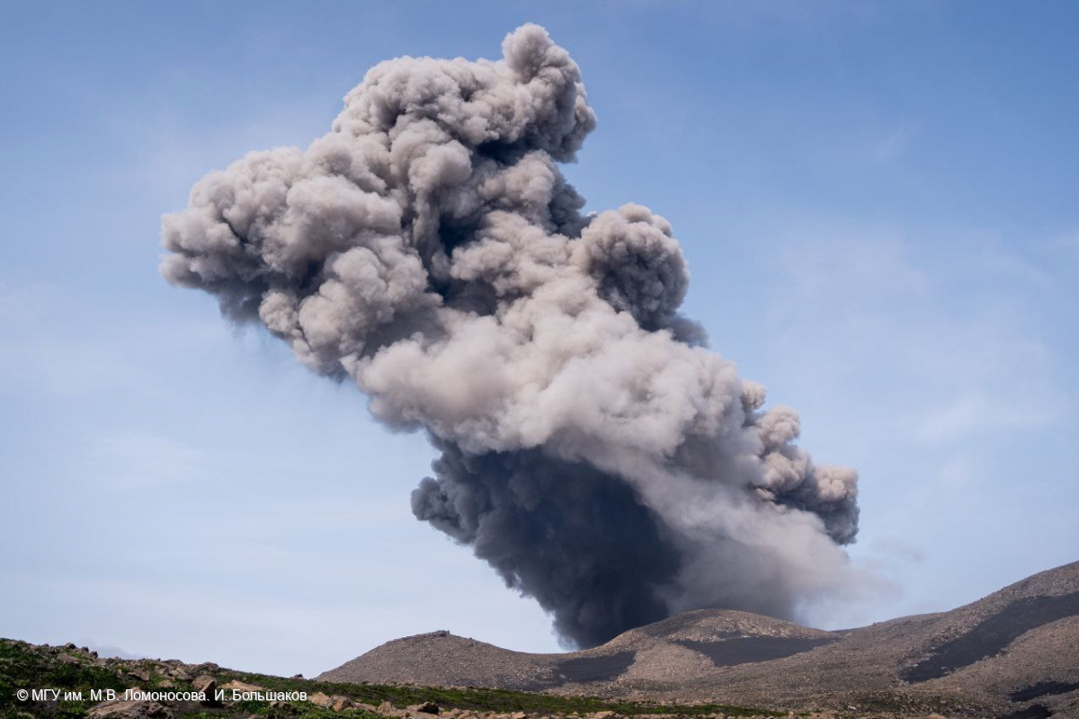
A moderate explosive activity of the volcano continues. According to visual data from Severo-Kurilsk, explosions sent ash up to 4.5 km a.s.l., an ash cloud is drifting to the east of the volcano.
A moderate eruptive activity of the volcano continues. Ash explosions up to 6 km (19,700 ft) a.s.l. could occur at any time. Ongoing activity could affect low-flying aircraft and airport of Severo-Kurilsk.
Volcanic cloud height:
4500 m (14760 ft) AMSL Time and method of ash plume/cloud height determination: 20230722/0630Z – Visual data
Other volcanic cloud information:
Distance of ash plume/cloud of the volcano: 3 km (2 mi)
Direction of drift of ash plume/cloud of the volcano: E
Time and method of ash plume/cloud determination: 20230722/0630Z – Visual data
Source : Kvert
Photo : I. Bolshakov. M.V. Lomonosov MGU.
Peru , Ubinas :
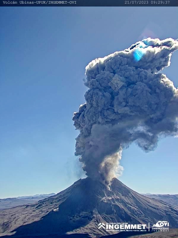
UBINAS (PROVINCE OF GENERAL SÁNCHEZ CERRO) – IN AN ERUPTIVE PROCESS.
Eruptive process with low to moderate levels.
During the last 24 hours, 2 explosions have been recorded (00:56 and 09:22), in addition to ash and gas emissions, which reached a maximum height of 4,500 m above the summit of the volcano.
There were 95 earthquakes with a magnitude less than M1.5, associated with rock fracturing processes inside the volcano. In addition, 124 events believed to be related to gas and magma dynamics were recorded, along with 5.4 cumulative hours of seismic signals related to ash emission.
According to the analysis of satellite images and the SENAMHI dispersion model, the dispersion of ash and fumarole emissions took place towards the South-East and South sectors, towards the communities of Ubinas, Matalaque, Chojata and populated centers, as well as farms and pasture areas.
The approximate radius of assignment after today’s emissions is less than 25 km from the crater, that is to say in the area of the districts of Ubinas and Matalaque.
No thermal anomaly related to the proximity of a magmatic body to the surface of the crater has been detected.
The monitoring of the deformation on the volcanic structure shows variations of less than 7 mm of displacement (slight tendency to inflation).
Conclusion: The Ubinas volcano has started a new eruptive process, characterized by the recording of seismic signals associated with the rise of magma and fumarolic emissions which reached a maximum height of 4500 m above the crater. The population must remain attentive to possible ash falls and follow the recommendations issued by the Civil Protection authorities.
Recommendation: Maintain the volcanic alert level in orange.
Current Volcanic Alert Level: Orange
Source : Cenvul.
Photo : Ingemmet
Alaska , Shishaldin :
AVO/USGS Volcanic Activity Notice
Current Volcano Alert Level: WATCH
Current Aviation Color Code: ORANGE
Issued: Saturday, July 22, 2023, 4:53 PM AKDT
Source: Alaska Volcano Observatory
Notice Number: 2023/A1121
Location: N 54 deg 45 min W 163 deg 58 min
Elevation: 9373 ft (2857 m)
Area: Aleutians
Volcanic Activity Summary:
The level of unrest has increased at Shishaldin Volcano over the past 6 hours. A steady increase in seismic tremor and intermittent infrasound signals consistent with small explosions are ongoing. Despite cloud cover obscuring the volcano, elevated surface temperatures consistent with lava erupting at the summit are evident in the latest satellite data. Based on previous eruption cycles, minor ash emissions are likely to occur and may increase over the next few hours. Clouds are obscuring web cameras and satellite images, and we have had no clear views of the volcano over the past day. Based on the level of unrest, we infer that any ash emissions occurring are below 20,000 ft. (6 km) above sea level and below the altitude of clouds in the region.

The last three significant ash events during the current eruption resulted in ash clouds up to 40,000 ft. (12 km) above sea level, similar to other historical eruptions. These events can occur with little warning.
Shishaldin Volcano is monitored by local seismic and infrasound sensors, web cameras, and a telemetered geodetic network. The local monitoring network has been partially impaired over the last few weeks due to telecommunications issues but seismic stations and web cameras south of the volcano were brought back online on July 19. In addition to the local monitoring network, AVO uses nearby geophysical networks, regional infrasound and lighting data, and satellite images to detect eruptions.
Recent Observations:
[Volcanic cloud height] unknown
[Other volcanic cloud information] Meteorological cloud tops 20,000–30,000 ft. (6–9 km) above sea level. Ash emissions possible below this level.
Hazard Analysis:
[Ash cloud] unknown
[Ashfall] Trace ashfall possible downwind of the volcano
[Pyroclastic flow] Possible on all flanks
[Mud flow] Possible on all flanks
Source : AVO
Photo : Nick Enloe.