February 21 , 2022.
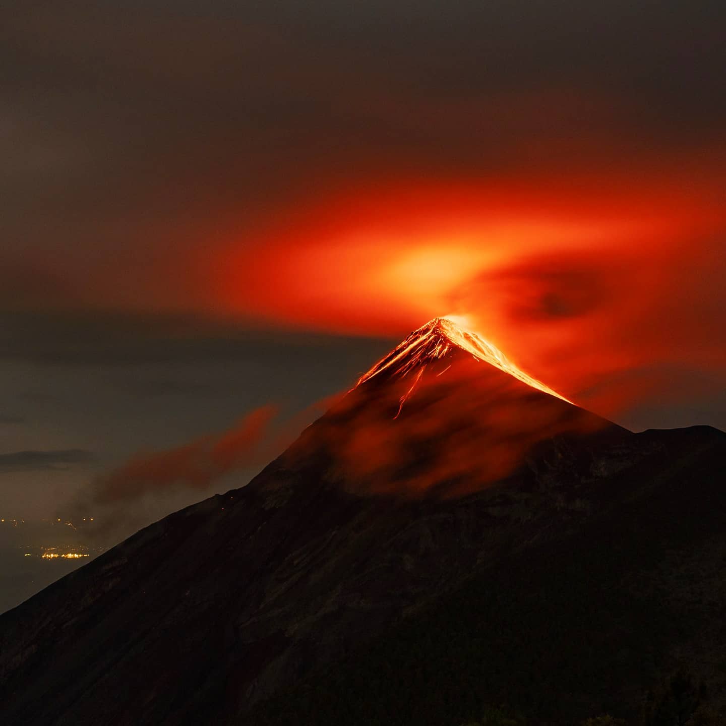
Alaska , Davidof :
51°57’15 » N 178°19’34 » E,
Summit Elevation 1076 ft (328 m)
Current Volcano Alert Level: ADVISORY
Current Aviation Color Code: YELLOW
Conditions were cloudy over the past day, obscuring satellite views. Seismicity remains elevated with a few small earthquakes detected. The earthquake swarm that began Monday, January 24, may be associated with volcanic unrest, or could be due to regional tectonic activity.
There is no real-time seismic monitoring network at Davidof volcano. The closest seismometers are approximately 9 miles (15 km) to the east of the volcano on Little Sitkin Island. Davidof is also monitored by satellite data and remote infrasound and lightning networks.
Source : AVO.
Photo : Neal, C. A.; Larsen, J. F. Alaska Volcano Observatory / U.S. Geological Survey / University of Alaska Fairbanks Geophysical Institute.
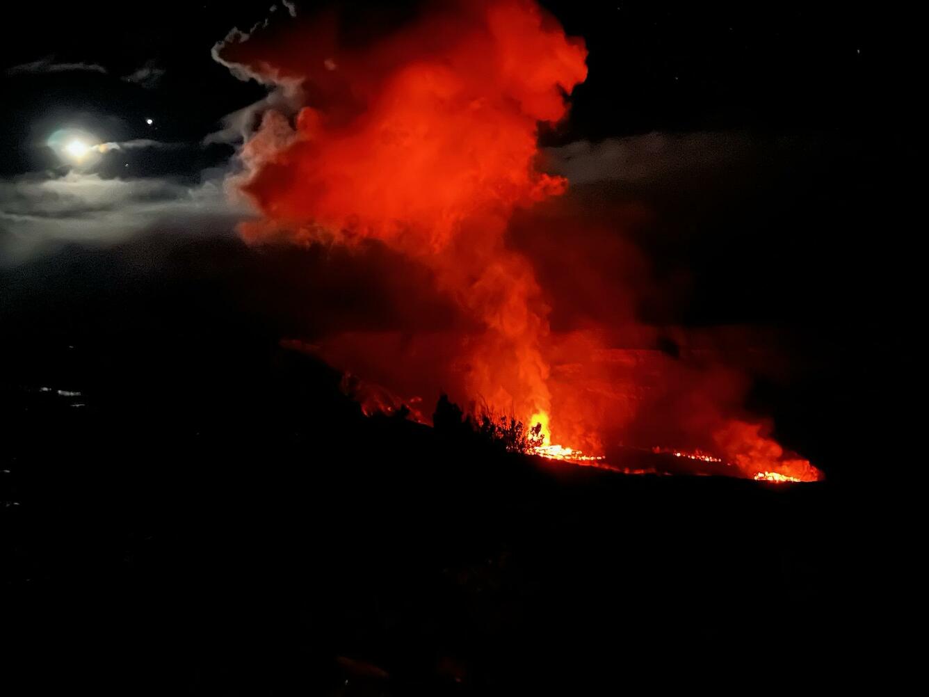
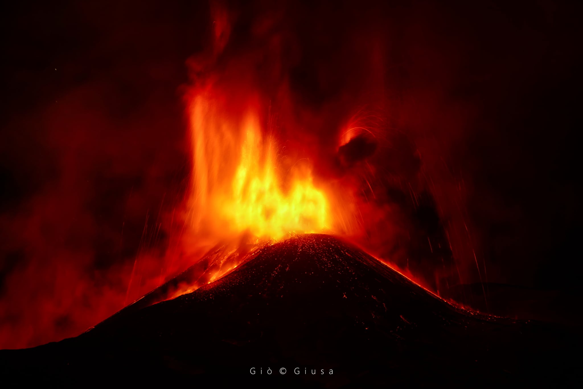
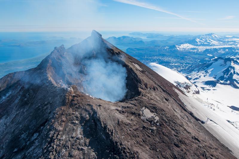
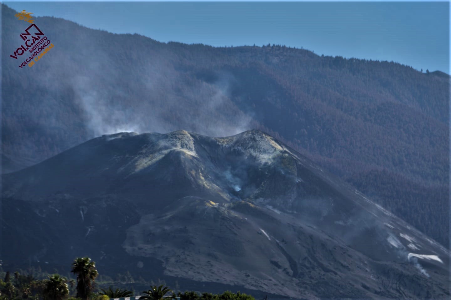
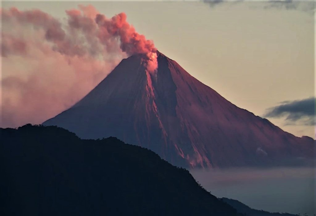
Spain / Canary Islands , Cumbre Vieja :
The post-eruptive activity continues in La Palma but decreases day by day, and is already beginning to reach levels close to those we had before, except for certain parameters such as gases.
The seismic energy released accumulated for 30 days tells us clearly, the system tends more and more to horizontality, that is to say, it deactivates, stops, and for the moment it does not there was no remarkable rebound.
These movements are due to adjustments of the magma at depth, which moves under the island to cover the void left by the eruption and slowly fills this void. This is also noticeable in small GPS variations.
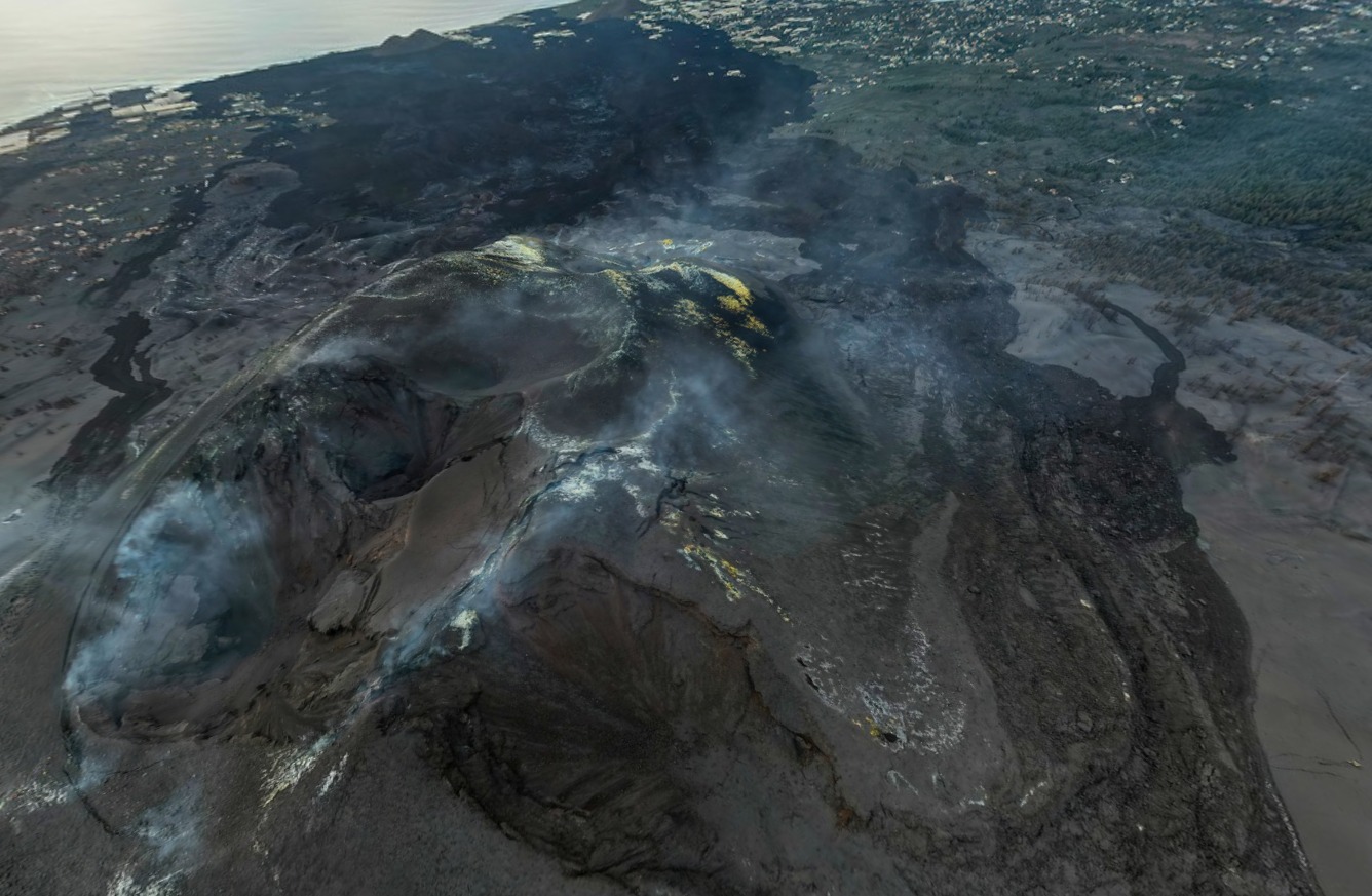
It should be noted a remarkable event with an earthquake last night in the area of Enmedio, of magnitude 3.7 at a depth of 12.9 km which was felt in the two capital islands.
This earthquake indicates to us that the regional stresses continue, with the continuation of the volcanic activity in the Canary Islands, with which we must be attentive, since it is very possible that this earthquake is followed by an activity on Tenerife, with the possibility of having swarm seismicity in the center of the island, the Arafo area or the coastal area of Guimar.
The question of volcanic risk maps on the islands is perhaps more worked on in Tenerife, but certainly not on the island of La Palma, given what happened during the last eruption. Many years ago there was an eruption in the Orotava Valley where a 4.5 km fissure formed and formed several eruptive cones and lava flows on which Puerto de la la is now located. Cruz, where tens of thousands of people live.
Source : Volcanes y Ciencia Hoy
Photo : I love the world .
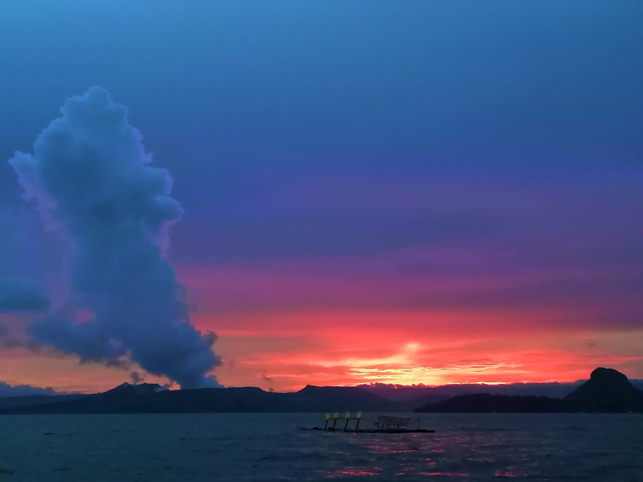
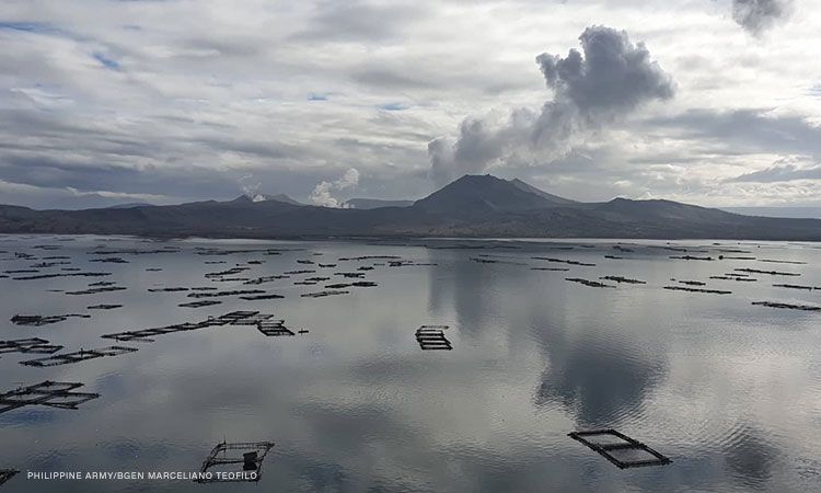
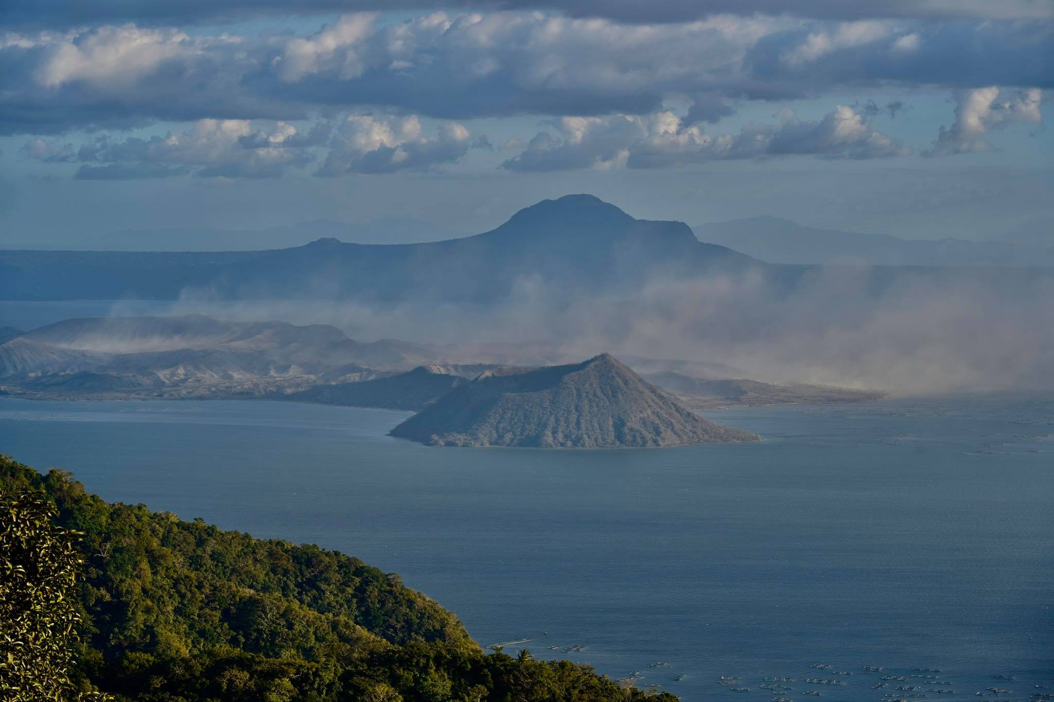
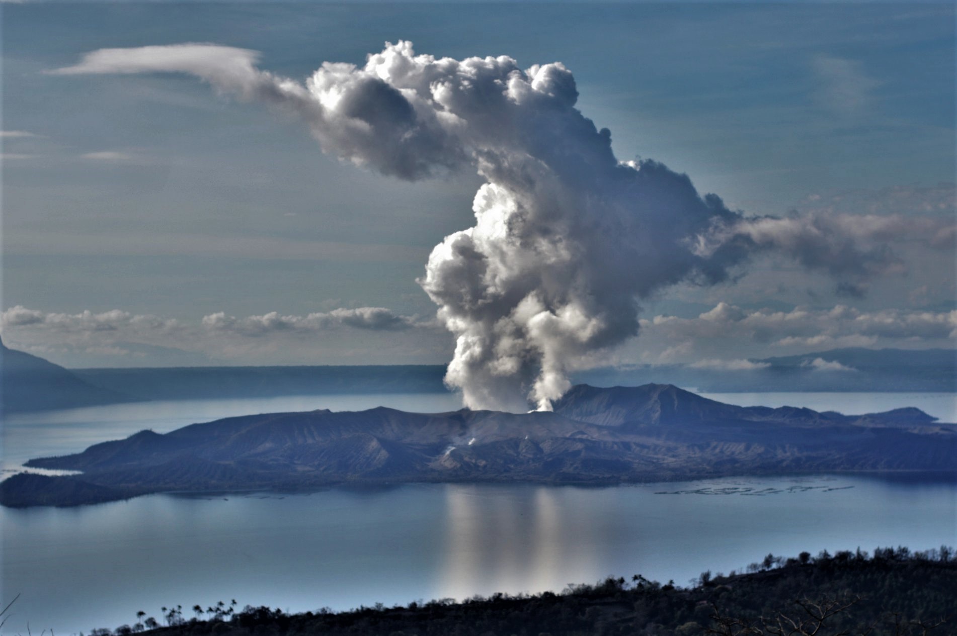
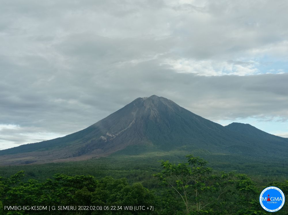
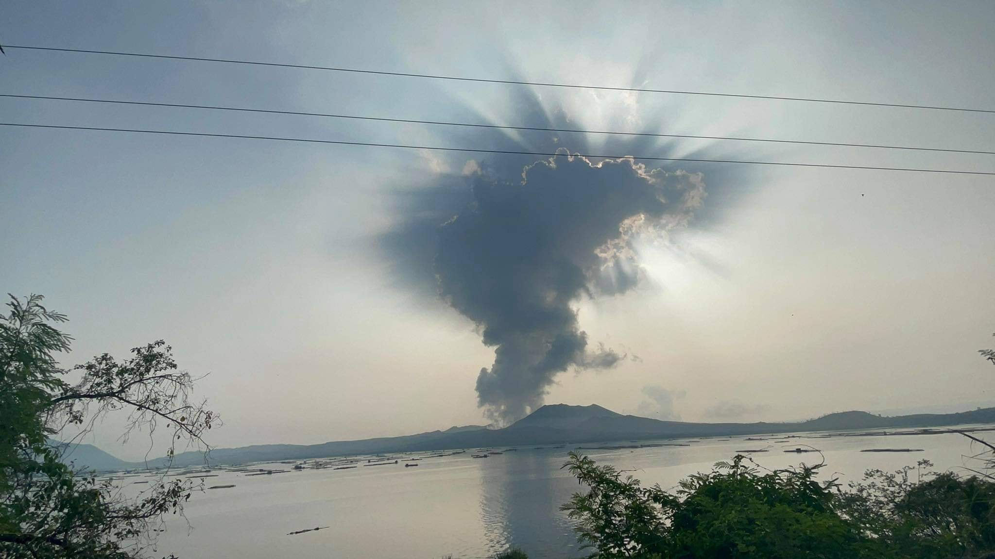
Philippines , Taal :
TAAL VOLCANO BULLETIN 21 February 2022 8:00 AM
In the past 24-hour period, the Taal Volcano Network recorded ninety-two (92) volcanic earthquakes, including eighty-six (86) volcanic tremor events having durations of two (2) to twelve (12) minutes, and four (4) low-frequency volcanic earthquakes. Activity at the Main Crater was dominated by upwelling of hot volcanic fluids in its lake which generated plumes 600 meters tall that drifted southwest. Sulfur dioxide (SO2) emission averaged 6,366 tonnes/day on 18 February 2022. Based on ground deformation parameters from electronic tilt, continuous GPS and InSAR monitoring, Taal Volcano Island and the Taal region has begun deflating in October 2021.
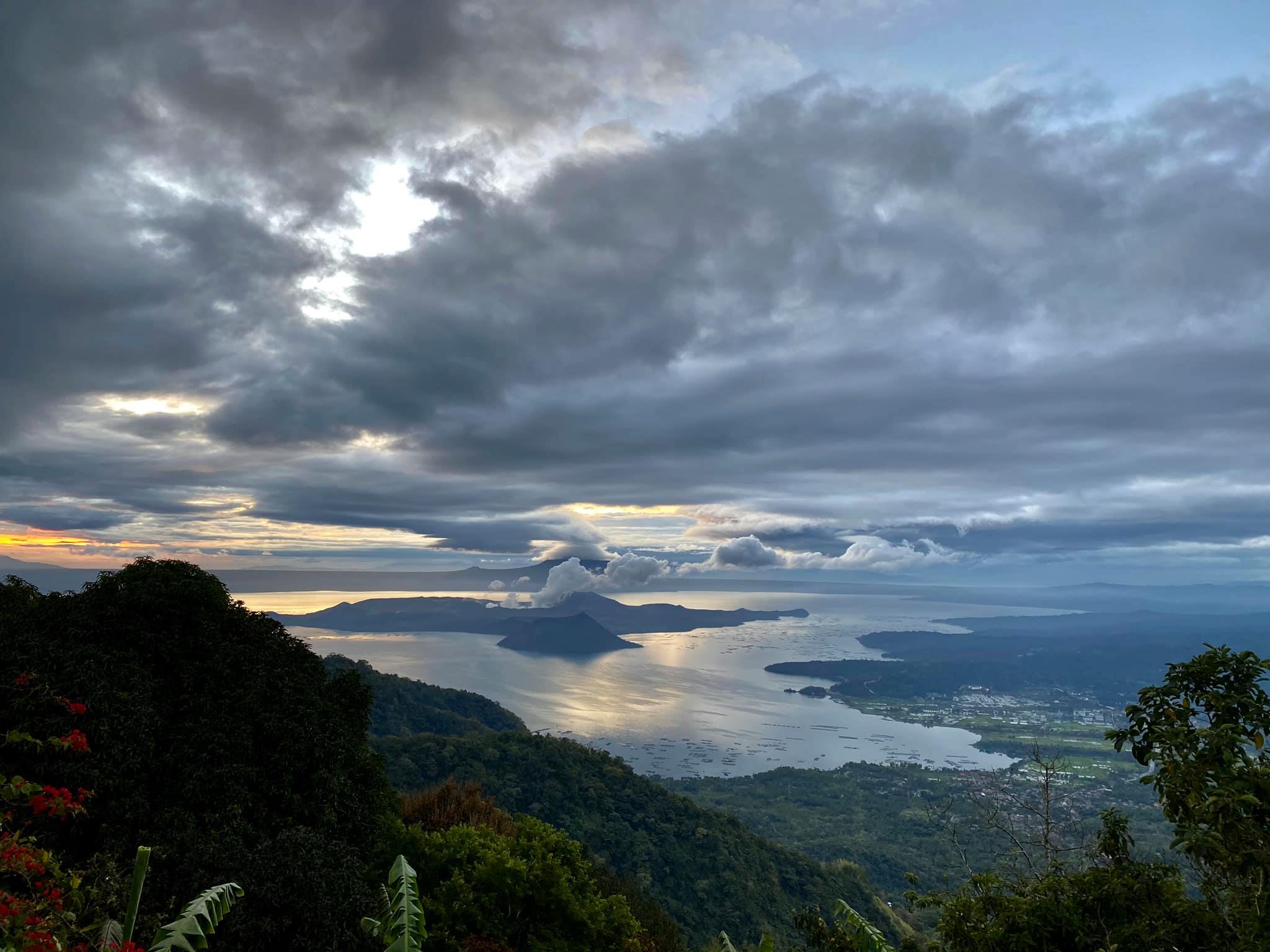
Alert Level 2 (Increased Unrest) prevails over Taal Volcano. DOST-PHIVOLCS reminds the public that at Alert Level 2, sudden steam- or gas-driven explosions, volcanic earthquakes, minor ashfall, and lethal accumulations or expulsions of volcanic gas can occur and threaten areas within and around TVI. DOST-PHIVOLCS strongly recommends that entry into Taal Volcano Island, Taal’s Permanent Danger Zone or PDZ must be strictly prohibited, especially the vicinities of the Main Crater and the Daang Kastila fissure, and extended stays on Taal Lake.
Source : Phivolcs.
Photo : Raffy Tima .
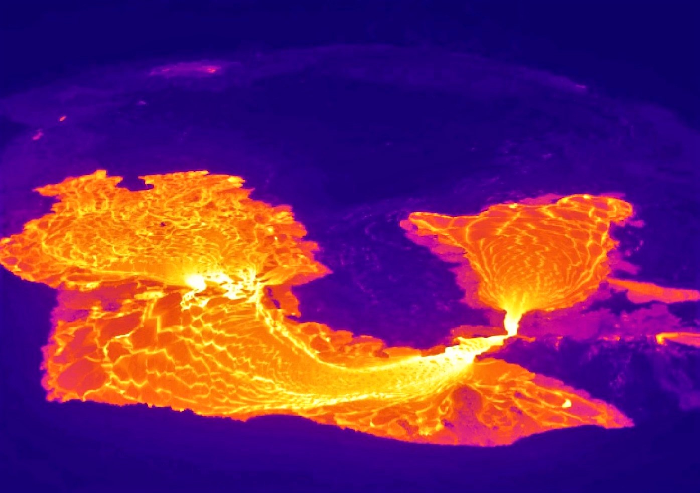
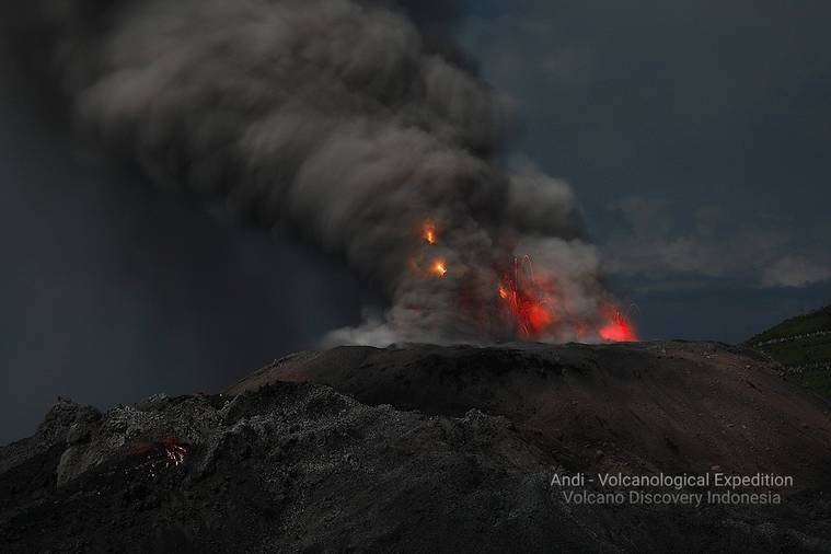
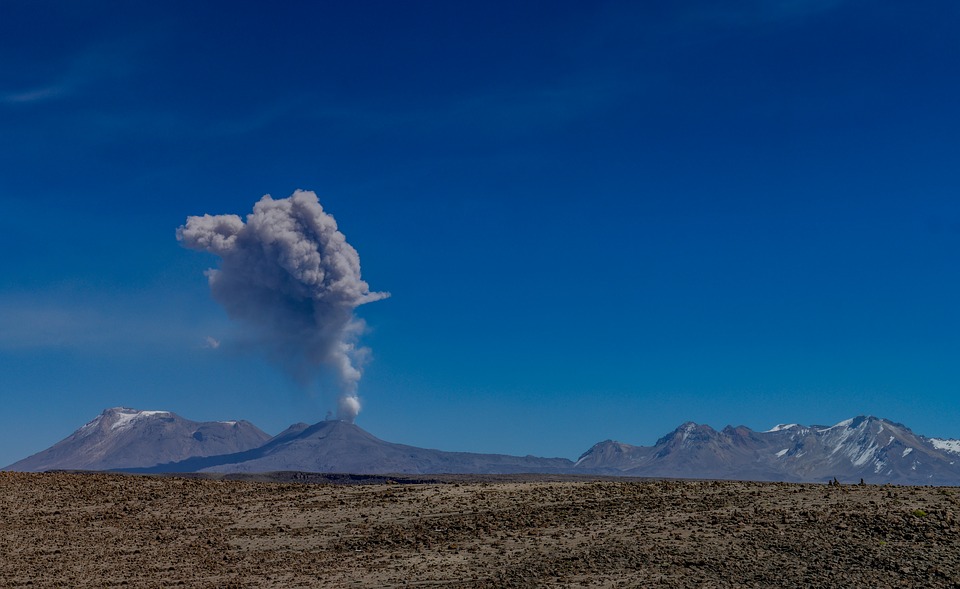
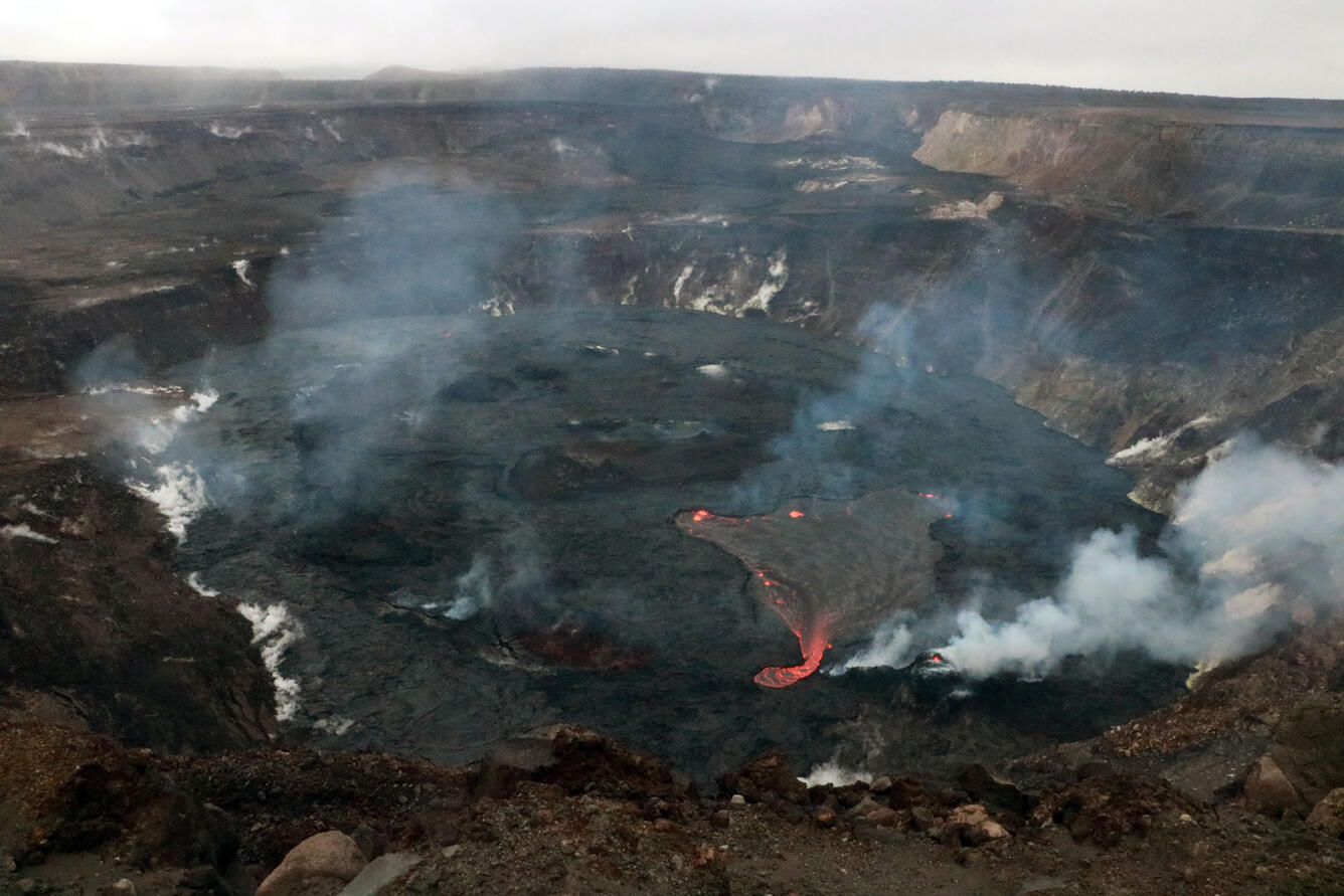
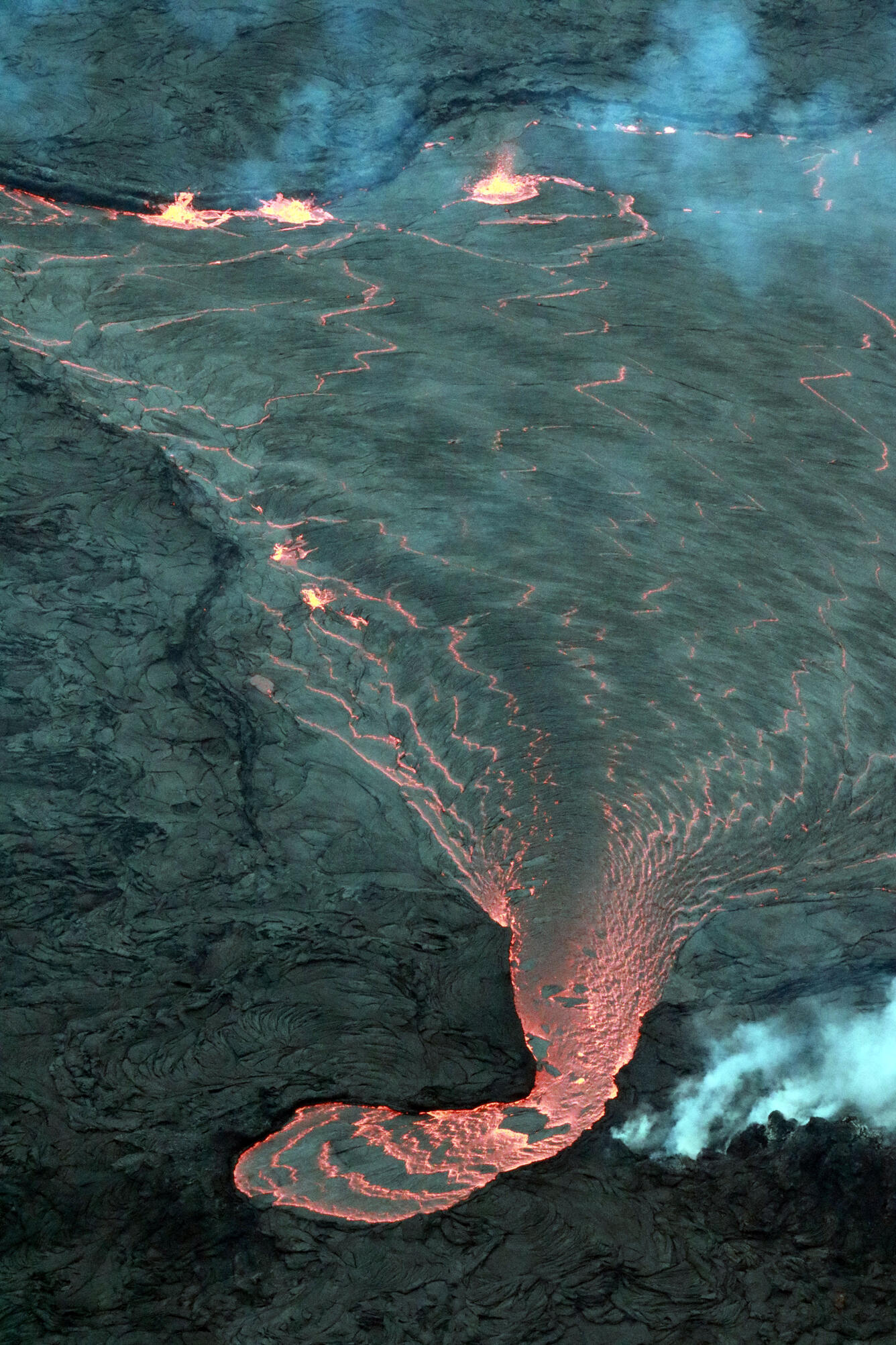
Ecuador , Sangay / Wolf :
DAILY REPORT OF THE STATE OF THE VOLCANO Sangay, Thursday February 20, 2022.
Information Geophysical Institute – EPN.
Surface Activity Level: High, Surface Trend: No change.
Internal activity level: High, Internal trend: No change.
Seismicity: From February 19, 2022, 11:00 a.m. to February 20, 2022, 11:00 a.m.:
Due to reference station transmission problems, complete seismic event statistics are not available. However, the large number of long-period type earthquakes, which involve internal movements of fluids, stands out.
Explosion (EXP) 42
Long Periods (LP) 256
Rains / Lahars:
Rain was recorded in the region. **In the event of heavy rains, these could remobilize the accumulated materials, generating mudslides and debris that would descend on the flanks of the volcano and flow into the adjacent rivers.**
Emission / ash column:
During the morning today, an emission of steam and ash from a height of less than 1000 meters in a southeasterly direction was observed. The Washington VAAC reported 4 ash emissions with heights of 1170 meters in a Southeast direction
Other Monitoring Parameters:
FIRMS registers 56 thermal alerts while MIROVA registers 1 moderate and 1 high thermal alert (115 MW) in the last 24 hours
Observation:
Most of the time the volcano remained cloudy.
Alert level: Orange.
——————————————————————————————
DAILY REPORT OF THE STATE OF WOLF VOLCANO. February 20, 2022.
Surface Activity Level: High, Surface Trend: Downward
Internal activity level: High, Internal trend: Downward
Seismicity: From February 19, 2022, 11:00 a.m. to February 20, 2022, 11:00 a.m.:
Due to reference station transmission problems, complete seismic event statistics are not available. However, the large number of long-period type earthquakes, which involve internal movements of fluids, stands out.
Long Periods (LP) 1
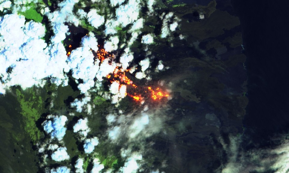
Emission / ash column:
In the past 24 hours, there have been no reports from Washington’s VAAC
Other Monitoring Parameters:
MIROVA records 1 moderate thermal alert in the last 24 hours. WORLDVIEW records 101 thermal alerts in the past 12 hours
Observation:
On satellite images (GOES-16), thermal anomalies continue to be observed on the volcano.
Source : IGEPN.
Photos : IGEPN , Sentinel 1A
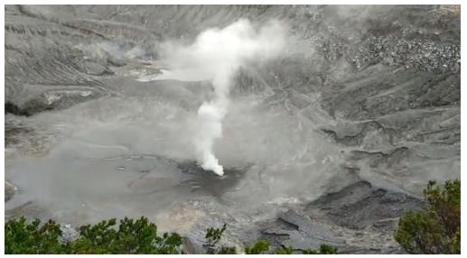
Nicaragua , Telica :
The Telica volcano continues to expel ash through a series of low-intensity explosions that occur at intervals of between 10 and 20 minutes, without posing greater danger to the surrounding population, according to the Nicaraguan Institute of territorial studies (INETER). .
Telica volcano maintains ash production through low intensity exhalations and explosions
The report indicates that most of the ash falls on the slopes of the volcano and that another, smaller part is transported by the wind to the localities located to the west, southwest and south of Telica.
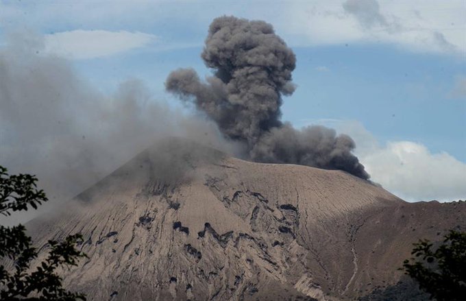
Nicaraguan authorities stressed that these exhalations are part of the volcano’s normal process and that this behavior is expected to continue over the next few days.
The gas emission and the real-time seismic amplitude (RSAM) are within normal parameters, however the micro-seismicity of the volcano is slightly above its usual levels, underlines the report.
Nicaraguan government authorities recommend that residents stay at least one kilometer around the Telica crater.
Source : nuevaya.com.ni via Manfred Meyer .
Photo : Enfoque Noticias