March 15 , 2023.
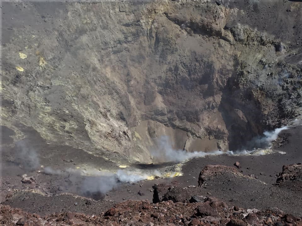
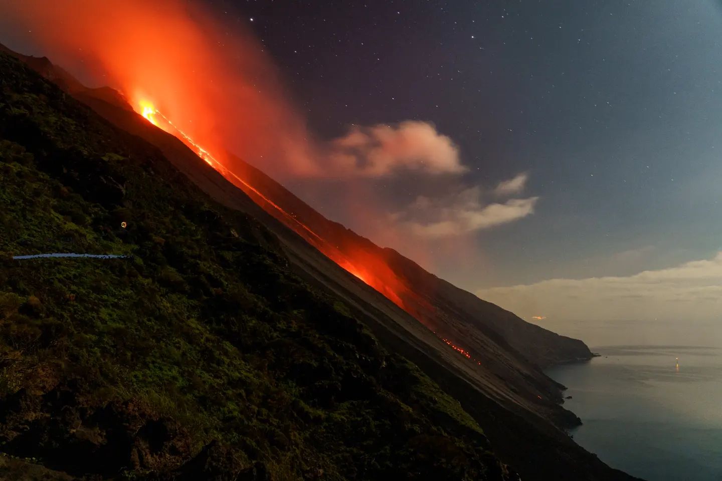
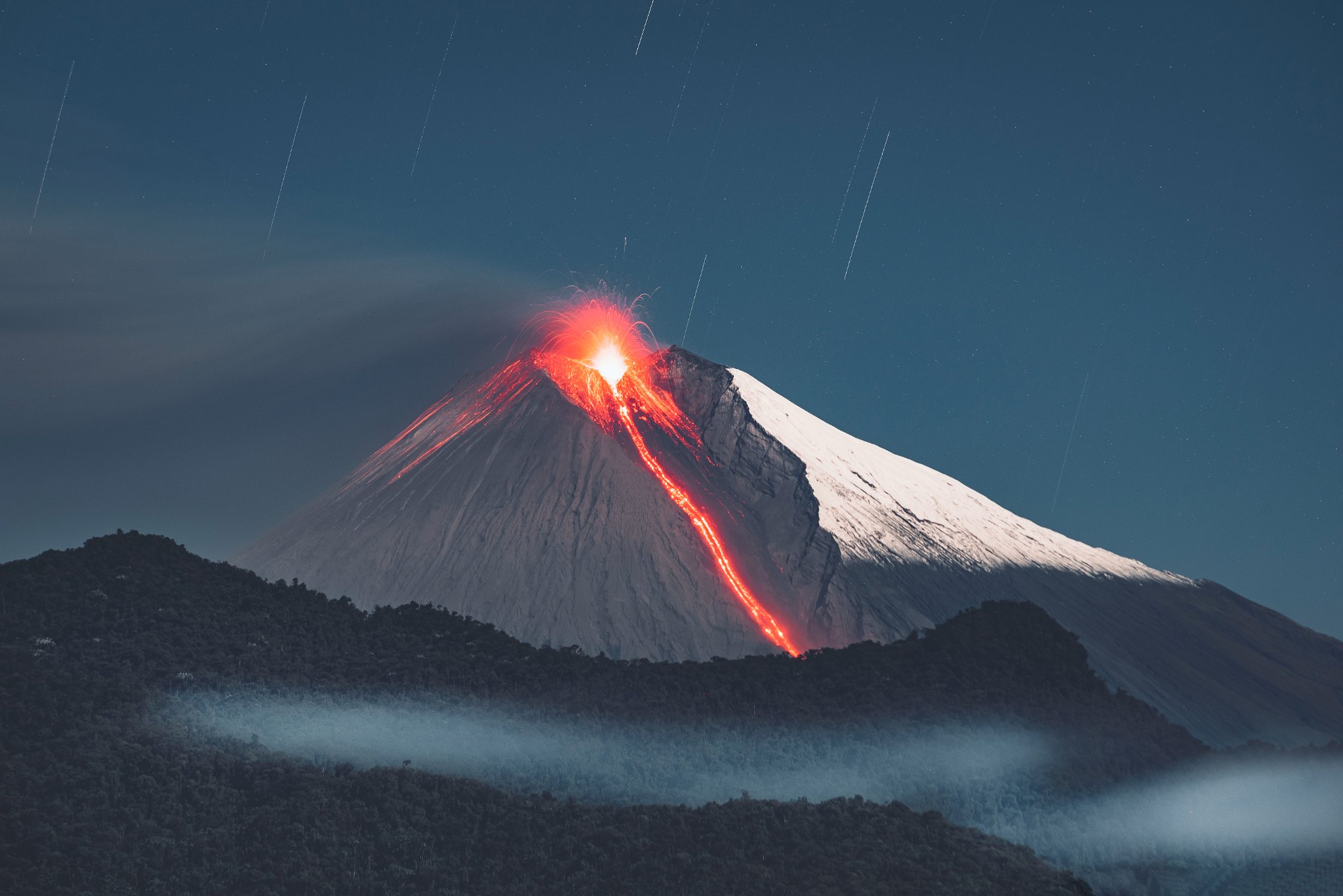
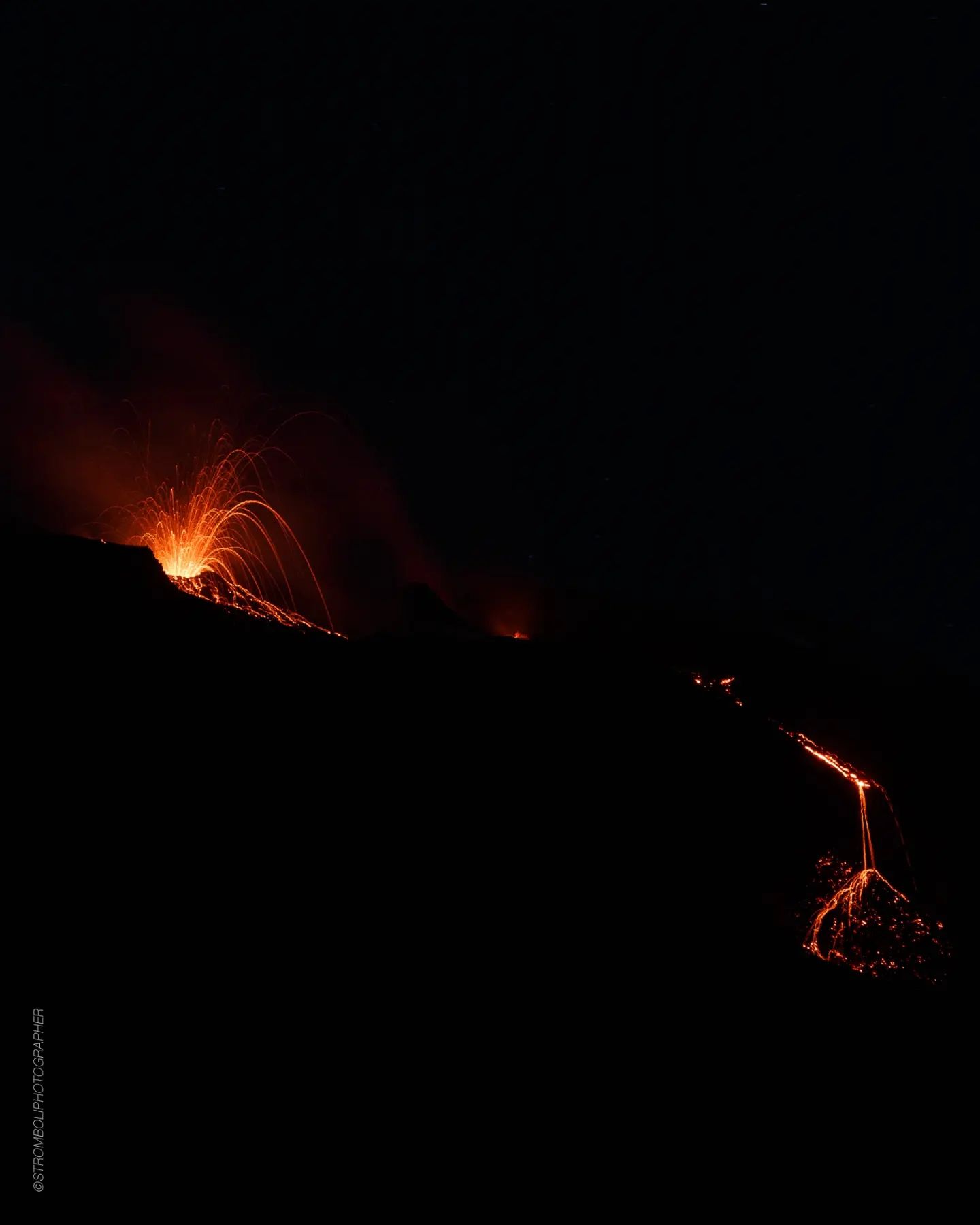
Italy , Stromboli :
WEEKLY BULLETIN, from March 06, 2023 to March 12, 2023. (issue date March 14, 2023)
ACTIVITY STATUS SUMMARY
In the light of the monitoring data, it is highlighted:
1) VOLCANOLOGICAL OBSERVATIONS: During this period, normal Strombolian activity was observed with spattering activity and lava overflows from the North Crater area. The total hourly frequency fluctuated between average values (11-13 events/h). The intensity of the explosions was mainly medium and low in the North crater area and medium in the Center-South crater area.
2) SEISMOLOGY: The seismological parameters monitored do not show any significant variations.
3) SOIL DEFORMATIONS: The island’s soil deformation monitoring networks did not show any significant variation to report for the period considered.
4) GEOCHEMISTRY: The flow of SO2 at an average level
CO2 fluxes show an increase from medium to high outgassing values.
The C/S values are at average values.
Isotope ratio of dissolved helium in heat sinks: There are no updates
5) SATELLITE OBSERVATIONS: Thermal activity observed by satellite was generally weak to moderate.

VOLCANOLOGICAL OBSERVATIONS
During the observation period, the eruptive activity of Stromboli was characterized by the analysis of the images recorded by the surveillance cameras of the INGV-OE at an altitude of 190 m (SCT-SCV), Punta dei Corvi, while the cameras at 400m altitude and Pizzo are currently unavailable.
Due to the unfavorable weather conditions of March 7 and 9, the visibility of the crater area was insufficient for a correct description of the eruptive activity.
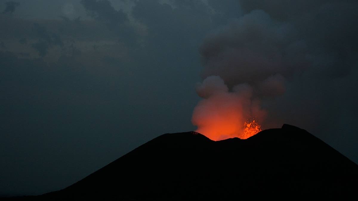
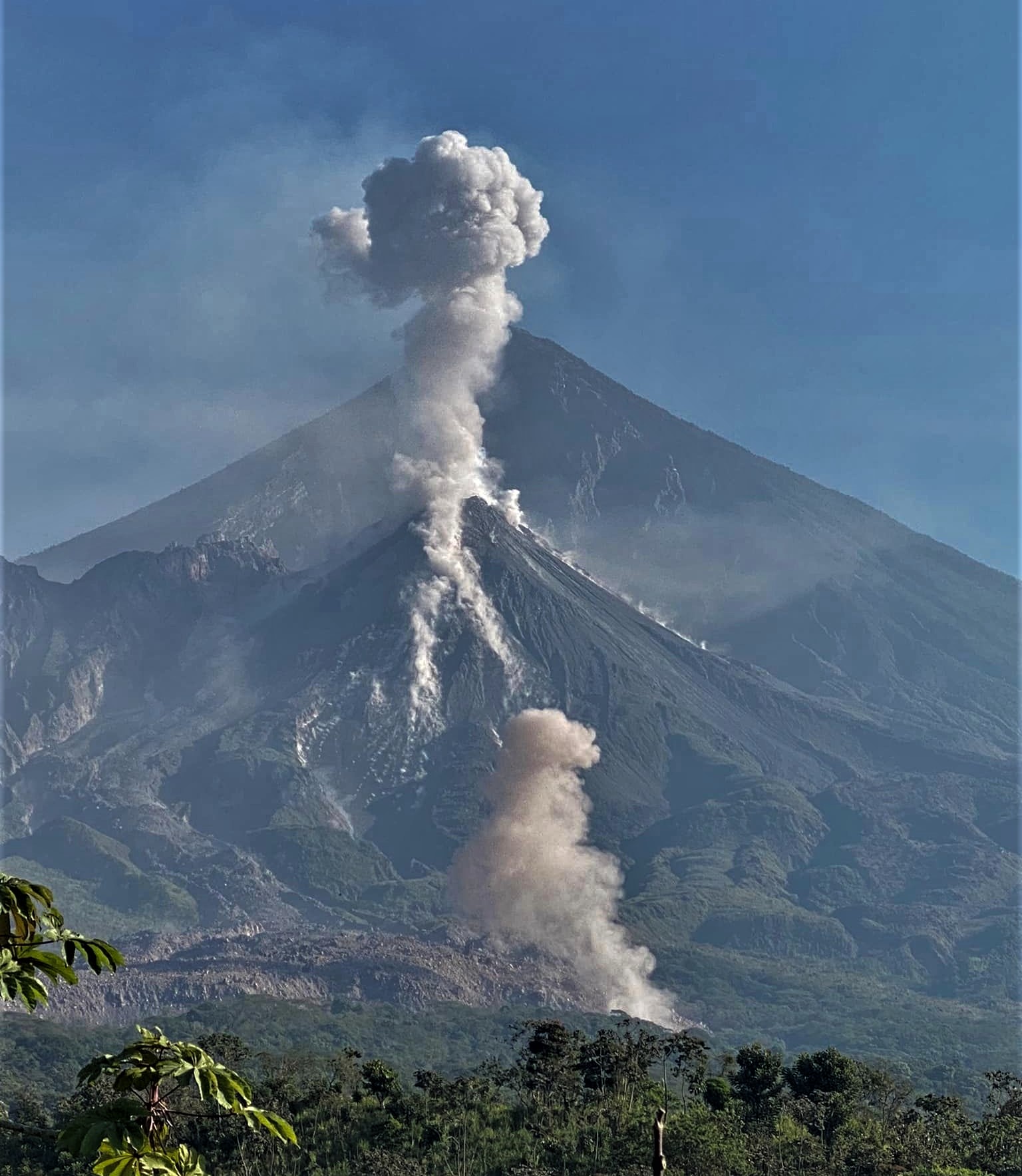
Three lava overflows were observed on March 8, 9 and 11, 2023 from the northern area of the crater.
Observations of explosive activity captured by surveillance cameras
In the area of the North crater (N) from the mouths of the two sectors N1 and N2, an explosive activity of variable intensity from low (less than 80 m in height) to medium (less than 150 m in height) emitting materials coarse (bombs and lapilli)). In addition, intense and short-lived spattering activity was observed on March 6 in sector N1. The average frequency of explosions varied from 7 to 9 events/h.
In the Center-South (CS) zone, only from sector S2, explosive activity of medium intensity was observed (sometimes the products exceeded 150 in height) emitting coarse materials. The frequency was variable between 1 and 6 events/h.
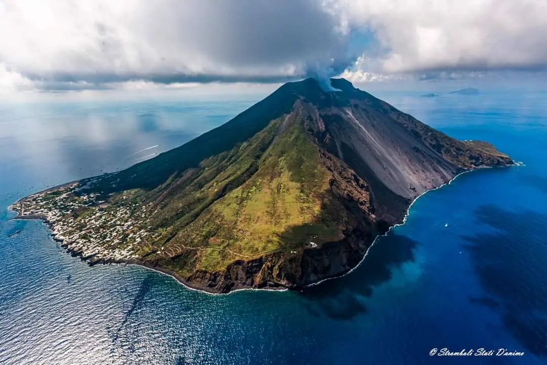
Lava overflows of March 8 and 9, 2023.
On March 8, 2023, the N2 sector of the North Crater area produced a lava overflow described below. Times are in UTC format.
Around 05:10 the overflow of the mouth of sector N2 begins. The lava flow flowed into the ravine formed on October 9, 2022. At 4:00 p.m. the flow appeared little
powered and cooled.
On March 9, 2023 from approximately 5:12 p.m. an overflow began, overlapping the lava flow from the day before. This second flow seemed to have ceased to be fed around 9:00 p.m. In both lava overflows, material was distributed along the Sciara and only a modest portion, barely visible by the SPCT camera, reached the shoreline.
On March 11, 2023, a lava overflow was observed starting at 1:15 a.m. with an increase at 1:29 a.m. The lava flow, which overlapped the two previous flows inside the ravine, is
stopped at the end of the afternoon of March 12.
Source : INGV.
Photos : Stromboli Stati d’animo ( archives).
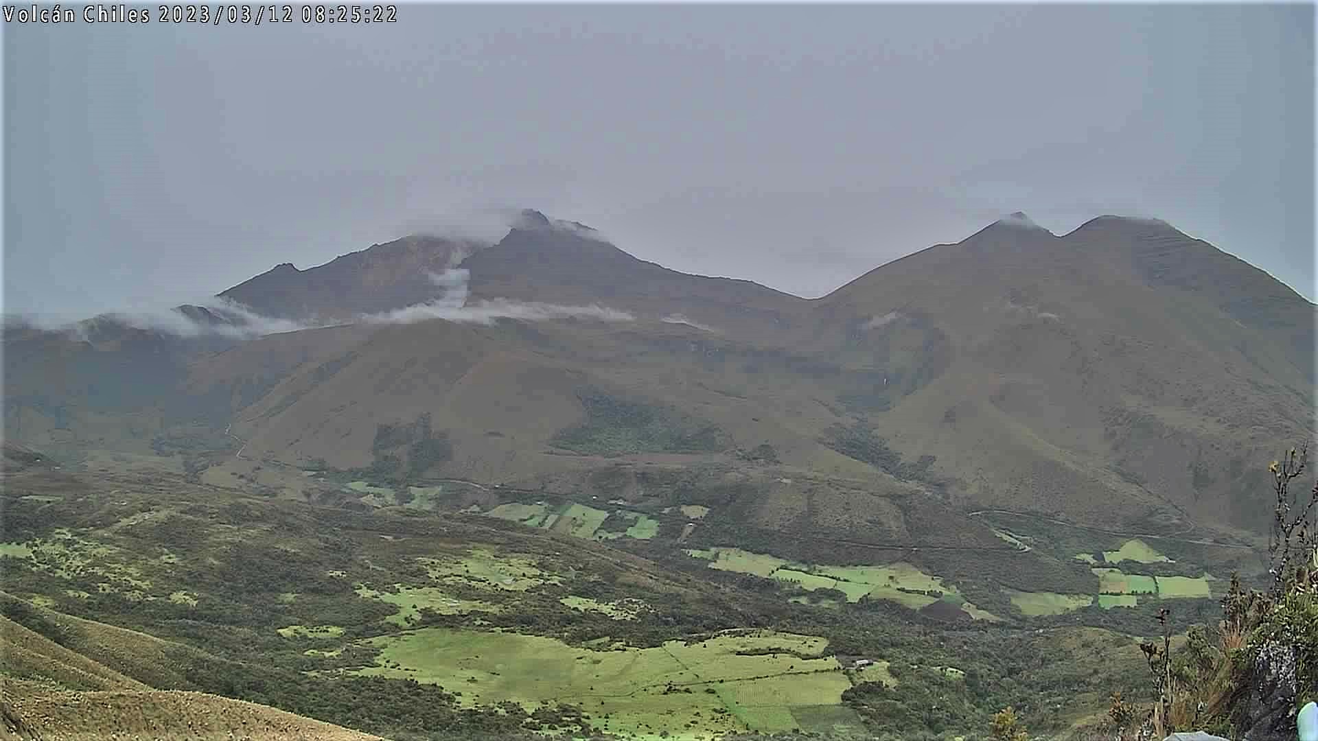
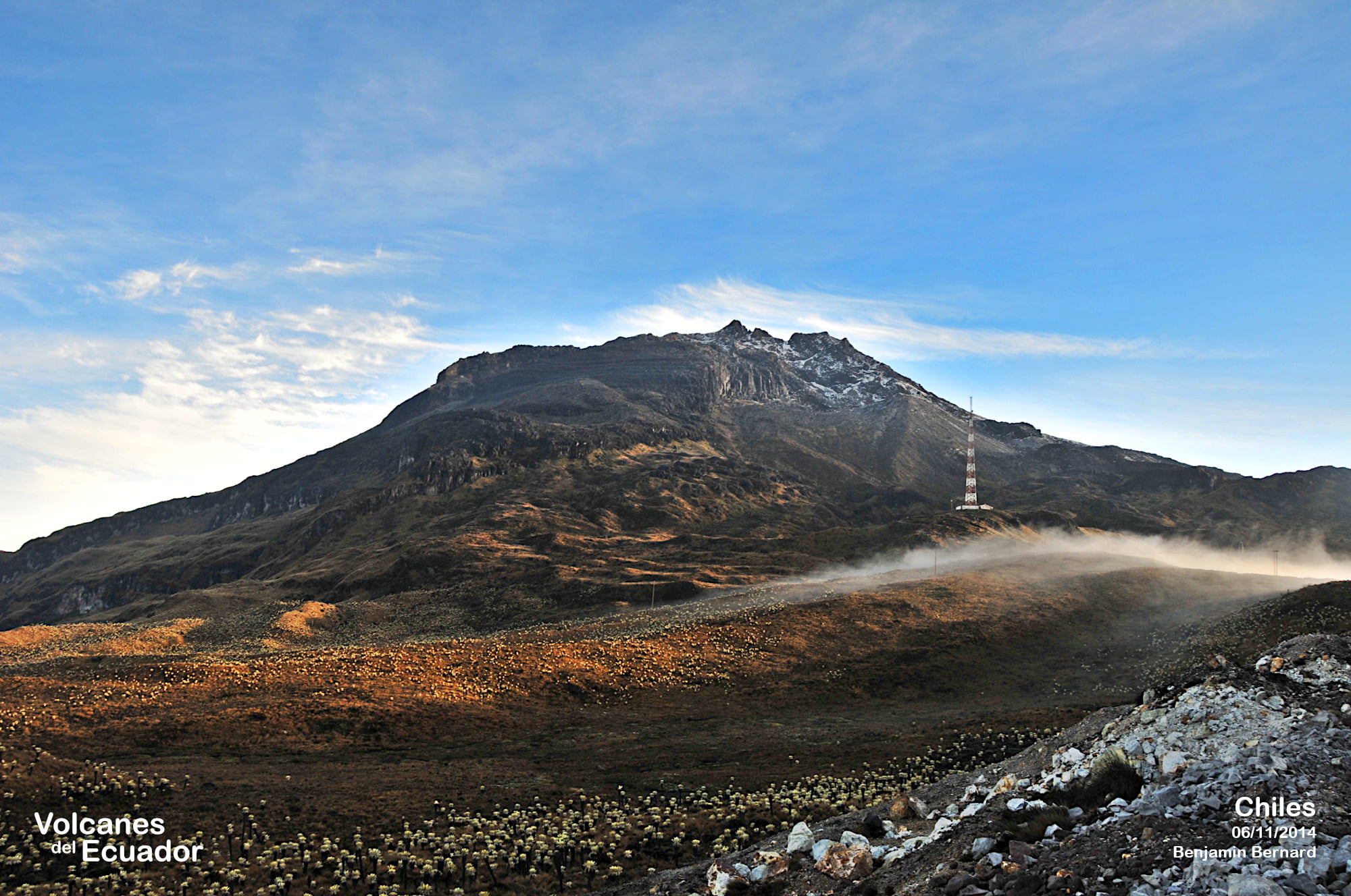
Colombia , Chiles / Cerro Negro :
Weekly activity bulletin of the volcanic complex of Chiles and Cerro Negro (CVCCN)
Regarding the monitoring of the activity of the VOLCANOES CHILES AND CERRO NEGRO, the MINISTRY OF MINES AND ENERGY through the COLOMBIAN GEOLOGICAL SERVICE (SGC) informs that:
In the week of March 7 to 13, 2023, the activity in the region of the Chiles and Cerro Negro volcanoes experienced a very significant change starting at 4:30 a.m. on March 9, reported in the extraordinary bulletins of March 9 and 10.
Seismicity continues with high levels, both of occurrence and of seismic energy, with fluctuations and the maintenance of the predominance of earthquakes associated with the fracture of the rock, although earthquakes related to the movement of fluids inside the volcano were also recorded. This activity was accompanied by a deformation of the surface of the CVCCN.

In summary, the following aspects emerge from this period: there is the recording of a total of 37,276 earthquakes, with a daily distribution of 5,311, 9,886, 9,332, 7,601 and 5,146 events for the March 9, 10, 11, 12 and 13, 2023 respectively, with values that fluctuated between 455 and 175 events per hour. There has been a report of 9 earthquakes felt, with magnitudes greater than 2.1, of which 5 events with magnitudes between 3.1 and 3.2 stand out (8:10 p.m. on March 9, 1:37 a.m., 5:26 a.m. and 5:06 p.m.). March 10 and 11:53 p.m. March 11). From the perspective of the daily occurrence of earthquakes, what was recorded on March 9 and 10, 2023 exceeded what was recorded for the period 2014-2022, which was 8,036 events for October 24, 2014 .
The possibility of earthquakes with greater energy that can be felt by the inhabitants of the area of influence is not excluded.
The activity level of volcanoes remains at: YELLOW LEVEL ■ (III): CHANGES IN THE BEHAVIOR OF VOLCANIC ACTIVITY
Source : SGC.
Photo : IGEPN.
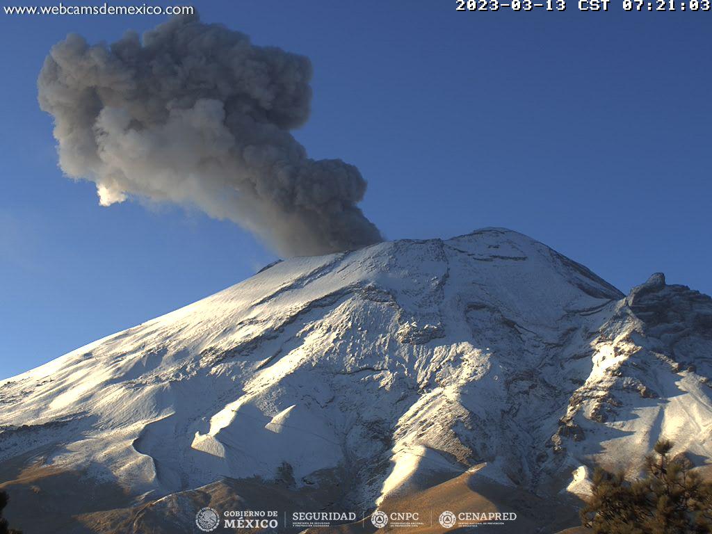
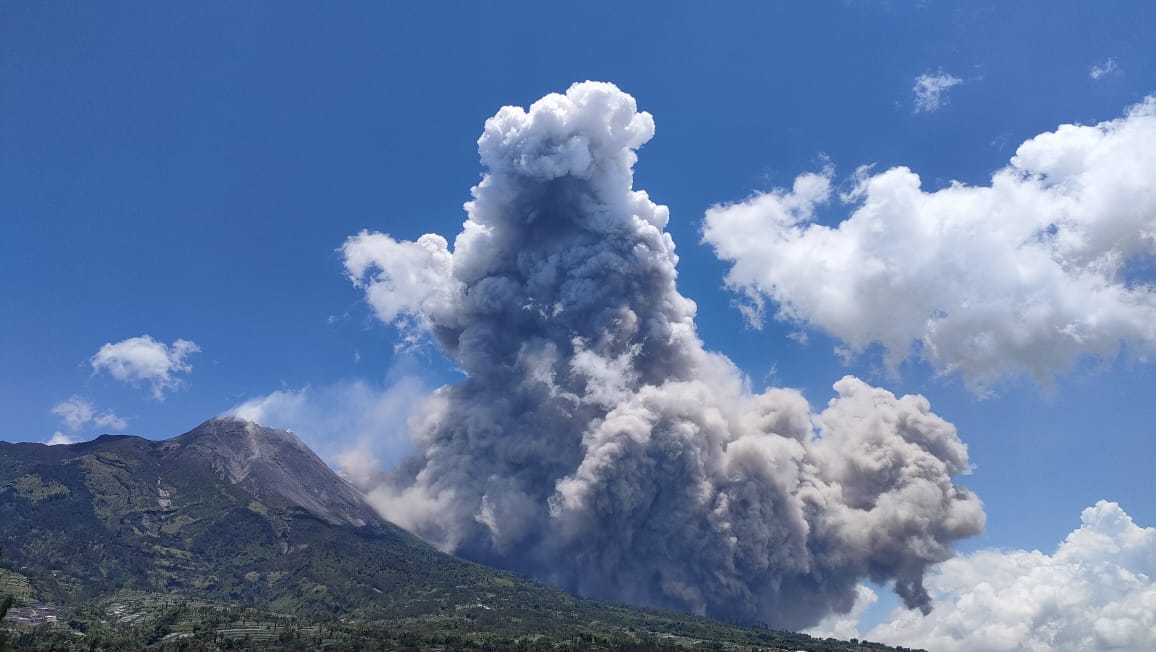
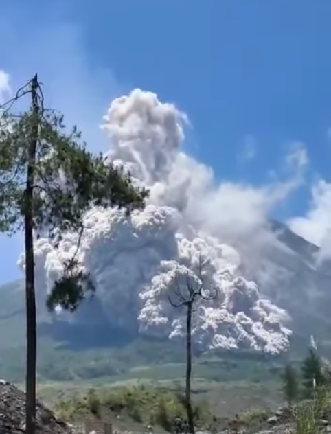
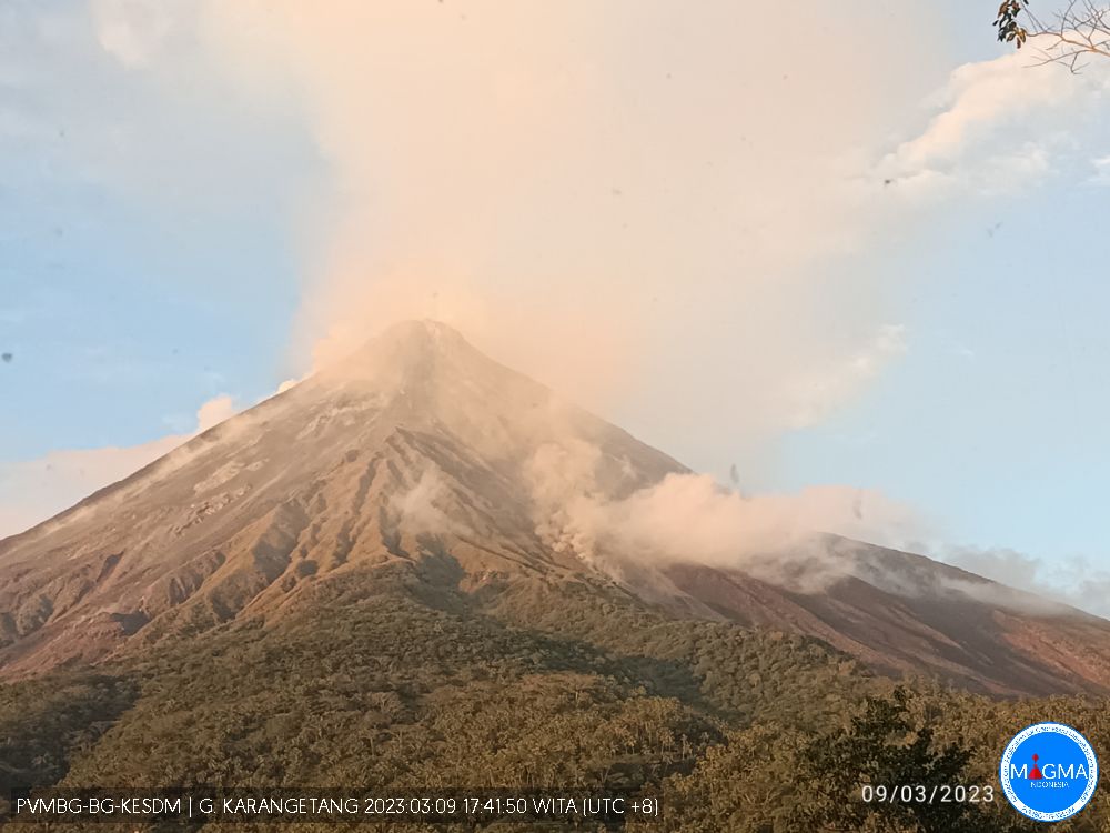
Indonesia , Merapi :
VOLCANO OBSERVATORY NOTICE FOR AVIATION – VONA
Issued : March 15 , 2023 .
Volcano : Merapi (263250)
Current Aviation Colour Code : ORANGE
Previous Aviation Colour Code : orange
Source : Merapi Volcano Observatory
Notice Number : 2023MER006
Volcano Location : S 07 deg 32 min 31 sec E 110 deg 26 min 31 sec
Area : Special Region of Yogyakarta, Indonesia
Summit Elevation : 9498 FT (2968 M)
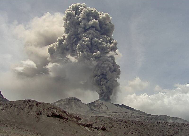
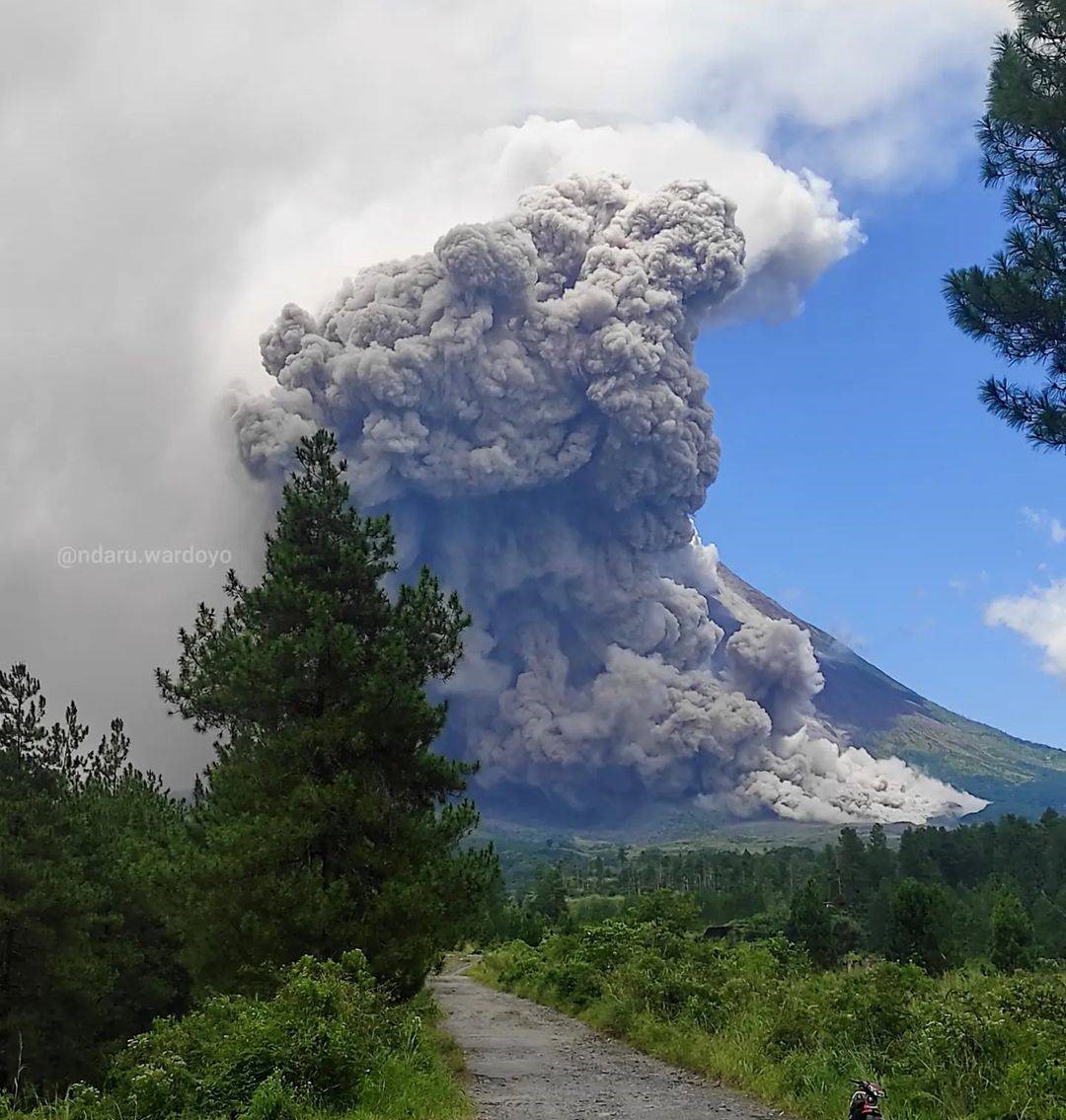
Volcanic Activity Summary :
Eruption with volcanic ash cloud at 03h36 UTC (10h36 local).

Volcanic Cloud Height :
Best estimate of ash-cloud top is around 13338 FT (4168 M) above sea level or 3840 FT (1200 M) above summit. May be higher than what can be observed clearly. Source of height data: ground observer.
Other Volcanic Cloud Information :
Ash cloud moving to east. Volcanic ash is observed to be gray to brown. The intensity of volcanic ash is observed to be medium.
Remarks :
Eruption recorded on seismogram with maximum amplitude 65 mm and maximum duration 133 second. Ash cloud generated by pyroclastic density currents.
SEISMICITY OBSERVATION
1 hot cloud avalanche earthquake with an amplitude of 65 mm and a duration of 133.4 seconds.
52 avalanche earthquakes with an amplitude of 5 to 30 mm and a duration of 37.5 to 144.1 seconds.
5 hybrid/multi-phase earthquakes with amplitudes of 3 to 6 mm, and durations of 5.3 to 7.6 seconds.
1 Shallow volcanic earthquake with an amplitude of 40 mm and a duration of 8.2 seconds.
Source : Magma Indonésie .
Photo : Imamismadin
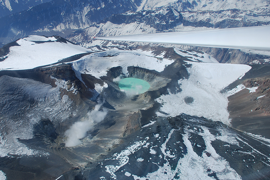
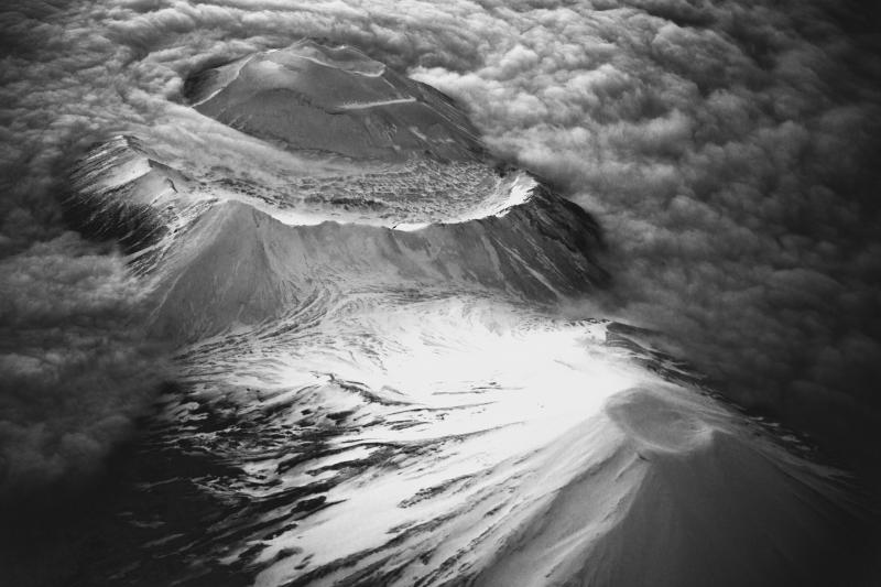
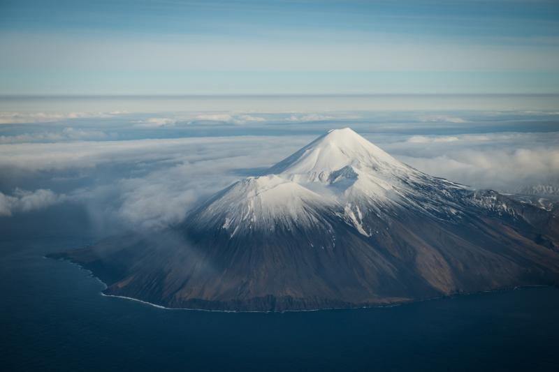
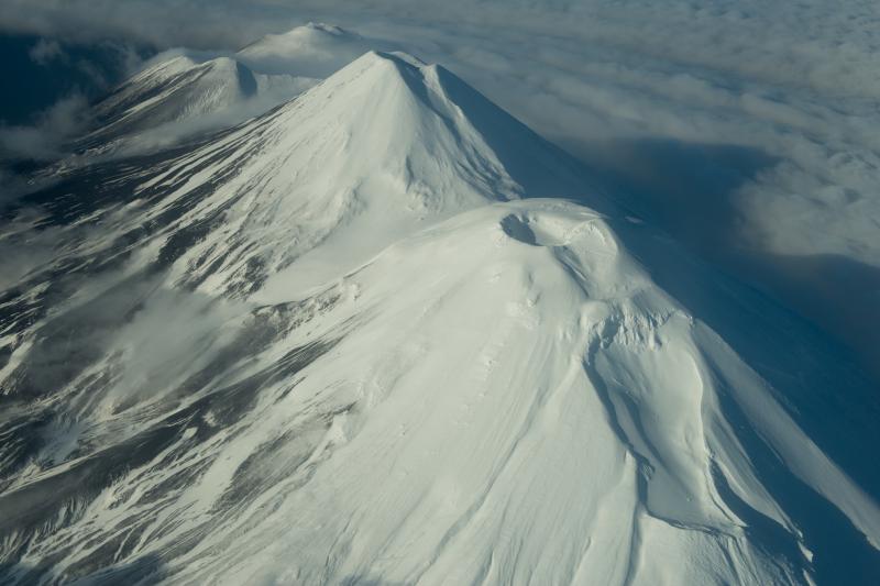
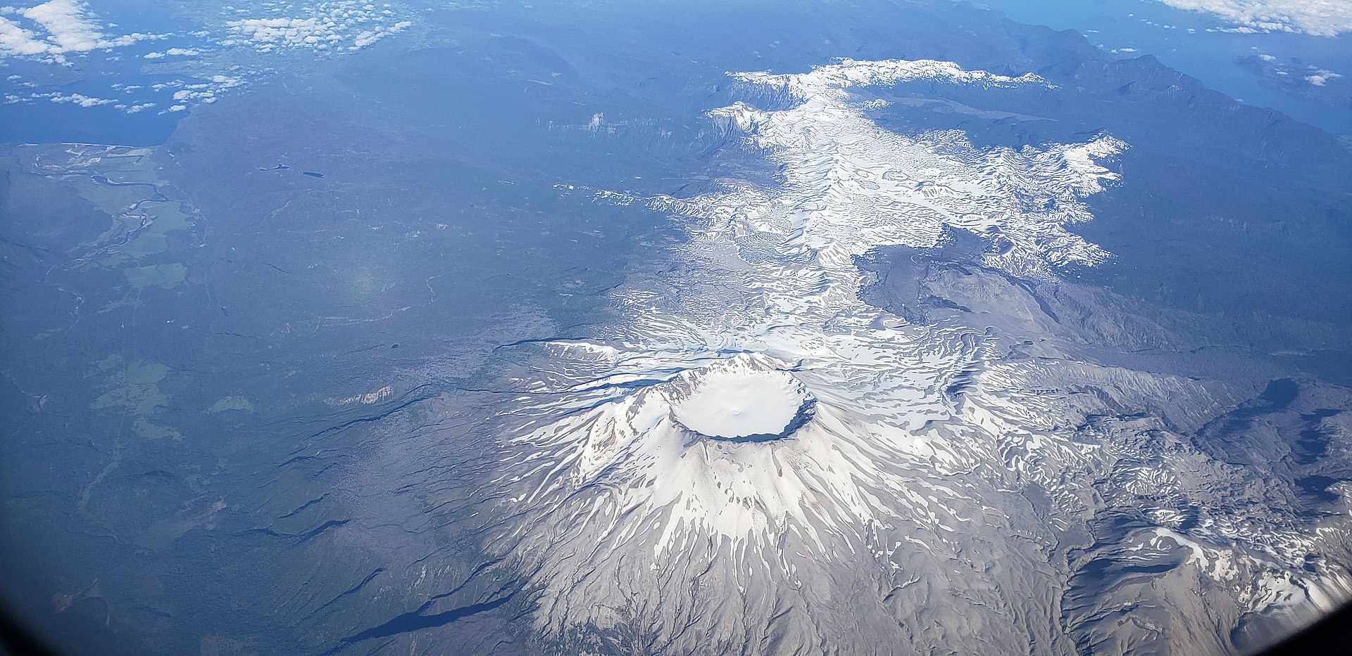
Alaska , Takawangha :
51°52’1″ N 178°1’37 » W,
Summit Elevation 4754 ft (1449 m)
Current Volcano Alert Level: WATCH
Current Aviation Color Code: ORANGE
Earthquake activity beneath Takawangha volcano and nearby Tanaga Volcano, which is about 8 km (5 miles) west of Takawangha volcano on Tanaga Island, continued over the past 24 hours, although at a reduced rate. The earthquakes recorded during this swarm have magnitudes up to about M4 and are mostly occurring at depths less than about 6 km (4 miles) below sea level. No eruptive signals or other signs of unrest have been detected in other data streams. Satellite views of the volcano were cloudy.
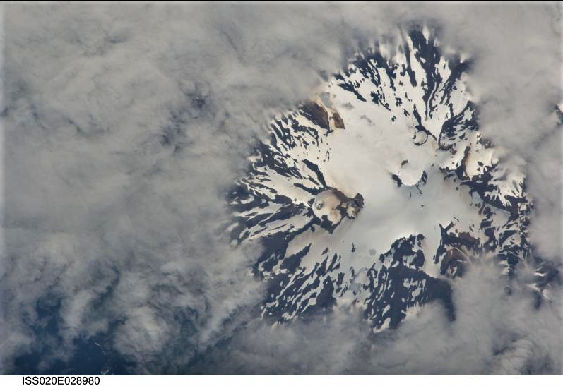
The Takawangha volcano seen from the International Space Station. North is down in this image; NASA Photo ID ISS020-E-28980 Focal length 800mm Date taken 2009.08.06 Time taken 23:24:55 GMT
Increases in seismic activity have been detected previously at Takawangha volcano and other similar volcanoes, with no subsequent eruptions. We expect additional shallow seismicity and possibly other signs of unrest, such as gas emissions, elevated surface temperatures, and surface deformation to precede any future eruption, if one were to occur.
Takawangha volcano is monitored by local seismic and infrasound sensors, satellite data, and regional infrasound and lightning networks.
Source : AVO.
Photo : International Space Station, NASA
Costa Rica , Rincon de la Vieja :
A background tremor of low amplitude and dominant frequency begins to recover around 2.2 Hz. Very few volcanic earthquakes of low amplitude, « tornillos » type earthquakes and volcano-tectonic earthquakes at the same time proximal and distal, of low magnitude. Records of small hydrothermal explosions dominate which produce plumes of gas and water vapor that do not exceed 500 meters above crater level. The extension and uplift of the ground observed in the previous weeks has stopped. During the previous week, 136 ± 176 t/d was recorded as the average SO2 flux, which has remained relatively constant since the beginning of 2023. However, after several hydrothermal explosions, values close to 1200 t/d were recorded. measured.
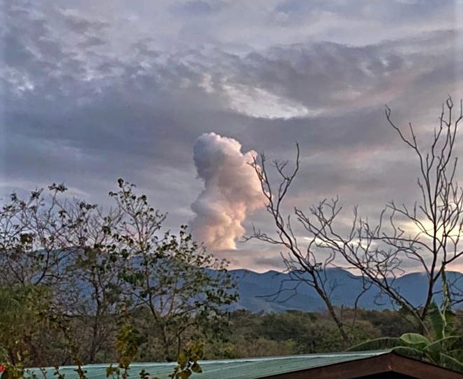
ERUPTION REPORT – OVSICORI-UNA
Volcano: Rincon de la Vieja
Location: N10.83 W85.34
Height of the massif: 1916mts. (6284 feet)
Date: 2023-03-14 Time: 05:29
Plume height (above crater): 6560 feet. (2000 meters)
Feather Observation Source: Direct Observation, Webcam, Infrasound, Seismic
Observed activity:
Two eruptions were observed on Rincón de la Vieja. the first at 05:29 and the second at 05:49.
The plume is mostly steam with little ash. The plume is heading west, northwest. No ash fall or lahars were reported.
Previously, a tremor was detected from 9:00 p.m. with a frequency of 1.5-3 hz.
Activity Level: Warning
Source : Ovsicori.