January 22, 2024. EN. Alaska : Kanaga , Indonesia : Ibu , Chile : Villarica , Northern Mariana Islands : Ahyi Seamount , Mexico : Popocatepetl .

January 22 , 2024.


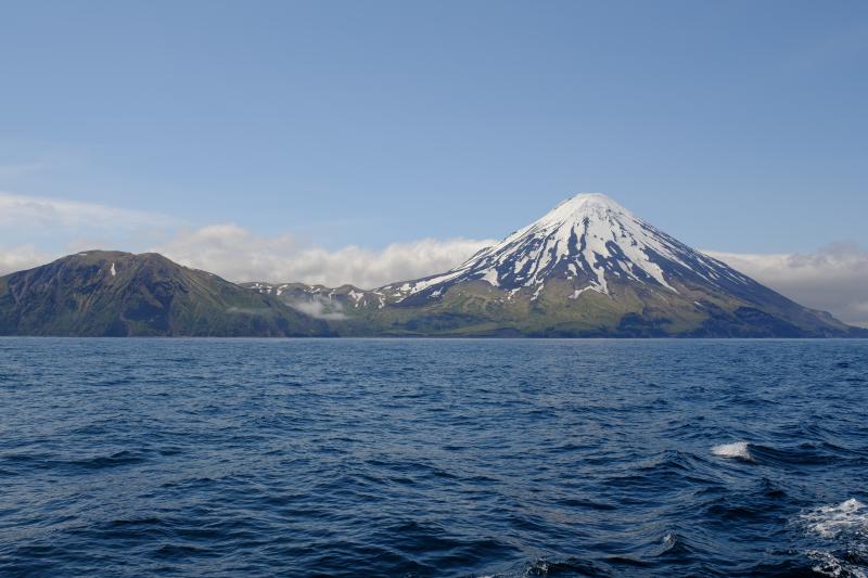
Alaska , Kanaga :

Satellite images over the past this week show no change at the volcano’s summit following the December 18 (December 19 UTC) steam-driven explosive event.

Local monitoring data have been off-line since January 2 due to a storm-related power failure.

This new unrest indicates a possibility for sudden explosions to occur at any time. These explosions may produce ash clouds exceeding 20,000 feet above sea level.

Prior to the current activity, the last unrest at Kanaga Volcano was in February 2012 when a steam-driven explosion occurred together with the opening of a large fissure on the southern crater rim.

Kanaga Volcano is monitored by local seismic and infrasound sensors (when operational), regional infrasound and lightning networks, and satellite data.

Source : AVO

Photo : Loewen, M. W./ AVO / U.S. Geological Survey


Indonesia , Ibu :

Mount Ibu erupted on Monday, January 22, 2024, at 11:57 p.m. WIT. The height of the eruptive column was observed to be ±500 m above the summit (±1,825 m above sea level). The ash column was gray in color with a thick intensity, oriented towards the South-East. The eruption was recorded on a seismograph with a maximum amplitude of 28 mm and a duration of 73 seconds.

SEISMICITY OBSERVATIONS
32 eruption earthquakes with an amplitude of 15 to 28 mm and a duration of 21 to 129 seconds.
56 emission earthquakes with an amplitude of 2 to 14 mm and earthquake duration of 15 to 50 seconds.
11 harmonic tremors with an amplitude of 2 to 14 mm and an earthquake duration of 35 to 335 seconds.
171 shallow volcanic earthquakes with amplitude of 2 to 14 mm and duration of 4 to 14 seconds.
6 deep volcanic earthquakes with an amplitude of 3 to 10 mm, and an earthquake duration of 5 seconds.
14 distant tectonic earthquakes with an amplitude of 2 to 17 mm,  the duration of the earthquakes was 36 to 115 seconds.

RECOMMENDATION
Communities around Mount Ibu and visitors/tourists are advised not to carry out activities within a radius of 2.0 km with a sectoral extension of 3.5 km towards the opening of the crater in the northern part of the crater active Mount Ibu.

Source et photo : Magma Indonesie.


Chile , Villarica :

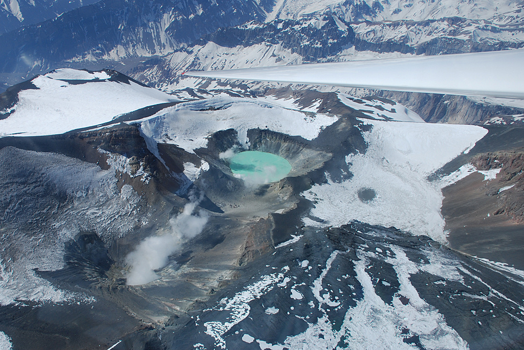
Special Report on Volcanic Activity (REAV), La Araucanía and Los Ríos regions, Villarrica volcano, January 22, 2024, 02:48 local time (mainland Chile)

The National Geology and Mining Service of Chile (Sernageomin) announces the following PRELIMINARY information, obtained through the monitoring equipment of the National Volcanic Monitoring Network (RNVV), processed and analyzed at the Southern Andean Volcano Observatory (Ovdas):

On Monday, January 18, 2024, at 02:21 local time (5:21 UTC), monitoring stations installed near the Villarrica volcano recorded an earthquake associated with the fracturing of rocks (Volcano-tectonic) inside the volcanic system.


The characteristics of the earthquake after its analysis are as follows:

ORIGINAL TIME: 02:21 local time (05:21 UTC)
LATITUDE: 39.421°S
LONGITUDE: 71.875°E
DEPTH: 5.2 km
LOCAL MAGNITUDE: 3.9 (ML)

Observation :

In the hours preceding the event mentioned in this report, an increase in the occurrence of volcano-tectonic seismicity was recorded, which remains sustained for the moment.

Reports have been received from localities in the vicinity of Pucon mentioning the perception of this earthquake.

No changes in the behavior of the fluid-type seismic activity of the volcano have been recorded, nor any associated surface activity observed.

The technical volcanic alert is maintained at YELLOW level.

Source : Sernageomin.

Photo : ameriquedusud.org.


Northern Mariana Islands , Ahyi Seamount :

NMI/USGS Volcanic Activity Notice

Current Volcano Alert Level: ADVISORY
Previous Volcano Alert Level: UNASSIGNED

Current Aviation Color Code: YELLOW
Previous Aviation Color Code: UNASSIGNED

Issued: Sunday, January 14, 2024, 8:50 AM ChST
Source: U.S. Geological Survey
Notice Number: 2024/N5
Location: N 20 deg 25 min E 145 deg 1 min
Elevation: -259 ft (-79 m)
Area: Northern Mariana Islands

Volcanic Activity Summary:
Signs of unrest at Ahyi Seamount have been observed in satellite data over the past few weeks. Plumes of discolored water were observed drifting 1.5–6.2 miles (2.4–10 km) away from the volcano in satellite images on December 24 and 31, 2023 and January 4 and 10, 2024. Nothing significant has been detected from the direction of Ahyi in hydroacoustic array data at Wake Island; however, submarine plumes have been observed at Ahyi in the past without clear hydroacoustic signals. Due to the increased likelihood of an underwater eruption occurring at Ahyi Seamount, the Aviation Color Code and Volcano Alert Level are being raised to YELLOW and ADVISORY. We will continue to monitor satellite and distal hydroacoustic data for additional evidence of volcanic activity.

An undersea eruption at Ahyi Seamount was last detected starting mid-October 2022. The activity appeared to pause beginning in early April 2023 but briefly resumed in late May 2023.

Hazard Analysis:
[Other hazards] Shallow submarine eruptions may present hazards to mariners in the water above the vent.

Remarks:
Ahyi seamount is a large conical submarine volcano that rises to within 450 ft (137 m) of the sea surface about 11 miles (18 km) southeast of Farallon de Pajaros (Uracas) Island in the northern Marianas, about 370 miles (600 km) north of the island of Saipan. In the past, discolored water has been observed over the submarine volcano. In 1979, the crew of a fishing boat felt shocks over the summit area and then observed upwelling of sulfur-bearing water. On April 24-25, 2001 an explosive submarine eruption was detected seismically from a seismic station on Rangiroa Atoll, Tuamotu Archipelago. The event was well constrained (+/- 9 miles or 15 km) at a location near the southern base of Ahyi.

Source : U.S. Geological Survey

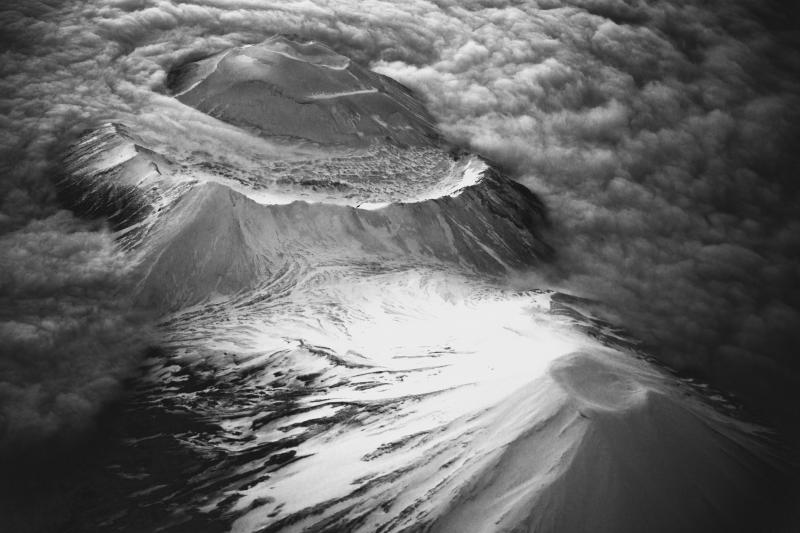
Photo : Susan Merle (Oregon State University/NOAA Vents Program). GVP.


Mexico , Popocatepetl :

January 21, 11:00 a.m. (January 21, 5:00 p.m. GMT)

Activity from the last 24 hours

1255 minutes of high frequency, low amplitude tremors (20.91 h) were recorded, in addition to 27 low intensity expirations. Both volcanic events were accompanied by water vapor, other gases and ash.

During this morning, a continuous emission of water vapor, volcanic gases and ash was observed, which dispersed towards the North.

The Popocatépetl volcanic warning fire is in yellow phase 2.

The scenarios planned for this phase are:

A few small to moderate explosions
Appearance of tremors of variable amplitude
Light to moderate ash rain in surrounding towns and some more distant towns
Ejection of incandescent fragments within the exclusion radius of 12 kilometers
The occurrence of lahars can be expected to descend into the ravines, due to the accumulation of ash on the slopes and its interaction with the rains expected in the coming weeks.
Possibility of pyroclastic flows not reaching populations

Source : Cenapred.


July 19, 2023. EN. Alaska : Shishaldin , La Réunion : Piton de la Fournaise , Italy / Sicily : Etna , Iceland : Litli Hrútur , Alaska : Tanaga / Takawangha .

July 19 , 2023.


Alaska , Shishaldin :

AVO/USGS Volcanic Activity Notice

Current Volcano Alert Level: WARNING
Previous Volcano Alert Level: WATCH
Current Aviation Color Code: RED
Previous Aviation Color Code: ORANGE

Issued: Tuesday, July 18, 2023, 7:56 AM AKDT
Source: Alaska Volcano Observatory
Notice Number: 2023/A1082
Location: N 54 deg 45 min W 163 deg 58 min
Elevation: 9373 ft (2857 m)
Area: Aleutians

Volcanic Activity Summary:
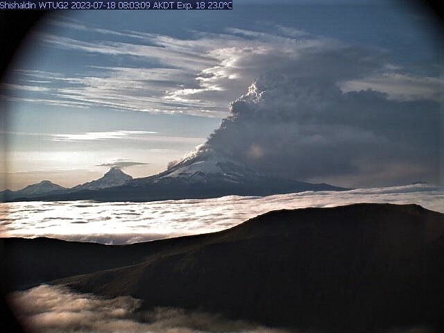
The eruption of Shishaldin Volcano has intensified. A rapidly growing ash cloud was observed starting at 7:00 am AKDT (15:00 UTC) and drifting SSE. Cloud height is undertermined at this time and could be more than 20,000 ft. above sea level (6 km). In response, the aviation Color Code is being raised to RED and the Volcano Alert Level is being raised to WARNING. The National Weather Service has issued a SIGMET for this activity.

Eruptive activity began increasing overnight starting around 1 am AKDT (09:00 UTC) with increased lava eruption from or within the summit crater but no significant ash emissions. Activity was detected on regional infrasound arrays, increasing seismic tremor, and elevated surface temperatures in satellite data. Overnight webcam images confirmed glowing from the summit with only minor ash emission.

Eruptions from Shishaldin have produced minor and on occasion significant ash clouds in the past. These can occur with little warning. Shishaldin is monitored by local seismic and infrasound sensors, web cameras, and a telemetered geodetic network. The local monitoring network is partially impaired, therefore AVO is also using nearby geophysical networks, satellite data and regional infrasound and lighting data to detect activity. AVO will continue to closely monitor unrest at Shishaldin Volcano.

Recent Observations:
[Volcanic cloud height] unknown at this time, appear to have rapid growth over 20,000 ft. asl
[Other volcanic cloud information] SSE Drifting ash cloud seen in satellite imagery, see current NWS SIGMET

Hazard Analysis:
[Ash cloud] SSE drifting ash cloud observed in satellite data, see current NWS SIGMET
[Ashfall] trace ashfall possible downwind of the volcano.
[Mud flow] on all flanks of the volcano

Issued: Tuesday, July 18, 2023, 8:37 AM AKDT
Volcanic Activity Summary:
An ash cloud with an initial height of around 30,000 ft. (7 km) above sea level from Shishaldin volcano began at 7:00 am AKDT (15:00 UTC) and is drifting SSE. The eruption is continuing and recent pilot observations estimated a 24,000 ft. (6 km) above sea level height. The aviation Color Code remains at RED and the Volcano Alert Level at WARNING. The National Weather Service has issued a SIGMET for this activity.

Eruptive activity began increasing overnight starting around 1 am AKDT (09:00 UTC) with increased lava eruption from or within the summit crater but no significant ash emissions. Activity was detected on regional infrasound arrays, increasing seismic tremor, and elevated surface temperatures in satellite data . Webcam images confirmed glowing from the summit with only minor ash emission.

Issued: Tuesday, July 18, 2023, 12:08 PM AKDT
Volcanic Activity Summary:

The eruption of Shishaldin Volcano has gradually declined. Current observations indicate continued but low-level ash emissions below 10,000 ft. (3 km) above sea level and drifting to the south. Reflecting this lower-level activity, the Aviation Color Code is being reduced to ORANGE and the Volcano Alert Level is being lowered to WATCH.

This morning a significant ash plume was detected starting around 7:00 am AKDT (15:00 UTC) and reaching a height of around 30,000 ft. (7 km) above sea level. Around 9:30 am AKDT (17:30 UTC) satellite data showed the main initial plume had detached but residual, low-level ash emissions continued from the vent. The detached plume is still visible between 60–280 mi (100 and 450 km) away from the volcano.

Source : AVO.

Photos : WTUG webcam, AVO , False Pass SW, FAA weather cam, Woodsen Saunders , avo( archive).


La Réunion , Piton de la Fournaise :

Press release from the Paris Institute of Earth Physics, Piton de la Fournaise Volcanological Observatory, July 18, 2023 – 10:30 a.m. – 06:30 a.m. UTC
Ongoing eruption

The eruption which began on July 02, 2023, around 08:30 local time continues. The amplitude of the volcanic tremor, (indicator of an emission of lava and gas on the surface) is always fluctuating over time on the scale of a few tens of minutes, with phases of continuous tremor and phases of intermittent tremor . The amplitude of the tremor nevertheless remains low compared to the beginning of the eruption and shows a new downward trend for the last few days.
The fluctuations observed in the tremor are reflected at the level of the eruptive site by variations in intensity in the activity, with projections of lava fountains at the level of the eruptive cone more or less intense.

Given the persistent bad weather conditions currently on site:
– no visual feedback on the eruptive site and the lava field could be made today and tonight,
– nor any estimate of lava flows by satellite method.
The flow front has not changed since July 5 and is still 1.8 km from the road.

A resumption of inflation in the summit area seems to be taking shape. This parameter will be confirmed in the coming days. It could be an indicator of a deep magma transfer to the superficial feeding system.
The seismic activity recorded under the summit zone remains weak. Thus over the last 24 hours, four superficial volcano-tectonic earthquakes have been recorded. This low seismic activity leads to a reduction in the risk of the appearance of a new crack and/or collapse in the crater, but does not mean that it can be excluded.

Alert level: Alert 2-1 (eruption in the Enclos without any particular threat to the safety of people, property or the environment).

Source : OVPF

Photo : RB/www.imazpress.com


Italy / Sicily , Etna :

WEEKLY BULLETIN, from July 10, 2023 to July 16, 2023. (issue date 18 July 2023)

ACTIVITY STATUS SUMMARY

In the light of the monitoring data, it is highlighted:
1) VOLCANOLOGICAL OBSERVATIONS: Degassing activity at the level of the summit craters, in particular at the level of the Bocca Nuova crater and eruptive activity of the Strombolian type at the level of the Southeast crater.
2) SEISMOLOGY: The seismicity of the week was characterized by the occurrence of a single event with M>2.0. The amplitude of the volcanic tremor remained at average values and the location of the centroid of the sources of the volcanic tremor remains in the area of the Southeast crater.
3) INFRASOUND: Moderate increase with sources located at the Southeast and Bocca Nuova craters.
4) GROUND DEFORMATIONS: During the last week, the ground deformation monitoring networks have not recorded any significant variations.
5) GEOCHEMISTRY: SO2 flux at an average level.
Soil CO2 flux in average values.
Isotope ratio of helium on high values.
CO2 dissolved in the Ponteferro drainage tunnel without significant changes.
6) SATELLITE OBSERVATIONS: Thermal activity observed from the satellite was generally weak.

VOLCANOLOGICAL OBSERVATIONS
The follow-up of the volcanic activity of Etna during the observation period was carried out thanks to the analysis of the images acquired by the network of surveillance cameras of the INGV, Osservatorio Etneo (INGV-OE) and through observations with thermal cameras and drones acquired during different inspections in the summit area.
Overall, the volcanic activity of Etna was characterized by a variable level degassing of the summit craters and by the resumption of eruptive activity at the level of the Southeast crater. In particular, during the week, the Southeast crater showed continuous degassing with occasional intervals of modest ash emissions with rapid dispersion in the atmosphere. This state of activity evolved on July 14 at 18:34 UTC with the start of a modest Strombolian-type eruptive activity confined inside the crater and fed by a vent located in the eastern sector of the Southeast crater. With the exception of a verified ash emission at 18:37 UTC, the activity produced no significant ash production. Activity at other craters in the period continued with no noticeable variations from previous weeks, with Bocca Nuova continuing to be characterized by a type of impulsive degassing coupled with roars caused by pressurized gases and flashes visible at night due to the high temperature of the gases. Finally, the Voragine and the Northeast Crater still maintain a state of absence of activity on the first and slight degassing of the fumarolic type on the second.

Inspections in the summit area between July 12 and 14, 2023
Among the various inspections in the summit area carried out during the period under review, during those carried out between July 12 and 14, the state of the craters was observed using a thermal camera and drones.
The inversion of the data made it possible to characterize in detail the state of activity and the craters and their morpho-structural arrangement. Characterizations for each crater are reported below.

– Bocca Nuova crater: the data indicate thermal anomalies on the ground up to 550°C (+/-20°C) of the fumarolic field of the BN1 and BN2 vents, with explosions at BN1 with a variable frequency of 5 to 15 minutes .

Observations of the Bocca Nuova using drones (a) and thermal camera (b-d). In (c) panoramic view of the crater taken from the West with BN2 in the foreground and BN1 immediately after, in the background of the image the fumarolic field anomaly.
The BN2 thermal anomaly extends over approximately 50×50 m (red circles in a).

– Southeast Crater: the inspection of July 12 indicated a state of generalized degassing in particular of the edges of the crater and the absence of eruptive activity. From a morpho-structural point of view, on the southwest side of the crater several concave fractures were found with a morphology similar to detachment niches, very superficial with a length varying between approximately 150 and 200 m with slight thermal anomalies in the surrounding areas.
The anomalies are probably attributable to the rheomorphic deposition of the products of the May 21 activity. Finally, another thermal anomaly was observed in the area under the rim of the crater of the North-East vent, in correspondence with a small niche (estimated length less than 30 m; ).

-Voragine and North-East Crater: the thermal camera survey shows the absence of eruptive activity in the two craters, with low temperatures or slight anomalies associated with the internal fumarolic zones of the CNE.

Source : OVPF

Photos : Gio Giusa , INGV.


Iceland ,  Litli Hrútur :

July 18, 2023

New data came from the Pléiades satellite yesterday afternoon.

Lava flow measurements (July 17)

The images were obtained from the Pléiades satellite around July 13 and Landmæring Íslands prepared a terrain model from the photos. Measurements show that the lava flow over the past four days (July 13-17) has averaged nearly 13 m 3 /s. This is slightly lower than it was between July 11 and 13 (14.5 m3/s), but given the uncertainty of the measurements, the difference is not significant. The lava had reached 0.83 km 2 and its volume was 8.4 million cubic meters. The lava margin moved an average of 300 to 400 meters per day, but the movement varies considerably from day to day. The maximum lava thickness is more than 20 meters, while the average thickness is about 10 meters.

The production of the Litli Hrútur eruption during these first seven days is very similar to the eruption of Meradälar 2022, but 2 to 3 times higher than that of Geldingadälar 2021.

Chemical Composition Measurements (July 12)

The lava that appeared at the start of the eruption at Litli Hrútur is of a similar type to the lava that appeared at the end of the eruption in 2021 and in August last year. For example, the concentration of MgO is comparable and the K2O/TiO2 ratio is almost the same. Lava also contains crystals that shed light on changing crystallization conditions.

The chemical composition of the gas is also comparable to that of the start of the 2022 eruption, with a relatively high concentration of carbon dioxide (CO2), which probably accumulated during the preparation of the July 10 eruption. .

These results therefore indicate a link with the eruption that characterized most of the 2021 eruption, but also the eruption that took place in 2022. The exact relationship between these eruptions calls for more detailed research. Interestingly, there is no immediate bubble similar to what occurred during the initial phase of these events in March 2021.

Source : jardvis.hi.is.

Photo :  Arvind Jayashankar Photography via Sherine France.


Alaska , Tanaga / Takawangha :

AVO/USGS Volcanic Activity Notice

Current Volcano Alert Level: NORMAL
Previous Volcano Alert Level: ADVISORY
Current Aviation Color Code: GREEN
Previous Aviation Color Code: YELLOW

Issued: Tuesday, July 18, 2023, 4:28 PM AKDT
Source: Alaska Volcano Observatory
Notice Number: 2023/A1092
Location: N 51 deg 53 min W 178 deg 8 min
Elevation: 5925 ft (1806 m)
Area: Aleutians


Volcanic Activity Summary:
Earthquake activity near Tanaga Volcano has decreased in both rate and magnitude from the peak of the swarm on March 9–11 when over 150 earthquakes per day were located on Tanaga Island to less than 3 earthquakes per day in the last few weeks. Recent satellite images do not indicate any ongoing deformation on the island. No other signs of volcanic unrest have been detected. The Alaska Volcano Observatory is therefore lowering the Aviation Color Code to GREEN and the Volcano Alert Level to NORMAL.

The Alaska Volcano Observatory will continue to closely monitor seismic activity on Tanaga Island.

AVO/USGS Volcanic Activity Notice

Current Volcano Alert Level: NORMAL
Previous Volcano Alert Level: ADVISORY
Current Aviation Color Code: GREEN
Previous Aviation Color Code: YELLOW

Issued: Tuesday, July 18, 2023, 4:28 PM AKDT
Source: Alaska Volcano Observatory
Notice Number: 2023/A1093
Location: N 51 deg 52 min W 178 deg 1 min
Elevation: 4754 ft (1449 m)
Area: Aleutians

Volcanic Activity Summary:
Earthquake activity near Takawangha Volcano has decreased in both rate and magnitude from the peak of the swarm on March 9–11 when over 150 earthquakes per day were located on Tanaga Island to less than 3 earthquakes per day in the last few weeks. Recent satellite images do not indicate any ongoing deformation on the island. No other signs of volcanic unrest have been detected. The Alaska Volcano Observatory is therefore lowering the Aviation Color Code to GREEN and the Volcano Alert Level to NORMAL.

The Alaska Volcano Observatory will continue to closely monitor seismic activity on Tanaga Island.

Source : AVO.

Photos : Clifford, Roger , Coombs, M. L.

19 Juillet 2023. FR. Alaska : Shishaldin , La Réunion : Piton de la Fournaise , Italie / Sicile : Etna , Islande : Litli Hrútur , Alaska : Tanaga / Takawangha .

19 Juillet 2023.


Alaska , Shishaldin :

Avis d’activité volcanique AVO/USGS

Niveau d’alerte volcan actuel : AVERTISSEMENT
Niveau d’alerte volcanique précédent : SURVEILLANCE
Code couleur actuel de l’aviation : ROUGE
Code couleur aviation précédent : ORANGE

Émis : mardi 18 juillet 2023, 7 h 56 AKDT
Source : Observatoire du volcan d’Alaska
Numéro d’avis : 2023/A1082
Emplacement : N 54° 45 min O 163° 58 min
Altitude: 9373 pieds (2857 m)
Zone : Aléoutiennes

Résumé de l’activité volcanique :
L’éruption du volcan Shishaldin s’est intensifiée. Un nuage de cendres à croissance rapide a été observé à partir de 7h00 AKDT (15h00 UTC) et dérivant au Sud-Sud-Est. La hauteur des nuages est sous-estimée à ce moment et pourrait être à plus de 20 000 pieds au-dessus du niveau de la mer (6 km). En réponse, le code couleur de l’aviation passe au ROUGE et le niveau d’alerte volcanique passe à AVERTISSEMENT. Le National Weather Service a émis un message SIGMET pour cette activité.

L’activité éruptive a commencé à augmenter du jour au lendemain à partir d’environ 1 h du matin AKDT (09 h 00 UTC) avec une augmentation de l’éruption de lave depuis ou à l’intérieur du cratère sommital, mais aucune émission de cendres significative. Une activité a été détectée sur des réseaux de capteurs d’infrasons régionaux, une augmentation des tremors sismiques et des températures de surface élevées dans les données satellitaires. Les images de la webcam ont confirmé la lueur du sommet avec seulement une émission mineure de cendres.

Les éruptions du Shishaldin ont produit des nuages de cendres mineurs et parfois importants dans le passé. Ceux-ci peuvent se produire avec peu d’avertissement. Le Shishaldin est surveillé par des capteurs sismiques et infrasonores locaux, des caméras Web et un réseau géodésique télémesuré. Le réseau de surveillance local est partiellement altéré, c’est pourquoi l’AVO utilise également les réseaux géophysiques à proximité, les données satellitaires et les données régionales d’infrasons et de foudre pour détecter l’activité. L’AVO continuera de surveiller de près les troubles au volcan Shishaldin.

Observations récentes :
[Hauteur des nuages volcaniques] inconnue pour le moment, semble avoir une croissance rapide à plus de 20 000 pieds asl
[Autres informations sur les nuages volcaniques] Sud-Sud-Est. Nuage de cendres dérivant vu sur l’imagerie satellite, voir le message SIGMET actuel du NWS

Analyse de risque:
[Nuage de cendres] Nuage de cendres dérivant au Sud-Sud-Est observé dans les données satellitaires.
[Ashfall] trace d’éventuelles chutes de cendres sous le vent du volcan.
[coulée de boue] sur tous les flancs du volcan

Émis : mardi 18 juillet 2023, 8 h 37 AKDT
Résumé de l’activité volcanique :
Un nuage de cendres d’une hauteur initiale d’environ 30 000 pieds (7 km) au-dessus du niveau de la mer du volcan Shishaldin a commencé à 7h00 AKDT (15h00 UTC) et dérive vers le Sud-Sud-Est. L’éruption se poursuit et les observations récentes des pilotes ont estimé à 24 000 pieds (6 km) au-dessus du niveau de la mer. Le code couleur de l’aviation reste au ROUGE et le niveau d’alerte du volcan à AVERTISSEMENT. Le National Weather Service a émis un message SIGMET pour cette activité.

L’activité éruptive a commencé à augmenter soudainement à partir d’environ 1 h du matin AKDT (09 h 00 UTC) avec une augmentation de l’éruption de lave depuis ou à l’intérieur du cratère sommital, mais aucune émission de cendres significative. Une activité a été détectée sur des réseaux d’infrasons régionaux, une augmentation des tremors sismiques et des températures de surface élevées dans les données satellitaires. Les images de la webcam ont confirmé la lueur du sommet avec seulement une émission mineure de cendres.

Émis : mardi 18 juillet 2023, 12 h 08 AKDT
Résumé de l’activité volcanique :
L’éruption du volcan Shishaldin a progressivement diminué. Les observations actuelles indiquent des émissions de cendres continues mais de faible niveau en dessous de 10 000 pieds (3 km) au-dessus du niveau de la mer et dérivant vers le Sud. Reflétant cette activité de niveau inférieur, le code de couleur de l’aviation est réduit à ORANGE et le niveau d’alerte du volcan est abaissé à ATTENTION.

Ce matin, un important panache de cendres a été détecté à partir d’environ 7h00 AKDT (15h00 UTC) et atteignant une hauteur d’environ 30 000 pieds (7 km) au-dessus du niveau de la mer. Vers 9 h 30, les données satellitaires de l’AKDT (17 h 30 UTC) ont montré que le panache initial principal s’était détaché, mais que des émissions de cendres résiduelles de faible niveau se sont poursuivies à partir de l’évent. Le panache détaché est toujours visible entre 60 et 280 mi (100 et 450 km) du volcan.

Source : AVO.

Photos : WTUG webcam, AVO , False Pass SW, FAA weather cam, Woodsen Saunders , avo( archive).


La Réunion , Piton de la Fournaise :

Communiqué de l’ Institut de physique du globe de Paris , Observatoire volcanologique du Piton de la Fournaise , 18 Juillet 2023 – 10h30 – 06h30 UTC
Éruption en cours

L’éruption qui a débutée le 02 Juillet 2023, aux alentours de 08h30 heure locale se poursuit. L’amplitude du trémor volcanique , (indicateur d’une émission de lave et de gaz en surface) est toujours fluctuante au cours du temps à l’échelle de quelques dizaines de minutes, avec des phases de trémor continue et des phases de trémor intermittent. L’amplitude du trémor reste néanmoins faible par rapport au début d’éruption et montre une nouvelle tendance à la baisse depuis les derniers jours .
Les fluctuations observées dans le trémor se traduisent au niveau du site éruptif pas des variations d’intensité dans l’activité, avec des projections de fontaines de lave au niveau du cône éruptif plus ou moins intenses.

Compte tenu des mauvaises conditions météorologiques persistantes actuellement sur site :
– aucun retour visuel sur le site éruptif et le champ de lave n’a pu être fait aujourd’hui et cette nuit,
– ni aucune estimation des débits de lave par méthode satellite.
Le front de coulée quant à lui n’a pas évolué depuis le 5 juillet et se situe toujours à 1,8 km de la route.

Une reprise de l’inflation de la zone sommitale semble se dessiner. Ce paramètre sera à confirmer ces prochains jours. Il pourrait être indicateur d’un transfert de magma profond vers le système d’alimentation superficiel.
L’activité sismique enregistrée sous la zone sommitale reste faible. Ainsi sur les dernières 24h, quatre séismes volcano-tectoniques superficiels ont été enregistrés. Cette faible activité sismique entraine une diminution du risque d’apparition d’une nouvelle fissure et/ou d’effondrement dans le cratère, mais ne permet pas pour autant de l’exclure.

Niveau d’alerte : Alerte 2-1 (éruption dans l’Enclos sans menace particulière pour la sécurité́ des personnes, des biens ou de l’environnement).

Source : OVPF

Photo : RB/www.imazpress.com


Italie / Sicile , Etna :

BULLETIN HEBDOMADAIRE , du 10 Juillet 2023 au 16 Juillet 2023 . (date d’émission 18 Juillet 2023)

RÉSUMÉ DE L’ÉTAT DE L’ACTIVITÉ

A la lumière des données de suivi, il est mis en évidence :
1) OBSERVATIONS VOLCANOLOGIQUES : Activité de dégazage au niveau des cratères sommitaux notamment au niveau du cratère de la Bocca Nuova et activité éruptive de type strombolienne au niveau du cratère Sud-Est.
2) SISMOLOGIE : La sismicité de la semaine a été caractérisée par la survenue d’un événement unique avec M>2.0. L’amplitude du tremor volcanique est restée à des valeurs moyennes et l’emplacement du centroïde des sources du tremor volcanique reste dans la zone du cratère Sud-Est.
3) INFRASONS : Augmentation modérée avec des sources situées aux cratères Sud-Est et Bocca Nuova.
4) DEFORMATIONS DU SOL : Au cours de la dernière semaine, les réseaux de surveillance des déformations du sol n’ont pas enregistré de variations significatives.
5) GEOCHIMIE : Flux de SO2 à un niveau moyen.
Flux de CO2 du sol en valeurs moyennes.
Rapport isotopique de l’hélium sur des valeurs élevées.
CO2 dissous dans le tunnel de drainage de Ponteferro sans changements significatifs.
6) OBSERVATIONS SATELLITAIRES : L’activité thermique observée depuis le satellite était généralement faible.

OBSERVATIONS VOLCANOLOGIQUES
Le suivi de l’activité volcanique de l’Etna au cours de la période d’observation a été réalisé grâce à l’analyse des images acquises par le réseau de caméras de surveillance de l’INGV, Osservatorio Etneo (INGV-OE) et à travers des observations avec des caméras thermiques et des drones acquis en au cours de différentes inspections dans la zone sommitale.
Dans l’ensemble, l’activité volcanique de l’Etna a été caractérisée par un dégazage à niveau variable des cratères sommitaux et par la reprise de l’activité éruptive au niveau du cratère Sud-Est. En particulier, au cours de la semaine, le cratère Sud-Est a montré un dégazage continu avec des intervalles occasionnels d’émissions de cendres modestes avec une dispersion rapide dans l’atmosphère. Cet état d’activité a évolué le 14 juillet à 18h34 UTC avec le début d’une modeste activité éruptive de type strombolienne confinée à l’intérieur du cratère et alimentée par un évent situé dans le secteur Est du cratère Sud-Est. À l’exception d’une émission de cendres vérifiée à 18h37 UTC, l’activité n’a produit aucune production significative de cendres. L’activité au niveau des autres cratères de la période s’est poursuivie sans variations notables par rapport aux semaines précédentes, la Bocca Nuova continuant d’être caractérisée par un type de dégazage impulsif couplé à des rugissements causés par des gaz sous pression et des éclairs visibles la nuit en raison de la haute température des gaz. Enfin, la Voragine et le Cratère Nord-Est maintiennent encore un état d’absence d’activité sur le premier et de léger dégazage de type fumeroliens sur le second.

Inspections dans la zone sommitale entre le 12 et le 14 juillet 2023
Parmi les différentes inspections dans la zone sommitale réalisées au cours de la période sous revue, durant celles réalisées entre le 12 et le 14 juillet, l’état des cratères a été observé à l’aide d’une caméra thermique et de drones.
L’inversion des données a permis de caractériser en détail l’état d’activité et les cratères et leur disposition morpho-structurale. Les caractérisations pour chaque cratère sont rapportées ci-dessous.

– Cratère Bocca Nuova : les données indiquent des anomalies thermiques au sol jusqu’à 550°C (+/-20°C) du champ fumerolien des évents BN1 et BN2, avec des explosions à BN1 avec une fréquence variable de 5 à 15 minutes  .

Observations de la Bocca Nuova à l’aide de drones (a) et caméra thermique (b-d). En (c) vue panoramique du cratère prise de l’Ouest avec BN2 au premier plan et BN1 immédiatement après, en arrière-plan de l’image l’anomalie du champ fumerolien .
L’anomalie thermique de BN2 s’étend sur environ 50×50 m (cercles rouges en a).

– Cratère Sud-Est : l’inspection du 12 juillet a indiqué un état de dégazage généralisé en particulier des bords du cratère et l’absence d’activité éruptive. D’un point de vue morpho-structural, du côté Sud-Ouest du cratère plusieurs fractures concaves ont été trouvées avec une morphologie similaire à des niches de détachement, très superficielles avec une longueur variant entre environ 150 et 200 m avec de légères anomalies thermiques dans les zones environnantes .
Les anomalies sont vraisemblablement imputables au dépôt rhéomorphe des produits de l’activité du 21 mai. Enfin, une autre anomalie thermique a été observée dans la zone sous le bord du cratère de l’évent Nord-Est, en correspondance avec une petite niche (longueur estimée inférieure à 30 m ; ).

-Voragine et Cratère Nord-Est : le relevé par caméra thermique montre l’absence d’activité éruptive dans les deux cratères, avec des températures basses ou de légères anomalies associées aux zones fumeroliennes internes du CNE  .

Source : OVPF

Photos : Gio Giusa , INGV.


Islande ,  Litli Hrútur :

18 juillet 2023

De nouvelles données sont venues du satellite Pléiades hier après-midi.

Mesures de coulée de lave (17 juillet)

Les images ont été obtenues du satellite Pléiades autour du 13 Juillet et Landmæring Íslands ont préparé un modèle de terrain à partir des photos. Les mesures montrent que le flux de lave au cours des quatre derniers jours (du 13 au 17 juillet) a été en moyenne de près de 13 m 3 /s. C’est légèrement inférieur à ce qu’il était entre les 11 et 13 Juillet (14,5 m3/s), mais compte tenu de l’incertitude des mesures, la différence n’est pas significative. La lave avait atteint 0,83 km 2 et son volume était de 8,4 millions de mètres cubes. La marge de lave s’est déplacée en moyenne de 300 à 400 mètres par jour, mais le mouvement varie considérablement d’un jour à l’autre. L’épaisseur maximale de la lave est supérieure à 20 mètres, tandis que l’épaisseur moyenne est d’environ 10 mètres.

La production de l’éruption de Litli Hrútur au cours de ces sept premiers jours est très similaire à l’éruption de Meradälar 2022, mais 2 à 3 fois plus élevée que celle de Geldingadälar 2021.

Mesures de composition chimique (12 juillet)

La lave qui est apparue au début de l’éruption à Litli Hrútur est d’un type similaire à la lave qui est apparue à la fin de l’éruption en 2021 et en août de l’année dernière. Par exemple, la concentration de MgO est comparable et le rapport K 2 O/TiO 2 est quasiment le même . La lave contient également des cristaux qui éclairent l’évolution des conditions de cristallisation.

La composition chimique du gaz est également comparable à celle du début de l’éruption de 2022, avec une concentration relativement élevée de dioxyde de carbone (CO 2 ), qui s’était probablement accumulé lors de la préparation de l’éruption du 10 juillet.

Ces résultats indiquent donc un lien avec l’éruption qui a caractérisé la majeure partie de l’éruption de 2021, mais aussi l’éruption qui a eu lieu en 2022. La relation exacte entre ces éruptions appelle des recherches plus détaillées. Il est intéressant de noter qu’il n’y a pas de bulle immédiate similaire à celle qui s’est produite lors de la phase initiale de ces événements en mars 2021.

Source : jardvis.hi.is.

Photo :  Arvind Jayashankar Photography via Sherine France.


Alaska , Tanaga / Takawangha :

Avis d’activité volcanique AVO/USGS

Niveau d’alerte volcan actuel : NORMAL
Niveau d’alerte volcanique précédent : AVIS
Code couleur actuel de l’aviation : VERT
Code couleur aviation précédent : JAUNE

Émis : mardi 18 juillet 2023, 16 h 28 AKDT
Source : Observatoire du volcan d’Alaska
Numéro d’avis : 2023/A1092
Emplacement : N 51° 53 min O 178° 8 min
Altitude: 5925 pieds (1806 m)
Zone : Aléoutiennes

Résumé de l’activité volcanique :
L’activité sismique près du volcan Tanaga a diminué en rythme et en ampleur depuis le pic de l’essaim du 9 au 11 mars, lorsque plus de 150 tremblements de terre par jour étaient localisés sur l’île de Tanaga, à moins de 3 tremblements de terre par jour au cours des dernières semaines. Les images satellites récentes n’indiquent aucune déformation en cours sur l’île. Aucun autre signe d’agitation volcanique n’a été détecté. L’observatoire des volcans d’Alaska abaisse donc le code de couleur de l’aviation au VERT et le niveau d’alerte du volcan à NORMAL.

L’observatoire du volcan d’Alaska continuera de surveiller de près l’activité sismique sur l’île de Tanaga.

Avis d’activité volcanique AVO/USGS

Niveau d’alerte volcan actuel : NORMAL
Niveau d’alerte volcanique précédent : AVIS
Code couleur actuel de l’aviation : VERT
Code couleur aviation précédent : JAUNE

Émis : mardi 18 juillet 2023, 16 h 28 AKDT
Source : Observatoire du volcan d’Alaska
Numéro d’avis : 2023/A1093
Emplacement : N 51° 52 min O 178° 1 min
Altitude: 4754 pieds (1449 m)
Zone : Aléoutiennes

Résumé de l’activité volcanique :
L’activité sismique près du volcan Takawangha a diminué en rythme et en ampleur depuis le pic de l’essaim du 9 au 11 mars, lorsque plus de 150 tremblements de terre par jour étaient localisés sur l’île de Tanaga à moins de 3 tremblements de terre par jour au cours des dernières semaines. Les images satellites récentes n’indiquent aucune déformation en cours sur l’île. Aucun autre signe d’agitation volcanique n’a été détecté. L’observatoire des volcans d’Alaska abaisse donc le code de couleur de l’aviation au VERT et le niveau d’alerte du volcan à NORMAL.

L’observatoire du volcan d’Alaska continuera de surveiller de près l’activité sismique sur l’île de Tanaga.

Source : AVO.

Photos : Clifford, Roger , Coombs, M. L.

May 16, 2023. EN. Russia / Kuril Islands : Ebeko , Chile : Tupungatito , Colombia : Nevado del Ruiz , Alaska : Tanaga , Peru : Sabancaya .

May 16, 2023.


Russia / Kuril Islands , Ebeko :

VOLCANO OBSERVATORY NOTICE FOR AVIATION (VONA)

Issued: May 15 , 2023
Volcano: Ebeko (CAVW #290380)
Current aviation colour code: ORANGE
Previous aviation colour code: orange
Source: KVERT
Notice Number: 2023-69
Volcano Location: N 50 deg 41 min E 156 deg 0 min
Area: Northern Kuriles, Russia
Summit Elevation: 1156 m (3791.68 ft)

Volcanic Activity Summary:
A moderate explosive activity of the volcano continues. According to visual data an explosion sent ash up to 3 km a.s.l., an ash cloud is drifting to the east of the volcano.
A moderate eruptive activity of the volcano continues. Ash explosions up to 6 km (19,700 ft) a.s.l. could occur at any time. Ongoing activity could affect low-flying aircraft and airport of Severo-Kurilsk.

Volcanic cloud height:
3000 m (9840 ft) AMSL Time and method of ash plume/cloud height determination: 20230515/2132Z – Visual data

Other volcanic cloud information:
Distance of ash plume/cloud of the volcano: 5 km (3 mi)
Direction of drift of ash plume/cloud of the volcano: E
Time and method of ash plume/cloud determination: 20230515/2132Z – Visual data

Source : Kvert

Photo : L. Kotenko. IVS FEB RAS


Chile , Tupungatito :

Seismology

The seismological activity of the period was characterized by the recording of:
76 VT-type seismic events, associated with rock fracturing (Volcano-Tectonics). The most energetic earthquake presented a value of local magnitude (ML) equal to 3.2, located 5.7 km north-north-west of the volcanic edifice, at a depth of 6.8 km by relative to the crater.
36 LP-type seismic events, associated with fluid dynamics within the volcanic system (Long Period). The size of the largest earthquake assessed from the Reduced Displacement (DR) parameter was equal to 7.9 cm2.
1 HB-type seismic event, associated with both rock fracturing and fluid dynamics within the volcanic system (Hybrid). The earthquake size estimated from the Reduced Displacement (DR) parameter was equal to 2.5 cm2.

Fluid Geochemistry
No anomalies in sulfur dioxide (SO2) emissions into the atmosphere have been reported in the area near the volcanic system, according to data published by the Tropospheric Monitoring Instrument (TROPOMI) and the Ozone Monitoring Instrument (OMI) Sulfur Dioxide Group.

Satellite thermal anomalies
During the period, no thermal alert was recorded in the area associated with the volcanic edifice, according to the analytical processing of Sentinel 2-L2A satellite images, in combination with false color bands.

Surveillance cameras
The images provided by the fixed camera, installed near the volcano, recorded regular degassing during the evaluated period, with a maximum column height of 1,340 meters on April 4.

Activity remained at levels considered low, suggesting stability of the volcanic system. The volcanic technical alert is maintained at:
GREEN TECHNICAL ALERT: Active volcano with stable behavior – There is no immediate risk

Source et photo : Sernageomin


Colombia , Nevado del Ruiz :

Manizales, May 15, 2023 10:35 a.m.

Regarding the monitoring of the activity of the NEVADO DEL RUIZ VOLCANO, the MINISTRY OF MINES AND ENERGY through the COLOMBIAN GEOLOGICAL SERVICE (SGC) informs that:

Since 9:00 a.m. yesterday (May 14) until the time of publication of this bulletin, the seismic activity associated with the fracturing of the rock inside the volcanic edifice has shown a significant increase in terms of the number of earthquakes. earth and seismic energy released compared to the day before (May 13) and the week before. This seismicity was located mainly to the southwest of the Arenas crater, at a distance of between 4 and 5 km from it, with depths of between 2 and 4 km. The maximum magnitude was 2.8 ML (Local Magnitude), corresponding to two earthquakes recorded yesterday at 12:59 m. and 1:00 p.m., both reported as felt in the Lagunilla sector of the municipality of Murillo (department of Tolima).

Similarly, the seismic activity related to the movement of fluids inside the volcanic conduits, presented an increase in particular of the seismic energy released compared to
the day before (May 13). Some of the seismic signals were associated with pulsating ash emissions, confirmed by web cameras used for volcanic monitoring.
The ash emission recorded this morning at 05:20 a.m. stands out, which generated ash falls in the city of Manizales and the municipality of Villamaría (department of Caldas).

In addition to this, reports of the smell of sulfur have been received from various areas of Manizales. This may be due to the dispersion of a high concentration of sulfur dioxide (SO2) from the volcano, which, together with certain components of the ash, could react with the humidity of the environment and create a similar irritating smell and sensation. to sulfur compounds. The appearance of this type of phenomenon does not indicate any relevant change in the activity of the volcano, it simply occurs occasionally when this type of factor comes together (SO2 concentration and high humidity), and is considered in the parameters of a volcano at the orange activity level. It would only affect people if the exposure is direct and prolonged over time, but this is not the case in Manizales, as sulfur dioxide concentrations decrease as they disperse into the atmosphere.

Regarding the maximum height of the column of gas and / or ash observed, it was 500 m measured from the summit of the volcano. Between yesterday and today, the preferred direction of dispersion of the column of gas and / or ash remained towards the West and the North-West of the volcano. On the other hand, variations continue in the degassing of sulfur dioxide and the release of water vapor from the crater into the atmosphere.

Source et photo : SGC


Alaska , Tanaga :

51°53’2″ N 178°8’35 » W,
Summit Elevation 5925 ft (1806 m)
Current Volcano Alert Level: ADVISORY
Current Aviation Color Code: YELLOW

Earthquake activity beneath Tanaga Volcano and nearby Takawangha volcano remained elevated over the past day. This is not unusual during periods of unrest. No other activity was observed in cloudy satellite images.

Increases in seismic activity have been detected previously at Tanaga Volcano and other similar volcanoes, with no subsequent eruptions. We expect additional shallow seismicity and possibly other signs of unrest, such as gas emissions, elevated surface temperatures, and additional surface deformation to precede any future eruption, if one were to occur.

Tanaga Volcano and Takawangha volcano are monitored with a local seismic and infrasound network, regional infrasound and lightning detection networks, and satellite data. Takawangha volcano is about 5 miles (8 km) east of Tanaga Volcano on Tanaga Island.

Source : AVO

Photo : Clifford, Roger


Peru , Sabancaya :

Analysis period: from May 08, 2023 to May 14, 2023, Arequipa, May 15, 2023.
Alert level: ORANGE

The Geophysical Institute of Peru (IGP) reports that the eruptive activity of the Sabancaya volcano remains at moderate levels, that is to say with the recording of an average of 23 daily explosions, with columns of ash and of gas up to 1.7 km altitude above the summit of the volcano and their subsequent dispersion. Therefore, for the following days, no significant change is expected in eruptive activity.

The IGP recorded and analyzed the occurrence of 293 earthquakes of volcanic origin, associated with the circulation of magmatic fluids inside the Sabancaya volcano. An average of 23 explosions was recorded daily, in addition to recording Volcano-Tectonic (VT) type events associated with rock fracturing inside the Sabancaya volcano.


Monitoring the deformation of the volcanic structure using GNSS techniques (processed with fast orbits) does not show any significant anomalies. Visual surveillance identified columns of gas and ash up to 1.7 km above the summit of the volcano, which were scattered towards the eastern and southeastern sectors of Sabancaya. Satellite recordings identified the presence of 1 thermal anomaly, with a maximum value of 1 MW, associated with the presence of a lava body on the surface of the volcano’s crater.

RECOMMENDATIONS
• Keep the volcanic alert level orange.
• Do not approach within a radius of less than 12 km from the crater.

Source : Cenvul.

Photo :Ingemmet


16 Mai 2023. FR. Russie / Iles Kouriles : Ebeko , Chili : Tupungatito , Colombie : Nevado del Ruiz , Alaska : Tanaga , Pérou : Sabancaya .

16 Mai 2023.


Russie / Iles Kouriles , Ebeko :

AVIS D’OBSERVATION DU VOLCAN POUR L’AVIATION (VONA)

Publié : 15 mai 2023
Volcan : Ebeko (CAVW #290380)
Code couleur aviation actuel : ORANGE
Code couleur aviation précédent : orange
Source : KVERT
Numéro d’avis : 2023-69
Emplacement du volcan : N 50 deg 41 min E 156 deg 0 min
Région : Kouriles du Nord, Russie
Altitude du sommet : 1156 m (3791,68 pi)

Résumé de l’activité volcanique :
Une activité explosive modérée du volcan se poursuit. Selon les données visuelles, une explosion a envoyé des cendres jusqu’à 3 km d’altitude, un nuage de cendres dérive vers l’Est du volcan.
Cette activité continue. Des explosions de cendres jusqu’à 6 km (19 700 pieds) au-dessus du niveau de la mer pourrait survenir à tout moment. L’activité en cours pourrait affecter les avions volant à basse altitude et l’aéroport de Severo-Kurilsk.

Hauteur des nuages volcaniques :
3000 m (9840 ft) AMSL Heure et méthode de détermination de la hauteur du panache de cendres/nuages : 20230515/2132Z – Données visuelles

Autres informations sur les nuages volcaniques :
Distance du panache de cendres/nuage du volcan : 5 km (3 mi)
Direction de dérive du panache de cendres/nuage du volcan : E
Heure et méthode de détermination du panache de cendres/nuage : 20230515/2132Z – Données visuelles

Source : Kvert

Photo : L. Kotenko. IVS FEB RAS


Chili , Tupungatito :

Sismologie

L’activité sismologique de la période a été caractérisée par l’enregistrement de :
76 Événements sismiques de type VT, associés à la fracturation des roches (Volcano-Tectonique). Le tremblement de terre le plus énergétique a présenté une valeur de magnitude locale (ML) égale à 3,2, situé à 5,7 km au Nord-Nord-Ouest de l’édifice volcanique, à une profondeur de 6,8 km par rapport au cratère.
36 événements sismiques de type LP, associés à la dynamique des fluides au sein du système volcanique (Longue Période). La taille du plus grand tremblement de terre évaluée à partir du paramètre Déplacement réduit (DR) était égale à 7,9 cm2.
1 Evénement sismique de type HB, associé à la fois à la fracturation des roches et à la dynamique des fluides au sein du système volcanique (Hybride). La taille du tremblement de terre évaluée à partir du paramètre Déplacement réduit (DR) était égale à 2,5 cm2.

Géochimie des fluides
Aucune anomalie des émissions de dioxyde de soufre (SO2) dans l’atmosphère n’a été signalée dans le secteur proche du système volcanique, selon les données publiées par le Tropospheric Monitoring Instrument (TROPOMI) et l’Ozone Monitoring Instrument (OMI) Sulfur Dioxide Group .

Anomalies thermiques satellitaires
Au cours de la période, aucune alerte thermique n’a été enregistrée dans la zone associée à l’édifice volcanique, selon le traitement analytique des images satellite Sentinel 2-L2A, en combinaison de bandes de fausses couleurs.

Caméras de surveillance
Les images fournies par la caméra fixe, installée à proximité du volcan, ont enregistré des dégazages réguliers durant la période évaluée, avec une hauteur de colonne maximale de 1 340 mètres le 4 avril.

L’activité est restée à des niveaux considérés comme faibles, suggérant une stabilité du système volcanique. L’alerte technique volcanique est maintenue à :
ALERTE TECHNIQUE VERTE : Volcan actif au comportement stable – Il n’y a pas de risque immédiat

Source et photo : Sernageomin


Colombie , Nevado del Ruiz :

Manizales, 15 mai 2023 10h35

Concernant le suivi de l’activité du VOLCAN NEVADO DEL RUIZ, le MINISTÈRE DES MINES ET DE L’ÉNERGIE à travers le SERVICE GÉOLOGIQUE COLOMBIEN (SGC) informe que :

Depuis 9h00 hier (14 mai) jusqu’au moment de la publication de ce bulletin, l’activité sismique associée à la fracturation de la roche à l’intérieur de l’édifice volcanique a montré une augmentation significative en termes de nombre de tremblements de terre et d’énergie sismique libérée par rapport à la veille (13 mai) et la semaine d’avant. Cette sismicité était située principalement au Sud-Ouest du cratère Arenas, à une distance comprise entre 4 et 5 km de celui-ci, avec des profondeurs comprises entre 2 et 4 km. La magnitude maximale était de 2,8 ML (Local Magnitude), correspondant à deux séismes enregistrés hier à 12h59 m. et 13h00, tous deux signalés comme ressentis dans le secteur Lagunilla de la municipalité de Murillo (département de Tolima).

De même, l’activité sismique liée au mouvement des fluides à l’intérieur des conduits volcaniques, a présenté une augmentation notamment de l’énergie sismique dégagée par rapport à
la veille (13 mai). Certains des signaux sismiques étaient associés à des émissions de cendres pulsatiles, confirmées par les caméras Web utilisées pour la surveillance volcanique.
L’émission de cendres enregistrée ce matin à 05h20 se démarque, qui a généré des chutes de cendres dans la ville de Manizales et la municipalité de Villamaría (département de Caldas).

En plus de cela, des rapports sur l’odeur de soufre ont été reçus de divers secteurs de Manizales. Cela peut être dû à la dispersion d’une forte concentration de dioxyde de soufre (SO2) du volcan, qui, avec certains composants de la cendre, pourrait réagir avec l’humidité de l’environnement et créer une odeur et une sensation irritante similaires à des composés soufrés. L’apparition de ce type de phénomène n’indique aucun changement pertinent dans l’activité du volcan, il se produit simplement occasionnellement lorsque ce type de facteur se réunit (concentration de SO2 et humidité élevée), et est envisagé dans les paramètres d’un volcan au niveau d’activité orange . Il n’affecterait les personnes que si l’exposition est directe et prolongée dans le temps, mais ce n’est pas le cas à Manizales, car les concentrations de dioxyde de soufre diminuent à mesure qu’ils se dispersent dans l’atmosphère.

Concernant la hauteur maximale de la colonne de gaz et/ou de cendres observée, elle était de 500 m mesurée depuis le sommet du volcan. Entre hier et aujourd’hui, la direction préférentielle de dispersion de la colonne de gaz et/ou de cendres est restée vers l’Ouest et le Nord-Ouest du volcan. D’autre part, les variations se poursuivent dans le dégazage du dioxyde de soufre et le dégagement de vapeur d’eau du cratère dans l’atmosphère.

Source et photo : SGC


Alaska , Tanaga :

51°53’2″ N 178°8’35 » O,
Altitude du sommet :5925 pi (1806 m)
Niveau d’alerte volcanique actuel : AVIS
Code couleur actuel de l’aviation : JAUNE

L’activité sismique sous le volcan Tanaga et le volcan voisin Takawangha est restée élevée au cours de la dernière journée. Ce n’est pas inhabituel pendant les périodes de troubles. Aucune autre activité n’a été observée dans les images satellites nuageuses.

Des augmentations de l’activité sismique ont déjà été détectées sur le volcan Tanaga et d’autres volcans similaires, sans éruptions ultérieures. Nous nous attendons à ce qu’une sismicité peu profonde supplémentaire et éventuellement d’autres signes d’agitation, tels que des émissions de gaz, des températures de surface élevées et une déformation de surface supplémentaire, précèdent toute future éruption, si elle devait se produire.

Le volcan Tanaga et le volcan Takawangha sont surveillés avec un réseau de capteurs sismique et infrasonore local, des réseaux régionaux de détection des infrasons et de la foudre et des données satellitaires. Le volcan Takawangha se trouve à environ 8 km à l’Est du volcan Tanaga sur l’île de Tanaga.

Source : AVO

Photo : Clifford, Roger


Pérou , Sabancaya :

Période d’analyse: du 08 Mai 2023 au 14 Mai 2023 , Arequipa, 15 Mai 2023 .
Niveau d’alerte: ORANGE

L’Institut géophysique du Pérou (IGP) rapporte que l’activité éruptive du volcan Sabancaya reste à des niveaux modérés, c’est-à-dire avec l’enregistrement d’une moyenne de 23 explosions quotidiennes , avec des colonnes de cendres et de gaz jusqu’à 1,7 km d’altitude au-dessus du sommet du volcan et leur dispersion consécutives . Par conséquent, pour les jours suivants, aucun changement significatif n’est attendu concernant l’ activité éruptive.

L’IGP a enregistré et analysé l’occurrence de 293 tremblements de terre d’origine volcanique, associés à la circulation de fluides magmatiques à l’intérieur du volcan Sabancaya. Une moyenne de 23 explosions a été enregistrée quotidiennement , en plus d’enregistrement d’évènements  de type Volcano-Tectoniques (VT) associés à des fracturations rocheuses à l’intérieur du volcan Sabancaya .


Le suivi de la déformation de la structure volcanique à l’aide de techniques GNSS (traitées avec des orbites rapides) ne présente pas d’anomalies significatives. La surveillance visuelle a permis d’identifier des colonnes de gaz et de cendres jusqu’à 1,7  km d’altitude au-dessus du sommet du volcan , qui étaient dispersées vers les secteurs Est et Sud-Est  du  Sabancaya.  Les enregistrements par satellites ont identifiés la présence de 1 anomalie  thermique , avec une valeur maximale de 1 MW , associées à la présence d’un corps de lave à la superficie du cratère du volcan.

RECOMMANDATIONS
• Garder le niveau d’alerte volcanique en orange.
• Ne pas s’ approcher dans un rayon de moins de 12 km du cratère.

Source : Cenvul.

Photo :Ingemmet


April 01 , 2023. EN. Colombia : Nevado del Ruiz , Alaska : Tanaga , Indonesia : Ili Lewotolok , Kamchatka : Sheveluch , Chile : Lascar .

April 01 , 2023.


Colombia , Nevado del Ruiz :

Manizales, March 31, 2023 3:15 p.m.

Regarding the monitoring of the activity of the NEVADO DEL RUIZ VOLCANO, the MINISTRY OF MINES AND ENERGY through the COLOMBIAN GEOLOGICAL SERVICE (SGC) informs that:

Seismicity recording of fractured rocks within the volcanic edifice continues. Yesterday March 30, 11,600 events were recorded, reaching a maximum magnitude of 3.1, corresponding to the 3:46 p.m. earthquake. It should be noted that, since the beginning of the increase until the time of the issuance of this bulletin, the seismicity has migrated in the direction of the Arenas crater, however, the depth of the events has not varied, it remains in a range of between 2 and 4 km.

In addition, seismic signals related to the movement of fluids continue to be presented, some of them associated with ash emissions, which have been confirmed by the cameras installed in the volcano area. The maximum height observed yesterday was 1800 m measured from the summit of the volcano and the direction of the column oscillated between the North-West and the South-West.
The community is recommended to remain calm, but to be attentive to the information provided by the Colombian Geological Service on the evolution of the state of the volcano.

The level of activity of the volcano remains at LEVEL ORANGE or (II): PROBABLE ERUPTION IN TERM OF DAYS OR WEEKS

Source et photo : SGC


Alaska , Tanaga :

51°53’2″ N 178°8’35 » W,
Summit Elevation 5925 ft (1806 m)
Current Volcano Alert Level: ADVISORY
Current Aviation Color Code: YELLOW

Earthquake activity beneath Tanaga Volcano, which began on March 4, peaked on March 9–11 and has declined since. Over the past week, frequent earthquakes continued at a steady rate, with around 40 earthquakes located each day beneath Tanaga Island at less than 4 miles (6 km) below sea level. Most of the recent earthquakes locate between Tanaga Volcano and nearby Takawangha volcano, which is about 5 miles (8 km) east of Tanaga Volcano on Tanaga Island. Multiple magnitude 2 and two magnitude 3 events were recorded in the last week. Radar satellite data through March 20 shows recent surface deformation near Sajaka volcano (a subfeature of Tanaga Volcano) suggestive of magma intrusion and consistent with earthquake activity.

Because seismic activity is also elevated at nearby Takawangha volcano, if an eruption were to occur, it is unclear at this stage whether it would come from Tanaga Volcano or Takawangha volcano. No eruptive signals or other signs of unrest have been detected in other data streams or in satellite data.

AVO continues to monitor the activity closely. We expect an increase in shallow seismicity and possibly other signs of unrest, such as gas emissions, elevated surface temperatures, and additional changes in surface deformation to precede any eruption.

Tanaga is monitored with a local seismic network, a single local infrasound sensor, regional infrasound and lightning sensors, and satellite imagery.

Tanaga Island lies in the Andreanof Islands approximately 62 miles (100 km) west of the community of Adak and 1260 miles (2025 km) SW of Anchorage. The northern half of the island is home to the Tanaga volcanic complex, comprising three main volcanic edifices. Tanaga Volcano is the tallest of these (5,925 ft or 1,806 m) and lies in the center of the complex. The last reported eruption of Tanaga occurred in 1914 and earlier eruptions were reported in 1763-1770, 1791, and 1829. Reports of these eruptions are vague, but deposits on the flanks of the volcano show that typical eruptions produce blocky lava flows and occasional ash clouds.

Eruptions have occurred both from the summit vent and a 5,197 ft (1,584 m)-high satellite vent on the volcano’s northeast flank. Immediately west of Tanaga volcano lies Sajaka, a 4,443 ft (1,354 m)-high compound edifice with an older cone to the east that collapsed into the sea within the last few thousand years, and a new cone that has grown in the breach. The new cone is 4,305 ft (1,312 m) high and consists of steeply dipping, interbedded cinders and thin, spatter-fed lava flows. To the east of Tanaga lies Takawangha, which is separated from the other active volcanic vents by a ridge of older rock. No historical eruptions are known from Sajaka or Takawangha; however, field work shows that recent eruptions have occurred, and it is possible that historic eruptions attributed only to Tanaga may instead have come from these other vents.

Source : AVO.

Photos : Brad Singer , Clifford, Roger .


Indonesia , Ili Lewotolok :

An eruption of G. Ili Lewotolok occurred on Friday March 31, 2023 at 06:54 WITA. The height of the eruptive column was observed at ± 700 m above the summit (± 2123 m above sea level). The ash column was observed to be gray with a thick intensity, oriented northwest. The eruption was recorded on a seismograph with a maximum amplitude of 37.7 mm and a duration of 55 seconds.

VOLCANO OBSERVATORY NOTICE FOR AVIATION – VONA

Issued : March 31 , 2023.
Volcano : Ili Lewotolok (264230)
Current Aviation Colour Code : ORANGE
Previous Aviation Colour Code : orange
Source : Ili Lewotolok Volcano Observatory
Notice Number : 2023LEW015
Volcano Location : S 08 deg 16 min 19 sec E 123 deg 30 min 18 sec
Area : East Nusa Tenggara, Indonesia
Summit Elevation : 4554 FT (1423 M)

Volcanic Activity Summary :
Eruption with volcanic ash cloud at 22h54 UTC (06h54 local).

Volcanic Cloud Height :
Best estimate of ash-cloud top is around 6794 FT (2123 M) above sea level or 2240 FT (700 M) above summit. May be higher than what can be observed clearly. Source of height data: ground observer.

Other Volcanic Cloud Information :
Ash cloud moving to northwest. Volcanic ash is observed to be gray. The intensity of volcanic ash is observed to be thick.

Remarks :
Eruption recorded on seismogram with maximum amplitude 37.7 mm and maximum duration 55 second.

Source et photo : Magma Indonésie.


Kamchatka , Sheveluch :

VOLCANO OBSERVATORY NOTICE FOR AVIATION (VONA)

Issued: April 01 , 2023
Volcano: Sheveluch (CAVW #300270)
Current aviation colour code: ORANGE
Previous aviation colour code: orange
Source: KVERT
Notice Number: 2023-39
Volcano Location: N 56 deg 38 min E 161 deg 18 min
Area: Kamchatka, Russia
Summit Elevation: 3283 m (10768.24 ft), the dome elevation ~2500 m (8200 ft)


Volcanic Activity Summary:
The growth of the lava dome continues, a strong fumarole activity, an incandescence of the lava dome, sometimes explosions, and hot avalanches accompanies this process. Satellite data by KVERT showed a weak ash plume extended about 30 km to the south-east from the volcano.
An extrusive eruption of the volcano continues. Ash explosions up to 10-15 km (32,800-49,200 ft) a.s.l. could occur at any time. Ongoing activity could affect international and low-flying aircraft.

Volcanic cloud height:
2500-3000 m (8200-9840 ft) AMSL Time and method of ash plume/cloud height determination: 20230401/0208Z – JPSS-1 15m16

Other volcanic cloud information:
Distance of ash plume/cloud of the volcano: 30 km (19 mi)
Direction of drift of ash plume/cloud of the volcano: SE / azimuth 126 deg
Time and method of ash plume/cloud determination: 20230401/0208Z – JPSS-1 15m16

Source : Kvert.

Photo : I. Nuzhdaev, IVS FEB RAS


Chile , Lascar :

Seismic activity:
Seismicity over the past 24 hours has been characterized by volcano-tectonic (VT) events, related to rupture processes of isolated rock materials and earthquakes associated with fluid dynamics inside conduits and volcanic fractures (LP, long period).

Observations:
The most energetic rupture earthquake corresponded to a VT type event with a Local Magnitude (ML) of 1.3, located 2.3 km in an East-South-East direction, with a depth of 5.4 km in reference to the active crater.
The earthquake associated with the fluid dynamics of the higher energy volcanic system corresponded to an LP-type event with a reduced displacement value of 4.6 cm2.
Degassing is observed from the active crater, without the presence of pyroclasts.

Other Notes:
Position variations continue to be recorded at GNSS stations, both in the length of the survey line and in the vertical components. The QUEB-PUNA line maintains a shortening trend with an average of 0.86 cm/month, caused mainly by the displacement of the PUNA station, which records a variation rate of 0.81 cm/month towards the North-West in a horizontal direction and 0.16 cm/month of vertical variation. The use of the satellite analysis technique (InSAR) representative indices of the deformation are detected, showing only areas of weak coherence in the upper zone of the volcanic edifice, allowing to deduce that the activity associated with the deformation would focus on very superficial changes and / or limited to areas of instrumental monitoring and do not represent changes in the internal dynamics of the volcano.
No new satellite thermal anomaly was detected (date of last image: March 31).
No new satellite anomaly of SO2 emissions has been detected (latest image: March 30).
The average SO2 flux was 59 t/d on March 30 (latest data available). This value was measured with a device based on Sernageomin differential optical absorption spectrometry (DOAS).

Source : Sernageomin .

Photo : Sernageomin / Gabriel Orozco.


01 Avril 2023. FR. Colombie: Nevado del Ruiz , Alaska : Tanaga , Indonésie : Ili Lewotolok , Kamchatka : Sheveluch , Chili : Lascar .

01 Avril 2023.


Colombie , Nevado del Ruiz :

Manizales, 31 mars 2023 15h15

Concernant le suivi de l’activité du VOLCAN NEVADO DEL RUIZ, le MINISTÈRE DES MINES ET DE L’ÉNERGIE à travers le SERVICE GÉOLOGIQUE COLOMBIEN (SGC) informe que :

L’enregistrement de sismicité des roches fracturées à l’intérieur de l’édifice volcanique se poursuit. Hier 30 mars, 11 600 événements ont été enregistrés, atteignant une magnitude maximale de 3,1, correspondant au séisme de 15h46. Il convient de noter que, depuis le début de l’augmentation jusqu’au moment de l’émission de ce bulletin, la sismicité a migré en direction du cratère Arenas, cependant, la profondeur des événements n’a pas varié, elle reste dans une fourchette comprise entre 2 et 4 km.

De plus, des signaux sismiques liés au mouvement des fluides continuent d’être présentés, certains d’entre eux associés à des émissions de cendres, qui ont été confirmés par les caméras installées dans la zone du volcan. La hauteur maximale observée hier était de 1800 m mesurée depuis le sommet du volcan et la direction de la colonne oscillait entre le Nord-Ouest et le Sud-Ouest.
Il est recommandé à la communauté de rester calme, mais d’être attentive aux informations fournies par le Service géologique colombien sur l’évolution de l’état du volcan.

Le niveau d’activité du volcan reste au NIVEAU ORANGE ou (II): ERUPTION PROBABLE EN TERME DE JOURS OU DE SEMAINES

Source et photo : SGC


Alaska , Tanaga :

51°53’2″ N 178°8’35 » O,
Altitude du sommet : 5925 pi (1806 m)
Niveau d’alerte volcanique actuel : AVIS
Code couleur actuel de l’aviation : JAUNE

L’activité sismique sous le volcan Tanaga, qui a commencé le 4 mars, a culminé du 9 au 11 mars et a diminué depuis. Au cours de la semaine dernière, les tremblements de terre fréquents se sont poursuivis à un rythme régulier, avec environ 40 tremblements de terre localisés chaque jour sous l’île de Tanaga à moins de 6 km sous le niveau de la mer. La plupart des tremblements de terre récents se situent entre le volcan Tanaga et le volcan voisin Takawangha, qui se trouve à environ 8 km à l’Est du volcan Tanaga sur l’île de Tanaga. Plusieurs événements de magnitude 2 et deux de magnitude 3 ont été enregistrés la semaine dernière. Les données satellitaires radar jusqu’au 20 mars montrent une déformation de surface récente près du volcan Sajaka (une sous-entité du volcan Tanaga) suggérant une intrusion de magma et cohérente avec l’activité sismique.

Étant donné que l’activité sismique est également élevée sur le volcan Takawangha voisin, si une éruption devait se produire, il n’est pas clair à ce stade si elle proviendrait du volcan Tanaga ou du volcan Takawangha. Aucun signal éruptif ou autre signe d’agitation n’a été détecté dans d’autres flux de données ou dans les données satellitaires.

L’AVO continue de surveiller l’activité de près. Nous nous attendons à une augmentation de la sismicité peu profonde et éventuellement à d’autres signes d’agitation, tels que des émissions de gaz, des températures de surface élevées et des changements supplémentaires dans la déformation de la surface avant toute éruption.

Le Tanaga est surveillé avec un réseau sismique local, un seul capteur d’infrasons local, des capteurs régionaux d’infrasons et de foudre et des images satellites.

L’île de Tanaga se trouve dans les îles Andreanof à environ 100 km à l’Ouest de la communauté d’Adak et à 2025 km au Sud-Ouest d’Anchorage. La moitié Nord de l’île abrite le complexe volcanique de Tanaga, composé de trois principaux édifices volcaniques. Le volcan Tanaga est le plus haut d’entre eux (5 925 pieds ou 1 806 m) et se trouve au centre du complexe. La dernière éruption signalée du Tanaga s’est produite en 1914 et des éruptions antérieures ont été signalées en 1763-1770, 1791 et 1829. Les rapports sur ces éruptions sont vagues, mais les dépôts sur les flancs du volcan montrent que les éruptions typiques produisent des coulées de lave en blocs et des nuages de cendres occasionnels.

Des éruptions se sont produites à la fois à partir de l’évent du sommet et d’un évent satellite de 5 197 pieds (1 584 m) de haut sur le flanc Nord-Est du volcan. Immédiatement à l’Ouest du volcan Tanaga se trouve le Sajaka, un édifice composite de 4 443 pieds (1 354 m) de haut avec un cône plus ancien à l’Est qui s’est effondré dans la mer au cours des derniers milliers d’années, et un nouveau cône qui s’est développé dans la brèche. Le nouveau cône mesure 1 312 m (4 305 pieds) de haut et se compose de cendres interstratifiées à fort pendage et de fines coulées de lave alimentées par des éclaboussures. À l’Est du Tanaga se trouve le Takawangha, qui est séparé des autres cheminées volcaniques actives par une crête de roche plus ancienne. Aucune éruption historique n’est connue du Sajaka ou du Takawangha; cependant, les travaux de terrain montrent que des éruptions récentes se sont produites, et il est possible que des éruptions historiques attribuées uniquement au Tanaga proviennent plutôt de ces autres évents.

Source : AVO.

Photos : Brad Singer , Clifford, Roger .


Indonésie , Ili Lewotolok :

Une éruption du G. Ili Lewotolok s’est produite le vendredi 31 mars 2023 à 06h54 WITA. La hauteur de la colonne éruptive a été observée à ± 700 m au-dessus du sommet (± 2123 m au-dessus du niveau de la mer). La colonne de cendres a été observée comme étant grise avec une intensité épaisse , orientée au Nord-Ouest. L’éruption a été enregistrée sur un sismographe avec une amplitude maximale de 37,7 mm et une durée de 55 secondes.

AVIS D’OBSERVATION DU VOLCAN POUR L’AVIATION – VONA

Émis : 31 mars 2023.
Volcan : Ili Lewotolok (264230)
Code Couleur Aviation Actuel : ORANGE
Code Couleur Aviation précédent : orange
Source : Observatoire du volcan Ili Lewotolok
Numéro d’avis : 2023LEW015
Emplacement du volcan : S 08 deg 16 min 19 sec E 123 deg 30 min 18 sec
Région : East Nusa Tenggara, Indonésie
Altitude du sommet : 4554 FT (1423 M)

Résumé de l’activité volcanique :
Eruption avec nuage de cendres volcaniques à 22h54 UTC (06h54 locale).

Hauteur des nuages volcaniques :
La meilleure estimation du sommet du nuage de cendres est d’environ 6794 FT (2123 M) au-dessus du niveau de la mer ou 2240 FT (700 M) au-dessus du sommet. Peut être plus élevé que ce qui peut être observé clairement. Source des données de hauteur : observateur au sol.

Autres informations sur les nuages volcaniques :
Nuage de cendres se déplaçant vers le Nord-Ouest. On observe que la cendre volcanique est grise. On observe que l’intensité des cendres volcaniques est épaisse.

Remarques :
Eruption enregistrée sur sismogramme avec une amplitude maximale de 37,7 mm et une durée maximale de 55 secondes.

Source et photo : Magma Indonésie.


Kamchatka , Sheveluch :

AVIS D’OBSERVATION DU VOLCAN POUR L’AVIATION (VONA)

Publié : 01 avril 2023
Volcan : Sheveluch (CAVW #300270)
Code couleur aviation actuel : ORANGE
Code couleur aviation précédent : orange
Source : KVERT
Numéro d’avis : 2023-39
Emplacement du volcan : N 56 degrés 38 min E 161 degrés 18 min
Région : Kamtchatka, Russie
Altitude du sommet : 3 283 m (10 768,24 pi), l’altitude du dôme ~2 500 m (8 200 pi).


Résumé de l’activité volcanique :
La croissance du dôme de lave se poursuit, une forte activité de fumerolles, une incandescence du dôme de lave, parfois des explosions, et des avalanches chaudes accompagnent ce processus. Les données satellitaires du KVERT ont montré un faible panache de cendres étendu à environ 30 km au Sud-Est du volcan.
L’ éruption extrusive du volcan se poursuit. Des explosions de cendres jusqu’à 10-15 km (32 800-49 200 pieds) d’altitude pourraient survenir à tout moment. L’activité en cours pourrait affecter les aéronefs internationaux volant à basse altitude.

Hauteur des nuages volcaniques :
2500-3000 m (8200-9840 ft) AMSL Heure et méthode de détermination de la hauteur du panache de cendres/nuages : 20230401/0208Z – JPSS-1 15m16

Autres informations sur les nuages volcaniques :
Distance du panache de cendres/nuage du volcan : 30 km (19 mi)
Direction de dérive du panache de cendres/nuage du volcan : SE / azimut 126 deg
Heure et méthode de détermination du panache de cendres/nuage : 20230401/0208Z – JPSS-1 15m16.

Source : Kvert.

Photo : I. Nuzhdaev, IVS FEB RAS


Chili , Lascar :

Activité sismique:
La sismicité au cours des dernières 24 heures a été caractérisée par des événements volcano-tectoniques (VT), liés à des processus de rupture de matériaux rocheux isolés et des tremblements de terre associés à la dynamique des fluides à l’intérieur des conduits et des fractures volcaniques (LP, longue période).

Observations :
Le séisme de rupture le plus énergétique correspondait à un événement de type VT avec une Magnitude Locale (ML) de 1,3, situé à 2,3 km dans une direction Est-Sud-Est, avec une profondeur de 5,4 km en référence au cratère actif.
Le tremblement de terre associé à la dynamique des fluides du système volcanique de plus haute énergie correspondait à un événement de type LP avec une valeur de déplacement réduit de 4,6 cm2.
Un dégazage est observé à partir du cratère actif, sans présence de pyroclastes.

Autres remarques :
Des variations de position continuent d’être enregistrées aux stations GNSS, à la fois dans la longueur de la ligne de surveillance et dans les composantes verticales. La ligne QUEB-PUNA maintient une tendance au raccourcissement avec une moyenne de 0,86 cm/mois, causé principalement par le déplacement de la station PUNA, qui enregistre un taux de variation de 0,81 cm/mois vers le Nord-Ouest dans une direction horizontale et de 0,16 cm/mois de variation verticale. L’utilisation de la technique d’analyse par satellite (InSAR) des indices représentatifs de la déformation sont détectés, ne montrant que des zones de faible cohérence dans la zone supérieure de l’édifice volcanique, permettant de déduire que l’activité associée à la déformation se concentrerait sur des changements très superficiels et/ou limités aux zones de surveillance instrumentale et ne représentent pas les changements de la dynamique interne du volcan.
Aucune nouvelle anomalie thermique satellitaire n’a été détectée (date de la dernière image : 31 mars ).
Aucune nouvelle anomalie satellitaire d’émissions de SO2 n’a été détectée (dernière image en date : 30 mars ).
Le flux moyen de SO2 était de 59 t/j au 30 mars (dernières données disponibles). Cette valeur a été mesurée avec un appareil basé sur la spectrométrie d’absorption optique différentielle (DOAS) du Sernageomin.

Source : Sernageomin .

Photo : Sernageomin / Gabriel Orozco.


March 21, 2023. EN. Indonesia : Anak Krakatau , Alaska : Tanaga , Hawaii : Kilauea , Russia / Kuril Islands : Ebeko , Chile : Villarica , Peru : Sabancaya .

March 21 , 2023.


Indonesia , Anak Krakatau :

An eruption of Mount Anak Krakatau occurred on Saturday March 18, 2023 at 2:46 p.m. WIB. The height of the eruptive column was observed at ± 500 m above the summit (± 657 m above sea level). The ash column was white to gray with moderate to thick intensity to the southwest. At the time of writing this report, the eruption was still ongoing.

VOLCANO OBSERVATION NOTICE FOR AVIATION – VONA

Issued: March 18, 2023
Volcano: Anak Krakatau (262000)
Current Aviation Color Code: ORANGE
Previous Aviation Color Code: orange
Source: Anak Krakatau Volcano Observatory
Notice number: 2023KRA037
Volcano location: S 06 deg 06 min 07 sec E 105 deg 25 min 23 sec
Region: Lampung, Indonesia
Summit elevation: 502 FT (157 M)

Volcanic Activity Summary:
Eruption with cloud of volcanic ash at 11:46 UTC (6:46 p.m. local).

Height of volcanic clouds:
The best estimate of the ash cloud top is about 1462 FT (457 M) above sea level or 960 FT (300 M) above the summit. May be higher than what can be observed clearly. Source of height data: ground observer.

Other Volcanic Cloud Information:
Ash cloud moving southwest. We observe that the volcanic ash is gray. The intensity of volcanic ash is observed from medium to thick.

Remarks :
Eruption recorded on seismogram with a maximum amplitude of 38 mm and a maximum duration of 53 seconds.

Source : Magma Indonésie.


Alaska , Tanaga :

AVO/USGS Volcanic Activity Notice

Current Volcano Alert Level: ADVISORY
Previous Volcano Alert Level: WATCH
Current Aviation Color Code: YELLOW
Previous Aviation Color Code: ORANGE

Issued: Thursday, March 16, 2023, 10:40 AM AKDT
Source: Alaska Volcano Observatory
Notice Number: 2023/A314
Location: N 51 deg 53 min W 178 deg 8 min
Elevation: 5925 ft (1806 m)
Area: Aleutians

Volcanic Activity Summary:
Earthquake activity near Tanaga Volcano has decreased in both rate and magnitude from the peak of the swarm on March 9 – 11. The significant decline in earthquake activity decreases the potential for an eruption at the volcano. No other signs of unrest have been detected in other monitoring data. AVO is therefore lower the Aviation Color Code to Yellow and the Volcano Alert Level to ADVISORY.

Seismic activity has also declined at Takawangha volcano, which is about 8 km (5 miles) east of Tanaga Volcano on Tanaga Island. The Aviation Color Code/Alert Level has also been lowered to YELLOW/ADVISORY for Takawangha.

AVO continues to monitor the activity closely and seismic analysts are locating events as time permits. Earthquakes are occurring under Tanaga Island at a rate of up to several per minute. The largest event over the past 24 hours was a M3.1 located between Takawangha volcano and Tanaga Volcano.

Tanaga is monitored with a local seismic network, a single local infrasound sensor, regional infrasound and lightning sensors, and satellite imagery.

Remarks:
Tanaga Island lies in the Andreanof Islands approximately 100 km (62 miles) west of the community of Adak and 2025 km (1260 miles) SW of Anchorage. The northern half of the island is home to the Tanaga volcanic complex, comprising three main volcanic edifices. Tanaga Volcano is the tallest of these (1,806 m or 5,925 ft) and lies in the center of the complex. The last reported eruption of Tanaga occurred in 1914 and earlier eruptions were reported in 1763-1770, 1791, and 1829. Reports of these eruptions are vague, but deposits on the flanks of the volcano show that typical eruptions produce blocky lava flows and occasional ash clouds. Eruptions have occurred both from the summit vent and a 1,584 m (5,197 ft)-high satellite vent on the volcano’s northeast flank. Immediately west of Tanaga volcano lies Sajaka, a 1,354 m (4,443 ft)-high compound edifice with an older cone to the east that collapsed into the sea within the last few thousand years, and a new cone that has grown in the breach. The new cone is 1,312 m (4,305 ft) high and consists of steeply dipping, interbedded cinders and thin, spatter-fed lava flows. To the east of Tanaga lies Takawangha, which is separated from the other active volcanic vents by a ridge of older rock. Takawangha’s 1,449 m (4,754 ft)-high summit is mostly ice-covered, except for four young craters that have erupted ash and lava flows in the last few thousand years. Parts of Takawangha’s edifice are hydrothermally altered and may be unstable, and could produce localized debris avalanches. No historical eruptions are known from Sajaka or Takawangha; however, field work shows that recent eruptions have occurred and it is possible that historic eruptions attributed only to Tanaga may instead have come from these other vents.

Source : AVO.

Photos : Clifford, Roger , Plucinski, T. A.


Hawaii , Kilauea :

Monday, March 20, 2023, 8:19 AM HST (Monday, March 20, 2023, 18:19 UTC)

19°25’16 » N 155°17’13 » W,
Summit Elevation 4091 ft (1247 m)
Current Volcano Alert Level: WATCH
Current Aviation Color Code: ORANGE

Aerial photo looking east shows the Halema‘uma‘u western vent complex rising in the foreground. Notice how lava from the eastern end of the lake has flown around the western side and along the western went rampart. Further east is the basin that contained the active western pond and the small southern pool basin. The island that was created within the first hours of the December 2020 eruption can be seen barely sticking out behind the pond basin. It can be picked out by the brown color and lower reflection surface. In the background, the vent area for the more recently active eastern pond can be seen.

Activity Summary:
Kīlauea volcano is not erupting. The summit eruption of Kīlauea volcano, within Halemaʻumaʻu crater, remains paused. Lava is no longer flowing on the crater floor. Resumption of eruptive activity may occur in the near future with little or no warning. No significant changes have been observed along either of the volcano’s rift zones. Low rates of ground deformation and modest rates of seismicity continue across the volcano.

Halemaʻumaʻu Lava Lake Observations:
No active lava has been observed over the past 24 hours.

An aerial view looking down into the frozen pool basin south of the western lava lake in Halema‘uma‘u crater at the summit of Kīlauea. Spatter deposits can be seen all around the pool basin. The circular feature within the pool is the remains of a small, perched pond in the northern part of the pool basin.

Summit Observations:
Uēkahuna tiltmeter is recording a deflationary tilt trend. We are in the “D” portion of a DI event. Seismicity is at background levels. Sulfur dioxide (SO2) measurements have been hampered by southerly winds. The last emission rate of approximately 250 tonnes per day (t/d) was measured on February 28.

Rift Zone Observations:
No unusual activity has been noted along the Rift Zones; steady rates of ground deformation and seismicity continue along both. Measurements from continuous gas monitoring stations downwind of Puʻuʻōʻō, in the middle East Rift Zone, have been below detection limits for SO2, indicating that SO2 emissions from Puʻuʻōʻō are negligible.

Source : HVO.

Photos : USGS/J. Schmith .


Russia / Kurils Islands , Ebeko :

VOLCANO OBSERVATORY NOTICE FOR AVIATION (VONA)

Issued: 20230321/0332Z
Volcano: Ebeko (CAVW #290380)
Current aviation colour code: ORANGE
Previous aviation colour code: orange
Source: KVERT
Notice Number: 2023-33
Volcano Location: N 50 deg 41 min E 156 deg 0 min
Area: Northern Kuriles, Russia
Summit Elevation: 1156 m (3791.68 ft)

Volcanic Activity Summary:
A moderate explosive activity of the volcano continues. According to visual data by volcanologists from Severo-Kurilsk, an explosion sent ash up to 2.8 km a.s.l., an ash cloud is drifting to the east of the volcano.
A moderate eruptive activity of the volcano continues. Ash explosions up to 6 km (19,700 ft) a.s.l. could occur at any time. Ongoing activity could affect low-flying aircraft and airport of Severo-Kurilsk.

Volcanic cloud height:
2800 m (9184 ft) AMSL Time and method of ash plume/cloud height determination: 20230321/0258Z – Visual data

Other volcanic cloud information:
Distance of ash plume/cloud of the volcano: 5 km (3 mi)
Direction of drift of ash plume/cloud of the volcano: E / azimuth 80 deg
Time and method of ash plume/cloud determination: 20230321/0258Z – Visual data

Source : Kvert.

Photo : L. Kotenko, IVS FEB RAS


Chile , Villarica :

Special Report on Volcanic Activity (REAV), La Araucanía and Los Ríos regions, Villarrica volcano, March 19, 2023, 7:45 p.m. local time (mainland Chile)

The National Geology and Mining Service of Chile (Sernageomin) announces the following PRELIMINARY information, obtained through the monitoring equipment of the National Volcanic Monitoring Network (RNVV), processed and analyzed at the Observatory of Volcanoes of the Southern Andes (Ovdas):

On Sunday March 19, 2023, at 7:21 p.m. local time (22:21 UTC), monitoring stations installed near the Villarrica volcano recorded an earthquake associated with fluid dynamics inside the volcanic system (type LP).

The characteristics of the earthquake, after its analysis, are as follows:

ORIGINAL TIME: 7:21 p.m. local time (22:21 UTC)
REDUCED TRAVEL: 137.7 (cm*cm)

The characteristics of this activity are as follows:
MAXIMUM HEIGHT OF THE COLUMN: 340 meters above the point of emission
DIRECTION OF DISPERSION: Northeast (N-E).

COMMENTS:

It was recorded by the surveillance cameras an emission of particulate matter in relation to the event described. The monitoring parameters remain at the levels observed in recent days.

The volcanic technical alert is maintained at the Yellow level.

Source : Sernageomin.

Photo : 24 horas


Peru , Sabancaya :

Analysis period: from March 13, 2023 to March 19, 2023, Arequipa, March 20, 2023.
Alert level: ORANGE

The Geophysical Institute of Peru (IGP) reports that the eruptive activity of the Sabancaya volcano remains at moderate levels, that is to say with the recording of an average of 31 daily explosions, with columns of ash and of gas up to 2.3 km altitude above the summit of the volcano and their subsequent dispersion. Therefore, for the following days, no significant change is expected in eruptive activity.

The IGP recorded and analyzed the occurrence of 345 earthquakes of volcanic origin, associated with the circulation of magmatic fluids inside the Sabancaya volcano. An average of 31 explosions was recorded daily, in addition to recording Volcano-Tectonic (VT) type events associated with rock fracturing inside the Sabancaya volcano.


Monitoring the deformation of the volcanic structure using GNSS techniques (processed with fast orbits) does not show any significant anomalies. Visual surveillance identified columns of gas and ash up to 2.3 km above the summit of the volcano, which were dispersed towards the West, South, South-East, South-West sectors. and Northwest Sabancaya. Satellite recordings identified the presence of 4 thermal anomalies, with a maximum value of 5 MW, associated with the presence of a lava body on the surface of the volcano’s crater.

RECOMMENDATIONS
• Keep the volcanic alert level orange.
• Do not approach within a radius of less than 12 km from the crater.

Source  : Cenvul

Photo : Zintia Roxana Fernández Licla


21 Mars 2023. FR. Indonésie : Anak Krakatau , Alaska : Tanaga , Hawaii : Kilauea , Russie / Iles Kouriles : Ebeko , Chili : Villarica , Pérou : Sabancaya .

21 Mars 2023.


Indonésie , Anak Krakatau :

Une éruption du mont Anak Krakatau s’est produite le samedi 18 mars 2023 à 14h46 WIB. La hauteur de la colonne éruptive a été observée à ± 500 m au-dessus du sommet (± 657 m au-dessus du niveau de la mer). La colonne de cendres était blanche à grise avec une intensité modérée à épaisse vers le sud-ouest. Au moment de la rédaction de ce rapport, l’éruption était toujours en cours.

AVIS D’OBSERVATION DU VOLCAN POUR L’AVIATION – VONA

Émis : 18 mars 2023
Volcan : Anak Krakatau (262000)
Code Couleur Aviation Actuel : ORANGE
Code Couleur Aviation précédent : orange
Source : Observatoire du volcan Anak Krakatau
Numéro d’avis : 2023KRA037
Emplacement du volcan : S 06 deg 06 min 07 sec E 105 deg 25 min 23 sec
Région : Lampung, Indonésie
Altitude du sommet : 502 FT (157 M)

Résumé de l’activité volcanique :
Eruption avec nuage de cendres volcaniques à 11h46 UTC (18h46 locale).

Hauteur des nuages volcaniques :
La meilleure estimation du sommet du nuage de cendres est d’environ 1462 FT (457 M) au-dessus du niveau de la mer ou 960 FT (300 M) au-dessus du sommet. Peut être plus élevé que ce qui peut être observé clairement. Source des données de hauteur : observateur au sol.

Autres informations sur les nuages volcaniques :
Nuage de cendres se déplaçant vers le Sud-Ouest. On observe que la cendre volcanique est grise. L’intensité des cendres volcaniques est observée de moyenne à épaisse.

Remarques :
Eruption enregistrée sur sismogramme avec une amplitude maximale de 38 mm et une durée maximale de 53 secondes.

Source : Magma Indonésie.


Alaska , Tanaga :

Avis d’activité volcanique AVO/USGS

Niveau d’alerte volcanique actuel : AVIS
Niveau d’alerte volcanique précédent : SURVEILLANCE
Code couleur actuel de l’aviation : JAUNE
Code couleur aviation précédent : ORANGE

Émis : jeudi 16 mars 2023, 10 h 40 AKDT
Source : Observatoire du volcan d’Alaska
Numéro d’avis : 2023/A314
Emplacement : N 51° 53 min O 178° 8 min
Altitude: 5925 pieds (1806 m)
Zone : Aléoutiennes

Résumé de l’activité volcanique :
L’activité sismique près du volcan Tanaga a diminué à la fois en nombre et en ampleur depuis le pic de l’essaim du 9 au 11 mars. La baisse significative de l’activité sismique diminue le potentiel d’éruption sur le volcan. Aucun autre signe d’agitation n’a été détecté dans d’autres données de surveillance. L’AVO abaisse donc le code de couleur de l’aviation au jaune et le niveau d’alerte du volcan à AVIS.

L’activité sismique a également diminué sur le volcan Takawangha, qui se trouve à environ 8 km (5 miles) à l’Est du volcan Tanaga sur l’île de Tanaga. Le code de couleur de l’aviation/niveau d’alerte a également été abaissé à JAUNE/AVIS pour le Takawangha.

L’AVO continue de surveiller l’activité de près et les analystes sismiques localisent les événements dès que le temps le permet. Des tremblements de terre se produisent sous l’île de Tanaga à un rythme allant jusqu’à plusieurs par minute. Le plus grand événement au cours des dernières 24 heures a été un M3.1 situé entre le volcan Takawangha et le volcan Tanaga.

Le Tanaga est surveillé avec un réseau de capteurs sismique local, un seul capteur d’infrasons local, des capteurs régionaux d’infrasons et de foudre et des images satellites.

Remarques:
L’île de Tanaga se trouve dans les îles Andreanof à environ 100 km (62 miles) à l’Ouest de la communauté d’Adak et à 2025 km (1260 miles) au Sud-Ouest d’Anchorage. La moitié Nord de l’île abrite le complexe volcanique de Tanaga, composé de trois principaux édifices volcaniques. Le volcan Tanaga est le plus haut d’entre eux (1 806 m ou 5 925 pieds) et se trouve au centre du complexe. La dernière éruption signalée du Tanaga s’est produite en 1914 et des éruptions antérieures ont été signalées en 1763-1770, 1791 et 1829. Les rapports sur ces éruptions sont vagues, mais les dépôts sur les flancs du volcan montrent que les éruptions typiques produisent des coulées de lave en blocs et des nuages de cendres occasionnels. Des éruptions se sont produites à la fois à partir de l’évent du sommet et d’un évent satellite de 1 584 m (5 197 pieds) de haut sur le flanc Nord-Est du volcan. Immédiatement à l’Ouest du volcan Tanaga se trouve le Sajaka, un édifice composé de 1354 m (4443 pieds) de haut avec un cône plus ancien à l’Est qui s’est effondré dans la mer au cours des derniers milliers d’années, et un nouveau cône qui s’est développé dans la brèche. Le nouveau cône mesure 1 312 m (4 305 pieds) de haut et se compose de cendres interstratifiées à fort pendage et de fines coulées de lave alimentées par des éclaboussures. À l’est du Tanaga se trouve le Takawangha, qui est séparé des autres cheminées volcaniques actives par une crête de roche plus ancienne. Le sommet de 1 449 m (4 754 pieds) du Takawangha est principalement recouvert de glace, à l’exception de quatre jeunes cratères qui ont émis des coulées de lave au cours des derniers milliers d’années. Certaines parties de l’édifice du Takawangha sont altérées par l’hydrothermie et peuvent être instables,  pouvant produire des avalanches de débris localisées. Aucune éruption historique n’est connue du Sajaka ou du Takawangha; cependant, les travaux de terrain montrent que des éruptions récentes se sont produites et il est possible que des éruptions historiques attribuées uniquement au Tanaga proviennent plutôt de ces autres évents.

Source : AVO.

Photos : Clifford, Roger , Plucinski, T. A.


Hawaii , Kilauea :

Lundi 20 mars 2023, 8 h 19 HST (lundi 20 mars 2023, 18 h 19 UTC)

19°25’16 » N 155°17’13 » O,
Altitude du sommet : 4091 pieds (1247 m)
Niveau d’alerte volcanique actuel : SURVEILLANCE
Code couleur actuel de l’aviation : ORANGE

Une photo aérienne orientée vers l’Est montre le complexe d’évents Ouest du cratère Halema’uma’u s’élevant au premier plan. Remarquez comment la lave de l’extrémité Est du lac a volé autour du côté Ouest et le long du rempart Ouest. Plus à l’Est se trouve le bassin qui contenait l’étang Ouest actif et le petit bassin Sud de la piscine. L’île qui a été créée dans les premières heures de l’éruption de décembre 2020 est à peine visible derrière le bassin de l’étang. Il peut être repéré par la couleur brune et la surface de réflexion inférieure. En arrière-plan, la zone d’évent de l’étang oriental plus récemment actif peut être vue.

Résumé de l’activité :
Le volcan Kīlauea n’est pas en éruption. L’éruption au sommet du volcan Kīlauea, dans le cratère Halema’uma’u, reste en pause. La lave ne coule plus sur le fond du cratère. La reprise de l’activité éruptive peut se produire dans un avenir proche avec peu ou pas d’avertissement. Aucun changement significatif n’a été observé le long de l’une ou l’autre des zones de faille du volcan. De faibles taux de déformation du sol et des taux modestes de sismicité se poursuivent à travers le volcan.

Observations du lac de lave du cratère Halemaʻumaʻu :
Aucune lave active n’a été observée au cours des dernières 24 heures.

Une vue aérienne plongeant dans le bassin de la piscine solidifiée au Sud du lac de lave occidental dans le cratère Halema’uma’u au sommet du Kīlauea. Des dépôts de projections sont visibles tout autour du bassin de l’étang. L’élément circulaire à l’intérieur de la piscine est le vestige d’un petit étang perché dans la partie Nord du bassin de la piscine.

Observations du sommet :
L’inclinomètre d’Uēkahuna enregistre une tendance d’inclinaison déflationniste. Nous sommes dans la partie « D » d’un événement DI. La sismicité est à des niveaux de fond. Les mesures de dioxyde de soufre (SO2) ont été entravées par les vents du Sud. Le dernier taux d’émission d’environ 250 tonnes par jour (t/j) a été mesuré le 28 février.

Observations de la zone de rift :
Aucune activité inhabituelle n’a été notée le long des Rift Zones ; des taux constants de déformation du sol et de sismicité se poursuivent le long des deux. Les mesures des stations de surveillance continue des gaz sous le vent de Puʻuʻōʻō, dans la zone du Rift du Sud-Est, ont été inférieures aux limites de détection du SO2, ce qui indique que les émissions de SO2 de Puʻuʻōʻō sont négligeables.

Source : HVO.

Photos : USGS/J. Schmith .


Russie / Iles Kouriles , Ebeko :

AVIS D’OBSERVATION DU VOLCAN POUR L’AVIATION (VONA)

Émis : 20230321/0332Z
Volcan : Ebeko (CAVW #290380)
Code couleur aviation actuel : ORANGE
Code couleur aviation précédent : orange
Source : KVERT
Numéro d’avis : 2023-33
Emplacement du volcan : N 50 deg 41 min E 156 deg 0 min
Région : Kouriles du Nord, Russie
Altitude du sommet : 1156 m (3791,68 pi)

Résumé de l’activité volcanique :
Une activité explosive modérée du volcan se poursuit. Selon les données visuelles des volcanologues de Severo-Kurilsk, une explosion a envoyé des cendres jusqu’à 2,8 km d’altitude, un nuage de cendres dérive vers l’Est du volcan.
Cette activité continue. Des explosions de cendres jusqu’à 6 km (19 700 pieds) au-dessus du niveau de la mer pourraient survenir à tout moment. L’activité en cours pourrait affecter les avions volant à basse altitude et l’aéroport de Severo-Kurilsk.

Hauteur des nuages volcaniques :
2800 m (9184 ft) AMSL Heure et méthode de détermination de la hauteur du panache de cendres/nuages : 20230321/0258Z – Données visuelles

Autres informations sur les nuages volcaniques :
Distance du panache de cendres/nuage du volcan : 5 km (3 mi)
Direction de dérive du panache de cendres/nuage du volcan : E / azimut 80 deg
Heure et méthode de détermination du panache de cendres/nuage : 20230321/0258Z – Données visuelles.

Source : Kvert.

Photo : L. Kotenko, IVS FEB RAS


Chili , Villarica :

Rapport spécial sur l’activité volcanique (REAV), régions de La Araucanía et Los Ríos, volcan Villarrica, 19 Mars 2023, 19h45 heure locale (Chili continental)

Le Service national de géologie et des mines du Chili (Sernageomin) annonce les informations PRÉLIMINAIRES suivantes, obtenues grâce à l’équipement de surveillance du Réseau national de surveillance volcanique (RNVV), traitées et analysées à l’Observatoire des volcans des Andes du Sud (Ovdas) :

Le Dimanche 19 Mars 2023 , à 19h21 heure locale (22h21 UTC ) , les stations de surveillance installées à proximité du volcan Villarrica ont enregistré  un séisme associé à la dynamique des fluides à l’intérieur du système volcanique ( type LP).


Les caractéristiques du séisme, après son analyse, sont les suivantes :

HEURE D’ORIGINE : 19h21 heure locale (22h21 UTC )
DEPLACEMENT RÉDUIT : 137,7 (cm*cm)

 Les caractéristiques de cette activité sont les suivantes :
HAUTEUR MAXIMALE DE LA COLONNE : 340 mètres au-dessus du point d’émission
DIRECTION DE LA DISPERSION : Nord-Est (N-E).

OBSERVATIONS :

Il a été enregistré par les caméras de surveillance une émission de matériaux particulaires en relation avec l’évènement décrit . Les paramètres de surveillance se maintiennent aux niveaux observés ces derniers jours.

L’alerte technique volcanique est maintenue au niveau Jaune.

Source : Sernageomin.

Photo : 24 horas


Pérou , Sabancaya :

Période d’analyse: du 13 Mars 2023 au 19 Mars 2023 , Arequipa, 20 Mars 2023 .
Niveau d’alerte: ORANGE

L’Institut géophysique du Pérou (IGP) rapporte que l’activité éruptive du volcan Sabancaya reste à des niveaux modérés, c’est-à-dire avec l’enregistrement d’une moyenne de 31 explosions quotidiennes , avec des colonnes de cendres et de gaz jusqu’à 2,3 km d’altitude au-dessus du sommet du volcan et leur dispersion consécutives . Par conséquent, pour les jours suivants, aucun changement significatif n’est attendu concernant l’ activité éruptive.

L’IGP a enregistré et analysé l’occurrence de 345 tremblements de terre d’origine volcanique, associés à la circulation de fluides magmatiques à l’intérieur du volcan Sabancaya. Une moyenne de 31 explosions a été enregistrée quotidiennement , en plus d’enregistrement d’évènements  de type Volcano-Tectoniques (VT) associés à des fracturations rocheuses à l’intérieur du volcan Sabancaya .


Le suivi de la déformation de la structure volcanique à l’aide de techniques GNSS (traitées avec des orbites rapides) ne présente pas d’anomalies significatives. La surveillance visuelle a permis d’identifier des colonnes de gaz et de cendres jusqu’à 2,3  km d’altitude au-dessus du sommet du volcan , qui étaient dispersées vers les secteurs Ouest , Sud , Sud-Est , Sud-Ouest et Nord- Ouest  du  Sabancaya.  Les enregistrements par satellites ont identifiés la présence de 4 anomalie  thermique , avec une valeur maximale de 5 MW , associées à la présence d’un corps de lave à la superficie du cratère du volcan.

RECOMMANDATIONS
• Garder le niveau d’alerte volcanique en orange.
• Ne pas s’ approcher dans un rayon de moins de 12 km du cratère.

Source  : Cenvul

Photo : Zintia Roxana Fernández Licla


March 13, 2023. EN. Alaska : Tanaga , Indonesia : Merapi , Chile : Lascar , Ecuador : Chiles / Cerro Negro , Hawaii : Kilauea .

March 13 , 2023.


Alaska , Tanaga :

51°53’2″ N 178°8’35 » W,
Summit Elevation 5925 ft (1806 m)
Current Volcano Alert Level: WATCH
Current Aviation Color Code: ORANGE

Earthquake activity beneath Tanaga Volcano and nearby Takawangha volcanol, which is about 8 km (5 miles) east of Tanaga Volcano on Tanaga Island, continued at a rate of up to several events per minute over the past 24 hours. The earthquakes have magnitudes up to about M4 and are mostly occurring at depths less than about 6 km (4 miles) below sea level. No eruptive signals or other signs of unrest have been detected in other data streams. Satellite views of the volcano were cloudy.

Increases in seismic activity have been detected previously at Tanaga Volcano and other similar volcanoes, with no subsequent eruptions. We expect additional shallow seismicity and possibly other signs of unrest, such as gas emissions, elevated surface temperatures, and surface deformation to precede any future eruption, if one were to occur.

Tanaga Volcano is monitored with a local seismic and infrasound network, regional infrasound and lightning detection networks, and satellite data.

Source : AVO.


Indonesia , Merapi :

VOLCANO OBSERVATORY NOTICE FOR AVIATION – VONA

Issued : March 12 , 2023
Volcano : Merapi (263250)
Current Aviation Colour Code : ORANGE
Previous Aviation Colour Code : orange
Source : Merapi Volcano Observatory
Notice Number : 2023MER004
Volcano Location : S 07 deg 32 min 31 sec E 110 deg 26 min 31 sec
Area : Special Region of Yogyakarta, Indonesia
Summit Elevation : 9498 FT (2968 M)

Volcanic Activity Summary :
Eruption with volcanic ash cloud at 09h19 UTC (16h19 local).

Volcanic Cloud Height :
Best estimate of ash-cloud top is around 17498 FT (5468 M) above sea level or 8000 FT (2500 M) above summit. May be higher than what can be observed clearly. Source of height data: ground observer.

Other Volcanic Cloud Information :
Ash cloud moving from north to northwest. Volcanic ash is observed to be white to gray. The intensity of volcanic ash is observed from medium to thick.

Remarks :
Eruption recorded on seismogram with maximum amplitude 70 mm and maximum duration 145 second. Ash cloud generated by pyroclastic density currents.

OBSERVED SEISMICITY:

3 earthquakes of hot cloud avalanches with an amplitude of 45-75 mm and a duration of 103.9-144.9 seconds.
51 avalanche earthquakes with an amplitude of 3 to 37 mm and a duration of 26.7 to 199.8 seconds.
28 hybrid/multiphase earthquakes with amplitudes of 3 to 25 mm, and durations of 5.2 to 9.3 seconds.
7 shallow volcanic earthquakes with an amplitude of 53 to 75 mm and a duration of 8.6 to 13.6 seconds.

Source : Magma Indonésie .

Photo : Merapi Uncover/ twitter.


Chile , Lascar :

Special report on volcanic activity (REAV), Antofagasta region, Lascar volcano, March 12, 2023, 09:50 a.m. local time (mainland Chile).

The National Service of Geology and Mines of Chile (Sernageomin) publishes the following PRELIMINARY information, obtained through the monitoring equipment of the National Volcanic Monitoring Network (RNVV), processed and analyzed at the Volcanological Observatory of the Southern Andes ( Ovdas):

On Sunday March 12, 2023, at 09:33 local time (12:33 UTC), the monitoring stations installed near the Lascar volcano recorded a long-period type earthquake (LP type) associated with fluid dynamics in the system. volcanic.


The characteristics of earthquakes after their analysis are as follows:

ORIGINAL TIME: 09:33 local time (12:33 UTC)
REDUCED TRAVEL: 71.3 (cm*cm)

COMMENTS:

Following the event, no changes in the seismic behavior of the volcano were recorded. Also, no superficial activity was recorded following the event.

The volcanic technical alert remains at the Orange level.

Sources :  Sernageomin.

Photo :  ingeominas /saf.


Ecuador , Chiles / Cerro Negro :

DAILY REPORT OF THE STATE OF THE VOLCANO Chiles / Cerro Negro, Sunday March 12, 2023.
Information Geophysical Institute – EPN.

Surface activity level: Very low, Surface trend: No changes
Internal activity level: High, Internal trend: No change

Seismicity: From March 11, 2023, 11:00 a.m. to March 12, 2023, 11:00 a.m.:

The following table shows the automatic earthquake count of the CHL1 reference station over the past 24 hours.

Volcano-tectonic (VT): 4915

Rains / Lahars:

In the early morning and in the morning of today, several episodes of rain were recorded in the sector, without any report of lahars having been received.

Observation:
For the past 24 hours, the volcano has remained mostly cloudy.

Alert Level: Yellow

Source et photo : IGEPN.


Hawaii , Kilauea :

Sunday, March 12, 2023, 9:29 AM HST (Sunday, March 12, 2023, 19:29 UTC)

19°25’16 » N 155°17’13 » W,
Summit Elevation 4091 ft (1247 m)
Current Volcano Alert Level: WATCH
Current Aviation Color Code: ORANGE

Activity Summary:
Kīlauea volcano is not erupting. The summit eruption of Kīlauea volcano, within Halemaʻumaʻu crater, remains paused. Lava is no longer flowing on the crater floor, where all recent eruptive activity has been confined. No significant changes have been observed along either of the volcano’s rift zones. Yesterday, increased rates of seismicity and deformation at the summit suggested the eruption was about to resume. However, rates of seismicity and deformation later diminished and magma did not reach the surface, resulting in an intrusion instead of an eruption. Resumption of eruptive activity at Kīlauea summit no longer appears to be imminent, although it is possible that another intrusion or resumption may occur in the near future with little or no warning.

Halemaʻumaʻu crater Lava Lake Observations:
No active lava has been observed over the past 24 hours. A few features on the crater floor are still glowing slightly in overnight webcam views, but these are not erupting lava.

Summit Observations:
HVO summit tiltmeters recorded a relatively sudden transition from inflation to deflation last night at approximately 8:00 p.m. HST. The current deflationary signal follows several days of sustained inflation leading up to yesterday’s magmatic intrusion. A shallow earthquake swarm was detected beneath the summit yesterday between 10:30 and 11:00 a.m. HST. The swarm was followed by a Magnitude-3.4 earthquake located 4 km SW of Volcano, Hawaii, at a depth of approximately 1 km (0.6 miles) at 11:50 a.m HST. This earthquake was felt locally and triggered a rockfall near Uēaloha (Byron Ledge) in Hawai’i Volcanoes National Park. Tilt excursions also coincided with these earthquakes. Seismicity diminished at approximately 12:00 p.m. HST yesterday and has since returned to background levels.

Source : HVO

Photo : USGS / K. Lynn ( archive)