March 13 , 2023.
Alaska , Tanaga :
51°53’2″ N 178°8’35 » W,
Summit Elevation 5925 ft (1806 m)
Current Volcano Alert Level: WATCH
Current Aviation Color Code: ORANGE
Earthquake activity beneath Tanaga Volcano and nearby Takawangha volcanol, which is about 8 km (5 miles) east of Tanaga Volcano on Tanaga Island, continued at a rate of up to several events per minute over the past 24 hours. The earthquakes have magnitudes up to about M4 and are mostly occurring at depths less than about 6 km (4 miles) below sea level. No eruptive signals or other signs of unrest have been detected in other data streams. Satellite views of the volcano were cloudy.
Increases in seismic activity have been detected previously at Tanaga Volcano and other similar volcanoes, with no subsequent eruptions. We expect additional shallow seismicity and possibly other signs of unrest, such as gas emissions, elevated surface temperatures, and surface deformation to precede any future eruption, if one were to occur.
Tanaga Volcano is monitored with a local seismic and infrasound network, regional infrasound and lightning detection networks, and satellite data.
Source : AVO.
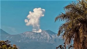
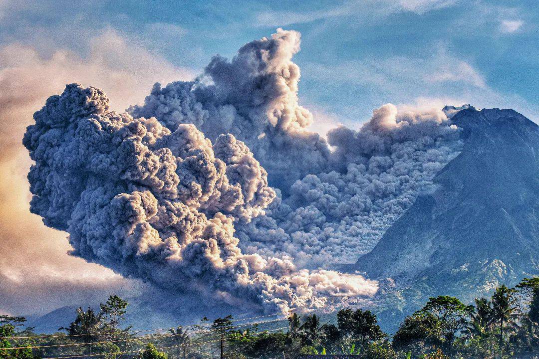
Indonesia , Merapi :
VOLCANO OBSERVATORY NOTICE FOR AVIATION – VONA
Issued : March 12 , 2023
Volcano : Merapi (263250)
Current Aviation Colour Code : ORANGE
Previous Aviation Colour Code : orange
Source : Merapi Volcano Observatory
Notice Number : 2023MER004
Volcano Location : S 07 deg 32 min 31 sec E 110 deg 26 min 31 sec
Area : Special Region of Yogyakarta, Indonesia
Summit Elevation : 9498 FT (2968 M)
Volcanic Activity Summary :
Eruption with volcanic ash cloud at 09h19 UTC (16h19 local).
Volcanic Cloud Height :
Best estimate of ash-cloud top is around 17498 FT (5468 M) above sea level or 8000 FT (2500 M) above summit. May be higher than what can be observed clearly. Source of height data: ground observer.
Other Volcanic Cloud Information :
Ash cloud moving from north to northwest. Volcanic ash is observed to be white to gray. The intensity of volcanic ash is observed from medium to thick.
Remarks :
Eruption recorded on seismogram with maximum amplitude 70 mm and maximum duration 145 second. Ash cloud generated by pyroclastic density currents.
OBSERVED SEISMICITY:
3 earthquakes of hot cloud avalanches with an amplitude of 45-75 mm and a duration of 103.9-144.9 seconds.
51 avalanche earthquakes with an amplitude of 3 to 37 mm and a duration of 26.7 to 199.8 seconds.
28 hybrid/multiphase earthquakes with amplitudes of 3 to 25 mm, and durations of 5.2 to 9.3 seconds.
7 shallow volcanic earthquakes with an amplitude of 53 to 75 mm and a duration of 8.6 to 13.6 seconds.
Source : Magma Indonésie .
Photo : Merapi Uncover/ twitter.
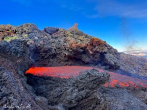
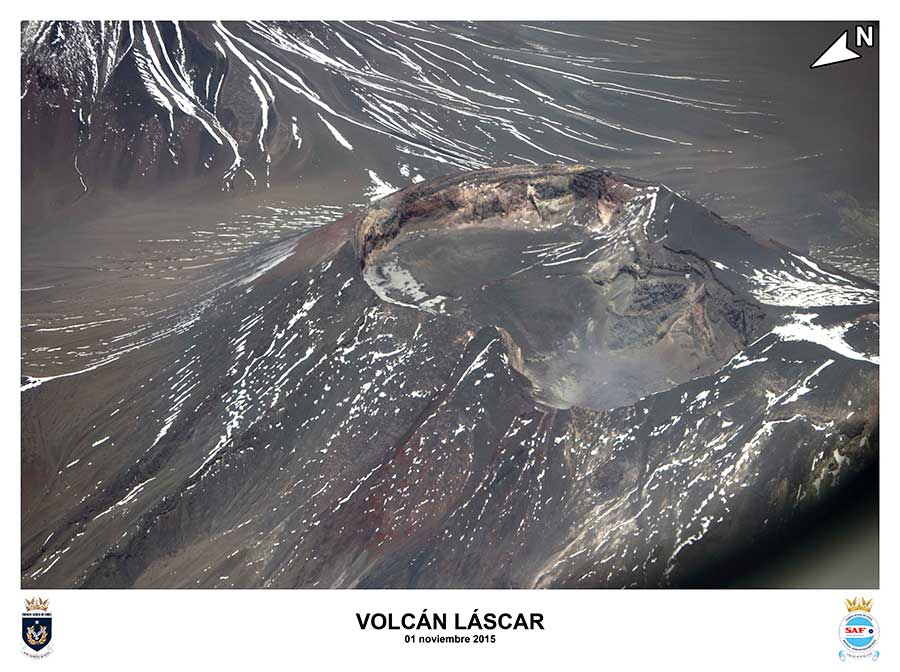
Chile , Lascar :
Special report on volcanic activity (REAV), Antofagasta region, Lascar volcano, March 12, 2023, 09:50 a.m. local time (mainland Chile).
The National Service of Geology and Mines of Chile (Sernageomin) publishes the following PRELIMINARY information, obtained through the monitoring equipment of the National Volcanic Monitoring Network (RNVV), processed and analyzed at the Volcanological Observatory of the Southern Andes ( Ovdas):
On Sunday March 12, 2023, at 09:33 local time (12:33 UTC), the monitoring stations installed near the Lascar volcano recorded a long-period type earthquake (LP type) associated with fluid dynamics in the system. volcanic.
The characteristics of earthquakes after their analysis are as follows:
ORIGINAL TIME: 09:33 local time (12:33 UTC)
REDUCED TRAVEL: 71.3 (cm*cm)
COMMENTS:
Following the event, no changes in the seismic behavior of the volcano were recorded. Also, no superficial activity was recorded following the event.
The volcanic technical alert remains at the Orange level.
Sources : Sernageomin.
Photo : ingeominas /saf.
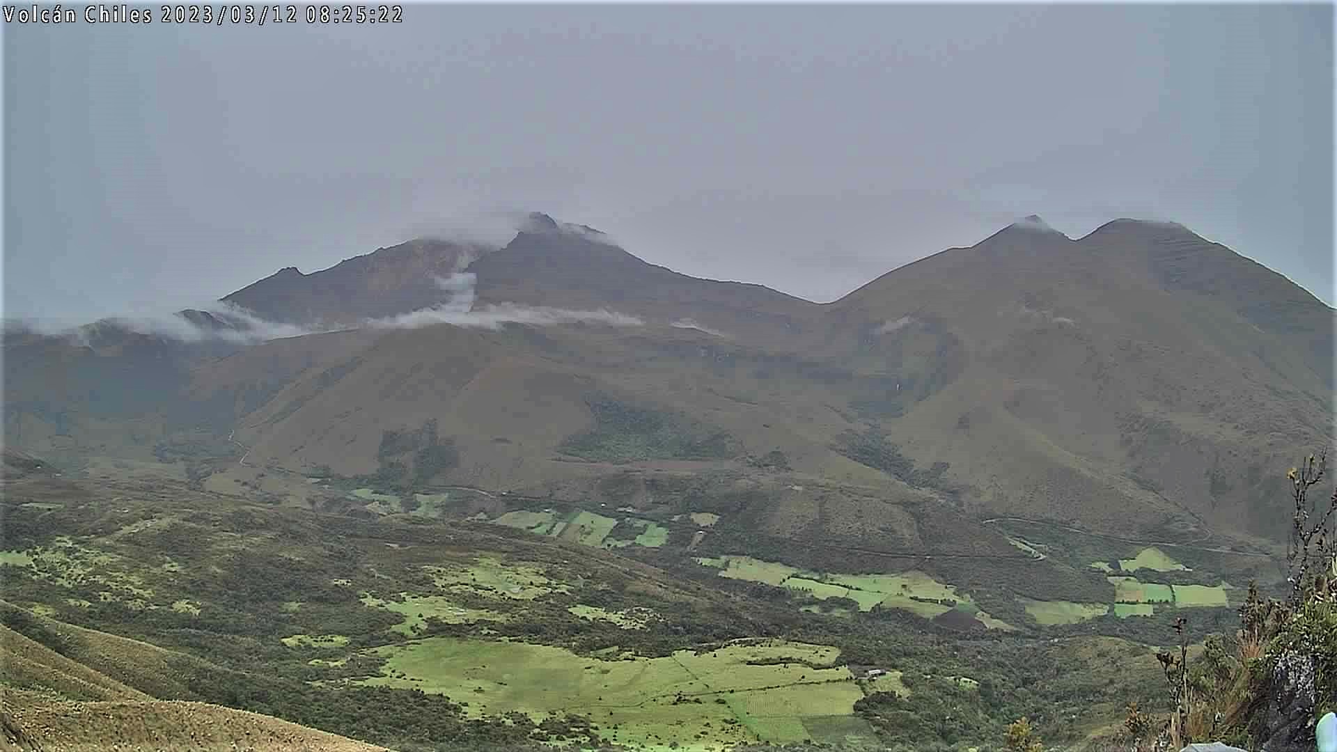
Ecuador , Chiles / Cerro Negro :
DAILY REPORT OF THE STATE OF THE VOLCANO Chiles / Cerro Negro, Sunday March 12, 2023.
Information Geophysical Institute – EPN.
Surface activity level: Very low, Surface trend: No changes
Internal activity level: High, Internal trend: No change
Seismicity: From March 11, 2023, 11:00 a.m. to March 12, 2023, 11:00 a.m.:
The following table shows the automatic earthquake count of the CHL1 reference station over the past 24 hours.
Volcano-tectonic (VT): 4915
Rains / Lahars:
In the early morning and in the morning of today, several episodes of rain were recorded in the sector, without any report of lahars having been received.
Observation:
For the past 24 hours, the volcano has remained mostly cloudy.
Alert Level: Yellow
Source et photo : IGEPN.
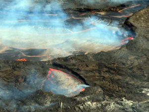
Hawaii , Kilauea :
Sunday, March 12, 2023, 9:29 AM HST (Sunday, March 12, 2023, 19:29 UTC)
19°25’16 » N 155°17’13 » W,
Summit Elevation 4091 ft (1247 m)
Current Volcano Alert Level: WATCH
Current Aviation Color Code: ORANGE
Activity Summary:
Kīlauea volcano is not erupting. The summit eruption of Kīlauea volcano, within Halemaʻumaʻu crater, remains paused. Lava is no longer flowing on the crater floor, where all recent eruptive activity has been confined. No significant changes have been observed along either of the volcano’s rift zones. Yesterday, increased rates of seismicity and deformation at the summit suggested the eruption was about to resume. However, rates of seismicity and deformation later diminished and magma did not reach the surface, resulting in an intrusion instead of an eruption. Resumption of eruptive activity at Kīlauea summit no longer appears to be imminent, although it is possible that another intrusion or resumption may occur in the near future with little or no warning.
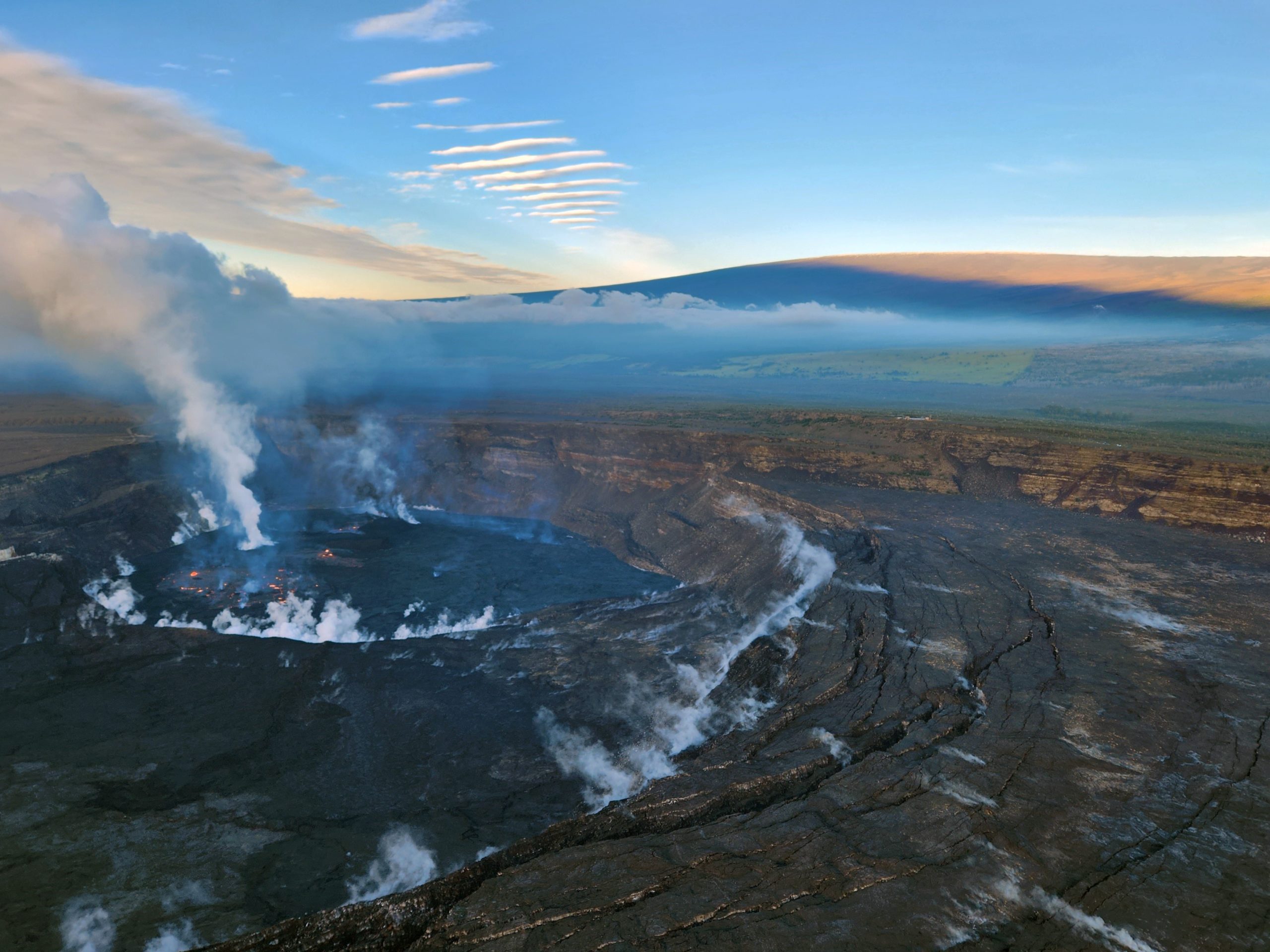
Halemaʻumaʻu crater Lava Lake Observations:
No active lava has been observed over the past 24 hours. A few features on the crater floor are still glowing slightly in overnight webcam views, but these are not erupting lava.
Summit Observations:
HVO summit tiltmeters recorded a relatively sudden transition from inflation to deflation last night at approximately 8:00 p.m. HST. The current deflationary signal follows several days of sustained inflation leading up to yesterday’s magmatic intrusion. A shallow earthquake swarm was detected beneath the summit yesterday between 10:30 and 11:00 a.m. HST. The swarm was followed by a Magnitude-3.4 earthquake located 4 km SW of Volcano, Hawaii, at a depth of approximately 1 km (0.6 miles) at 11:50 a.m HST. This earthquake was felt locally and triggered a rockfall near Uēaloha (Byron Ledge) in Hawai’i Volcanoes National Park. Tilt excursions also coincided with these earthquakes. Seismicity diminished at approximately 12:00 p.m. HST yesterday and has since returned to background levels.
Source : HVO
Photo : USGS / K. Lynn ( archive)