May 02 , 2020 .
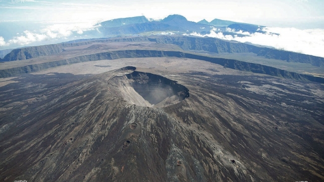
La Réunion , Piton de la Fournaise :
Monthly bulletin for Friday, May 1, 2020.
Seismicity
In April 2020, the OVPF recorded at Piton de La Fournaise: 392 shallow volcano-tectonic earthquakes (0 to 2 km depth) below the summit craters; 10 deep earthquakes (>2 km depth); 312 rockfalls (inside the Cratère Dolomieu or along the cliff of the Enclos Fouqué caldera and the Rivière de l’Est rempart).
In April 2020, the volcano-tectonic activity below the summit of Piton de la Fournaise was predominated by the seismic crisis preceding the April 2-6, 2020 eruption (with 92 earthquakes between 8h15 and 8h51 local time on February 10, and the increase of the seismicity recorded at the end of the eruption . Most of this seismicity was located between 1.5 and 2.5 km depth below the south-eastern part of the Dolomieu crater .Deeper earthquakes (up to 4 km depth) were also located in this area at the end of the eruption, on April 5 and 6 .
In the long term, the eruption of 2-6 April 2020 was only preceded by 4 days of renew of seismicity below the summit zone with 1, 3, 7 and 12 shallow volcano-tectonic earthquakes on March 29, 30, 31 and April 1, respectively .
Following the end of the eruption (April 6), the summit volcano-tectonic activity remained weak, with only 7 shallow volcano-tectonic earthquakes below the summit craters recorded between April 7 and April 30 . Five deep earthquakes (> 2 km depth; below the western flank of the terminal cone and below the eastern flank) were also recorded between April 7 and 30 .
Deformation
No significant inflation directly preceded the April 2-6, 2020 eruption. Indeed, the edifice inflation, which had re-started after the end of the February 10-16, 2020 eruption, stopped around March, 10 2020, and only re-starded around March 29-30 .
The magma injection that led to the April 2-6, 2020 eruption was accompanied by rapid ground deformation of low (a few cm). A deflationary trend of low magnitude at the terminal cone was recorded during the eruption (summit contraction of <5.5 cm).
Edifice inflation directly resumed after the end of the eruption, on April 6, at rates similar to those observed upon the end of the February 10-16 eruption .
Summary
The new increase of soil CO2 flux following the October 25-27 eruption, together with discontinuous edifice inflation, are signs of a deep magma refilling and a pressurization of the shallow magma reservoir. This pressurization stopped on March 10 and re-started only 4 days before the April 2-6, 2020 eruption. Edifice inflation resumed directly following the end of the eruption.
Source : OVPF.
Read the whole article : http://www.ipgp.fr/sites/default/files/ovpf_20200501_bullmensu.pdf
Photos : IPR ,
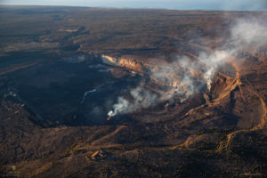
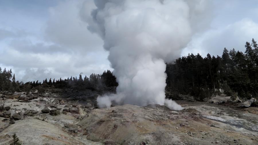
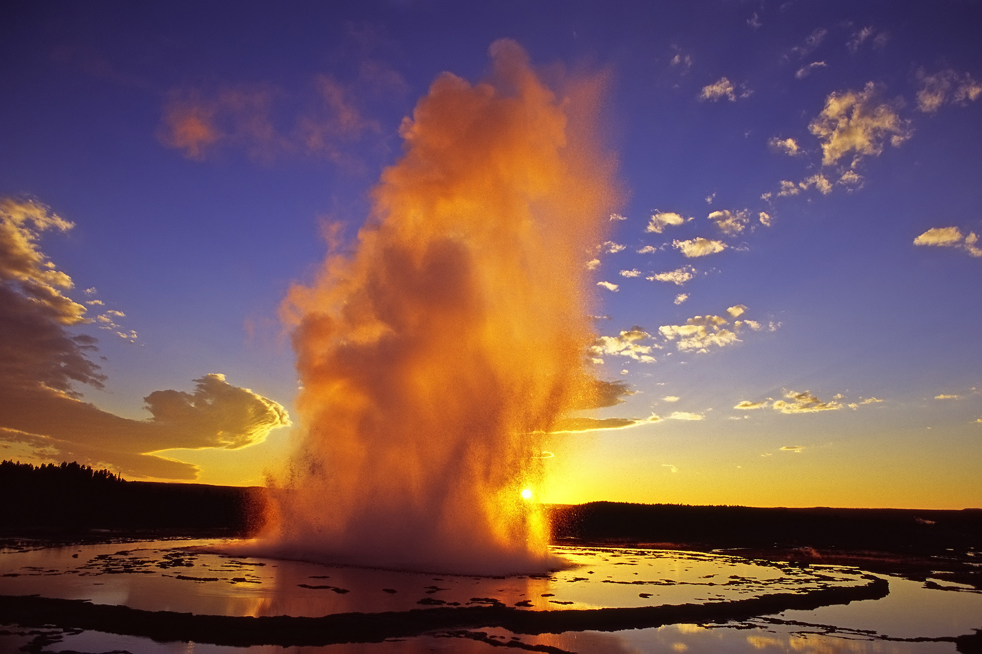
United-States , Yellowstone :
44°25’48 » N 110°40’12 » W,
Summit Elevation 9203 ft (2805 m)
Current Volcano Alert Level: NORMAL
Current Aviation Color Code: GREEN
Recent work and news
YVO would like to reiterate that the earthquake sequences occurring in central Idaho and near Salt Lake City are not related to Yellowstone, and they are not a sign of magma moving. These are aftershocks of the M6.5 central Idaho earthquake on March 31 and the M5.7 Utah earthquake on March 18. Strong earthquakes in the western USA are followed by aftershock sequences that can last months to years and that diminish gradually with time as the fault readjusts. The activity is related to tectonic extention of the western USA.
Steamboat geyser, in Norris Geyser Basin, experienced three water eruptions in the past month, on April 2, 10, and 27, bringing the total number of eruptions for the year to 12.
Seismicity
During April 2020, the University of Utah Seismograph Stations, responsible for the operation and analysis of the Yellowstone Seismic Network, located 134 earthquakes in the Yellowstone National Park region. The largest event was a minor earthquake of magnitude 1.9 located 8 miles north of West Yellowstone, MT, on April 3 at 9:27 PM MDT.
A swarm of 20 earthquakes ranging in magnitude from 0.2 to 1.5 occurred about 4 miles south-southeast of West Thumb in Yellowstone National Park during April 12-13. The largest swarm event occurred on April 12 at 5:52 PM MDT.
Earthquake sequences like these are common and account for roughly 50% of the total seismicity in the Yellowstone region.
Yellowstone earthquake activity remains at background levels.
Ground deformation
The overall deformation style and rate at Yellowstone remains unchanged since the last update. Subsidence of Yellowstone caldera, which has been ongoing since 2015, continues at an average rate of 2-3 cm (about 1 in) per year. In the area of Norris Geyser Basin, little deformation has been detected by a nearby GPS station since the start of 2020.
Source : YVO.
Photos : Behnaz Hosseini. Parc National.
Costa Rica , Turrialba / Poas / Rincon de la Vieja :
Turrialba Volcano :
No eruption is reported.
Seismic activity is similar to that of yesterday.
At the time of this report, the winds were blowing southwest.
The CO2 / SO2 AND H2S / SO2 ratios remain stable while the SO2 concentration shows a significant increase to 11.23 ppm. A plume rich in water vapor is observed.
Poas Volcano:
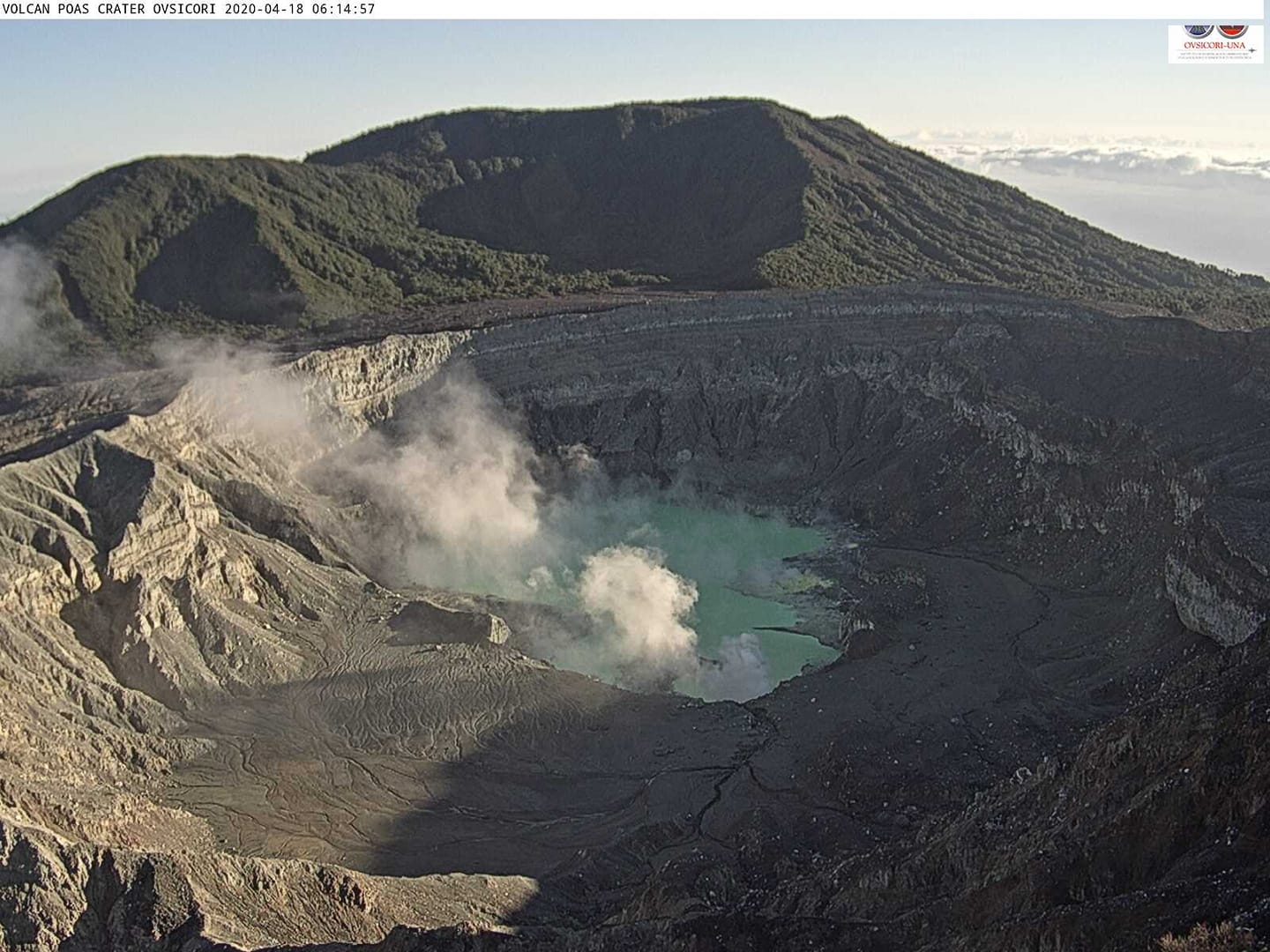
No eruption is reported.
Seismic activity is similar to that of yesterday.
At the time of this report, the winds were blowing southwest.
The CO2 / SO2 AND H2S / SO2 ratios remain stable, as does the SO2 concentration. The maximum SO2 concentration at the point of view was low in the morning, it did not exceed 0.5 ppm. Seismicity shows a continuous tremor between 4-5 Hz. Degassing is observed in the main mouths and from the lake.
Rincon de la Vieja volcano
Activity report of the Rincon de la Vieja volcano, April 30, 2020.
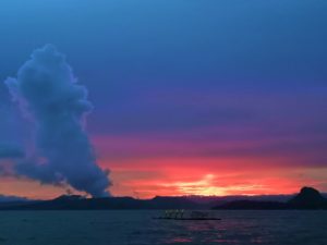
The day April 30, 2020 at 16:10 local time, an eruption was recorded on the Rincon de la Vieja volcano, with a column which rose to 1500 meters above the height of the crater and to 3416 meters above above sea level (11204.48 ft).
Duration of the activity: In progress.
https://www.facebook.com/OVSICORI/videos/678953862867989/
Ash fall reported: no ash fall is reported
Sulfur odor reported: no sulfur odor is reported
Comments: Eruption on the Rincon de la Vieja volcano. The plume of gas and water vapor rises more than 1,500 meters.
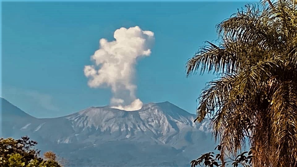
Since April 30, 2020, a continuous eruption has been recorded on the Rincon de la Vieja volcano, with a column that rises 1,500 meters above the height of the crater and 3,416 meters above sea level (11,204.48 ft).
Seismic activity is similar to that of yesterday.
The wind direction is unknown at this time.
Yesterday’s eruption momentarily interrupted the continuous tremor that had occurred, then continued, but there has been a significant decrease in its amplitude since 8 a.m.
Source : Ovsicori .
Vidéo : Ovsicori .
Photos : Dr Paulo ruiz , Theresa Lopez , Maurice Gutiérrez .
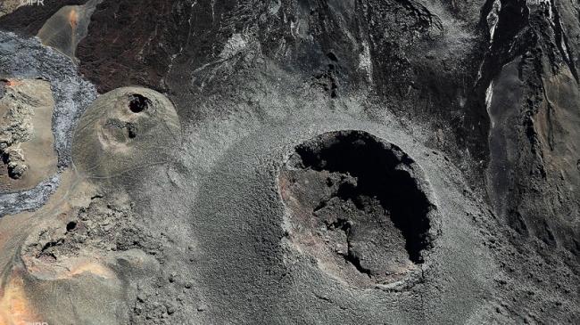
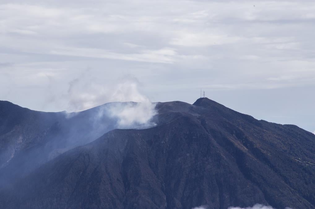
Indonesia , Anak Krakatau :
Level of activity at level II (Waspada) since March 25, 2019. The Anak Krakatau volcano (157 m) has experienced an increase in its volcanic activity since June 18, 2018, which was followed by a series of eruptions in the period from September 2018 to February 2019. The last eruption occurred on April 17, 2020 with a strong eruption column that was not observed.
The volcano is covered with fog. The weather is sunny / rainy, the wind is light towards the North, the East and the North-West.
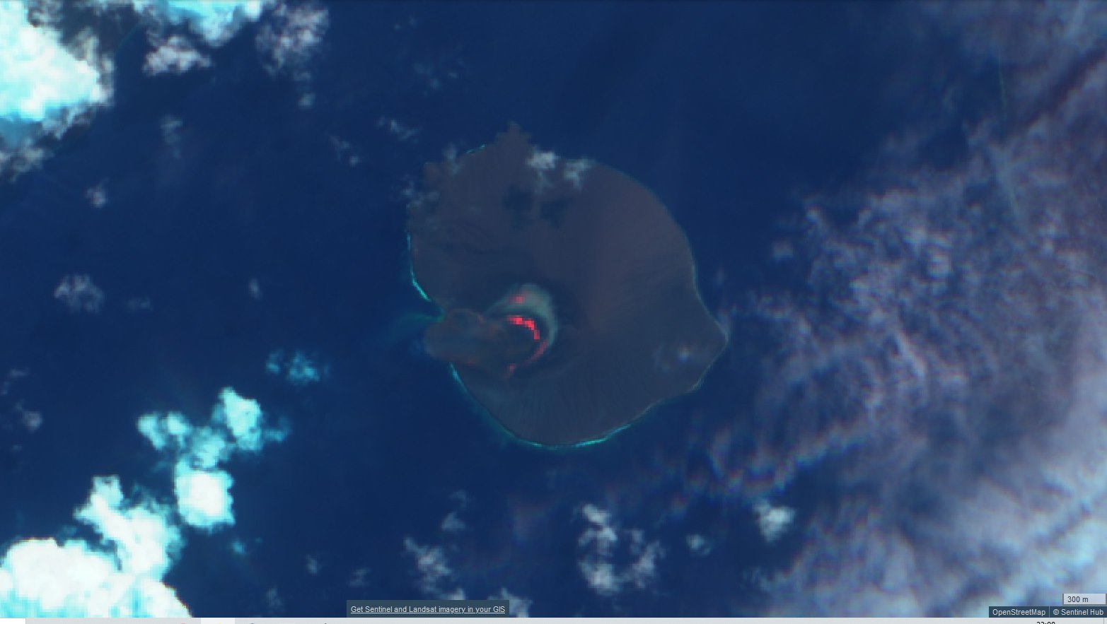
According to seismographs, on May 1, 2020, it was recorded: continuous tremors, amplitude 0.5 to 1 mm (dominant value 0.5 mm)
Recommendation: People / tourists are not allowed to approach the crater within a radius of 2 km.
VONA: The last VONA ORANGE color code was published on April 17, 2020 at 5:51 p.m. No eruption related to the height of the eruption column was observed.
Source : PVMBG.
Photo : Sentinel 2 , 29 / 04/ 2020.