September 06 , 2021.
Iceland , Skaftá River :
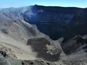
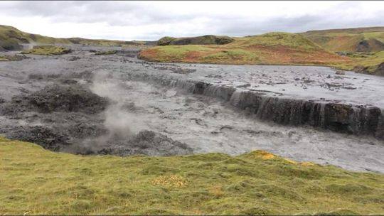
Flood from the Eastern-Skaftá cauldron now imminent , 5.9.2021
This is following a flood from the western cauldron that started Sept 1st and is declining
Updated 5.9. 12:45
GPS measurements from Vatnajökull glacier show that the surface of Eastern-Skaftá cauldron has started to subside. That indicates that slowly the glacieal melt water will drain and in consequence a glacial flood is imminent. Last flood from the Eastern-Skaftá cauldron occurred in August 2018 but minor flood from the western cauldron was in September 2019.
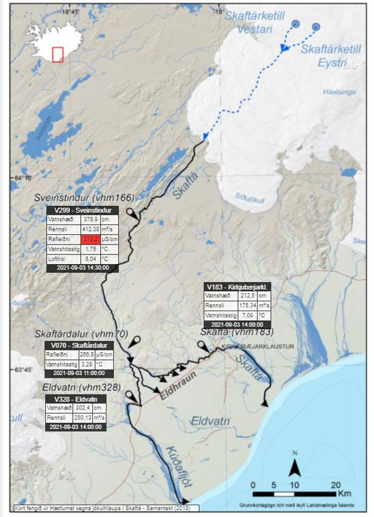
The increase in electrical conductivity in the Skaftá river is probably due to steam explosions from the geothermal area beneath the ice cauldron. Steam explosions occur as the geothermal area adjusts to decreased water pressure resulting from the drainage of the cauldron. The explosions increase the amount of dissolved material in the floodwater, which is detectable downstream as a conductivity increase in the river.
Measurements show the surface of the cauldron has subsided 1 m since 23:00 last night. Initially the water flows 40 km long path below the glacier and then 20 km along Skaftá before it reaches the first hydrological station at Sveinstindur (See map). Maximum discharge during floods from the Eastern cauldron has previously reached 3.000 m3/s but last flood in 2018 peaked at 2.000 m3/s. If compared to the flood in 2018 the first hyderological station will see the first signs of flood water in the morning of the 6th of September.
Danger level due to glacial flooding
The state police and the police headquarters of Südland have declared the level of danger due to the descent of the glacier. A state police announcement said: “The water can spread more than in the past few days, and traffic obstacles are to be expected on the slopes near the Skaftá. Drivers are advised to inquire about road conditions before setting off. Sulfur gases can rise from flood waters that gush out under the glacier and are extremely irritating to the eyes, respiratory tract and mucous membranes. Other rivers in the region can overflow their banks and make roads impassable. Tourists should therefore absolutely stay away from the region around Skaftá above the Skaftárdalurs, as well as the foot of Skaftárjökull, Tungajökull and Síðujökull, as long as the glacial flood continues.
IMO will monitor this event closely and send out more information as it is progressing.
Source : Vedur is , icelandreview.com/
Photo : Páll Stefansson.
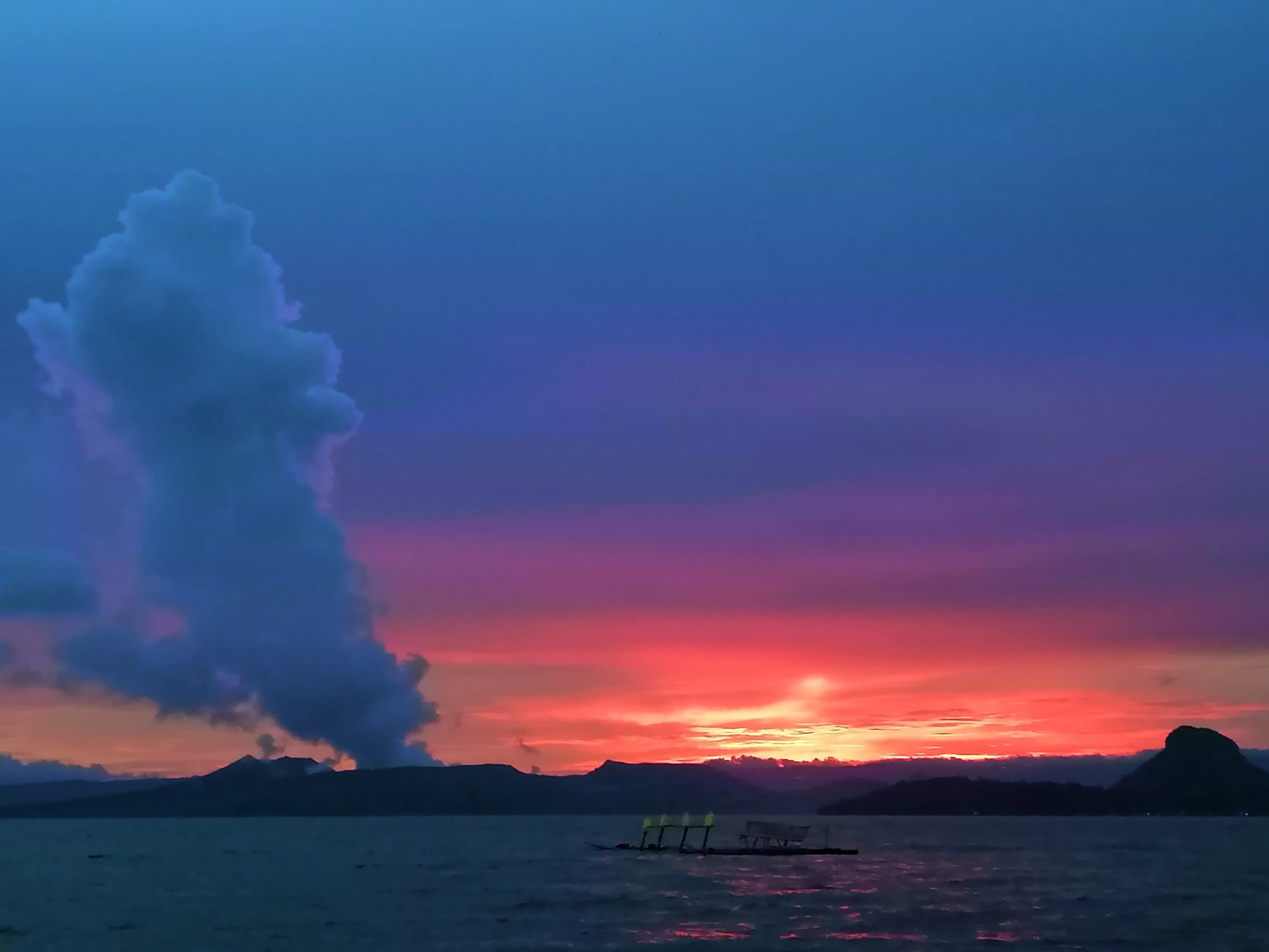
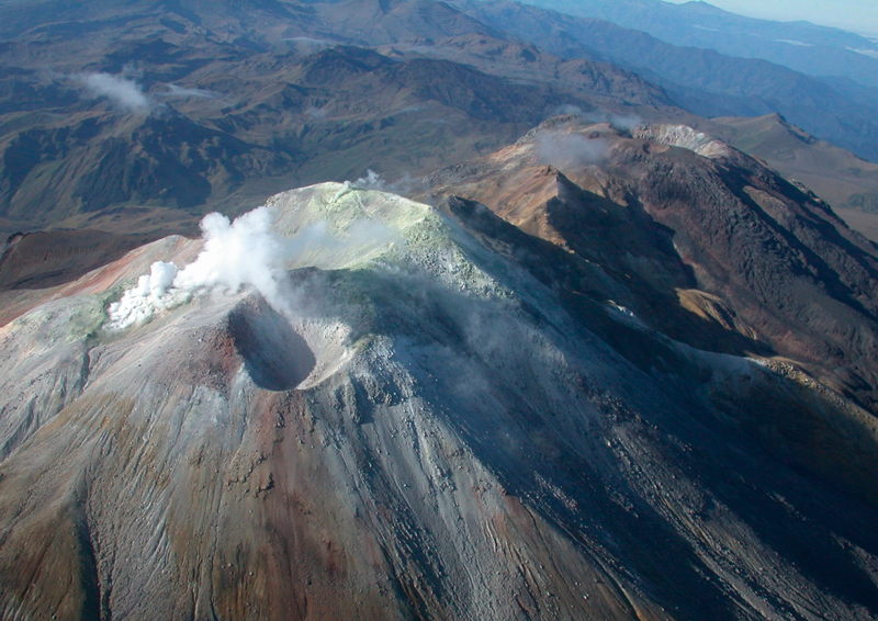
Philippines , Taal :
TAAL VOLCANO BULLETIN 06 September 2021 8:00 AM
In the past 24-hour period, the Taal Volcano Network recorded fourteen (14) volcanic earthquakes, including five (5) volcanic tremor events having durations of one (1) to ten (10) minutes, eight (8) low-frequency volcanic earthquakes, one (1) hybrid event, and low-level background tremor that has persisted since 7 July 2021. Activity at the Main Crater was dominated by upwelling of hot volcanic fluids in its lake which generated plumes 2,500 meters tall that drifted east.
Sulfur dioxide (SO2) emission averaged 5,015 tonnes/day on 5 September 2021. Based on ground deformation parameters from electronic tilt, continuous GPS and InSAR monitoring, Taal Volcano Island has begun deflating in April 2021 while the Taal region continues to undergo very slow extension since 2020.
Source : OVPF
Photo : Paleny Paleny.
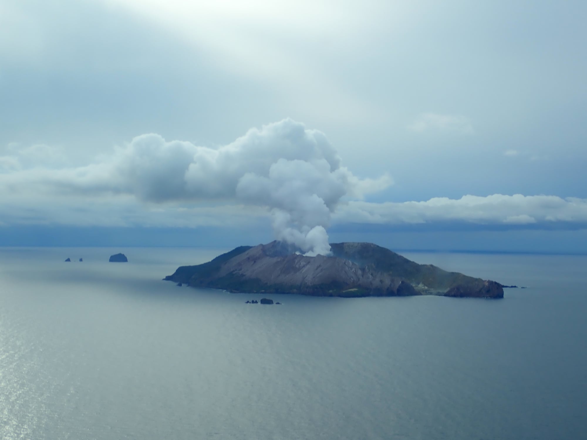
New Zealand , White Island :
Ash emissions reduced, night glow continues , Published: Mon Sep 6 2021 3:55 PM
While intermittent ash emissions have reduced since last week, the volcano remains in a moderate to heightened state of unrest. The Volcanic Alert Level remains at Level 2.
Some sustained ash emissions were observed on Thursday and Friday last week but have now decreased. While the ash was carried downwind towards the coast, no ash falls were observed on the mainland.
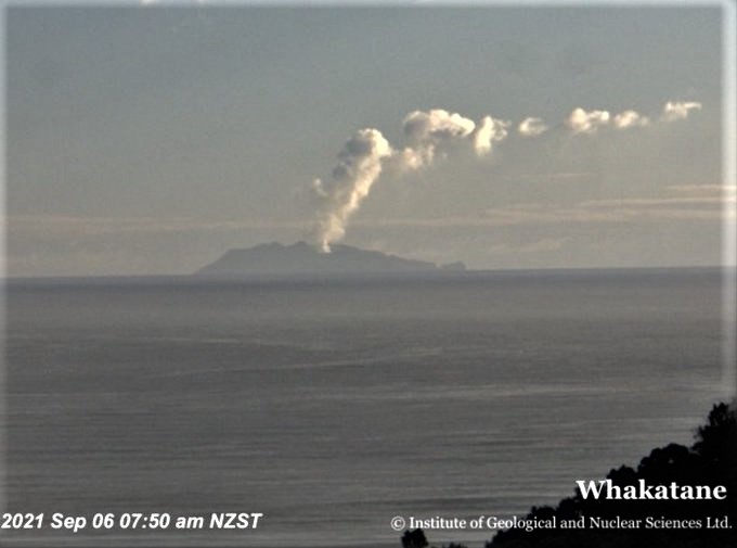
Persistent night glow continues to be observed on our night vision cameras, indicating high-temperature gas emissions. The volcano is emitting a lot of hot gas and steam and coupled with weather conditions, this has caused plumes to form above the island. These have been well observed from the coast.
Satellite based ground deformation measurements continue to show a broad region of subsidence around the active vents. This may be attributed to the release of pressurised gas at depth which has fed the recently observed plumes. It is likely that weak wall fragments fall into the gas stream through the active vents, leading to the reported ash emissions. We have recorded several volcanic earthquakes, but other seismic activity has been minor.
The current level of activity is consistent with moderate to heightened levels of unrest. As such the Volcanic Alert Level remains at 2 and the Aviation Colour Code remains at Yellow.
Equipment that provides real-time monitoring on the island is currently degraded and we are continuing to work on restoration options.
The Volcanic Alert Level reflects the current level of volcanic unrest or activity and is not a forecast of future activity. While Volcanic Alert Level 2 is mostly associated with volcanic unrest hazards (including discharge of steam and hot volcanic gases, earthquakes, landslides, and hydrothermal activity), potential for eruption hazards also exists and eruptions can still occur with little or no warning.
GNS Science and the National Geohazards Monitoring Centre continue to monitor Whakaari/White Island for further changes in unrest.
Source : Geonet / Yannik Behr / Duty Volcanologist
Photos : Geonet
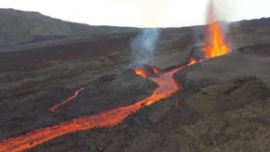
Colombia , Cumbal :
Cumbal Volcanic Complex Weekly Activity Bulletin
The activity of the Cumbal Volcanic Complex continues at: YELLOW LEVEL ■ (III): CHANGES IN THE BEHAVIOR OF VOLCANIC ACTIVITY.
From monitoring the activity of the CUMBAL VOLCANIC COMPLEX, the COLOMBIAN GEOLOGICAL SERVICE (SGC) reports that:
For the period August 24-30, 2021, seismicity recorded a slight increase in both occurrence and energy released, compared to the previous week.
Most of the earthquakes were located in an area south-east of the two active cones of the complex, at distances less than 4 km and at depths less than 2 km from the height of the crater La Plazuela (4700 m d ‘altitude ). Other earthquakes were located in a dispersed manner, at distances of up to 8 km and at depths less than 4 km. The maximum local magnitude was 2.0.
Favorable atmospheric conditions allowed the recording of gas emissions from the El Verde fumarole field (in the North-East), with white columns and a variable dispersion according to the direction of the winds.
No significant variation was observed in the other parameters of the volcanic monitoring.
The COLOMBIAN GEOLOGICAL SERVICE remains attentive to the evolution of the volcanic phenomenon.
Source et photo : SGC.
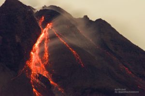
Guatemala , Fuego :
ACTIVITY:
Seismic stations reflect activity and OVFGO observers report that weak white fumaroles and explosions accompanied by ash were observed overnight and early in the morning in a range of 10 to 15 per hour. These rise to an approximate height of 4,500 m (14,764 feet) in a north and northwest direction, generating ash falls in areas near the volcano.

Incandescent pulses were observed rising 100-200 above the crater, accompanied by a faint white fumarole. Some of the explosions generate weak, moderate and some loud rumbles that generate vibrating shock waves on roofs and windows within a 10 kilometer radius in the villages of the West and South West Flanks. Constant boulder avalanches were heard in the direction of the ravines of Ceniza, Taniluya, Trinidad and Santa Teresa, some of the material reached the edge of the vegetation. A degassing noise identical to a train locomotive is reported.
Source : Insivumeh.
Photo : @davidrojasgtfoto