May 16, 2023.
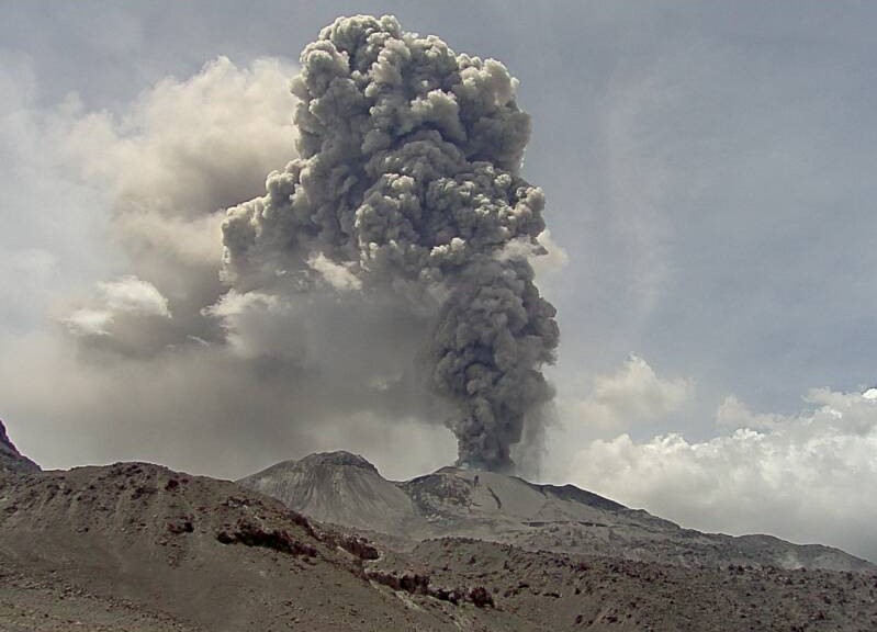
Russia / Kuril Islands , Ebeko :
VOLCANO OBSERVATORY NOTICE FOR AVIATION (VONA)
Issued: May 15 , 2023
Volcano: Ebeko (CAVW #290380)
Current aviation colour code: ORANGE
Previous aviation colour code: orange
Source: KVERT
Notice Number: 2023-69
Volcano Location: N 50 deg 41 min E 156 deg 0 min
Area: Northern Kuriles, Russia
Summit Elevation: 1156 m (3791.68 ft)
Volcanic Activity Summary:
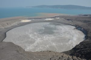
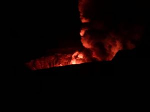
A moderate explosive activity of the volcano continues. According to visual data an explosion sent ash up to 3 km a.s.l., an ash cloud is drifting to the east of the volcano.
A moderate eruptive activity of the volcano continues. Ash explosions up to 6 km (19,700 ft) a.s.l. could occur at any time. Ongoing activity could affect low-flying aircraft and airport of Severo-Kurilsk.
Volcanic cloud height:
3000 m (9840 ft) AMSL Time and method of ash plume/cloud height determination: 20230515/2132Z – Visual data
Other volcanic cloud information:
Distance of ash plume/cloud of the volcano: 5 km (3 mi)
Direction of drift of ash plume/cloud of the volcano: E
Time and method of ash plume/cloud determination: 20230515/2132Z – Visual data
Source : Kvert
Photo : L. Kotenko. IVS FEB RAS
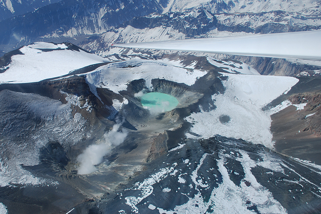
Chile , Tupungatito :
Seismology
The seismological activity of the period was characterized by the recording of:
76 VT-type seismic events, associated with rock fracturing (Volcano-Tectonics). The most energetic earthquake presented a value of local magnitude (ML) equal to 3.2, located 5.7 km north-north-west of the volcanic edifice, at a depth of 6.8 km by relative to the crater.
36 LP-type seismic events, associated with fluid dynamics within the volcanic system (Long Period). The size of the largest earthquake assessed from the Reduced Displacement (DR) parameter was equal to 7.9 cm2.
1 HB-type seismic event, associated with both rock fracturing and fluid dynamics within the volcanic system (Hybrid). The earthquake size estimated from the Reduced Displacement (DR) parameter was equal to 2.5 cm2.
Fluid Geochemistry
No anomalies in sulfur dioxide (SO2) emissions into the atmosphere have been reported in the area near the volcanic system, according to data published by the Tropospheric Monitoring Instrument (TROPOMI) and the Ozone Monitoring Instrument (OMI) Sulfur Dioxide Group.
Satellite thermal anomalies
During the period, no thermal alert was recorded in the area associated with the volcanic edifice, according to the analytical processing of Sentinel 2-L2A satellite images, in combination with false color bands.
Surveillance cameras
The images provided by the fixed camera, installed near the volcano, recorded regular degassing during the evaluated period, with a maximum column height of 1,340 meters on April 4.
Activity remained at levels considered low, suggesting stability of the volcanic system. The volcanic technical alert is maintained at:
GREEN TECHNICAL ALERT: Active volcano with stable behavior – There is no immediate risk
Source et photo : Sernageomin
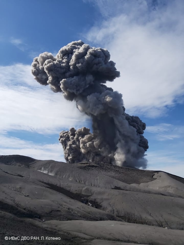
Colombia , Nevado del Ruiz :
Manizales, May 15, 2023 10:35 a.m.
Regarding the monitoring of the activity of the NEVADO DEL RUIZ VOLCANO, the MINISTRY OF MINES AND ENERGY through the COLOMBIAN GEOLOGICAL SERVICE (SGC) informs that:
Since 9:00 a.m. yesterday (May 14) until the time of publication of this bulletin, the seismic activity associated with the fracturing of the rock inside the volcanic edifice has shown a significant increase in terms of the number of earthquakes. earth and seismic energy released compared to the day before (May 13) and the week before. This seismicity was located mainly to the southwest of the Arenas crater, at a distance of between 4 and 5 km from it, with depths of between 2 and 4 km. The maximum magnitude was 2.8 ML (Local Magnitude), corresponding to two earthquakes recorded yesterday at 12:59 m. and 1:00 p.m., both reported as felt in the Lagunilla sector of the municipality of Murillo (department of Tolima).
Similarly, the seismic activity related to the movement of fluids inside the volcanic conduits, presented an increase in particular of the seismic energy released compared to
the day before (May 13). Some of the seismic signals were associated with pulsating ash emissions, confirmed by web cameras used for volcanic monitoring.
The ash emission recorded this morning at 05:20 a.m. stands out, which generated ash falls in the city of Manizales and the municipality of Villamaría (department of Caldas).

In addition to this, reports of the smell of sulfur have been received from various areas of Manizales. This may be due to the dispersion of a high concentration of sulfur dioxide (SO2) from the volcano, which, together with certain components of the ash, could react with the humidity of the environment and create a similar irritating smell and sensation. to sulfur compounds. The appearance of this type of phenomenon does not indicate any relevant change in the activity of the volcano, it simply occurs occasionally when this type of factor comes together (SO2 concentration and high humidity), and is considered in the parameters of a volcano at the orange activity level. It would only affect people if the exposure is direct and prolonged over time, but this is not the case in Manizales, as sulfur dioxide concentrations decrease as they disperse into the atmosphere.
Regarding the maximum height of the column of gas and / or ash observed, it was 500 m measured from the summit of the volcano. Between yesterday and today, the preferred direction of dispersion of the column of gas and / or ash remained towards the West and the North-West of the volcano. On the other hand, variations continue in the degassing of sulfur dioxide and the release of water vapor from the crater into the atmosphere.
Source et photo : SGC
Alaska , Tanaga :
51°53’2″ N 178°8’35 » W,
Summit Elevation 5925 ft (1806 m)
Current Volcano Alert Level: ADVISORY
Current Aviation Color Code: YELLOW
Earthquake activity beneath Tanaga Volcano and nearby Takawangha volcano remained elevated over the past day. This is not unusual during periods of unrest. No other activity was observed in cloudy satellite images.
Increases in seismic activity have been detected previously at Tanaga Volcano and other similar volcanoes, with no subsequent eruptions. We expect additional shallow seismicity and possibly other signs of unrest, such as gas emissions, elevated surface temperatures, and additional surface deformation to precede any future eruption, if one were to occur.
Tanaga Volcano and Takawangha volcano are monitored with a local seismic and infrasound network, regional infrasound and lightning detection networks, and satellite data. Takawangha volcano is about 5 miles (8 km) east of Tanaga Volcano on Tanaga Island.
Source : AVO
Photo : Clifford, Roger
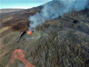
Peru , Sabancaya :
Analysis period: from May 08, 2023 to May 14, 2023, Arequipa, May 15, 2023.
Alert level: ORANGE
The Geophysical Institute of Peru (IGP) reports that the eruptive activity of the Sabancaya volcano remains at moderate levels, that is to say with the recording of an average of 23 daily explosions, with columns of ash and of gas up to 1.7 km altitude above the summit of the volcano and their subsequent dispersion. Therefore, for the following days, no significant change is expected in eruptive activity.
The IGP recorded and analyzed the occurrence of 293 earthquakes of volcanic origin, associated with the circulation of magmatic fluids inside the Sabancaya volcano. An average of 23 explosions was recorded daily, in addition to recording Volcano-Tectonic (VT) type events associated with rock fracturing inside the Sabancaya volcano.
Monitoring the deformation of the volcanic structure using GNSS techniques (processed with fast orbits) does not show any significant anomalies. Visual surveillance identified columns of gas and ash up to 1.7 km above the summit of the volcano, which were scattered towards the eastern and southeastern sectors of Sabancaya. Satellite recordings identified the presence of 1 thermal anomaly, with a maximum value of 1 MW, associated with the presence of a lava body on the surface of the volcano’s crater.
RECOMMENDATIONS
• Keep the volcanic alert level orange.
• Do not approach within a radius of less than 12 km from the crater.
Source : Cenvul.
Photo :Ingemmet