March 10 , 2023 .
Italy , Stromboli :
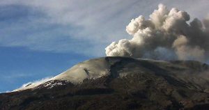
Statement on Stromboli activity, 08 March 2023, 08:27 (07:27 UTC),
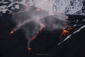
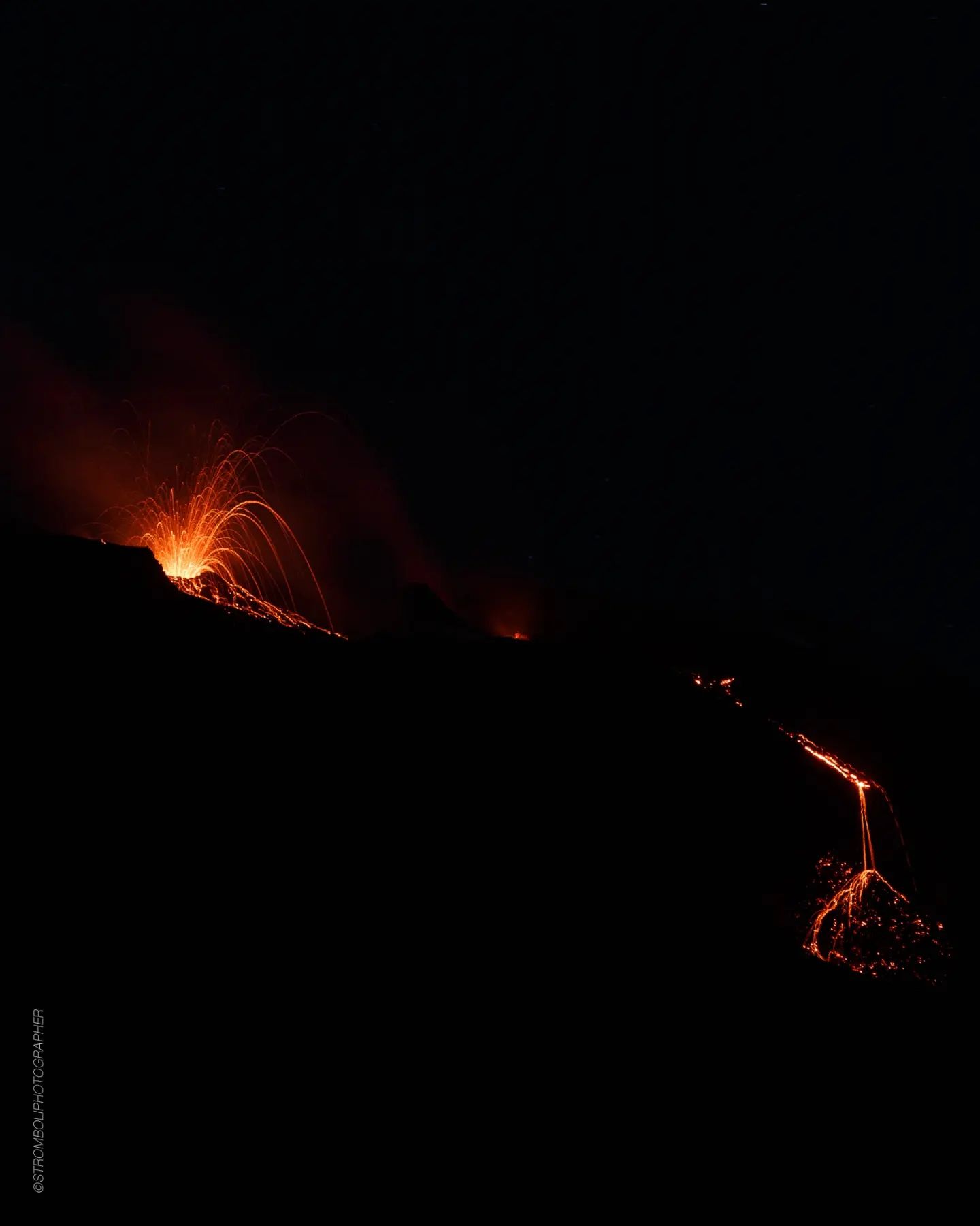
The National Institute of Geophysics and Volcanology, Osservatorio Etneo, communicates that from the analysis of the surveillance cameras, it is observed that an overflow of lava is in progress from the area of the North crater, which began towards 05:20 UTC. The overflow was accompanied by pyroclastic flows and rolling blocks that reached the base of the Sciara del Fuoco, in particular at 05:32, 05:53, 06:01, 06:24 and 06:39 UTC.
From a seismic point of view, over the last 24 hours the average amplitude of the volcanic tremor has almost always remained within the range of average values; only in the last hours of yesterday evening, from 21:00 UTC, the amplitude of the tremor reached high values. At present, small amplitude fluctuations have been recorded during the day, which still remains within the range of average values.
There are no significant variations in the rate of occurrence and in the amplitude of the blast quakes.
Data from the geodetic monitoring networks of the island of Stromboli show no significant variation over the past 12 hours.
Statement on Stromboli activity, March 09, 2023, 09:30 (08:30 UTC),
The National Institute of Geophysics and Volcanology, Osservatorio Etneo, communicates that from the analysis of the images of the surveillance cameras, it has been observed that the lava flow described in the press release of 08/03 (06 :39 UTC) stopped yesterday afternoon. The flow cools and explosive activity is observed from the North and South Center crater area.
From a seismic point of view, over the last 24 hours the average amplitude of the volcanic tremor has always remained within the range of average values; it was only around 18:00 UTC yesterday that the amplitude of the tremor reached medium to high values.
There are no significant variations in the rate of occurrence and in the amplitude of the blast quakes.
Data from the geodetic monitoring networks of the island of Stromboli show no significant variation in the last 24 hours.

Statement on Stromboli activity, March 09, 2023, 18:41 (17:41 UTC)
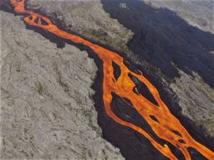
The National Institute of Geophysics and Volcanology, Osservatorio Etneo, communicates that from the analysis of the surveillance cameras, it is observed that from 17:20 UTC, an overflow of lava is in progress from the area of the crater North. Strong spattering activity is also observed from one of the vents in the northern area of the crater. From a seismic point of view, since the last update at 08:30 UTC, the average amplitude of the volcanic tremor showed oscillations between average and low values. There are no significant variations in the rate of occurrence and in the amplitude of the explosion tremors.
Data from the geodetic monitoring networks of the island of Stromboli show no significant variation in the last 24 hours
Further updates will be communicated soon.
Source : INGV.
Photos : Stromboli Stati d’animo. INGV.
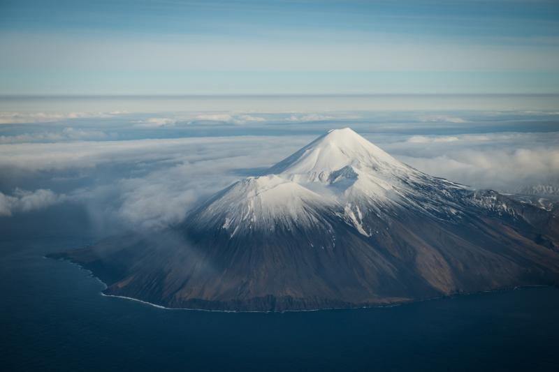
Alaska , Tanaga / Takawangha :
51°53’2″ N 178°8’35 » W,
Summit Elevation 5925 ft (1806 m)
Current Volcano Alert Level: ADVISORY
Current Aviation Color Code: YELLOW
Earthquake activity beneath Tanaga Volcano began to increase starting at about 1:30 PM AKST yesterday (March 7). At roughly 8:45 PM AKST last night, the activity escalated with earthquakes occurring as often as 2 or 3 each minute. Initial locations of these earthquakes place them beneath the summit of Tanaga Volcano and to the west, beneath Sajaka volcano. The largest of these earthquakes have magnitudes between 2 and 3. Seismic activity slowed overnight before picking up again this morning, with several dozen events occurring per hour. In response to this seismicity, the Alaska Volcano Observatory raised the Aviation Color Code to YELLOW and the Volcano Alert Level to ADVISORY.
AVO/USGS Volcanic Activity Notice
Current Volcano Alert Level: WATCH
Previous Volcano Alert Level: ADVISORY
Current Aviation Color Code: ORANGE
Previous Aviation Color Code: YELLOW
Issued: Thursday, March 9, 2023, 5:19 PM AKST
Source: Alaska Volcano Observatory
Notice Number: 2023/A268
Location: N 51 deg 53 min W 178 deg 8 min
Elevation: 5925 ft (1806 m)
Area: Aleutians
Volcanic Activity Summary:
Over the past 48 hours, earthquake activity near Tanaga Volcano has been elevated and continues. This sustained activity indicates an increased potential for eruption at the volcano. Therefore AVO is raising the Aviation Color Code to ORANGE and the Volcano Alert Level to WATCH.
Seismic activity is also elevated at Takawangha volcano, which is about 8 km (5 miles) east of Tanaga on Tanaga Island. If an eruption were to occur, it is uncertain at this stage if it would come from Tanaga or Takawangha.
AVO analysts continue to monitor the situation closely, and locate events as time permits. Earthquakes are occurring under Tanaga Island at a rate of up to several per minute. The largest event over the past 24 hours was a M3.9 located under Tanaga Volcano.
No eruptive activity or signs of unrest have been detected in satellite or other monitoring data.
Tanaga Volcano is monitored with a local seismic and infrasound network, regional infrasound and lightning detection networks, and satellite data.
At 22h15 on 7 March AVO raised the Aviation Color Code for Tanaga to Yellow and the Volcano Alert Level to Advisory due to increased seismicity. Earlier that afternoon, starting at about 13h30, seismicity began to increase and by around 2045 earthquakes were occurring at a rate of 2-3 per minute. The events were located at shallow depths and the largest events were M2-3.
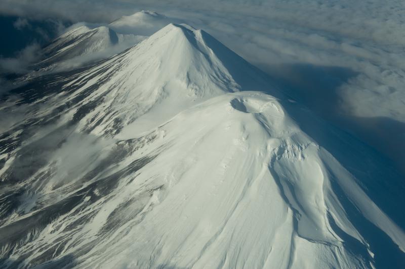
Volcan Takawangha:
AVO/USGS Volcanic Activity Notice
Current Volcano Alert Level: WATCH
Previous Volcano Alert Level: ADVISORY
Current Aviation Color Code: ORANGE
Previous Aviation Color Code: YELLOW
Issued: Thursday, March 9, 2023, 5:22 PM AKST
Source: Alaska Volcano Observatory
Notice Number: 2023/A225
Location: N 51 deg 52 min W 178 deg 1 min
Elevation: 4754 ft (1449 m)
Area: Aleutians
Volcanic Activity Summary:
Over the past 48 hours, earthquake activity near Takawangha volcano has been elevated and continues. This sustained activity indicates an increased potential for eruption at the volcano. Therefore AVO is raising the Aviation Color Code to ORANGE and the Volcano Alert Level to WATCH.

Seismic activity is also elevated at Tanaga Volcano, which is about 8 km (5 miles) west of Takawangha on Tanaga Island. If an eruption were to occur, it is uncertain at this stage if it would come from Takawangha or Tanaga.
AVO analysts continue to monitor the situation closely, and locate events as time permits. Earthquakes are occurring under Tanaga Island at a rate of up to several per minute. The largest event over the past 24 hours was a M3.9 located under Tanaga Volcano.
No eruptive activity or signs of unrest have been detected in satellite or other monitoring data.
Takawangha is monitored with a local seismic network, a single local infrasound sensor, regional infrasound and lightning sensors, and satellite imagery.
Source : AVO , GVP.
Photos : Roger Clifford , Coombs, M. L.
Indonesia , Karangetang :
INFORMATION
Seismicity is dominated by avalanche earthquakes
Observation of seismicity:
1 distant tectonic earthquake with an amplitude of 10 mm and 64 seconds.
1 Continuous tremor with an amplitude of 0.5 to 2 mm, dominant value of 1 mm.
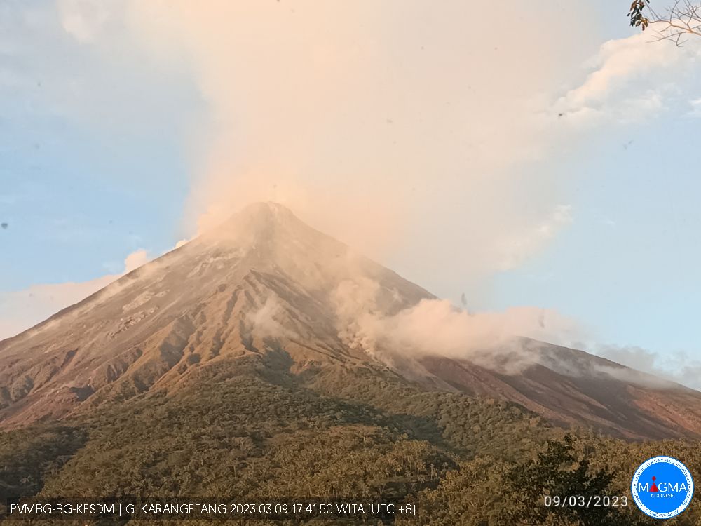
According to PVMBG the eruption at Karangetang’s Main Crater (S crater) continued during 1-7 March. Nighttime webcam images posted with daily reports showed flows of incandescent material descending the flanks, though incandescence decreased towards the end of the week. The Alert Level remained at 3 (on a scale of 1-4) and the public were advised to stay 2.5 km away from Main Crater with an extension to 3.5 km on the S and SE flanks.
Source : Magma Indonésie , GVP.
Chile , Puyehue – Cordon Caulle :
Seismology
The seismological activity of the period was characterized by the recording of:
101 VT-type seismic events, associated with rock fracturing (Volcano-Tectonics). The most energetic earthquake presented a value of local magnitude (ML) equal to 1.8, located 6.0 km south-south-east of the eruptive center of the year 2011, with a depth of 5, 1 km in reference to the crater.
15 LP-type seismic events, associated with fluid dynamics within the volcanic system (Long Period). The size of the largest earthquake assessed from the Reduced Displacement (DR) parameter was equal to 4 cm2.
1 TR type seismic event, associated with the dynamics maintained over time of the fluids within the volcanic system (TRemor). The earthquake size estimated from the Reduced Displacement (DR) parameter was equal to 4 cm2.
Fluid Geochemistry
No anomaly of sulfur dioxide (SO2) emissions in the atmosphere has been reported in the area close to the volcanic complex, according to data published by the Tropospheric Monitoring Instrument. (TROPOMI) and Ozone Monitoring Instrument (OMI) Sulfur Dioxide Group.
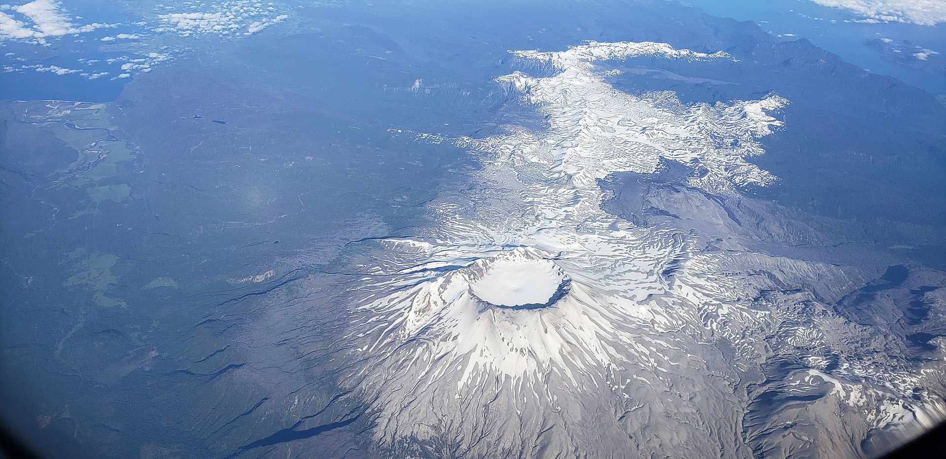
Satellite thermal anomalies
During the period, no thermal alert was recorded in the area associated with the volcanic complex, according to data processed by Middle Infrared Observation of Volcanic Activity (MIROVA) and through the analytical processing of Sentinel 2-L2A satellite images. , in combination with false color bands.
Geodesy
Based on the data provided by 5 GNSS stations installed on the volcanic complex, it can be seen that the continuous inflationary process prevails at rates of change slightly higher than the average recorded since 2017. The maximum flow in the vertical direction is 1. 25 cm/month, recorded at the ANTR station, located North-North-East of the 2011 emission center. By radar interferometry using images between December 2022 and February 2023, a signal coherent with the deformation measured by GNSS can be highlighting.
Surveillance cameras
The images provided by the fixed camera, installed near the complex, did not record any degassing columns or variations linked to surface activity.
Activity remained at levels considered low, suggesting stability of the volcanic system. The volcanic technical alert is maintained at: GREEN TECHNICAL ALERT: Active volcano with stable behavior – There is no immediate risk.
Source et photo : Sernageomin.
New Zealand , White Island :
Whakaari/White Island continues to emit significant amounts of gas and steam. Published: Fri Mar 10 2023 4:00 PM
Volcanic Alert Level remains at 2
Aviation Colour Code remains at Yellow
Recent observation and gas flights confirm that active vents are continuing to emit a significant steam and gas plume. The Volcanic Alert Level remains at 2.
An observation flight on 2 March 2023 and a gas flight on 9 March 2023 showed that Whakaari continues to emit significant amounts of steam and gas at a temperature of around 240 C. To put this into context, we observed temperatures of more than 600 C in the past. During certain weather patterns the steam coming out the crater can generate large plumes that are clearly visible from the mainland as happened on 5 March 2023 (Figure 1). Gas fluxes have increased compared to the previous measurements but are within the usual range for Whakaari.
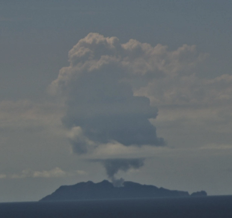
Figure 1: Large steam plume over Whakaari/White Island as seen from Whakatane on 5 March 2023.
The substantial amounts of rain during the past month have raised the water levels in the crater lake and some of the smaller pools. As a result, some fumaroles are now under water leading to geysering and bubbling. No signs of volcanic ash in the plume or other eruptive activity were observed during the recent flights.

Figure 2: View of the active vent area producing steam and gas emission, 2 March 2023.
The VAL remains at Level 2 (moderate to heightened unrest) and the Aviation Colour Code remains at Yellow, acknowledging the current level of activity, but also continuing to acknowledge the greater level of uncertainty in our interpretation due to the current lack of consistent, useful real-time data.
As the weather allows, we will under-take additional gas and observation flights to the island until we can service our on-island equipment and power supplies. We still have intermittent access to webcams images from the island, providing some level of visual monitoring between our flights.
The Volcanic Alert Level reflects the current level of volcanic unrest or activity and is not a forecast of future activity. While Volcanic Alert Level 2 is mostly associated with volcanic unrest hazards (including discharge of steam and hot volcanic gases, earthquakes, landslides, and hydrothermal activity), potential for eruption hazards also exists and eruptions can still occur with little or no warning.
Source et photos : Geonet / Yannik Behr ,Duty Volcanologist