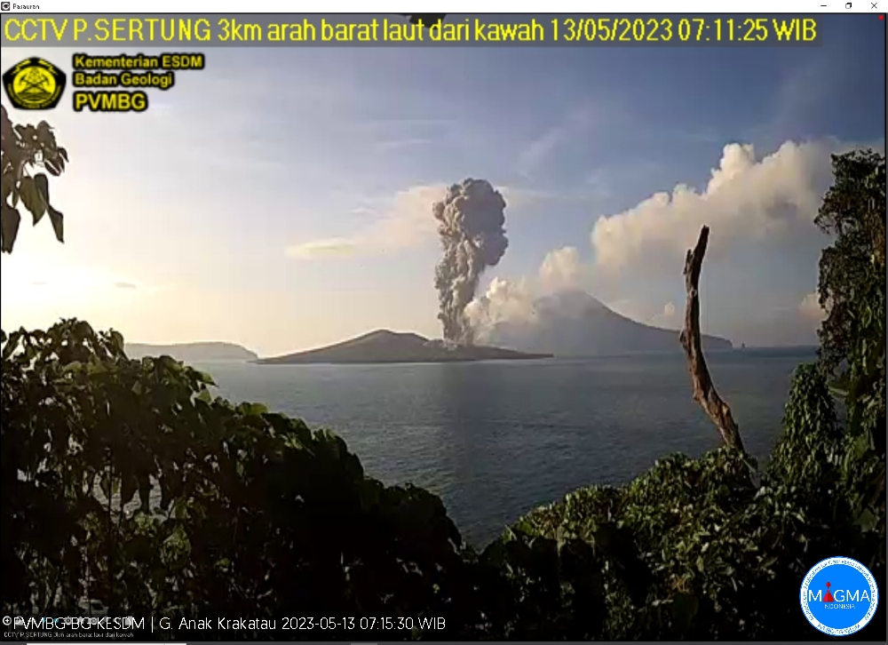
May 13 , 2023.
Indonesia , Anak Krakatau :
An eruption of Anak Krakatau occurred on Saturday May 13, 2023 at 07:10 WIB. The height of the eruptive column was observed at ± 2000 m above the summit (± 2157 m above sea level). The ash column was observed to be gray with a thick intensity, oriented to the southwest. The eruption was recorded on a seismograph with a maximum amplitude of 65 mm and a duration of 68 seconds.
VOLCANO OBSERVATORY NOTICE FOR AVIATION – VONA
Issued : May 13 , 2023.
Volcano : Anak Krakatau (262000)
Current Aviation Colour Code : ORANGE
Previous Aviation Colour Code : orange
Source : Anak Krakatau Volcano Observatory
Notice Number : 2023KRA051
Volcano Location : S 06 deg 06 min 07 sec E 105 deg 25 min 23 sec
Area : Lampung, Indonesia
Summit Elevation : 502 FT (157 M)
Volcanic Activity Summary :
Eruption with volcanic ash cloud at 00h10 UTC (07h10 local).
Volcanic Cloud Height :
Best estimate of ash-cloud top is around 6902 FT (2157 M) above sea level or 6400 FT (2000 M) above summit. May be higher than what can be observed clearly. Source of height data: ground observer.
Other Volcanic Cloud Information :
Ash cloud moving to southwest. Volcanic ash is observed to be gray. The intensity of volcanic ash is observed to be thick.
Remarks :
Eruption recorded on seismogram with maximum amplitude 65 mm and maximum duration 68 second.
Source et photo : Magma Indonésie .
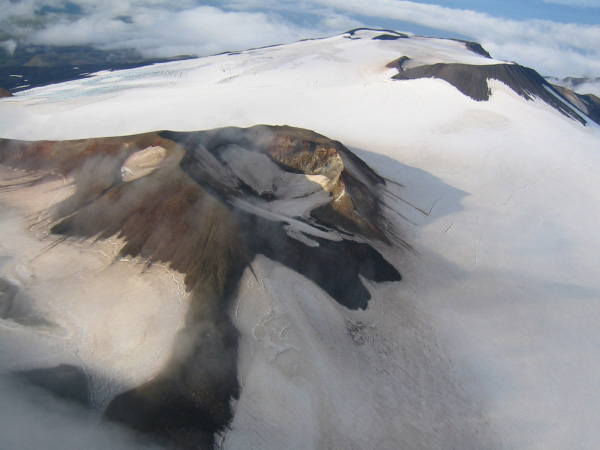
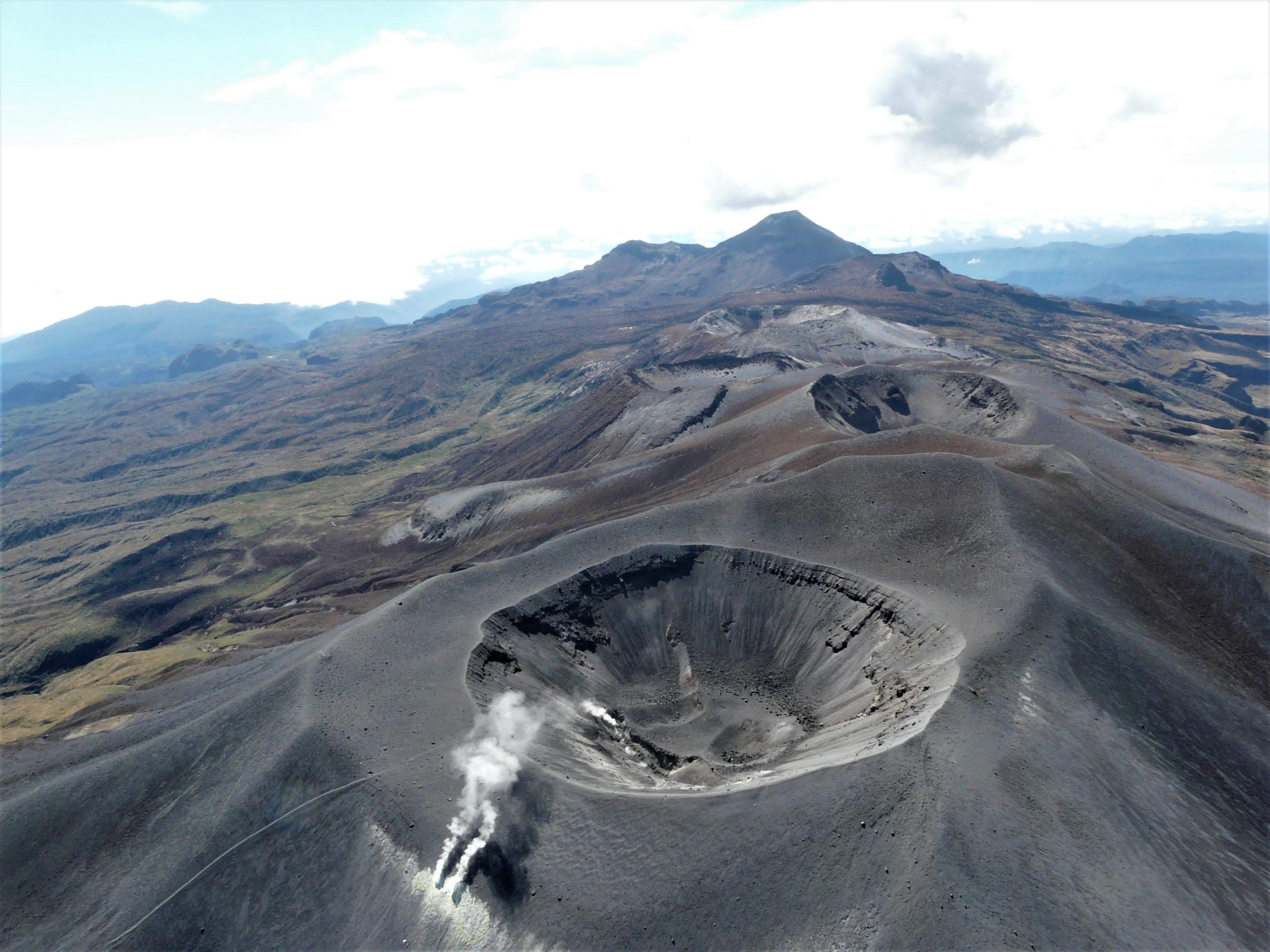
Alaska , Takawangha :
51°52’1″ N 178°1’37 » W,
Summit Elevation 4754 ft (1449 m)
Current Volcano Alert Level: ADVISORY
Current Aviation Color Code: YELLOW
Earthquake activity beneath Takawangha volcano, which began in the fall of 2022 and peaked on March 9–11, continued over the past week. The number of earthquakes located each day beneath Tanaga Island varied but continued at an overall rate similar to previous weeks. Most recent earthquakes locate between Takawangha volcano and nearby Tanaga Volcano, about 5 miles (8 km) west of Takawangha volcano on Tanaga Island. The earthquakes were generally between M1–2.
No other signs of volcanic unrest were observed in satellite data over the last week, and no new satellite radar data were available to analyze ground movement.
Because seismic activity is also elevated at nearby Tanaga Volcano, if an eruption were to occur, it is unclear at this stage whether it would come from Tanaga Volcano or Takawangha volcano.
An increase in shallow seismicity and possibly other signs of unrest, such as gas emissions, elevated surface temperatures, and additional changes in ground movement, will likely precede any eruption if one were to occur.
Takawangha is monitored with a local seismic network, a single local infrasound sensor, regional infrasound and lightning sensors, and satellite imagery.
Takawangha is a remote, 4,754 ft (1,449 m)-high stratovolcano located on the northeast portion of Tanaga Island, roughly 59 miles (95 km) west of Adak in the Andreanof Islands. Takawangha’s summit is mostly ice-covered, except for four young craters that have erupted ash and lava flows in the last few thousand years. Parts of Takawangha’s edifice are hydrothermally altered and may be unstable, possibly leading to localized debris avalanches from its flanks. Takawangha lies across a saddle from historically active Tanaga volcano to the west. No historical eruptions are known from Takawangha; however, field work shows that recent eruptions have occurred, and it is possible that historic eruptions attributed to Tanaga may instead have come from Takawangha.
Source : AVO.
Photo : Coombs, M. L.
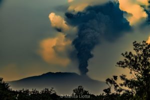
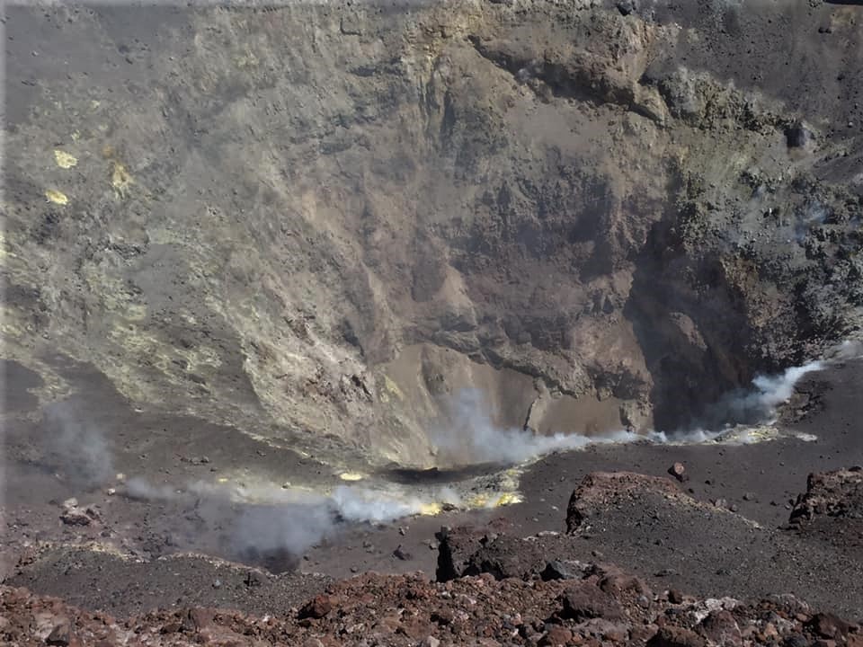
Chile , Lascar :
Seismology
The seismological activity of the period was characterized by the recording of:
212 VT-type seismic events, associated with rock fracturing (Volcano-Tectonics). The most energetic earthquake presented a Local Magnitude (ML) value equal to 2.7 located 1.2 km south-south-east of the volcanic edifice, at a depth of 3.4 km with reference to the crater .
48 LP-type seismic events, associated with fluid dynamics within the volcanic system (Long Period). The size of the largest earthquake assessed from the Reduced Displacement (DR) parameter was equal to 4.6 cm2.
16 TO-type seismic events, associated with fluid dynamics within the volcanic system characterized by its particular waveform (TOrnillo). The size of the largest earthquake (DR) was equal to 2.9 cm2.
Fluid Geochemistry
The sulfur dioxide (SO2) emission data obtained by the Differential Absorption Optical Spectroscopy (DOAS) equipment, corresponding to the Emú station, located 6 km in an East-South-East (ESE) direction from the active crater, presented an average value of 361 ± 64 t / d, with a maximum daily value of 979 t / d on April 23.
Satellite thermal anomalies
1 thermal alert was recorded in the area associated with the volcanic edifice during the period, with a maximum Volcanic Radiative Power (VRP) <1 MW on April 27, a value considered low according to the data processed by the Observation Middle Infrared of MIROVA Volcanic Activity. At the same time, according to the analytical processing of the satellite images (Sentinel 2-L2A in combination of false color bands), no luminance anomaly was observed for the period evaluated.
During the evaluated period, the recording of seismic activity continues with a downward trend and with various signals (VT, LP and TO) of low energy, however, the recorded signals suggest a source associated with surface processes related to the dynamics of a magma body emplaced near the surface; similarly, SO2 release values remain low and vertical and horizontal displacement values from GNSS stations suggest incipient crustal deformation processes that should be confirmed in the coming days. A diffuse degassing is observed on the surface, without highlighting of fine particles and absence of incandescent phenomena. This indicates that, although the monitoring parameters show a decreasing trend, there are still particular seismic signals that suggest some type of activity related to shallow magmatic processes.
For this reason, the yellow technical alert and its possible assignment zone of a radius of 5 km from the active crater are maintained.
YELLOW TECHNICAL ALERT: Changes in volcanic activity behavior
Source : Sernageomin
Photo : Eric Jo ( 2019).
Colombia , Purace / Los Coconucos volcanic Range :
Puracé Volcano Weekly Activity Bulletin – Los Coconucos Volcanic Range
From the monitoring of the activity of the PURACÉ VOLCANO – VOLCANIC CHAIN OF LOS COCONUCOS, the MINISTRY OF MINES AND ENERGY through the COLOMBIAN GEOLOGICAL SERVICE (SGC) reports:
During the week between May 2 and May 8, 2023, the seismic activity showed similar values in terms of energy released and number of events, compared to that observed in previous weeks, characterized by the predominance of earthquakes related to fluid dynamics in volcanic conduits. This process is accompanied by a deformation process located in the upper part of the volcanic chain of Los Coconucos.
A degassing of the volcanic system was highlighted, with a white column preferentially oriented towards the northwest with stable values in the fluxes of sulfur dioxide (SO2). The concentration of carbon dioxide (CO2) in the crater area of the Puracé volcano remained at high values compared to its baseline.
The other parameters measured and used for the diagnosis of volcanic activity did not show significant changes during the period evaluated.
Volcanic activity continues to record variations which could evolve towards higher levels of activity.
The activity level of the volcano remains at:
YELLOW LEVEL (III): CHANGES IN THE BEHAVIOR OF VOLCANIC ACTIVITY
Source et photo : SGC.
Costa Rica , Poas / Rincon de la Vieja :
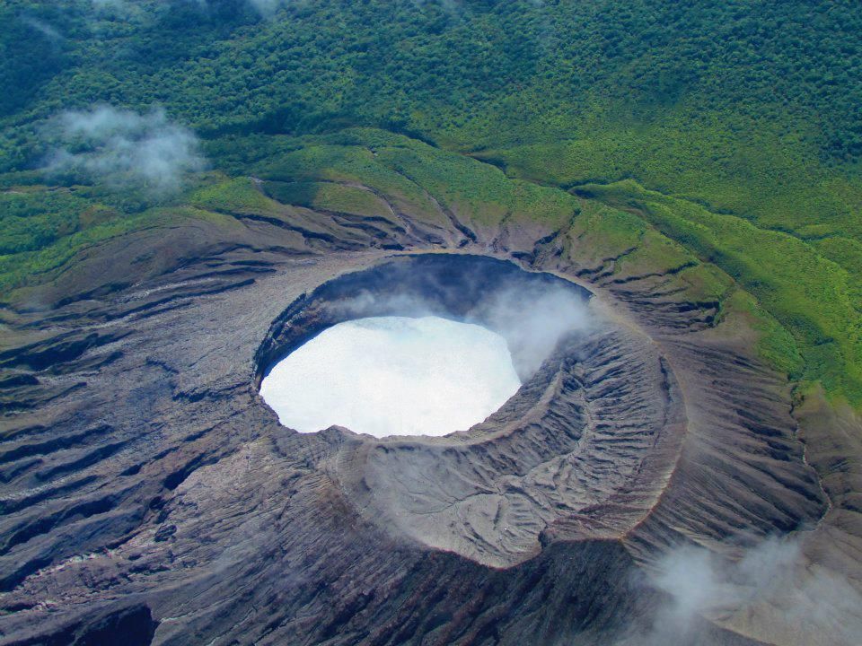
Poas Volcano
latitude: 10.20°N;
Long: 84.23° W;
Altitude: 2687m
Current activity level: warning
Possible manifestations: Small eruptions, gush or geyser, significant gas emission, temperature rise (incandescence), seismic swarms or volcanic tremor, slight inflation-extension of the volcanic edifice.
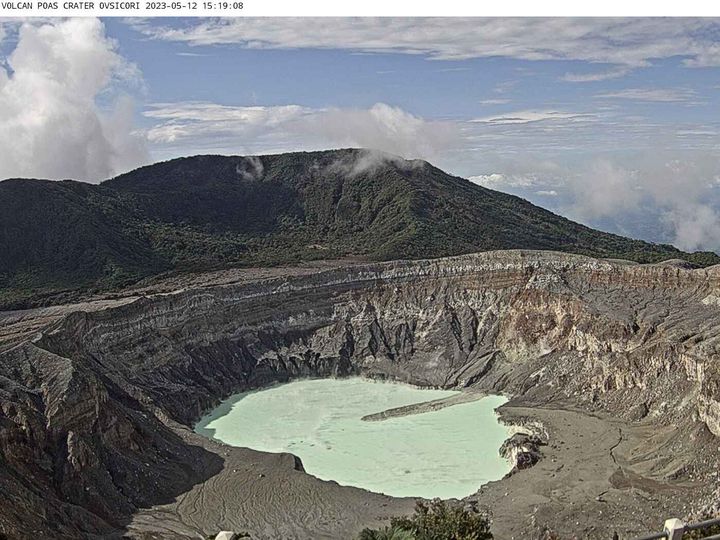
The appearance of seismic signals of low amplitude and low frequency continues. The background tremor is maintained with a broad spectrum and variable dominant frequency. The number of LP type events remains similar to last week. Geodetic observations show a very slight contraction of the volcanic massif without significant vertical movement. The level of the lake continues to drop, for the date of May 11, 2023 it reached the value of 2328.8 m. During the previous week, the SO2 flux was 152 +/- 53 t/d and has remained relatively constant over the past month. The gas ratios measured in the plume remain similar to last week with weekly averages of SO2/CO2 = 0.94 +/- 0.16 and H2S/SO2 < 0.01. The concentration of SO2 in the ambient air around the lookout has fluctuated between 0 ppm and 6.8 ppm this week. The temperature of the hyperacid Poás Lake has been measured at 42 degrees Celsius.
Rincon de la Vieja Volcano
latitude: 10.83°N;
Long: 85.34°W;
Altitude: 1916m
Current activity level: warning
Possible manifestations: Small eruptions, gush or geyser, significant gas emission, temperature rise (incandescence), seismic swarms or volcanic tremor, slight inflation-extension of the volcanic edifice, hot springs.
Frequent hydrothermal explosions of variable amplitude and increasingly superficial are recorded. Few volcano-tectonic earthquakes are recorded, both proximal and distal, and low-frequency volcanic earthquakes, although tornillo-type earthquakes are not recorded. The tremor is broad-spectrum, of variable amplitude and fragmented. During the past week, geodetic measurements have detected a change in deformation at the summit with a movement from the North-East (in the direction of the crater) towards the West-South-West (opposite direction), which could indicate a movement of volcanic fluid on the surface. The stations at the base of the volcano do not show a very clear deformation pattern. During the past week, the SO2 flux was 234 +/- 84 t/d. After a few eruptions, maximum flows close to 1200 t/d were measured.
Source : Ovsicori.
Photos : Ovsicori , Raul Mora / RSN / UCR