May 08 , 2020.
Hawaii , Kilauea :
19°25’16 » N 155°17’13 » W,
Summit Elevation 4091 ft (1247 m)
Current Volcano Alert Level: NORMAL
Current Aviation Color Code: GREEN
Activity Summary:
Kīlauea Volcano is not erupting. Monitoring data for the month of April show variable but typical rates of seismicity and ground deformation, low rates of sulfur dioxide emissions, and only minor geologic changes since the end of eruptive activity in September 2018.
Observations:
Monitoring data have shown no significant changes in volcanic activity in April.
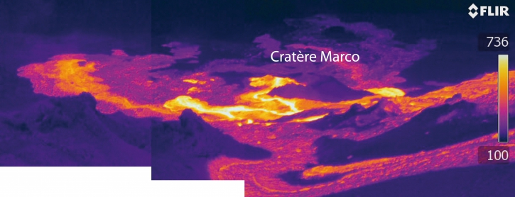
Rates of seismicity over the month were about 25 per cent lower than during the past month. Sulfur dioxide emission rates are low at the summit and are below detection limits at Puʻu ʻŌʻō and the lower East Rift Zone. The crater lake at the bottom of Halema’uma’u continues to slowly expand and deepen. As of May 3rd, the lake depth was approximately 35 meters or 115 feet.
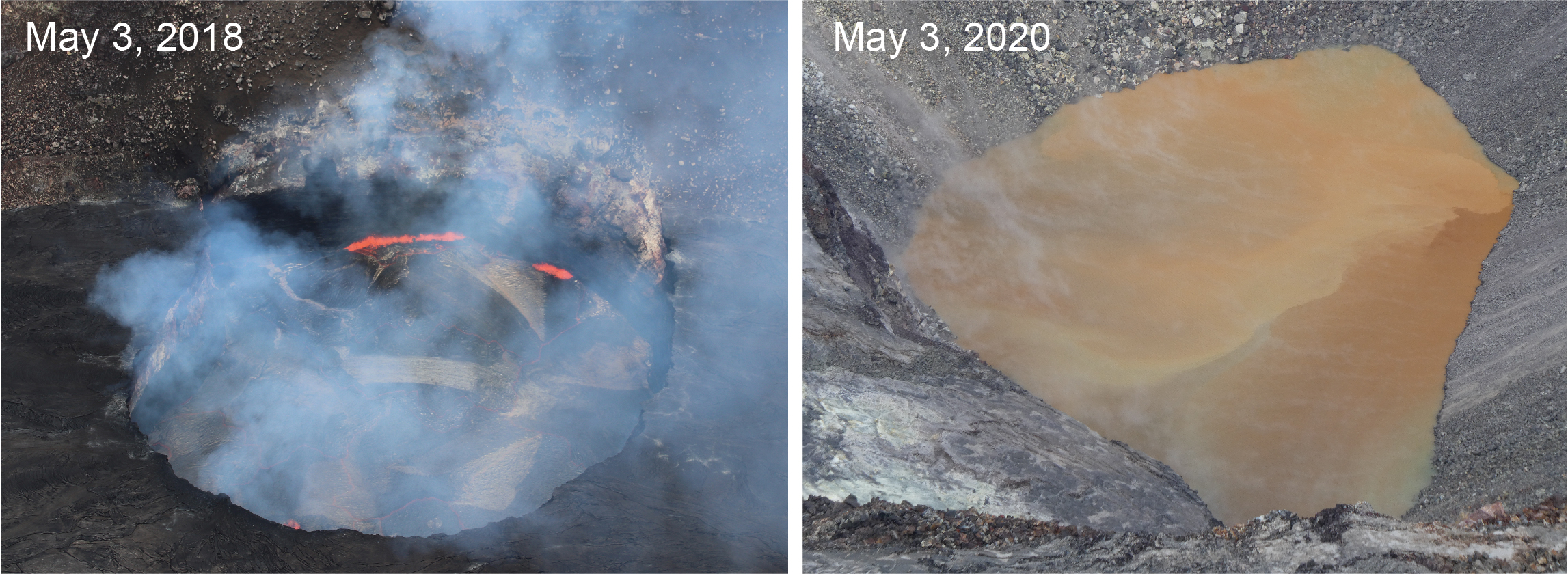
The lower East Rift Zone eruption started two years ago, on May 3, 2018. At that time, the lava lake in Halema‘uma‘u, at Kīlauea’s summit, had just started dropping in response to the changes in the East Rift Zone. Today, two years later, a new lake is present in Halema‘uma‘u, but formed from water. Many of the monitoring techniques remain the same, however. HVO scientists make routine visual observations, measure the lake level with a laser rangefinder, and track the activity 24/7 with webcams and thermal cameras. USGS photos by C. Parcheta and M. Patrick.
Over the past month, the summit tiltmeter recorded 4 deflation-inflation events–down from 10 recorded last month. In April 2020, deformation rates at Kilauea’s summit and middle East Rift Zone continue to show inflation, consistent with magma supply to the volcano’s shallow storage system. Gas measurements show continuing low levels of sulfur dioxide emission from the Halema’uma’u area, consistent with no significant shallowing of magma. Some amount of sulfur dioxide is being dissolved into the summit lake and work continues to try and quantify this process. The lake was last sampled by UAS in January and additional sampling with UAS is planned.
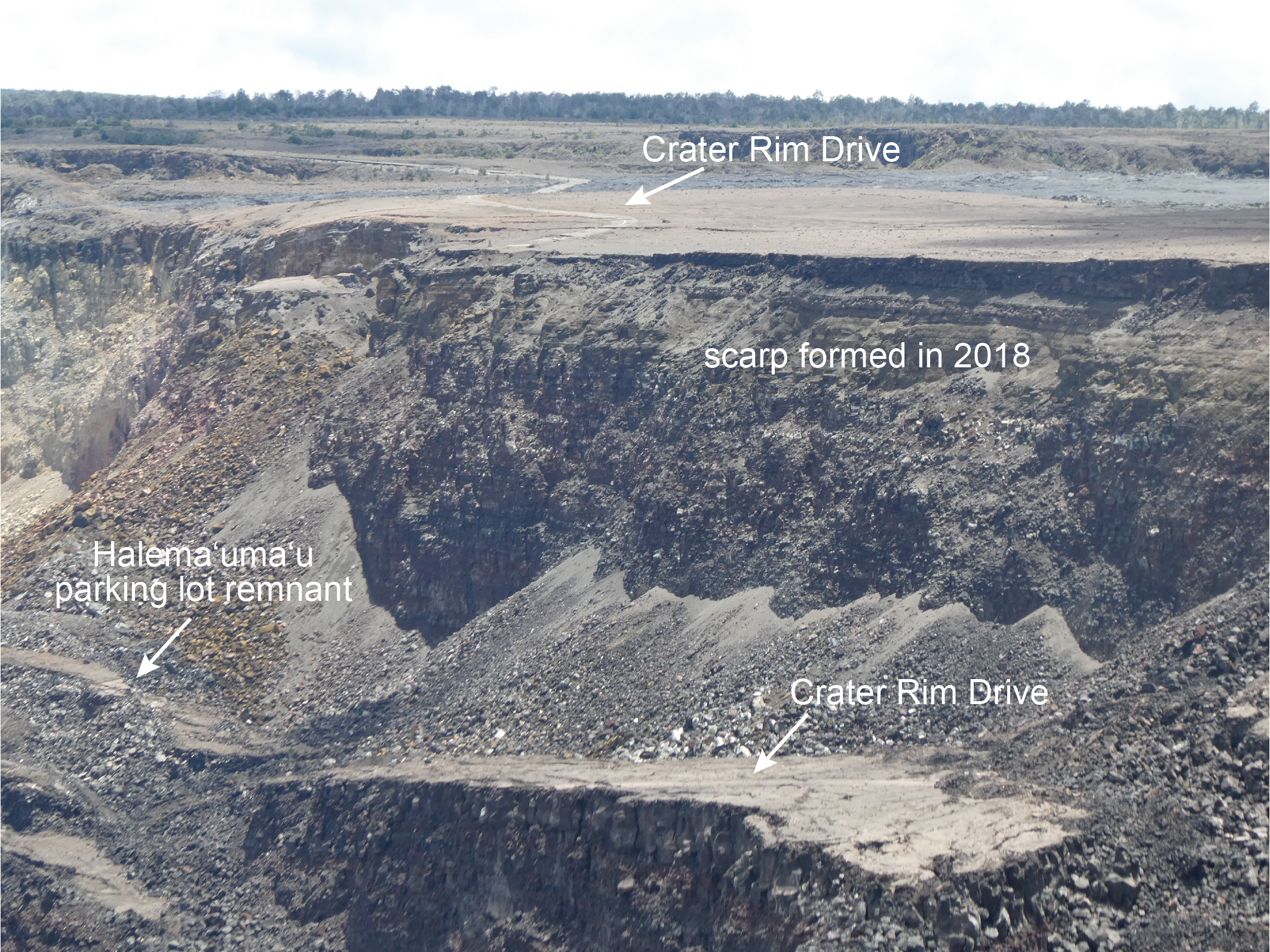
This photo shows the southern portion of Kīlauea Caldera, and was taken from the water pond observation area on the west caldera rim. The photo gives a sense of the scale of the 2018 collapse. A portion of Crater Rim Drive is present on the lower block, which was originally level with the remainder of Crater Rim Drive visible at the top of the photo. This section of the road dropped approximately 80 meters (260 feet), but other parts of the caldera floor dropped more than 500 meters (1600 feet). The scarp formed during the 2018 collapse sequence. Most of the large Halema‘uma‘u parking lot disintegrated during the 2018 collapses, but a tiny portion remains at the base of the talus slope. USGS photo by M. Patrick.
Farther east, GPS stations and tiltmeters continue to show motions consistent with slowed refilling of the deep East Rift Zone magmatic reservoir in the broad region between Puʻu ʻŌʻō and Highway 130. The decrease in deformation rates at tilt station POO, observed in February, continued through April. GPS station JOKA, and tilt station JKA, in the lower East Rift Zone, experienced another episode of deformation through April with a different direction from the longer term trend. Monitoring data do not suggest any imminent change in volcanic hazard for this area. The south flank of Kīlauea continued to creep seaward at elevated rates following the May 4, 2018 M6.9 earthquake near Kalapana. HVO continues to carefully monitor all data streams along the Kīlauea East Rift Zone and south flank for important changes.
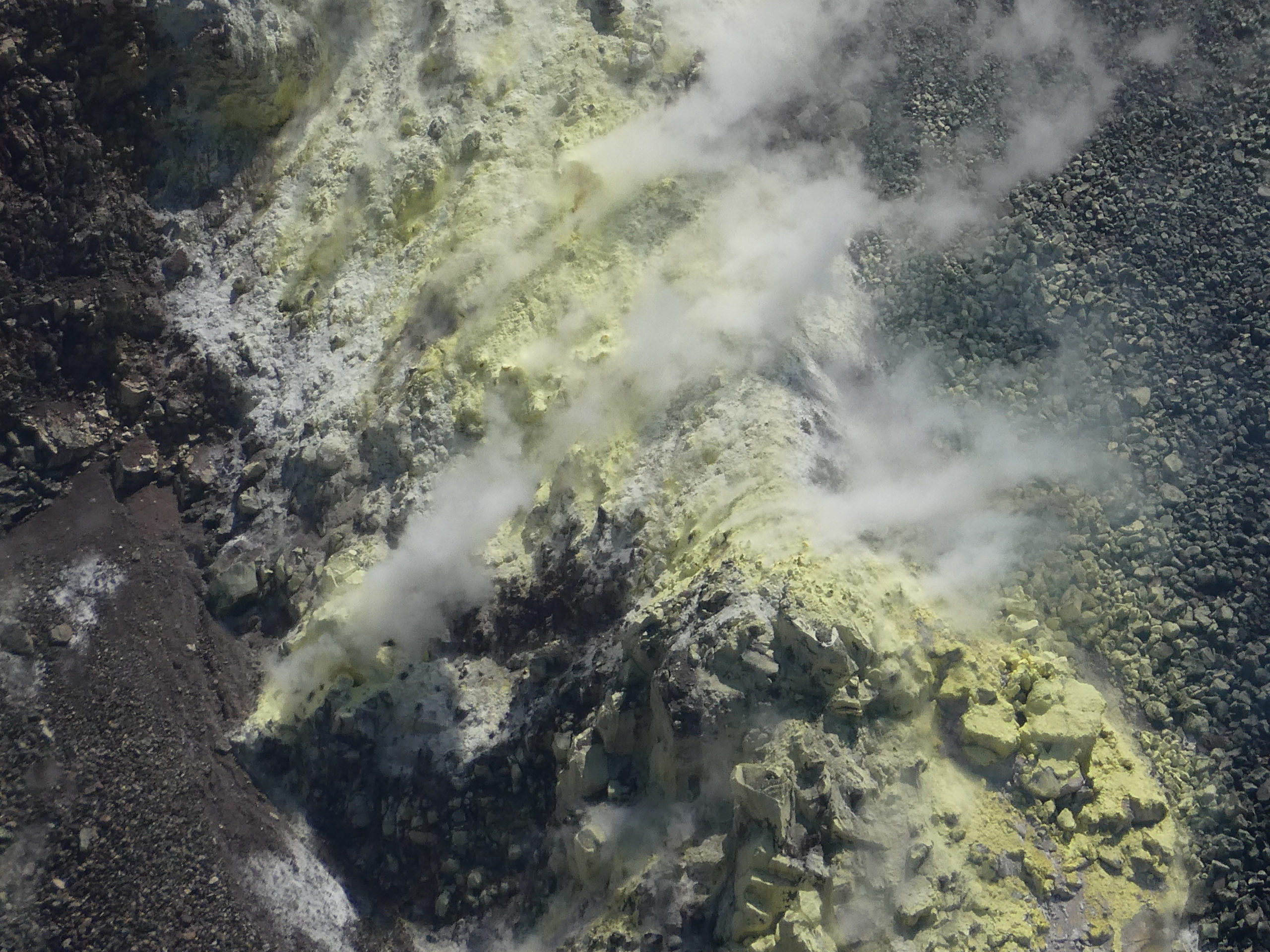
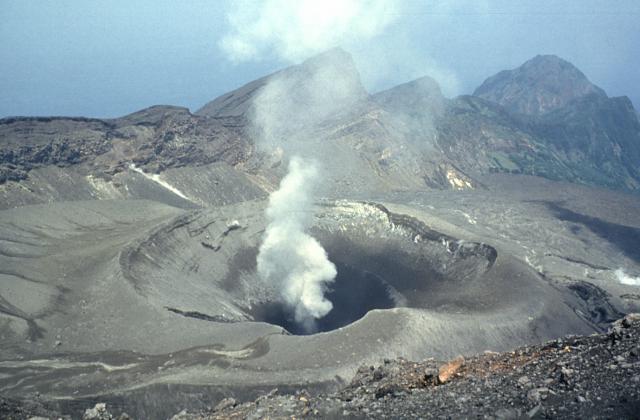
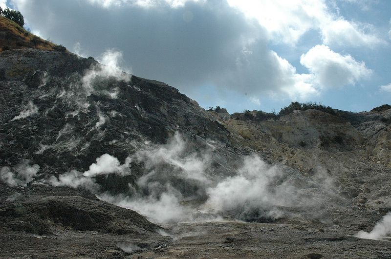
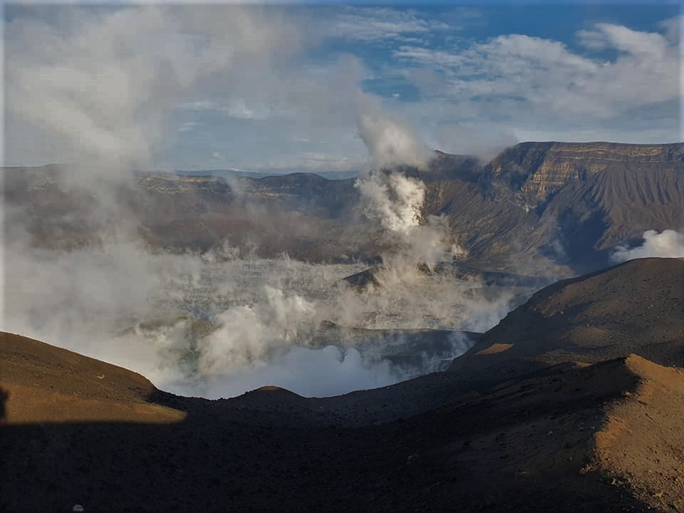
This photo shows the fumarolic area on the south wall of Halema‘uma‘u, a crater within Kīlauea’s summit caldera. The area is several tens of meters (yards) wide and individual gas vents can be seen as small black holes surrounded by the yellow sulfur deposits. No major changes have been observed in this area. USGS photo by M. Patrick.
Although not currently erupting, areas of persistently elevated ground temperatures and minor release of gases are still found in the vicinity of the 2018 lower East Rift Zone fissures. These include steam (water), very small amounts of hydrogen sulfide, and carbon dioxide. These conditions are expected to be long-term. Similar conditions following the 1955 eruption continued for years to decades.
Source : HVO.
Alaska , Cleveland :
AVO/USGS Volcanic Activity Notice
Current Volcano Alert Level: UNASSIGNED
Previous Volcano Alert Level: ADVISORY
Current Aviation Color Code: UNASSIGNED
Previous Aviation Color Code: YELLOW
Issued: Thursday, May 7, 2020, 3:37 PM AKDT
Source: Alaska Volcano Observatory
Location: N 52 deg 49 min W 169 deg 56 min
Elevation: 5676 ft (1730 m)
Area: Aleutians
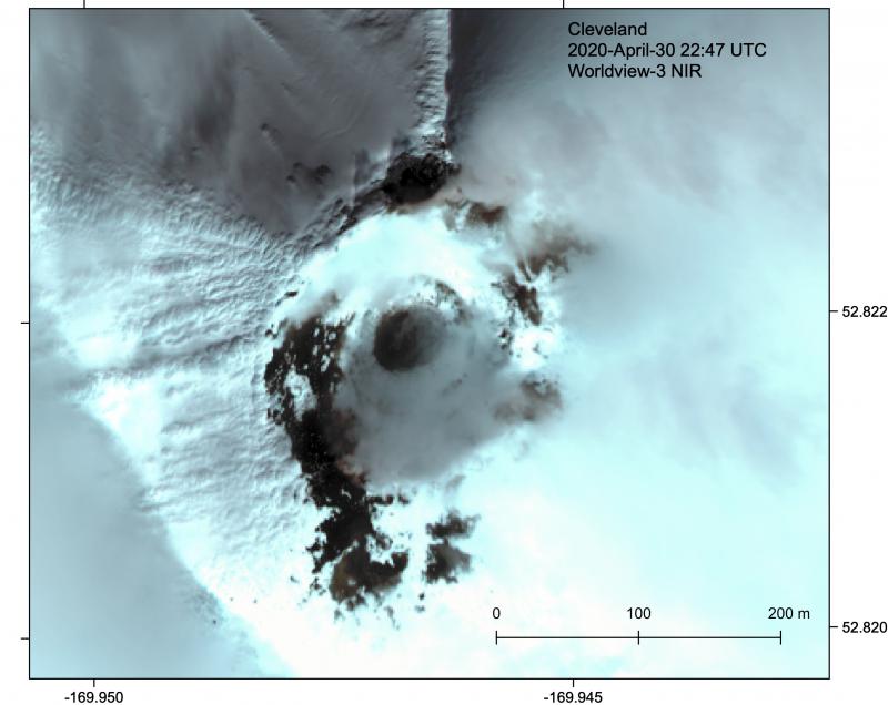
Clear Worldview-3 satellite image of the Cleveland summit crater and lava dome, April 30, 2020. Digital Globe image via NextView License.
Volcanic Activity Summary:
A sustained decline in volcanic unrest at Cleveland Volcano over the last several months has prompted the Alaska Volcano Observatory to downgrade the Aviation Color Code and Volcano Alert Level from YELLOW/ADVISORY to UNASSIGNED/UNASSIGNED.
The last explosive eruption at Cleveland occurred on January 9, 2019, and was followed by the extrusion of a small mound of lava in the summit crater. Since then, there has been an overall decrease in detected surface temperature and no observed changes in the summit crater.
Cleveland is one of the most active volcanoes of the Aleutian Arc, and the latest eruptive phase has waxed and waned almost annually since 2001. Local seismic, infrasound, and web camera data have been mostly unavailable for several weeks due to an equipment failure in a remote facility. Nonetheless, monitoring of Cleveland continues with regional seismic and infrasound stations on nearby islands. These, along with lightning and satellite data, should allow AVO to detect an ash-producing eruption, if one were to occur.
Source : AVO.
Photo : Loewen, Matt .
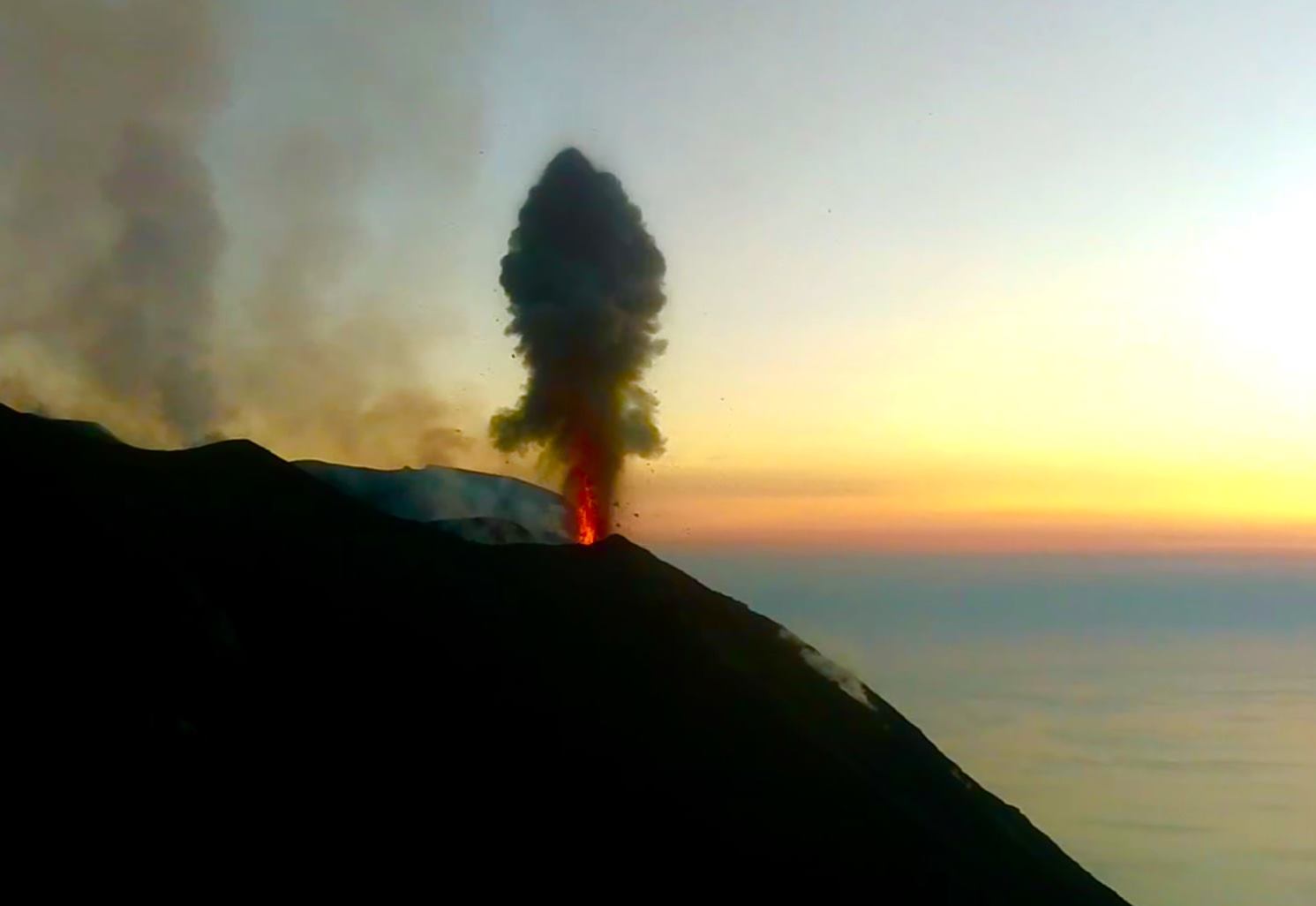
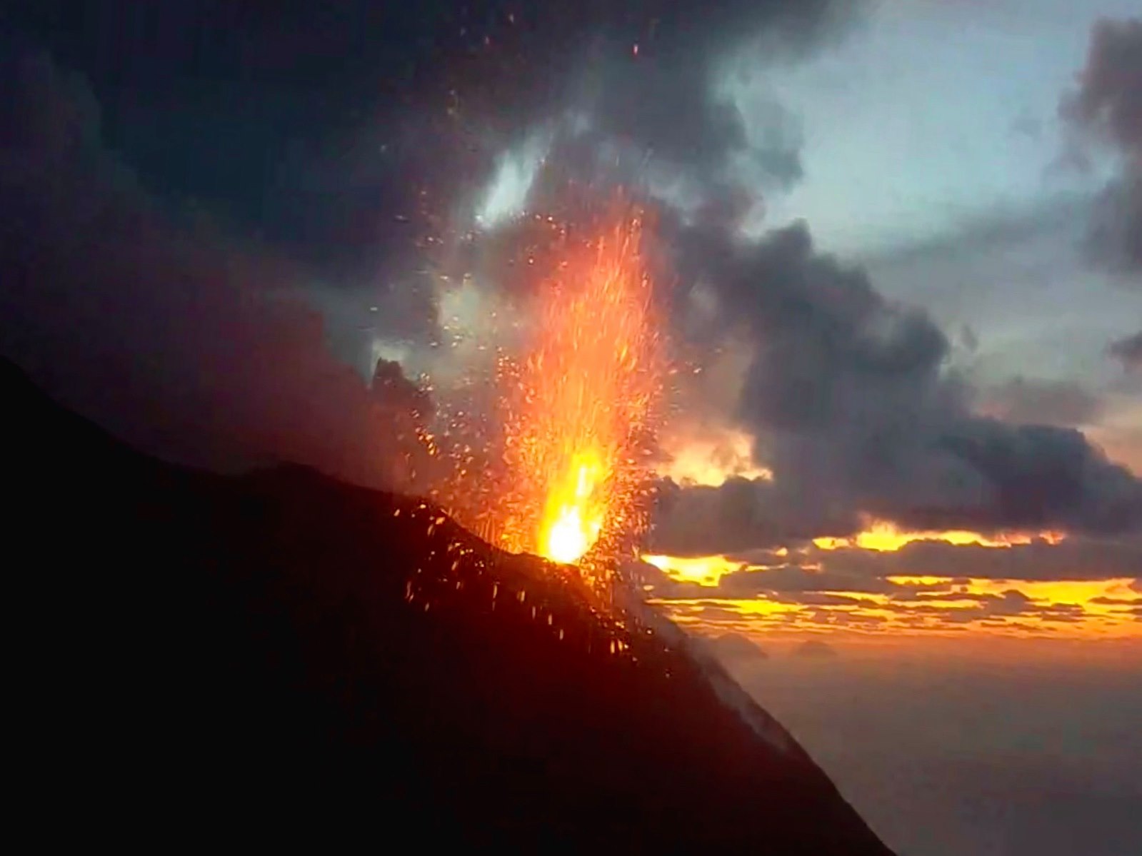
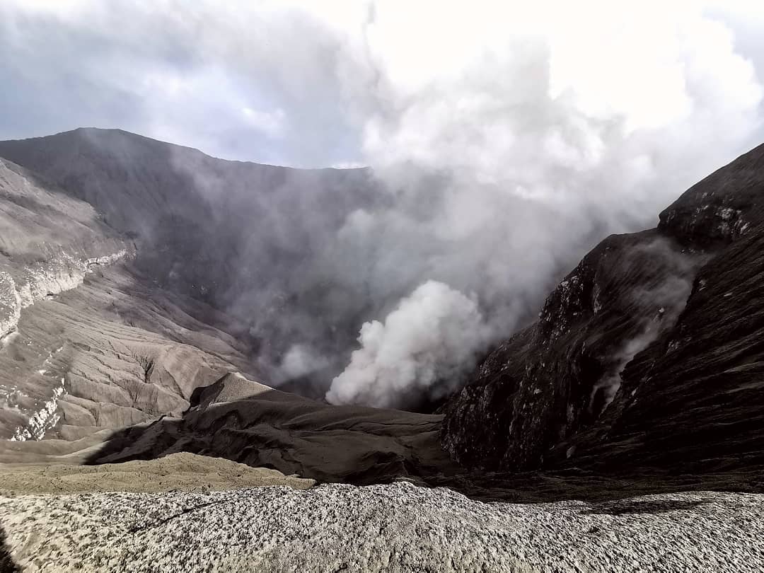
Indonesia , Dukono :
VOLCANO OBSERVATORY NOTICE FOR AVIATION – VONA.
Issued: May 08 , 2020.
Volcano: Dukono (268010)
Current Aviation Colour Code: ORANGE
Previous Aviation Colour Code: orange
Source: Dukono Volcano Observatory
Notice Number: 2020DUK30
Volcano Location: N 01 deg 41 min 35 sec E 127 deg 53 min 38 sec
Area: North Maluku, Indonesia
Summit Elevation: 3933 FT (1229 M)
Volcanic Activity Summary:
Eruption with volcanic ash cloud at 23h03 UTC (08h03 local).
Volcanic Cloud Height:
Best estimate of ash-cloud top is around 5213 FT (1629 M) above sea level, may be higher than what can be observed clearly. Source of height data: ground observer.
Other Volcanic Cloud Information:
Ash-cloud moving to east.
Remarks:
Eruption and ash emission is continuing.
According to seismographs, on May 7, 2020, it was recorded: continuous tremors, amplitude 0.5 to 4 mm (dominant value 2 mm)
Recommendation:
The communities around G. Dukono and visitors / tourists must not move, climb and approach the crater of Malupang Warirang within a radius of 2 km.
Since volcanic ash eruptions occur periodically and the dispersion of ash follows the wind direction and speed, when the ash is not fixed, it is recommended that the community around G. Dukono always wear masks / nose and mouth cover to be used when necessary to avoid threats of the danger of volcanic ash in the respiratory system.
Source : Magma Indonésie , PVMBG.
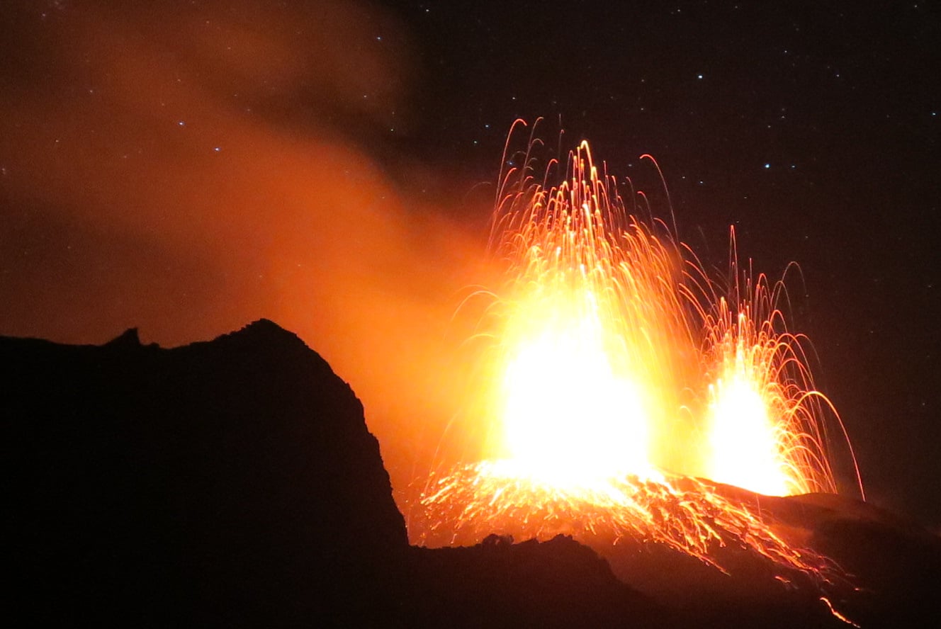
Photos : Martin Rietze ,
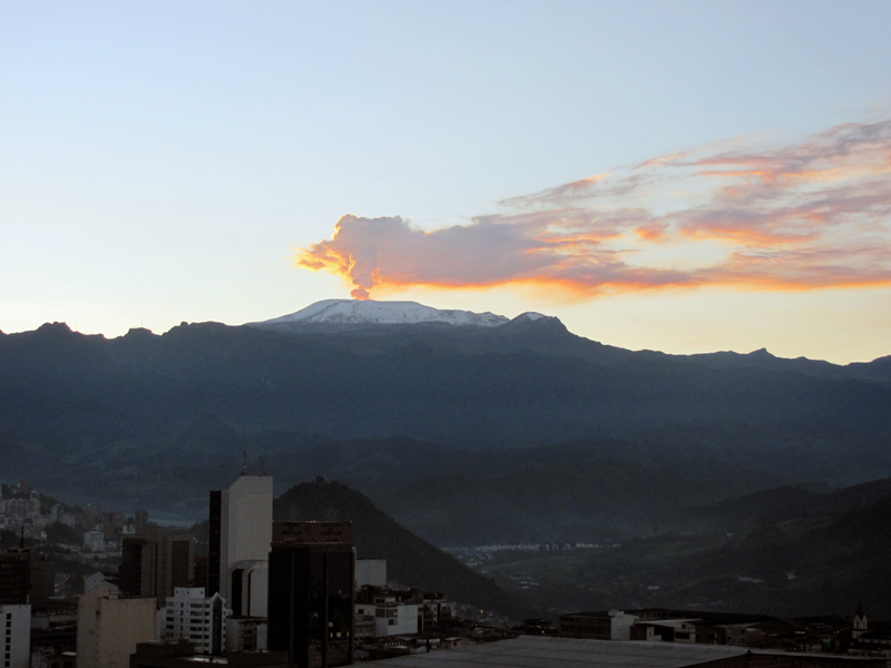
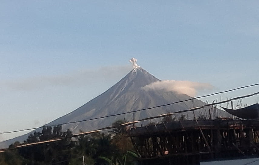
El Salvador , Santa Ana ( Llamatepec) :
Location: shared by the departments of Santa Ana and Sonsonate
Altitude: 2381 meters above sea level
Type of volcano: Stratovolcan
Type of activity: Vulcanian- Strombolian
Last eruption: October 1, 2005.
The seismic vibration of the volcano was maintained between 17 and 20 RSAM units, on average per day, ie within a normal range.
As for sulfur dioxide (SO2) emissions, measured with DOAS equipment, they fluctuated between 164 and 296 tonnes per day, with an average of 205 tonnes per day, the threshold being 300 tonnes per day.
Park wardens monitoring the area did not report any plumes of gas emerging from the crater. Despite the above parameters, the activity of the volcano remains stable and at its normal level, like all active volcanoes.
Source : Marn .
Photo : kaytetours.com.
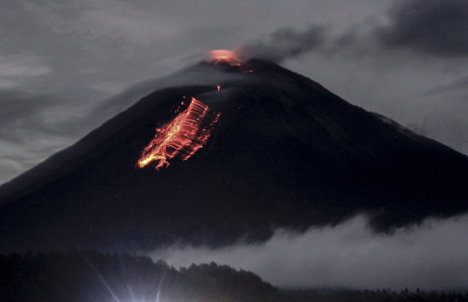
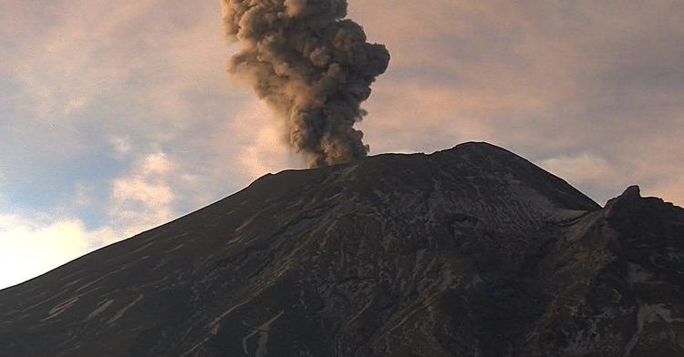
Japan , Sakurajima :
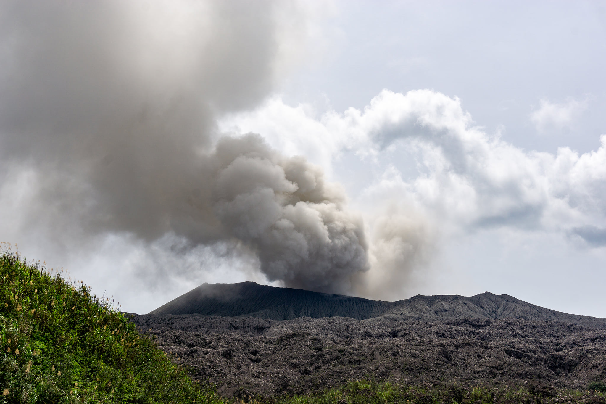
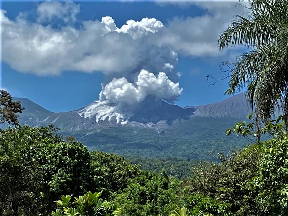
Big eruption on Sakurajima on May 8, 2020 at 7:03 am, accompanied by a plume of ash and gas reaching 2,000 meters above the active crater, dissipating towards the North-West.
Other explosions preceded him at 6:53 a.m. and 7:08 a.m.
Source et vidéo : Escenario final via Facebook.