April 26 ,2024.
Italy / Sicily , Etna :
On April 7, 2024, Bocca Nuova (BN), one of Etna’s four summit craters, was hit by a sequence of explosions lasting approximately four minutes that significantly altered (see photo B) the small collapse crater which was formed almost a year ago. before, in July 2023 (photo A). The other crater inside Bocca Nuova (BN1 in photo A) has also widened and deepened a bit. The lines of white dots drawn on the rim of the internal craters, dating from last year, make their recent morphological changes easily perceptible.
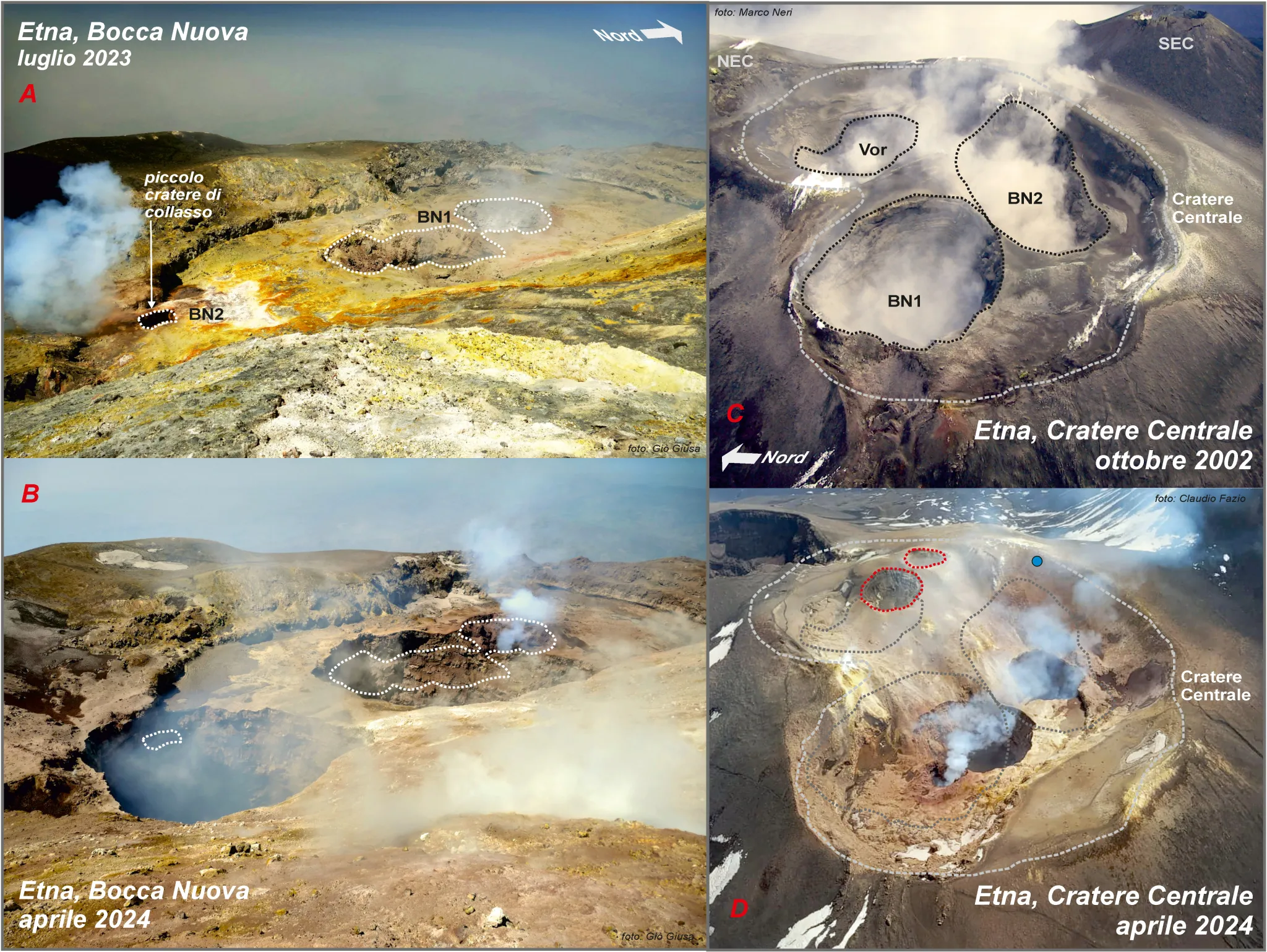
These changes in Etna’s summit craters are normal events for a very active open-vent volcano. This is demonstrated, for example, by the two photos on the right, which show the Central Crater seen from above respectively in October 2002 (photo C) and, twenty-two years later, in mid-April 2024 (photo D). By tracing here also the edge of the craters on the oldest photo (2002) and bringing it back to the photo from 2024, we can estimate that inside the Voragine (Vor) the deep crater has been replaced, at from 2019, by a pyroclastic cone characterized by two small vents at the top (highlighted by red dotted lines). Even more appreciated is the transformation of Bocca Nuova, where the large craters (BN1 and BN2) existing in 2002 are currently much less evident.
Source et photo : Marco Neri / INGV
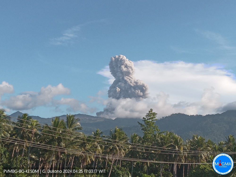
Indonesia , Dukono :
An eruption of Mount Dukono occurred on Thursday, April 25, 2024 at 5:00 p.m. WIT with the height of the ash column observed at ±1,500 m above the summit (±2,587 m above sea level) . The ash column was observed to be white to gray in color with thick intensity, oriented towards the North-West. This eruption was recorded on a seismograph with a maximum amplitude of 21 mm and a duration of 47.47 seconds.
Observation of seismicity:
8 eruption/explosion earthquakes with an amplitude of 4 to 27 mm and earthquake duration of 32.25 to 53.53 seconds.
2 deep tectonic earthquakes with an amplitude of 4-5 mm, and earthquake duration 61.63-115.08 seconds.
1 Continuous tremor with an amplitude of 0.5 to 2 mm, Dominant value of 1 mm.
RECOMMENDATION
(1) People around Mount Dukono and visitors/tourists are advised not to do activities, climb or approach Malupang Warirang Crater within a 3 km radius.
(2) Considering that eruptions with volcanic ash occur periodically and the distribution of ash follows the direction and speed of the wind, so that the landing area of the ash is not fixed, it is recommended that the community around Mount Dukono always provides masks/nose and mouth coverings to use when needed to avoid the threat of volcanic ash on the respiratory system.
Source et photo : Magma Indonésie.
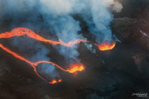
Vanuatu Archipelago , Ambrym ( Bembow / Marum ) :
Ambrym volcanic activity is continuing in the major unrest state. The Ambrym Volcanic Alert Level remains at Level 2.
Major volcanic unrest continues at Ambrym volcano and confined inside Benbow and Marum craters. New field observations and data analysis confirmed that Ambrym volcanic activity conditions at this major unrest state remain unstable. This activity is likely to continue at similar level, consistent with Volcanic Alert Level 2. The danger zone for life safety remain at 1 km radius from Benbow crater and 2 km radius from Marum crater and major cracked of 2018 eruption at the south eastern part of Ambrym
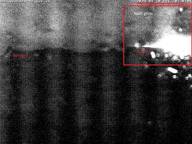
Recent field observation photos via webcam showed ongoing small steam cloud emission (fumarole) from both craters. The night glow at Marum crater is no longer visible as observed on 20th to 21st April 2024. Satellite images from 23rd April 2024 confirmed low to moderate thermal anomaly at Ambrym volcano. The satellite image showed evidence of minor volcanic degassing on April 20 2024. Seismic data analysis confirmed the ongoing major volcanic unrest activity at Ambrym. Volcanic hazards remain inside Benbow crater, areas around Marum crater and areas of major cracks of 2018 eruption at the South East of Ambrym.
Although, the night glow at the volcano is not appear, Ambrym volcanic Alert Level remain at Level 2 since 17th January 2024. Observations of the current activity are consistent with the Volcanic Alert Level 2. Level 2 indicates “Major unrest. The danger zone is at the Exclusion Zone which is about 1 km radius from Benbow crater and the Danger Zone A which is about 2 km radius from Marum crater with major cracked areas at the south eastern part of Ambrym”. With this current volcanic activity, it is a useful reminder that eruptions can occur with little or no warnings.
Source : Geohazard
Photos : Geohazard , G Vitton ( archive).
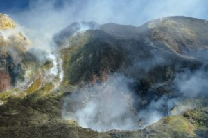
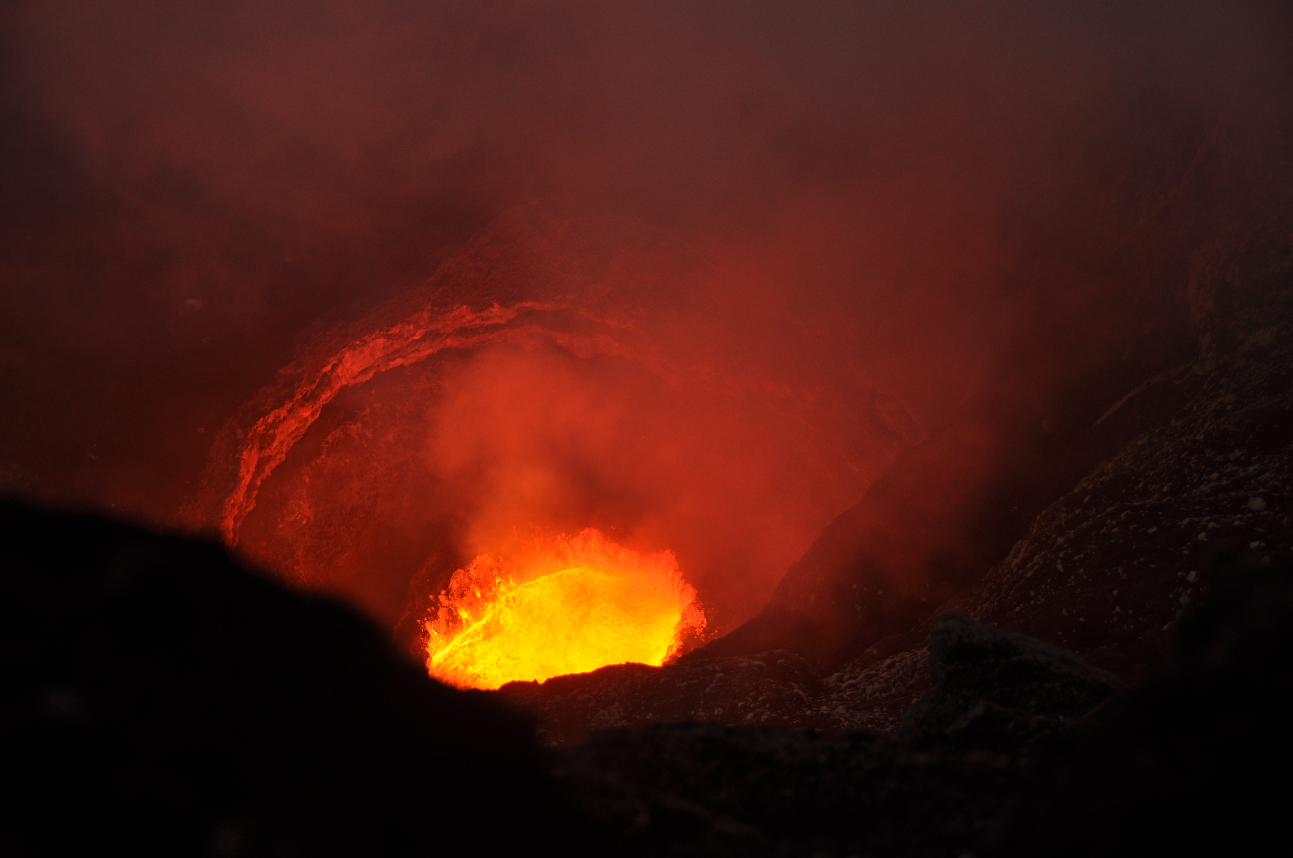
Colombia , Nevado del Ruiz :
Weekly activity bulletin: Nevado del Ruiz Volcano
Regarding the monitoring of the activity of the NEVADO DEL RUIZ VOLCANO, the MINISTRY OF MINES AND ENERGY, through the COLOMBIAN GEOLOGICAL SERVICE (SGC), reports that:
In the week of April 16 to 22, 2024, the volcano continued with unstable behavior. Compared to the previous week, the main variations in the monitored parameters
were:
– Seismicity linked to fluid dynamics inside volcanic conduits has decreased in the number of earthquakes recorded and in the seismic energy released. Most of these seismic signals were associated with pulsatile emissions of ash and gas into the atmosphere. The energy level of these seismic signals varied from low to moderate. During this week, the recording of long period signals also continued. Using cameras used to monitor the volcano, several ash emissions and temperature changes in emitted materials associated with some of these seismic events have been confirmed.
– Seismic activity associated with the fracturing of rocks inside the volcanic edifice increased in the number of earthquakes recorded and decreased in the seismic energy released. The earthquakes were located in the Arenas crater and on the different flanks of the volcano, at distances generally less than 6 km from the crater. Seismicity showed some concentrations on the North-East and East-South-East flanks. The depths of the events varied between less than 1 and 8 km from the volcano summit. The earthquakes were of low energy level (magnitudes less than 1). Furthermore, the recording of seismicity linked to the activity of the lava dome (protuberance or mound) located at the bottom of the crater continued, with low energy levels. On April 21, this type of seismicity showed a notable increase in the number of recorded events, but the energy levels of the events were low. It is important to mention that, since December 2023, no episode with these characteristics has been recorded.
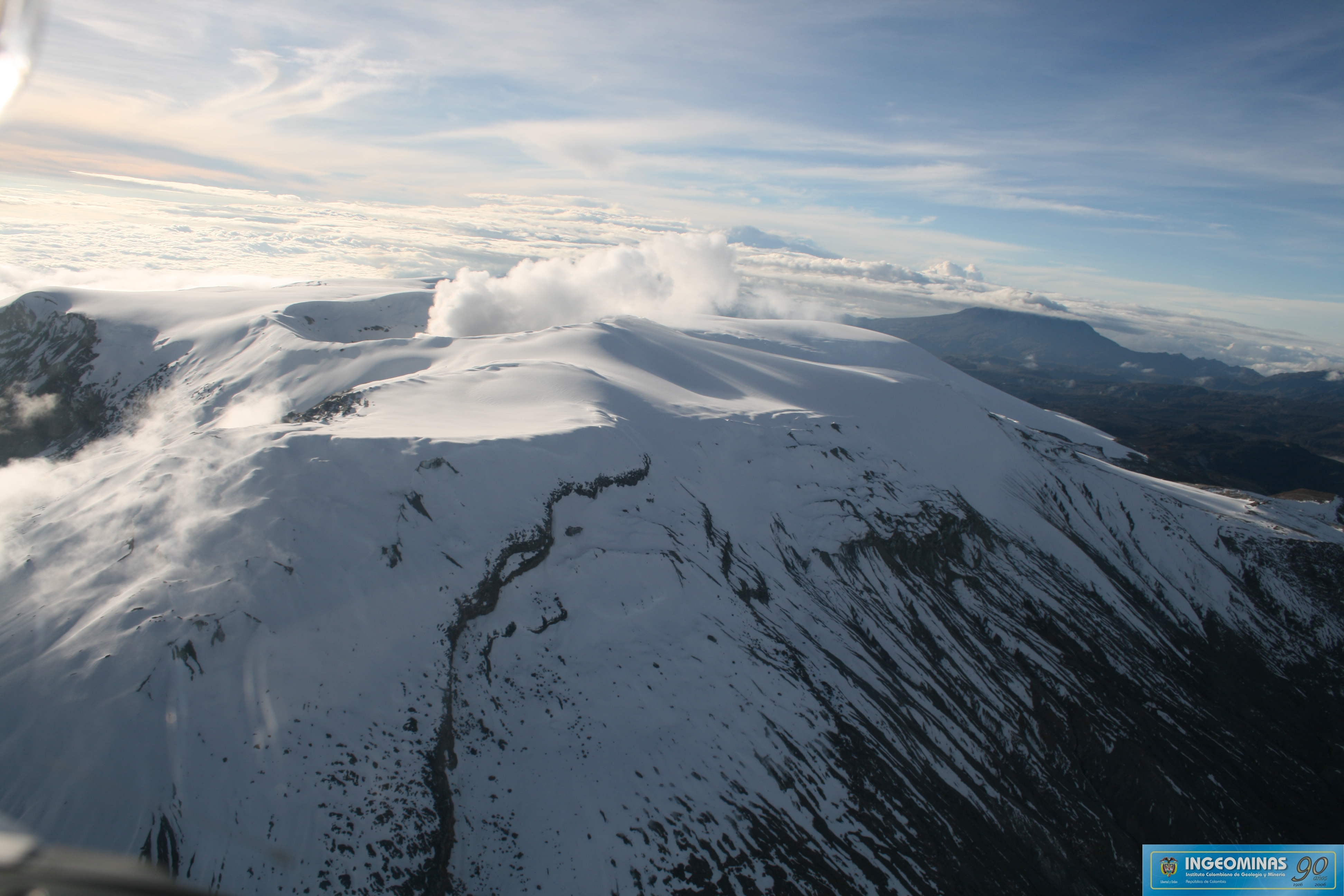
The release of water vapor and gases into the atmosphere from the volcano’s crater continued. Sulfur dioxide (SO2) outgassing rates were variable and showed a slight increase from the previous week. The maximum height of the gas or ash column was 1,700 m vertically. This value was estimated at the summit of the volcano on April 18. The direction of dispersion of the gas column was variable with a preferential tendency towards the eastern flank, from North-North-East to South-East, generating on several occasions damage due to ash falls (according to reports received) in the municipality of Murillo, department of Tolima. Additionally, to a lesser extent, when the wind direction was towards the northwest flank, reports of ashfall were received in areas close to the volcano.
– In monitoring surface activity, from satellite monitoring platforms, the persistence of thermal anomalies at the bottom of Arenas crater continues with moderate energy levels.
The alert status for volcanic activity remains at: YELLOW ALERT: ACTIVE VOLCANO WITH CHANGES IN THE BEHAVIOR OF THE BASE LEVEL OF MONITORED PARAMETERS AND OTHER MANIFESTATIONS.
Source : SGC
Photos : Julian Fernando Aranzazu Henao , Ingeominas.
Hawaii , Kilauea :
Thursday, April 25, 2024, 10:23 AM HST (Thursday, April 25, 2024, 20:23 UTC)
19°25’16 » N 155°17’13 » W,
Summit Elevation 4091 ft (1247 m)
Current Volcano Alert Level: ADVISORY
Current Aviation Color Code: YELLOW
Activity Summary:
Kīlauea volcano is not erupting. Increased seismicity over the past month indicates heightened activity beneath the summit of Kīlauea. Shallow earthquakes have also been observed beneath the upper East Rift Zone over the past two days. Updates will be provided daily while at a heightened state of unrest.
Summit Observations:
Earthquake activity has increased over the past month beneath the summit of Kīlauea and south of the caldera. Activity has alternated between typical shallow, 0.5-2.5 miles (1-4 km) earthquakes beneath the south caldera region and 3-6 miles (5-10 km) deep earthquakes directly beneath Kīlauea caldera. Most of these earthquakes have been smaller than magnitude-2. Kīlaueaʻs summit remains inflated. Overall ground deformation rates remain low, with ongoing inflation of the summit and uplift south of the caldera. Tiltmeters near Sand Hill and Uēkahuna showed no significant changes over the past day. Sulfur dioxide (SO2) gas emission rates remain low. An SO2 emission rate of approximately 52 tonnes per day was recorded on April 23.
Rift Zone Observations:
Seismicity in Kīlauea’s upper East Rift Zone and Southwest Rift Zone remains low overall. Shallow earthquakes, 0.5-2.5 miles (1-4 km) deep, have been observed beneath the upper East Rift Zone over the past two days. Most of these earthquakes have been smaller than magnitude-2. No unusual activity has been noted along the middle and lower sections of Kīlauea’s East Rift Zone. We continue to closely monitor both rift zones.
Measurements from continuous gas monitoring stations downwind of Puʻuʻōʻō in the middle East Rift Zone—the site of 1983–2018 eruptive activity—continue to be below detection limits for SO2, indicating that SO2 emissions Puʻuʻōʻō are negligible.
Source : HVO
Photo : USGS/ K. Mulliken.