April 24 , 2024.
Italy , Stromboli :
WEEKLY BULLETIN, from April 15, 2024 to April 21, 2024. (issue date April 23, 2024).
SUMMARY STATEMENT OF ACTIVITY
In light of the monitoring data, it appears:
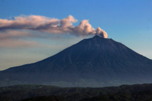
1) VOLCANOLOGICAL OBSERVATIONS: Normal Strombolian activity was observed during this period. The total hourly frequency fluctuated between average values (11-14 events/h). The intensity of the explosions was low and sometimes medium in the areas of the North and South-Central craters.
2) SISMOLOGY: The monitored seismological parameters do not show significant variations.
3) GROUND DEFORMATIONS: The ground deformation monitoring networks did not show significant variations.
4) GEOCHEMISTRY: SO2 flux in the volcanic plume at an average level.
The CO2 flux in the summit zone is at average values.
The C/S ratio in the plume is at average values
Helium Isotope Ratio in Thermal Aquifer: There are no updates.
CO2 flow in Mofeta in the San Bartolo area: medium-low values.
CO2 flux in Scari: stable values at average levels.
5) SATELLITE OBSERVATIONS: Thermal activity observed by satellite was generally weak.
VOLCANOLOGICAL OBSERVATIONS
In the observed period, the eruptive activity of Stromboli was characterized through the analysis of images recorded by the INGV-OE surveillance cameras located at Pizzo (SPT), at altitude 190m (SCT-SCV) and at Punta dei Corvi (SPCT). The explosive activity was mainly produced by 2 (two) eruptive vents located in the northern area of the crater and by 3 (three) vents located in the south central area. Due to unfavorable weather conditions on April 17, the visibility of the crater terrace was insufficient for a correct description of the eruptive activity while from 03:51 UTC on April 19 until the end of the analyzed period (21 April), a system interruption occurred from the station at 190 m altitude, which interrupted the recording of the cameras at 190 m altitude and at Pizzo.
Observations of explosive activity captured by surveillance cameras
In the area of the North crater (N), with a mouth located in sector N1 and a mouth located in sector N2, explosive activity was observed which was constant in sector N1 and sporadic in sector N2. In sector N1 the intensity was low (less than 80 m in height) and sometimes medium (less than 150 m in height) while in sector S2 the explosions were of low intensity (a few tens of meters). The products emitted in the eruption were mainly coarse materials (bombs and lapilli). The average frequency of explosions oscillated between 4 and 9 events/h. In the South-Central (CS) zone, sector C did not show significant activity while in sector S1, sporadic and low gas emissions were observed. In sector S2, with two emission points, the explosions were mainly of low intensity (less than 80 m in height) and sometimes of medium intensity (less than 150 m in height) emitting fine materials mixed with large ones. The average frequency of explosions varied from 2 to 10 events/h.
Source : INGV.
Photo : Stromboli stati d’animo / Sebastiano Cannavo.
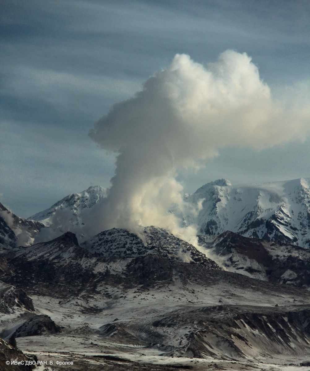
Kamchatka , Sheveluch :
VOLCANO OBSERVATORY NOTICE FOR AVIATION (VONA)
Issued: April 23 , 2024
Volcano: Sheveluch (CAVW #300270)
Current aviation colour code: ORANGE
Previous aviation colour code: orange
Source: KVERT
Notice Number: 2024-24
Volcano Location: N 56 deg 38 min E 161 deg 18 min
Area: Kamchatka, Russia
Summit Elevation: 3283 m (10768.24 ft), the dome elevation ~2500 m (8200 ft)
Volcanic Activity Summary:
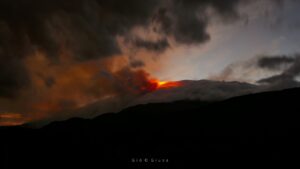
Video and satellite data by KVERT shows a strong wind lifts ash from the southern slopes of Sheveluch volcano, and a plume of resuspended ash is extending about 92 km to the southeast of the volcano.
An extrusive-effusive eruption of the volcano continues. A danger of ash explosions up to 6 km (19,700 ft) a.s.l. remains. Ongoing activity could affect low-flying aircraft.
Volcanic cloud height:
2500-3000 m (8200-9840 ft) AMSL Time and method of ash plume/cloud height determination: 20240423/2305Z – Video data
Other volcanic cloud information:
Distance of ash plume/cloud of the volcano: 92 km (57 mi)
Direction of drift of ash plume/cloud of the volcano: SE / azimuth 133 deg
Time and method of ash plume/cloud determination: 20240423/2220Z – Himawari-9 14m15
Remarks:
Resuspended ash
Source : Kvert.
Photo : V. Frolov. IVS FEB RAS
Colombia , Chiles / Cerro Negro :
Weekly Activity Bulletin: Chiles Volcanic Complex and Cerro Negro (CVCCN)
Regarding the monitoring of the activity of the CHILES AND CERRO NEGRO VOLCANOES, the MINISTRY OF MINES AND ENERGY, through the COLOMBIAN GEOLOGICAL SERVICE (SGC), reports that:
Between April 16 and 22, 2024, and compared to last week, seismic activity increased both in terms of occurrence and in the seismic energy released. The predominant seismicity continues to be linked to the fracture of the rocks inside the volcanic edifice, although the presence of earthquakes associated with the movement of fluids inside these volcanoes continues, some of them with very low frequency content.
Fracture seismicity has been located in two sources: the first, in the South-Southeast quadrant of the Chiles volcano, at distances less than 15 km, with depths between 4 and 11 km from its summit (4 700 m altitude) with a maximum magnitude of 2.4. The other group of earthquakes was located in the collapse zone north of the summit of the Chiles volcano, with depths between 2.5 and 4 km compared to its summit (4,700 m above sea level) and a maximum magnitude of 2.6. No felt earthquakes were reported.
Volcanic deformation processes recorded by sensors installed on the ground and by remote satellite sensors continue. The evolution of CVCCN activity is the result of
internal processes derived from the complex interaction between the magmatic system, the hydrothermal system and the geological faults of the area. Thus, the probability of the occurrence of energetic earthquakes that can be felt by residents of the CVCCN zone of influence continues.
Volcanic activity remains in a YELLOW ALERT state: Active volcano with changes in the behavior of the base level of monitored parameters and other manifestations.
Source et photo : SGC
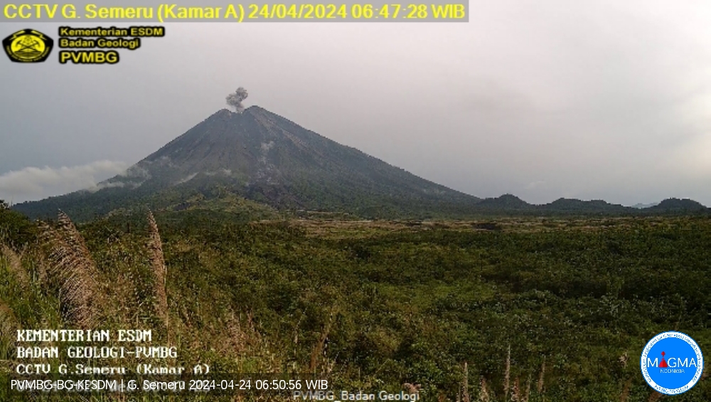
Indonesia , Semeru :
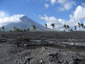
Mount Semeru exhibited an eruption on Wednesday, April 24, 2024 at 05:47 WIB with the height of the ash column observed at ± 600 m above the summit (± 4276 m above sea level). The ash column was observed to be white to gray in color with moderate intensity, oriented southwest. At the time of writing, the eruption was still ongoing.
Observation of seismicity
6 eruption/explosion earthquakes with an amplitude of 20 to 22 mm and earthquake duration of 70 to 115 seconds.
1 harmonic tremor with an amplitude of 8 mm, and an earthquake duration of 166 seconds.
2 deep tectonic earthquakes with an amplitude of 24-32 mm, and a seismic duration of 41-82 seconds.
RECOMMENDATION
1. Do not carry out any activities in the South-East sector along Besuk Kobokan, 13 km from the summit (center of the eruption). Apart from this distance, people do not carry out activities within 500 meters of the river bank along Besuk Kobokan as they are likely to be affected by expanding warm clouds and descending lahars up to a distance of 17 km from the summit.
2. Do not practice activities within a 5 km radius of the crater/summit of the Mount Semeru volcano as it is subject to the danger of ballistic projections.
Source et photo : Magma Indonésie
Costa Rica , Poas / Rincon de la Vieja :
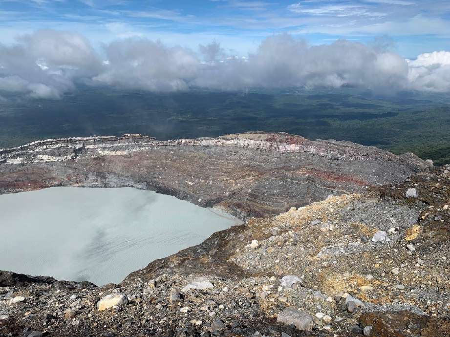
Poas Volcano
Latitude: 10.2
Longitude: -84,233
Altitude: 2,687 meters above sea level
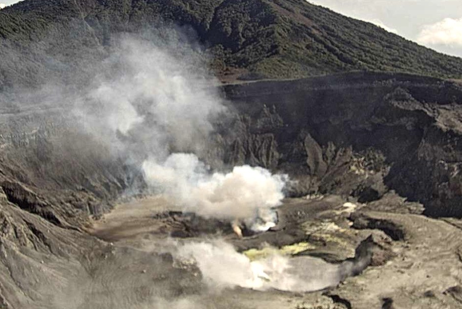
Activity observed:
The emission of a plume of gas with a low ash content is observed. The amplitude of the volcanic tremor continues to show variations but, in general, it is of very low amplitude. A slight tendency towards horizontal contraction is observed from geodetic observations. Regarding gas measurements, the gas ratios as well as the sulfur dioxide (SO2) concentration remain stable.
Environmental conditions:
The wind blows towards the South-West. The summit is partly cloudy.
Activity Level: Warning (2)
Rincón de la Vieja Volcano
Latitude: 10.83
Longitude:-85.324
Altitude: 1,916 meters above sea level
Activity observed:
During the last 24 hours, a tremor with frequencies between 1 and 5 Hz and of moderate magnitude continues to be recorded. In contrast, sporadic low-frequency signals are recorded. Geodetic observations detect a slight extension of the base of the volcano.
Environmental conditions:
The wind blows from the South-West and the summit is cloudy.
Activity Level: Caution (3)
Source : Ovsicori
Photos : Ovsicori , Juan Carlos López del ICE.