February 15 , 2020 .
La Réunion , Piton de la Fournaise :
Activity bulletin for Friday 14 February at 2 p.m. (local time).
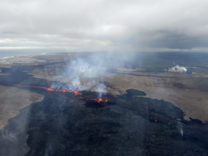
The eruption which started on 02/10/2020 at around 10:50 am local time continues. The intensity of the volcanic tremor (indicator of the intensity of the eruption) has been relatively stable over the past 48 hours (Figure 1). Note the presence of some fluctuations, certainly linked to a resonance effect within the volcanic cone which is closing laterally.
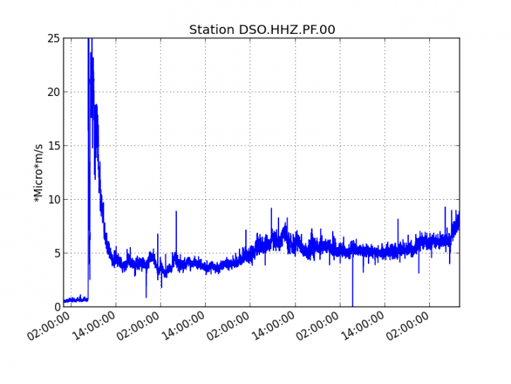
Figure 1: Evolution of the RSAM (indicator of the volcanic tremor and the intensity of the eruption) between 02/10/2020 and 02/14/2020 1:00 p.m. local time (4:30 a.m. UT) on the DSO seismological station located at the summit of the volcano. (© OVPF / IPGP).
Two volcano-tectonic earthquakes were recorded today under the summit craters.
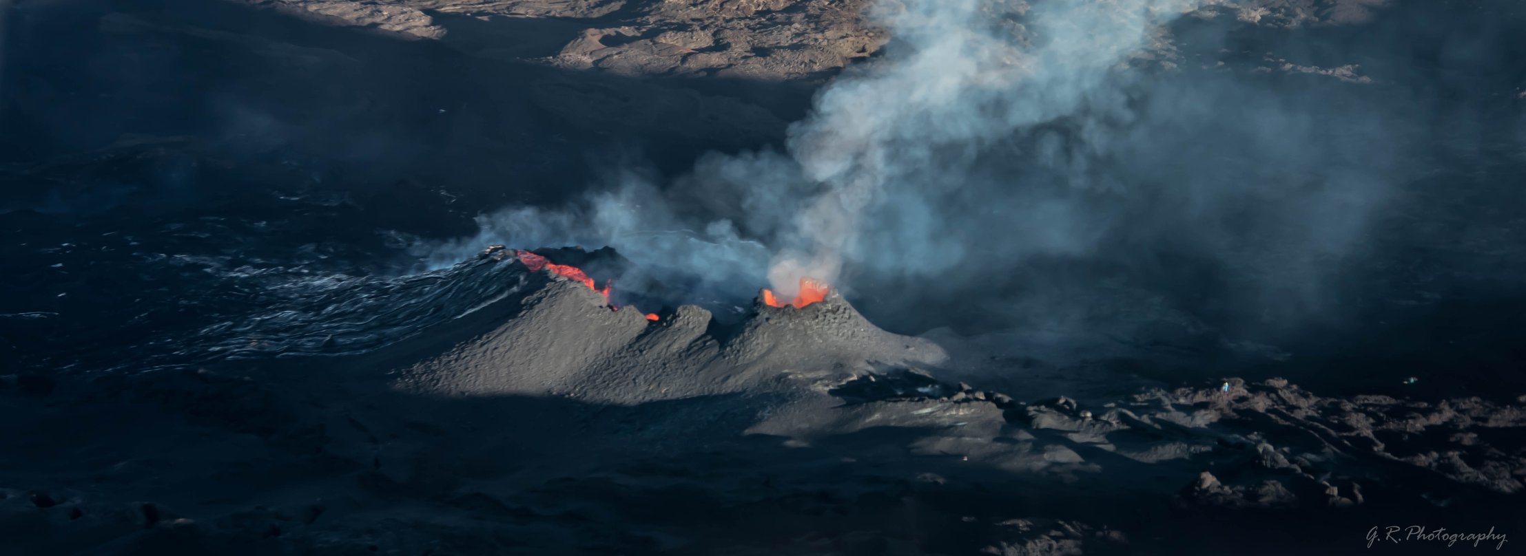
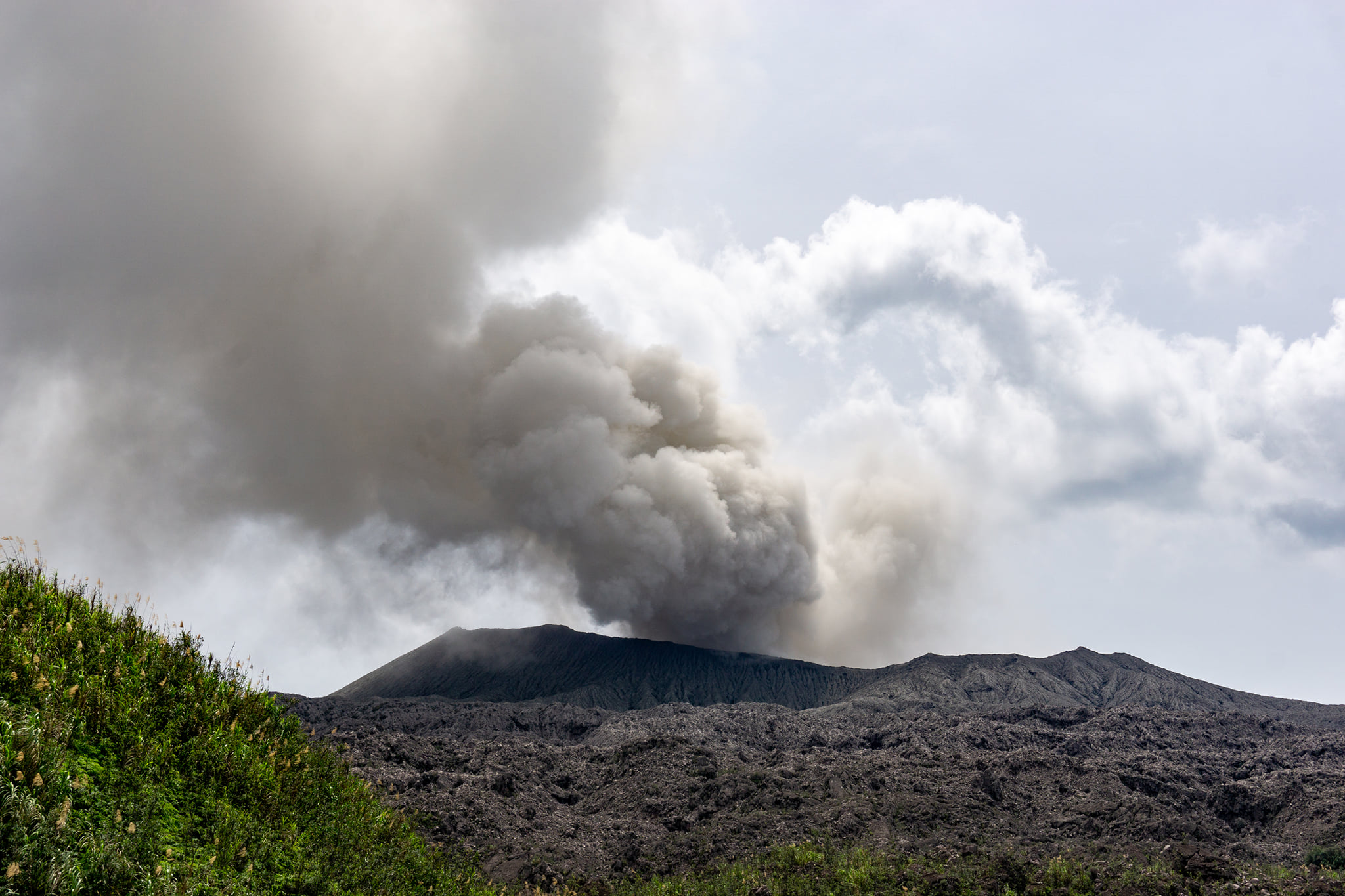
The lowest elevation flow front (1400 m) observed at the start of the eruption was no longer active on yesterday and the maximum extension of the flows now active was around 1900 m above sea level, below Marco crater (Figure 2). The observations of this night from RN2 confirm that the front of the active flows has not progressed much since.
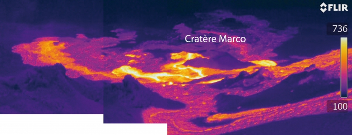
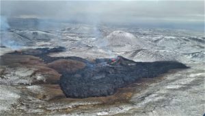
Figure 2: Thermal imaging shot of the active lava field located below the eruptive site on 02/13/2020 at 1 p.m. local time (© OVPF / IPGP).
This morning, the estimated surface flows, from satellite data via the HOTVOLC (OPGC – University of Auvergne) and MIROVA (University of Turin) platforms, were between 8 and 16 m3 / s.
Alert level: 2-2.
Source : OVPF.
Read the article : http://www.ipgp.fr/fr/ovpf/bulletin-dactivite-vendredi-14-fevrier-a-14h00-heure-locale.
Photo : Geraldine Royer / Passion volcan / Facebook .
Guatemala , Fuego :
Type of activity: Vulcanian
Morphology: composite stratovolcano
Location: 14 ° 28’54˝ Latitude N; 90 ° 52’54˝ Longitude W
Activity:
Presence of degassing fumarole at an altitude of 4200 m which moves west and northwest. 10 to 14 low to moderate explosions are generated per hour which expel the gray ash columns at a height of 4,500 to 4,800 m above sea level (14,765-15,750 feet) and disperse over 15 to 20 km west and North West. At night and early in the morning incandescent pulses were observed at 400 – 500 m high with moderate avalanches around the crater, mainly towards the ravines of Seca, Taniluya, Cenizas, Trinidad and Las Lajas. Low to moderate rumblings are perceived, causing moderate shock waves that vibrate the houses near the volcano. There are sounds similar to those of train locomotives constantly. Fine particles of ash fall in the villages of Sangre de Cristo, Buena Vista, La Cruz, Pajales, Yepocapa, Alotenango and others. An 800 m long lava flow descends towards the Canyon Cenizas.
Note: The description above corresponds to the activity of the special BEFGO bulletin # 01-2020.
INCREASE IN SEISMIC ACTIVITY, INCANDESCENCE AND DEGASIFICATION ON THE FUEGO VOLCANO.
The Fuego volcano shows an increase in its effusive activity, which results in an increase in seismic activity, incandescence and degassing, according to the special vulcanological bulletin BEFGO # 01-2020 published in the afternoon of this Thursday February 13, 2020, by the National Institute of Seismology, Volcanology, Meteorology and Hydrology -INSIVUMEH-.
According to information from our scientific entity, the activity is accompanied by a lava flow of 700 meters towards the Ceniza Canyon.
In the last few hours, the number of strong to moderate explosions should decrease, but the weak explosions and the continuous degassing increase.
Through the Volcano Prevention Unit -UPV- of the Executive Secretariat of the National Disaster Reduction Coordinator -SE-CONRED-, communication and surveillance are maintained with radio bases and the authorities in order to activate the established procedures to prevent a major change in the current phase of the Fuego volcano.
The population is advised to be attentive to the information that the authorities make known through the media and social networks and to avoid putting their lives at risk.
Sources : Insivumeh , Conred .
Photo : Thomas Jøhnk / Facebook .
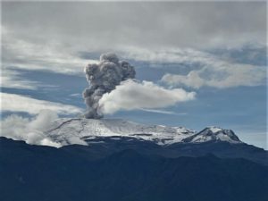
Mexico , Popocatepetl :
February 14, 11:00 a.m. (February 14, 5:00 p.m. GMT).
According to the monitoring systems of the Popocatepetl volcano, 177 exhalations and 382 minutes of tremors have been identified. Some of these events were accompanied by the emission of gas and light amounts of ash which dispersed north-northeast. Two minor explosions were recorded at 11.35 a.m. and 5.59 p.m. In addition to 2 volcano-tectonic earthquakes recorded yesterday at 09:23 and 09:24 h, with a calculated magnitude of 1.0 and 1.2, respectively.
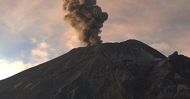
During this morning and until the time of this report, volcanic gas emissions and light amounts of ash were dispersed to the northeast, with a maximum height of 400 m.
CENAPRED urges NOT to APPROACH the volcano and especially the crater, because of the danger of falling ballistic fragments, and in case of heavy rain, stay far from the bottom of the ravines because of the danger of mudslides and debris.
The Popocatépetl volcanic signaling light is in YELLOW PHASE 2.
Source : Cenapred .
Indonesia, Dukono :
VOLCANO OBSERVATORY NOTICE FOR AVIATION – VONA.
Issued: February 13 , 2020.
Volcano: Dukono (268010)
Current Aviation Colour Code: ORANGE
Previous Aviation Colour Code: orange
Source: Dukono Volcano Observatory
Notice Number: 2020DUK10
Volcano Location: N 01 deg 41 min 35 sec E 127 deg 53 min 38 sec
Area: North Maluku, Indonesia
Summit Elevation: 3933 FT (1229 M)
Volcanic Activity Summary:
Eruption with volcanic ash cloud at 09h46 UTC ( 18h46 local).
Volcanic Cloud Height:
Best estimate of ash-cloud top is around 4893 FT (1529 M) above sea level, may be higher than what can be observed clearly. Source of height data: ground observer.
Other Volcanic Cloud Information:
Ash-cloud moving to west
Remarks:
Eruption and ash emission is continuing.
Level of activity at level II (WASPADA). G. Dukono (1 229 m above sea level) experiences a continuous eruption. The most recent eruption occurred on February 13, 2020 with a column height of 300 m.
The volcano is clearly visible until they are covered with fog. The smoke from the crater is observed white / gray with a height of 100 to 300. The weather is sunny to cloudy, the wind is weak in the southwest and west. Air temperature 26-30 ° C.
According to the seismographs of February 14, 2020, it was recorded:
1 distant tectonic earthquake
Continuous tremor, amplitude 0.5 to 4 mm (dominant value of 1 mm)
Recommendation:
The community around G. Dukono and visitors / tourists must not move, climb and approach the crater of Malupang Warirang within a radius of 2 km.
Since volcanic ash eruptions occur periodically, as the ash dispersion follows the wind direction and speed, when these are not fixed, it is recommended that the community around G. Dukono always provide masks / nose and mouth cover to use when necessary to avoid threats. danger of volcanic ash in the respiratory system.
Source : Magma Indonésie , PVMBG .
Photo : Claudio Jung.