
September 14 , 2020 .
Philippines , Taal :
TAAL VOLCANO BULLETIN 14 September 2020 08:00 A.M.
In the past 24-hour period, the Taal Volcano Network recorded six (6) volcanic earthquakes. Very weak steaming or fumarolic activity rising 5 meters high before drifting northwest was observed from fissure vents along the Daang Kastila Trail.
Alert Level 1 (Abnormal) is maintained over Taal Volcano. DOST-PHIVOLCS reminds the public that at Alert Level 1, sudden steam-driven or phreatic explosions, volcanic earthquakes, minor ashfall, and lethal accumulations or expulsions of volcanic gas can occur and threaten areas within the Taal Volcano Island (TVI).
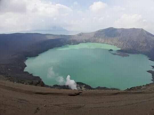
DOST-PHIVOLCS strongly recommends that entry into TVI, Taal’s Permanent Danger Zone or PDZ, especially the vicinities of the Main Crater and the Daang Kastila fissure, must remain strictly prohibited. Local government units are advised to continuously assess previously evacuated barangays around Taal Lake for damages and road accessibilities and to strengthen preparedness, contingency, and communication measures in case of renewed unrest. People are also advised to observe precautions due to ground displacement across fissures, possible ashfall, and minor earthquakes. Civil aviation authorities must advise pilots to avoid flying close to the volcano as airborne ash and ballistic fragments from sudden explosions and wind-remobilized ash may pose hazards to aircraft.
DOST-PHIVOLCS is closely monitoring Taal Volcano’s activity and any new significant development will be immediately communicated to all stakeholders.
Source : Phivolcs .
Photo : Yuri Harmony
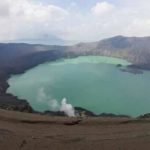
Indonesia , Semeru :
VOLCANO OBSERVATORY NOTICE FOR AVIATION – VONA.
Issued : September 14 , 2020 .
Volcano : Semeru (263300)
Current Aviation Colour Code : ORANGE
Previous Aviation Colour Code : orange
Source : Semeru Volcano Observatory
Notice Number : 2020SMR93
Volcano Location : S 08 deg 06 min 29 sec E 112 deg 55 min 12 sec
Area : East java, Indonesia
Summit Elevation : 11763 FT (3676 M)
Volcanic Activity Summary :
Eruption with volcanic ash cloud at 02h49 UTC (09h49local).
Volcanic Cloud Height :
Best estimate of ash-cloud top is around 13043 FT (4076 M) above sea level, may be higher than what can be observed clearly. Source of height data: ground observer.
Other Volcanic Cloud Information :
Ash-cloud moving to south.
Remarks :
Eruption recorded on seismogram with maximum amplitudo 19 mm and duration 82 second
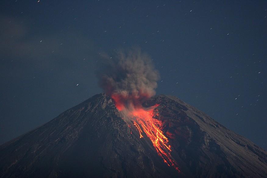
Level of activity at level II ( Waspada). the Semeru (3,676 m above sea level) is continuously erupting. Explosive and effusive eruptions are observed, causing lava flows towards the southern and southeast slopes, as well as explosions of incandescent rocks around the summit crater. The last eruption occurred on September 13, 2020 with the height of the eruption column not observed.
The volcano is clearly visible until it is covered in fog. Smoke from the crater was not observed. The weather is sunny, the winds weak, oriented to the North, South-West and West.
According to the seismographs of September 13, 2020, it was recorded:
– 29 eruption earthquakes
– 5 earthquakes of emissions
– 3 distant tectonic earthquakes.
Recommendation:
1. The community must not carry out activities within a radius of 1 km and in an area of up to 4 km in the sector of the South-South-East slope of the active crater which is the area of the active opening of the crater of Mount Semeru (Jongring Seloko) as a flow of hot clouds.
2. Be aware of the presence of the lava dome in Jongring Seloko Crater.
Source : Magma Indonésie , PVMBG .
Photo : M. Rietze , wikipedia , licence creative common .
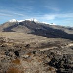
Guatemala , Pacaya :
SPECIAL VOLCANOLOGICAL BULLETIN
Type of activity: Strombolian.
Morphology: composite stratovolcano
Geographical location: 14 ° 22’50˝ Latitude N; 90 ° 36’00˝ Longitude W.
Height: 2,552 meters above sea level.
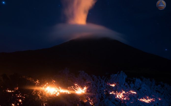
VOLCANIC ACTIVITY UPDATE
The volcanic activity of the Pacaya volcano recorded last week has been mainly effusive with periods of moderate to strong Strombolian explosiveness that rejects materials up to 200 meters high on the crater. Some of these events generating the fall of ballistic products in a radius of about 50 meters, a constant incandescence and degassing also visible from various points of the city of Guatemala. This degassing generates a plume of white / blue color due to its water and sulfur dioxide composition. The explosive activity maintains the cycle of construction and destruction of the intacrater active cone.
During these last weeks the activity of the lava flows has been maintained on the Northwest and North flanks, with lava flows of different lengths, ranging from 150 meters to 1 km. On the plateau of the northwest flank, in unstable areas, there are still areas of thermal anomalies and cracks from which steam emanates. Currently active lava flows, reported by INSIVUMEH observers, are moving in a northeast direction and another in a northern direction, over 1250 meters and 50 meters, respectively.
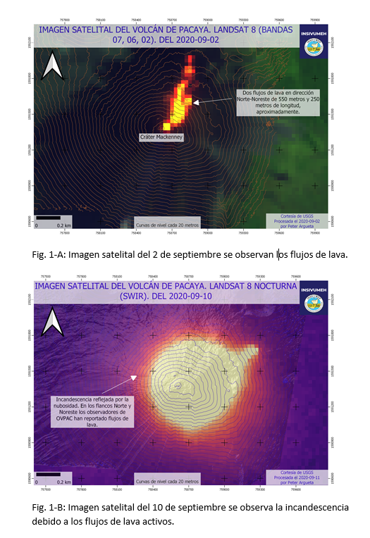
The seismic activity recorded by the PCG and PCG5 stations is the same as in recent months when there were periods of greater activity and decrease in it, as well as tremors generated by the movement of lava flows, l rise of magma and the pressure of magmatic gases. See figure n ° 2.
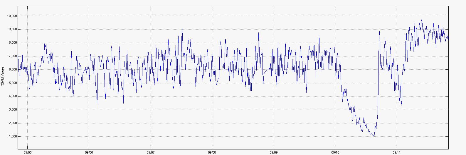
Figure n ° 2: average seismic amplitudes of the PCG station, from September 5 to 11.
The explosive activity generates low to moderate rumblings that vibrate the windows and roofs of houses in the villages of San Francisco de Sales, El Patrocinio, El Rodeo and others, located within a radius of 4 kilometers around the volcano. INSIVUMEH provides visual and instrumental surveillance, by means of a webcam, of seismic stations (PCG and PCG5) and OVPAC observers.
Source : Insivumeh .
Photo : Conred .
Guadeloupe , La Soufrière :
Sunday September 13, 2020 at 1:00 p.m. local time
Sequence of earthquakes in the La Soufrière area of Guadeloupe – Basse Terre.
A sequence of volcanic earthquakes began on Saturday September 12, 2020 at 7.20 a.m. local time (Saturday September 12, 2020 at 11:20 a.m. UTC *) in the area of the volcano of La Soufriere.
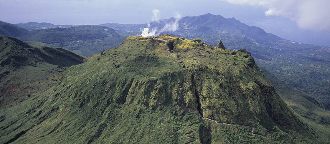
Since then, the OVSG-IPGP networks have recorded 75 very low magnitude earthquakes (M <1).
No earthquakes were reported felt. The events are located at a depth of <2.5 km below the top of the dome of La Soufrière.
The alert level remains: yellow, vigilance.
Source : Direction of OVSG-IPGP.
Photo : P Giraud / ctig


No comment yet, add your voice below!