26 Janvier 2020 .
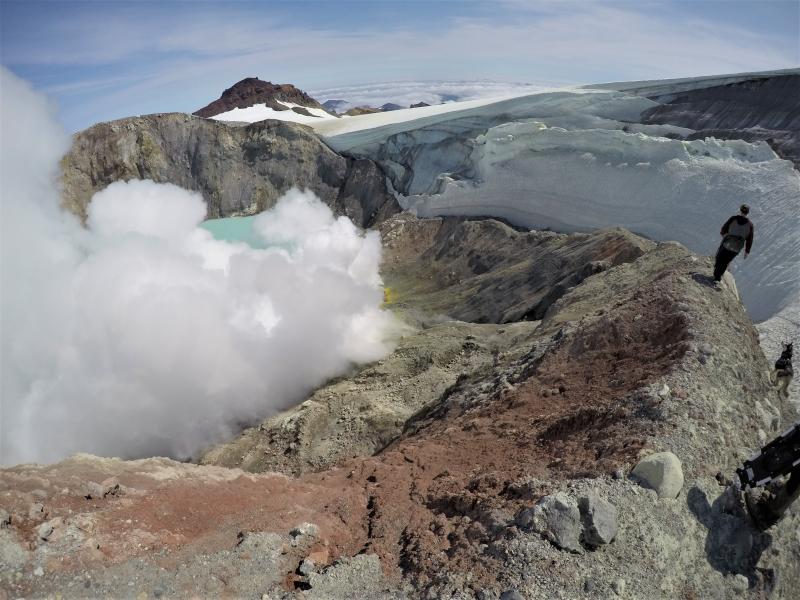
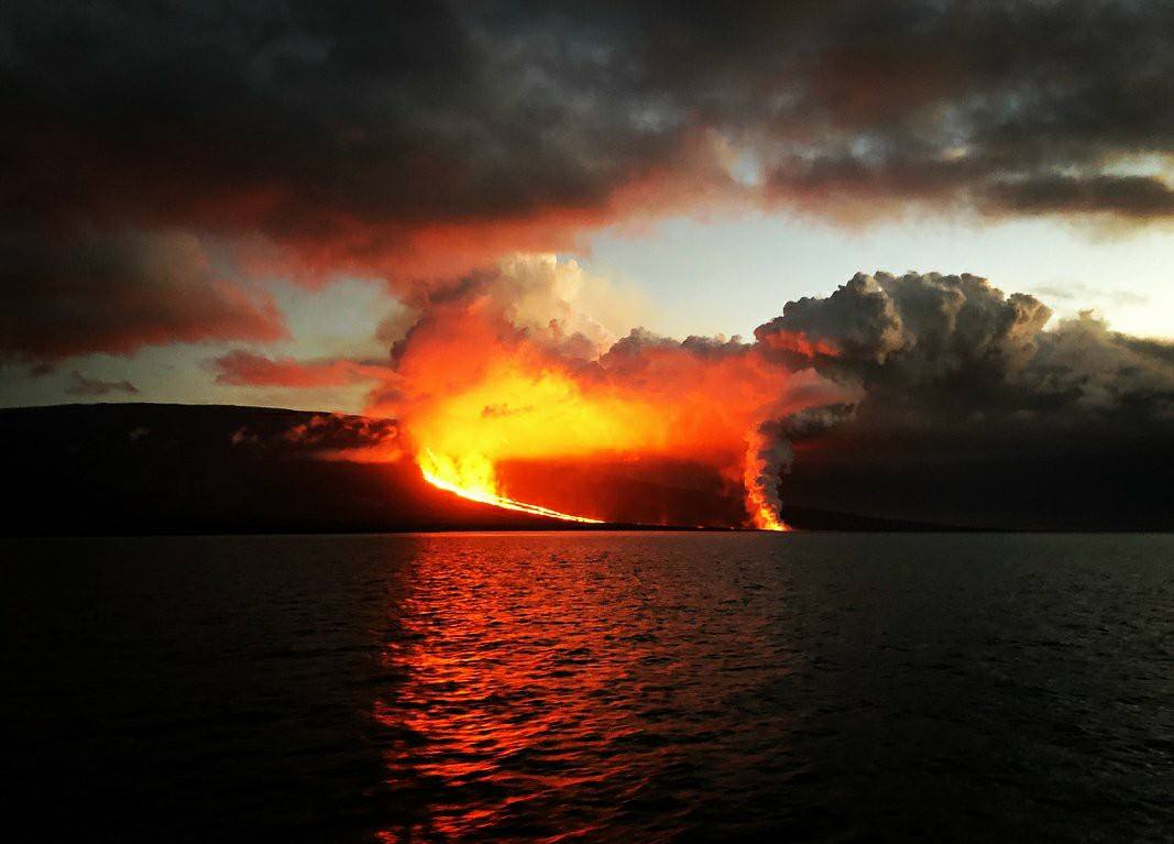
Equateur / Galapagos , Fernandina :
Rapport spécial n ° 3 sur le volcan Fernandina – 2020 . Mise à jour de l’activité éruptive
Résumé:
L’activité sismique après l’éruption du 12 janvier 2020 n’est pas revenue à ses niveaux de base (pré-éruption); au contraire, elle a augmenté, présentant des tremblements de terre sporadiques de magnitude supérieure à M 3,0 et de petits essaims sismiques qui ont évolué au fil du temps. Le séisme le plus fort a été enregistré le 21 janvier 2020 avec une magnitude de 4,2. De plus, une déformation du sol d’environ 35 cm a été détectée dans la zone d’émission des coulées de lave. L’estimation préliminaire des coulées de lave émises le 12 janvier 2020, situées à l’Est du volcan, indique qu’elles couvrent une superficie d’environ 3,8 km2 (Fig.1), valeur inférieure aux estimations des précédentes éruptions circonférentielles (2017 et 2005) . Au moment de la publication de ce rapport, aucune nouvelle anomalie thermique ou émission de gaz n’a été enregistrée. Dans certaines des éruptions précédentes de volcans dans les îles Galapagos (Fernandina 2009, Wolf 2015, Sierra Negra 2018), l’absence d’activité de surface après une première impulsion éruptive peut être suivie d’une deuxième phase éruptive, il n’est donc pas exclu que quelque chose de similaire puisse se produire à cette occasion sur Fernandina. L’IG-EPN poursuit la surveillance volcanique et informera s’il y a des changements dans l’activité interne ou externe du volcan.
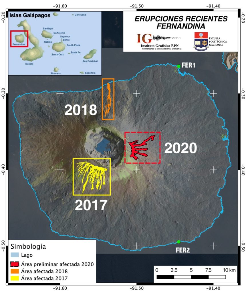
Figure 1. Carte des récentes éruptions du volcan Fernandina, qui met en évidence en rouge la zone précédemment affectée par les coulées de lave produites le 12 janvier 2020 (zone rouge), qui couvre une superficie approximative de 3,8 km2. Carte obtenue grâce à des images InSAR de cohérence (traitées avec l’ISCE, P. Espín, préparée par FJ. Vásconez).
Antécédents
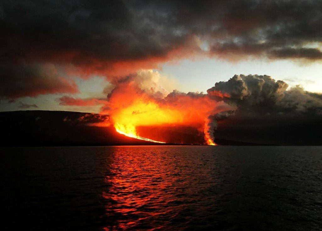
Le volcan Fernandina a présenté son dernier processus éruptif le 12 janvier 2020, qui a duré environ 9 heures et a été caractérisé par l’ouverture d’une fissure circonférentielle située sous le bord Est de la caldeira où des coulées de lave ont été émises vers le flanc oriental. En outre, un nuage de gaz a été généré qui a atteint une hauteur maximale de 3,5 km au-dessus du niveau de la mer, comme indiqué dans le rapport spécial n ° 2-2020.
Annexe technico-scientifique
Sismicité.
L’évolution temporelle de la magnitude des tremblements de terre situés sous le volcan indique que Fernandina est toujours sous agitation (figures 2a-c). La plupart de l’activité se situe dans la caldeira ou à proximité. La profondeur de ces événements est principalement superficielle, bien qu’il y ait parfois eu des événements plus profonds (plus de 10 km de profondeur). Jusqu’à présent, les tremblements de terre détectés la semaine dernière ont atteint M 4,2, et aucun n’a été ressenti par les populations les plus proches situées sur l’île Isabela.
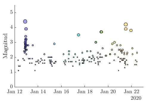
Figure 2a: Evolution temporelle de la magnitude des tremblements de terre détectés sous le volcan Fernandina. La taille de chaque symbole correspond à la magnitude de l’événement. La couleur de chaque symbole correspond à la progression dans le temps de l’activité.

Figure 2b: Evolution temporelle des profondeurs des tremblements de terre localisés sous le volcan Fernandina. La taille de chaque symbole est fonction de l’ampleur de l’événement. La couleur de chaque symbole détermine l’évolution à travers le temps de l’activité.
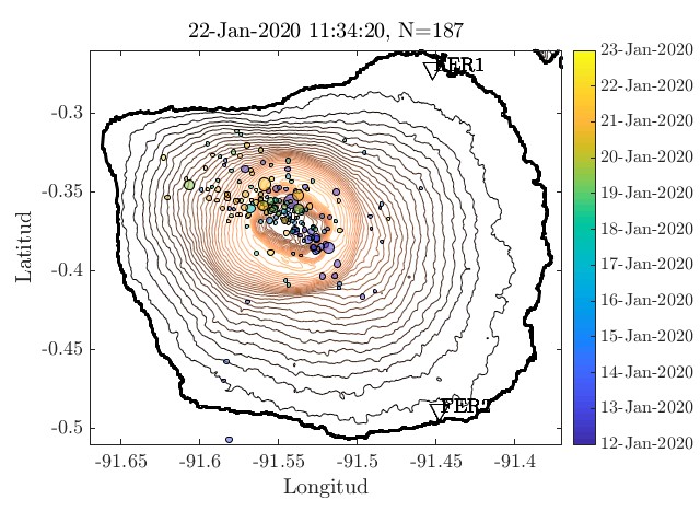
Figure 2c: Localisation des tremblements de terre détectés sous le volcan Fernandina. La taille de chaque symbole est fonction de l’ampleur de l’événement. La couleur de chaque symbole détermine l’évolution à travers le temps de l’activité.
Anomalies thermiques et nuages de gaz
Depuis le point culminant de l’éruption le 13 janvier à 3 heures (heure des Galapagos), aucune anomalie thermique ou émission de gaz sur le volcan n’a été détectée grâce aux capteurs à distance disponibles.
Déformation
Le traitement des images satellites Sentinel-1 entre janvier 2019 et janvier 2020 indique des schémas d’inflation avec un déplacement total supérieur à 30 cm. De plus, l’analyse de la période entre le 3 décembre 2019 et le 10 janvier 2020 (deux jours avant l’éruption) montre une déformation de 2,3 cm dans la ligne de visée satellite (LOS). La plus grande déformation, une déflation d’environ 35 cm (LOS), a été enregistrée lors de l’éruption dans la zone d’émission de lave à l’Est de la caldeira. Au cours de la même période, une inflation est observée sur le flanc Sud-Sud-Ouest du volcan de 21,8 cm (figure 3). Pour le même secteur entre le 15 et le 21 janvier, il y a une déformation de 5,79 cm.
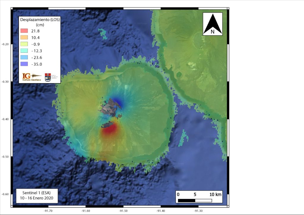
Figure 3. Carte du déplacement du sol dans la ligne de visée satellite (LOS) dans la région de l’île Fernandina entre le 10 et le 16 janvier 2020, montrant la déformation qui a provoqué l’éruption du 12 janvier 2020. ( Traité avec ISCE, P. Espín).
Scénarios éruptifs:
Sur la base des données historiques et géologiques des éruptions du volcan Fernandina, plusieurs scénarios pour une éventuelle éruption devraient être envisagés. Dans le cas des volcans de type bouclier, tels que Fernandina, les éruptions sont caractérisées comme étant principalement hawaïennes, avec des coulées de lave pouvant provenir de fissures circonférentielles (parallèles à la caldeira), radiales (perpendiculaires à la caldeira) ou d’évents à l’intérieur de la caldeira. En cas de nouvelle phase éruptive sur le volcan Fernandina, les scénarios suivants sont considérés , classés du plus probable au moins probable:
1. Emplacement.
1a Historiquement, l’activité éruptive du volcan Fernandina a alterné entre des éruptions de fissures circonférentielles et radiales (Bagnardi et al. 2013). L’éruption du 12 au 13 janvier 2020 étant circonférentielle, la prochaine activité est susceptible de se produire en raison d’une fissure radiale. De plus, selon les enregistrements de déformation du sol, il est possible que cette fissure soit ouverte sur le flanc Sud-Sud-Ouest du volcan où l’inflation est enregistrée, un secteur où les éruptions de 1995 et 2009 se sont produites.
1.b. La possibilité d’une nouvelle éruption circonférentielle, à l’intérieur de la caldeira ou sous-marine, n’est pas non plus exclue.
2. Taille de l’éruption .
2a La plupart des éruptions historiques de Fernandina sont de petite taille (<20 millions de m³). La taille de la déformation enregistrée dans le volcan suggère un scénario tout aussi petit.
2.b. Des éruptions de taille moyenne (20-200 millions de m³) se sont produites au cours des dernières semaines, voire des mois, mais sont moins fréquentes.
2.c. Enfin, la possibilité d’une éruption importante (> 200 millions de m3) comme cela s’est produit en 1968 n’est pas exclue, cependant, la probabilité de tels événements est encore faible.
3. Phénomènes volcaniques.
Pendant les éruptions de Fernandina, les phénomènes les plus courants sont les fontaines , les coulées de lave et les nuages de gaz avec une faible ou modérée teneur en cendres. Les coulées de lave peuvent provoquer des incendies comme cela s’est produit en 2017.
3.a. En cas d’éruption radiale sur le flanc du volcan, la lave est susceptible d’atteindre la côte, comme cela s’est produit en 2018, 2009 et 1995.
3.b. En cas d’éruption circonférentielle près de la caldeira, la lave est susceptible de descendre du sommet du volcan jusqu’à la rupture de la pente sans atteindre la mer, comme cela s’est produit en 2020, 2017 et 2005.
3.c. Si l’éruption se produit dans la caldeira, l’interaction de la lave avec le lagon (existant) peut provoquer de violentes explosions hydro-volcaniques, l’émission de grandes quantités de cendres et la formation de nuages brûlants (ou courants de densité pyroclastique), comme cela s’est produit en 1968 .
3.d. Il y a également la possibilité de l’apparition d’un grand glissement de la paroi de la caldeira, similaire à ce qui s’est produit en 1988. Ces phénomènes sont rares et affectent principalement la zone à l’intérieur de la caldeira et la partie supérieure du volcan, bien que les nuages de cendres peuvent atteindre des zones peuplées en fonction de la direction et de la vitesse du vent.
3.e. Fernandina est une île volcanique et son activité peut également provoquer des glissements de terrain dans la zone côtière ou sur les flancs sous-marins, ce qui peut déclencher la formation de tsunamis, comme cela s’est produit sur le volcan Anak Krakatau en Indonésie en 2018. Ce scénario est très peu commun et rien n’indique qu’il puisse se produire dans le cadre de ce processus éruptif, cependant, si ce phénomène est généré, il pourrait avoir un impact important sur les îles Galapagos.
Recommandations:
Il n’y a pas d’établissements humains sur l’île Fernandina. En raison de la direction prédominante du vent vers l’Ouest-Nord-Ouest, si de nouvelles colonnes de gaz et de cendres se produisent, les îles peuplées (Isabela, Santa Cruz, Floreana et San Cristóbal) ne devraient pas être affectées, sauf si le vent change de direction. Si des coulées de lave pénètrent dans la mer, il est recommandé de rester à l’écart, car des explosions et la libération de gaz nocifs peuvent se produire lorsque la lave entre en contact avec l’eau froide de la mer. De même, en cas d’éruption, il n’est pas recommandé de s’approcher de la zone de l’éruption, en raison du risque d’être affecté par des produits éruptifs ou des phénomènes secondaires tels que les incendies.
Source : IGEPN. SV, BB, SH, PE, SA, FJV, PR, MFN, SV / Instituto Geofísico / Escuela Politécnica Nacional.
Photo : IGEPN , éruption 2018 .
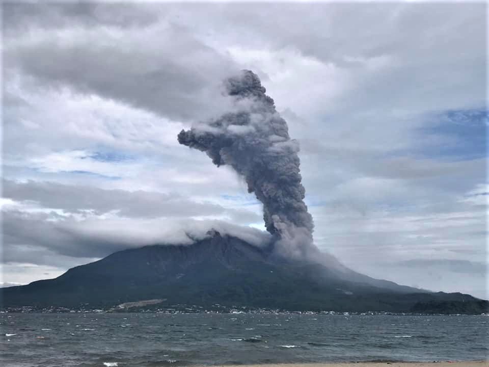
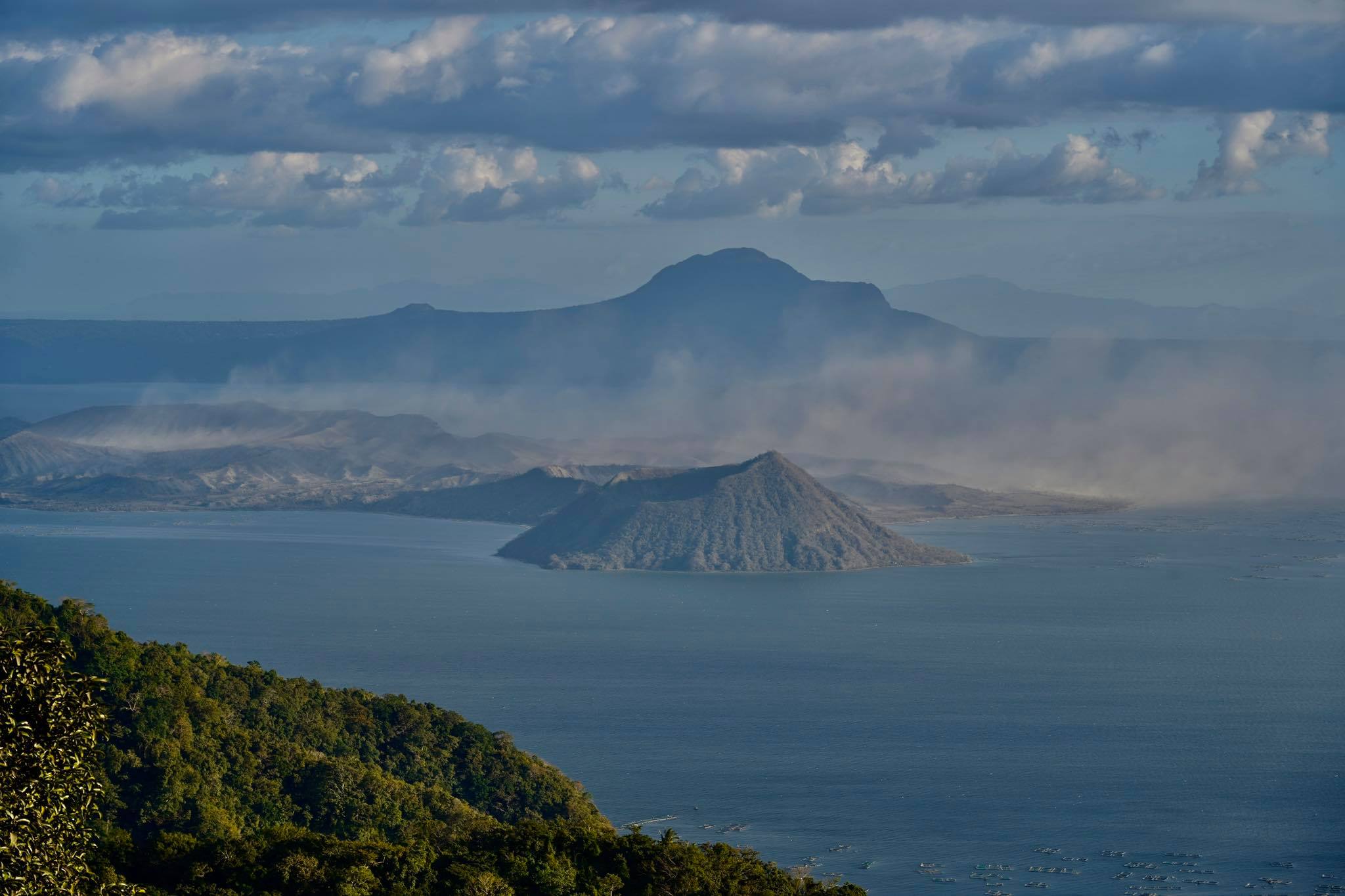
Philippines , Taal :
BULLETIN D’ACTIVITE DU VOLCAN TAAL , 26 janvier 2020 , 08:00 .
Ceci sert de préavis pour l’abaissement du statut du volcan Taal du niveau d’alerte 4 (éruption dangereuse imminente) au niveau d’alerte 3 (tendance réduite à une éruption dangereuse).
L’état du volcan Taal dans les deux semaines suivant l’éruption phréato-magmatique du 12 au 13 janvier 2020 (phase éruptive principale) a généralement décliné en une activité sismique volcanique moins fréquente, une déformation au sol ralentie des édifices de la caldeira du Taal et de l’île du volcan Taal (TVI) et une faible émission de vapeur / gaz dans le cratère principal. Ces observations sont appuyées par les paramètres de surveillance suivants:

Les tremblements de terre importants enregistrés par le réseau sismique philippin (PSN) dans la région du Taal sont passés de 959 à 27 événements / jour et les magnitudes maximales de M4,1 à M2,1 entre le 12 et le 24 janvier. Le réseau volcanique du Taal (TVN) a également enregistré une tendance à la baisse des tremblements de terre volcaniques , passant de 944 à 420 événements / jour entre le 17 et le 24 janvier, avec une baisse correspondante de l’énergie sismique totale quotidienne libérée. En particulier, les tremblements de terre hybrides qui ont suivi la recharge post-éruptive du réservoir de magma profond du Taal vers une région de magma peu profonde sous l’île du volcan Taal (TVI) ont cessé le 21 janvier, tandis que le nombre et l’énergie des événements de basse fréquence associés à l’activité dans la région du magma peu profonde ont diminué.
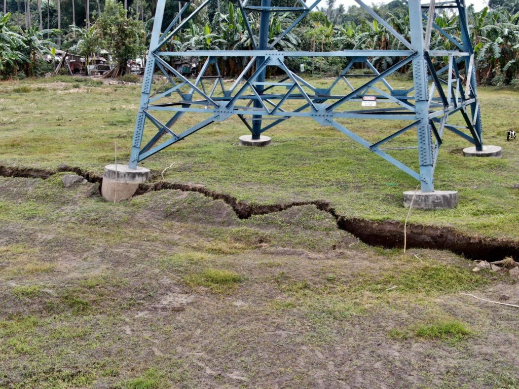
Les données du Global Positioning System (GPS) ont enregistré une déformation du sol après la phase éruptive principale qui comprenait un élargissement soudain de la caldeira du Taal d’environ 1 mètre, un soulèvement de son secteur Nord-Ouest d’environ 20 centimètres et un affaissement de la partie Sud-Ouest du TVI d’environ 1 mètre. Ces modèles ont été suivis à des taux beaucoup plus faibles entre le 15 et le 22 janvier 2020 et ont été généralement étayés par des observations sur le terrain de la récession de l’eau lacustre de ~ 30 centimètres autour du lac Taal hier. Les observations sur le terrain ont également mesuré une récession de ~ 2,5 m d’eau le long de la rive Sud-Ouest du lac, indiquant un soulèvement de portions de la vallée de la rivière Pansipit où une fissuration a été signalée. Le schéma global de déformation du sol est en grande partie soutenu par les données InSAR (satellite) et donne une inflation nette du volcan Taal occidental en raison de l’intrusion de magma dans la région magmatique peu profonde jusqu’au 21 janvier.
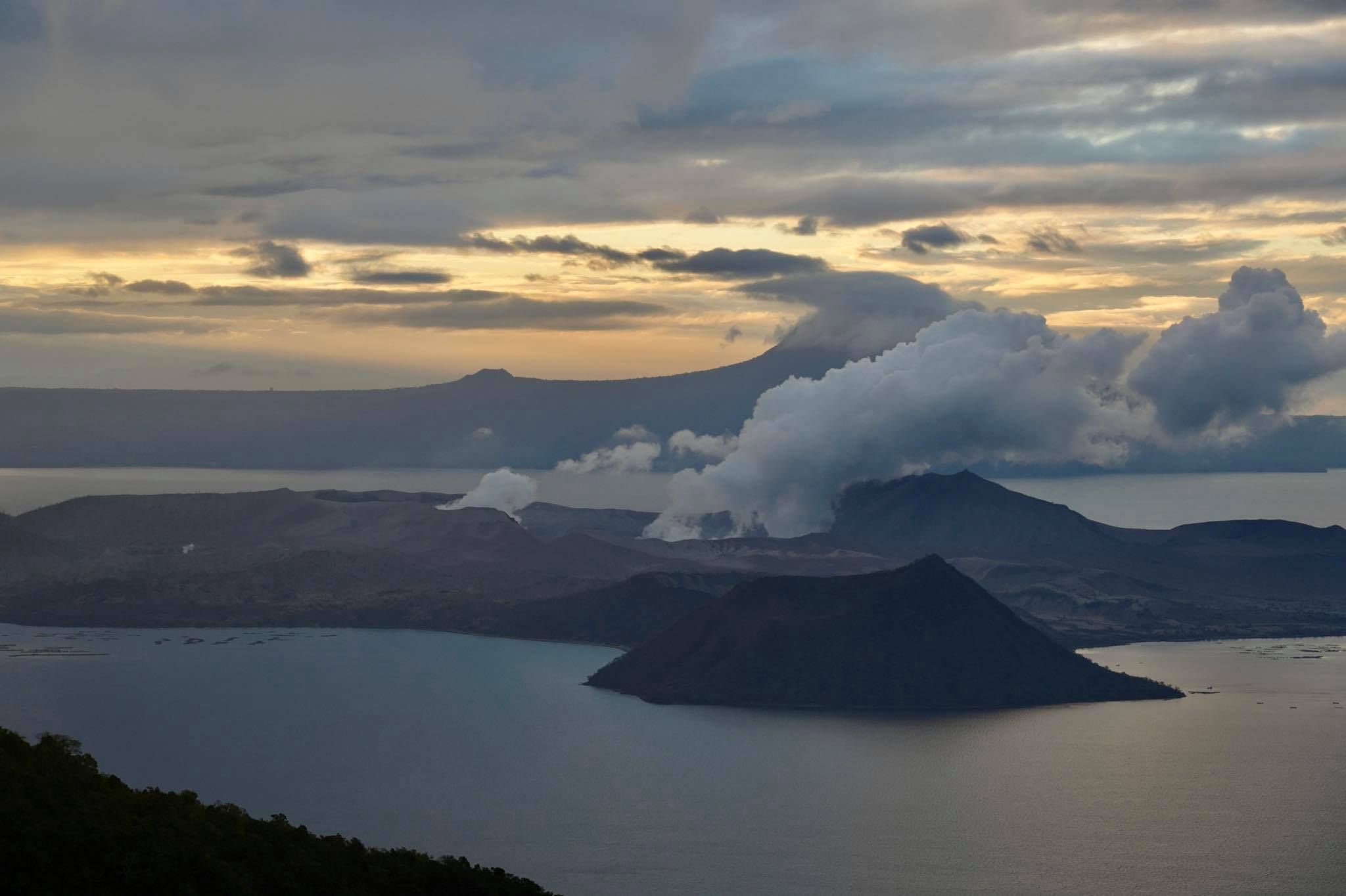
Après la phase éruptive principale, l’activité dans le cratère principal du Taal a diminué à de rares éruptions de cendres faibles et à de plus longs épisodes de dégazage ou de vapeur qui ont généré des panaches chargés de vapeur <1000 mètres de hauteur. Ce déclin marqué couplé à l’activité sismique volcanique suggère un décrochage, un dégazage et une réduction des pressions de gaz du magma éruptible dans la région magmatique peu profonde qui alimente l’activité éruptive de surface.
Le flux de dioxyde de soufre ou de SO2 basé sur les données de la campagne Flyspec a oscillé entre un maximum de ~ 5 300 tonnes / jour le 13 janvier et un minimum de ~ 140 tonnes / jour le 22 janvier mais s’est maintenu à une moyenne de 250 tonnes / jour au cours des cinq derniers journées. Cette faible concentration moyenne est compatible avec une source de magma peu profonde dégazée progressivement et une activité de panache diminuée.

Compte tenu des observations ci-dessus, Le DOST-PHIVOLCS abaisse le statut d’alerte du volcan Taal du niveau d’alerte 4 au niveau d’alerte 3 pour refléter la diminution globale du niveau des paramètres de surveillance. Le niveau d’alerte 3 signifie qu’il y a une tendance diminuée à une éruption explosive dangereuse, mais ne doit pas être interprété comme signifiant que les troubles ont cessé ou que la menace d’une éruption dangereuse a disparu. Si une tendance à la hausse ou un changement prononcé des paramètres surveillés prévient une éruption explosive potentiellement dangereuse, le niveau d’alerte peut être relevé au niveau d’alerte 4. Les personnes résidant dans des zones à haut risque de surtensions de base qui sont revenues après la réduction du niveau d’alerte doivent donc être prêt pour une évacuation rapide et organisée à ce moment. Inversement, en cas de tendance à la baisse persistante des paramètres surveillés après une période d’observation suffisante, le niveau d’alerte sera encore abaissé au niveau d’alerte 2.
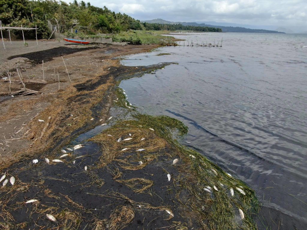
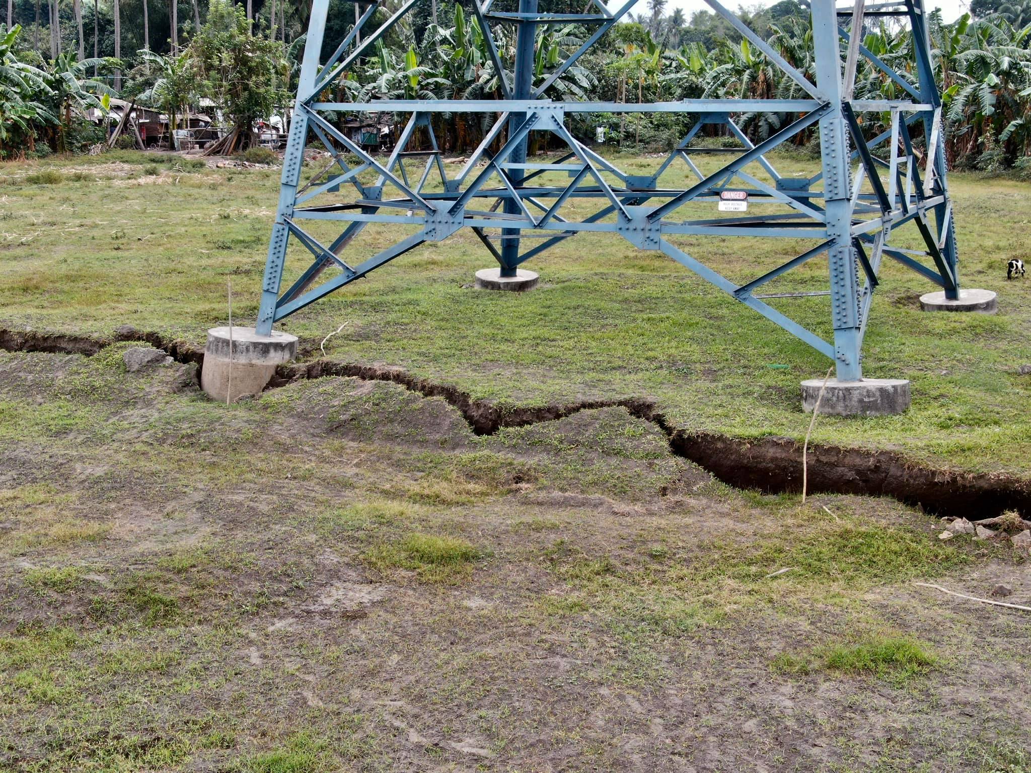
Le DOST-PHIVOLCS rappelle au public qu’au niveau d’alerte 3, des explosions phréato-magmatiques soudaines entraînées par la vapeur , même faibles, des tremblements de terre volcaniques, des chutes de cendres et des expulsions de gaz volcaniques mortelles peuvent se produire et menacer des zones au sein de l’île du volcan Taal (TVI) et des rives des lacs à proximité. Le DOST-PHIVOLCS recommande que l’entrée dans l’île du volcan Taal (TVI), la zone de danger permanent du Taal, ainsi que dans les zones sur le lac Taal et les communautés à l’Ouest de TVI dans un rayon de sept (7) kilomètres du cratère principal soit strictement interdite. Les autorités locales sont invitées à évaluer les zones situées en dehors du rayon de sept kilomètres pour les dommages et l’accessibilité routière et à renforcer les mesures de préparation, d’urgence et de communication en cas de nouvelle agitation. Il est également conseillé aux gens de prendre des précautions en raison du déplacement du sol à travers les fissures, des chutes de cendres fréquentes et des tremblements de terre mineurs. Les communautés situées à côté des canaux fluviaux actifs, en particulier là où les cendres de la phase d’éruption principale ont été épaisses, devraient accroître la vigilance en cas de pluies abondantes et prolongées car les cendres peuvent être emportées et former des lahars le long des canaux. Les autorités de l’aviation civile doivent conseiller aux pilotes d’éviter de voler près du volcan, car les cendres en suspension dans l’air et les fragments balistiques d’explosions soudaines et de cendres remobilisées par le vent peuvent présenter des risques pour les avions.
Le PHIVOLCS-DOST surveille étroitement l’activité du volcan Taal et tout nouveau développement significatif sera immédiatement communiqué à toutes les parties prenantes.
Source : Phivolcs .
Photos : Raffy Tima .
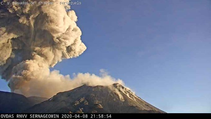
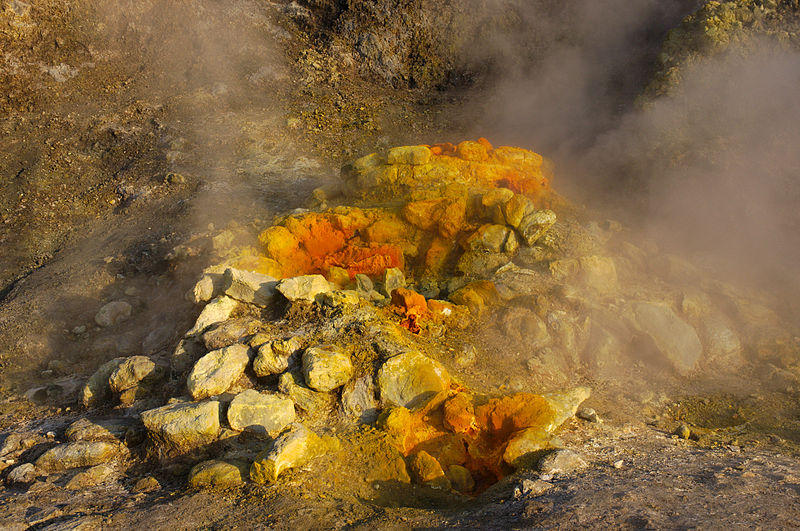
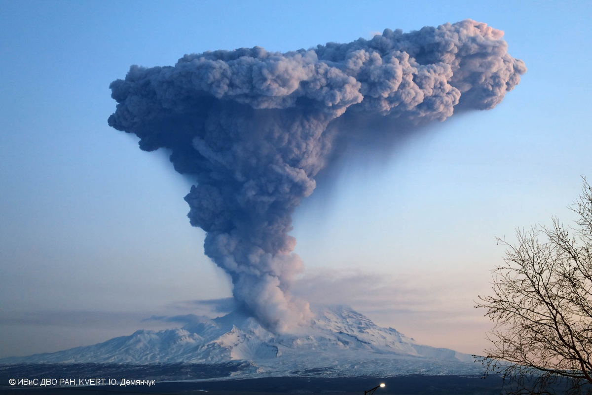
Kamchatka , Sheveluch :
56,64 N, 161,32 E;
Altitude 10768 pi (3283 m), élévation du dôme ~ 8200 pi (2500 m)
Code couleur de l’aviation : ORANGE.

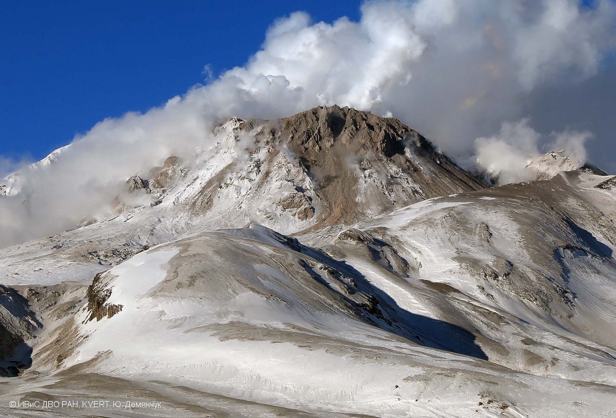
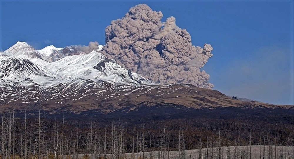
L’activité fumerolienne du dôme de lave du volcan Molodoy Sheveluch le 23 janvier 2020.
L’éruption explosive-extrusive du volcan continue. Des explosions de cendres jusqu’à 32800-49200 pi (10-15 km) d’altitude pourraient survenir à tout moment. L’activité en cours pourrait affecter les avions internationaux volant à basse altitude.
La croissance du dôme de lave se poursuit, une forte activité fumerolienne parfois avec une certaine quantité de cendres, une incandescence des blocs du dôme et des avalanches chaudes accompagne ce processus. Les données satellitaires ont montré une anomalie thermique sur le volcan toute la semaine.
Source : Kvert.
Photo : Yu. Demyanchuk, IVS FEB RAS, KVERT .
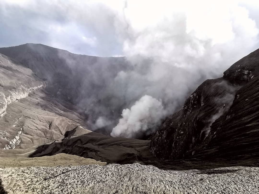
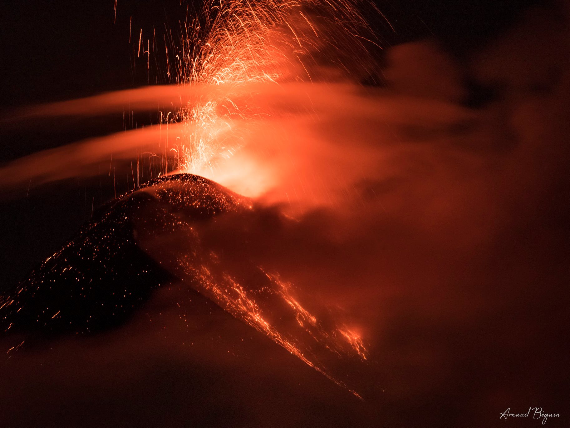
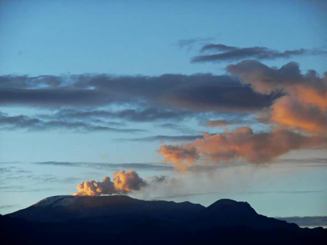
Indonésie , Anak Krakatau :
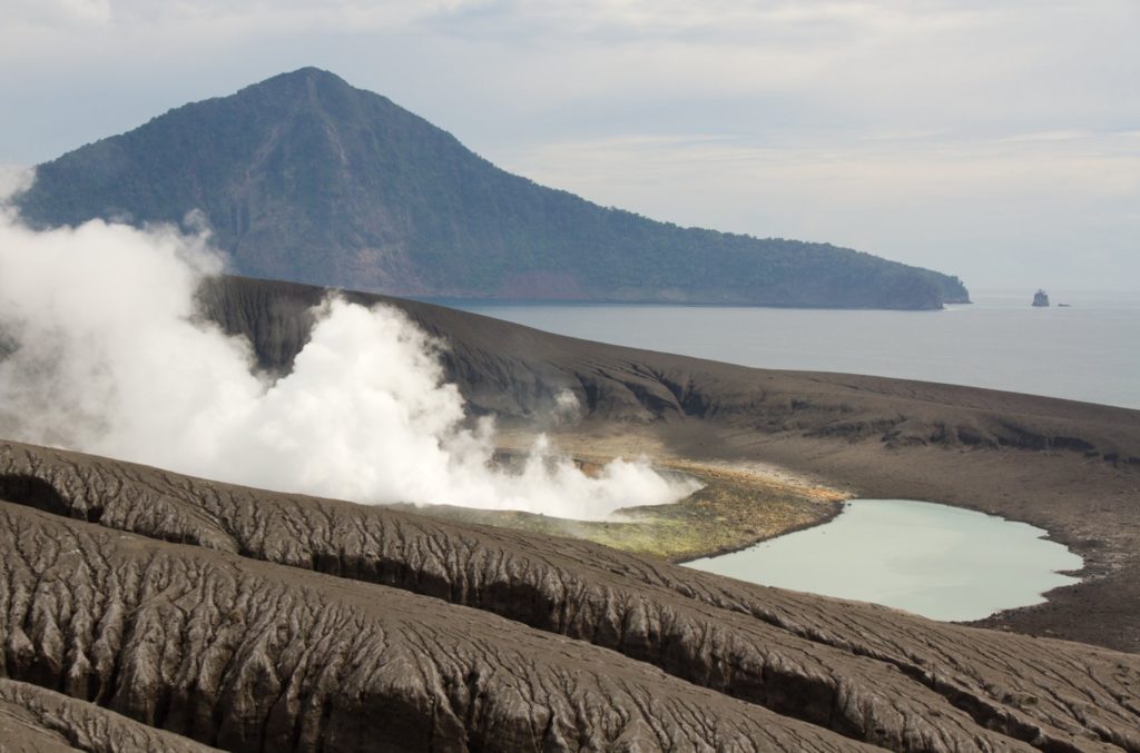
Niveau d’activité de niveau II (Waspada), depuis le 25 mars 2019. Le G. Anak Krakatau (157 m d’altitude) a connu une augmentation de son activité volcanique depuis le 18 juin 2018ce qui a été suivi d’une série d’éruptions dans la période de septembre 2018 à février 2019.
Le volcan est clairement visible jusqu’à ce qu’il soit recouvert de brouillard. Le temps est ensoleillé / pluvieux, le vent est faible , orienté à l’Est. La température de l’air est d’environ 25 °à 29 ° C. La fumée issue du cratère est blanche avec une intensité fine à épaisse à environ 25-250 mètres au dessus du sommet.
Selon les sismographes , le 25 janvier 2020, il a été enregistré:
1 tremblement de terre à basse fréquence
Tremor continu, amplitude 0,5-9 mm (valeur dominante 1 mm)
Recommandation: Les personnes / touristes ne sont pas autorisés à s’approcher du cratère dans un rayon de 2 km .
VONA: Le dernier code couleur VONA ORANGE a été publié le 15 janvier 2020 à 12 h 01 min . Les cendres volcaniques étaient observées sous forme de cendres épaisses avec une hauteur de 150 mètres au dessus du fond du cratère.
Source : PVMBG.
Photo : Sergey Biryukov.
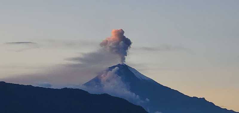
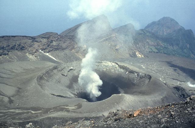
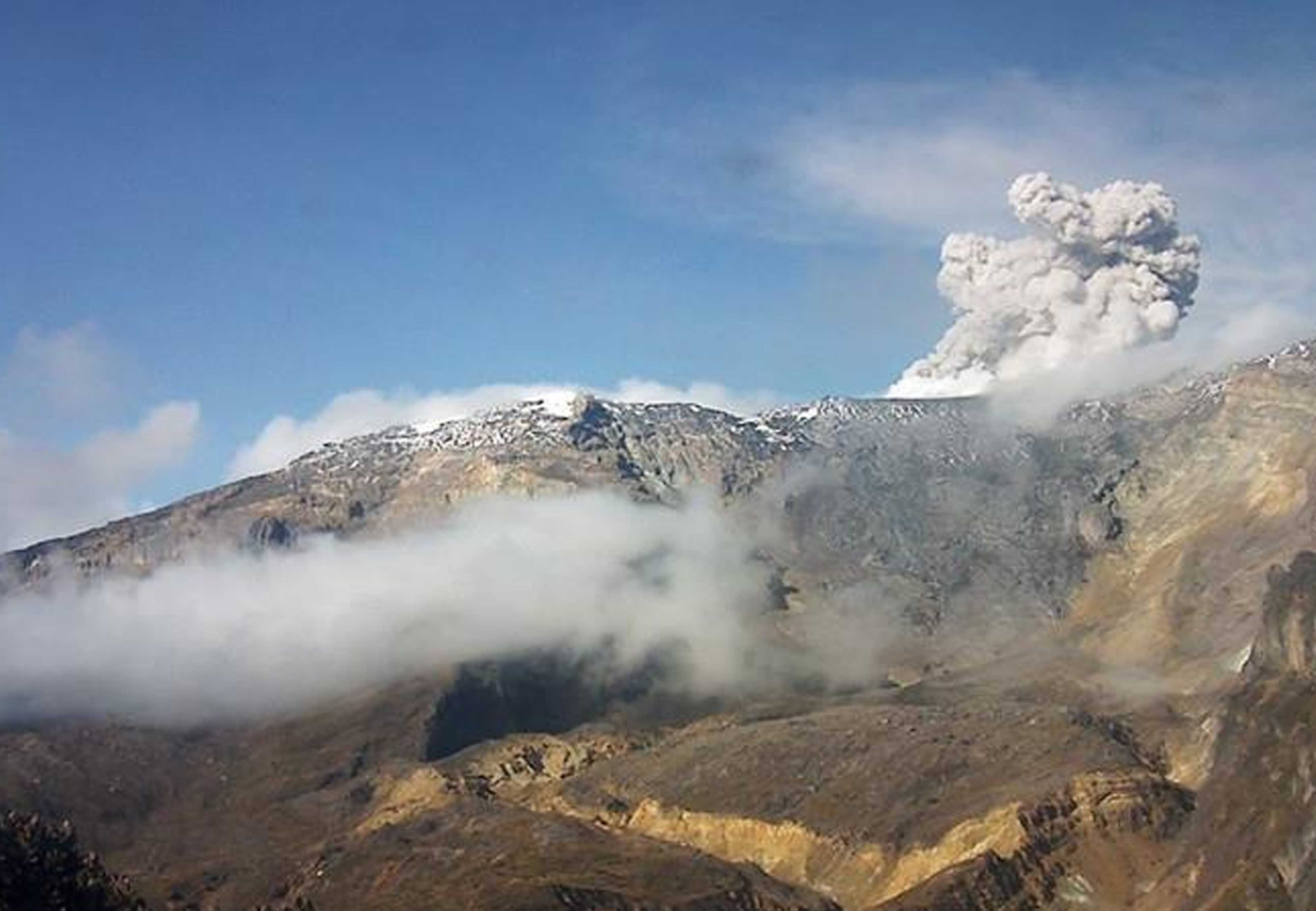
Guatemala , Santiaguito :
Type d’activité: Peléenne
Morphologie: Complexe de dômes dacitiques
Situation géographique: 14 ° 44 ’33 ˝ Latitude N; 91 ° 34’13˝ de longitude O.
Hauteur: 2500 m .
Conditions atmosphériques : Clair
Vent: Est à 3 km / h
Précipitations: 0,0 mm.

Activité:
Un dégazage blanc qui s’élève à une hauteur de 3000 mètres au-dessus du niveau de la mer (9842 pieds) se disperse au Sud-Ouest .Des explosions faibles à modérées sont enregistrées qui élèvent les colonnes de cendres à une hauteur approximative de 3300 mètres au-dessus du niveau de la mer (10827 pieds) et se dispersent vers le Sud-Ouest sur une distance approximative de 1,5 kilomètre. On note une incandescence dans le cratère du dôme Caliente la nuit. Des avalanches faibles et parfois modérées sur les flancs Sud-Est et Nord-Est du dôme Caliente génèrent un soulèvement de matière au cours de leur trajet. Avec le retour du vent dans la zone, il y a une probabilité de chute de cendres dans différentes directions.
Source : Insivumeh .
Photo : Annie Winson , earthobservatory.sg