November 19 , 2019.
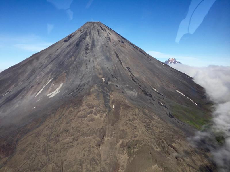
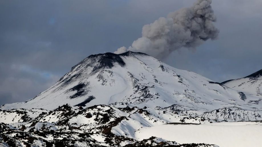
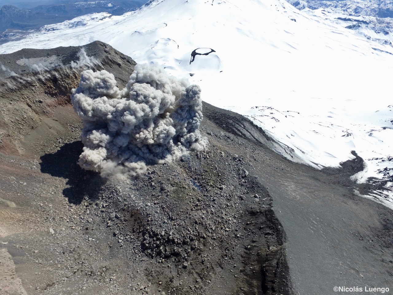
Peru , Sabancaya :
Period of analysis: November 11 to 17, 2019. Arequipa, November 18, 2019.
Alert level: ORANGE
The Geophysical Institute of Peru (IGP) reports that the eruptive activity of the Sabancaya volcano has remained at moderate levels; that is, with the recording of continuous moderate explosions and resulting ash emission. Therefore, for the following days, no significant change in activity is expected.

The analysis of the recordings obtained from the seismic network of the Sabancaya volcano for the period from 11 to 17 November 2019 has made it possible to identify the occurrence of about 2155 earthquakes of volcanic origin, the highest percentage being associated with the movements of magmatic fluids. During the past week, an average of 50 medium to low explosions per day have been observed.
The monitoring of the deformation of the volcanic structure, using GNSS data (processed with fast orbits), presents no significant anomalies. Visual surveillance, using surveillance cameras, identified the appearance of columns of gas and ash up to 2.5 km high above the summit of the volcano, which dispersed in the southern sectors. and Southeast of Sabancaya. Satellite monitoring identified 7 volcanic anomalies on the volcano ranging from 2 to 39 MW, associated with the presence of a lava dome in the volcano crater of about 240 m. diameter.
Source : IGP
Photo : Sernageomin
Peru , Ubinas :
Period of analysis: November 11 to 17, 2019. Arequipa, November 18, 2019.
Current alert level: ORANGE.
The Geophysical Institute of Peru (IGP) reports that the eruptive activity of the Ubinas volcano remains low. To date, the energy of earthquakes associated with the rise of magma at the surface has decreased. Bluish gas (magmatic) and water vapor emissions were observed by means of surveillance cameras. Under this scenario, volcanic explosions and / or ash emissions are unlikely to occur.

During the period from 11 to 17 November, the IGP recorded and analyzed a total of 480 seismic events associated with the eruptive process of the Ubinas volcano, with predominant seismicity of the volcano-tectonic (VT) type, related to the fracturing of rocks inside the volcano, with an average value of 50 events per day, all with magnitudes less than M2.0. The seismic signals that are related to the rise of the magma (hybrid type) have decreased both in number of events (12 earthquakes daily) and in energy generated by these signals. In addition, there has been no volcanic explosion since September 12th.
The surveillance cameras recorded light and sporadic emissions of blue (magmatic) gas and water vapor, with heights below 500 m above the volcano’s summit. The monitoring of the deformation of the volcanic structure, using GNSS data (processed with fast orbits), presents no anomalies. MIROVA satellite monitoring did not record thermal anomalies on the volcano.
Source : IGP
Photo : unknown author
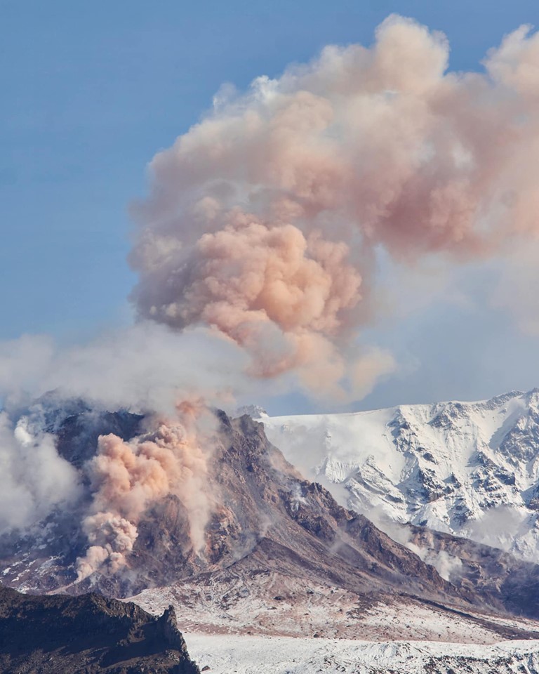
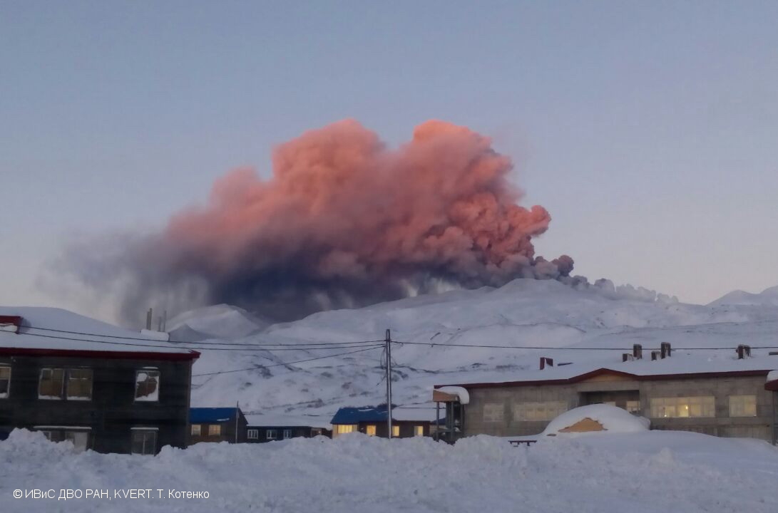
Chile, Nevados of Chillan :
Special Volcanic Activity Report (REAV), region of the Nevados de Chillán volcanic complex, November 18, 2019 at 19:45 local time (mainland Chile).
The National Geological and Mining Service of Chile (Sernageomin) discloses the following PRELIMINARY information obtained from the monitoring equipment of the National Volcanic Monitoring Network (NVRN) processed and analyzed at the Volcanological Observatory of the South Andes (OVDAS) ):
On Monday 18 November at 19:17 local time (22:17 UTC), the monitoring stations installed near the Nevados de Chillán volcanic complex recorded an explosion associated with an LP-type seismic signal.
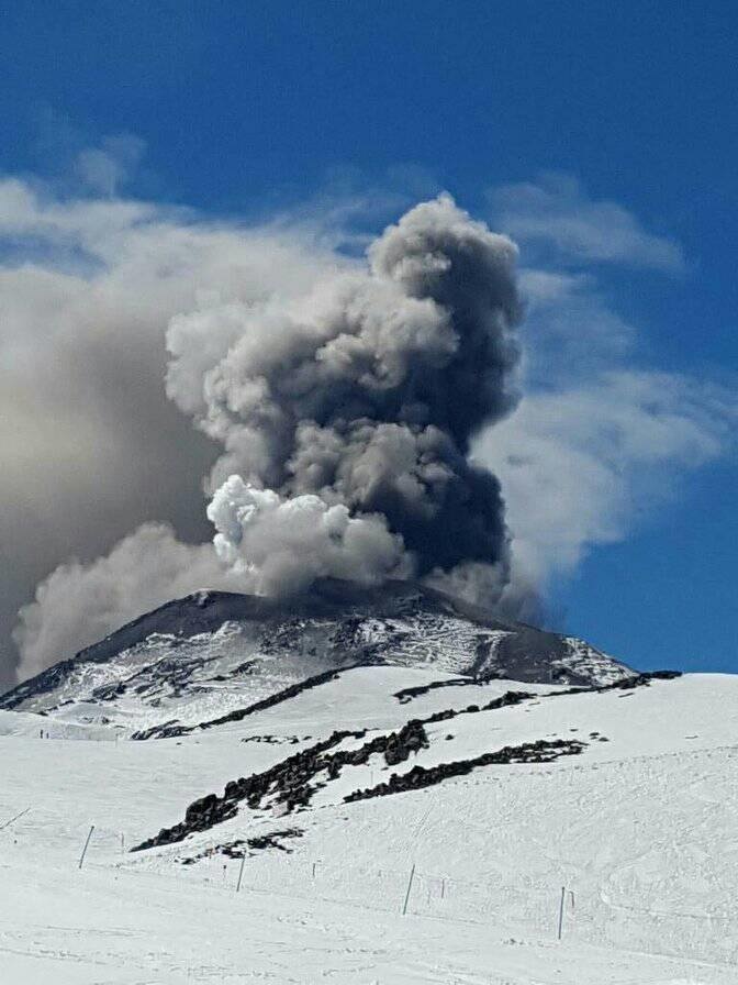
The characteristics of the LP earthquake are as follows:
TIME OF ORIGIN: 7:17 pm local time (22:17 UTC)
LATITUDE: 36,863 ° S
LONGITUDE: 71,376 ° W
DEPTH: 1.2 km
REDUCED TRAVEL: 567 cm2
ACOUSTIC SIGNAL: 7.8 Pascals (Pa) reduced to 1 km
OBSERVATIONS:
The gas column associated with the explosion was approximately 560 m high, above the crater.
The volcanic technical alert is maintained at the ORANGE level.
Sernageomin monitors online and informs in a timely manner of possible changes in volcanic activity.
Source : Sernageomin .
Photo : unknown author
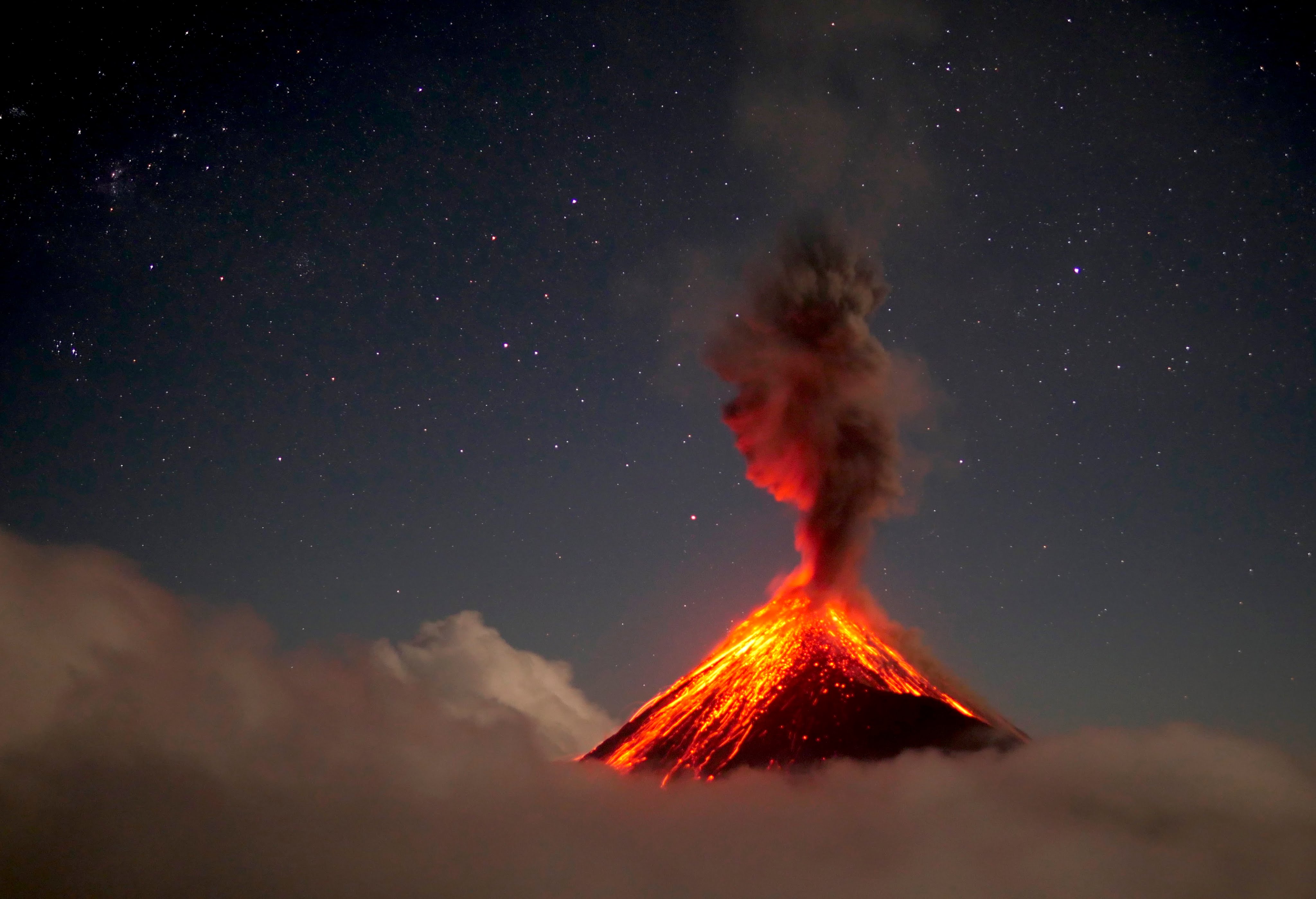
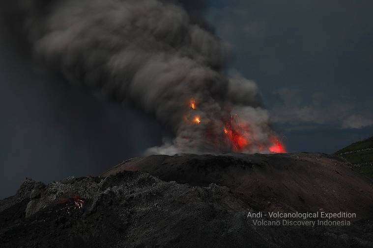
Indonesia , Ibu :
Level II Activity Level (WASPADA). G. Ibu (1340 m) has been erupting continuously since 2008.
The volcano is clearly visible until it is covered with fog. There is a white / gray smoke, thin, of medium to thick intensity, of low to medium to high pressure of 200 to 800 m above the summit. The wind is weak in the northeast.
Through a seismographic recording of November 18, 2019, it was noted:
71 earthquakes of eruption
60 emission earthquakes
1 avalanche earthquake
47 harmonic earthquakes
1 earthquake Low Frequency
6 distant tectonic tremors.
Recommendation:
The community around G. Ibu and visitors / tourists should not move, climb and approach within 2 km of the crater, with a sectoral expansion 3.5 km to the opening in the northern part of the active crater of G. Ibu.
VONA:
The last VONA code was sent with the color code ORANGE, published on October 20, 2019 at 8:52 am, eastern time, related to an eruption with ash column height around 1825 m above the sea level or about 500 m above the summit. The column of ashes was moving westward.
Source : PVMBG.
Photo : Andi Rosati / Volcanodiscovery.
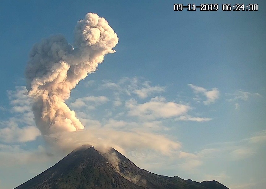
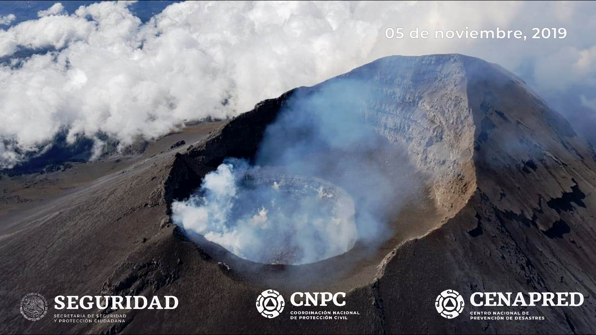
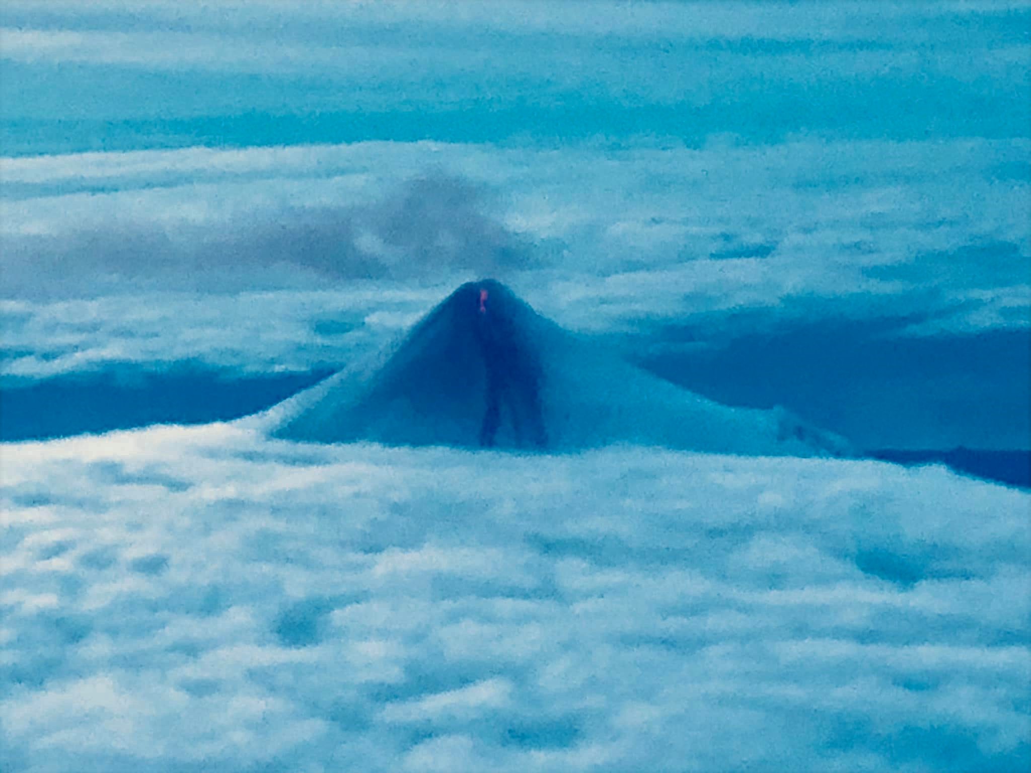
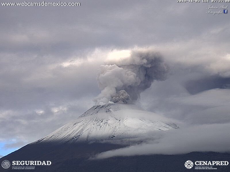
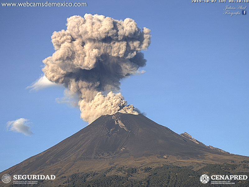
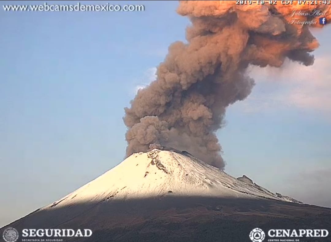
Mexico , Popocatepetl :
November 18 at 11:00 am (November 18 at 17:00 GMT).
According to the surveillance systems of the Popocatépetl volcano, 211 exhalations have been identified, visibility to the crater being low due to weather conditions. In addition, 172 minutes of tremor were recorded. During the night, a slight incandescence was observed during certain expirations.
From today morning until the present report, there is a continuous emission of water vapor, volcanic gases and exhalations containing ash, which the wind disperses preferentially towards the East.
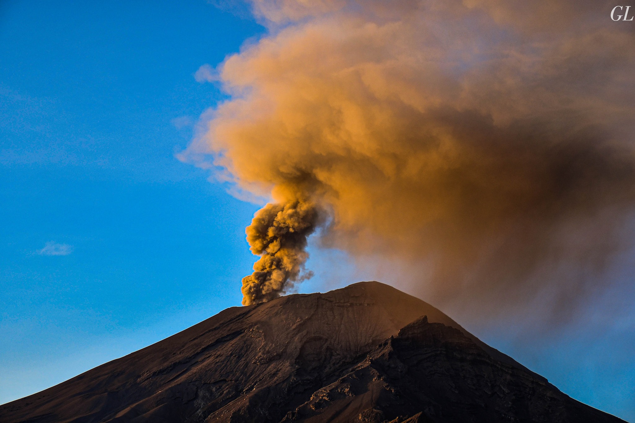
November 18 at 12:30 (November 18 at 18:30 GMT). Update.
From 11:28 am, a constant ash emission started, as the wind moved to the East. There are currently 62 minutes.
Ash falls are possible in the cities of San Nicolás de los Ranchos, Nealtican, Tianguismanalco and Atlimeyaya.
CENAPRED urges NOT to approach the volcano and in particular the crater, because of the risk of falling ballistic fragments, and in case of heavy rains to stay away from the bottom of the ravines due to the risk of mudslides and debris.
The warning light of Popocatépetl is in YELLOW PHASE 2.
Source : Cenapred .
Photo : GL Volcán Popocatépetl