October 27 , 2019.
La Réunion , Piton de la Fournaise :
Activity bulletin of Saturday, October 26, 2019 at 17:15 (local time).
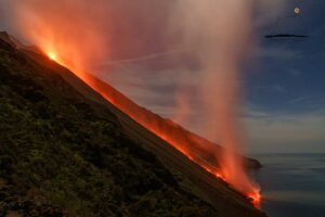
The eruptive activity that began on October 25, 2019 at Piton de la Fournaise at 2:40 pm local time continues. The front of the lava flow was at 17:00 to about 250m from the national road 2. The front of the flow has increased by about 150m in 9h. The progression of the flows is now on average slopes of 19% (against 16% this morning).
https://www.facebook.com/B.FILMS974/videos/506103189945133/
The slow progression of the flow front of these last hours is explained by the decrease of surface flows and by the slopes which are lower than those traversed by the lava during the day of 25/10/2019.
Alert level: Alert 2-2.
This fifth eruption of the year 2019 is exceptional. Twelve years that the flows front had not been so close to the RN2. At last information, it was about 250 meters from the road. The intensity of the eruption has decreased however, the progression of lava on the Great Slopes continues. Less rhythmic than at the beginning, this new eruption could be part of those which marked the collective memory. As a safety measure, the RN2 is still cut between the roundabout Citron Galet Tremblet and the Coulée 2004 – Old dump in the Grand Brulé which does not begin the motivation of the curious who make the last kilometers on foot to admire the show. (photo rb / www.ipreunion.com)
Source : OVPF . IpRéunion.com .
Read the articles: http://www.ipgp.fr/fr/ovpf/bulletin-dactivite-samedi-26-octobre-2019-a-17h15-heure-locale
Vidéo : B.Films974.
Photo : IPR Réunion.
Indonesia , Merapi :
ACTIVITY REPORT OF MONT MERAPI, 18-24 October 2019.
RESULTS OF OBSERVATION
Visuals:
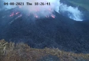
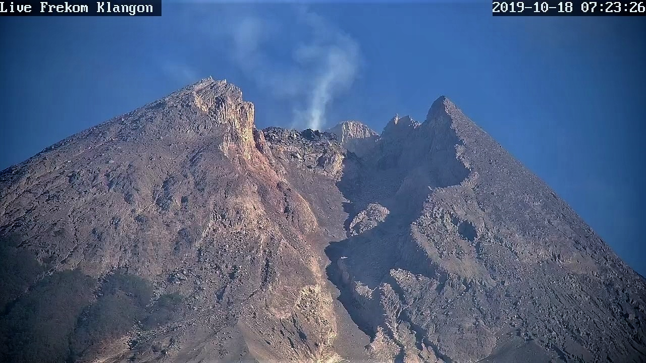
The weather around Mount Merapi is usually sunny in the morning while the evening until the night is cloudy and foggy. There is a white smoke, thin to thick with low pressure. A maximum height of 500 m of smoke was observed at the Kali Merapi observation post on 18 October 2019 at 06:02 WIB.
The volume of the lava dome based on analysis of aerial photos with drones dated October 16, 2019 amounted to 397,000 m3. The morphological analysis of the crater area based on photographs of the Southeast sector revealed no significant morphological changes.
This Sunday, there were no hot clouds or lava collapses.
Earthquake:
This week the seismicity of Mount Merapi recorded:
2 emission earthquakes (DG),
7 deep volcanic earthquakes (VTA),
14 multiple phase earthquakes (MPs),
64 avalanche earthquakes (RF),
3 low frequency earthquakes
11 tectonic earthquakes (TT).
The internal seismicity of Merapi (VTA, VTB and LF) is relatively fluctuating compared to last week
Deformation:
The deformation of G. Merapi, monitored by EDM and GPS this week, showed no significant change.
Rain and lahars:
This week, no rain or lahar was reported, nor was there any additional flow in the rivers flowing out of Mount Merapi.
Conclusion:
Based on the results of the visual and instrumental observations, it was concluded that:
1. The lava dome is currently in a stable state with relatively low growth rates.
2. The volcanic activity of Mount Merapi is still quite high and is determined by the level of activity « WASPADA ».
Source : BPPTKG.
Photo : Live Frekom Klangon 18.10.2019 / 7h23
Hawaii , Mauna Loa :
19°28’30 » N 155°36’29 » W,
Summit Elevation 13681 ft (4170 m)
Current Volcano Alert Level: ADVISORY
Current Aviation Color Code: YELLOW
Activity Summary:
Mauna Loa Volcano is not erupting. Rates of deformation and seismicity have not changed significantly over the past week and remain above long-term background levels.
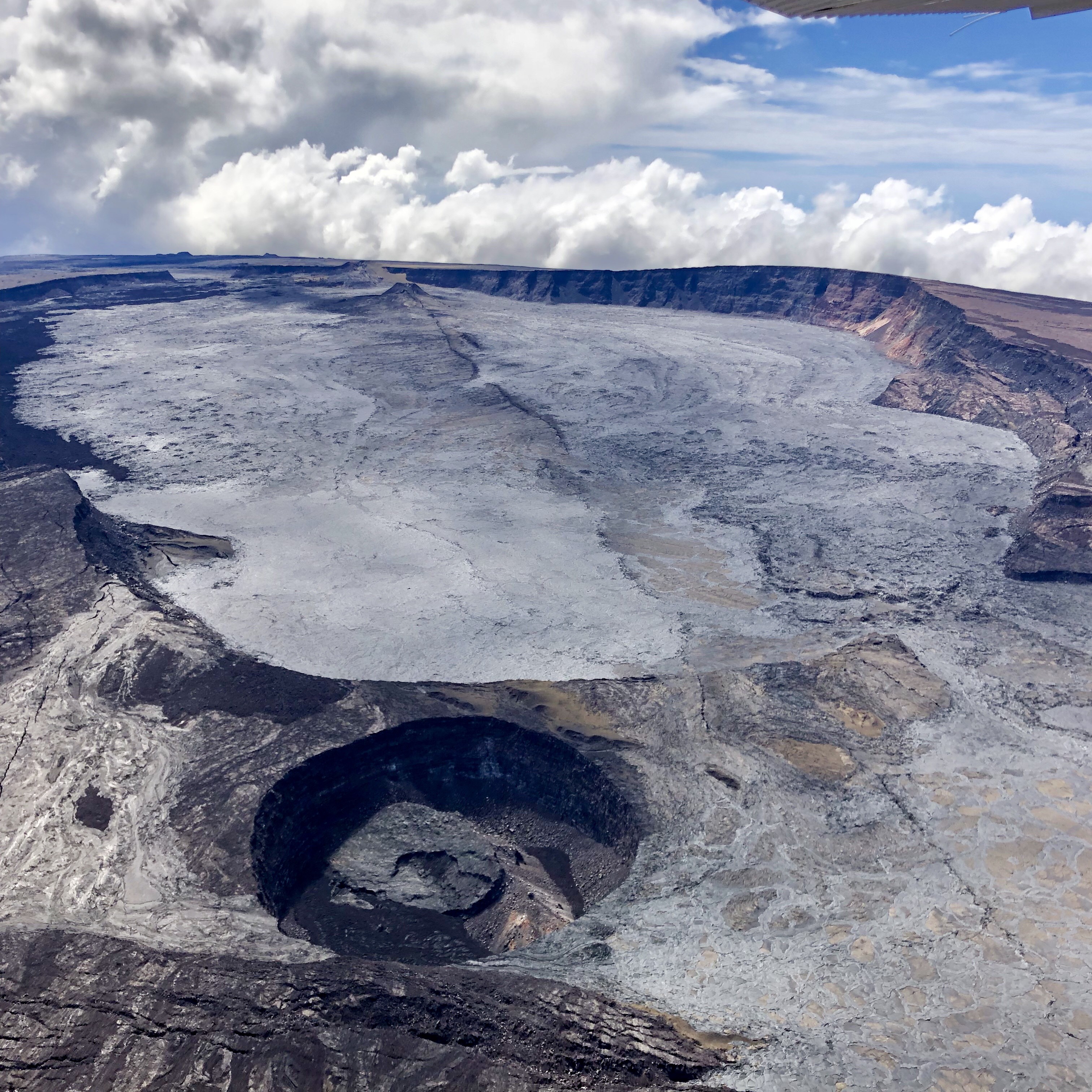
Aerial view of Mauna Loa’s summit caldera, Moku‘āweoweo, captured by Civil Air Patrol on Sunday, October 20, 2019. Lua Poholo is the name of the pit crater in the bottom left corner of the image. Cones that formed during the 1940 and 1949 eruptions of Mauna Loa are visible in the background, as well as fissures that extend through the center of the caldera. These fissures formed during the most recent eruption of Mauna Loa, in 1984.
Observations:
During the past week, approximately 80 small-magnitude earthquakes (nearly all smaller than M2.0) were detected beneath the upper elevations of Mauna Loa. Most of the earthquakes occurred at shallow depths of less than 5 km (~3 miles) below ground level.
Global Positioning System (GPS) and Interferometric Synthetic Aperture Radar (InSAR) measurements show continued summit inflation, consistent with magma supply to the volcano’s shallow storage system.
Readings of fumarole temperature and gas concentrations at the Sulphur Cone monitoring site on the Southwest Rift Zone remain stable.
Source et photo : HVO.
Indonesia , Anak Krakatau :
Information on the eruption of G. Anak Krakatau, October 27, 2019
The Anak Krakatau was erupted on 27 October 2019 at 05:43, but the height of the ash column was not observed. This eruption was recorded on a seismogram with a maximum amplitude of 45 mm and a duration of ± 1 minute 9 seconds.
No noise, there was a high white-black smoke 150 meters above the bottom of the crater.
Currently, Anak Krakatau is at Level II status (WASPADA) with these recommendations:
The public / tourists are not allowed to approach the crater within a radius of 2 km.
https://www.facebook.com/100005385285209/videos/1136476323208533/
VOLCANO OBSERVATORY NOTICE FOR AVIATION – VONA.
Issued: October 26 ,2019
Volcano: Anak Krakatau (262000)
Current Aviation Colour Code: ORANGE
Previous Aviation Colour Code: orange
Source: Anak Krakatau Volcano Observatory
Notice Number: 2019KRA188
Volcano Location: S 06 deg 06 min 07 sec E 105 deg 25 min 23 sec
Area: Lampung, Indonesia
Summit Elevation: 502 FT (157 M)
Volcanic Activity Summary:
recorded eruption at 22:43 UTC (05:43 local )
Volcanic Cloud Height:
Ash-cloud is not visible
Other Volcanic Cloud Information:
visually from cctv crater seen volcanic ash moving to north, volcanic ash white-gray thick 150 meters high from the bottom of the crater.
Remarks:
Eruption recorded on seismogram with maximum amplitude 45 mm and duration 69 second.
Source : PVMBG , Magma Indonésie.
Vidéo : Mama Rakata.
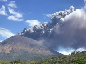
Mexico , Popocatepetl .
October 26, 11:00 h (October 26, 16:00 GMT)
In the last 24 hours, through the monitoring systems of the Popocatepetl volcano, 101 long period events were identified. Due to dense clouds, in few cases was possible to verify that they were accompanied by steam and gas . Also 247 minutes of tremor were recorded along with two minor explosions, yesterday at 19:07 h and 03:22 h today.
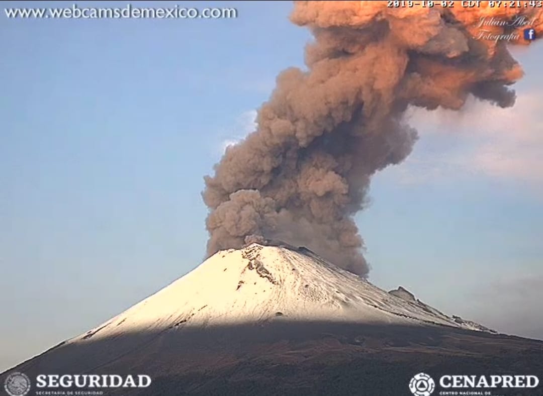
At the time of this report there is no visibility towards the volcano; however, at previous hours an emission of steam and gases, with north-northeast direction was observed (image 2)
CENAPRED emphasizes that people SHOULD NOT go near the volcano, especially near the crater, due to the hazard caused by ballistic fragments (image 3) and in case of heavy rains leave the bottoms of ravines because of the danger of landslides and debris flows.
The Volcanic Traffic Light of Popocatepetl is Yellow Phase 2.
Source et photo : Cenapred.