May 30 , 2023.
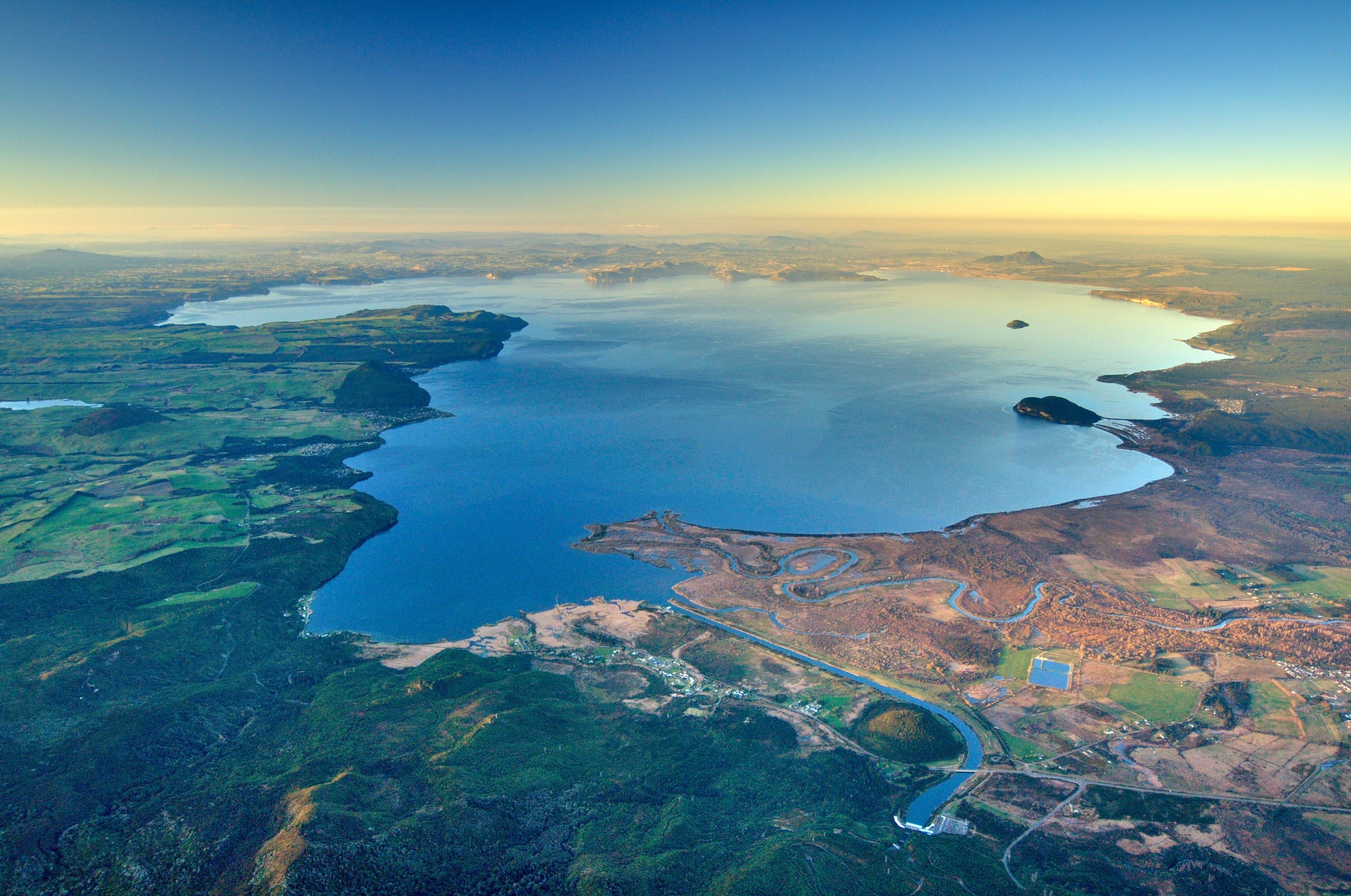
New Zealand , Lake Taupo :
Volcanic activity at Taupō Volcano is now back to background levels. The Volcanic Alert Level is lowered to Level 0.
Monitoring at Taupō Volcano shows that both ground deformation and earthquake activity have continued to decrease over the past few weeks. These monitoring data indicate the level of unrest has now returned to what is normally seen as the background. The Volcanic Alert Level is now lowered to Level 0 for Taupō Volcano.
This latest episode of unrest at Taupō volcano started in May 2022. The Volcanic Alert Level for Taupō volcano was raised to 1 in September 2022 in response to this activity, indicating minor unrest was occurring. This unrest has now paused. We have recorded both ground deformation signals and shallow earthquakes under the central lake area during this period.
Through early 2023 (January to April) earthquake activity has continued with ground deformation. However, both were showing declines. These have returned to typical background levels in May 2023. A combination of magma movement at depth, faults slipping, and hydrothermal fluids has likely been driving the earthquakes and ground deformation observed this last year. This activity has now paused.
We have seen several processes at play during the volcanic unrest over the last year at Taupō Volcano. In the initial phase starting in early May 2022, we saw an increase in the number of earthquakes per month and by June there was an indication of uplift at Horomatangi Reef in the lake. By September both trends were well established with the monthly number of earthquakes ranging between 20 and 90 per month (Fig. 1). Our GNSS (GPS) instruments around the lake recorded outward movement around the lake and Horomatangi Reef showed some uplift at a rate of 60 ± 20 mm per year. These were within our expectations for Taupō volcano at Volcanic Alert Level 1. Between September and November 2022 earthquake activity slowed down.
On 30 November 2022 a Magnitude 5.7 event occurred at 9 km depth. This earthquake was widely felt and accompanied by significant ground movement at Horomatangi Reef. We measured 180 mm (18 cm) of uplift and a shift to the southeast of 160 mm (16 cm). This movement of the lakebed created a small tsunami in the lake while the ground shaking set off a submarine landslide near Wharewaka Point. This created a 2nd local tsunami that flooded the foreshore area. Aftershocks continued through to February 2023; over 820 were located. Another moderate sized earthquake occurred on 5 March (M4.4).
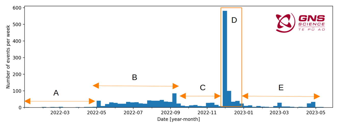
Figure 1. The number of earthquakes per week from January 2022 until May 2023. Five intervals are identified in this period, labelled A through E.
Overall, over the past year, there have been just over 1800 earthquakes under Taupō volcano, accompanied by some measurable – although too small to impact local communities – ground deformation of the lake floor and around the lake. Although this is the first time the VAL has been raised, this is not the first volcanic unrest at Taupō. It is the most recent of 18 historical unrest episodes in the past 150 years. Several of these were more severe than what we have observed over the last year. None of those episodes, or the many other episodes which would have occurred over the past 1800 years before written records were kept, ended in an eruption. The last eruption at Taupō volcano was in 232 AD ± 10 years. The chance of an eruption at Taupō remains very low in any one year.
Source : Geonet / Agnes Mazot / Duty Volcanologist
Photos : Geonet.
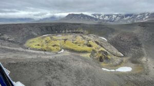
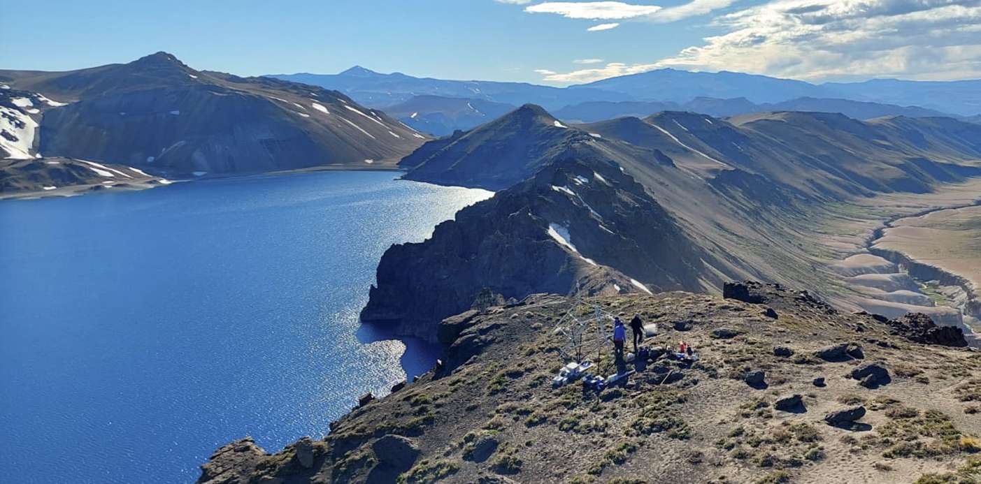
Chile , Laguna del Maule :
Special Report on Volcanic Activity (REAV), Maule region, Laguna del Maule volcanic complex, May 29, 2023, 8:30 p.m. local time (mainland Chile)
The National Geology and Mining Service of Chile (Sernageomin) announces the following PRELIMINARY information, obtained through the monitoring equipment of the National Volcanic Monitoring Network (RNVV), processed and analyzed at the Volcanological Observatory of the Andes del Sud ( Ovdas):
On Monday, May 29 at 8:13 p.m. local time (23:13 UTC), monitoring stations installed near the Laguna del Maule volcanic complex recorded a swarm of earthquakes, associated with volcano-tectonic activity (VT). At the time of issuing this report, 100 events had been recorded, including the event of greatest magnitude located 9.0 km west-south-west of the center of the lagoon.
The characteristics of the earthquake of greatest magnitude recorded for the moment after its analysis are as follows:
ORIGINAL TIME: 8:13 p.m. local time (23:13 UTC)
LATITUDE: 36.114°S
LONGITUDE: 70.584°E
DEPTH: 4.1 km
LOCAL MAGNITUDE: 0.7 (ML)
Comments:
During the issuance of this report, the volcano-tectonic seismicity continues to be recorded, with low magnitude events (ML<1.0). Similarly, the localized seismicity is focused in an area close to the Nieblas station located southwest of the center of the lagoon.
The volcanic technical alert remains at the Yellow level.
Source : Sernageomin.
Photo : neuqueninforma.gob.ar
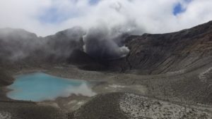
Peru , Sabancaya :
Analysis period: from May 22, 2023 to May 28, 2023, Arequipa, May 29, 2023.
Alert level: ORANGE
The Geophysical Institute of Peru (IGP) reports that the eruptive activity of the Sabancaya volcano remains at moderate levels, that is to say with the recording of an average of 23 daily explosions, with columns of ash and of gas up to 1.5 km altitude above the summit of the volcano and their subsequent dispersion. Therefore, for the following days, no significant change is expected in eruptive activity.
The IGP recorded and analyzed the occurrence of 296 earthquakes of volcanic origin, associated with the circulation of magmatic fluids inside the Sabancaya volcano. An average of 23 explosions was recorded daily, in addition to recording Volcano-Tectonic (VT) type events associated with rock fracturing inside the Sabancaya volcano.
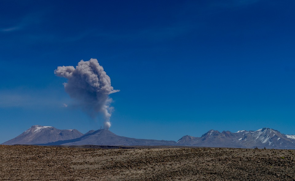
Monitoring the deformation of the volcanic structure using GNSS techniques (processed with fast orbits) does not show any significant anomalies. However, in general, a slight inflation process was observed in the northern sector (surroundings of the Hualca Hualca volcano). Visual surveillance identified columns of gas and ash up to 1.5 km above the summit of the volcano, which were dispersed towards the eastern and southeastern sectors of Sabancaya. Satellite recordings have identified the presence of 8 thermal anomalies, with a maximum value of 5 MW, associated with the presence of a lava body on the surface of the volcano’s crater.
RECOMMENDATIONS
• Keep the volcanic alert level orange.
• Do not approach within a radius of less than 12 km from the crater.
Source : Cenvul.
Photo :pixabay
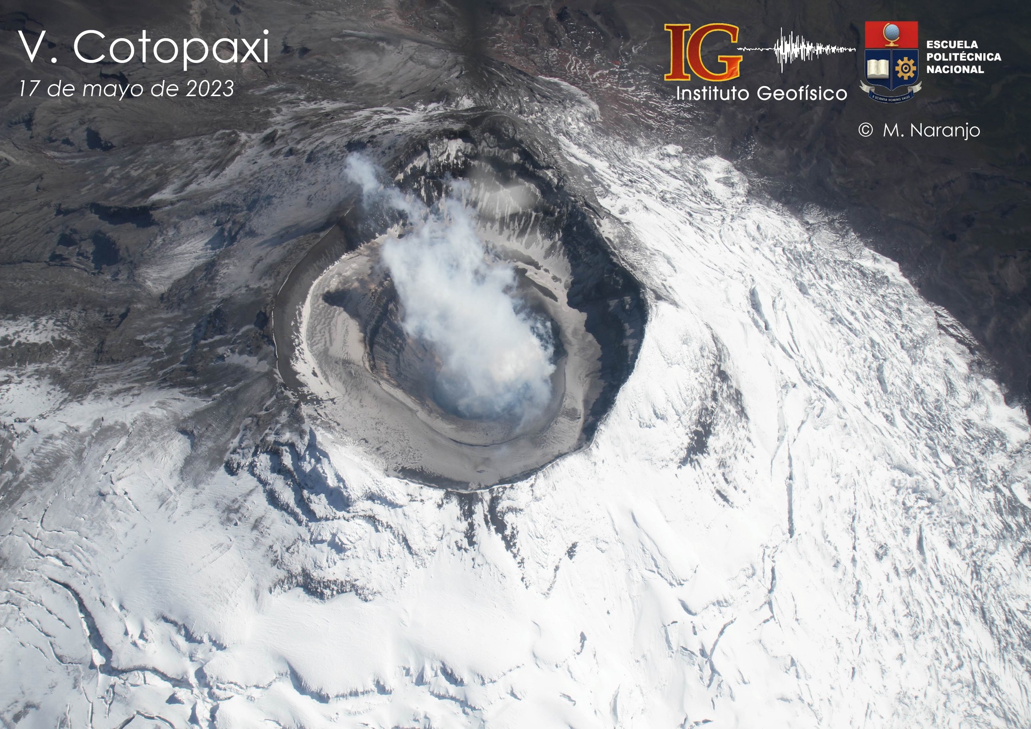
Ecuador , Cotopaxi :
Seismicity:
Since mid-February of this year, the Cotopaxi has shown a gradual decrease in all seismic parameters, including: event rate, number of ash emissions and cumulative daily hours of emission tremor.
Geodesy:
Internal processes of the volcano, such as the entry of new magma into the system, produce increased pressure and changes in the state of stress within the volcanic system. These phenomena are manifested at the surface level by deformations of the volcanic edifice or its environment, which are detectable by means of high-precision instruments. In 2022, the geodetic monitoring bases located around the volcanic cone began to record displacements, indicating an increase of several millimeters in the distance which separates the bases from each other. This trend, called « inflation, » continued until February, when the deformation began to slow. Between the months of February and March, the deformation showed a slightly downward trend, and then stabilized. Between the months of April and May, the positioning data shows an increase of a few millimeters in the West-East section of the volcano, however, in the North-South section, for the moment, the trend remains relatively stable.
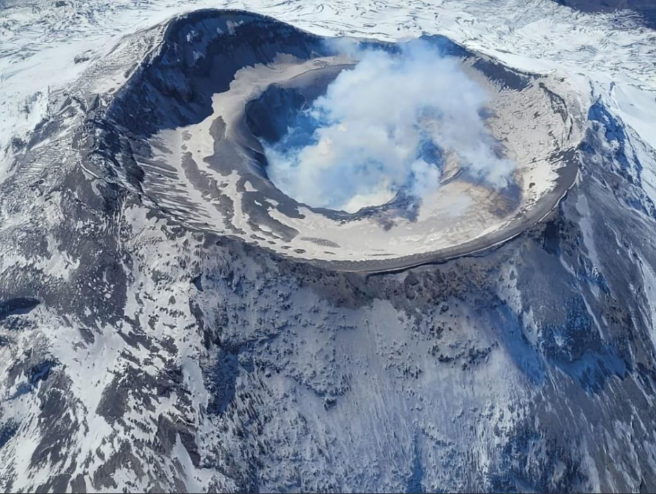
Thermography:
During the flyby carried out on May 17, new thermal sequences of the volcano were obtained. On this occasion, the conditions of activity during the flight (for example, low quantity of gas and absence of ash) made it possible to obtain high-resolution thermal images of the bottom of the crater. The Maximum Apparent Temperatures (TMA) obtained in this area correspond to the highest recorded on the volcano since March 2018, when 313 ° C was measured. The average TMA obtained from the analysis of the different thermal sequences of May 17 is 235 ± 39°C (bright yellow zone in the figure ) and corresponds to volcanic rock heated by magmatic gases at very high temperature. In this sense, it must be considered that the distance and the presence of gas in the duct can underestimate the temperature. Likewise, this temperature confirms that the activity presented by the volcano is of magmatic origin. In the fumarolic fields, the TMAs are still below 30°C, i.e. low temperature.
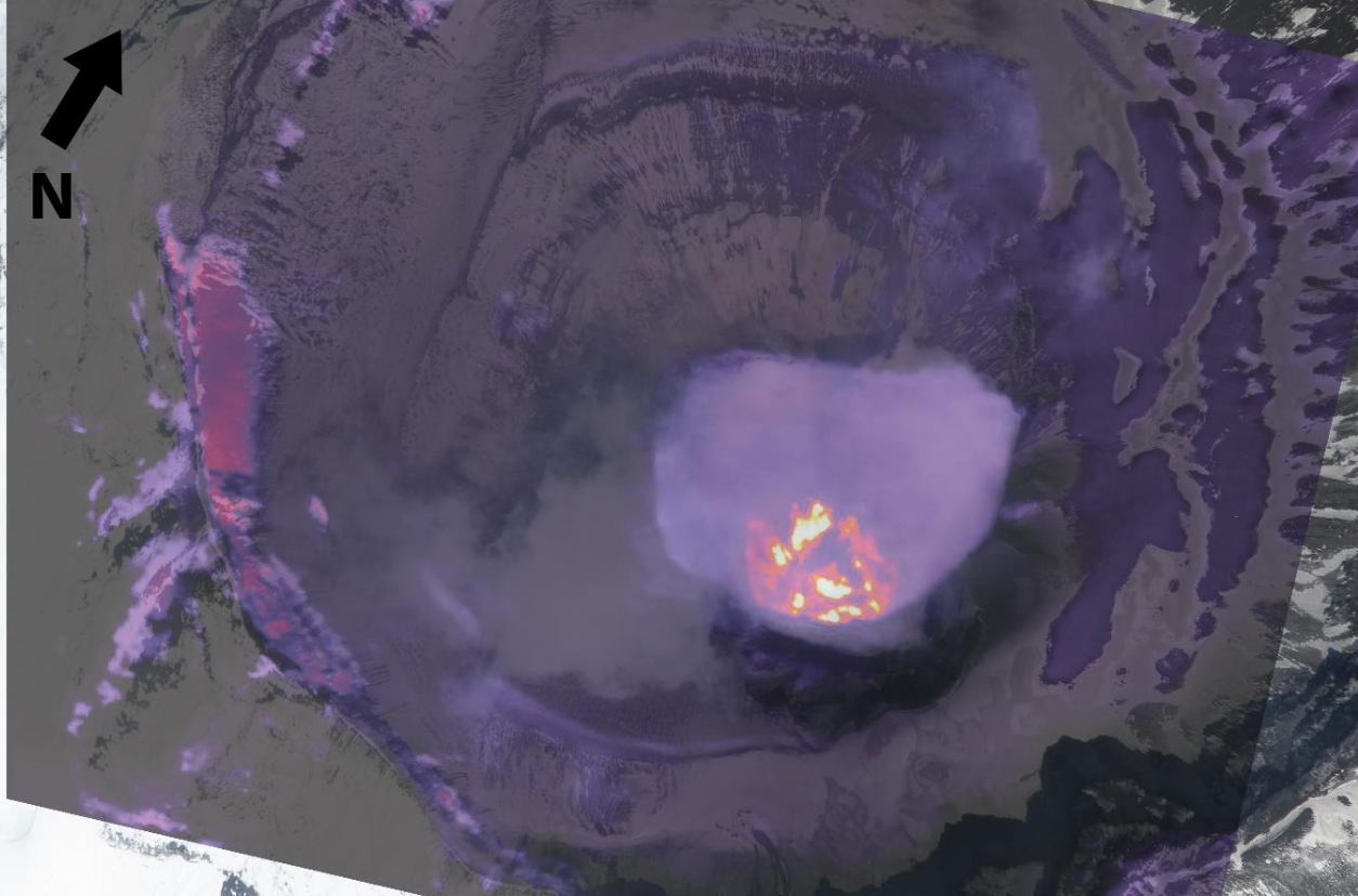
Figure 9. Superposition of the thermal image with the image of the visible domain, corresponding to the bottom of the crater of the Cotopaxi volcano. The areas of orange (low temperature) and bright yellow colors, temperature corresponding to rocks heated by gas at very high temperatures and should not be interpreted as volcanic lava on the surface (Photo: F Naranjo, Thermal image: M Almeida; May 17, 2023 – IGEPN)
Data interpretation:
Based on the information available in this report, it can be seen that some monitoring parameters showed a slight increase and others show a downward trend, given the fluctuating characteristics of the eruptive processes, the activity of the Cotopaxi volcano has was classified as moderate with an unchanged trend both internally and on the surface. The joint analysis of the various monitoring parameters shows that the recent activity is caused by the presence of a small body of magma within the volcanic conduit, which is responsible for SO2 and ash emissions. The current eruptive period lasts from October 2022 to May 2023 (about 7 months), exceeding the four-month period of the August-November 2015 eruptive phase. However, the intensity of the current eruptive period is much lower, both for gas as well as emissions and ash fall. Temperatures in the fumarolic fields around the crater remain at low levels.
Magmatic gases, in particular SO2, are abundant in the volcanic plume, and are still detected both by the permanent monitoring network (DOAS – Novac Project) and by satellite sensors. At the time of writing this report, measurements obtained during surveillance overflights (thermal images, Multi-GAS measurements) show that the activity is of magmatic origin. For its part, internally, seismicity continues to be dominated by LP and VLP type earthquakes and less and less energetic tremor episodes; while the deformation shows a stable trend, varying within a range of 2 mm since February this year. Specifically, monitoring data indicates that surface and internal activity have exhibited fluctuations since late February. At the moment it is at a level below that recorded in February, however, it continues and has not returned to the levels before the current eruptive period (before October 2022).
Source : IGEPN
Read the full article : https://informes.igepn.edu.ec/igepn-registro-web/pages/public/InformeGenerado.jsf?directorio=30402&fbclid=IwAR0hoT0H-lUj6hWKgZ3vBB1EexzJfPH-AQR1ORTyc1BcmwxCWrRC7b8U_6s
Photos : IGEPN.
Mexico , Popocatepetl :
May 29, 11:00 a.m. (May 29, 5:00 p.m. GMT)
During the past 24 hours, according to the monitoring systems of the Popocatépetl volcano, nine exhalations accompanied by water vapor, other volcanic gases and ash have been detected.
1,425 minutes (23.75 hours) of low to medium amplitude high frequency tremor was recorded, associated with the continuous emission of gas, water vapor and ash, as well as occasionally, to the expulsion of incandescent fragments a short distance from the crater.
During this period, the National Center for Communication and Civil Protection Operations (CENACOM) reported a slight ash fall in the municipalities of Ecatzingo, State of Mexico; Tetela del Volcán and Hueyapan, Morelos; Nopalucan, Puebla Capital, San Andrés Cholula, Cuautlancingo, Amozoc, San Pedro Benito Juárez (Atlixco) and Tianguismanalco in Puebla.
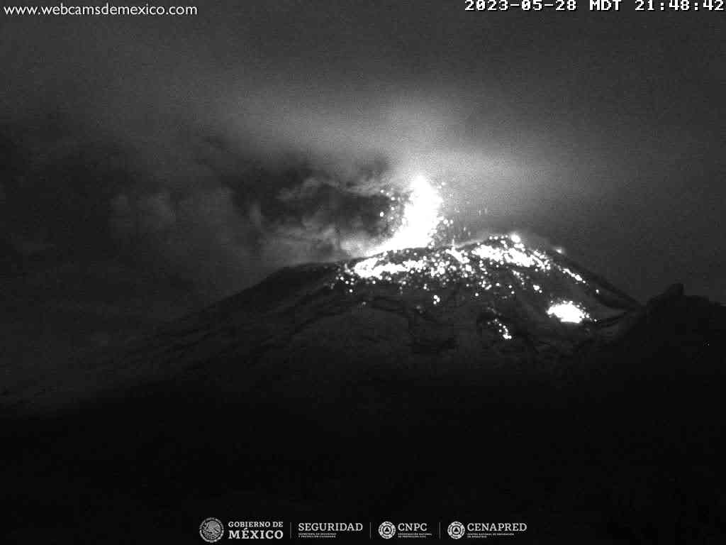
At the time of publication of this report, there is no visibility; however, in the morning, an emission of water vapor, volcanic gases and light amounts of ash was observed in a South-South-East direction.
Update May 29, 7:00 p.m. (May 30, 01:00 GMT)
For the moment, the high frequency tremor signal continues, keeping a low amplitude. This tremor signal is associated with the emission of ash and the expulsion of glowing fragments.
The volcanic alert traffic light remains YELLOW PHASE 3
Source : Cenapred .