May 07 , 2023.
Indonesia , Gamalama :
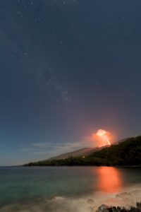
Volcanic activity of G. Gamalama May 3, 2023
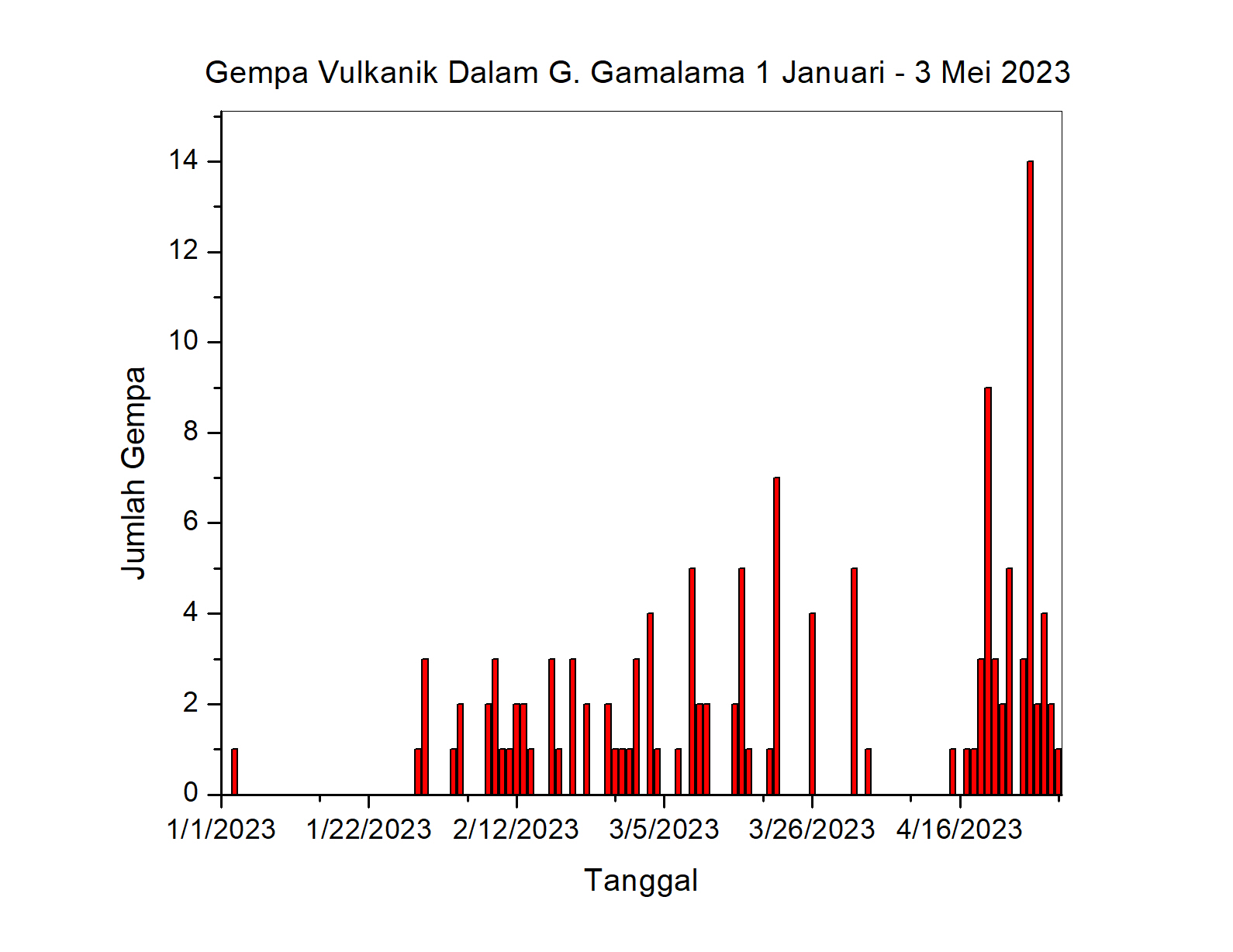
The seismicity of G. Gamalama since January 2023 has been dominated by distant tectonic earthquakes, local tectonic earthquakes and deep volcanic earthquakes (VA). Volcanic earthquake (VA) events are typically recorded with 1-2 events per day. The smoke emission from the crater is generally observed to be white, weak to thick, with a height of 10 to 300 meters above the summit. The level of activity is currently at level II (WASPADA) since March 10, 2015. The last eruption occurred on October 4, 2018 with an ash column 250 meters high from the summit. The character of the eruption generally occurs in the central crater with relatively short eruption precursors.
The latest developments in the activities of G. Gamalama until May 3, 2023 at 09:00 WIT are as follows:
There has been an increase in deep volcanic (VA) earthquakes since May 1, 2023. On May 1, 2023, 11 deep volcanic earthquakes were recorded and on May 2, 2023, 14 deep volcanic earthquakes were recorded . On May 3, 2023 from 00:00 a.m. to 09:00 a.m., 5 deep volcanic earthquakes, 1 shallow volcanic earthquake, 5 emission earthquakes, 1 low frequency earthquake and 5 distant tectonic earthquakes were recorded.
Emission activity from the crater from May 1 to 3, 2023 was observed with a thin white plume from a height of 50 to 100 meters.
In general, the activity of G. Gamalama from May 01 to 03, 2023 at 09:00 WIT tends to fluctuate and is always dominated by deep volcanic earthquakes and distant tectonic earthquakes which are related to regional tectonic activity around the Halmahera Islands.

Under the above conditions, and given the characteristics of the precursor to the G. Gamalama eruption, the potential hazard most likely to occur is a phreatic eruption with the current threat of material ejection from the main crater hitting a area with a radius of 1.5 km from the center of the eruption. Light ash rain may occur with distance and intensity depending on wind direction and speed.
Based on the results of observations, analysis of visual and instrumental data until May 3, 2023 at 12:00 WIT, the activity level of G. Gamalama is still at level II (WASPADA).
Recommendations for this Level II (Waspada) level of activity are: During the rainy season, people who live around the rivers that descend from G. Gamalama are advised to be aware of the potential threat of danger from lahars .
Italy / Sicily , Etna :
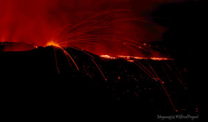
06 May 2023, 23:27 (21:27 UTC), communication on the activity of ETNA.
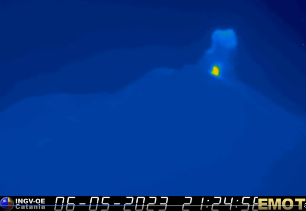
The National Institute of Geophysics and Volcanology, Osservatorio Etneo, communicates that the monitoring networks recorded at 23:26 (21:26 UTC), a sudden explosion with emission of ash.
Further updates will be communicated soon.
07 May 2023, 00:06 (22:06 UTC), communication on the activity of ETNA.
The National Institute of Geophysics and Volcanology, Osservatorio Etneo, communicates that at 21:25 UTC, through the surveillance cameras, an explosion was observed in the Southeast crater, which produced a weak emission of ash which is quickly dispersed in the crater area. From the seismic point of view, there are no variations in the level of the tremor which remains at average levels. The location of the source results in an area close to the Southeast crater in a range of depths between 1500 and 2500 meters above sea level. Even the rate of occurrence of localized infrasound events does not show variations with sources close to the Bocca Nuova crater area.
Further updates will be communicated promptly and in any case within 3 hours of this press release.
Source et photo : INGV.
Colombia , Nevado del Ruiz :
Manizales, May 06, 2023 10:10 a.m.
Regarding the monitoring of the activity of the NEVADO DEL RUIZ VOLCANO, the MINISTRY OF MINES AND ENERGY through the COLOMBIAN GEOLOGICAL SERVICE (SGC) informs that:
Yesterday May 5, and until today, the seismic activity linked to the movement of fluids inside the volcanic conduits has predominated. This activity shows a similar behavior in terms of the number of earthquakes and seismic energy released compared to the previous day (May 4). Some of these signals have been linked to pulsating ash emissions, confirmed by web cameras used for volcanic monitoring.

Regarding the seismic activity associated with the fracturing of the rock within the volcanic edifice, it showed a decrease in the number of earthquakes recorded and the seismic energy released, compared to the day before. The seismicity was located mainly in the Arenas crater and in the East-North-East sector, at a maximum distance of 4 km from it. The depths of the earthquakes ranged from 1 to 6 km. During this morning, until 8:30 a.m., this seismicity was located in the Southeast sector and the maximum magnitude recorded so far was 1.6, corresponding to the earthquake recorded at 3:09 a.m., located at 2.0 km southeast of the Arenas crater and 3.5 km deep.
Variations continue in the outgassing of sulfur dioxide, which has shown a slight increase in recent days, and the release of water vapor into the atmosphere from the crater. The maximum height of the column of gas and / or ash observed yesterday was 1200 m measured from the summit of the volcano. Regarding the direction of dispersion of the column, it had a preferential direction towards the northwest sector of the volcano.
The level of activity of the volcano remains at the ORANGE LEVEL of activity or (II): PROBABLE ERUPTION IN TERM OF DAYS OR WEEKS.
Source : SGC
Photo : Archive SGC
Hawaii , Kilauea :
Saturday, May 6, 2023, 7:41 AM HST (Saturday, May 6, 2023, 17:41 UTC)
19°25’16 » N 155°17’13 » W,
Summit Elevation 4091 ft (1247 m)
Current Volcano Alert Level: ADVISORY
Current Aviation Color Code: YELLOW
Activity Summary:
Kīlauea volcano is not erupting, and no active lava has been observed since March 7, 2023. Instruments in the summit region are tracking gradual inflationary to flat tilt at this time, while summit seismicity remains slightly elevated. No significant changes have been observed along either of the volcano’s rift zones over the past day.
Halemaʻumaʻu Crater Observations:
No active lava has been observed over the past day.

During a morning overflight on May 3, 2023, HVO scientists did not observe any activity within Halema‘uma‘u crater at the summit of Kīlauea. The most recent eruptive activity was observed on March 7. Since April 16, small flurries of earthquakes have occurred irregularly beneath Halema‘uma‘u, Keanakāko‘i Crater, and the southern margin of Kaluapele (Kīlauea caldera), and the summit region has been showing gradual inflationary tilt.
Summit Observations:
Instruments in the summit region have tracked gradual inflationary to flat tilt over the past day, which continues at this time. Small flurries of earthquakes have occurred irregularly beneath Halemaʻumaʻu, Keanakākoʻi Crater, and the southern margin of Kaluapele (Kīlauea caldera) since April 16. Rates of summit earthquakes remain elevated, and continued earthquake flurries are possible. The most recent sulfur dioxide (SO2) emission rate of approximately 135 tonnes per day was measured on May 3.
Rift Zone Observations:
No unusual activity has been noted along the East Rift Zone or Southwest Rift Zone; steady rates of ground deformation and seismicity continue along both. Measurements from continuous gas monitoring stations in the middle East Rift Zone—the site of 1983–2018 eruptive activity—remain below detection limits for SO2.
Source : HVO.
Photo : USGS / K. Mulliken.
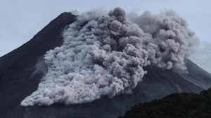
Mexico , Popocatepetl :
May 6, 11:00 a.m. (May 6, 5:00 p.m. GMT)
During the last 24 hours, according to the monitoring systems of the Popocatépetl volcano, 205 exhalations, 140 minutes of tremors and 11 minor explosions have been detected.
The National Center for Communication and Civil Protection Operations (CENACOM) today reported a slight ash fall in the municipalities of Amecameca, Ayapango, Temamatla, Tenango del Aire, Tlalmanalco and Tepetlixpa in the State of Mexico.
During the morning, and at the time of this report, the continuous emission of volcanic gases and ash is observed in a northwest direction (NW).

Explosions that occur on Popocatépetl or any active volcano are accompanied by seismic and sound signals, the latter recorded by pressure detectors or microphones. It is possible to hear them with different levels of intensity, depending on the atmospheric factors at the time of the events or the morphological conditions of the crater. This is a normal phenomenon and is not necessarily an indication of increased volcanic activity. It should be noted that in the current state of Popocatépetl, characterized by the formation of small lava domes, and their subsequent destruction by explosions, mainly of small to moderate size, it is likely that in the coming days or weeks the population near the volcano will perceive these audible phases.
CENAPRED insistently reiterates the recommendation NOT TO CLIMB to the crater of the volcano, because there is a possibility of explosions, as we have seen on several occasions in the past, involving the emission of incandescent fragments. Therefore, he is required to respect the exclusion radius of 12 km. Also, in heavy rain, stay away from the bottom of ravines due to the danger of mudslides and debris.
The Popocatépetl volcanic alert traffic light is in YELLOW PHASE 2.
Source et photo : Cenapred .