November 22 , 2020 .
Italy , Stromboli :
PRESS RELEASE ON THE EXPLODED ACTIVITY OF NOVEMBER 21, 2020 h. 00:33 UTC (01:33 local time) – NEW MAJOR EXPLOSION
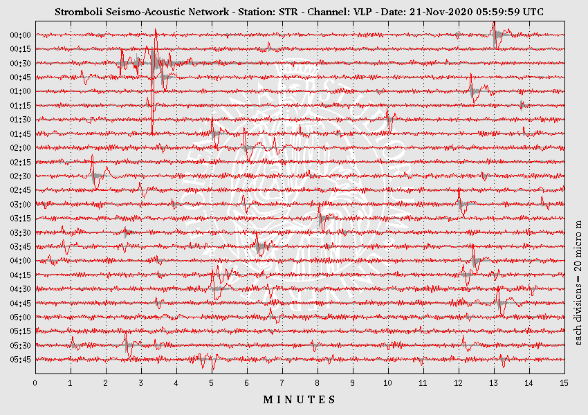
On November 21, 2020, at 00:33:21 hours UTC, the geophysical monitoring network recorded a very strong explosive event, associated with seismic parameters (1.05 x10- 4 m / s in speed and 1.24 x10- 5 m in displacement and soil deformation (0.41 mrad at the OHO reference tiltmeter in the Rina Grande) above ordinary explosive activity, the event falling within the lower limits of the major explosion field.
This explosive event was preceded by about 3 minutes of clear inflation of the soils.
Following the explosive event, no significant change in explosive activity was observed. All stations are functioning properly.
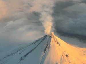
The photo above was taken by staff of the INGV-Etneo Observatory during a helicopter overflight (provided by the 2nd Catania Coast Guard Air Force Unit) on 11 November 2020, after the explosion the night before.
N.B. The paroxysmal explosion warning system was and still is in operation. This explosion (major and not paroxysmal) exceeded the width criterion (0.3 microrad) provided for by the Early – Paroxysmal Warning system but not that on the duration of the soil inflation before the paroxysmal explosions, so it was not surmounted the threshold of 0.85 provided by the automatic system to trigger the warning system.
Read the article: ESPLOSIONE MAGGIORE A STROMBOLI DEL 21/11/2020 00:33:21 UTC (unifi.it)
Photo : INGV.
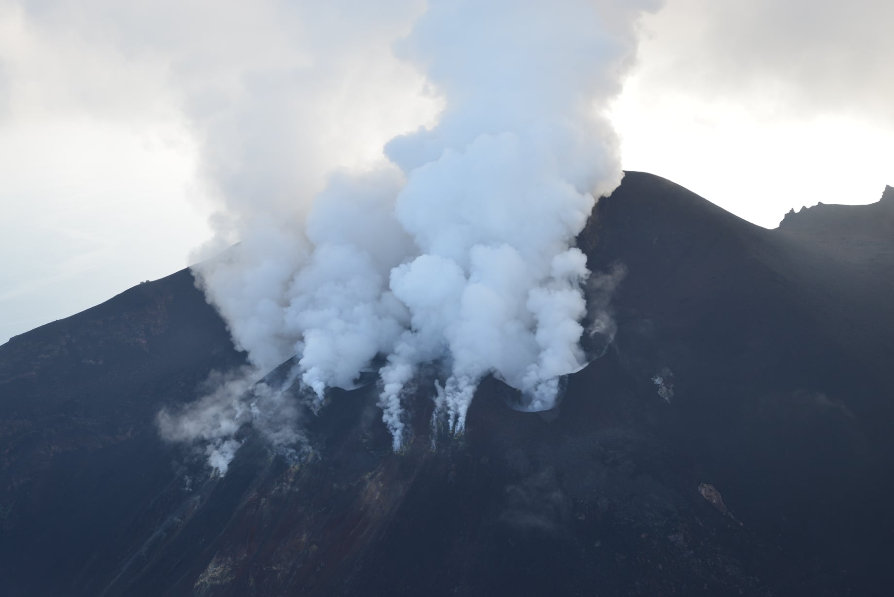
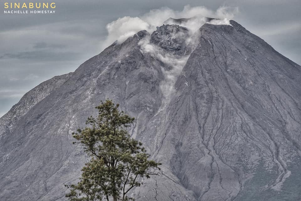
Indonesia , Sinabung :
VOLCANO OBSERVATORY NOTICE FOR AVIATION – VONA.
Issued : November 21 , 2020
Volcano : Sinabung (261080)
Current Aviation Colour Code : ORANGE
Previous Aviation Colour Code : orange
Source : Sinabung Volcano Observatory
Notice Number : 2020SIN31
Volcano Location : N 03 deg 10 min 12 sec E 98 deg 23 min 31 sec
Area : North Sumatra, Indonesia
Summit Elevation : 7872 FT (2460 M)
Volcanic Activity Summary :
Eruption with volcanic ash cloud at 14h37 UTC (21h37 local).
Volcanic Cloud Height : Ash-cloud is not visible
Other Volcanic Cloud Information :volcano cloudy
Remarks : Seismic activity is characterized by eruption volcanic event
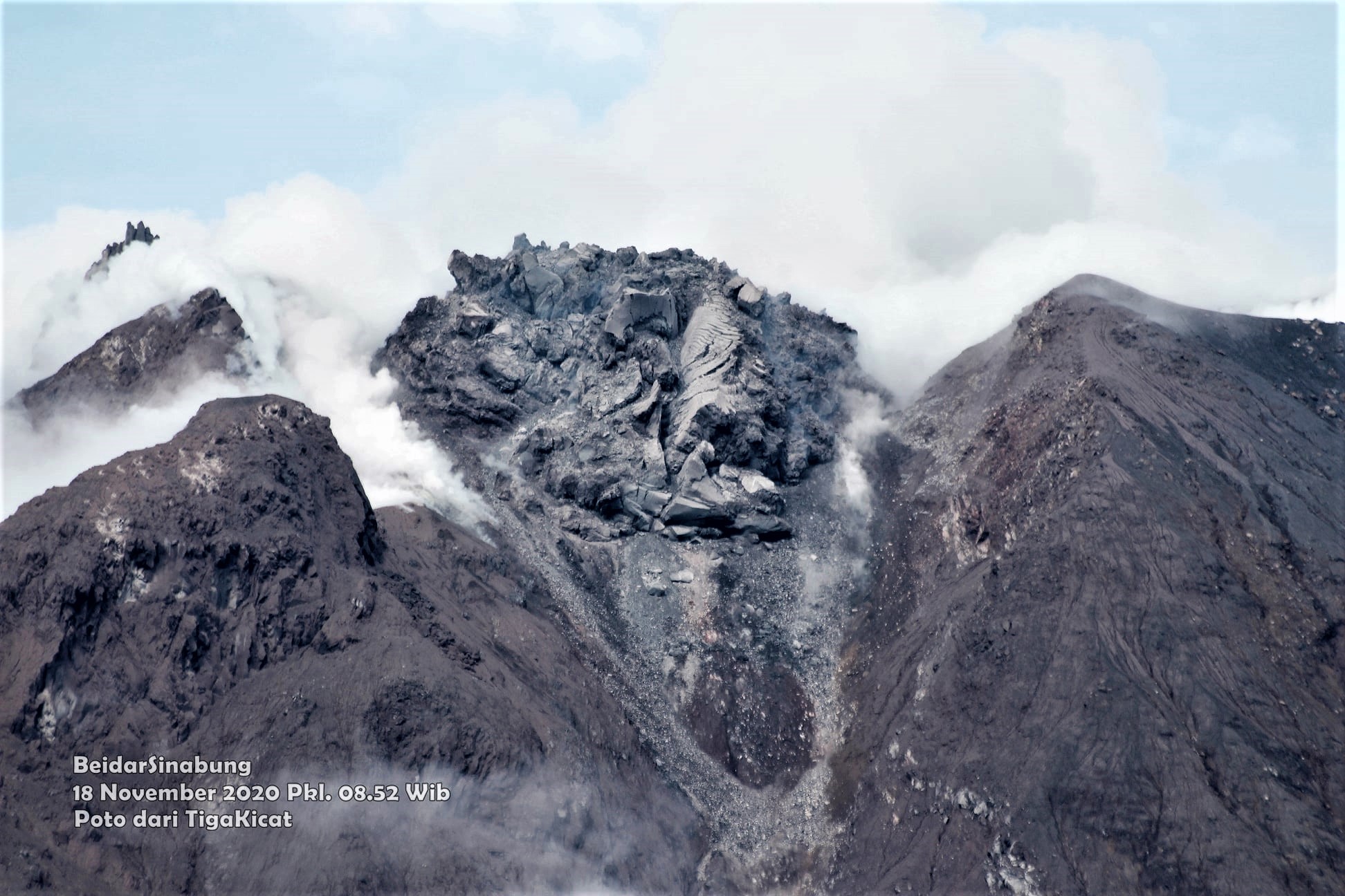
The activity level has been at level III (SIAGA) since May 20, 2019 at 10:00 a.m. WIB. The Sinabung volcano (2460 m altitude) has been erupting since 2013.
The volcano was clearly visible until it was covered in fog. Smoke from the crater was not observed. The weather is sunny / rainy, with weak to strong winds in the North-East, East and South-East. The air temperature is around 16-22 ° C.
According to the seismographs of November 21, 2020, it was recorded:
• 1 eruption / explosion earthquake
• 29 avalanche earthquakes
• 3 Tornillo-type earthquakes
• 17 low frequency earthquakes
• 1 Distant tectonic earthquake
Recommendation:
• Communities and visitors / tourists should not conduct activities in villages that have been relocated, as well as within a radial radius of 3 km around the summit of G. Sinabung, and a sector radius of 5 km for the sector. South-East and 4 km for the North-East sector.
Source : Magma Indonésie , PVMBG.
Photo : Nachelle Homestay , Firdaus Surbakti .
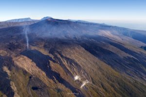
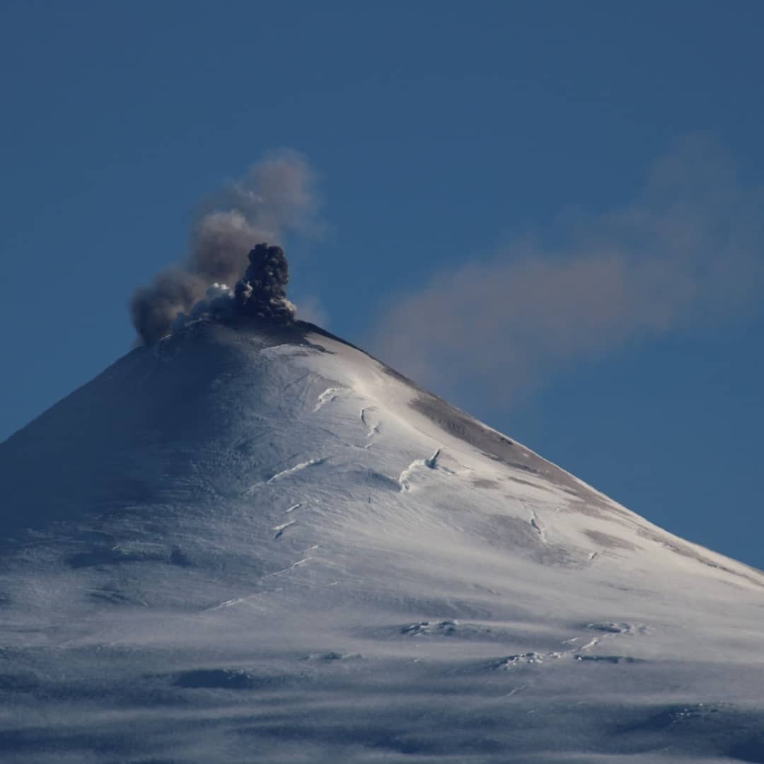
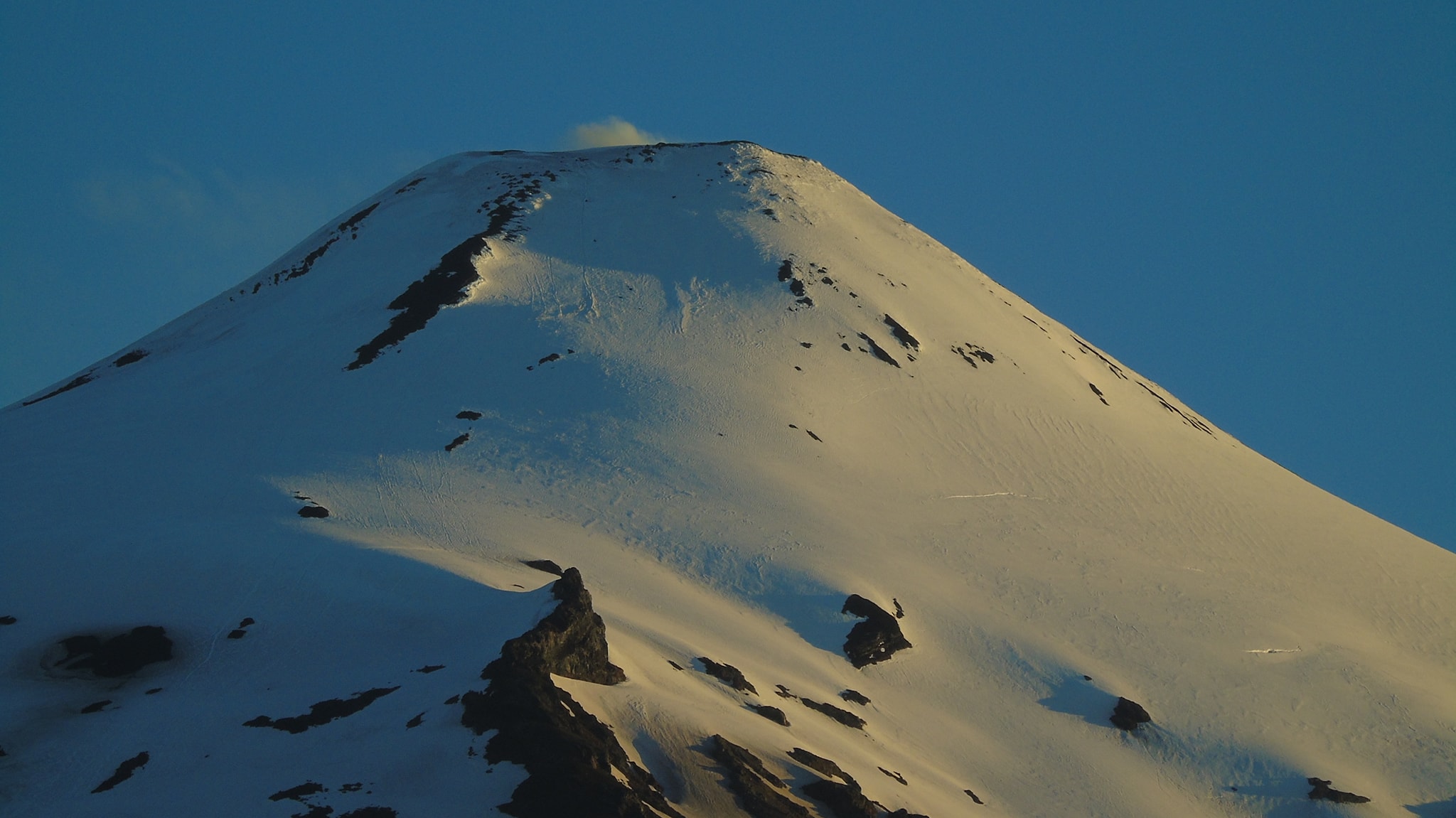
Chile , Villarica :
216 earthquakes related to fluid dynamics within the volcanic building were recorded, classified as long period type events (LP), with a maximum reduced displacement (DR) of 20 cm2.
– The seismic recordings were dominated by a continuous tremor signal also related to the dynamics of the fluids inside the volcano, which presented oscillations related to the surface activity recorded between November 5 and 10, with a value Average DR equal to 4 cm2 and maximum values close to 9 cm2
. The spectral content of the signal varied from 0.7 to 7.0 Hz, mainly between 3 and 7 Hz.
– The infrasound sensors installed near the volcano recorded acoustic signals associated with explosions at the level of the crater, with maximum values of 9.4 Pa (reduced to 1 km as a reference), a value deemed moderate for the volcano. The recording of these signals increased between November 6 and 8.
– Two earthquakes classified as volcano-tectonic (VT) were recorded, associated with fracturing processes of rigid materials. The most important event had a local magnitude (ML) of 1.4 and was located 6.9 km to the south (S), with a depth of 3.2 km from the main crater.
– According to the data provided by the 3 GNSS stations, which measure the surface deformation of the volcanic environment, there are no variations suggesting changes in the internal dynamics of the volcano.
– Two anomalies were reported in sulfur dioxide (SO2) emissions into the atmosphere in the area near the volcanic building on November 7 and 11, according to data released by the Tropospheric Monitoring Instrument (TROPOMI) and Ozone Monitoring Instrument (IMO).
– 4 thermal alerts were recorded in the area associated with the volcanic building, with a maximum volcanic radiative power (VRP) of 24 MW on November 8, this anomaly was associated with an explosion; this value is considered moderate according to data processed by Middle Infrared Observation of Volcanic Activity (MIROVA) and by near real-time thermal monitoring of global hot spots (MODVOLC). Sentinel 2-L2A satellite images detected 2 radiation anomalies associated with the crater area on November 9 and 14.
The evolution towards a Strombolian dynamic, for example on November 6, is associated with the rupture of the crust which covers the lava lake, which rises, generating a partial degassing (as experienced on November 7). This mechanism of ascent of the lava lake would be evidenced by the reappearance of thermal radiation anomalies in the Sentinel L2 A images and the report of observations of the lava lake; however, it is considered to have remained relatively deep.
The period evaluated was characterized by a tremor signal which dominates the seismic recording and with a spectral content towards the high frequencies, which would be linked to partial obstructions of the degassing duct (s) and to a rise of magma. , allowing overpressures that trigger explosions such as those recorded on November 6.
In the discovery of these obstructions, based on the current history, it is suggested as an initial hypothesis that two trigger mechanisms could coexist, influenced by the level of obstruction of the lava lake:
1. The rupture of the crust that covers the lava lake, influenced by the rise of magma with a higher content of volatiles, due to a convection mechanism in the magma column without apparent input of new material,
2. The detachment of the blocks from inside the conduit due to the instability caused by the depth of the lava lake, falling into the magmatic column, generating a sharp increase in the accumulation of bubbles, increasing their explosiveness.
The calculated data for SO2 gas and thermal anomalies of satellites are considered low. This could indicate that this activity most likely has a superficial stimulus at the expense of a deeper contribution. With all of the above, it is emphasized that the system continues with the possibility of generating minor explosions that affect the area near the crater. It should be noted that the behavior of the lava lake is fluctuating, and that it continues to be located at surface level, causing minor explosions that can affect the proximity of the crater.
Consequently, the technical alert is maintained at the level:
YELLOW TECHNICAL ALERT: Changes in the behavior of volcanic activity.
Source : Sernageomin .
Photos : volcanologia en chile , Franco Vera.
Mexico , Popocatepetl :
November 21, 11:00 a.m. (November 21, 5:00 p.m. GMT)
During the last 24 hours, according to the monitoring systems of the Popocatépetl volcano, 415 exhalations accompanied by water vapor and volcanic gases have been identified. 30 minutes of low amplitude tremor were also recorded.

At the time of this report, there is visibility towards the volcano, during the morning an emission of water vapor and volcanic gases was observed with a northwest direction.
CENAPRED urges not to approach the volcano and in particular the crater, because of the danger posed by the fall of ballistic fragments and, in the event of heavy rains, to stay away from the bottom of the ravines because of the danger mudslides and debris.
The Popocatépetl volcanic alert semaphore is on YELLOW PHASE 2.
Source : Cenapred .