December 08 , 2023.
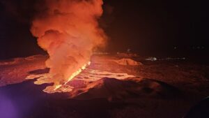
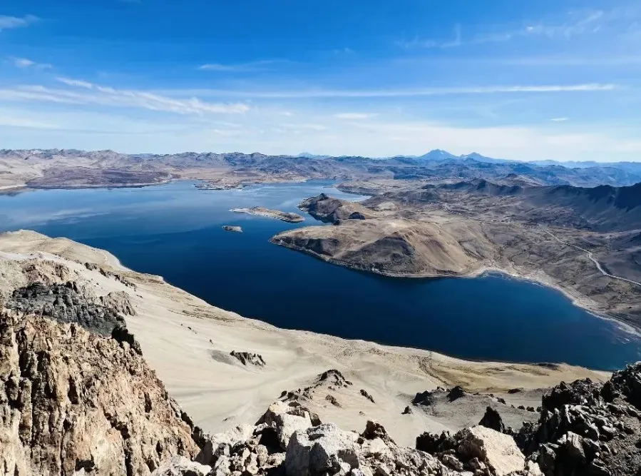
Alaska , Shishaldin :
54°45’19 » N 163°58’16 » W,
Summit Elevation 9373 ft (2857 m)
Current Volcano Alert Level: WATCH
Current Aviation Color Code: ORANGE
Low-level activity continues at Shishaldin Volcano. Seismic activity remains elevated with small, low-frequency earthquakes observed frequently over the past day. Satellite and webcam views were obscured by clouds.
Thirteen significant explosive events have occurred at Shishaldin since July 12 through October 3, 2023. These events have been preceded by increases in seismicity in the hours to days before they occur. It is unknown how long this period of ongoing activity will last. However, previous eruptions of Shishaldin Volcano have lasted weeks to months with repeated cycles of eruptive activity like those seen since July.
Local seismic and infrasound sensors, web cameras, and a geodetic network monitor Shishaldin Volcano. In addition to the local monitoring network, AVO uses nearby geophysical networks, regional infrasound and lighting data, and satellite images to detect eruptions.
Source : AVO
Photo : Reedy, Brian
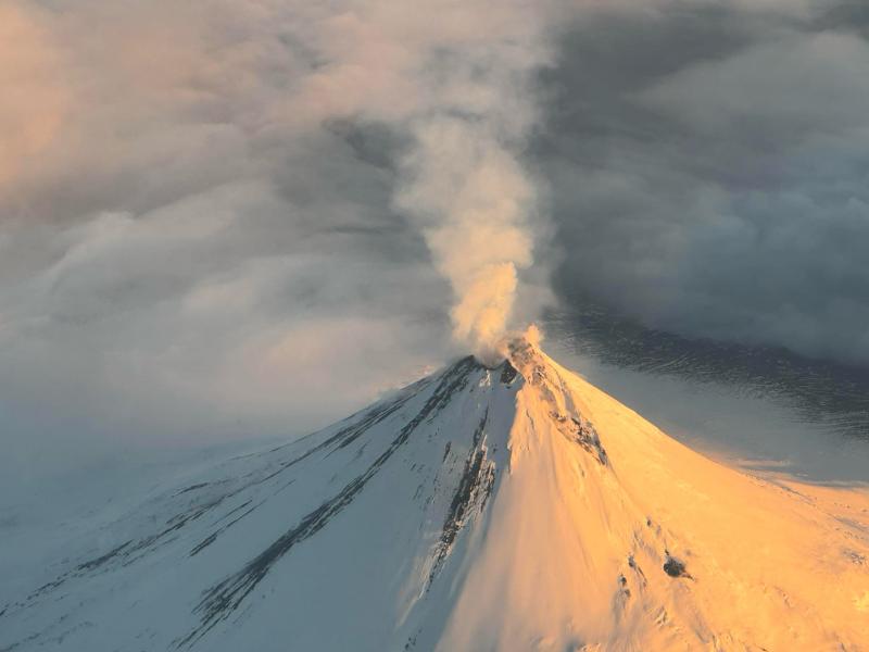
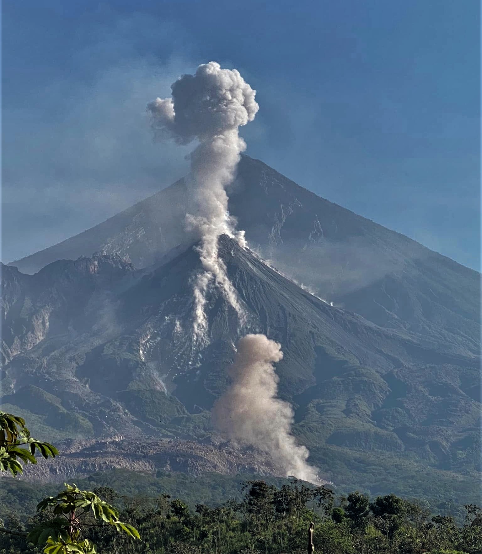
Philippines , Mayon :
MAYON VOLCANO BULLETIN (UPDATED) , 8 December 2023 , 8:00 AM
This serves as a notice for the lowering of Mayon Volcano’s status from Alert Level 3 (decreased tendency towards hazardous eruption) to Alert Level 2 (moderate level of unrest).
Mayon Volcano’s monitoring network and observation of day-to-day conditions have recorded a general decline in unrest since November 2023, as indicated by the following monitored parameters:
1. Seismic Activity: Volcanic earthquakes generated by magma extrusion and degassing and occasional rock-fracturing beneath the edifice have decreased from a monthly average of 11 events/day in November 2023 to nearly 0 event/day in the first week of December 2023. Recorded rockfall and pyroclastic density currents or PDCs also significantly decreased from monthly averages of 122 to 87 events/day and 5 to 2 events/day, respectively, between October and November 2023 to virtually 0 event/day in the first week of December 2023. These decreases indicate that magma supply to the summit crater has significantly diminished, resulting in the cessation of lava effusion from the crater and lava collapse-driven rockfall and PDC activity.
2. Summit and Lava Flow Observations: Visual and camera monitoring of the Mayon edifice recorded lessening incandescence of the summit crater and of the 2023 lava flow deposits since the last week of November 2023. The advancing front of overlapping lava flows on the Mi-isi, Bonga and Basud Gullies have been stalled at 2.8 kms, 3.4 kms and 1.1 kms, respectively, from the summit crater since July-August 2023. Of these, the newest lava deposit was observed to have rested within 400 meters of the crater on the Bonga Gully since 23 November 2023. The total volume of erupted deposits has therefore remained at approximately 49 million m3 since then. The stabilization and diminishing incandescence of lava deposits at the summit and depositional gullies are consistent with the cessation of magma supply to the summit crater.
3. Ground Deformation: In contrast to the above parameters, data from continuous GPS, campaign Electronic Distance Meter or EDM and real-time electronic tilt monitoring indicate asymmetric deformation of the Mayon edifice throughout its period of unrest that still persists. In the short-term, a general deflation was recorded by GPS beginning August-September 2023 and by electronic tilt since November 2023. In contrast, a more pronounced net inflation has been recorded in the longer-term by electronic tilt since June 2023 and by EDM since February 2023. Additionally, campaign microgravity measurements indicate positive (density increase) and negative (density decrease) anomalies on the lower and middle slopes of the volcano, respectively. Overall, ground deformation and microgravity parameters indicate that pressurization of the Mayon edifice has abated in the past month, but that the edifice remains generally pressurized (inflated) due to magma intrusion that has been transpiring since the onset of unrest in June 2023.
4. Volcanic Degassing: Volcanic SO2 emission measured by campaign Flyspec measurement peaked at an average of 4,756 tonnes/day on 16 August 2023 and has since been decreasing and increasing in cycles of generally lessened peaks. Monthly average SO2 emission increased from 1,173 to 1,417 tonnes/day between October and November 2023 before falling to an average of 1,095 tonnes/day in the first week of December 2023. SO2 emission yesterday, 7 December 2023, averaged 859 tonnes/day. The overall weakening of cyclic SO2 emission indicates that volcanic gas from lava exposed on the crater and slopes of Mayon and from magma stored within the volcano is diminishing, but that minor volumes of magma are still periodically intruded in storage beneath the edifice, consistent with ground deformation and microgravity data.
In view thereof, DOST-PHIVOLCS is lowering the Alert Level of Mayon Volcano from Alert Level 3 (tendency towards a hazardous eruption) to Alert Level 2 (moderate level of unrest).
Source : Phivolcs
Photo : Theworldnews
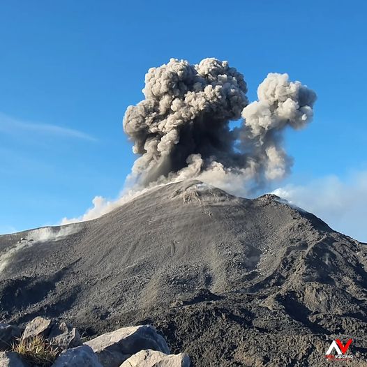
Indonesia , Ili Lewotolok :
An eruption of Mount Ili Lewotolok occurred on Friday, December 8, 2023, at 1:18 p.m. WITA. The height of the eruptive column was observed to be ± 400 m above the peak (± 1,823 m above sea level). The ash column was observed to be gray to black in color with moderate intensity, oriented towards the East. The eruption was recorded on a seismograph with a maximum amplitude of 35 mm and a duration of 65 seconds.
VOLCANO OBSERVATORY NOTICE FOR AVIATION – VONA
Issued : Gecember 08 , 2023
Volcano : Ili Lewotolok (264230)
Current Aviation Colour Code : ORANGE
Previous Aviation Colour Code : orange
Source : Ili Lewotolok Volcano Observatory
Notice Number : 2023LEW105
Volcano Location : S 08 deg 16 min 19 sec E 123 deg 30 min 18 sec
Area : East Nusa Tenggara, Indonesia
Summit Elevation : 4554 FT (1423 M)
Volcanic Activity Summary :
Eruption with volcanic ash cloud at 05h18 UTC (13h18 local).
Volcanic Cloud Height :
Best estimate of ash-cloud top is around 5834 FT (1823 M) above sea level or 1280 FT (400 M) above summit. May be higher than what can be observed clearly. Source of height data: ground observer.
Other Volcanic Cloud Information :
Ash cloud moving to east. Volcanic ash is observed to be gray to dark. The intensity of volcanic ash is observed to be medium.
Remarks :
Eruption recorded on seismogram with maximum amplitude 35 mm and maximum duration 65 second.
Source : Magma Indonésie.
Photo : Andi Volcanist
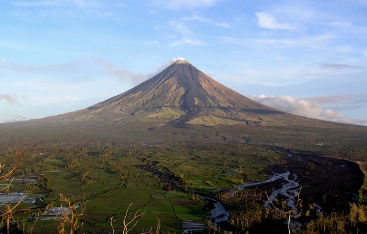
Chile , Laguna del Maule :
Seismology
The seismological activity of the period was characterized by the recording of:
1586 seismic events of type VT, associated with the fracturing of rocks (Volcano-Tectonics). The most energetic earthquake had a Local Magnitude (ML) value equal to 2.3, located 4.4 km South-South-East of the center of the lagoon, at a depth of 7.3 km compared to the average height of the lagoon.
17 LP type seismic events, associated with fluid dynamics inside the volcanic system (Long Period). The size of the earthquake evaluated from the Reduced Displacement (RD) parameter was equal to 56 cm2.
1 HB type seismic event, associated with both rock fracturing and fluid dynamics within the volcanic system (Hybrid). This earthquake had a Reduced Displacement (DR) value of 27.5 cm2 and a Local Magnitude (ML) value equal to 1.8, located 5.9 km to the West-South-West of the Barrancas volcanic complex , at a depth of 2.4 km from the crater.
Fluid geochemistry
No anomalies have been reported in emissions of sulfur dioxide (SO2) into the atmosphere in the area near the volcanic complex, according to data published by the Tropospheric Monitoring Instrument (TROPOMI) and the Ozone Monitoring Instrument (OMI) .
Satellite thermal anomalies
During the period, no thermal alerts were recorded in the area associated with the volcanic complex, according to the analytical processing of Sentinel 2-L2A satellite images, in combination of false color bands.
Geodesy
From the 4 GNSS stations operating in the volcanic complex, we observe that the inflationary process continues. The relative vertical deformation rate between the two stations for this period is 0.9 cm/month, slightly higher than the previous period, considered moderate. On the other hand, from Sentinel-1 satellite images and the use of radar interferometry, the elevation of the volcanic complex area is partially observed, without substantial changes compared to what was observed during previous periods.
The volcanic complex continues to show a slight and sustained increase in the recording of volcano-tectonic seismicity, however with lower energies than the previous fortnight. Likewise, long-period activity associated with fluid dynamics and/or pressure changes in internal conduits is evident. The locations of the VT earthquakes are distributed in two recurring sources over time, the South-West and East sectors in relation to the lagoon, and in addition for this period, a third source is added to the North of the lagoon.
At the same time, the process of cortical deformation remains active with uplift rates within the historically recorded average. These conditions allow us to deduce that the volcanic system is still above its basic threshold, therefore, the technical alert is maintained at YELLOW and a radius of possible impact by volcanic dangers of 2 km around the zone d maximum CO2 emission.
The technical volcanic alert is maintained in:
YELLOW TECHNICAL ALERT: Changes in the behavior of volcanic activity
Source : Sernageomin
Photo : OAVV
Guatemala , Santiaguito :
Weather conditions: partly cloudy
Wind: East
Precipitation: 0.0 mm.
Activity:
Weak outgassing is observed on the Caliente dome, with some short-lived pulses of increase. Seismic stations continue to record weak to moderate explosions which generate incandescences and avalanches mainly in the southwest and south direction. Moderate explosions form a column of gas and ash up to 3,400 meters above sea level (10,498 feet).
The ashes are scattered towards the West. This activity causes the fall of fine ash particles and a foggy environment near the volcano. During the night and early morning, it is possible to observe incandescence in the upper, middle and lower part of the dome. Strong avalanches and audible noises can be generated several kilometers from the volcanic edifice. The occurrence of block and ash flows of moderate to strong characteristics is not excluded, as well as possible pyroclastic flows over long distances in different directions.
Source et photo : Insivumeh