March 01 , 2020.
Philippines , Taal / Mayon :
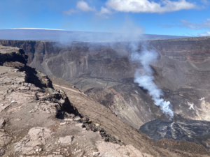
TAAL VOLCANO BULLETIN: 01 March 2020 8:00 A.M.
Activity in the Main Crater in the past 24 hours has been characterized by weak emission of steam-laden plumes rising 50 meters high before drifting northeast. The Taal Volcano Network recorded twenty-nine (29) volcanic earthquakes that are associated with rock fracturing processes beneath and around the edifice.
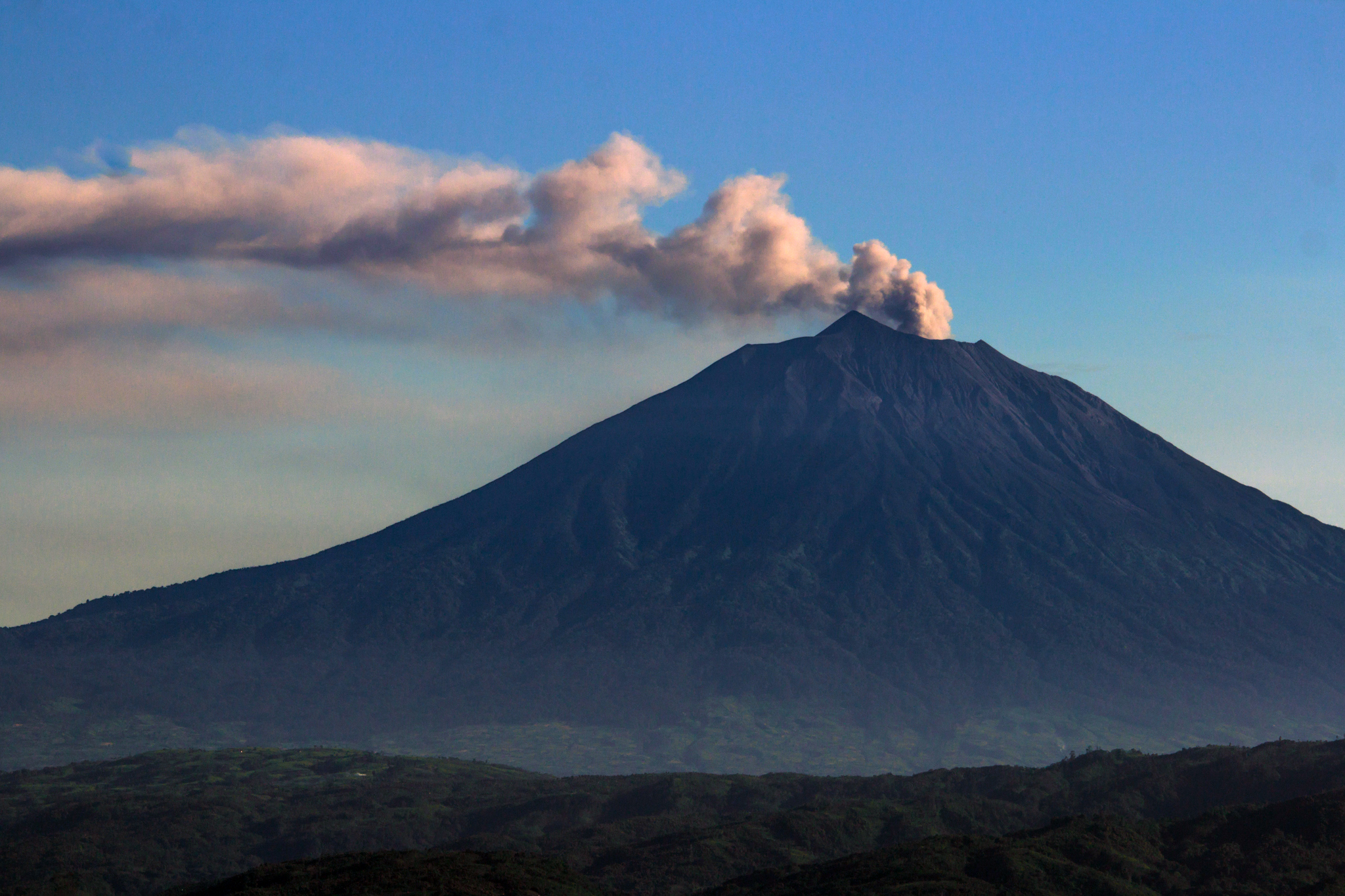
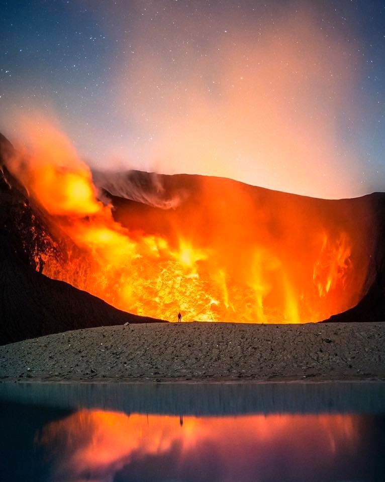
MAYON VOLCANO BULLETIN 01 March 2020: 08:00 A.M.
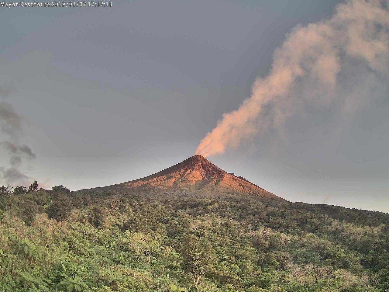
Mayon Volcano’s seismic monitoring network did not detect any volcanic earthquake during the 24-hour observation period. Moderate emission of white steam-laden plumes that crept downslope before drifting west-southwest was observed. Sulfur dioxide (SO2) emission was measured at an average of 478 tonnes/day on 23 February 2020. Recent electronic tilt data showed inflation of the middle to upper portions of the volcanic edifice that began in the last quarter of 2019. This follows an inflationary trend that began in February 2019 as recorded by continuous GPS monitoring.
Source : Phivolcs.
Photo : volcanodiscovery
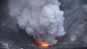
Indonesia , Kerinci :
VOLCANO OBSERVATORY NOTICE FOR AVIATION – VONA.
Issued: March 01 , 2020
Volcano: Kerinci (261170)
Current Aviation Colour Code: YELLOW
Previous Aviation Colour Code: yellow
Source: Kerinci Volcano Observatory
Notice Number: 2020KER07
Volcano Location: S 01 deg 41 min 49 sec E 101 deg 15 min 50 sec
Area: Jambi, West Sumatra, Indonesia
Summit Elevation: 12176 FT (3805 M)
Volcanic Activity Summary:
On March 01 , 2020, observed brown ash emission at 23:00 UTC ( 06:00 Local Time ).
Volcanic Cloud Height:
Best estimate of ash-cloud top is around 13776 FT (4305 M) above sea level, may be higher than what can be observed clearly. Source of height data: ground observer.
Other Volcanic Cloud Information:
Ash emission moving south – southwest.
Remarks:
Seismic activity is dominated by gas emission and continuous vulcanic tremor with amplitude 0,5-2 mm (dominan 1mm).
Source : Magma Indonésie.
Photo : Auteur Inconnu.
Costa Rica , Turrialba / Poas / Rincon de la Vieja :
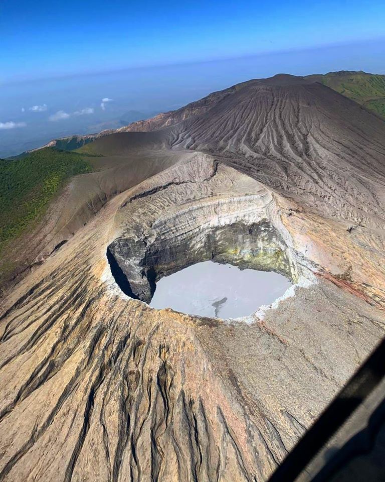
Turrialba volcano:
Lat: 10.025 ° N; Long: 83.767 ° W;
Altitude: 3340 m
Current activity level: 2 (active volcano)
Potentially associated hazards: gas, ash emission, proximal ballistic emissions.
No ash emission was detected. Seismicity has a stable number of LP type events and few distal VT type events. The volcanic building presents a contraction and a deflation. The CO 2 / SO 2 and H 2 S / SO 2 ratios remain stable and the flow of SO 2 has remained low (<300 t / d). The process of filling the bottom of the crater was quantified by photogrammetry by drone, which reached 80 m between February 2019 and February 2020, mainly fed by a collapse zone to the northwest and southeast of the crater. A crater about 40 meters in diameter has been detected inside the main crater (about 220 m in diameter). This small crater has a degassing and is located about 140 m below the north edge of the main crater.
Poás Volcano:
Lat: 10.2 ° N; Long: 84.233 ° W;
Altitude: 2780 m
Current activity level: 3 (active volcano)
Potential associated hazards: gas, ash emission, phreatic eruptions, proximal ballistic emissions.
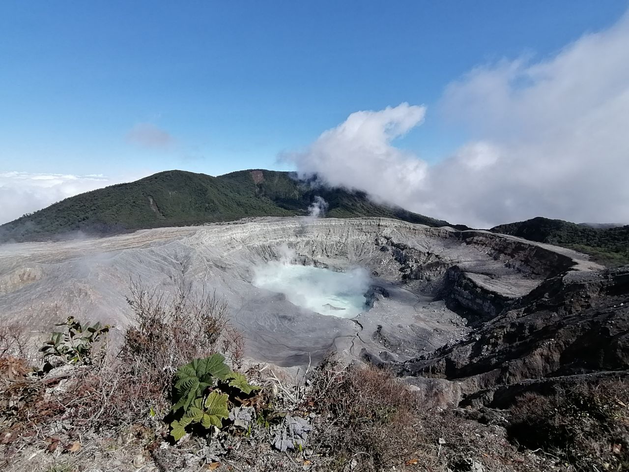
Seismic activity maintains a pattern of variations in the number of LP type events and intermittent low amplitude background tremors. Few VT-type events have been detected. Inflation continues slightly without reaching significant values. The CO 2 / SO 2 and H 2 S / SO 2 ratios decreased during the week and then increased during the weekend. The flow of SO 2 presented a high value (> 500 t / d) on February 23 compared to the previous weeks (<300 t / d) to be confirmed. Higher concentrations of SO 2 were measured at the viewpoint level on February 24. Activity is considered to be weaker compared to the end of January. However, the activity level is maintained at 3 due to the deformation and the increase in gas ratios.
Rincon de la Vieja volcano:
Lat: 10.83 ° N; Long: 85.324 ° W;
Altitude: 1895 m
Current activity level: 3 (volcanic eruption)
Potentially associated hazards: gas, groundwater eruptions, proximal ballistic emissions, lahars.
No eruption has been detected since February 17. An intermittent low amplitude tremor was maintained. LP type events were maintained in variable quantities. There has been a possible seismic swarm of 4-5 events between Orosí and Cacao, 14 km deep, which could be linked to the Rincon de la Vieja. There is no significant deformation.
Source : Ovsicori.
Photos : Javier Elizondo , RSN , Christopher Allen .
Mexico , Popocatepetl :
February 28, 11:00 a.m. (February 28, 5:00 p.m. GMT)
According to the monitoring systems of the Popocatepetl volcano, 278 exhalations and 216 minutes of tremors have been identified, some of these events have been accompanied by the emission of gases and small amounts of ash. In addition, two minor explosions were recorded at 6:56 a.m. and 8:29 a.m. Two volcano-tectonic earthquakes were also recorded today at 05:48 and 07:12 h with an estimated magnitude of 1.2 and 1.7.
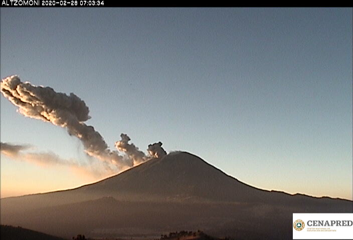
During this morning and until the time of this report, emissions of volcanic gases and slight quantities of ash were dispersed towards the East-South-East, with a maximum height of 1100 m.
CENAPRED urges NOT to APPROACH the volcano and especially the crater, because of the danger of falling ballistic fragments, and in case of heavy rain, to stay far from the bottom of the ravines because of the danger of mudslides and debris .
The Popocatépetl volcanic signaling light is in YELLOW PHASE 2.
Source : Cenapred .