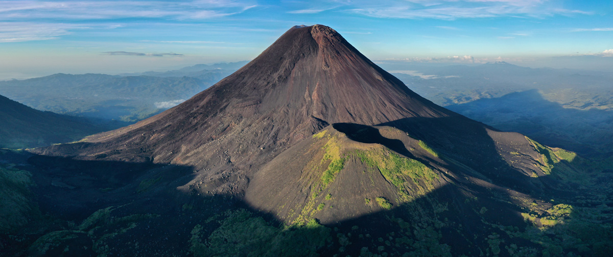
March 22, 2020. EN. Alaska : Shishaldin , Indonesia : Soputan , Colombia : Nevado del Huila , Mexico : Popocatepetl .

March 22 , 2020.


Alaska , Shishaldin :

54°45’19 » N 163°58’16 » W,
Summit Elevation 9373 ft (2857 m)
Current Volcano Alert Level: WATCH
Current Aviation Color Code: ORANGE

Worldview-2 false color image of Shishaldin’s summit on March 19, 2020. Steaming obscures any view inside the crater, with no lava visible through the steam or outside of the crater.

Eruptive activity continues at Shishaldin. Seismicity remains elevated with continuous tremor. Elevated surface temperatures were observed in mostly cloudy satellite views. At this time, eruptive activity appears confined to the summit area, but activity could increase with little or no warning resulting in lava flows outside of the crater, lahars, and ash emissions.

Shishaldin is monitored by local seismic and infrasound sensors, satellite data, web cameras, a telemetered geodetic network, and distant infrasound and lightning networks.

Source : AVO.

Photo : Loewen, Matt.


Indonesia , Soputan :

G.Soputan (1,809 m above sea level) decreased its volcanic activity so that the activity level was reduced from level III (SIAGA) to level II (Waspada) from October 8, 2019 at 4:00 p.m. The last eruption occurred on December 16, 2018, causing an eruption column height of 7000 m. It was observed that the color of the column went from gray to black.

The volcano is covered with fog. No smoke from the crater is observed. The weather is cloudy, light to moderate winds from the south-east and south.

According to seismographs, on March 21, 2020 it was recorded:
11 avalanche earthquakes
1 emission earthquake
1 deep tectonic earthquake

Recommendation:
The community must not be active within a radius of 1.5 km around the summit of G. Soputan and in the area of the South-South-West sector up to 2.5 km which is an opening area of the crater, to avoid the threat of lava avalanches and hot clouds.
Be aware of the threat of lahars, especially in the rivers that descend around the slopes of G. Soputan, such as S. Ranowangko, S. Lawian, S. Popang and Londola Kelewahu.
In the event of ash rain, people are encouraged to use masks to anticipate breathing problems.

VONA: The last VONA code has received a RED color code, published on December 16, 2018 at 05:40:00. Volcanic ash was observed at an altitude of 8809 m above sea level or about 7000 m above the summit.

Source : PVMBG.

Photos : avec la permission de Martin Rietze .


Colombia, Nevado del Huila :

Weekly activity bulletin of the Nevado del Huila volcano.
The activity level of the volcano continues at the Yellow activity level or (III): changes in the behavior of volcanic activity.

According to the analysis and evaluation of information obtained by the monitoring network of the Nevado del Huila volcano during the week of March 10 to 16, 2020, the COLOMBIAN GEOLOGICAL SERVICE – Popayán Volcanological and Seismological Observatory reports that:

During the period evaluated, a total of 550 seismic events were recorded, of which 264 were linked to rock fracturing processes (VT type) and 286 to fluid dynamics in volcanic conduits. Of these, 269 were cataloged as long period type events (LP type), 4 as hybrid types (HB type) and 13 as tremor pulses (TR) with low energy. 

The images obtained during the week by the web cameras of Caloto, Tafxnú, Maravillas and La Palma showed a weak degassing of the volcanic system. The sensors for monitoring soil deformation, magnetic fields and infrasonic waves did not record variations associated with changes in volcanic activity.

Therefore, it is concluded that during the evaluated period, the volcano continued to show stable behavior. The Colombian Geological Survey continues to monitor the evolution of the volcanic phenomenon and will report any changes that may occur in due course.

Source : Ingeominas.

Photo : SGC.


Mexico , Popocatepetl :

March 21, 11:00 a.m. (March 21, 5:00 p.m. GMT)

In the past 24 hours, 74 exhalations have been identified according to the Popocatépetl volcano monitoring systems, accompanied by emissions of volcanic gases, small amounts of ash and sometimes incandescent fragments. In addition, 60 minutes of low amplitude tremors were recorded.

A glow was observed at night in the crater area.

As of this morning and at the time of this report, we observe the constant emission of volcanic gases and sometimes light amounts of ash, which are dispersed towards the Northwest.

CENAPRED urges NOT to APPROACH the volcano and especially the crater, because of the danger involved in the fall of ballistic fragments and, in the event of heavy rain, to move away from the bottom of the ravines because of the danger of mudslides and rubble.

The Popocatépetl volcanic alert signaling light is in YELLOW PHASE 2.

Source : Cenapred .


22 Mars 2020. FR. Alaska : Shishaldin , Indonésie : Soputan , Colombie : Nevado del Huila , Mexique : Popocatepetl .

22 Mars 2020.


Alaska , Shishaldin :

54 ° 45’19 « N 163 ° 58’16 » O,
Altitude du sommet : 9373 pi (2857 m)
Niveau d’alerte volcanique actuel: ATTENTION
Code couleur actuel de l’aviation: ORANGE.

Image Worldview-2 en fausses couleurs du sommet du Shishaldin le 19 mars 2020. La vapeur obscurcit toute vue à l’intérieur du cratère, sans lave visible à travers la vapeur ou à l’extérieur du cratère.

L’activité éruptive se poursuit sur le Shishaldin. La sismicité reste élevée avec un tremor continu. Des températures de surface élevées ont été observées dans des vues satellites principalement nuageuses. En ce moment, l’activité éruptive semble confinée à la zone du sommet, mais l’activité pourrait augmenter avec peu ou pas d’avertissement, entraînant des coulées de lave à l’extérieur du cratère, des lahars et des émissions de cendres.

Le Shishaldin est surveillé par des capteurs sismiques et infrasons locaux, des données satellitaires, des caméras Web, un réseau géodésique télémétrique et des réseaux distants de capteurs d’infrasons et d’éclairs.

Source : AVO.

Photo : Loewen, Matt.


Indonésie , Soputan :

Le G.Soputan (1809 m d’altitude) a diminué son activité volcanique de sorte que le niveau d’activité a été réduit du niveau III (SIAGA) au niveau II (Waspada) à partir du 8 octobre 2019 à 16 h 00 . La dernière éruption s’est produite le 16 décembre 2018 , entraînant une hauteur de colonne d’éruption de 7000 m. On observait que la couleur de la colonne allait du gris au noir.

Le volcan est couvert de brouillard. Aucune fumée issue du cratère n’est observée. Le temps est nuageux, les vents faibles à modérés du Sud-Est et du Sud.

Selon les sismographes, le 21 mars 2020 il a été enregistré :
11 séismes d’avalanche
1 tremblement de terre d’émission
1 tremblement de terre tectonique profond

Recommandation:
La communauté ne doit pas être active dans un rayon de 1,5 km autour du sommet du G.Soputan et dans la zone du secteur Sud-Sud-Ouest jusqu’à 2,5 km qui est une zone d’ouverture du cratère, afin d’éviter la menace d’avalanches de lave et de descente de nuages ​​chauds  .
Soyez conscient de la menace de lahars, en particulier dans les rivières qui descendent autour des pentes du G. Soputan, comme S. Ranowangko, S. Lawian, S. Popang et Londola Kelewahu.
En cas de pluie de cendres, les gens sont encouragés à utiliser des masques  pour anticiper les problèmes respiratoires.

VONA: Le dernier code VONA a reçu un code de couleur ROUGE, publié le 16 décembre 2018 à 05:40:00  . Des cendres volcaniques étaient observées à une altitude de 8809 m au-dessus du niveau de la mer ou à environ 7000 m au-dessus du sommet.

Source : PVMBG.

Photos : avec la permission de Martin Rietze .


Colombie , Nevado del Huila :

Bulletin d’activité hebdomadaire du volcan Nevado del Huila.
Le niveau d’activité du volcan se poursuit au Niveau d’activité jaune ou (III): changements dans le comportement de l’activité volcanique.

D’après l’analyse et l’évaluation des informations obtenues par le réseau de surveillance du volcan Nevado del Huila au cours de la semaine du 10 au 16 mars 2020, le SERVICE GÉOLOGIQUE COLOMBIEN – Observatoire volcanologique et sismologique de Popayán rapporte que:

 Au cours de la période évaluée, un total de 550 événements sismiques ont été enregistrés, dont 264 étaient liés à des processus de fracturation des roches (type VT) et 286 à la dynamique des fluides dans les conduits volcaniques. Parmi ces derniers, 269 ont été catalogués comme événements de type longue période (type LP), 4 comme types hybrides (type HB) et 13 comme impulsions de tremor (TR) avec une faible énergie. 

Les images obtenues au cours de la semaine par les caméras Web de Caloto, Tafxnú, Maravillas et La Palma ont montré un faible dégazage du système volcanique. Les capteurs de surveillance de la déformation du sol, des champs magnétiques et des ondes infrasonores n’ont pas enregistré de variations associées aux changements de l’activité volcanique.

Par conséquent, il est conclu que pendant la période évaluée, le volcan a continué à montrer un comportement stable. Le Service géologique colombien continue de surveiller l’évolution du phénomène volcanique et signalera en temps opportun tout changement qui pourrait survenir.

Source : Ingeominas.

Photo : SGC.


Mexique , Popocatepetl :

21 mars, 11h00 (21 mars, 17h00 GMT)

Au cours des dernières 24 heures, 74 exhalations ont été identifiées selon les systèmes de surveillance du volcan Popocatépetl, accompagnées d’émissions de gaz volcaniques, de faibles quantités de cendres et parfois de fragments incandescents . De plus, 60 minutes de tremors de faible amplitude ont été enregistrées.

Une incandescence a été observée la nuit dans la zone du cratère .

Dès ce matin et au moment de ce rapport, on observe l’émission constante de gaz volcaniques et parfois de légères quantités de cendres, qui sont dispersées vers le Nord-Ouest .

Le CENAPRED demande instamment de NE PAS APPROCHER du volcan et surtout du cratère, en raison du danger impliqué par la chute de fragments balistiques et, en cas de fortes pluies, de s’éloigner du fond des ravins en raison du danger de coulées de boue et décombres.

Le feu de signalisation d’alerte volcanique du Popocatépetl est en PHASE JAUNE 2.

Source : Cenapred .