November 10 , 2020.
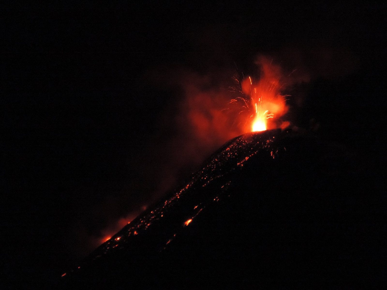
Peru , Sabancaya :
Analysis period: November 02 to 08, 2020, Arequipa, November 09, 2020.
Alert level: ORANGE
The Geophysical Institute of Peru (IGP) reports that the eruptive activity of the Sabancaya volcano remains at moderate levels, that is, with the continuous recording of explosions with columns of ash and gas up to 3 km of altitude above the summit of the volcano and their consecutive dispersion. Therefore, for the following days, no significant change is expected in the eruptive activity.
The IGP recorded and analyzed the occurrence of 2,200 earthquakes of volcanic origin, associated with the circulation of magmatic fluids inside the Sabancaya volcano. An average of 43 explosions were recorded daily of low to medium intensity. During this period, Volcano-Tectonic (VT) earthquakes were localized mainly in the North-East and South-East of Sabancaya and presented magnitudes between M2.2 and M2.6. The most representative earthquake (M2.6) was recorded on November 08 at 1:30 p.m., 16 km north-east of Sabancaya and 15 km deep.
The monitoring of the deformation of the volcanic structure using GNSS techniques (processed with fast orbits) does not present any significant anomalies. However, in general, an inflation process has been observed in the south-eastern sector of Sabancaya and the north sector (Hualca Hualca volcano). Visual surveillance made it possible to identify columns of gas and ash up to 3 km altitude above the summit of the volcano, which were scattered to the southwest, west, southeast, south and east of Sabancaya. Satellite monitoring has identified the presence of 9 thermal anomalies with values between 9 MW and 42 MW, associated with the presence of a lava body on the surface of the volcano crater.
RECOMMENDATIONS
• Keep the volcanic alert level in orange.
• Do not approach within a radius of less than 12 km from the crater.
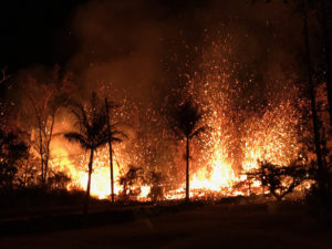
Source : IGP.
Photo : Losviajesdeali .
Ecuador , Reventador :
DAILY REPORT OF THE STATE OF THE REVENTADOR VOLCANO, Monday 09 November 2020.
Information Geophysical Institute – EPN.
Surface activity level: High, Surface trend: Increasing.
Internal activity level: High, Internal trend: No change.
Seismicity: From November 08, 2020, 11:00 a.m. to November 09, 2020, 11:00 a.m.
Explosions (EXP): 73 events
Long period type events (LP): 82
Emissions tremor (TR): 13
Harmonic tremor (TR): 6
Rains / lahars: There were no rainfall events in the area.
Emission / ash column: Thanks to the cameras, various gas and ash emissions were observed, with heights of up to 1000 meters above the crater level and directions of dispersion to the North and North-East . The Washington VAAC agency issued 3 alerts of emissions detected by satellite, which reached 1,400 meters above crater level. These emissions have dispersed to the North, North East and North West.
Other monitoring parameters: During the last 24 hours, MIROVA has recorded 1 low level thermal anomaly. The MOUNTS system did not detect any SO2 emissions exceeding the minimum daily threshold (0.1 tonnes).
Observations: Sometimes, the volcano was cleared, allowing to observe the ash emissions already described. During the night, an incandescence was observed in the crater as well as the rolling of blocks on the northeast flank, descending up to 600 meters below the level of the crater. The lava flow continues to be active (~ 450 m) to the northeast, without major changes.
Alert level: Orange.
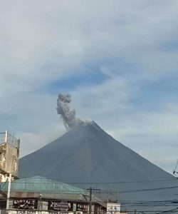
Source : IGEPN.
Photo : Hosteria.
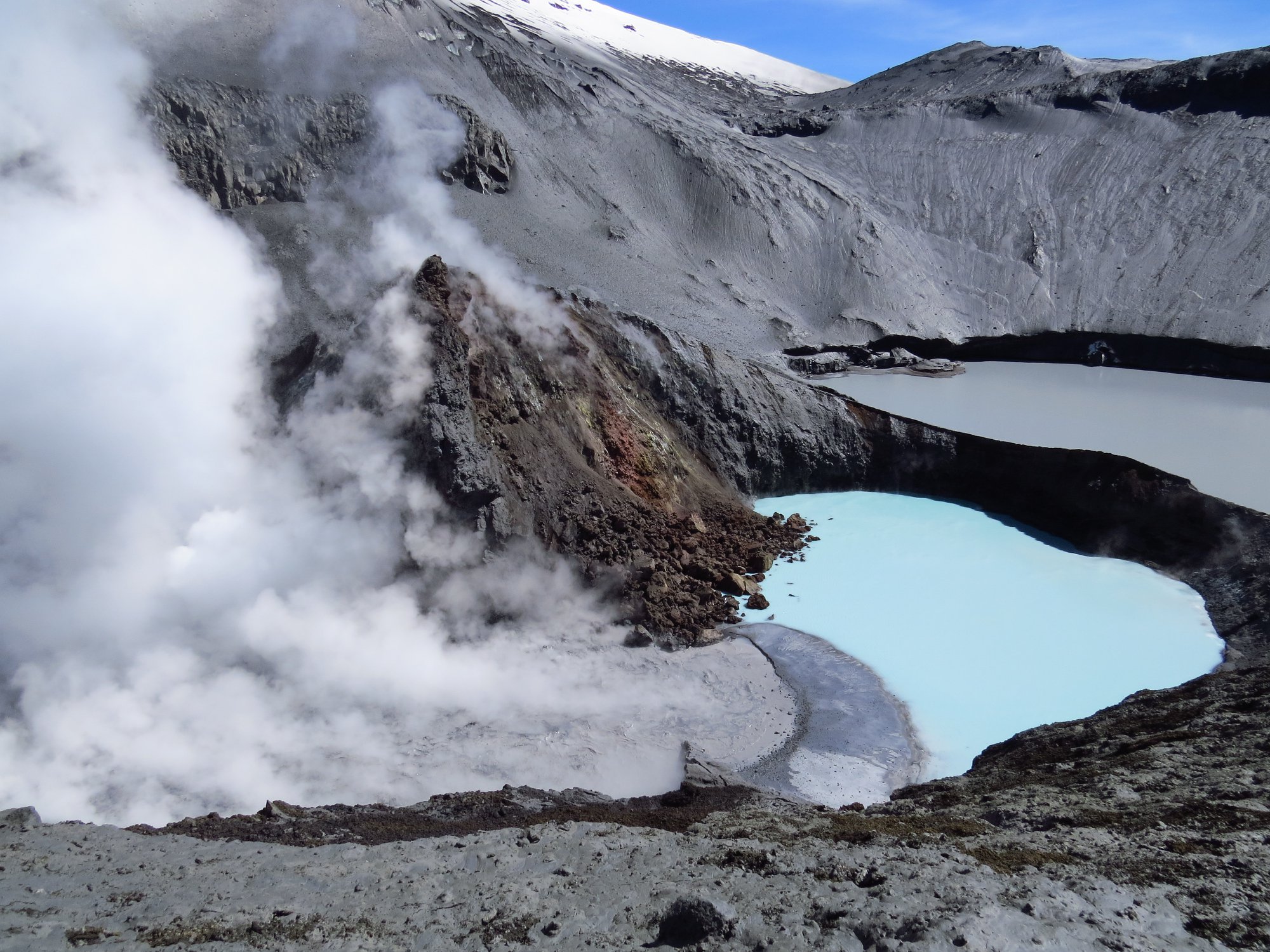
Chile , Copahue :
During the period, 17 seismic events classified as VT type were recorded, associated with fragile rupture processes in volcanic systems. The most energetic event had a local magnitude (ML) value of 1.3 and was located 8.1 km east-north-east (ENE) with a depth of 5.9 km. Likewise, 10 seismic events classified as LP type were recorded, associated with the dynamics of fluids present in a volcanic system. The most energetic event had a reduced displacement value (DR) of 2.6 cm2.
– The images provided by the IP cameras installed near the volcano recorded degassing columns with heights that showed a downward trend in the period evaluated, the maximum value being 1420 meters above the point of emission . The nocturnal incandescence, frequent during the preceding periods, ceased during the second half of October, as did the particulate matter content, which was imperceptible during the period evaluated.
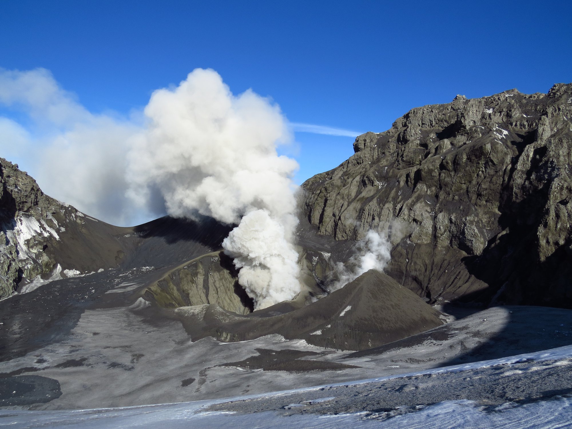
Thanks to the analysis of satellite images (Sentinel L2 A and Planet Scope in true color, in combination of thermal bands and others), no new deposit associated with ash falls around the active crater has been identified. Those associated with an activity occurring during the first half of October with a maximum range of 6 km remain. On October 17, the presence of a body of water in the El Agrio crater, adjacent to the active emission center, begins. It has an ellipsoidal shape and to date covers an area of 9300 m2. On the other hand, no radiation anomaly was detected in the infrared bands observed regularly during the last weeks thanks to the Sentinel 2 L2A images.
– From the geodetic data provided by the 3 GNSS stations which monitor the surface deformation of the volcano, no significant change linked to the internal activity of the volcanic system is detected. The trends observed during the previous period are maintained, with maximum average displacement rates below 0.1 cm / month.
– In addition, 4 anomalies were reported in the emissions of sulfur dioxide (SO2) in the atmosphere of the sector near the volcanic building during the period assessed according to data published by the Tropospheric Monitoring Instrument (TROPOMI) and Ozone Monitoring Instrument (IMO) Dioxide Group (http://so2.gsfc.nasa.gov/).
During the period, the activity of the Copahue volcano presented a slight decrease in monitoring parameters, represented by the absence of nocturnal incandescence, the cessation of particle emissions, the partial restoration of the crater lake and the low-energy seismic activity recording. , which suggests heat loss from the surface volcanic system. However, due to recent events recorded during the previous fortnight, where the activity was characterized by fluctuating behavior of the surface system, there is still the probability that the volcano could evolve in episodes with emissions of gases and particles. unexpectedly.
Consequently, the volcanic technical alert is maintained at the level: YELLOW TECHNICAL ALERT: Changes in the behavior of volcanic activity.
Observation: An impacted zone is considered to be that close to the active crater within a radius of 1000 m.
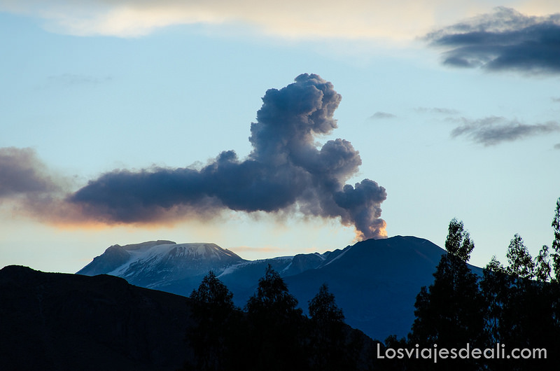
Source : Sernageomin.
Photos : Auteurs inconnus
Costa Rica , Rincon de la Vieja :
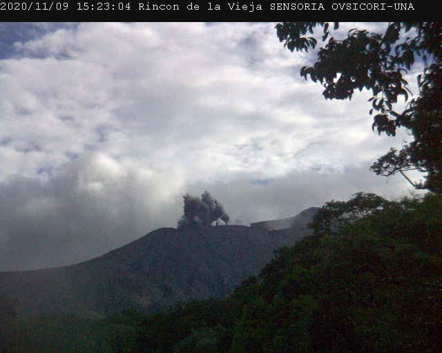
At the time of this report, the winds are blowing to the southwest.
The Rincón de la Vieja volcano continues to exhibit small to moderate hydrothermal eruptions. The largest eruption was recorded yesterday at 11:55 p.m. There is an intermittent background tremor. However, the eruptive activity of Rincón de la Vieja decreased in terms of the frequency of eruptions, but not in their amplitude. The number of daily LP type events and RSAM has also decreased. Geodetic monitoring shows a slight contraction of the summit of the volcano. No thermal anomaly was detected by the MODIS analysis.