November 07 , 2020.
Kamchatka , Klyuchevskoy :
VOLCANO OBSERVATORY NOTICE FOR AVIATION (VONA).
Issued: November 7 , 2020
Volcano: Klyuchevskoy (CAVW #300260)
Current aviation colour code: ORANGE
Previous aviation colour code: orange
Source: KVERT
Notice Number: 2020-205
Volcano Location: N 56 deg 3 min E 160 deg 38 min
Area: Kamchatka, Russia
Summit Elevation: 15580 ft (4750 m)
The lava flow continues to move along Apakhonchich chute on the southeastern volcanic flank.
Volcanic Activity Summary:
A moderate explosive-effusive eruption of the volcano continues. According to video and satellite data, gas-steam plume with some amount of ash extended for 36 km to the northeast of the volcano.
This eruption continues. Ash explosions up to 19,700-23,000 ft (6-7 km) a.s.l. could occur at any time. Ongoing activity could affect low-flying aircraft.
Volcanic cloud height:
18040-19024 ft (5500-5800 m) AMSL Time and method of ash plume/cloud height determination: 20201107/0420Z – Himawari-8
Other volcanic cloud information:
Distance of ash plume/cloud of the volcano: 22 mi (36 km)
Direction of drift of ash plume/cloud of the volcano: ENE / azimuth 76 deg
Time and method of ash plume/cloud determination: 20201107/0420Z – Himawari-8
Source : Kvert .
Photo : D. Bud’kov.
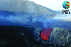
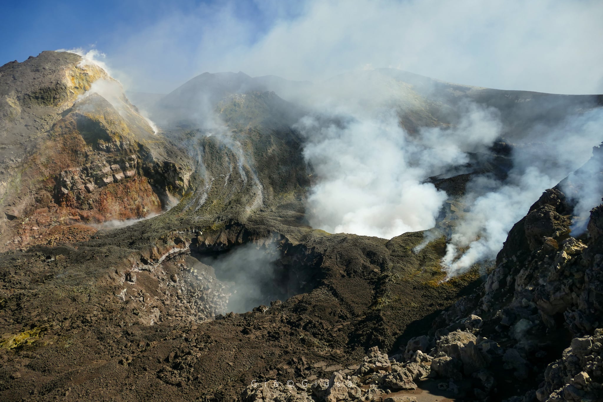
Italy / Sicily , Etna :
COMMUNICATION ON THE ACTIVITY OF ETNA [UPDATE n. 89], 06 November 2020 at 14:24 (13:24 UTC)
The National Institute of Geophysics and Volcanology, Osservatorio Etneo, announces that from yesterday, November 5, a Stromboli activity is observed in the crater of the Bocca Nuova. In particular, explosions occur from the pit crater formed in the western sector of the Bocca Nuova crater depression in early September. During an inspection this morning by INGV staff, it was observed that coarser materials are projected at heights beyond the edge of the pit crater, but do not fall back on the edges of the crater terrace. of the Bocca Nuova. The other pit crater formed at the center of the Bocca Nuova crater depression in April, is affected by degassing and collapse of materials from the vertical walls, which sometimes produce ash.
The average amplitude of the volcanic tremor did not show significant variations and indicates a stationary trend in the range of average values. The source is located in the New Southeast Crater (NSEC) area at an altitude between 2.8 and 3.0 km, above sea level. Even infrasound activity does not show significant variations. , with a fairly modest frequency of occurrence of events and a location of sources for the most part in the area of the NSEC crater and subordinate in that of the North-East crater. The signals from the soil deformation monitoring stations show only very small transients (less than the microadian) in some stations of the inclinometric network, coinciding with the most energetic events of last night’s seismic activity, which in any case did not change the trend of signals.
The high frequency GPS network has not seen any significant changes.
Source : INGV
Photo : Gio Giusa ( Bocca Nuova)
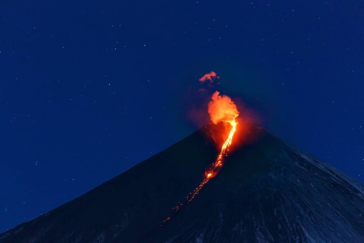
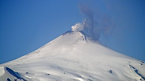
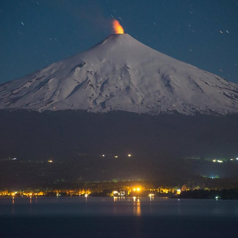
Chile / Argentina , Villarica :
Special Report on Volcanic Activity (REAV), La Araucanía region, Villarrica volcano, November 06, 2020, 08:20 local time (Continental Chile).
The National Service of Geology and Mines of Chile (Sernageomin), on the basis of information obtained through the monitoring equipment of the National Volcanic Surveillance Network (RNVV), processed and analyzed at the Volcanological Observatory of the Andes of the South ( Ovdas), and in relation to the activity of the Villarrica volcano, reports the following:
On Friday, November 6, between 7:57 a.m. and 8:08 a.m. local time (10:57 a.m. UTC), the IP cameras installed near the volcano recorded a pulsatile gas emission with input of particulate matter and without associated seismic signal.
The data obtained are as follows:
MAXIMUM HEIGHT OF THE COLUMN: 350 m with emission of particles.
DISPERSAL DIRECTION: North-West (NW)
The volcanic alert remains at the Yellow level.
For the period evaluated, the quantity and energy of the events associated with the movement of fluids inside the volcano (LP types) presented a very slight decrease compared to the previous period.
The continuous tremor signal exhibited minor variations, with a spectral content between 0.8 and 1.6 Hz.
It is evidenced that towards the end of the period, an increase in the frequency range of the continuous tremor signal up to 8 Hz.
When weather conditions permitted, it was possible to detect gaseous emissions above the crater level. Explosive events with the presence of particulate matter were also recorded, the maximum height of the columns recorded for these cases being 880 m, above the level of the crater.
During the period evaluated, it was possible to observe a nocturnal incandescence.
One (1) thermal anomaly was recorded with maximum values of 1 MW.
In turn, one (1) thermal alert was recorded on October 22, using Sentinel 2-L2A image processing.
CONCLUSIONS:
For the period evaluated, the recording of explosive activity continues with the addition of particulate matter. This activity, the most characteristic of recent months, has recorded the most important gas column heights of this year. Other parameters evaluated from data from the instrumental network were considered low for this volcano.
However, the recording of explosive activity and changes in the frequency content of the tremor signal could indicate a partial clogging of the volcanic duct, caused by a lower gas content in the magma column, and consequently a decrease of its temperature which results in the formation of a shell which acts as a partial plug. For this reason, as a greater volume of gas accumulates under this thin shell, overpressures are generated which would be the cause of the recorded surface explosions.
Due to the above, it is suggested that the system still has the ability to spontaneously generate activity with ballistic emissions that would affect the area near the crater. Although at the same time, a larger and untimely escalation of current levels of volcanic activity cannot be excluded.
It should be noted that the behavior of the lava lake is fluctuating and that it continues to be located near the surface, causing minor explosions that can affect the vicinity of the crater.
Source : Sernageomin , Segemar .
Photos : Segemar , Martini Fotografía .
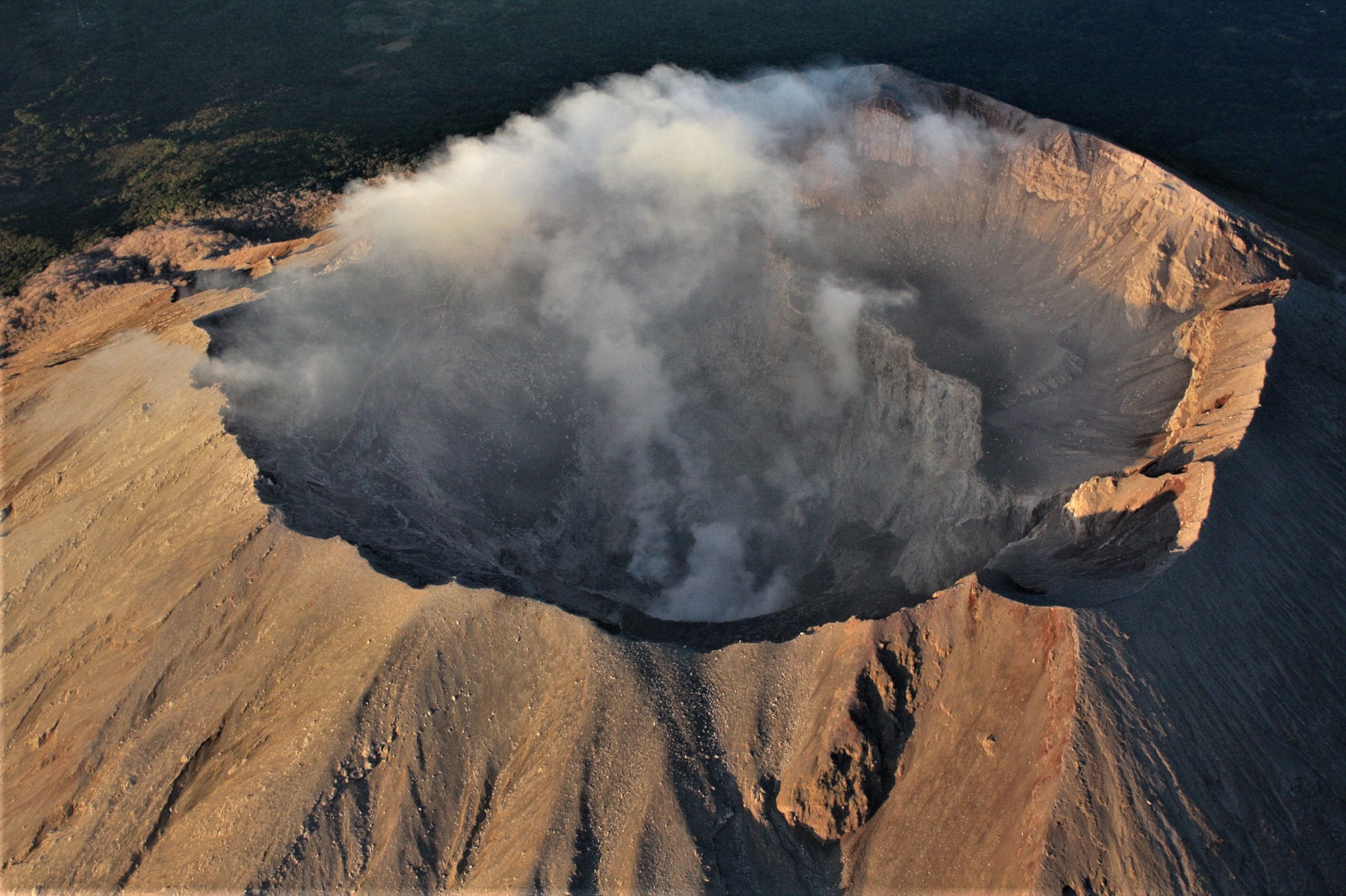
El Salvador , San Miguel ( Chaparrastique) :
Location: San Miguel department
Altitude: 2130 meters above sea level
Type of volcano: Stratovolcano
Type of activity: Strombolian-Vulcanian
Last significant eruption: December 29, 2013
In October, the seismic vibration of the San Miguel volcano continued to fluctuate between 36 and 58 RSAM units, on average per day, when the threshold was 150 units. No earthquake was perceived by the population living in the area of the volcano. In conclusion, the volcano continues to present a low level of activity, although sporadically, it presents small pulses of gas and vapors through its central crater, without exceeding 200 meters in height.
Sulfur dioxide (SO2) emissions have fluctuated between 39 and 326 tonnes / d, with an average of 143 tonnes / d, a value below the threshold of 620 tonnes / d, indicating that no magma injection has occurred again in the volcanic system. Thus, the volcano continues to be in equilibrium. However, it is not excluded that a new magmatic ascent may occur and the activity of the volcano suddenly changes, as has happened on previous dates, so it is suggested to mountaineers and, to the population in general, to avoid visiting the crater.
Source et photo : Marn .
Guadeloupe , La Soufrière :
Friday November 6, 2020 at 9:30 p.m.
Sequence of earthquakes in the La Soufrière area of Guadeloupe – Basse Terre.
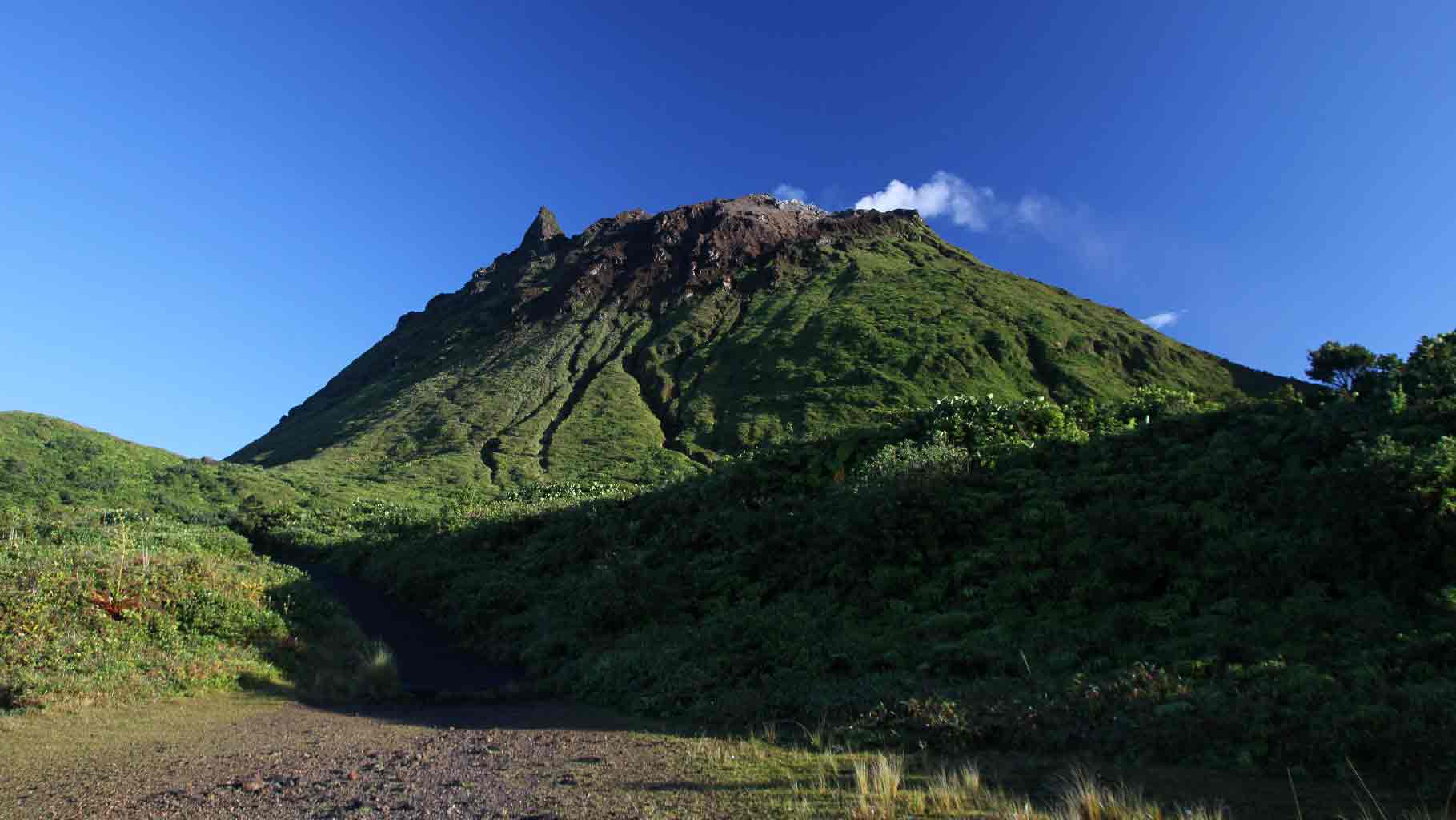
A sequence of volcanic earthquakes began on Friday, November 6, 2020 at 1:30 a.m. local time (Friday, November 6, 2020 5:30 a.m. UT *) in the La Soufrière volcano area. As of November 6, 2020 at 9:30 p.m. local, the OVSG-IPGP networks recorded 58 earthquakes of very low magnitude (M <1). No earthquakes were reported felt. The events are located at a depth of <2.5 km below the top of the dome of La Soufrière.
The alert level remains: yellow, vigilance.
Source : Direction de l’OVSG-IPGP.
Photo : aide-voyage.com