September 29 , 2020.
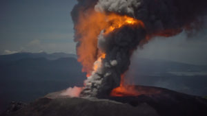
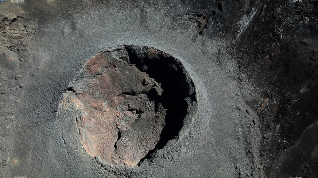
La Réunion , Piton de la Fournaise :
Activity bulletin for Monday, September 28, 2020 at 12:30 p.m. (local time)
Recommended alert level: Alert 1
Since 12:04 local time, a seismic crisis has been recorded on the instruments of the Volcanological Observatory of Piton de la Fournaise. This seismic crisis is accompanied by rapid deformation. This indicates that the magma is leaving the magma reservoir and is spreading towards the surface. An eruption is likely shortly within the next few minutes or hours.
Additional information will follow concerning the sector impacted by this magmatic propagation towards the surface.
Consequently, public access to the upper part of the Piton de la Fournaise enclosure, whether from the Pas de Bellecombe path or from any other path, is prohibited. It is recalled that landing aircraft in the volcano area is regulated and subject to authorization from the Prefecture. The national gendarmerie and the national forestry office have been tasked with ensuring the application of these security measures at the site.
The volcano had started to tremble again on September 20, where a succession of earthquakes had been observed.
Activity bulletin for Monday, September 28, 2020 at 9:30 p.m. (local time)
Recommended alert level: Alert 1
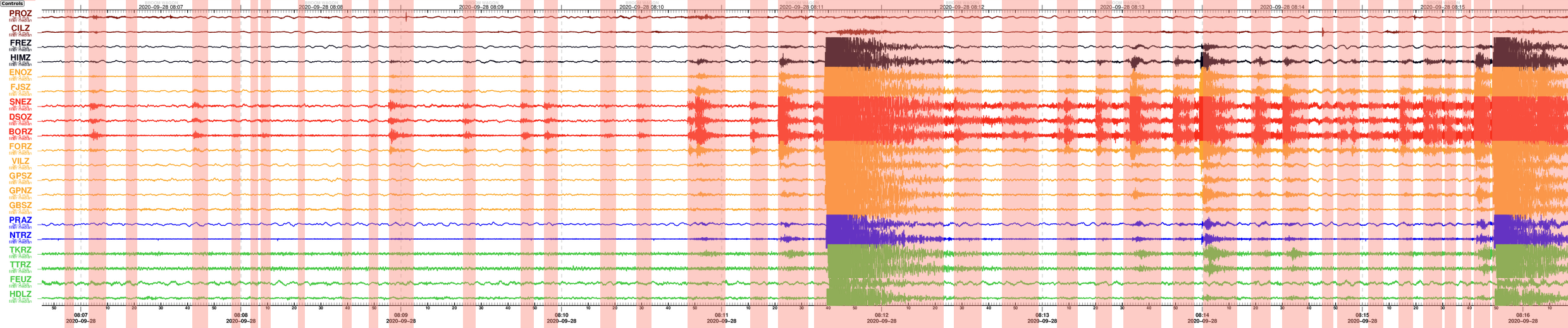
The seismic crisis that began at 12:04 local time continues. Between 12:04 p.m. and 9:30 p.m., more than 1,300 earthquakes were recorded by the OVPF. This seismicity is localized under the summit zone and under the eastern flank (between 1.6 and 5.2 km deep).

Figure 1: Location map (epicenters) and north-south and east-west sections (showing the location in depth, hypocenters) of the earthquakes recorded and located by the OVPF-IPGP on 09/28/2020 under the Piton de the furnace. Only localizable earthquakes have been shown on the map (© OVPF-IPGP).
The seismicity and the source of the deformations show a migration of the magma in depth towards the eastern flank of the volcano (Figures 1 and 2).
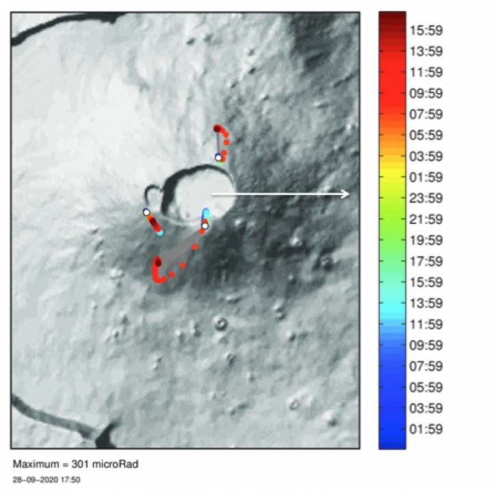
Figure 2: Slope variations (in microradians) recorded on the OVPF inclinometric network on 09/28/2020. The colored bar represents the time during the day. (© OVPF-IPGP).
Note that at Piton de la Fournaise the longer the seismic crises, the more the eruptive cracks open at low altitude. Therefore the opening of eruptive cracks at low altitude is not excluded.
Source et photos : OVPF. IPR .
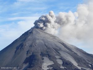
Peru , Sabancaya :
Analysis period: September 21-27, 2020, Arequipa, September 28, 2020.
Alert level: ORANGE
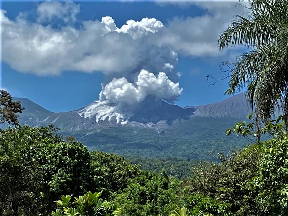
The Geophysical Institute of Peru (IGP) reports that the eruptive activity of the Sabancaya volcano remains at moderate levels; that is, with the continuous recording of explosions with columns of ash and gas that rise up to 2.5 km above the summit of the volcano. Therefore, for the following days, no significant change is expected regarding its eruptive activity.
During this period, the IGP recorded and analyzed the occurrence of 2239 earthquakes of volcanic origin associated with the circulation of magmatic fluids under the Sabancaya. On average, 36 low to medium intensity explosions were recorded daily. Likewise, volcano-tectonic (VT) earthquakes occurred with magnitudes between M1.4 and M3.0 and were mainly located in the Northeast and Southeast of Sabancaya. The representative earthquake (M3.0) was recorded on September 25 at 12:43 p.m., 15 km south-east of Sabancaya and 14 km deep.

The monitoring of the deformation of the volcanic structure, using GNSS equipment (processed with fast orbits), recorded a slight inflation in the south-eastern sector of the Sabancaya volcano and to the north of the Hualca Hualca volcano. Visual surveillance identified columns of gas and ash up to 2.5 km in height, which were scattered towards the South-East, East, South-West, West and North-East sectors of Sabancaya. On September 24, in the morning, an ash dispersion alert was issued via the Volcanes Perú mobile application due to the significant ash dispersion that covered the districts of Huanca and Lluta. Finally, satellite monitoring made it possible to identify the presence of 11 thermal anomalies with values between 1 MW and 49 MW, associated with the presence of a lava body (dome) on the surface of the volcano’s crater.
RECOMMENDATIONS
• Maintain the orange volcanic alert level.
Source : IGP.
Photo : Andina.
Costa Rica , Turrialba / Poas / Rincon de la Vieja :
Daily report of the state of volcanoes. OVSICORI-UNA, Date: September 28, 2020, Updated at: 10:58:00.
Turrialba volcano:
No eruption is reported.
Seismic activity is similar compared to yesterday.
At the time of this report, the winds are blowing west.

There is no change on the Turrialba volcano; the seismicity was maintained with volcanic earthquakes of low frequency and low amplitude, no explosion or volcanic tremor is recorded. Gas emissions remain stable with low concentrations and no appreciable deformation of the volcanic building is observed.
Poas volcano:
No eruption is reported.
Seismic activity is similar compared to yesterday.
At the time of this report, the winds are blowing west.

The activity of the Poás volcano remains stable at a low level. Seismicity is still dominated by low-frequency, low-amplitude volcanic earthquakes. Short duration and low amplitude tremors are sometimes recorded. Gas concentrations remain stable at a low level, as does the deformation of the volcanic building.
Rincon de la Vieja volcano:
No eruption is reported.
Seismic activity is similar compared to yesterday.
At the time of this report, the winds are blowing to the southwest.
The activity of the Rincón de la Vieja volcano continues. The last eruption was recorded yesterday, September 27, 2020, at midnight. Seismicity shows frequent volcanic tremors of short duration and low amplitude. The deformation of the volcanic building remains stable.
Source : Ovsicori .
Photos : RSN , Ovsicori , CNE .
Peru , Ubinas :
Analysis period: September 21-27, 2020, Arequipa, September 28, 2020
Alert level: YELLOW
The Geophysical Institute of Peru (IGP) reports that the Ubinas volcano (Moquegua region) continued to record a slight increase in seismic activity during the analysis period; therefore, it is suggested that the authorities and the public be informed of the bulletins published by the IGP.
During the analysis period, the occurrence of 36 Volcano-Tectonic (VT) earthquakes with magnitudes below M1.7 was identified, associated with rock breaking processes that occur at the inside the volcano. On average, 5 earthquakes were recorded per day. Likewise, 23 seismic signals have been recorded, associated with the movements of volcanic fluids (gas and water vapor).
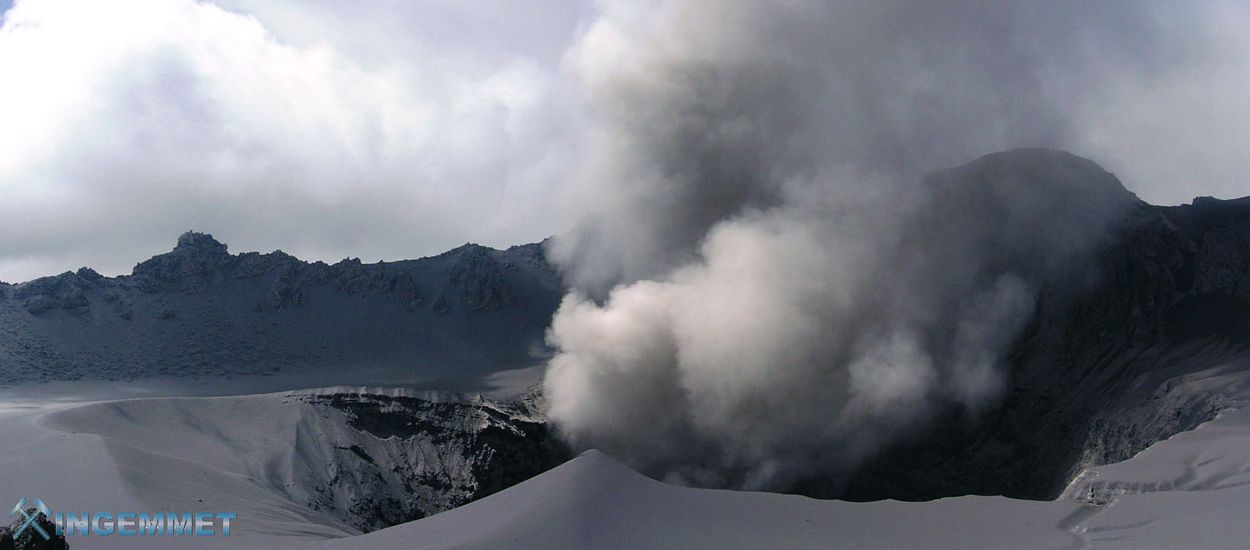
Surveillance cameras recorded columns of gas and water vapor that reached heights of up to 500 m above the summit of the volcano. These emissions were dispersed towards the northeast sector of the volcano.
Monitoring the deformation of the volcanic structure, using GNSS equipment (processed with fast orbits) does not show levels of deformation of the volcano. Satellite surveillance, carried out through the SENTINEL, OMI-NASA (SO2 gas) and MIROVA (thermal anomalies) systems, does not record any anomalies.
Source : IGP.
Photo : ingemmet