
October 28 , 2019.
La Réunion , Piton de la Fournaise :
Activity Bulletin from Sunday, October 27, 2019 to 12:00 (local time).
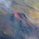
The eruptive activity that began on October 25, 2019 at Piton de la Fournaise at 2:40 pm local time continues.
After a gradual decline since the beginning of the eruption, the intensity of the tremor (indicator of the intensity of the eruption) shows signs of fluctuation since 2:45 local time (22:45 UTC) today (Figure 1). The phases of increase and decrease are to be related to the construction / dismantling of the volcanic cone that has formed, by accumulation of lava fountain products, at the level of the eruptive vent and which increases / decreases the pressure at the exit point of the lava and thus affects the intensity of the seismic noise (Figure 2).
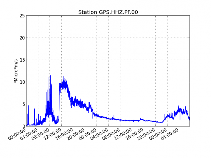
Figure 1: Evolution of the RSAM (indicator of the volcanic tremor and the intensity of the eruption) between 04:00 (00:00 UTC) on October 25 and October 27 at 11:45 (07:15 UTC) on the nearest GPS seismic station of the eruptive site (© OVPF / IPGP).
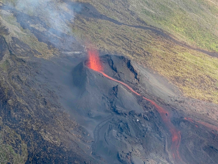
Figure 2: Shooting of the eruptive site around 8am (local time) (© OVPF / IPGP)
The observations made on site this morning by a team from the observatory show that:
– the eruptive activity at the level of the eruptive site located at 1050 m of altitude is weak. The height of the lava projections is less than 20 m, and the cone that has been built is about ten meters high. This morning at 8am (local time), only one active flow was present and discharged over a distance of less than 200m from the eruptive cone (Figures 2 and 3),
– The flow front closest to the RN2 was frozen and was no longer progressing. It was this morning at 8am (local time) still about 250m from the RN2 (Figures 4 and 5).
– The flows arm that bypassed the Piton Tremblet from the south at the end of yesterday was also frozen (Figure 6).
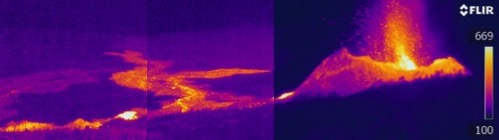
Figure 3: Thermal imaging of the eruptive site at 8am (local time) (© OVPF / IPGP).
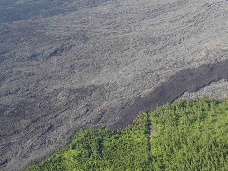
Figure 4: Shooting of the flow front at 8am (local time) (© OVPF / IPGP).
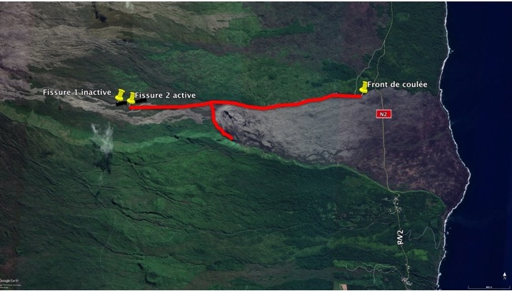
Figure 5: Location of the flow front on 27/10/2019 at 8am (local time) (© OVPF / IPGP).
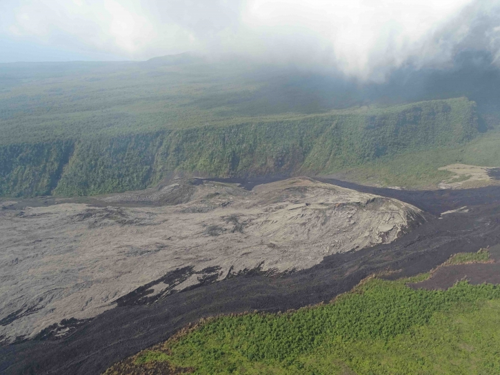
Figure 6: Piton Tremblet sector shooting at 8:00 am (local time) (© OVPF / IPGP).
On the day of October 26, 29 superficial volcanic-tectonic earthquakes were recorded.
After the strong deformations related to the magma transfer to the surface that occurred on October 25, 2019, no particular deformation signal is recorded.
The surface flows estimated from the satellite data, via the HOTVOLC platform (OPGC – Clermont Auvergne University) were included in the last 24 hours between <1 and 10 m3 / s (these measurements can be largely affected / reduced by the cloud cover) with a downward trend over the last 24 hours.
Activity Bulletin from Sunday, October 27, 2019 to 17:00 (local time).
The eruptive activity started on October 25, 2019 at 2:40 pm local time stopped today, October 27, 2019 at 16:30 local time, after a phase of activity in « gas piston » of about 1 hour.
No assumptions are made about the evolution of the future situation (final shutdown, resumption of activity on the same site, resumption of activity further downstream), given the following observations:
– 29 superficial superficial volcano-tectonic earthquakes were recorded during the day yesterday,
– « Piston gases » are always registered,
– very little lava was emitted on the surface.
Source : OVPF.
Read the full article : http://www.ipgp.fr/fr/ovpf/bulletin-dactivite-dimanche-27-octobre-2019-a-12h00-heure-locale
http://www.ipgp.fr/fr/ovpf/bulletin-dactivite-dimanche-27-octobre-2019-a-17h00-heure-locale
Vidéo : Lé Bon La Réunion.
Hawaii , Kilauea :
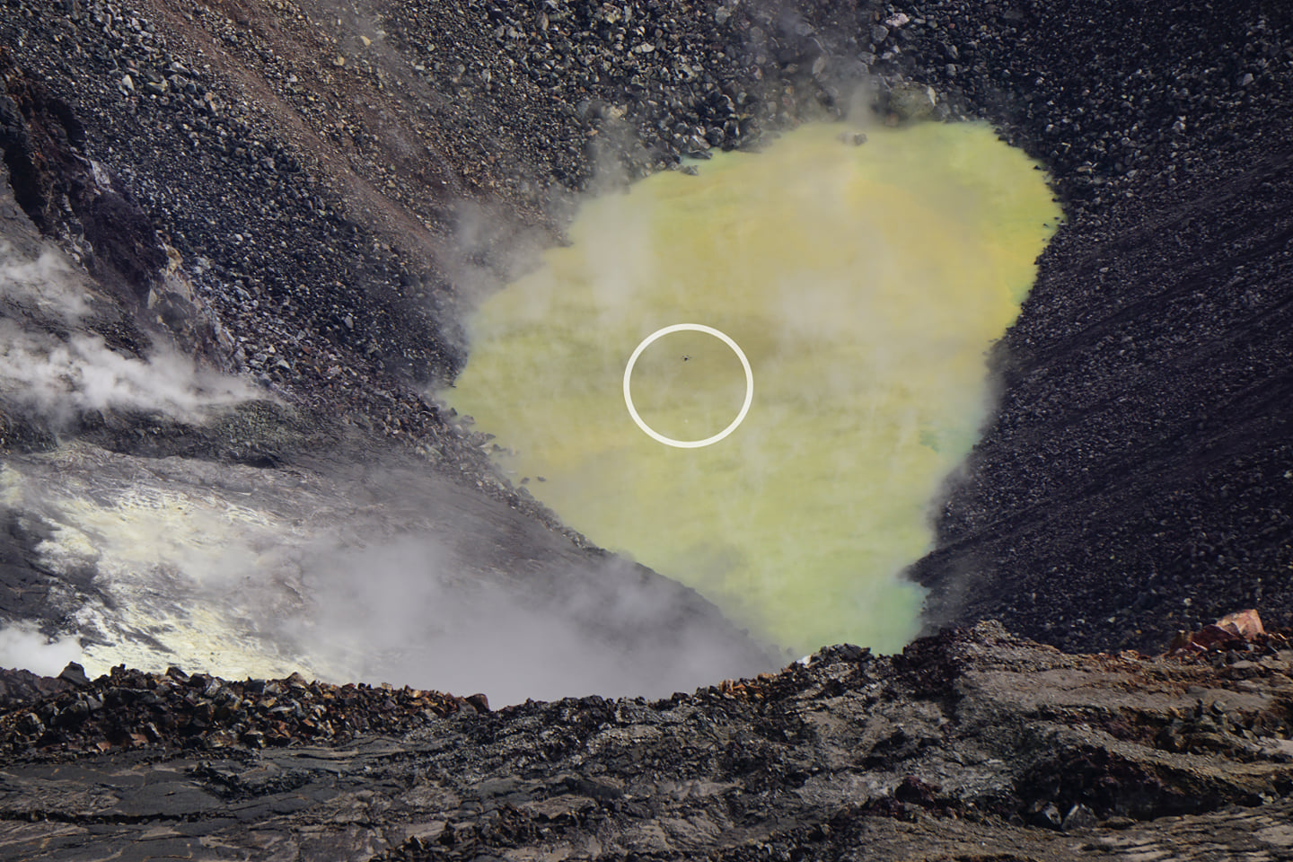
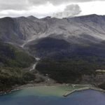
On October 26, our colleagues at the USGS Hawaiian Volcano Observatory took the next step in unlocking the secrets of this body of water. They launched a specialized unmanned aircraft system, UAS, that gathered photographs, gas measurements and a water sample from its scalding hot surface. Once the data is analyzed, USGS will announce its findings
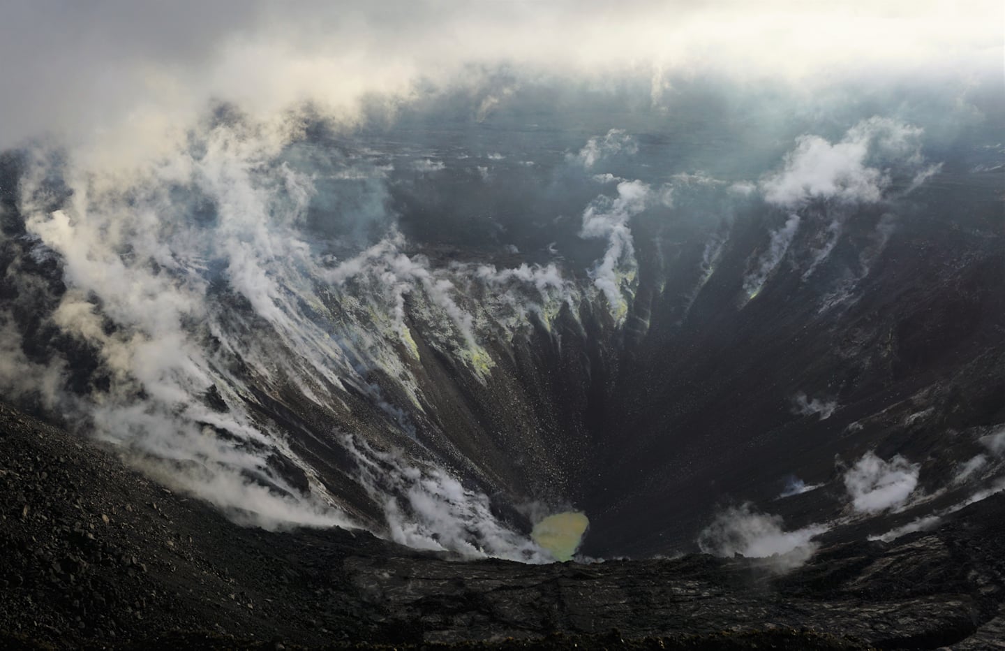
The lake is now the size of a football field, about 110 meters long (360 feet) by 50 meters wide (164 feet) and about 10 meters (33 feet) deep, rising in the bottom of the former Halema‘uma‘u Crater, about 600 meters (1,969 feet) below the western caldera rim. The water pond at the bottom of the crater was about 70 degrees Celsius (158 degrees Fahrenheit).
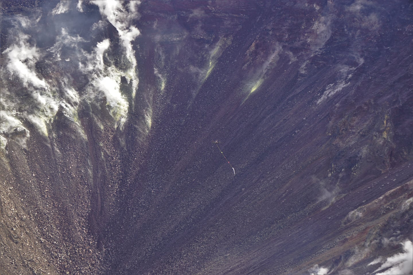
Using a UAS is the safest way to gather this groundbreaking research. Although scientists are confident the lake is the rising water table known to exist within Kīlauea, never before in modern history has there been water visible at the summit of Kīlauea in the form of a lake. USGS performed its innovative mission with support and approval from Hawai‘i Volcanoes National Park.
Kīlauea Activity Summary:
Kīlauea Volcano is not erupting. Monitoring data continue to show steady rates of seismicity and ground deformation, low rates of sulfur dioxide emission, and only minor geologic changes since the end of eruptive activity in September 2018. Water continues to pond at the bottom of Halema’uma’u inside the summit caldera.
Source : Hawai’i Volcanoes National Park
Photo: NPS /A. LaValle.
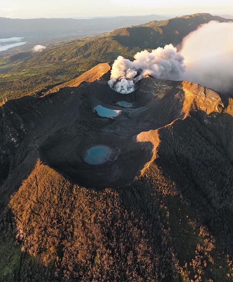
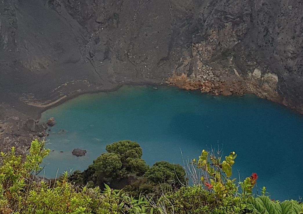
Costa Rica , Turrialba / Poas / Rincon de la Vieja / Irazú :
Daily report of the state of volcanoes. Date: October 27, 2019. Updated at: 12:25:00.
Turrialba Volcano:
No eruption is reported.
The seismic activity is similar to that of yesterday.
At the time of this report, the winds blow from the northwest.
The seismographs continue to record long-period LP-type seismic signals related to the transport of fluids in the volcano (water, steam, gas). The Turrialba MultiGAS gas monitoring station detects very low concentrations of SO2, just 0.1 ppm. NASA’s IMO-AURA satellite barely detected SO2 emissions from the Turrialba volcano in anything that happened in October 2019.
Poas Volcano:
No eruption is reported.
The seismic activity is similar to that of yesterday.
At the time of this report, winds are blowing from the south.

Seismographs record long-period LP-type earthquakes and bottom-up volcanic tremors related to the movement of fluids in the volcano (water, vapor, gas). During the last 24 hours, the MultiGAS monitoring station located to the west of the crater detected a maximum of 6 ppm traces of SO2 and H2S (H2S / SO2 = 0.21). On the other hand, the ExpoGAS gas monitoring sensor located at El Mirador for visitors to the south of the crater recorded between 0.2 and 7 ppm of SO2 during the morning. IMO instruments from NASA’s AURA satellite have detected between 2 and 200 tonnes of SO2 emitted by the Poás volcano.
Rincon de la Vieja Volcano:
No eruption is reported.
The seismic activity is lower than yesterday.
At the time of this report, the winds are blowing west.

Seismographs record low seismic activity on the volcano, with long-lived, sporadic LP-type earthquakes associated with fluid motions and fumarole activity.
Irazu Volcano:
No eruption is reported.
The seismic activity is lower than yesterday.
At the time of this report, the winds blow from the northeast.
The seismographs recorded less seismic activity compared to October 26 at 3:40 am, when VT type volcano-tectonic seismic signals associated with a slip on the northwest flank of the volcano were recorded. Saturday, October 26 around noon, the MSc. Jose Pablo Sibaja Brenes of the Laboratory of Atmospheric Chemistry of the School of Chemistry of the National University recognized, photographed and informed the OVSICORI-UNA of the observation of several new small landslides in the main crater, on the walls interior of the east flank of the volcano.
Source : Ovsicori .
Photos : jcarvaja17 , RSN , RSN , Federico Chavarría-Kopper – Ovsicori.
Philippines , Taal :
TAAL VOLCANO BULLETIN 28 October 2019 8:00 A.M.
Taal Volcano’s seismic monitoring network recorded fifty-nine (59) volcanic earthquakes during the 24-hour observation period. Field measurements on 24 October 2019 at the eastern sector of the Main Crater Lake yielded an increase in water temperature from 32.8°C to 33.0°C, a decrease in water level from 0.48 meters to 0.46 meters and a decrease in acidity from a pH of 2.85 to 2.93. Ground deformation measurements through precise leveling surveys from 19 – 26 September 2019 indicated inflation of the edifice consistent with recent results from continuous GPS data.
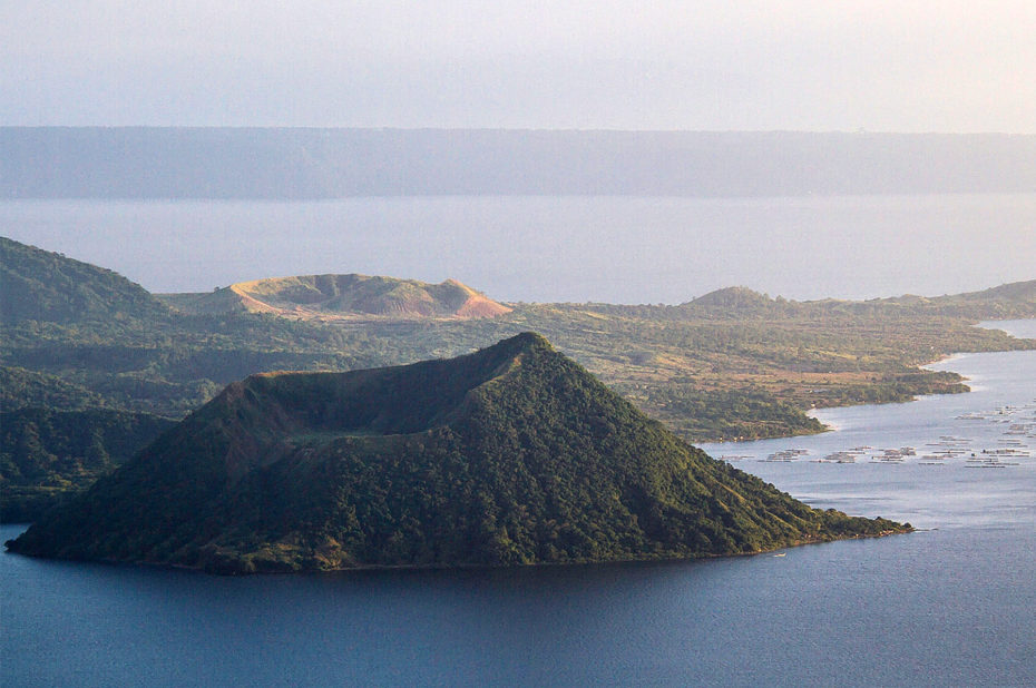
Alert Level 1 remains in effect over Taal Volcano. This means that hazardous eruption is not imminent. The public, however, is reminded that the Main Crater should be strictly off-limits because sudden steam explosions may occur and high concentrations of toxic gases may accumulate. The northern portion of the Main Crater rim, in the vicinity of Daang Kastila Trail, may also become hazardous when steam emission along existing fissures suddenly increases. Furthermore, the public is also reminded that the entire Volcano Island is a Permanent Danger Zone (PDZ), and permanent settlement in the island is strongly not recommended.
Source : Phivolcs .
Photo : Topexpos Voyages


No comment yet, add your voice below!