April 23 , 2024.
Indonesia , Lewotobi Laki-laki :
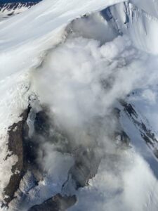
An eruption of Mount Lewotobi Laki-laki occurred on Tuesday, April 23, 2024 at 06:47 WITA with the height of the ash column observed at ±100 m above the summit (±1684 m above sea level ). The ash column was observed to be white to gray in color with moderate to thick intensity, oriented towards the South-West. This eruption was recorded on a seismograph with a maximum amplitude of 2.9 mm and a duration of 45 seconds.

Observation of seismicity:
2 eruption/explosion earthquakes with an amplitude of 1.4 to 2.9 mm and an earthquake duration of 161 to 176 seconds.
2 emission earthquakes with an amplitude of 1.4 to 2.2 mm and duration of the earthquake of 30 to 70 seconds.
9 harmonic tremors with an amplitude of 1.4 to 2.2 mm and an earthquake duration of 121 to 413 seconds.
5 non-harmonic tremors with an amplitude of 1.4 to 2.2 mm and an earthquake duration of 86 to 183 seconds.
1 Low frequency earthquake with an amplitude of 4.4 mm and an earthquake duration of 53 seconds.
2 hybrid/multi-phase earthquakes with an amplitude of 1.4 to 2.2 mm, and an earthquake duration of 17 to 19 seconds.
2 deep tectonic earthquakes with an amplitude of 2.9 to 4.4 mm, and duration of the earthquake 47 to 242 seconds.
RECOMMENDATION
1. Communities around Mount Lewotobi Laki-laki and visitors/tourists do not carry out any activities within a radius of 2 km around the center of the eruption of Mount Lewotobi Laki-laki and within a sector of 3 km in the direction North-North-East and 5 km in the direction of the North-East Sector.
2. The public should remain calm and follow the instructions of the regional government and not believe rumors whose origin is unclear.
Source et photo : Magma Indonésie.
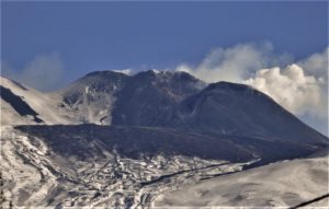
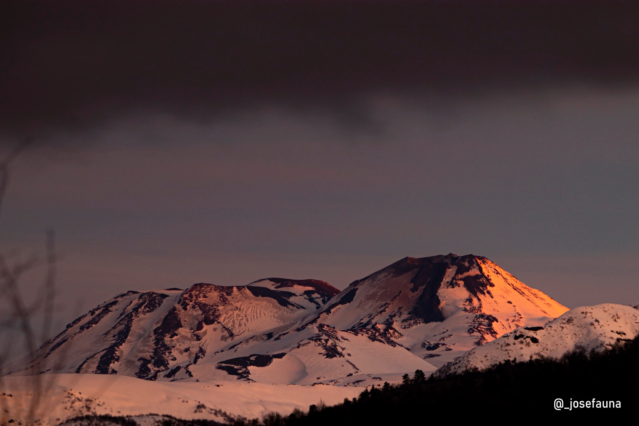
Chile , Nevados de Chillan :
Seismology
The seismological activity of the period was characterized by the recording of:
115 seismic events of type VT, associated with the fracturing of rocks (Volcano-Tectonics). The most energetic earthquake had a Local Magnitude (ML) value equal to 2.3, located 4.8 km East-South-East of the volcanic building, at a depth of 3.5 km in reference to the crater .
12 LP type seismic events, associated with fluid dynamics inside the volcanic system (Long Period). The size of the largest earthquake evaluated from the Reduced Displacement (RD) parameter was equal to 22.2 cm2.
Fluid Geochemistry
Data on sulfur dioxide (SO2) emissions obtained by the differential optical absorption spectroscopy (DOAS) equipment, corresponding to the Chillán station, installed 1.5 km in the South-South-East (SSE) direction ) of the active crater, presented an average value of 520 ± 107 t/d, with a maximum daily value of 1210 t/d on March 12, associated with high wind speeds.
Thermal anomalies by satellites
During the period, no thermal alerts were recorded in the area associated with the volcanic complex, according to the analytical processing of Sentinel 2-L2A satellite images, in combination of false color bands.
Geodesy
Data recorded by 5 GNSS stations, which make it possible to measure the deformation of the volcanic complex, show that the positions have remained stable in recent months, observing in some of them an annual cyclical trend with an amplitude not exceeding 2 cm. Vertical positions show slightly negative trends, with rates of change below 0.2 cm/month, while horizontal positions remain below 0.4 cm/month. In conclusion, there is no evidence of deformation of the volcanic system for the period evaluated.
Surveillance cameras
The images provided by the fixed camera, installed near the complex, recorded regular degassing, with a maximum column height of 140 m on March 7.
Activity remained at levels considered low, suggesting stability of the volcanic system.
The technical volcanic alert is maintained in:
GREEN TECHNICAL ALERT: Active volcano with stable behavior – There is no immediate risk
Observation: a potential volcanic danger zone is considered close to the active crater with a radius of 500 meters
Source : Sernageomin
Photo : Josefauna ( archive).
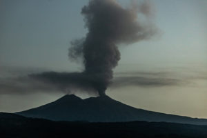
Colombia , Galeras :
Weekly activity bulletin: Galeras Volcano
Regarding the monitoring of the activity of the GALERAS VOLCANO, the MINISTRY OF MINES AND ENERGY, through the COLOMBIAN GEOLOGICAL SERVICE (SGC), reports that:
During the period April 9-15, 2024, seismic activity, in terms of occurrence and energy released, maintained fluctuating levels similar to those reported in previous weeks. The predominance of events linked to rock fracture, seismicity localized mainly at shallow depths and near the volcanic crater, continued. The most energetic earthquake was located towards the North-West sector, 4 km from the active cone, with a depth of 9 km compared to the summit (4,200 m altitude) and a magnitude of 2.

Throughout the week, small gas emissions were observed, mainly from the fumarole fields of Las Chavas, to the west, El Paisita, to the north of the crater, and the active cone, with white columns of gas, with variable height and dispersion due to the action of the winds. Other volcanic monitoring areas showed stability in their recordings.
Volcanic activity remains in a YELLOW ALERT state: Active volcano with changes in the behavior of the base level of monitored parameters and other manifestations.
Source et photo : Sernageomin
Hawaii , Kilauea :
Monday, April 22, 2024, 8:43 AM HST (Monday, April 22, 2024, 18:43 UTC)
19°25’16 » N 155°17’13 » W,
Summit Elevation 4091 ft (1247 m)
Current Volcano Alert Level: ADVISORY
Current Aviation Color Code: YELLOW
Activity Summary:
Kīlauea volcano is not erupting. Increased seismicity over the past three weeks, indicates heightened activity. Updates will be provided daily while at a heightened state of unrest.
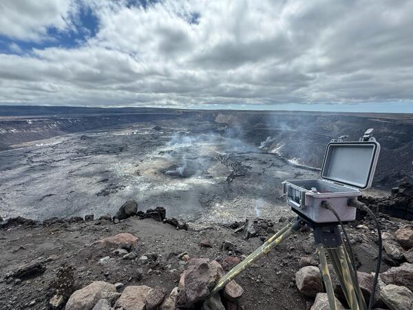
HVO geologists serviced the KWcam webcam, at the summit of Kīlauea.
Summit Observations:
Earthquake activity has been increasing over the past three weeks beneath the summit of Kīlauea. Activity has alternated between typical shallow, 0.5-2.5 miles (1-4 km) earthquakes beneath the south caldera region and 3-6 miles (5-10 km) deep earthquakes directly beneath Kīlauea caldera. While daily rates of seismicity have decreased following the deep earthquake swarm observed Friday evening, they remain elevated. Occasional short-lived bursts (10-30 minutes) of low frequency earthquakes continue to indicate movement of magma in the subsurface.
Kīlaueaʻs summit remains inflated, but recent ground deformation remains low with tiltmeters near Sand Hill and Uēkahuna showing no significant changes in the past day. Sulfur dioxide (SO2) gas emission rates have remained low since October 2023. An SO2 emission rate of approximately 96 tonnes per day was recorded on April 8.
Rift Zone Observations:
Seismicity in Kīlauea’s upper East Rift Zone and Southwest Rift Zone remain low. No unusual activity has been noted along the middle and lower sections of Kīlauea’s East Rift Zone. We continue to closely monitor both rift zones.
Source : HVO
Photo : USGS / M. Patrick.
Ecuador , Reventador :
DAILY REPORT ON THE STATE OF THE REVENTADOR VOLCANO, Monday April 22, 2024.
Information Geophysical Institute – EPN.
Surface activity level: Moderate, Surface trend: No changes
Internal activity level: Moderate, Internal trend: No changes
Seismicity: From April 21, 2024, 11:00 a.m. to April 22, 2024, 11:00 a.m.:
Seismicity:
Due to problems in the electrical energy service, it was not possible to count the volcanic events of the last 24 hours.
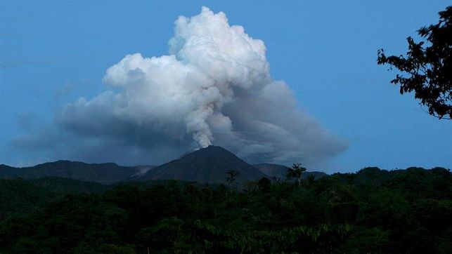
Precipitation/Lahars:
No rain was recorded in the volcano area. **In the event of heavy rains, these could remobilize the accumulated materials, generating mud and debris flows which would descend the sides of the volcano and flow into adjacent rivers.
Emissions/ash column:
Due to the climatic conditions of the area, it was not possible to record gas or ash emissions using the surveillance camera system and satellite images. The Washington VAAC agency also did not report gas and ash emissions.
Observation: Yesterday afternoon, at the time of this report, through satellite imagery, the volcano was recorded as completely cloudy.
Alert level: Yellow.
Source : IGEPN.
Photo : EDIIMA (archive).