June 26 , 2019.
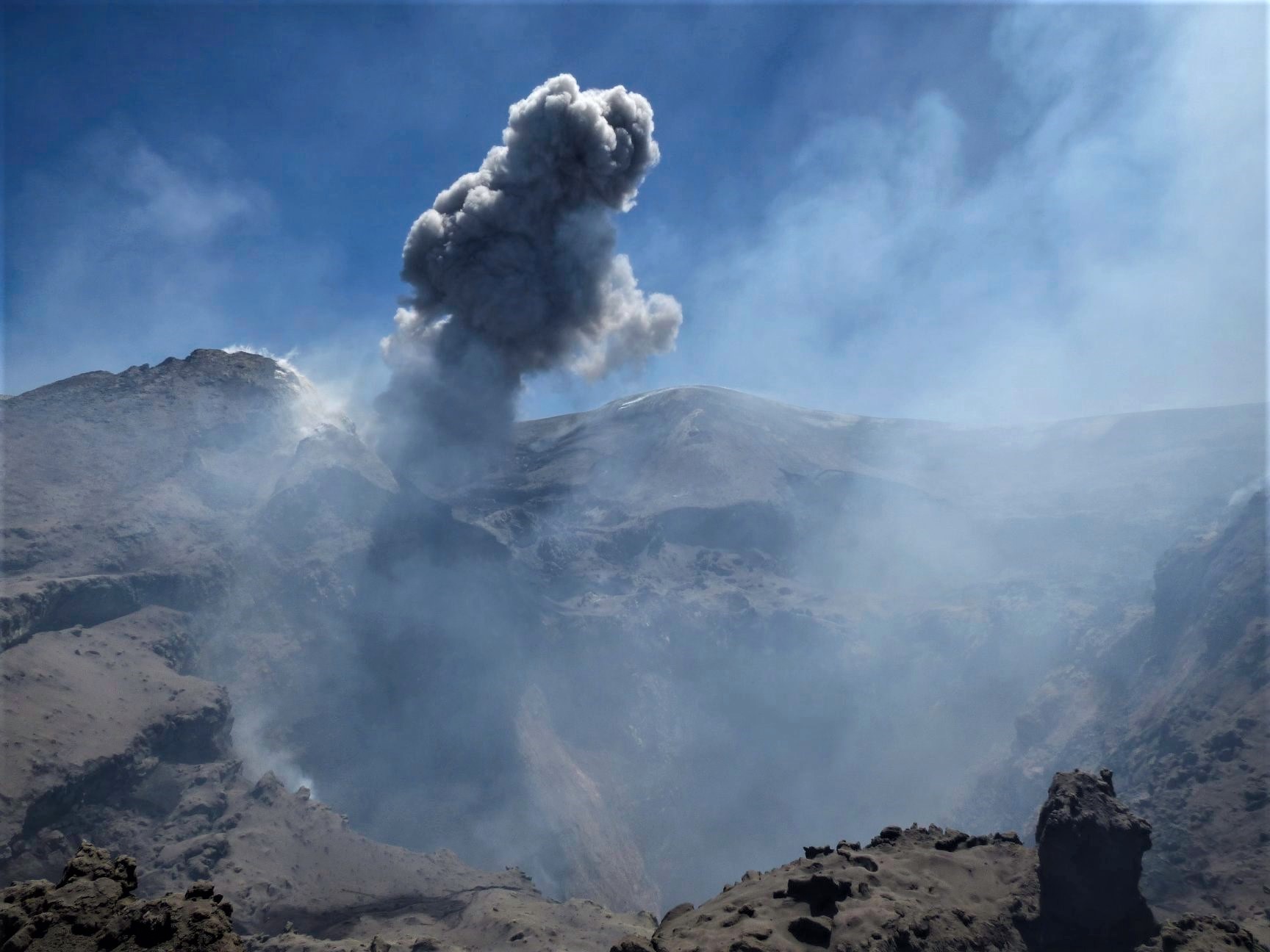
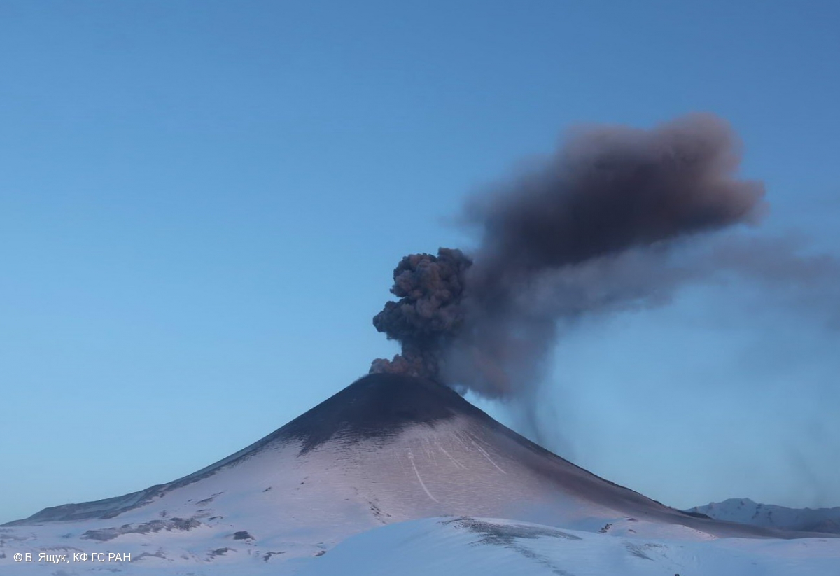
Italy , Stromboli :
VOLCANIC ACTIVITY COMMUNICATION of June 26 , 2019, 00:17:06 (UTC) – STROMBOLI.
The National Institute of Geophysics and Volcanology, Osservatorio Etneo, reports that a major explosion has occurred at Stromboli.
At 23.03.09 GMT a major explosion (https://ingvvulcani.wordpress.com/…/stromboli-e-le-sue-esp…/) occurred, involving the central-southern area of the terrace of the Stromboli craters. Video recorded by the surveillance cameras show pyroclastic material has fallen onto the Sciara del Fuoco and inside the crater terrace with blocks that have even surpassed its edge. The seismic signal associated with the event lasted about 4 minutes.
After this major explosion, no further major explosive events were observed. The seismic tracing returned to the levels prior to the explosion, and a normal Strombolian activity is visible from the surveillance cameras.
Source : INGV Vulcani.
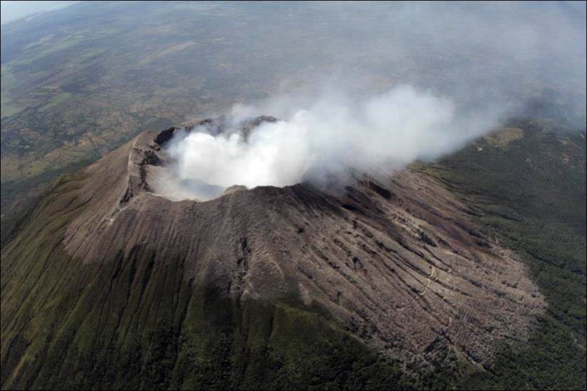
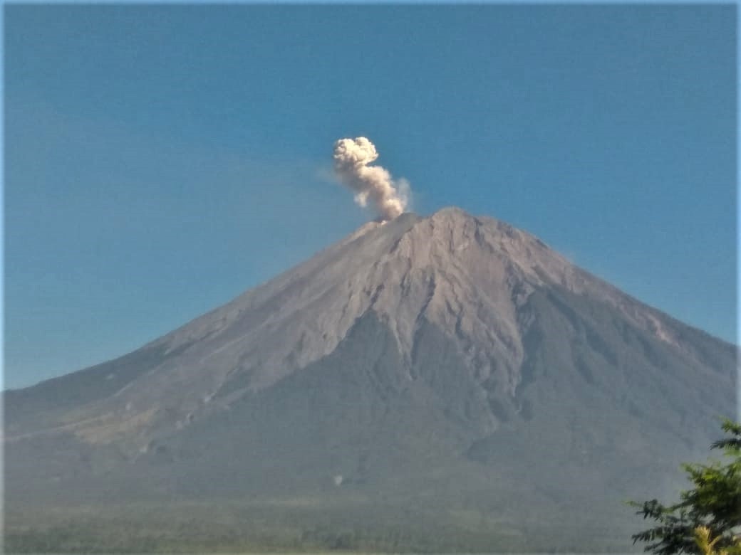
El Salvador , San Miguel ( Chaparrastique ) :
Special file 1 Evolution of the activity of the Chaparrastique volcano.
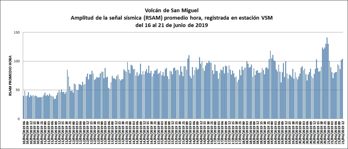
The periodic presence of micro-earthquakes, combined with an increase in seismic vibrations and the outgassing of the Chaparrastique volcano, shows a significant increase in activity since June 10 of this year. The signals obtained from the network of seismic stations monitoring the volcano recorded several periods of seismic vibration with amplitudes of up to 141 RSAM units per hour.
In the last few hours, the seismic vibration of the San Miguel volcano has fluctuated between 71 and 141 RSAM average hourly units. These are prolonged seismic signals related to changes in fluid pressure in the volcanic building, indicators of a clogged channel and greater activity of the Chaparrastique volcano.
Evolution of the internal pressure of the volcano since Monday, June 10, 2019
Analysis of the results obtained:
From the data analysis, it can be concluded that the magmatic reservoir of the San Miguel volcano often undergoes new magma injections, which contribute to the formation of gases in the system, generating an increase in seismicity and degassing.
Therefore, the volcano may have periods of more intense activity with emissions of gas and ash. If this episode occurs, the material will be transported to the south and west flanks of the crater.
The Ministry of Environment and Natural Resources (MARN) continues the systematic monitoring of the volcano and maintains close communication with the Directorate General of Civil Protection and local observers.
In addition, he calls on the general population to stay away from the upper part of the volcano, as sudden changes in behavior often occur.
If the activity does not evolve, the next report will be published Wednesday, June 26, 2019.
Source : Marn .
Photo : volcanohotspot .
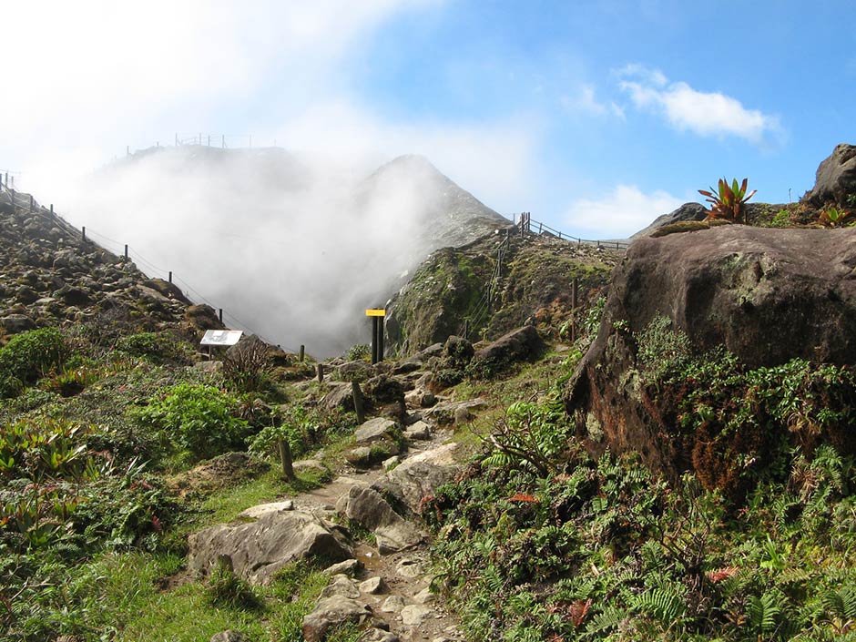
La Guadeloupe , La Soufrière :
Monday, June 24, 2019 at 09h50.
Sequence of earthquakes in La Soufrière area of Guadeloupe – Basse Terre
A sequence of volcanic earthquakes began on Saturday, June 22, 2019 at 20h local time (Sunday, June 23, 00:00 universal time TU *) in the La Soufrière volcano area. As of June 24, 2019, at 09:50 local time, the OVSG-IPGP networks recorded 109 earthquakes of very small magnitude (M <1). No earthquakes were reported felt . The events are located at a depth of <2.5 km under the summit of the dome of La Soufrière.
The alert level remains: yellow, vigilance.
Source : Direction de l’OVSG-IPGP .
Photo : pp.aircaraibes.com.
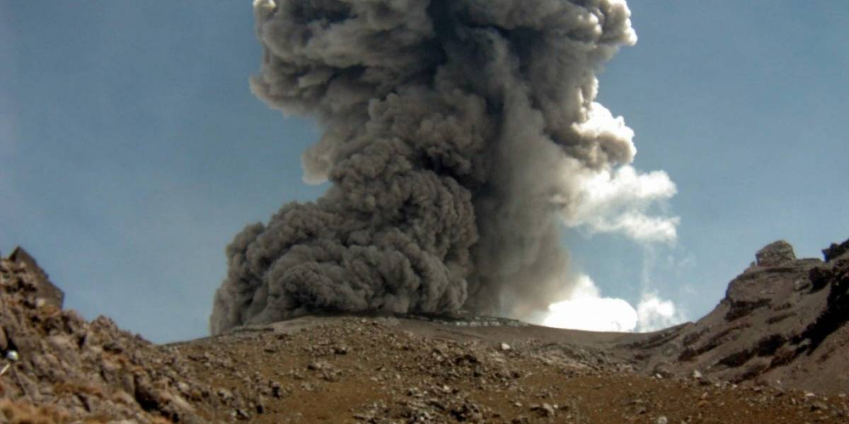
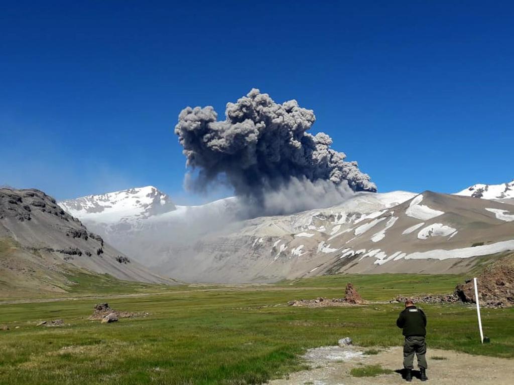
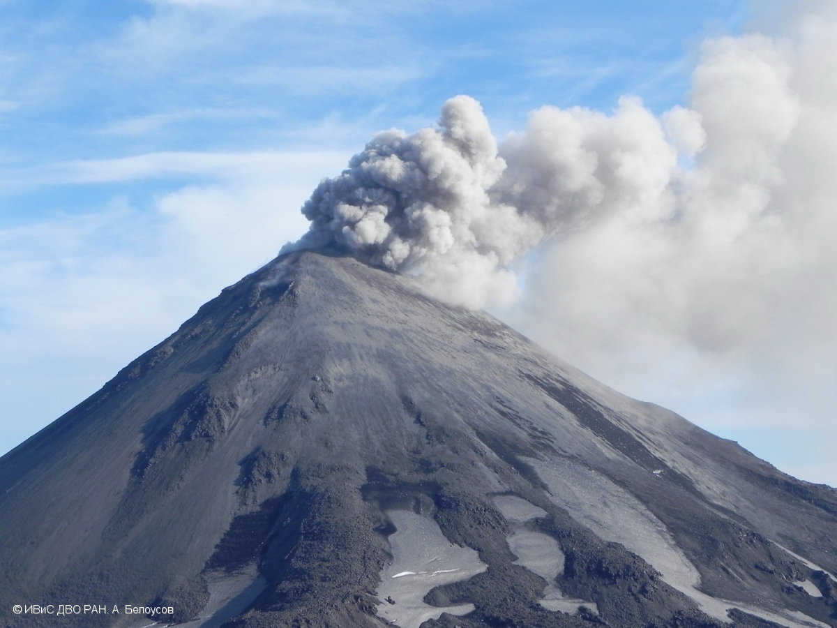
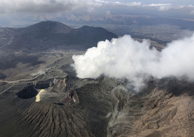
Chile , Planchon Peteroa :
During this period, 17 seismic events were recorded that were classified as volcano-tectonic (VT) types associated with rock fracturing processes. The largest energy event had a local magnitude of 1.6, located 3.7 km north of the active crater and 6.8 km deep.
In addition, 119 long-lived (LP) earthquakes related to fluid dynamics within the volcanic system were recorded. The largest of them had a reduced displacement value (DRC) of 8.7 cm2. The locations were concentrated near the crater area, at variable depths less than 3 Km.
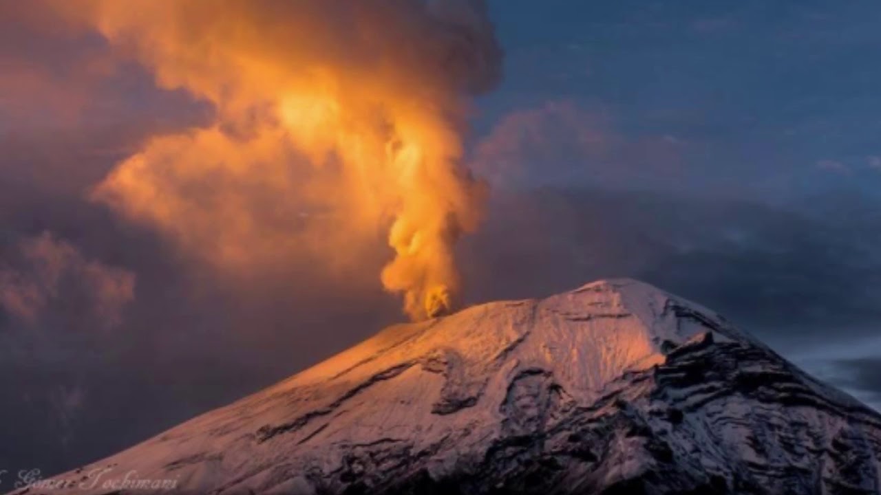
The frequency of the tremor type seismic signal maintains its highest potential around 3.0 to 4.0 Hz, with approximate reduced displacement values (DRc) at 1.0 cm 2.
The images provided by the IP camera show constant degassing throughout the evaluated period. It stands out the occurrence of a small pulse of particulate material recorded on June 3 with a maximum height of 600m above the active crater. Otherwise, degassing is characterized by a predominantly white coloration, reaching heights no greater than 600 m above the active crater.
From the data obtained by three (3) GNSS stations, which measure the deformation in the volcanic complex, one observes for this period of minimal deformation values of the stations installed on the volcanic complex. However, we do not observe deformation of the volcanic building.
No anomalies in sulfur dioxide (SO2) emissions have been reported, according to data obtained by the Ozone Monitoring Instrument (IMO).
There have been no reports of thermal warnings in the area associated with the volcanic complex, according to data published by Middle Observation InfraRed of Volcanic Activity (Mirova) on its website (http://www.mirovaweb.it/ ).
The monitoring parameters suggest a tendency towards stability of superficial volcanic activity, with constant degassing with a discrete supply of fine particulate matter, thus maintaining the characteristics of a weak phreatomatic eruption. Volcanic activity suggests the presence of a magmatic body that comes into contact with the hydrothermal system. Considering the characteristics present on the volcanic complex, we can not rule out the generation of new ash emissions of greater or equal intensity as previously recorded.
As a result, the volcanic alert is maintained at the level:
YELLOW LEVEL: Changes in the behavior of volcanic activity – Probable time for an eruption: WEEKS / MONTH.
Observations: The current area of assignment is considered to be within 1,000 meters of the area of active craters.
Source : Sernageomin
Photos : G Tochimani ( 02 / 2019), Sernageomin.
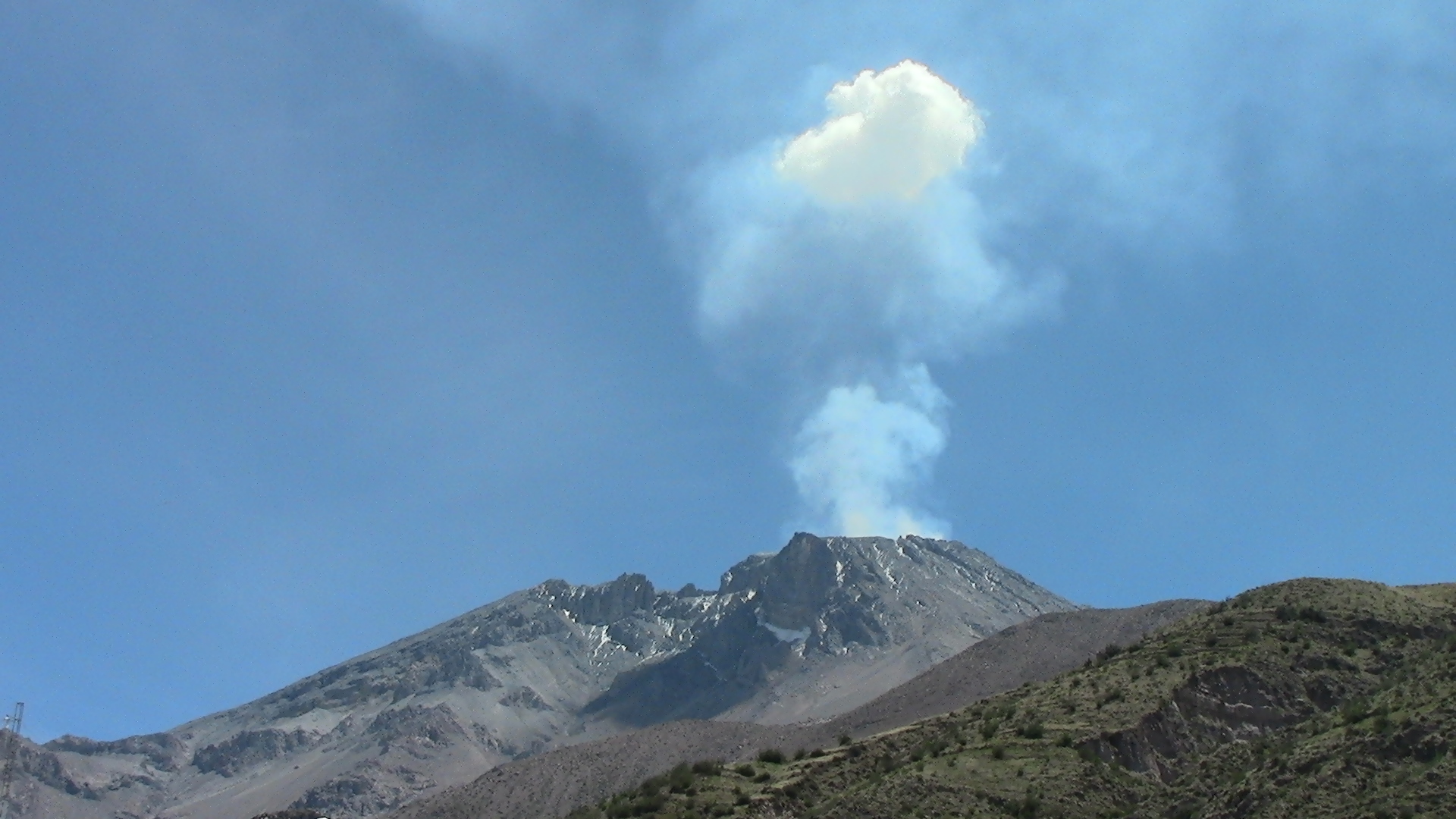
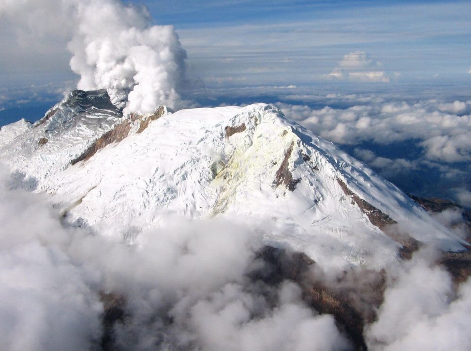
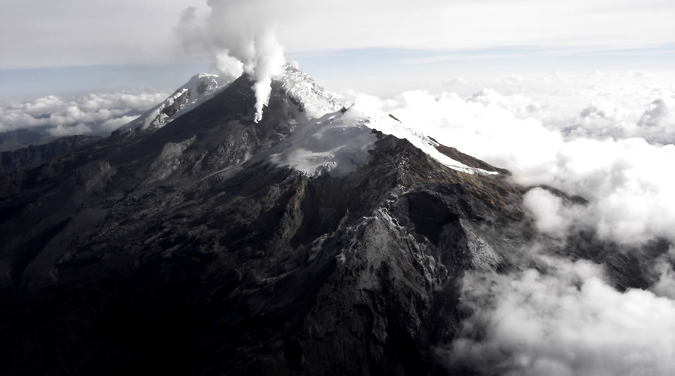
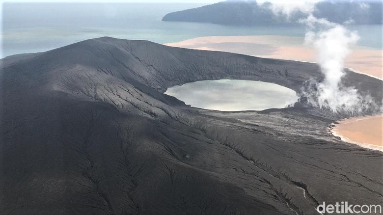
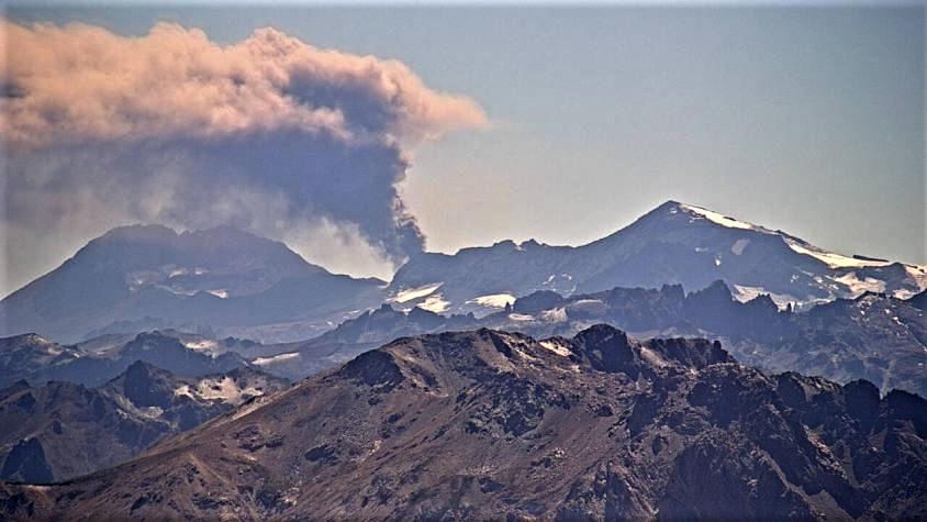
Colombia , Nevado del Huila :
Weekly activity bulletin of the Nevado del Huila volcano
The level of activity of the volcano continues at the level: yellow activity level or (III): changes in the behavior of volcanic activity.
Based on the analysis and evaluation of the information obtained through the monitoring network of the Nevado del Huila volcano, from 18 to 24 June 2019, the COLOMBIAN GEOLOGICAL SERVICE – Volayological and Volcanic Observatory of Popayán indicates that:
During the evaluated period, 102 seismic events were recorded, of which 63 were related to rock fracturing processes (type VT) and 39 to fluid dynamics in volcanic canals. Of these, 35 were classified as long-period (LP type), one (1) hybrid (HB type) and three (3) events as low energy tremor pulses (TR type).
Most of the localized earthquakes, associated with fracture processes, continue to be located northeast of the volcanic building, at a distance from the central peak between 13 and 19 km, with depths between 7 and 13 km.
The images obtained during the week by the web cameras of Caloto, Tafxnú, Maravillas and La Palma showed a weak degassing of the volcanic system.
On 18 June, a mobile measurement of SO2 emissions was carried out between the cities of Tunia (Cauca) and Jamundí (Valle del Cauca). The calculated flow was 1298 t / day, dispersed to the north-west side of the Nevado del Huila volcano.
Sensors for monitoring soil deformation, magnetic fields and infrasound waves have not recorded any variations associated with changes in volcanic activity.
It is repeated that, although the VT seismicity located to the northeast of the Nevado del Huila volcano is in its zone of influence, these events are generated in a tectonically active zone and have so far not affected other volcanic monitoring parameters, therefore, the level of activity of the volcano has not changed, which continues to Amarillo or level III.
Source : SGC.
Photo : SGC
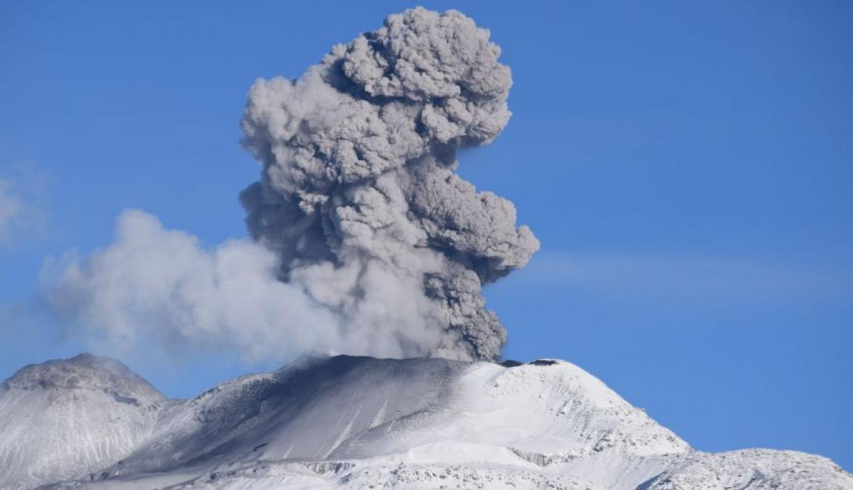
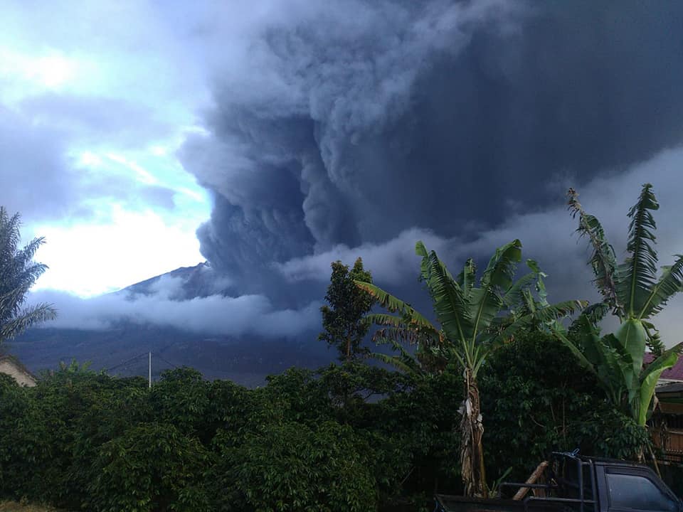
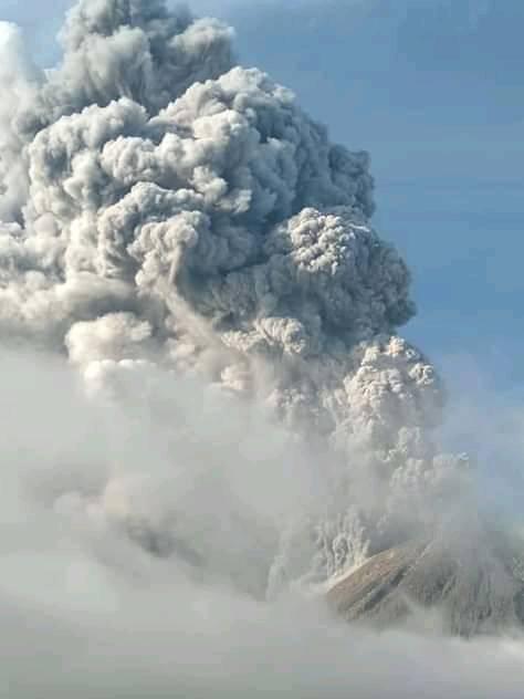
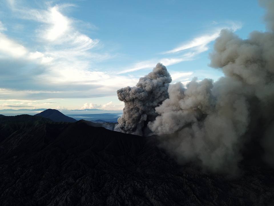
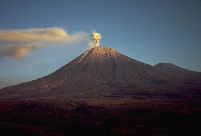
Indonesia , Semeru :
An eruption of Mount Semeru in East Java occurred on June 26, 2019 at 8:30 am, with ash column height observed at ± 600 m above the summit (± 4,276 m above sea level). It is observed that the column of ash is gray in color and that it inclines towards the Southwest. This eruption is recorded on a seismogram with a maximum amplitude of 24 mm and a duration of ± 1 minute.
Currently, G. Semeru is at Level II (WASPADA) with recommendations:
1. The community shall not operate within a radius of 1 km and towards the south-southeast slope zone of the active crater, up to 4 km, potentially dangerous due to avalanches in the form of hot clouds. from the active crater of G. Semeru (Jongring Seloko).
2. The community must be aware of the danger of the lava dome collapsing from the Jongring Seloko crater.
VOLCANO OBSERVATORY NOTICE FOR AVIATION – VONA.
Issued: June 26 , 2019 .
Volcano: Semeru (263300)
Current Aviation Colour Code: ORANGE
Previous Aviation Colour Code: unassigned
Source: Semeru Volcano Observatory
Notice Number: 2019SMR01
Volcano Location: S 08 deg 06 min 29 sec E 112 deg 55 min 12 sec
Area: East java, Indonesia
Summit Elevation: 11763 FT (3676 M)
Volcanic Activity Summary:
Eruption with volcanic ash cloud at 01h30 UTC (08h30 local)
Volcanic Cloud Height:
Best estimate of ash-cloud top is around 13683 FT (4276 M) above sea level, may be higher than what can be observed clearly. Source of height data: ground observer.
Other Volcanic Cloud Information:
Ash-cloud moving to southwest.
Remarks:
Eruption recorded on seismogram with maximum amplitude 24 mm and 60 seconds duration.
Source : PVMBG , Magma Indonésie .
Photos : PVMBG , Thomas J. Casadevall, USGS — Smithsonian – Global Volcanism Program .