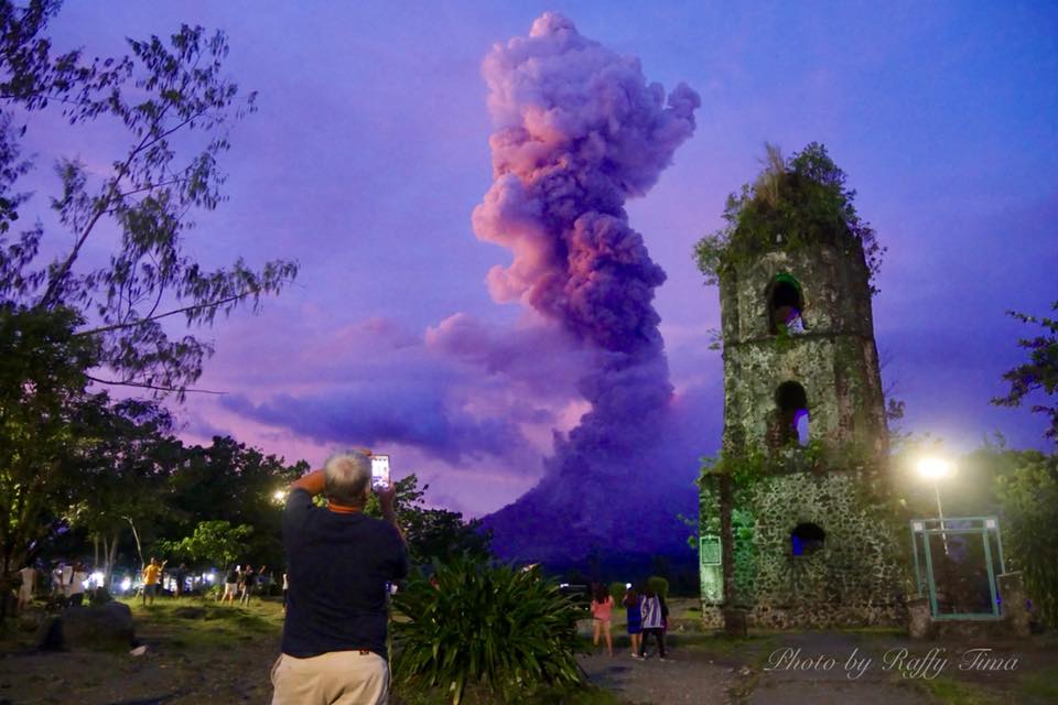
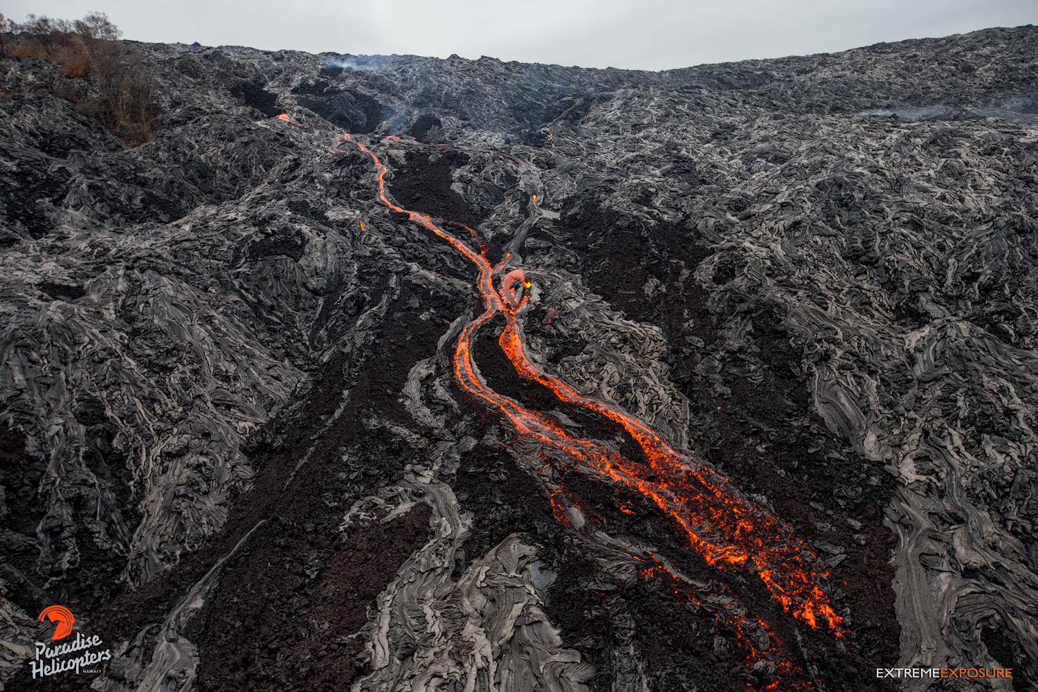
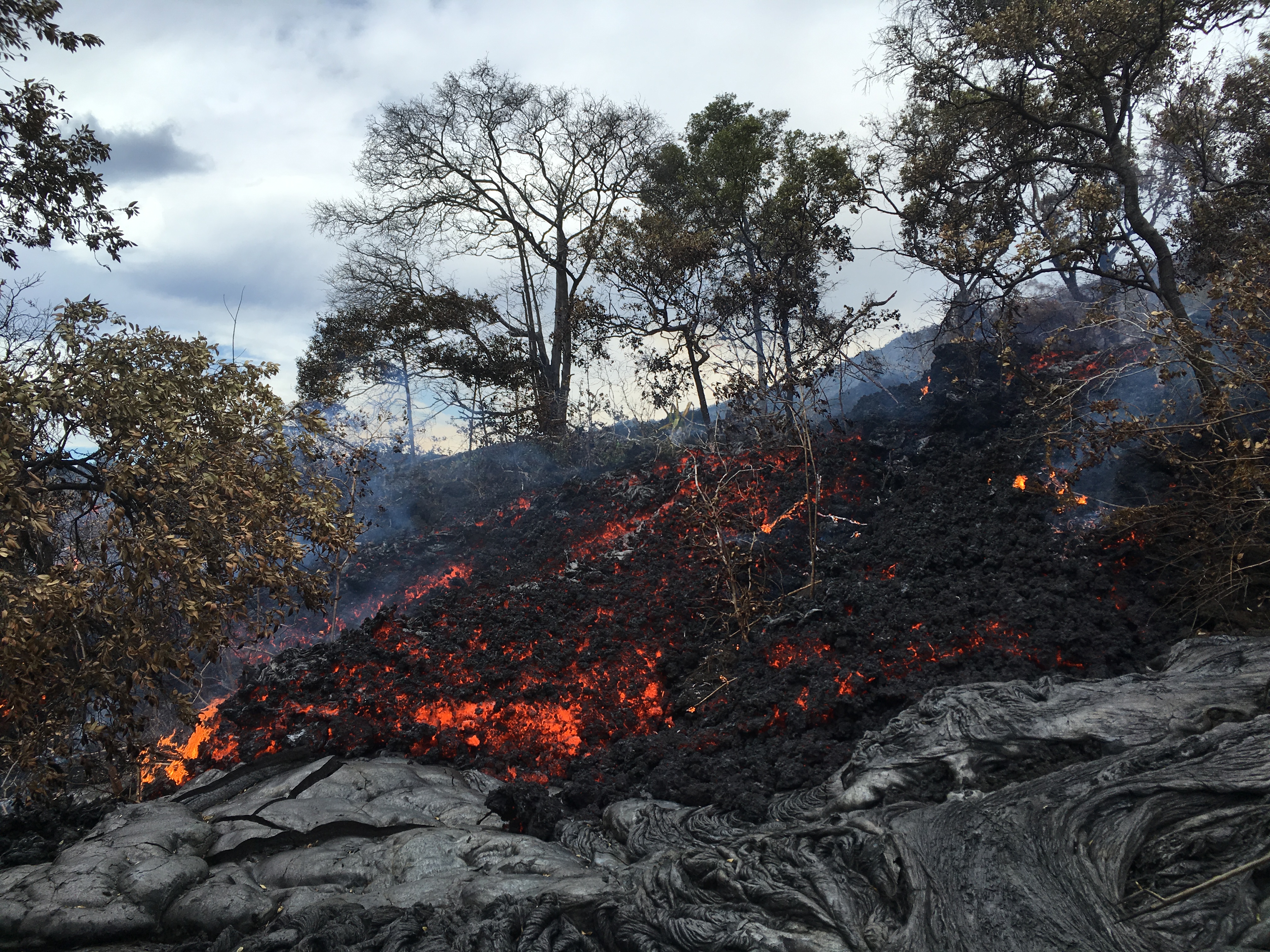
January 13 , 2018.
Kadovar , Papua New Guinea :
Post of Brandon Buser.
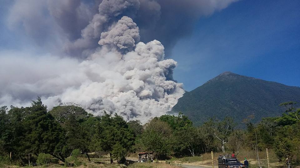
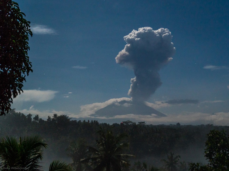
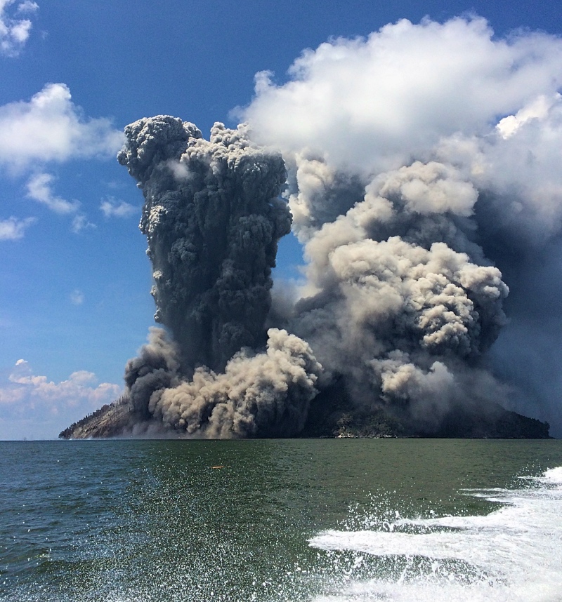
On Friday, Jan 5th, smoke started pouring out of an opening on the southeastern side. This was only God’s grace as the bulk of the population resides on the northwestern side. This smoke was seen by a village on the mainland and they sent two boats to help the islanders. Biem also sent a boat over to help out. These three rigs, along with numerous canoes, began the work of shifting the entire population over to the island of Ruprup 6 miles away. We were told that by the end of the day the entire population was moved over to Ruprup, and the timing could not have been better as later that night, near midnight, the mountain erupted violently.
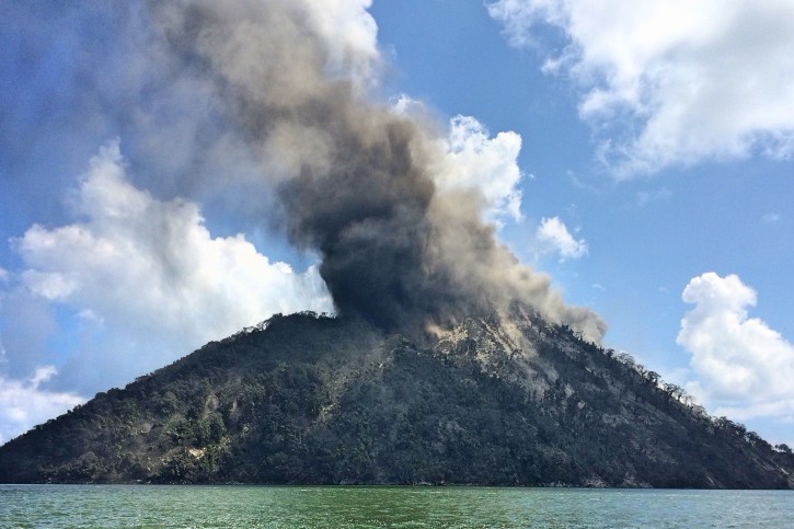
On Saturday, Jan 6th, my coworker Thomas Depner, Greg Kibai the Biem chief, and myself, jumped on our boat to make the trip to Kadowar and Biem. Despite bad visibility, we could see the smoke and ash of Kadowar from 40 miles away. At about the 15 mile mark we began feeling ash falling on us. We boated up to within a few hundred feet and started witnessing just how violent things had become. After a few minutes we circled the island to the side where the village was (see map of our track below…green show high speeds, purple is slow) to see if any inhabitants were there, but there were only a couple abandoned canoes left on the rocky shore.
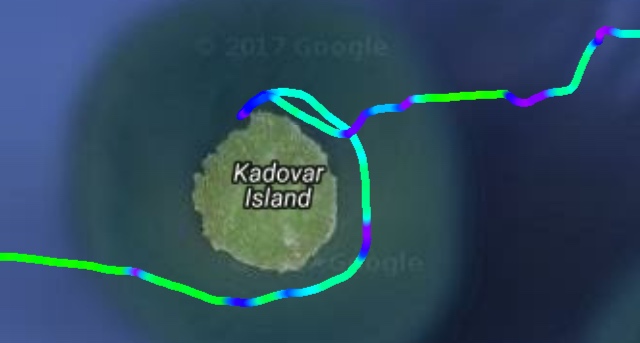
We then doubled back and intended to head on to Biem when the volcano came uncorked. A huge pillar of smoke rocketed hundreds of feet into the air and large boulders started falling straight into the ocean…we exited the area in a hurry (see the fluorescent green streak on the track line). At a safe distance we stopped and kept documenting the event. Shortly after we ran into one of the mainland boats that was returning home from Ruprup and they relayed the evacuation details to us. From there we continued on to Biem Island.
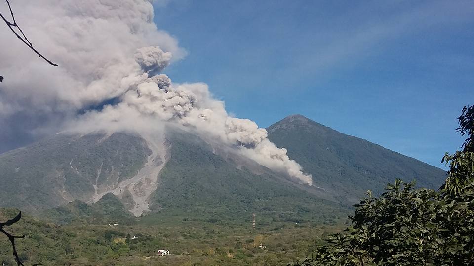
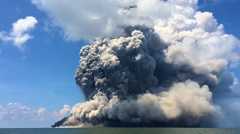
On Monday, Jan 8th, we left Biem for the return to the town of Wewak on the mainland. We stopped off of Kadowar again and documented the continuous erupting of the volcano, but this time it seemed to have found two new outlets from which it was erupting. We circled around to assess the village again and see what structures were still standing…ash covered everything that we could see (though the eruptions are more on the opposite side of the island, the strong seasonal winds are blowing the ash and debris directly over the village location). We continued on trying to cross underneath the ash cloud to clearer seas on the other side…that was a mistake as we got covered by wet falling ash.
The current status of Kadowar is that it’s completely uninhabitable, with no word yet as to the future of the Kadowar islanders and where they will reside. The island continues to erupt and the magnitude just seems to be increasing. What does all this mean for Biem, well, we don’t know. One thing that is interesting is that in the last year both of the islands neighboring Biem on either side (Manam and Kadowar) have erupted. We’re not sure if that venting is going to benefit or endanger Biem, but there are discussions at the government level of evacuating the islands to to increasing fault activity. One thing we are certain of though is that these things are in the hands of our good God. Thanks for your continued prayers for the islands and the folks that call these places their homes.
Source et Photos : Brandon Buser . https://us4.campaign-archive.com/?u=0391e5b77b3ec8dc327e96e6d&id=062c8e36be
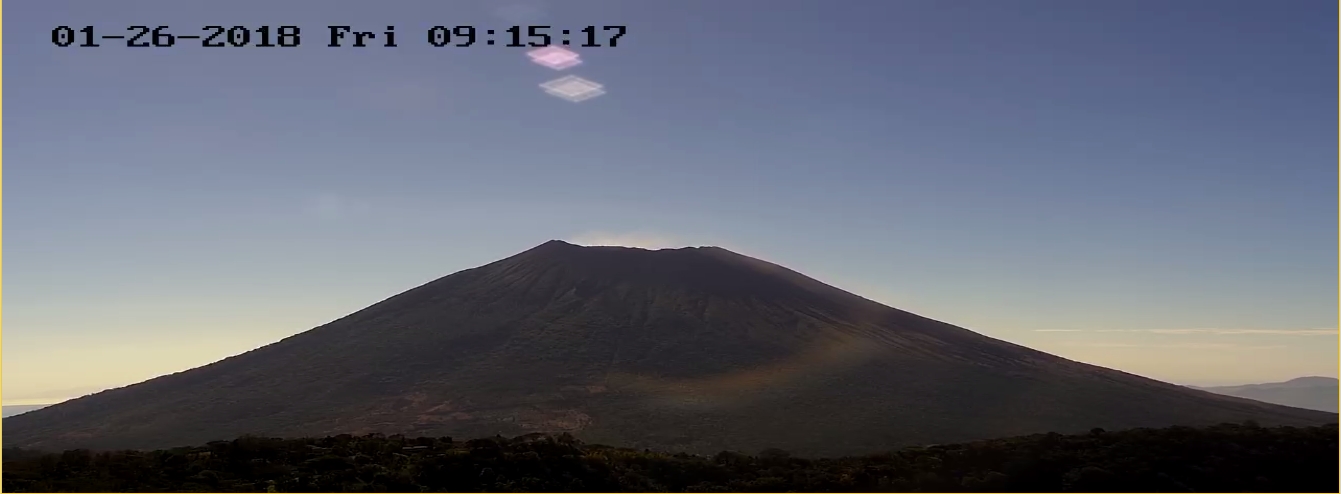
Cleveland , Alaska :
52°49’20 » N 169°56’42 » W,
Summit Elevation 5676 ft (1730 m)
Current Volcano Alert Level: WATCH
Current Aviation Color Code: ORANGE
Moderately elevated surface temperatures were observed in satellite data last Friday, January 5, but no other activity was noted in satellite imagery, though many satellite views were obscured by cloudy weather. No significant activity was observed in seismic or infrasound data over the past week. Elevated surface temperatures may indicate low-level lava effusion or cooling of recently erupted lava in the summit vent. The last small explosion at Cleveland occurred on December 17, which may have cleared the vent making way for new lava to effuse into the crater.
Cleveland volcano is monitored with a limited real-time seismic network, which inhibits AVO’s ability to detect precursory unrest that may lead to an explosive eruption. Rapid detection of an ash-producing eruption may be possible using a combination of seismic, infrasound, lightning, and satellite data.
Source : AVO
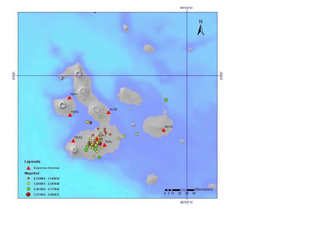
Sierra Negra , Galápagos , Ecuador :
Description of the state of internal agitation and possible eruptive scenarios.
ABSTRACT:
The Sierra Negra volcano is located on Isabela Island (Galápagos) and has recorded in recent weeks a marked increase of its activity characterized by: 1) a greater seismic activity and 2) a continuous elevation of the soil of its caldera (see Report Special No. 3 December 22, 2017). In recent days, earthquakes with a magnitude of up to 4.1 ML have been detected, with an epicenter inside the caldera. Some of these earthquakes were felt in the vicinity of the volcano. This increase in activity is interpreted as a state of internal agitation associated with an intrusion of magma inside the volcano, at relatively low depths (a few kilometers below the caldera). At present, no abnormal phenomena observed at the surface have been reported. The chances of a short-term eruption on the volcano (days to weeks) have increased.
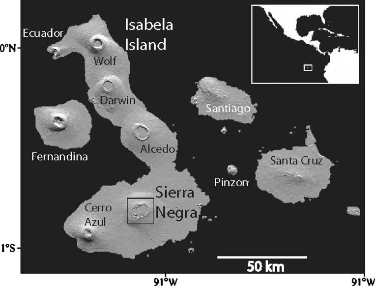
Fig. 1: Location of the Sierra Negra volcano in the Galapagos Islands.
INTRODUCTION
The Sierra Negra volcano is one of the largest volcanoes on the Galapagos Islands and is characterized by an oval caldera of 9 km in the east-west direction and 7 km in the north-south direction (Figure 2). This volcano produced at least 10 eruptions in the historic period, with an average rest period of 15 years between each eruptive episode. Its last two eruptions took place in the years 1979 and 2005 (Figure 2).
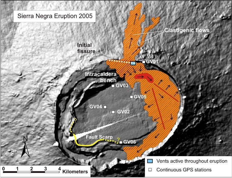
Fig. 2: The Sierra Negra caldera with the location of the eruptive fissures of the year 2005 (white line interrupted in the north of the caldera). The area covered by the lavas in 2005 (orange zone, from Geist et al., 2005) is also shown.
In both cases, the main product was large, very fluid lava flows (low viscosity), which were released from cracks in the northern part of the caldera (Figure 2). During the 1979 eruption, the lava flowed north of the volcano to the sea in Elizabeth Bay, and it is estimated that its total volume was close to 1 km³ (one billion m³). This eruption lasted about two months. In contrast, during the 2005 eruption, the location of the emission crack caused most lava flows into the caldera and only a small fraction sank north of the volcano; It is estimated that the total volume was 0.15 km³ (150 million m³), which was delivered in 9 days. In no recent eruption, lava flows have flowed south or south-east of the volcano, ie to Puerto Villamil or other inhabited areas of Isabela Island. Finally, in addition to the lava, eruptions of the Sierra Negra volcano also produce ash falls. In 1979, ash falls were reported in the eastern and southern areas of the caldera, causing significant damage in areas that were then populated.
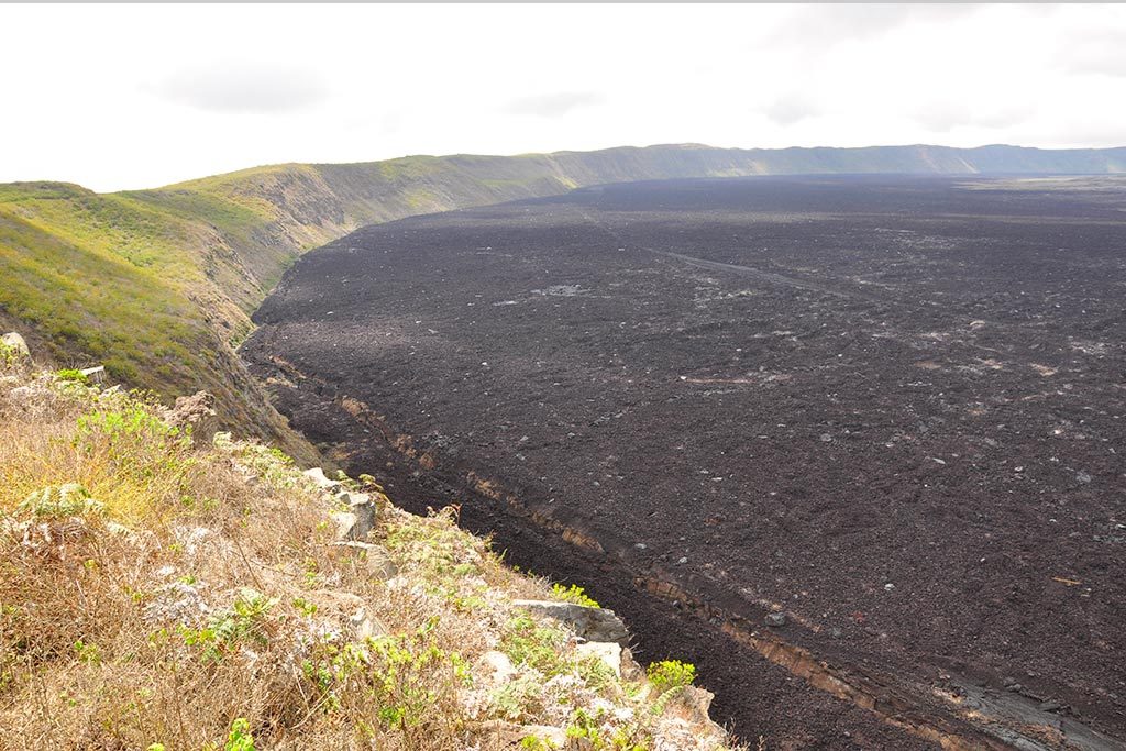
The « Chico » volcano, a well known tourist site on Isabela Island, is located in the north-eastern part of the caldera, and corresponds to the eruptive vents that formed during the eruption of 1979.
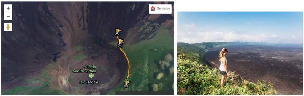
Fig. 3: a: The Sierra Negra caldera with the route of the route (orange line) used by visitors to reach the tourist site known as Chico volcano (last flag to the north). b: Panorama of the Sierra Negra caldera from the eastern edge.
RECENT SEISMIC ACTIVITY:
Since the last report (January 6, 2018), there has been an increase in seismic activity on the Sierra Negra volcano, reaching in the last weeks and days even more than 100 earthquakes daily (Figure 4 ).
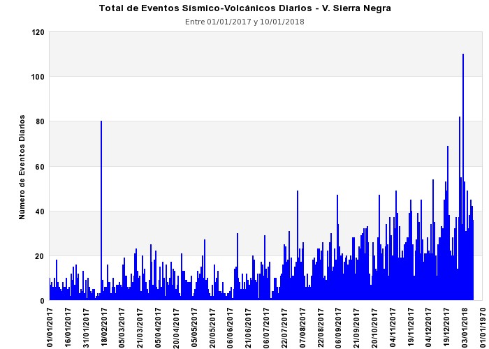
Fig. 4: Total number of daily earthquakes recorded in the Sierra Negra volcano during the last year.
In particular, since 1 January 2018, 398 earthquakes have been detected, most of which are of the « VT » voltano-tectonic type (related to the fracturing of rock bodies), with the occurrence of 8 earthquakes of greater magnitude. at 2.8 ML between 1 and 11 January 2018. Several of these earthquakes were felt by the population in the upper part of the volcano, especially a magnitude of 4.1 ML, December 10 at 10:01 am (local time) Galapagos), according to the report of the engineer Oscar Carvajal of the Isabela Operational Technical Direction of the Galapagos National Park. Most of these events have been located around the caldera (Figure 5).

Fig. 5: The earthquakes that occurred in the Galapagos in January 2018. Note the large accumulation of events in the Sierra Negra volcano area.
DEFORMATION MEASURES
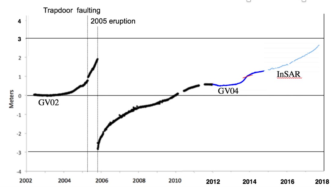
The deformation of the surface on the Sierra Negra volcano was detected by radar satellite interferometry (InSAR), thanks to our cooperation with the School of Atmospheric Sciences and the Sea of the University of Miami. The measurements obtained show a rapid inflation (uplift) of the caldera floor of the Sierra Negra volcano. Since the beginning of 2017, 98 cm of altitude have been measured, which coincides with the increase in the number of registered earthquakes (Figure 6).
In the longer term, since the last eruption in 2005, the Sierra Negra volcano has experienced a permanent rise in the caldera floor, with several episodes of accelerated uplift, totaling nearly 6 meters (Figure 7). The current level of uplift is already higher than that reached before the 2005 eruption (Fig. 7).
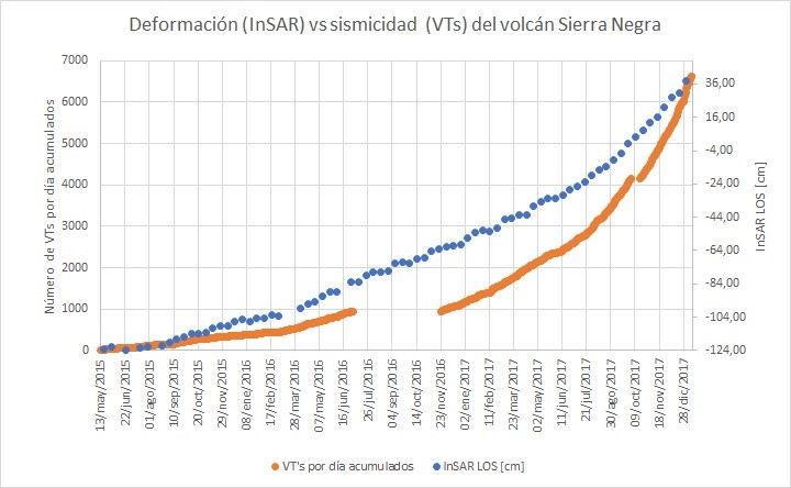
Fig. 6: The orange line corresponds to accumulated VT earthquakes and the blue points to the elevation of the caldera floor accumulated since the beginning of 2015. It can be seen that as of the end of 2017 the two lines become more inclined, which means that accumulations have increased.
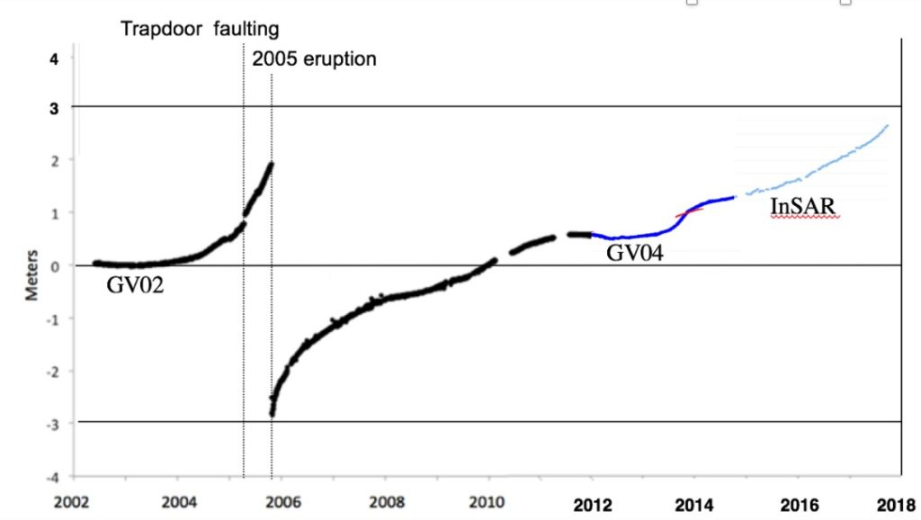
Fig. 7: Elevation of the caldera floor from 2002 to the end of 2017. Note the accelerated rise observed in 2005 before the eruption. After that, the bottom of the caldera sinks quickly and begins to rise, with periods of higher and lower lift speeds over the years. Since the end of 2017, a new period of accelerated elevation has been observed. The current level of uplift is higher than during the 2005 eruption.
PROSPECT:
The recent increase in the number and magnitude of recorded earthquakes, as well as their epicentres located in the caldera zone, coupled with the accelerated rise of the ground, indicate that the volcano is in a phase of internal turmoil. The observed evidence is interpreted as being associated with the current occurrence of an intrusion of magma that accumulates inside the volcano. Similarly, the recorded level of internal unrest implies that the short-term probabilities (days to weeks) of an eruption on the Sierra Negra volcano have increased compared to past weeks. However, it is equally likely that this agitation is similar to others that have occurred in past years and that have not led to any eruptive phase.
In any case, since the current process of agitation could accelerate and lead to an eruption very quickly (hours or days), in this case the safety of visitors in the volcano area would be threatened. Therefore, it is recommended that the competent authorities take the necessary measures to keep visitors away from the Chico volcano area, as long as the current activity conditions are maintained.
SCENARIOS OF FUTURE ACTIVITIES POSSIBLE
For the moment, in case of eruption on the Sierra Negra volcano, the following scenarios are considered as possible:
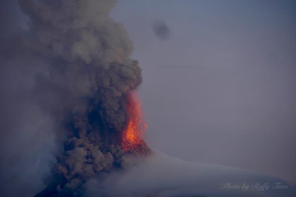
SMALL TO MODERATE ERUPTION ON THE NORTHERN FLANK. This case is similar or inferior to the 2005 eruption, which emitted 150 million cubic meters of lava. The eruption begins with a strong emission of steam, gas and ash, which could form a cloud of up to 10-15 km and then be carried by the wind. In addition, one or more fractures would form on the northern flank, from which flow vigorous and fluid lava flows that would flow on the north flank. Exceptionally, lava flows would reach the sea, or could also flow into the caldera, depending on the precise location of the fractures. The eruption can last up to about 10 days (one or two weeks). In case of eruption, this scenario is considered most likely.
MODERATE ERUPTION TO GREAT ON THE NORTHERN FLANK. This case is similar or smaller than the 1979 eruption, which emitted nearly 1,000 million cubic meters of lava. The eruption begins with a strong emission of steam, gas and ash, which could form a cloud of up to 10-15 km. One or more fractures would form on the northern flank, from which flow lava flow very vigorous and fluid would flow on the north flank. Flow rates would quickly reach the sea, or could also flow into the caldeira, depending on the precise location of the fractures. The eruption can last up to 50 days (1 or 2 months). In case of eruption, this scenario is considered the least likely.
ERUPTION ON THE SOUTH FLANK. This scenario could be similar to one of the two previous ones, but the emission site would be located on the southern flank of the volcano and the lava would flow south of the caldera, possibly including the population of Puerto Villamil and other smaller ones on the same flank. A scenario of this kind has not occurred during the hundred to several thousand years, so it is considered very improbable.
Source : PM, DA, PR , Instituto Geofísico , Escuela Politécnica Nacional.
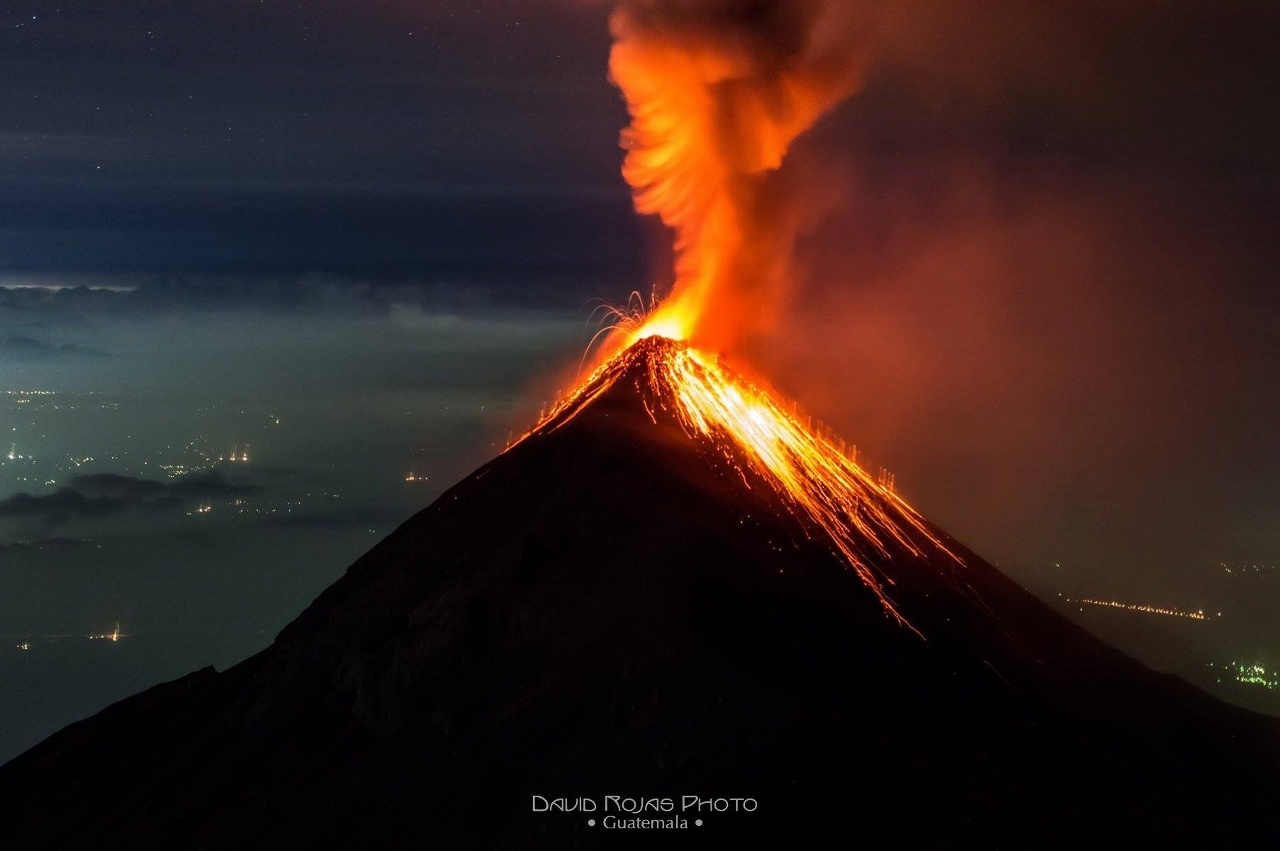
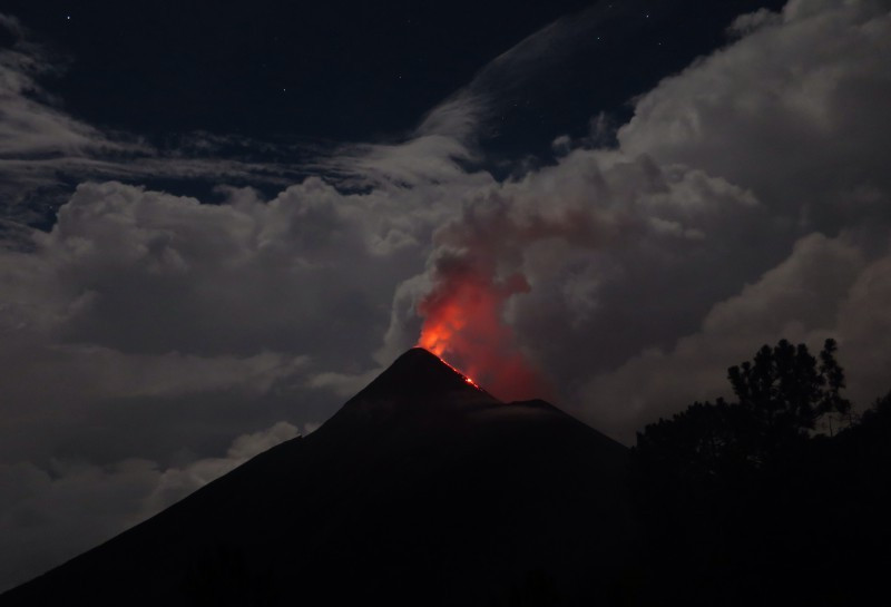
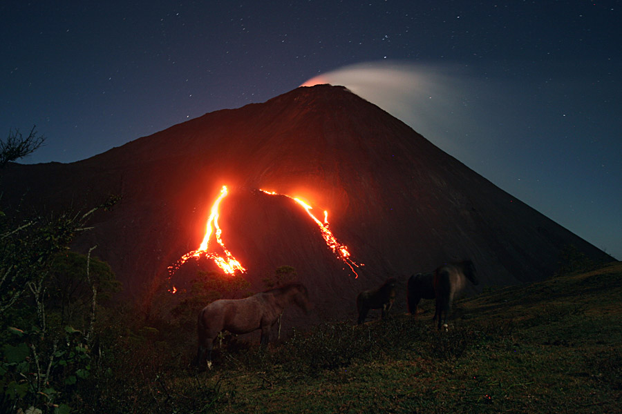
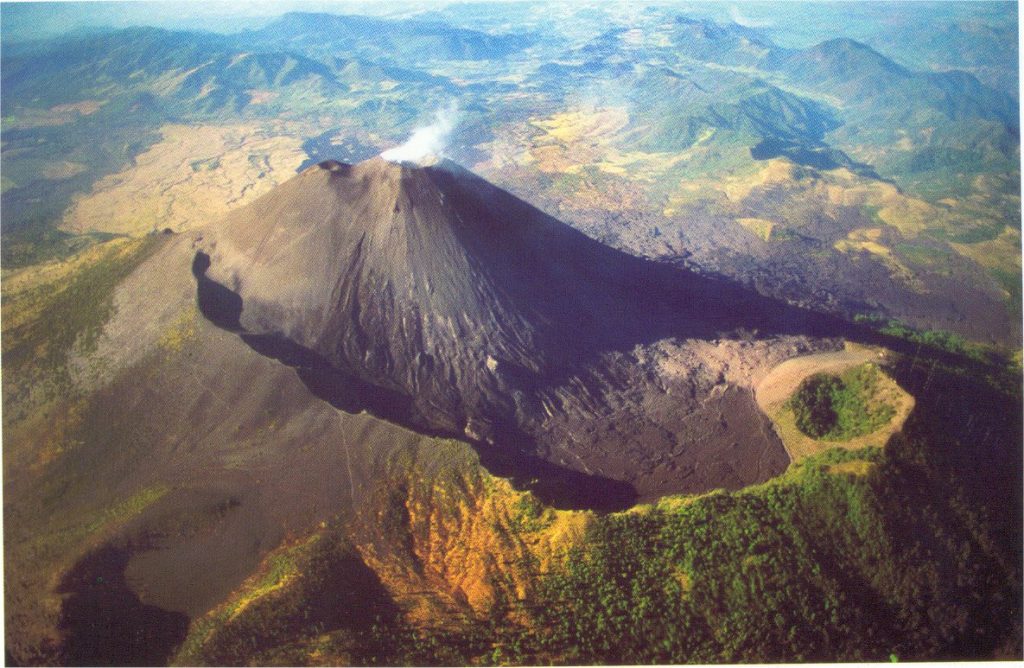
Pacaya , Guatemala :
Type of activity: Strombolian
Morphology: Composite Stratovolcan
Location: 14 ° 22’50˝Latitude N; 90 ° 36’00˝Longitude W.
Height: 2,552msnm.
Weather conditions: Clear
Wind: North.
Precipitation: 0.0 mm.
Activity:
Presence of Strombolian activity in the crater in weak form, expelling the volcanic material at 30 and 50 meters high, which settles in and around the crater Mackenney, At night, the glow is strong, the seismic station PCG records the internal tremor (vibration) produced by degassing, constant rise of magma and small explosions.
Source : Insivumeh