
January 29 , 2018.
Mayon , Philippines :
MAYON VOLCANO BULLETIN 29 January 2018 08:00 AM .
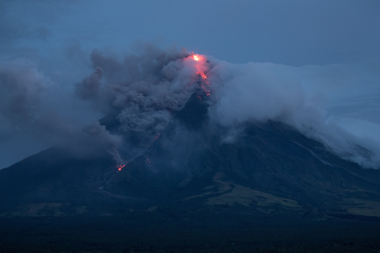
Between 05:36 AM yesterday to 07:47 PM last night, four (4) episodes of sporadic lava fountaining from the summit crater lasting thirty-six (36) minutes to fifty-seven (57) minutes occurred. The events fed lava flows on the Mi-isi and Bonga Gullies, sprayed near-vent lava spatter, and fed rockfall on the summit area. The lava fountaining events were succeeded by lava effusion in the early morning that fed new lava flow on the Bonga and Miisi Gullies. Heavy rainfall that lasted until the early morning generated channel confined lahars on the Binaan Channel and sediment-laden streamflows in channels draining the volcano edifice due to the remobilization of deposits of pyroclastic density currents or PDCs on the watershed areas.
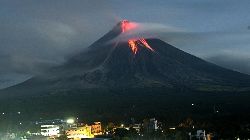
A total of forty-one (41) volcanic earthquakes, six (6) tremor events, four (4) of which correspond to the lava fountaining events, and sixteen (16) rockfall events were recorded by Mayon’s seismic monitoring network. Rockfall events were generated by the collapsing lava front and margins of the advancing lava flow on the Bonga and Miisi Gullies. Currently, the Miisi and Bonga lava flows have maintained their advance to three (3) and 1.8 kilometers, respectively, from the summit crater. Sulfur dioxide gas emission was measured at an average of 1,916 tonnes/day on 25 January 2018. Electronic tilt and continuous GPS measurements indicate a sustained swelling or inflation of the edifice since November and October 2017, consistent with pressurization by magmatic intrusion.
Alert Level 4 remains in effect over Mayon Volcano. The public is strongly advised to be vigilant and desist from entering the eight (8) kilometer-radius danger zone, and to be additionally vigilant against pyroclastic density currents, lahars and sediment-laden streamflows along channels draining the edifice. Civil aviation authorities must also advise pilots to avoid flying close to the volcano’s summit as ash from any sudden eruption can be hazardous to aircraft.
DOST-PHIVOLCS maintains close monitoring of Mayon Volcano and any new development will be communicated to all concerned stakeholders.
Source : Phivolcs
San Miguel , ( Chaparrastique ) , El Salvador :
Special Report No. 4
The changes continue in the seismic activity of the Chaparrastic volcano. Date and time of publication: January 26, 2018, 10:00:00
The Chaparrastic volcano continues to show changes in its seismic behavior, observing vibration processes (tremors) and discrete earthquakes followed by periods of calm. This abnormal situation is associated with fluid movements in the volcanic system (Figure 1).
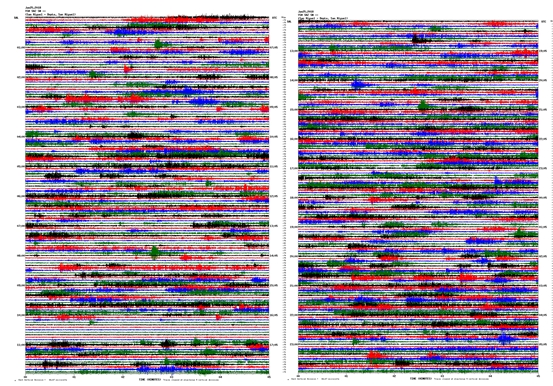
Figure 1. Seismogram of Thursday, January 25, recorded by the VSM seismic station located 1 km from the crater, on the northern flank of the volcano.
In the last 24 hours, the seismic vibration of the volcano has fluctuated between 75 and 179 RSAM units / hour of average, which is considered slightly above normal (Figure 2).
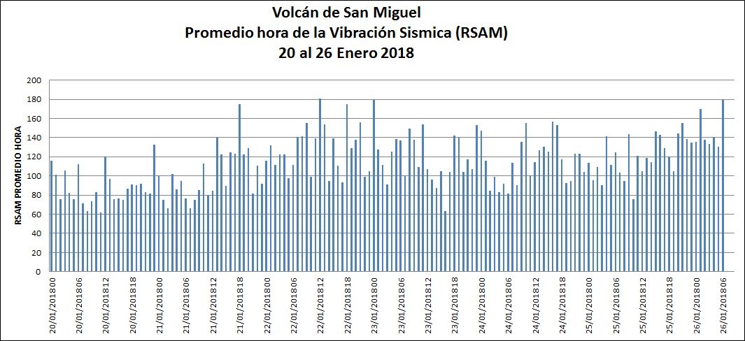
Figure 2. Fluctuations of the seismic vibration of the volcano exceeding the threshold of 150 RSAM units / hour.
The volcano continues to degas, observing small pulses of gas (Figure 3)
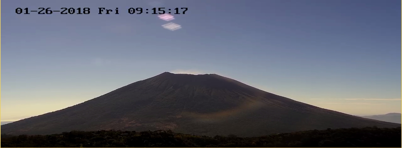
Figure 3. Current status of the volcano. Note the presence of gas in the crater area.
MARN continues the systematic monitoring of the volcano and maintains close communication with the Directorate General of Civil Protection and local observers. In addition, it invites tourists and mountaineers to stay away from the upper part of the volcano because, often, there are sudden changes in activity.
The volcano maintains gas emissions, associated with changes in seismicity, suggesting the presence of fluids in the system, so it is not excluded that in the coming days or weeks it will present episodes of gas emissions and ashes. If the conditions are maintained, the next report will be published on Friday, February 2 of this year.
Source : Snet
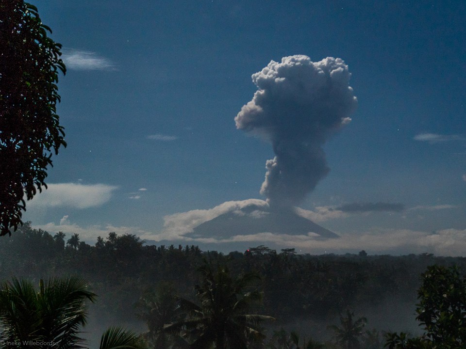
Agung , Indonesia :
On the basis of the results of the visual and instrumental data analysis and considering the potential threats of danger, on November 27, 2017 at 06:00, the status of G. Agung was raised from Level III (SIAGA) to Level IV (AWAS) . Since yesterday and until today visually the volcano is generally not observed because covered with fog. The wind is blowing eastward.
The seismograph records dated January 28, 2018 noted:
21 earthquakes of emission
3 shallow volcanic earthquakes (VB)
5 deep volcanic earthquakes (VA)
1 Far Tectonic Earthquakes (TJ)
A continuous tremor with an amplitude of 1 to 8 mm and a dominant value of 1 mm.
As of January 29, 2018 (00:00 to 18:00) it has been registered:
4 emission earthquakes
2 deep volcanic earthquakes (VA)
A continuous tremor with an amplitude of 1 to 3 mm and a dominant value of 2 mm.
Recommendations:
Communities around G. Agung and mountaineers / visitors / tourists must not climb, climb or do any activity in the danger zone around the G. Agung crater area and in all areas within 6 km from the crater of G. Agung. The estimated area risks are dynamic and continuously assessed and can be modified at any time based on the most recent observational data from G. Agung.
Level IV (AWAS) is only valid for a 6 km radius as mentioned above. Outside the activity area, everything can work like NORMAL and always SAFE.
Source : VSI
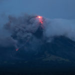
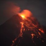
Fuego , Guatemala :
Type of activity: Vulcanian
Morphology: Composite Stratovolcan
Geographical location: 14 ° 28’54˝ N Latitude; 90 ° 52’54˝ Longitude W.
Altitude: 3,763msnm
Weather conditions: Clears
Wind: North East 6 kph
Precipitation: 0.0 mm
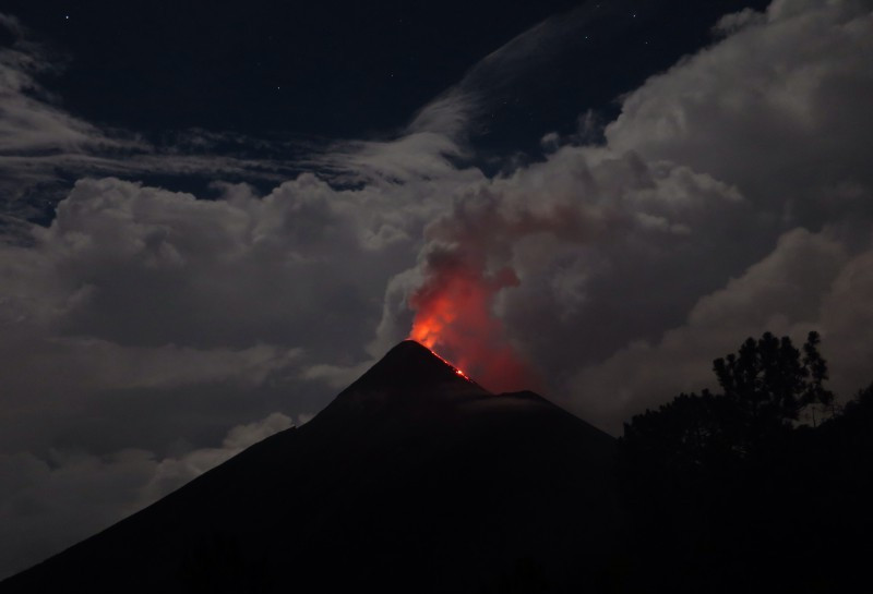
Activity:
The volcano maintains a range of 6 to 8 explosions per hour, accompanied by ash columns at 4700 m alt. (15,419 feet), which disperses 15 kilometers to the southwest. The explosions generate rumblings and shock waves, moderate to strong. At night, incandescent impulses are observed at a height of 250 meters above the crater, generating moderate to strong avalanches on the crater contour, and the descent of blocks towards the edge of the vegetation. Constant sounds similar to those of train locomotives are generated. Ash falls are noted on the villages of Morelia, Santa Sofia and Panimache. The seismic station FG3 records tremor increase pulses (internal vibration) associated with the rise of the magma, so that there is the probability of generation of lava flows.
Source : Insivumeh
Photo : Archive inconnue


No comment yet, add your voice below!