March 25 , 2018.
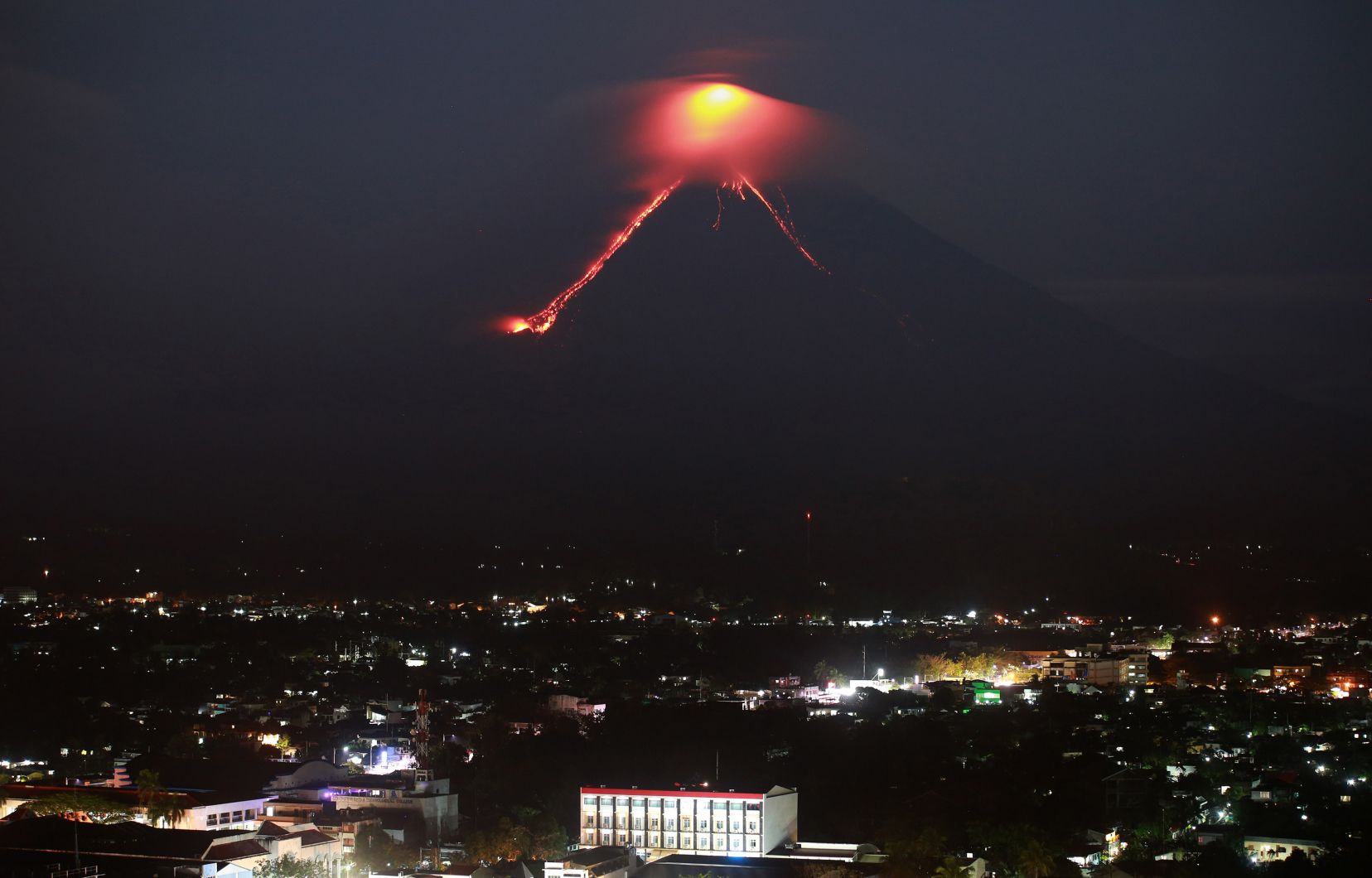
Kilauea , Hawai :
19°25’16 » N 155°17’13 » W,
Summit Elevation 4091 ft (1247 m)
Current Volcano Alert Level: WATCH
Current Aviation Color Code: ORANGE
Activity Summary:
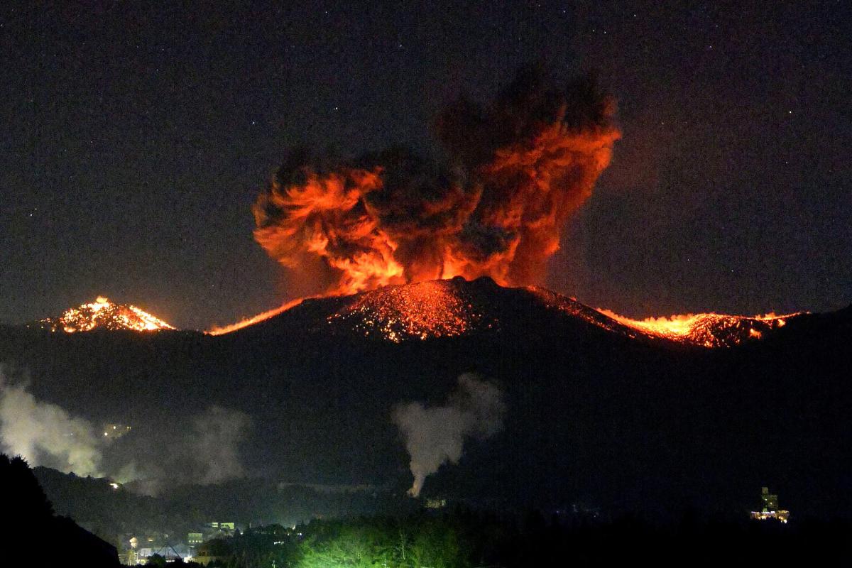
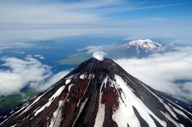
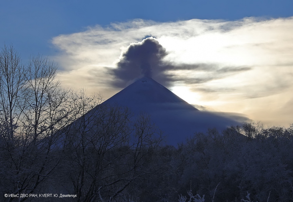
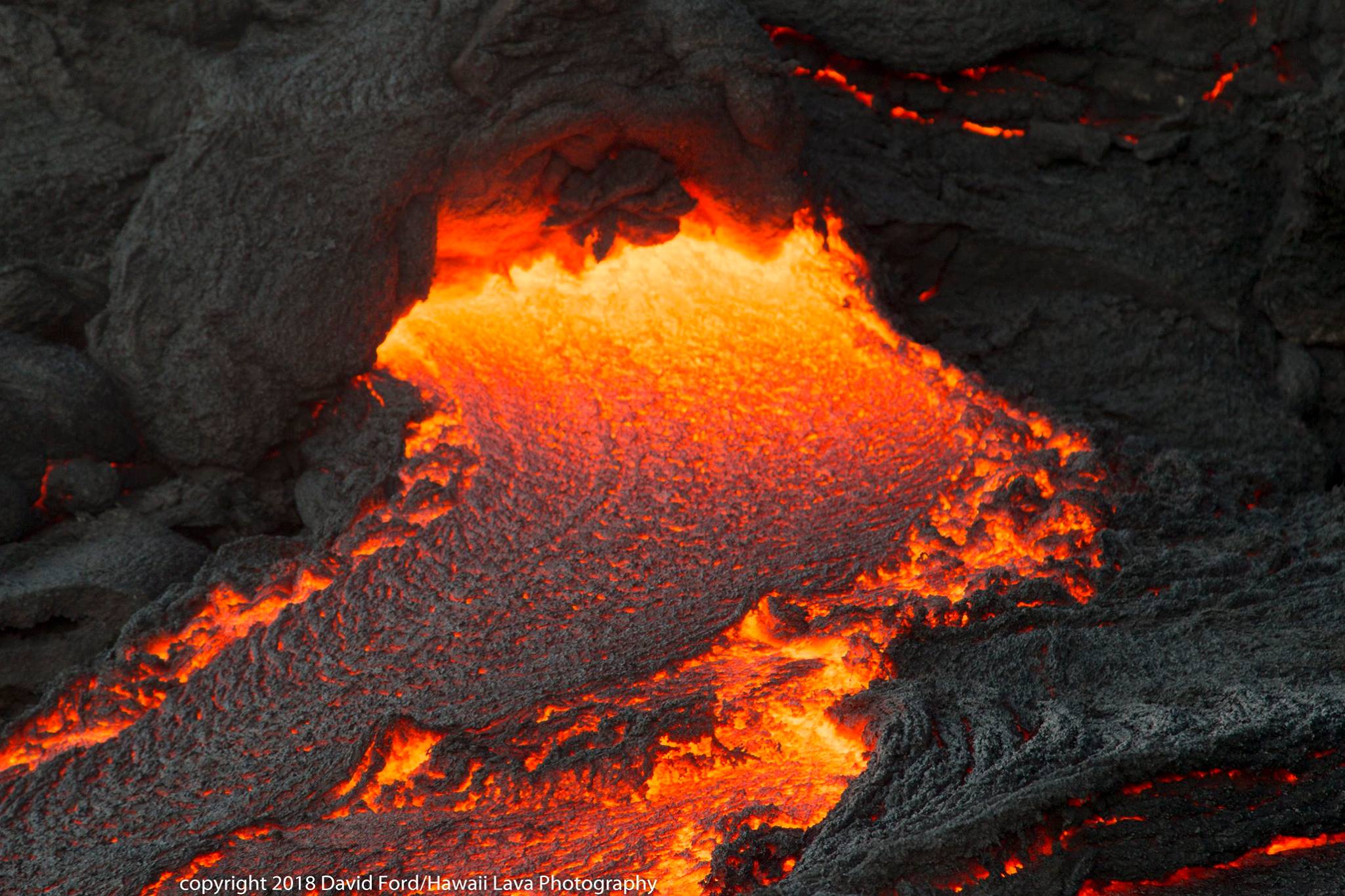
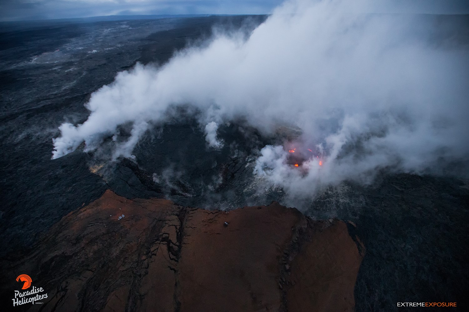
The eruptions at Kīlauea Volcano’s summit and East Rift Zone continue without significant changes. This morning, instrumentation shows that the depth to the lava lake surface within the Halemaʻumaʻu Overlook vent is 28-35 m (~92-115 ft) beneath the adjacent crater floor. The Episode 61g lava flow is active with scattered lava flows on the coastal plain. These lava flows pose no threat to nearby communities. Lava is not flowing into the ocean at this time. Low rates of ground deformation and seismicity continue across the volcano.
Summit Observations:
Instrumental measurements show that the surface of the lava lake within the Halemaʻumaʻu Overlook vent is between 28-35 m (~92-115 ft) below the adjacent Halemaʻumaʻu crater floor this morning. Inflationary tilt began early this morning. Seismicity in the summit area is within normal, background rates, with tremor amplitude fluctuations associated with lava lake spattering. Elevated summit sulfur dioxide emission rates persist
Puʻu ʻŌʻō Observations:
The tiltmeter on Pu`u `O`o cone continues to record the notable inflationary tilt that started on March 12. Continuously recording GPS stations on Pu`u `O`o also started recording extension across the cone on that date. Webcam views show that long-term sources of glow within Puʻu ʻŌʻō crater persist. Increased webcam views of spattering from the West Pit lava pond have been visible over the past few days. This is likely due to ground subsidence noted over the past two months, followed by the current rise in the surface level of the lava pond, coincident with the ongoing inflationary tilt. The sulfur dioxide emission rate from the East Rift Zone vents has been steady over the past several months and remains significantly lower than the summit emission rate.
Lava Flow Observations:
Webcam views of the episode 61g flow field show sparse lava flow activity on the coastal plains. No lava is flowing into the ocean at this time, and surface lava flow activity inland, near the base of the pali, appears to have diminished. The inland lava flows are not posing threats to nearby communities.
Source : HVO
Photos : David Ford , Bruce Omori .
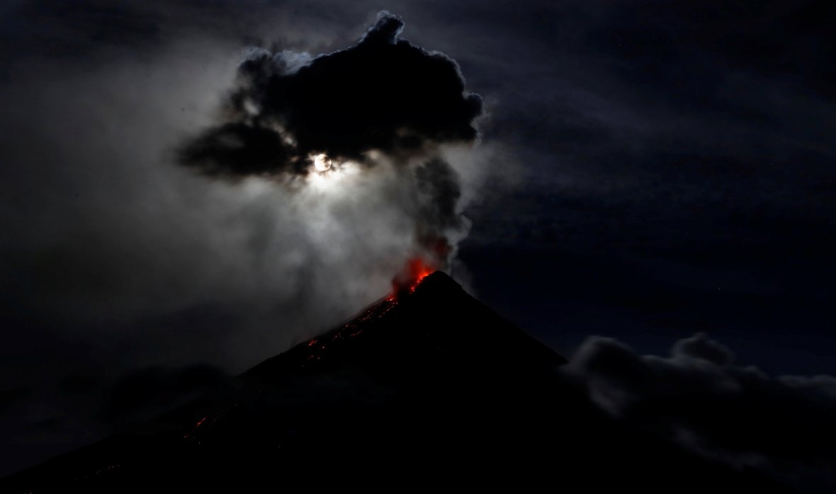
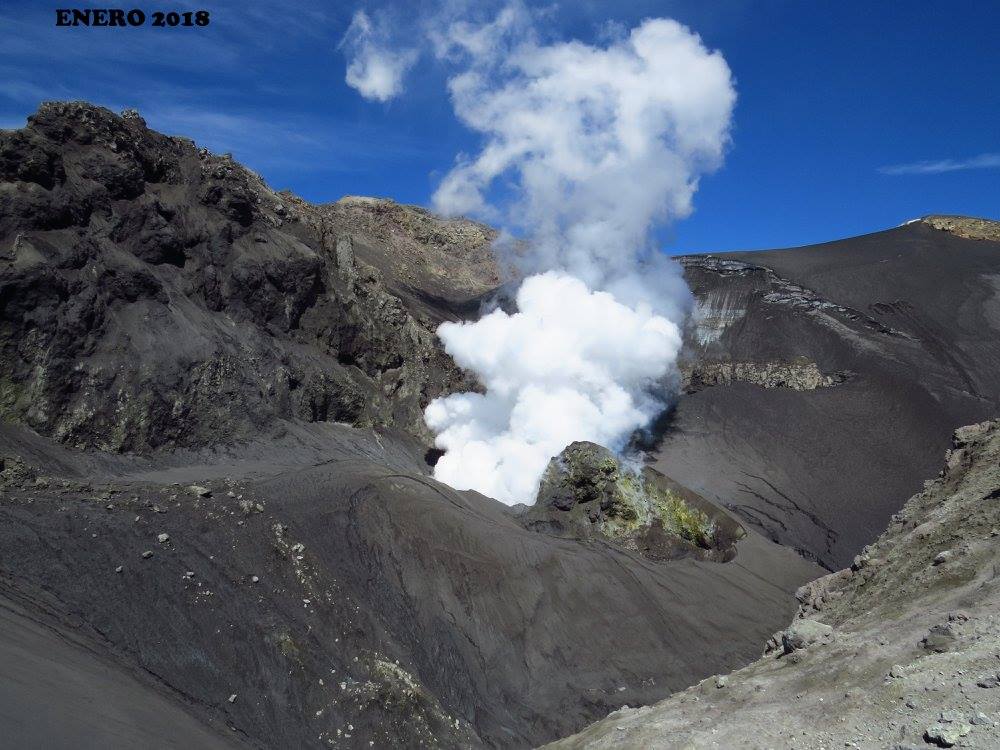
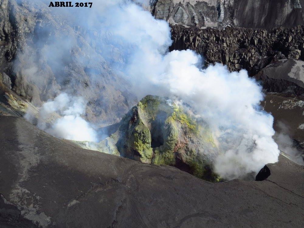
Ambae , Vanuatu :
Activity seems to be increasing on Ambae.
15°24’0”S 167°50’0”E
Summit 4908ft (1496m)
Current Vanuatu Volcano Alert Level: Level 3
Ambae volcano is in the minor eruption state; Its Alert Level is raised from Level 2 to Level 3 .
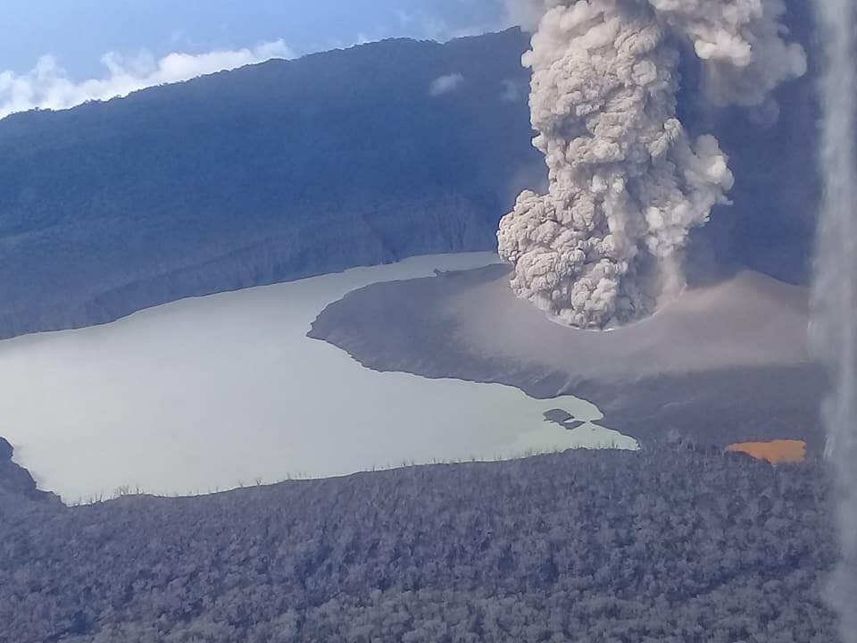
The volcanic eruption at Ambae confined inside the Lake Voui is stable at Alert Level 3. Scientific analyses confirm that the current activity is similar to the volcanic activity at the end of October 2017 but with more and sustained emissions of volcanic ashes. The possibility of imminent increasing activity is very low. The restricted area of risk is now limited to the area of 3 km from the active vent.

Observations of February and March 2018 confirm that the activity is continuing from the recent edified volcanic cone (island). Style of Ambae volcano activity is explosive, similar to what is seen and experienced at Yasur on Tanna Island. Explosions are accompanied by volcanic ashes and/or gases cloud. With the current size of the volcanic cone in Lake Voui, people from Ambae may hear explosions, view a minor volcanic ash and/or gas plume and glows over the mountain at night.
Source : Geohazard
Photo : Edward Banga , Dan Mc Garry.
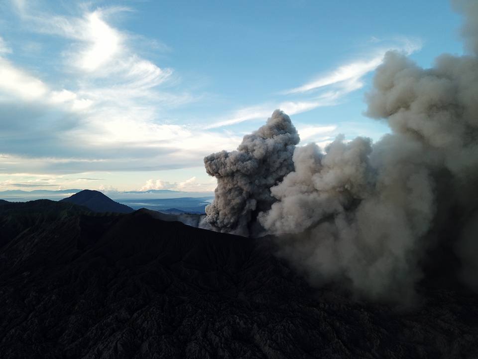
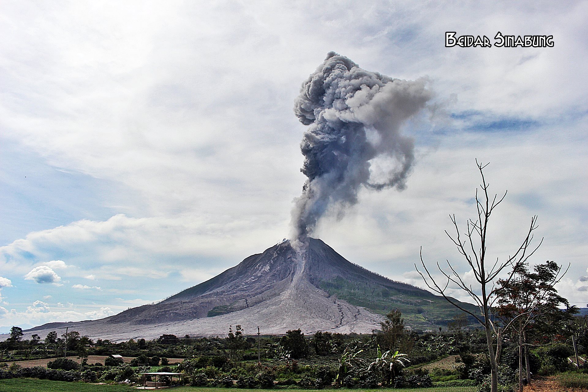
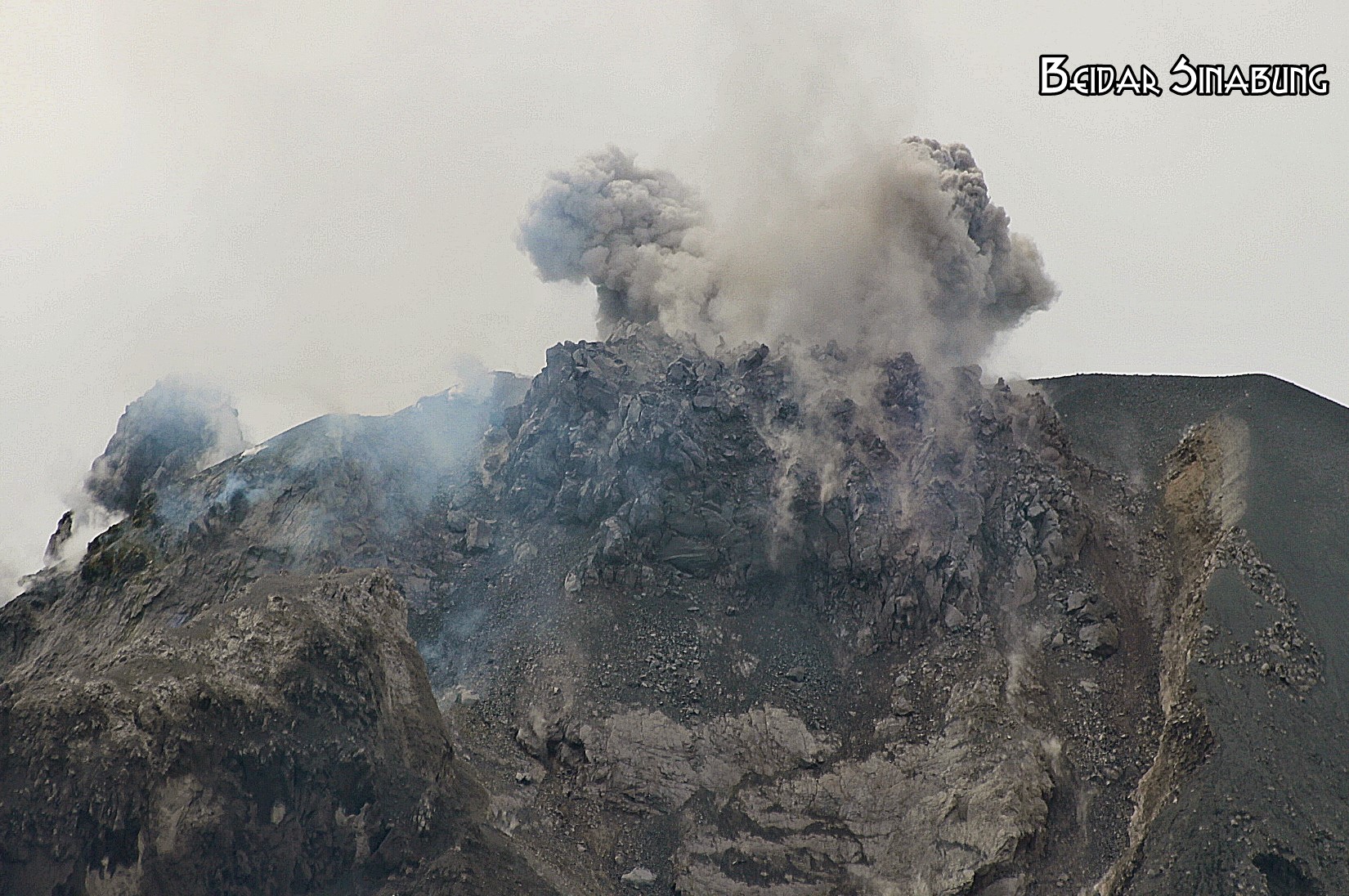
Shinmoedake , Japan :
The first pyroclastic flow was recorded on March 25 from an explosive eruption on Kyushu’s Mount Shinmoedake, which started erupting at the beginning of the month.
The Japan Meteorological Agency announced that a pyroclastic flow was confirmed over a distance of about 800 meters west of the crater, but it did not approach any residential area.
Eruptions began on March 1 with intermittent explosions from the crater, but this was the first recorded pyroclastic flow.
According to the JMA, explosive eruptions were recorded at 7:35 a.m. and 8:45 a.m. on March 25, and smoke and fumes rose to 3,200 meters. The pyroclastic flow was confirmed following the second explosive eruption.
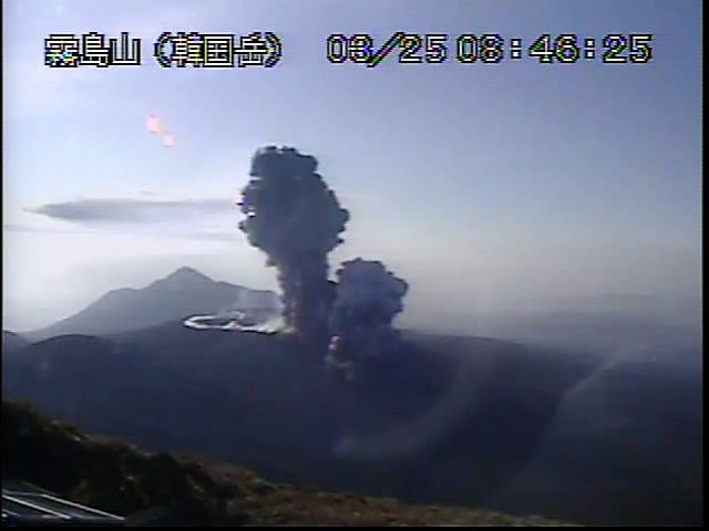
The last time an explosive eruption was recorded on Mount Shinmoedake was March 15.
The JMA maintained the alert level for the volcano at 3, meaning people should stay away from the 1,421-meter mountain, which straddles Miyazaki and Kagoshima prefectures.
However, local residents were urged to be cautious about pyroclastic flows within an area of 2 kilometers from the crater as well as for large flying rocks within 3 kilometers of the crater.
Source : Asahi Shimbun
Copahue , Chile :
Special Report on Volcanic Activity (REAV), 24 March 2018 16: 50 hours (local time).
The National Service of Geology and Mining (Sernageomin) of Chile discloses the following information, obtained thanks to the monitoring equipment of the National Network of Volcanic Surveillance (RNVV), processed and analyzed at the Volcanological Observatory of the South Andes . (OVDAS):
Today, Saturday, March 24, at 13:48 local time (16:48 GMT), monitoring stations installed near the Copahue volcano recorded forty-eight (48) long-period earthquakes (LP), possibly associated with hydrothermal activity, low energy and rhythmic appearance for about an hour. Subsequently, at 14:42 local time (17:42 GMT), an explosion, with a reduced displacement value (DR) of 44 cm2 and a duration of about 5 minutes was recorded with the emission of a column at about 1,000 meters above the crater level.
IP camera images show the presence of water vapor and fine to very fine particles precipitated a short distance from the crater in the north (N) direction.
After the occurrence of the explosion mentioned above, there is a slight increase in the background tremor level, reaching a reduced displacement value (DR) of 3 cm 2.
OBSERVATIONS
At the time of publication of this report, no new explosions have been recorded; the tremor continues to fluctuate.
Although this activity is presented in isolation, it is possible that new explosions of similar characteristics may be recorded.
The volcanic technical alert is maintained at the GREEN level.
Sernageomin is continuing its online monitoring and will report in a timely manner on possible changes in volcanic activity in the region.
Source : Sernageomin
San Miguel ( Chaparrastique) , El Salvador :
Special Report No. 7
The Chaparrastique volcano keeps its tremor and a weak degassing. Date and time of broadcasting: 23 March 2018, 13:45:00
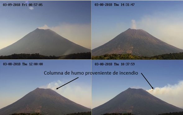
Continuous weak degassing occurs in the central crater of the volcano, which is dispersed according to the prevailing wind direction in the area, preferably to the southwestern flank (Figure 1 and 2). Likewise, the tremor or seismic vibration of the volcano continues intermittently indicating the movement of fluids within the volcano, which are released through the central conduit.
Given the historical behavior, it is not excluded that in the coming days the volcano will continue to have periods of degassing, which could be accompanied by small emissions of ash. Because of the prevailing wind direction, if this episode occurs, the material would be transported in a southwesterly direction relative to the crater.
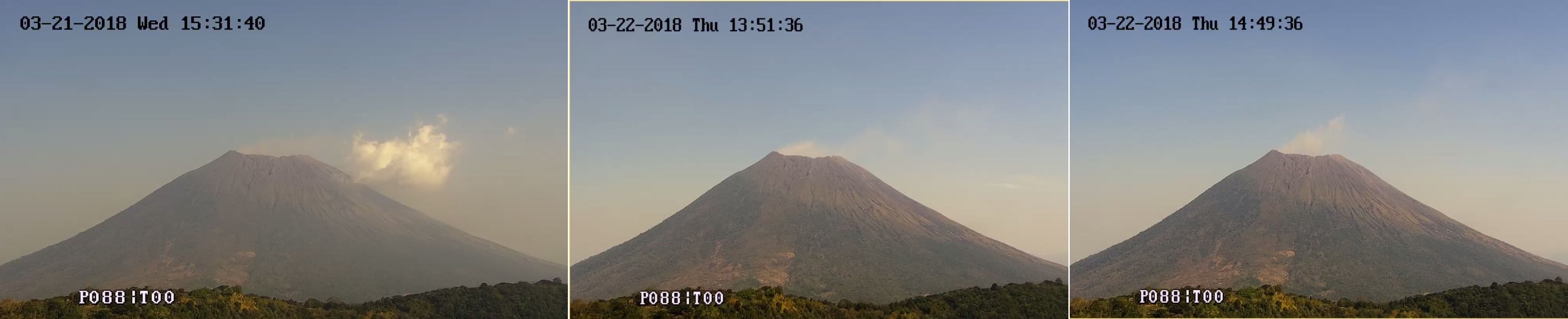
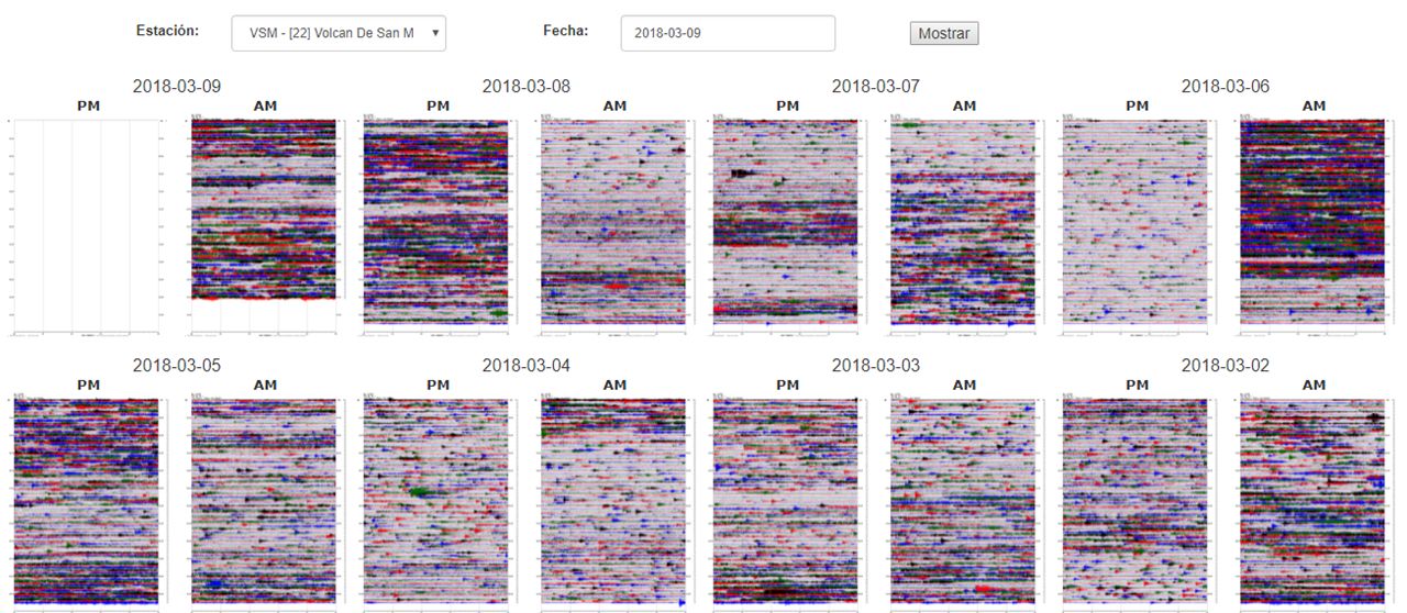
Figure 1: Degassing pulses captured by the surveillance camera located on the Pacayal volcano.
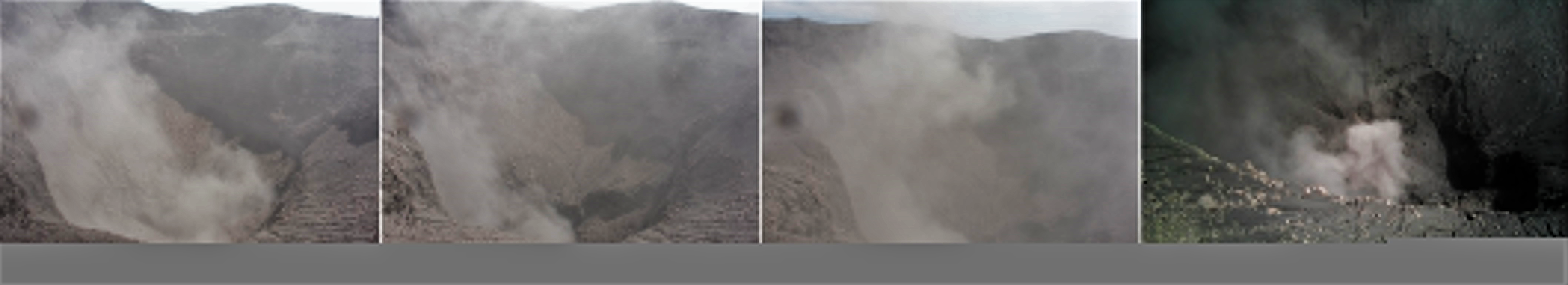
Figure 2. Degassing observed inside the crater, Monday, March 19th.
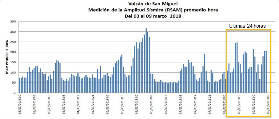
During the last 24 hours the seismic vibration has remained fluctuating between 51 and 127 RSAM units / hour, with an average of 80 units, the acceptable threshold of normality is 150 units (Figure 3).
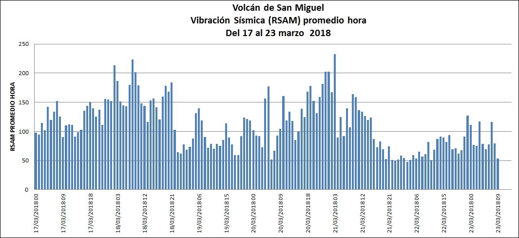
Figure 4: Behavior of the seismic vibration of the volcano recorded during the last seven days in the VSM station. Note the descent of the vibration from day 21.
Conclusion:
The measured CO2 and H2O gases probably correspond to those dissolved in the atmosphere and do not come from a magmatic source. There is no change or correlation with SO2 of magmatic origin.
The Ministry of Environment and Natural Resources (MARN) continues the systematic monitoring of the volcano and maintains close communication with the Directorate General of Civil Protection and local observers.
In addition, he asks the general population to stay away from the top of the volcano due to sudden changes in its behavior.
If the activity does not evolve, the next report will be published on Tuesday, April 3, 2018.
Source : Marn